Originally Posted by
andboy
It was a club ride, which apparently does not have a set route! But yes, please do send that route. I would like to build to that!
Ok Andboy, KaosJoe here. There's lots of ways to get to Montauk. This is the way I usually do it. I'm sure there are improvements to be made so I'll put this where other riders can see it and hopefully we both learn new tricks.
I see from your previous posts you're living in Patchogue and are familiar with the routes 65 & 36 (Middle Rd & South Country) ways of getting east as far as the Wertheim Nat. Refuge, but maybe not familiar with what's further out.
From the Wertheim Refuge, it's bite the bullet and get on Montauk Hwy for a while. Traffic, but a good shoulder for at least a couple of miles. Last time I did the Montauk ride a couple of weeks ago, I found bike route markings on the pavement at the first right turn after the Refuge. Apparently put there by one of the organized rides that traverse the area, it gets you off the highway(good), but the marks either peter out or I just lost the trail somewhere in the wilds of Mastic/Shirley. I just kept trying to head east or north and eventually rejoined Montauk Hwy. If you have GPS or the patience to mess with your phone navigation app this might be a good alternative, but until I join the electronic age I'm probably just going to stay on Montauk and ride with caution. Anyway, only a few miles gets you into Moriches where the traffic/commercial development thins out considerably.
Going further east, some of the organized rides opt to veer left on the Moriches Bypass (decent shoulder IIRC); I prefer to stay on Montauk & go through the towns. I just like it better,
Getting into Speonk, you can stay on Montauk Hwy which is just fine.....I prefer a little detour by veering right at the fork onto South Country and getting down into Remsenburg. Stay on S. Country to the end, turn left on Apaucuck Point Rd, right on South Rd, and left on Potunk Ln. (or go straight another block into Westhampton if in need of provisions). North on Potunk to traffic circle, right on Brook Rd, right on Meetinghouse Rd, which takes you back to Montauk Hwy. It's not confusing really because you're always heading north or east.
Now a longish stretch on Montauk thru Quogue, East Quogue, Hampton Bays. One of these days I'll try something different through here. Pushing on, cross the Shinnecock Canal and into, oh boy, da Hamptons. Traverse the Shinnecock Reservation, staying on Montauk which becomes Hill Street as it gets into Southampton. Getting into Southampton, you will come upon a little grassy triangle with lots of Civil War artillery. If you want to stop, don't ride straight ahead up Job's Lane, you risk a ticket. There is a nice deli to get food 50 yards east of the artillery, and a nice park right there to eat it. Clean public rest rooms here also. Back to the cannons, go north on Windmill St, Rotations Bike shop on the right if you need anything. Another block north and turn right on 27A and continue east. (Or you could meander the very beautiful area south of downtown, Toylsome Ln, Wickapogue Rd, Flying Point Rd, Cobb Rd, etc, but I'm trying to get you to Montauk before dark).
Montauk Hwy now designated rt 27 continues east thru Water Mill where you see your first windmill. Going further east into Bridgehampton, I like to get off 27 by making a right onto Newlight Ln which becomes Paul's Ln. (The village areas in the Hamptons are very pretty but kind of bustling so I usually opt for the quieter byways.) From Pauls Ln, left at the T on Ocean Ave, and a very quick right on Bridge Ln. Across the bridge....Bridge ends on Sagg Main Rd. A right turn dead ends at a beautiful beach, a left brings us to the next right turn and eastward leg on Hedges Ln. At the T, a right on Town Line, quick left on Wainscott Main. A one room schoolhouse and pretty little chapel on the left, views of the ocean away across the fields on the right. Left on Sayre's Path, quick right on Wainscott Stone Rd., and back to the sound of traffic on Montauk Hwy again.
Right turn, past Ron Perelman's (Revlon) extensive estate on the right. There's an M60 tank on the north side of the road that used to have its 105mm pointed right at the road till people complained. I like to get off 27 ASAP, so even though it adds a bit , I turn right on Georgica Rd. This is a staggeringly wealthy area. Stay with Georgica (NOT Georgica Close) to a sharp right on LaForest. Right on Apaquogue, which curls around to the left and becomes Lily Pond La. Georgica Beach on the right, rest rooms, beach showers. Rode past Steven Spielberg walking a dog here once. Heading east again on Lily Pond, left at the T on Ocean Ave, and into East Hampton. Stay right at the fork on James La, slow way down, and look about......historic cemetery, ancient church and windmill, a couple of small museums of local history, gorgeous Town Pond and Town Green on the left. This has been called the most beautiful village street in America. Maybe it is.
Turn right on Dunemere, which becomes Further Ln for a further stretch of eastbound gorgeousness. Right on Indian Wells Hwy (another beach at the end), but turn left on Bluff Rd. Bluff runs back into Montauk Hwy which is smooth flat and fast, but to avoid 99% of the traffic, cross it onto Cranberry Hole Rd which parallels it to the north. Wife & I almost t-boned a deer here on our tandem. Right on Napeague Meadow Rd which returns you to Montauk Hwy. Turn left. Pass the Lobster Roll, with its to-the-point "LUNCH" sign. Have a lobster roll.
With about 5 miles to go until Montauk village, the road forks. Your pick; the left fork brings a loooong gradual climb with an impressive vista at the top, a level-ish stretch through wooded land and then a long descent into the village on a butter smooth wide shoulder. Unfortunately 90% of the car/truck traffic is there with you. The right fork, Old Montauk Hwy, is a unique roller coaster of a road with kinda narrow shoulders, some rough spots and limited sight distances due to the short steep rollers, beautiful ocean views, a 30mph speed limit and much less traffic. Hither Hills St Park on the right, with a beach, water, rest rooms, showers, etc. If you've got the legs, the rollers are a lot of fun. If you're running on fumes.......
I almost always pick the right hand fork.
And into funky Montauk village. Food, lodging, a brew, all here. If you want fishing boats, etc with food and lodging, the "fishing village" is about 2 miles north, up Edgemere St at the mouth of the harbor. The railroad station, end of the line, is about halfway up, if taking the train back west.
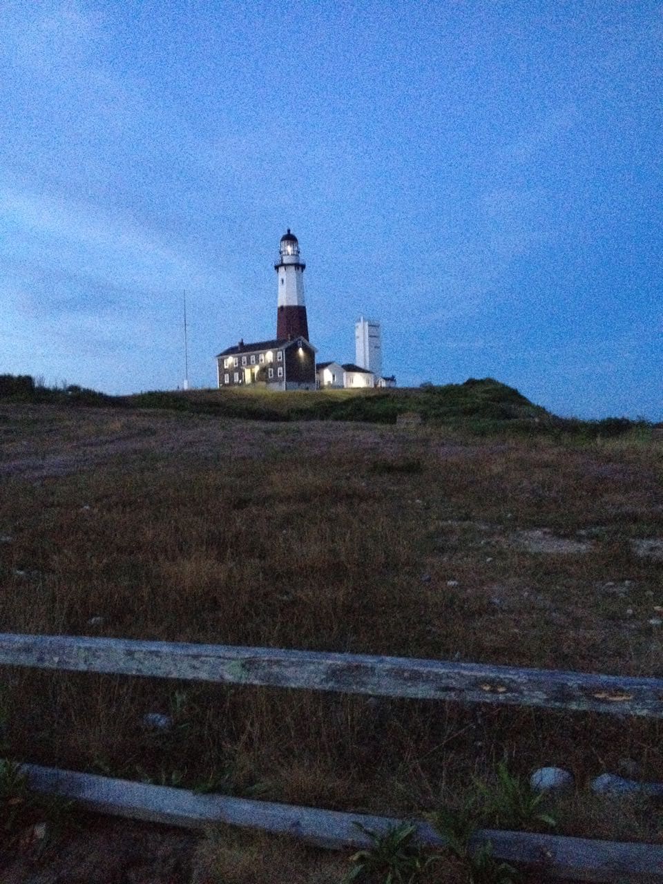
And about 6 rolling and beautiful miles past the village, is the iconic lighthouse.