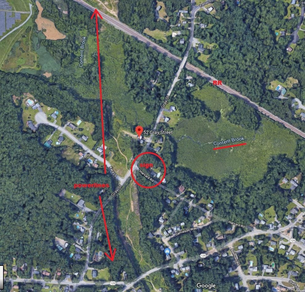
not in the "rectangle" but nearby
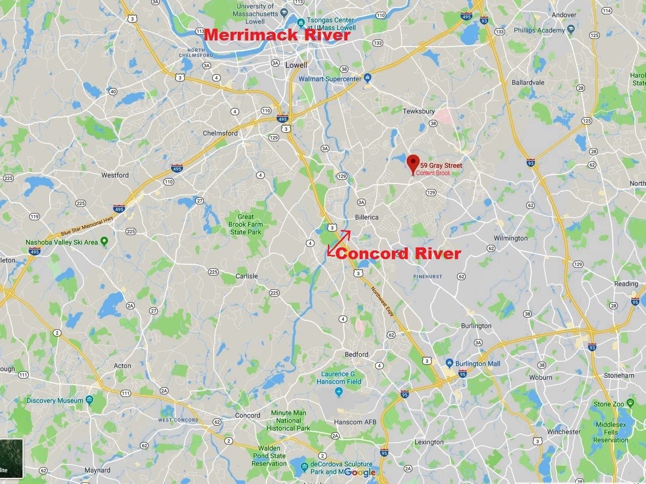
on my way to work in Tewksbury this morning, I saw a small sign indicating that I was passing a Middlesex Canal Crossing. this was before approaching & starting to climb a hill that lead to a RR overpass. approx. 59 Gray St Billerica.
The Middlesex Canal was a 27-mile (44-kilometer) barge canal connecting the Merrimack River with the port of Boston. When operational it was 30 feet (9.1 m) wide, and 3 feet (0.9 m) deep, with 20 locks, each 80 feet (24 m) long and between 10 and 11 feet (3.0 and 3.4 m) wide. It also had 8 aqueducts.
The canal was one of the first civil engineering projects of its type in the United States, and was studied by engineers working on other major canal projects such as the Erie Canal. A number of innovations made the canal possible, including hydraulic cement, which was used to mortar its locks, and an ingenious floating towpath to span the Concord River.
Funny the things you see from a bike that we otherwise wiz right by in our car
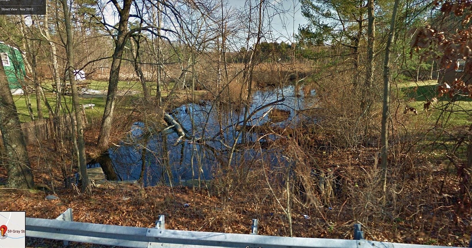
digging with Google maps the only water body I could find was something called "Content Brook" Photo courtesy of Google street view.
but maybe the canal was where the train tracks are now?
this is about where I saw the sign
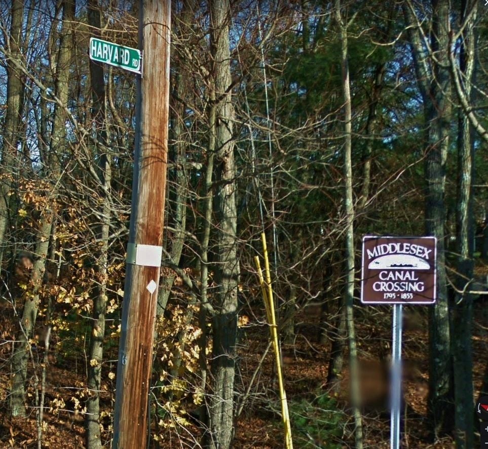
CORRECTION after viewing my video I see that the sign was at Harvard Rd adjacent to the powerlines, approx 52 Gray St. so maybe the old canal was along the powerlines not the RR? or maybe it was indeed at Content Brook?
The Middlesex Canal Corporation was chartered on June 22, 1793, with a signature by Governor John Hancock, who purchased shares, along with such other luminaries as John Adams, John Quincy Adams, James Sullivan, and Christopher Gore. The route of the canal was first surveyed in August 1793. In late September 1794 ground was broken in North Billerica. Water was diverted into the canal on December 1800, and by 1803 the canal was filled to Charlestown. The first boat operated on part of the canal in April 22, 1802 Freight boats required 18 hours from Boston up to Lowell, and 12 hours down, thus averaging 2.5 miles per hour; passenger boats were faster, at 12 and 8 hours, respectively (4 miles per hour).
CREDIT
WIKI