It's hard to guarantee that I will finish a century a month, but I certainly intend to. This thread should provide good motivation to follow through.
One-Hundred Miles of Central Texas
By 0600, the coffee was all gone. By 0630, I had made and devoured a short stack of pancakes. By 0730, the touring bike was rolling out of the driveway. It was already nearly 70�F with a thick humidity that would last all day; luckily a heavy overcast would hang around too, making for a near consistent temperature all day long. The goal, of course, was one hundred miles.
In my part of central Texas, I'm lucky to straddle the Balcones Escarpment, which provides two distinctive topographies. To the west, the infamous Texas Hill Country provides a web of roads easily exceeding an elevation gain of 75 feet per mile. To the east, the Blackland Prairies provide some relief, but a typical selection of back roads will still average 40 feet per mile. I started out west, hill-bound.
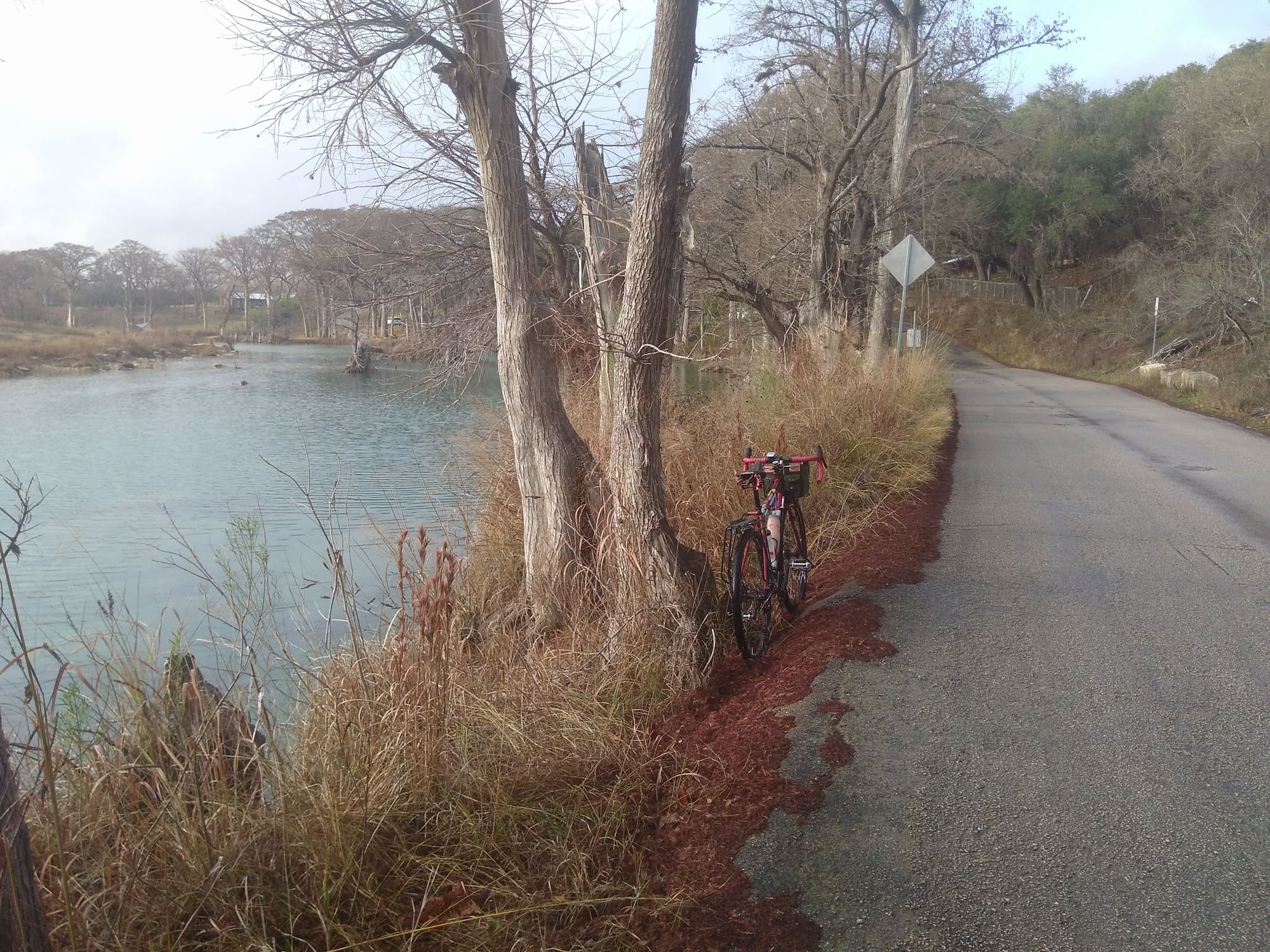
Fulton Ranch Road rolled through small hill country drainages, but the overall trend was mostly up; it's a local favorite for hill practice. At around 11 miles is a ranked Category 4 climb, but today, I would be descending. At the bottom of the hill is a wide valley nestling the Blanco River. Across the river, the road winds into Wimberly. A few miles into town, I stopped for a second breakfast. The Sugar Shack regularly has day-old baked goods for half price; I grabbed my usual, an over-sized cinnamon roll with heavy frosting. After breakfast, I savored the few remaining miles of mostly flat, scenic riding along the river
Image 1: The Blanco River (Mile 17)
The river road didn't last long and soon the road tilted up, obscuring any longer view of the horizon. I was glad just to be holding a 10 miles per hour average, even though I was struggling. I remind myself it should be fine to stop for pictures, though really, I just needed an excuse to rest my legs. After Fischer, the road got worse still. Suffering through my lowest gears, I carefully scrutinized my Garmin for the current grades: 10% or more on nearly every hill. After a few miles of what felt like torture, though, I was rewarded with a long horizon and a smooth rollout.
Image 2: Crane Mills Road (31.6, 1,158 feet, highest point of the ride)

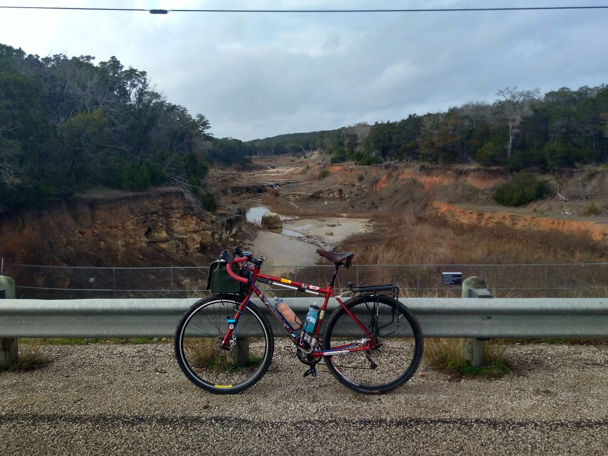
The back road ended, and I turned onto a state highway (FM 306) where the grades were much more manageable. The state highway eventually takes me past Canyon Lake, below an Army Corp dam, and left me aside the Guadalupe River. Along the way I got to cross the Canyon Lake Gorge, a local geomorphological icon leftover from when the dam was over-topped in 2015.
Image 3: Canyon Lake Gorge (Mile 45.0, 715 feet)
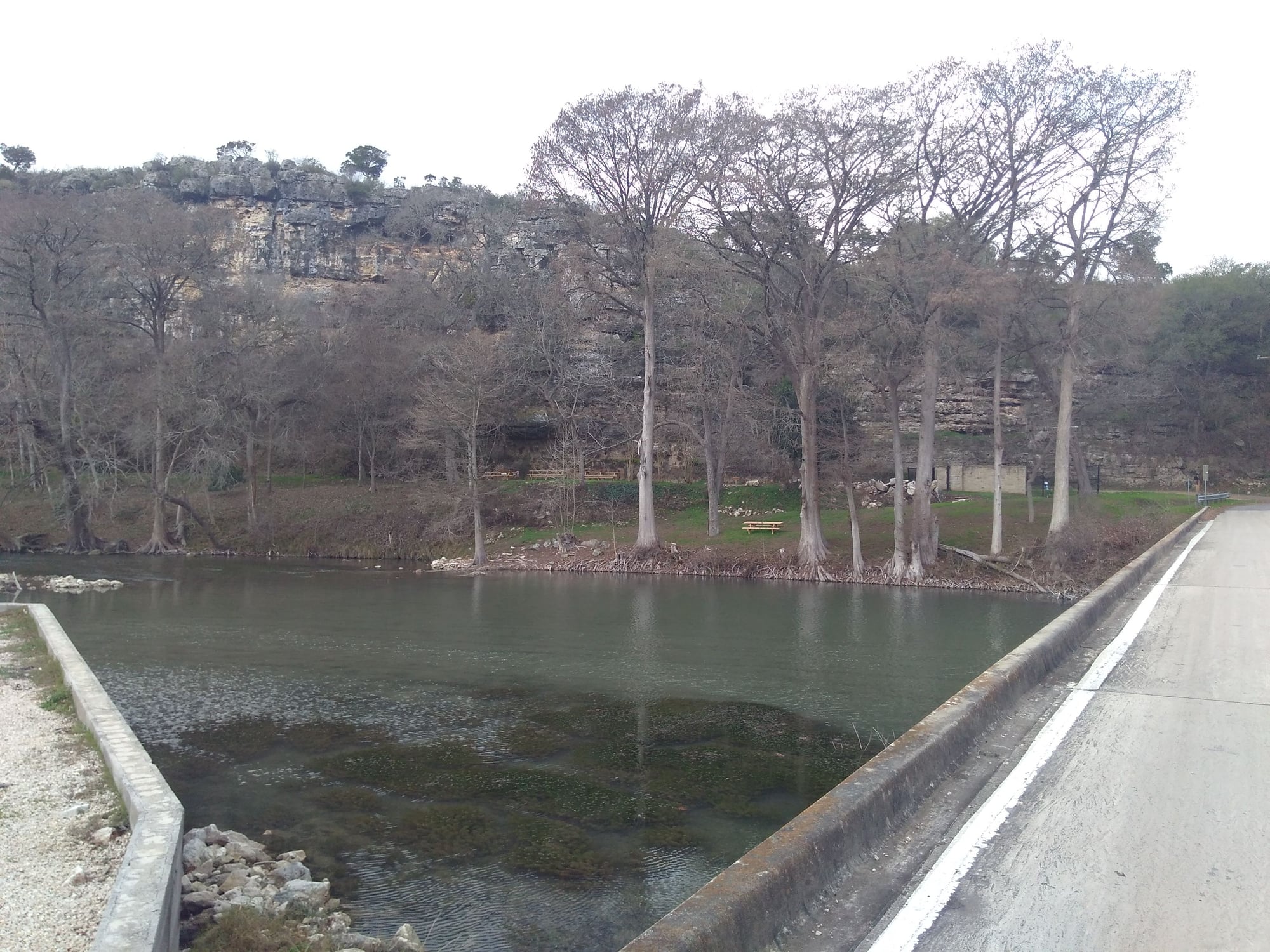
Not much further and I linked up with yet another River Road. Set in the Guadalupe River valley and flanked by steep hillsides, the road is always popular with cyclists, motorcyclists, and vacationers. The road is also renowned for its four river crossings, none of which are fenced or guarded in any way. A good picture of the crossings has always been elusive.
Image 4: Crossing of the Guadalupe River (Mile 53.7)
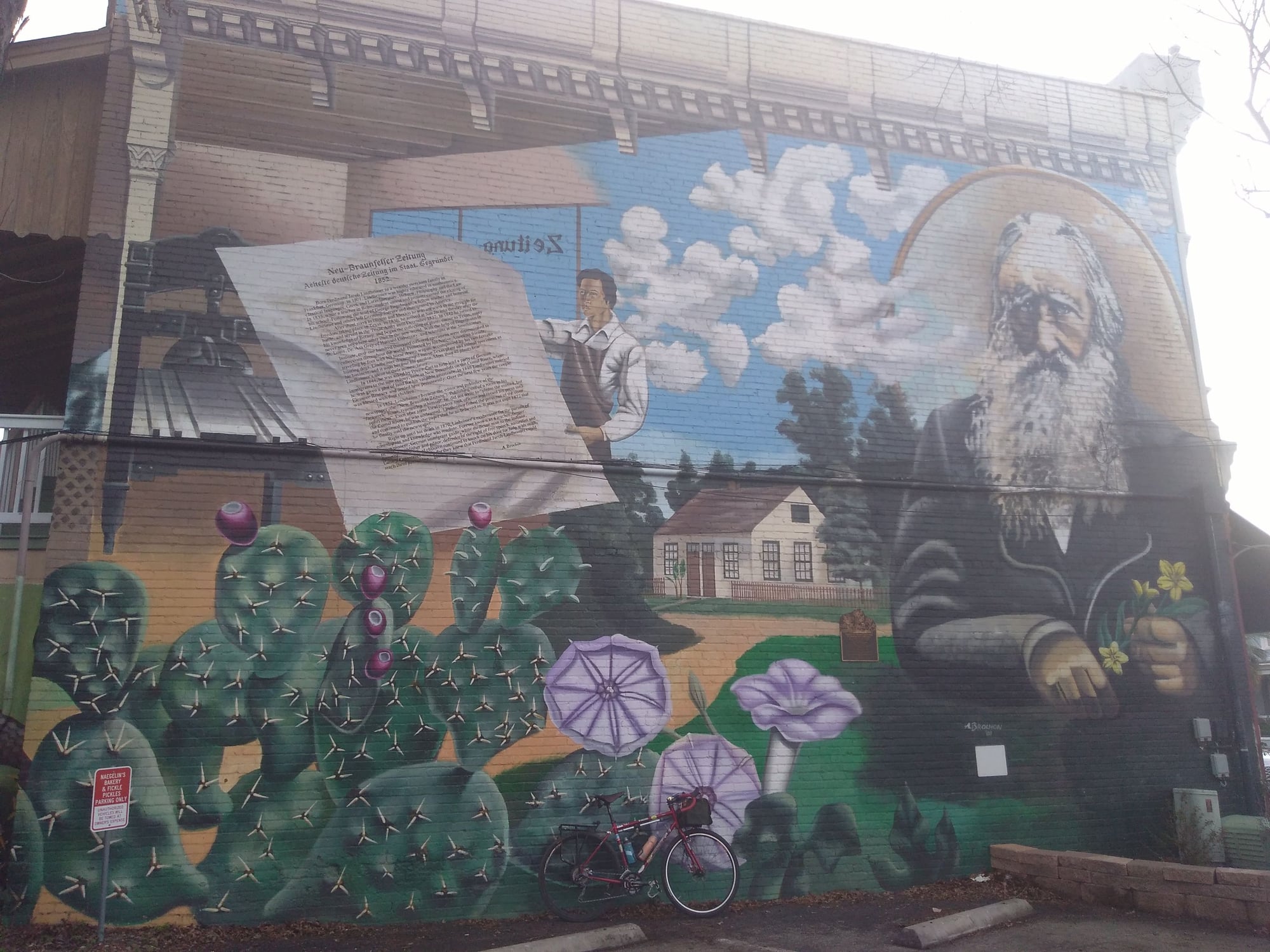
Following the Guadalupe leads to the center of New Braunfels and precariously close to Texas' oldest bakery. At Naeglin's, I can't help but try a bratwurst kolache and a custard-filled donut too. I take an extra minute to relax; I have nearly 100km behind me and only the eastern prairies ahead.
Image 5: Wall Mural, across from Naeglin's Bakery (Mile 61.7, 573 feet, approximately 4,000 feet of net elevation gain)
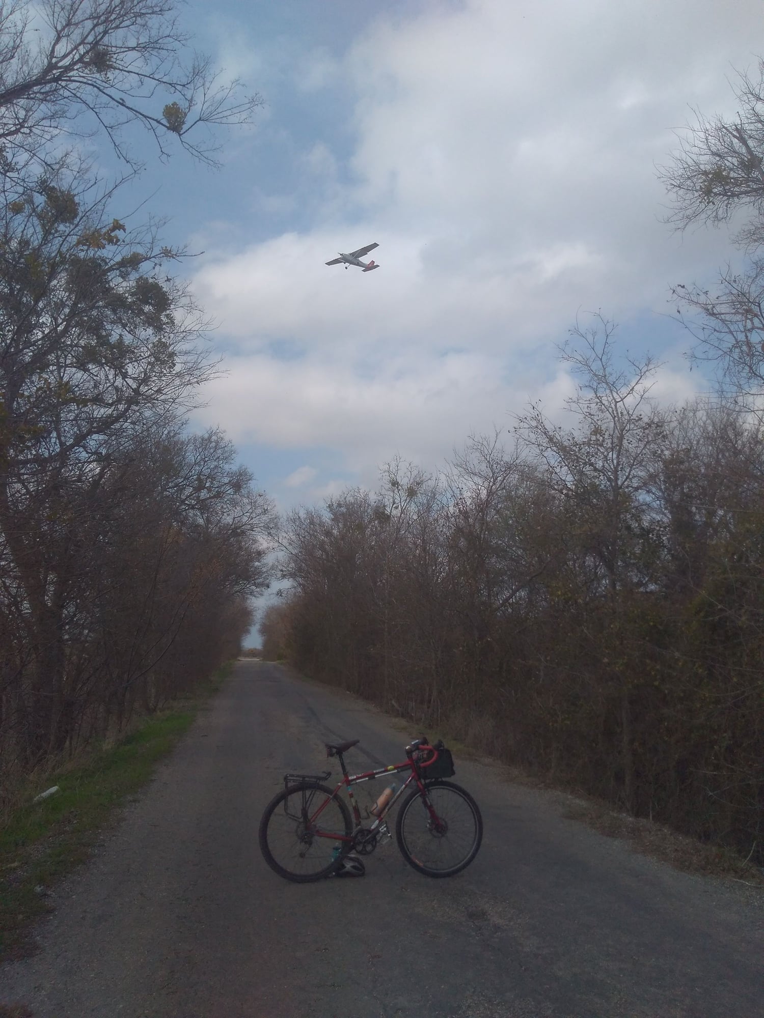
Feeling fresh from the pastries, the next 15 miles went by quickly. I ventured down an abandoned backroad, with the pavement broken and pocked from neglect. It was even signed "No Outlet", but I knew better -- the route passed under the aerial traffic pattern of the New Braunfels Airport. There are about three planes in the pattern, providing a rare opportunity to try a fun composition.
Image 6: Airport Road (Mile 73.5)
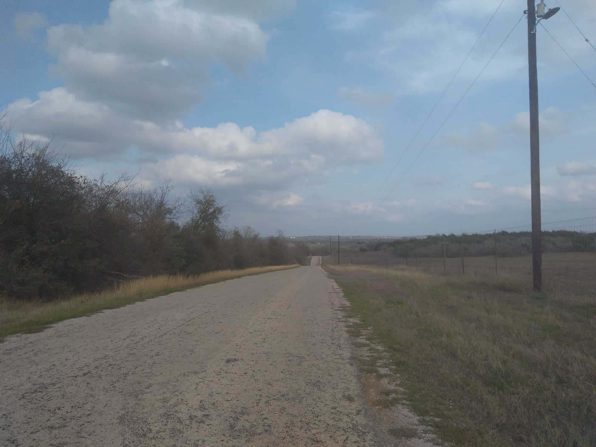
By now, I'm back in more familiar territory, on roads that the local cycling group favors week in and week out. I think to capture one more picture from the crest of a hill, a sweeping overview of the prairies. Then I put the camera away, put my head down and push forth. Despite the growing discomfort of the saddle, and the fatigue in my legs, home is getting close, and with it, the end of the day's ride. Maybe next time, I'll pack a sleeping bag...
Image 7: Looking out over the way home (Mile 78.0)
The Route:
