Originally Posted by
GrainBrain
Well it's not perfect. On maps if you go to the overlay they have an option to select biking which does a good job of marking
official trails. The single track along our greenbelt is shown. But other single track that's part of an official park is not shown so I got a little gung ho

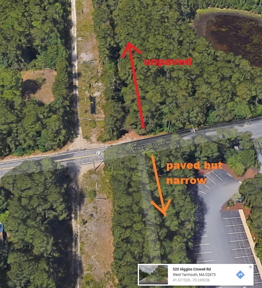
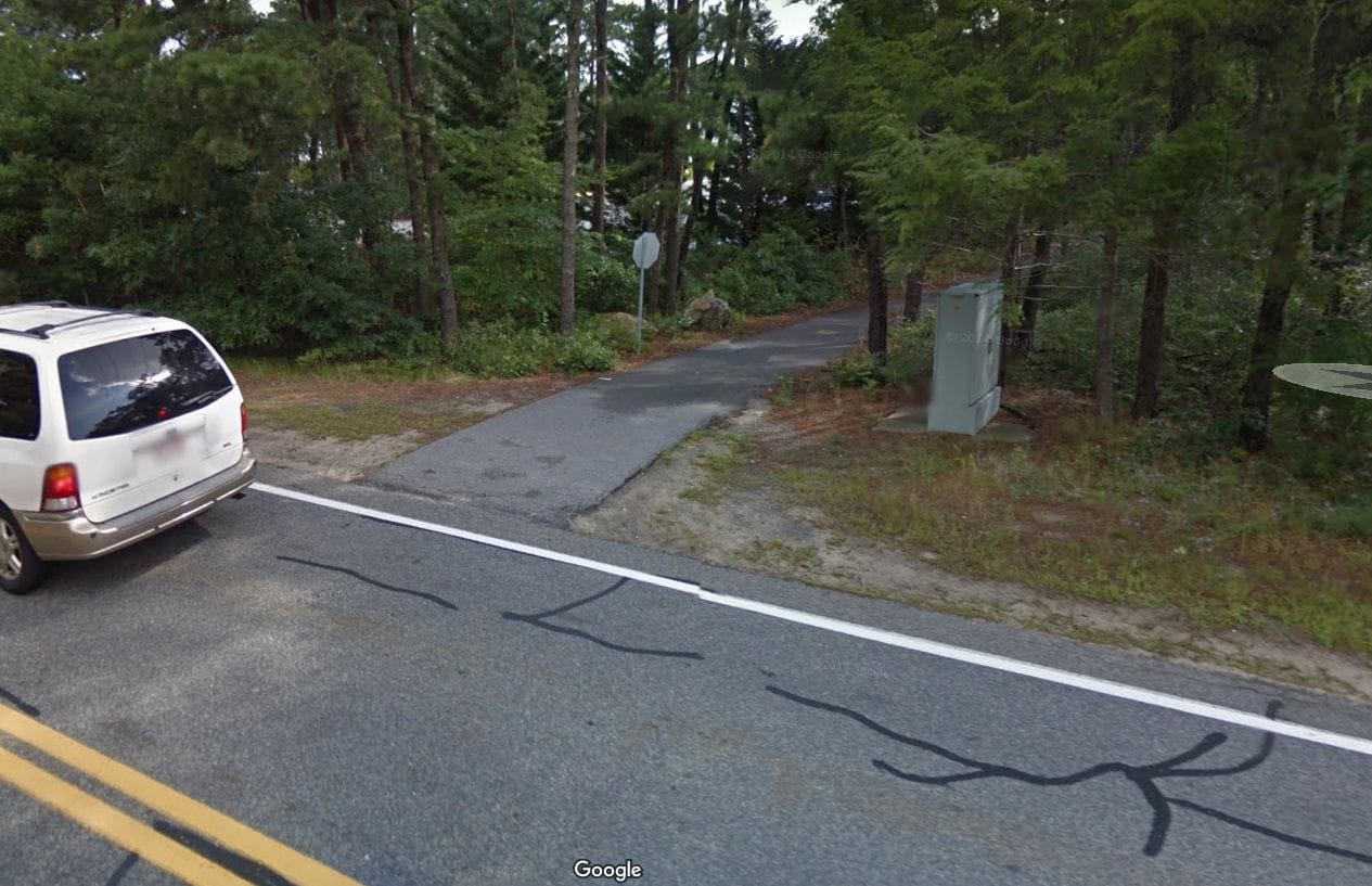
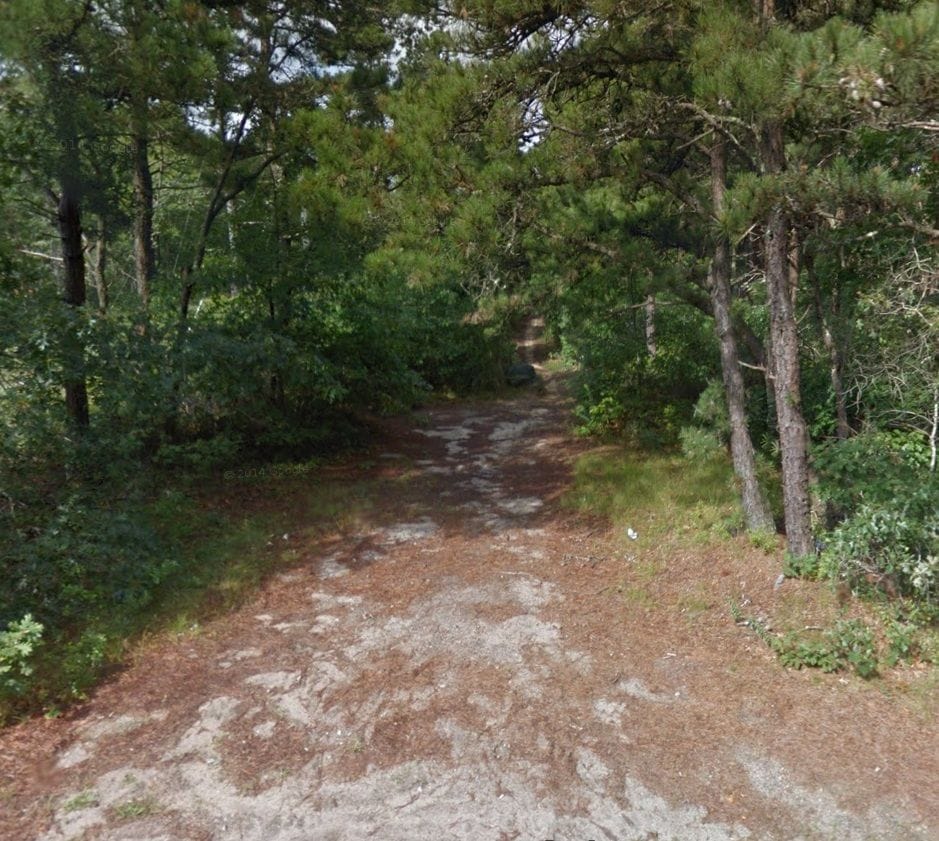
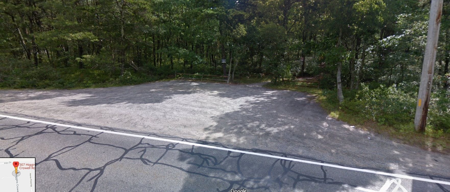
ok, gotcha. yeah I like to use a combination of techniques to gather as much info as possible before some rides. one trick I've developed is to go to Google Street View & place the cursor at intersections of legit paved roads, where they intersect bike trails, paved or not. this let's me "take a peak" in either direction for clues. also useful for examining parking areas. & of course satellite view! hehe