Originally Posted by
UniChris
Very glad to hear that! I like your idea of a loop northwards but will head the comment on rt 47. Maybe I can find something up the west side of the river to make the other side of a loop.
Saturday rode rt 5 south out of town to the Dinosaur footprints. Much of it was fine, but the section right on the edge of Northampton itself doesn't have much shoulder, I feel it's kind of misleading that google maps shows that as a bike routing, but south of the Oxbow it has a very generous shoulder that feels fine. On the return I opted to get on the Manhan branch at the Oxbow and took that the longer way home.
Sunday I set out and rode to Westfield to get on the Canal Trail and took that down to the CT line as a preview for longer plans (I've done the whole canal trail before but getting rides across the gaps). Followed the google maps routing by leaving the Manhan and taking Park St which becomes Line Street and then Country Rd, then a jog on 202 above the airport and finally rt 10 south into town. That was mostly fine - including the 202 and 10 portions, except that from crossing the Mass Pike to the Westfield river was unpleasant - no shoulder, sharrows, lots of people trying to pass in the right lane rather than changing to the left. There's also a hill, though coming back north the climb wasn't anywhere near as taxing as I'd worried riding down it. Opted to take rt 10 the whole way back to the Manhan and liked it less - narrower north of 202 and more curvy.
I am hoping to find a better solution across the Mass Pike and Westfield River though - it looks like County Rd continues as East Mountain Rd after crossing 202, then after the Mass Pike I could take Papermill west to Union and hit rt 10 just north of the river, skipping the sharrows zone. Seems to have a fair degree of usage on the Strava Heatmap though more take and earlier westbound option on Holyoke St - I don't like that as it would still mean most of the sharrows zone. Papermill does look like it could use re-paving but I've ridden worse.
Oh yeah, 202/10 South right after crossing the Pike looks like a nightmare to me, with the interchange and all the businesses that people will be turning into/out of, and what looks to be a 45mph two-lane road with no shoulder. That short section alone would make it a no go for me even on a road bike. And to make things worse, you're riding a unicycle?
Assuming you want to stay on 202/10 to take advantage of the wide shoulder
https://goo.gl/maps/yUtx61HL3xw59yVt7 the direct route is 4mi
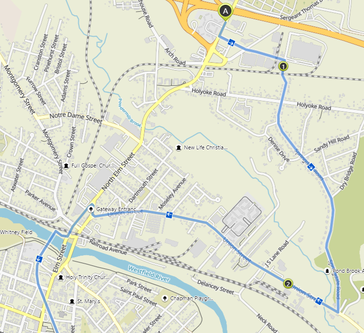
https://goo.gl/maps/z4WuxKvKP6oNdQgR7 For the alternative crossing east, on rural roads, you are at 6mi. 187/Union St. looks like it has decent shoulder and there's a very brief nasty segment on Springfield Rd westbound with the option of hopping on the sidewalk. Or instead of the picturesque Shaker Rd. you might opt for Ridgecrest Dr.
https://goo.gl/maps/4B8Ujqo1ieFJceko8
Another potential way to stick to mostly 202 and avoid that segment north of the river is to do an awkward elbow
https://goo.gl/maps/XKDXSY2sNXyypENi9 and then stay on the wide sidewalk of the northbound part of 202 when crossing the river. By the way, Komoot doesn't do any better than Google Maps in routing through here.
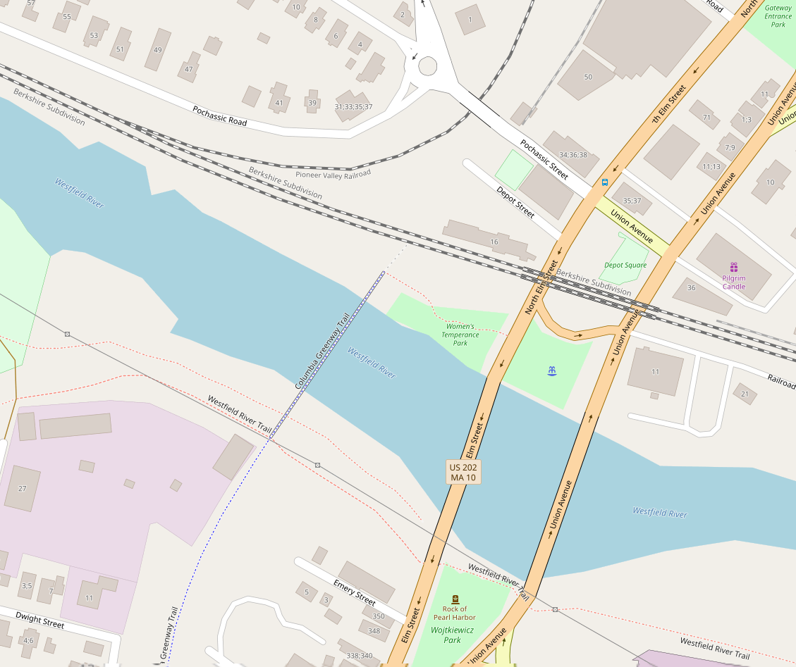
Hold it, I just noticed on
OpenStreetMaps that there's a bike bridge west of 202. Combined with the awkward detour
https://goo.gl/maps/XKDXSY2sNXyypENi9 this could be the best way to get across. Heh, shows you that you have to look at all available source of information...