Originally Posted by
Tourist in MSN
And further out west I think the road routing instead was based on animals pulling wheeled carts and wagons. Wheels are better on flatter roads.
I don’t know that I would agree with this part. We have a bunch of old stage roads here in Colorado. They tend to be rather steep and rugged. Some of them cling to the sides of hills over cliffs. Real flattening of the terrain came with the railroad. Many of our highways and a fair amount of old roads through the the mountains here actually follow the old railroad right of ways.
and while we are coming up with reasons why some roads are like they are, after biking up numerous passes in the Pyrenees, my first time in the mountains, and seeing how they are predominantly switchbacks all the time, hairpins, to keep the gradients to a reasonable amount--I reckoned that this was because in europe cars and trucks were generally low powered, so it just made sense to go this route.
vs V8 powered cars ? Anyway, that was my thinking......not sure if its right given that early American cars were just as underpowered....
Part facetiously but part seriously, I think there is a visual component to the way that roads are built. In the eastern US, the hills are covered with so many trees that visualizing a more gentle route is difficult so that just run them straight up the hill. Here in the Rockies (and in the Alps), people look at a mountain that is bare of trees and say “no frickin’ way!” They can go to the left and/or right to find a flatter route without some stupid bloody tree in the way!
There is also a game trail/cow path element to routing, especially for foot paths. I’ve been exploring the canyons of eastern Colorado recently and came to an epiphany on trails. The canyons can have fairly steep walls (100 feet or more) and there is not always an easy way through them. It leads to a lot of hike-a-bike or even climbing cliffs with bikes...not something I recommend. I started following cow paths since they were rather smooth and found that the cow paths offer nice, relatively easy ways up an out of canyons. No cow (or deer) will go where rocks are and will pick out the smoothest routes out of the canyon. Once I started following the cow paths, I had a whole lot more fun. I hate climbing cliffs in bike shoes!
Going waaaaay off topic here: Native Americans actually took advantage of this tendency of animals to avoid rocks. They built things called game traps (or game runs). Some are quite extensive with low walls (about a foot high and a foot wide) running for as far as a mile. I’ve been to one that is well documented and found a couple of others that no one else seems to know about.
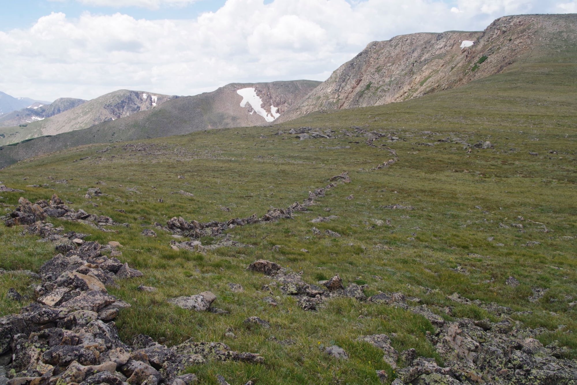
This one is on top of Rollins Pass and is well documented. It’s at a bit over 12,000 feet and could be 10,000 years or more old. They have found atal atal darts as well as arrow heads on the site. The tribe would drive the animals uphill and along the wall towards blinds where hunters hide.
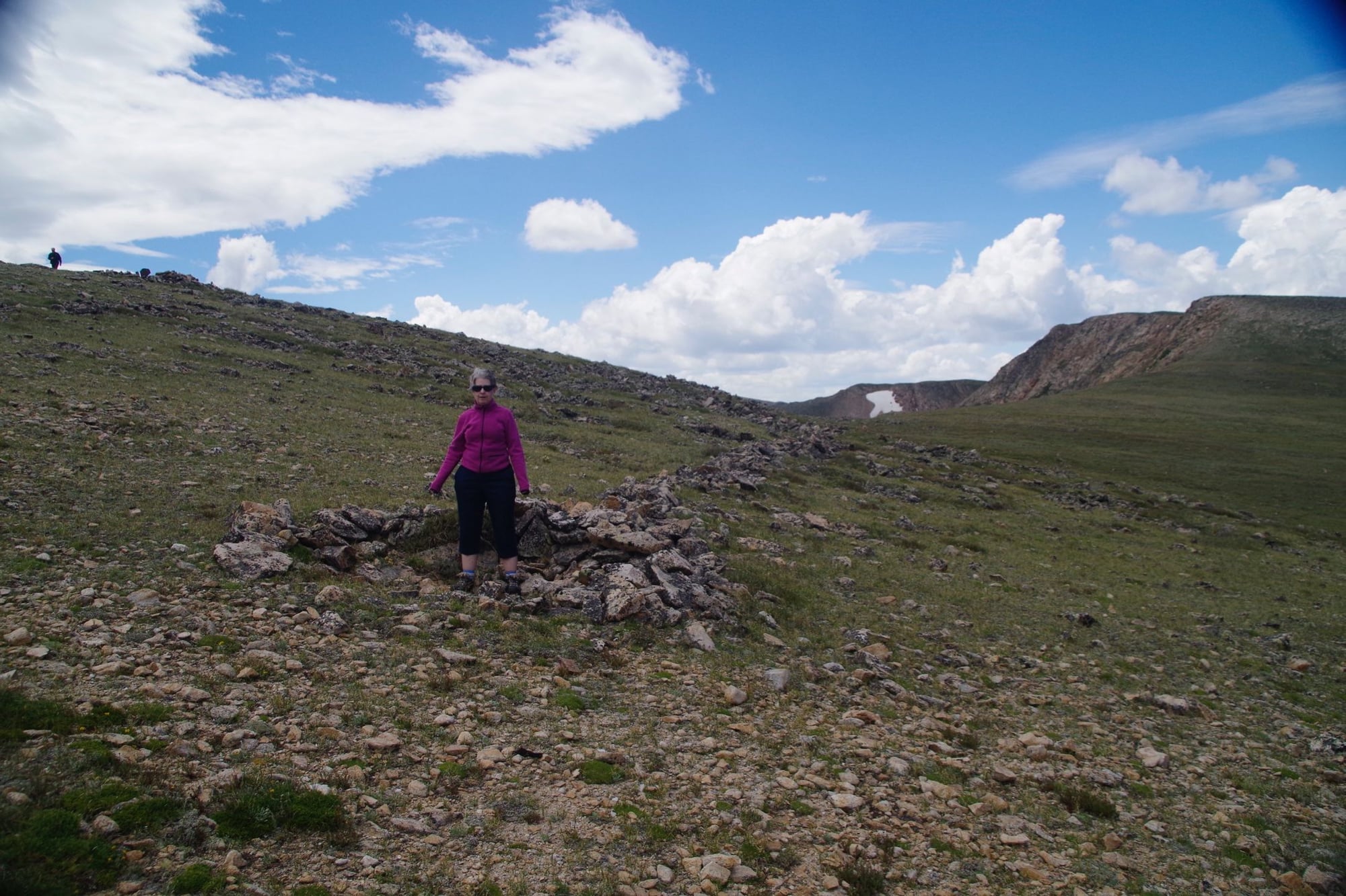
This is a blind at the opening of the trap. Hunters could kill the exhausted animals with impunity. I’m standing near another blind so the animals could be caught in a cross fire. They hunted big horn sheep. Animal still follow the walls to this day and will not just jump over them.
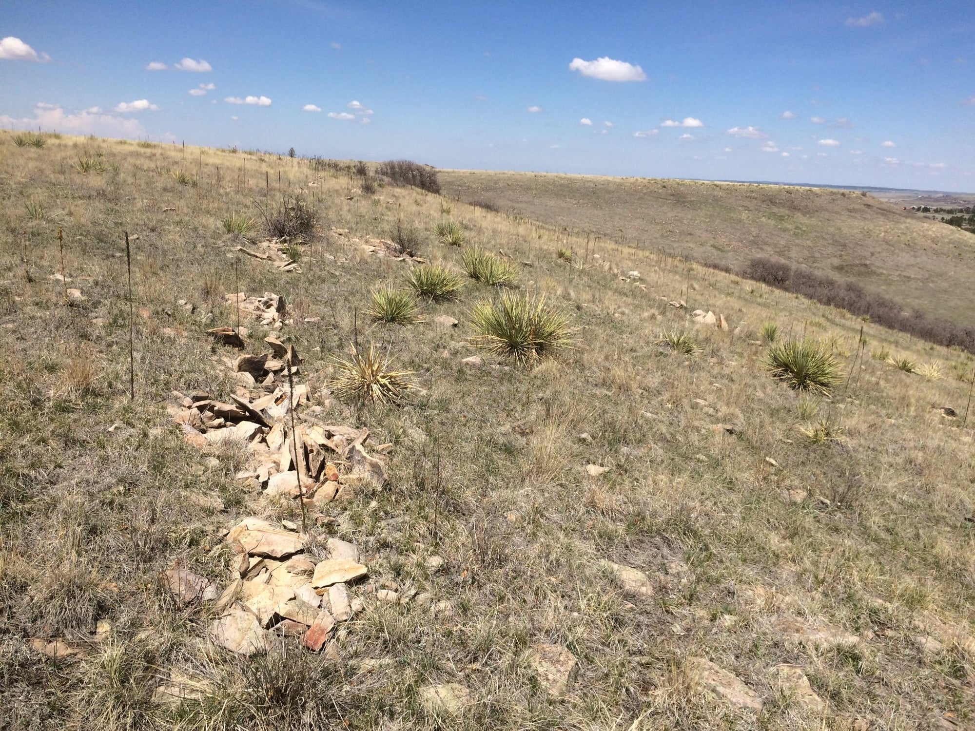
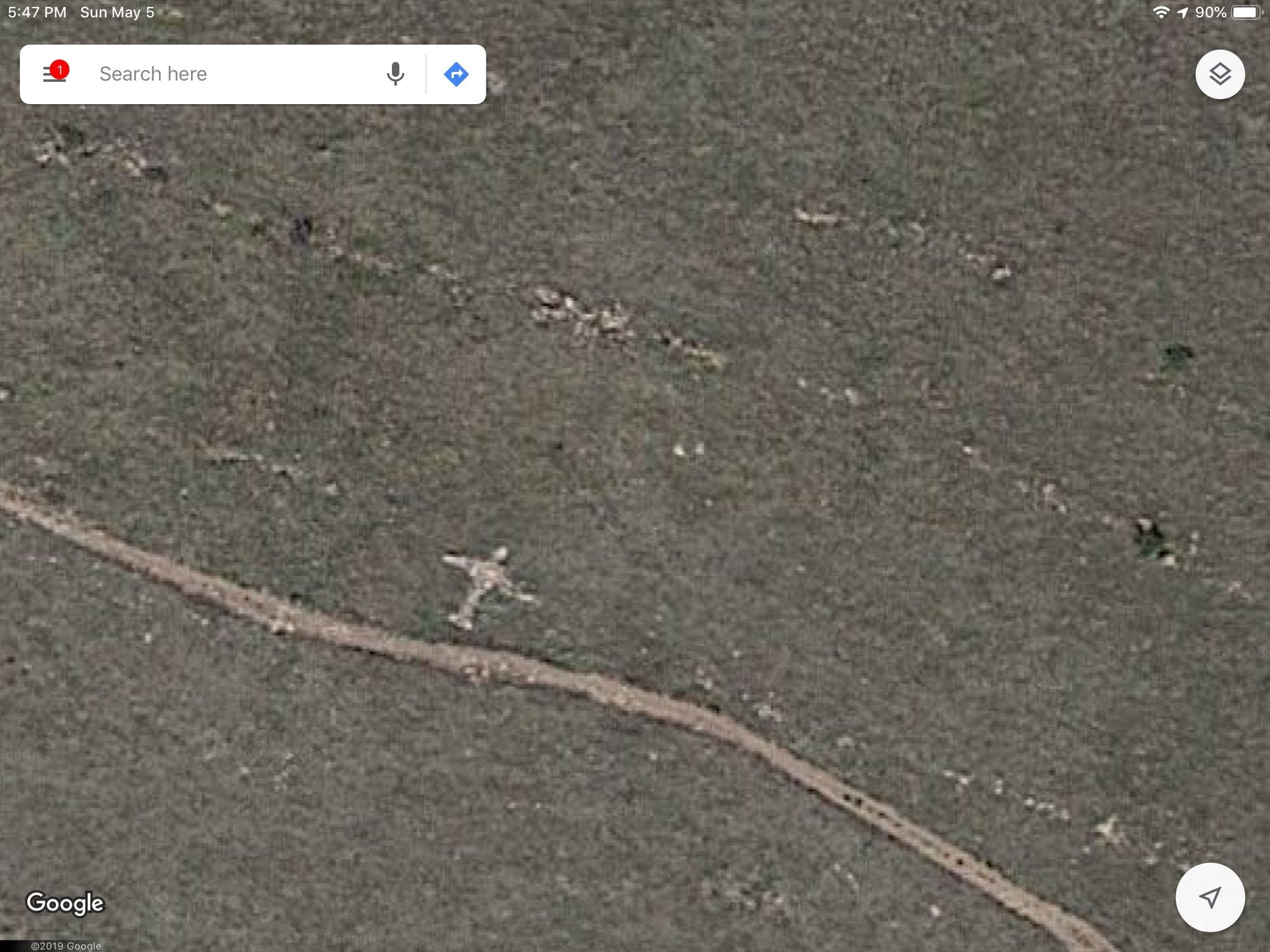
This is another one in eastern Colorado. It’s never been studied and the open space authority in charge of it doesn’t even know it exists. This one was for probably for bison. You can see 2 lines and there are even three lines of rock walls at this site.
The three line structure of the walls. The kind of “airplane” figure is a thunderbird. I contacted someone who studied the Rollins site and he thinks this isn’t contemporary but I’m not so sure. There are 3 of these figures in the system and one of them is way off the trail. The walls also align with the wing tips.
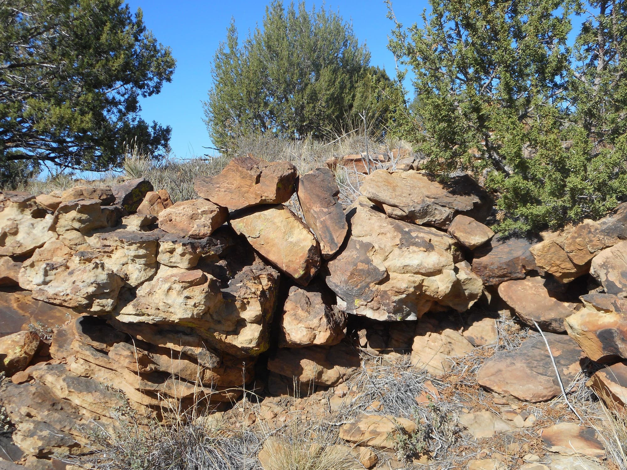
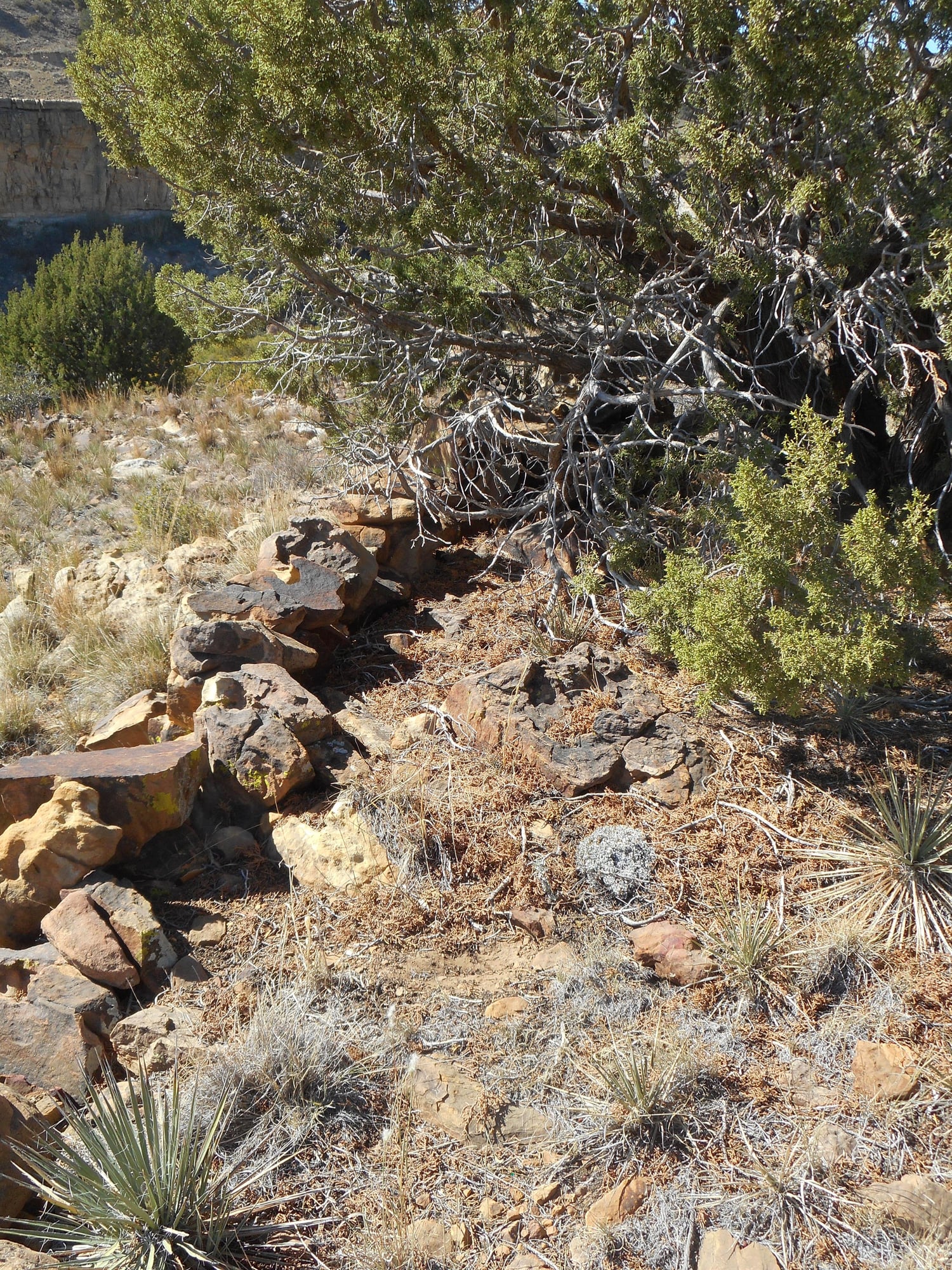
This is one I found in southeastern Colorado recently. It doesn’t look like much but it’s at the top of the hill and the wall guides animals to a jump that they can’t see
Sheep herders built walls throughout southeastern Colorado but those are circular structures.