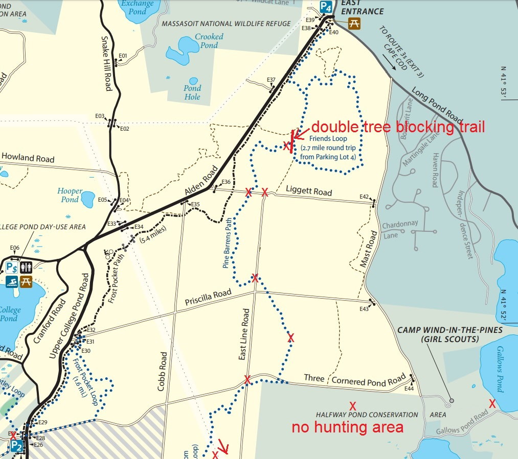
red "X" mark spots I located myself on the map while riding
also rode further South from this depicted area on the power line rd
did not note where I turned around tho
glad I didn't try the Pine Barrens Trail from lot#4 due to that double tree fall blocking the trail
got lost in the woods w/o signage while exploring the "Conservation Area" resulting in stopping at Gallows Pond. once I knew where I was it was a simple matter to use my compass to head West & North until I could find named dirt rds that were also on my map so I knew how to get back to my car
w/o cell phone GPS, map & compass, it would be pretty easy to get lost & stay lost for some time! go prepared!