Managed to get a sanctioned 400K done, I forgot my shoes when I drove to a closer one so this one required an out-of-town stay. Done solo this time.
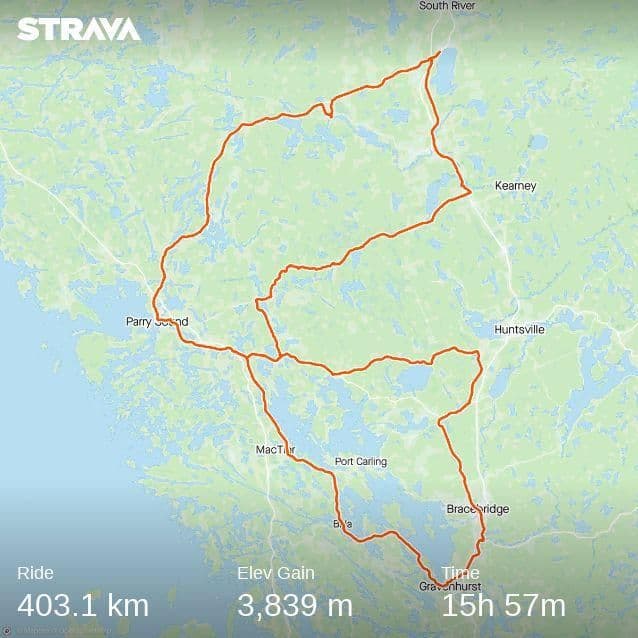
The start/finish was in Parry Sound so after 200K I was able to get more supplies from my hotel and I even showered and changed kit, something I've never done on a 400K before. I was trying for a 20h finish since I usually have trouble after 350km running of steam and I like to spend a lot of time stopping, so the plan this time was to make quick stops when needed and hopefully finish before midnight. I chose a 4am start. The loops are clockwise, and the southern one was the first one since it's busier roads, then the northern one to finish up.
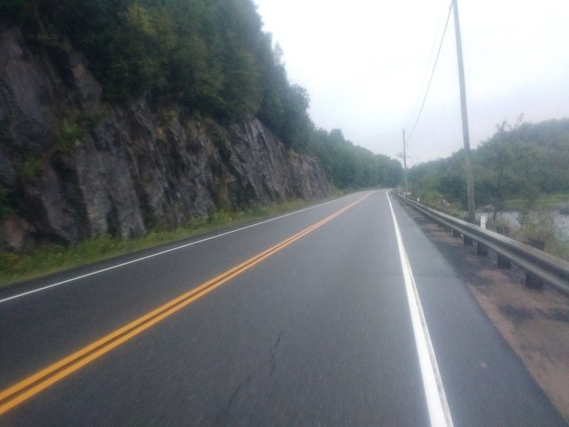
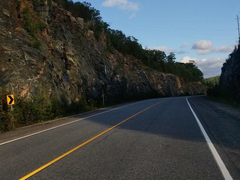
Thunderstorms passed through the area the night before and had just finished as I was starting. I hit a few small pockets of rain but nothing major. I had clip-on fenders since the forecast wasn't firm about how much it would rain. There was a bit of headwind for the first 20km and then I was in some heavily forested hilly areas so it didn't affect me much. The first control was a photo control at ~60km, then at Gravenhurst was another one where I had a coffee and some food. There was a tailwind from there until the town of Bala, then a headwind all the way back to Parry Sound, unfortunately the road is a secondary highway so it's much more exposed than the first 100km. The morning was cool; 16C and it stayed around there for first 200km, which took me about 10 hours including the lunch and shower stop. Due to the cooler temperatures and overcast sky, I was damp all morning which is why I took a shower and changed my kit. I also ditched the fenders.
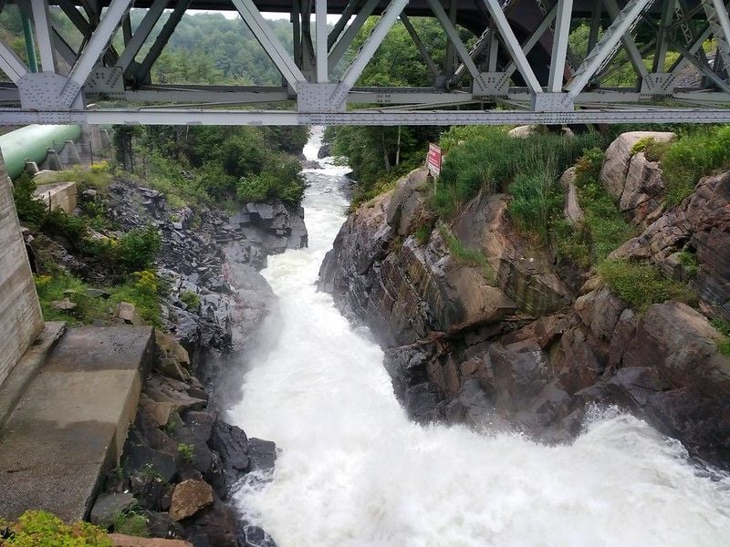
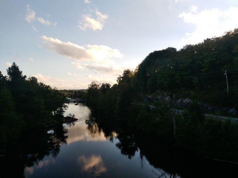
There were some really nice waterfalls on the ride, this one is near Bracebridge and the river is also dammed for hydroelectric purposes.
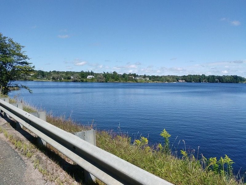
During my lunch stop, the weather changed drastically, and a strong westerly wind picked up and blew away all the clouds and humidity, the sun came out and I enjoyed a relatively easy 85km to the tiny town of Sundridge, at the easterly point of the northern loop. The road from Parry Sound to Sundridge is a secondary highway that was a little busy for ~25km out of Parry Sound, and it was gentle grades through some farms and many lakes like the one above. The area is a popular spot for summer holidays; fishing and boating, camping, etc. are all over the place. The towns are small though and many of the farms are abandoned. I'd never been to this part of the province so it was nice to see new places. The last ~75km of the eastern leg of the northern loop had a good paved shoulder and low traffic, but many climbs too. The wind made it fairly easy to moderate my output and I felt strong the whole time. I made it to the control in Sundridge around 6pm and found an open grocery store so I had a nice supper, loaded up with snacks and a litre of coke in my back pocket and set off to tackle the last ~115km back to the start. I knew there were two gas stations along this stretch that might be open until 9 or 10 in the evening but wasn't planning to count on them for supplies.
I wasn't sure I'd make my planned finish time since the wind was blowing still but as I made my way south through the town of Burk's Falls I noticed the wind started dying down... part of this I thought was the forest cover on the side roads and riding with the cross wind, but by the time I turned and headed westward it was pretty much done blowing. The south-bound portion of this loop was almost entirely devoid of traffic, aside from the village of Burk's Falls there was just nice pavement, beautiful rock cuts and scenic lakes.
As the shadows grew long I was on my way westward and into the evening, the road was in good shape and traffic was almost non-existent, but I kept seeing highway construction crews passing by me and after nightfall I came across where they were heading; a beaver dam had broke and flooded the road! They were in the middle of setting up signs to close the road but they let me walk through the cold water since a detour would have invovled back-tracking ~25km and adding another 50km to the day. My feet were cold after this! The nice thing about the road being closed after this stretch was that I had no traffic coming from behind me. This stretch was rolling hills with an overall downhill trend toward the end, so they didn't really dry in the dark and temperatures were 14C, finishing up at 12C at the end of the ride. This last ~50km of road was used on the Manitoulin 1000 last year and also part of it was on the Granite Anvil 1200 in 2017, so it was a lot of fun to ride these roads again and I had been keeping up a good average speed this whole section, so I finished the ride at 22:55 for an overall time of 18:55, by far a personal best for me on the 400K distance. The elevation was challenging but the grades weren't excessively steep and many of the hills are in rolling terrain so it's possible to keep up a decent average. The RWGPS for the course has the climbing around 4000m but I think it's probably closer to 3500. The massive pressure change over the course of the ride probably messed with the wahoo's barometer as it's been reading lower and lower elevation on my usual routes over the last year or so. Anyway, it was a great ride through a nice area I usually don't get out to very often.