Originally Posted by
KC8QVO
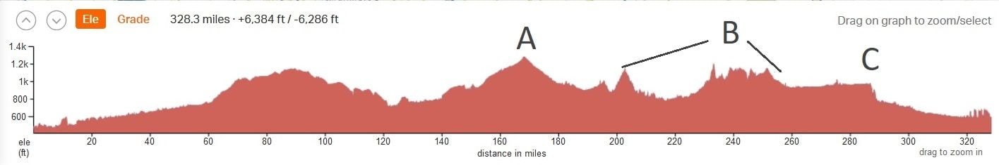
It looks like the section through and just E of Centerburg is the highest point of the trip, but the grade doesn't appear too terrible.
See A below
Originally Posted by
KC8QVO
Fredericksburg to Massillon shows some tough up and down going through several hills.
See B below
Originally Posted by
KC8QVO
Akron shows what appears to be a pretty steep drop off going north.
See C below
Originally Posted by
KC8QVO
Aside from the Fredericksburg to Massillon section of up and down - are there any note-worthy slow-down areas for one reason or another?
See B below again - the bigger hill at the start of that marked section is about 22 trail miles E of Mt Vernon/3 trail miles west of Glenmont. Fredericksburg is near the high point of the segment of up/down on the east side of that marked section.
Here is a visualization: