Originally Posted by
sherbornpeddler
Speaking of new routes and insightful observations of old routes,
I decided to ride my same old, same old loop de loop. For me the season is still young and I am (trying to be) cautious about ramping up miles to avoid a tweak or setback.
I think the same old is reassuring and routine maybe more so this pandemic year...
Originally Posted by
rumrunn6
I like familar routes because I know where the shift points are, when to save the legs, when I can go for it a little & where the potholes or rough surfaces are.
I was surprised to see route 109 in your map, I didn't realize it was within striking distance of Dover. used to date a girl in Norwood & I remeber 109 for some reason. does anyone think route 1 is it? or 1A? along the Fellsway is it? is good cycling?
I remember driving it, taking the long way to see her
Originally Posted by
Jim from Boston
"Park & Pedal experiment, Middlesex County, MA"
This, like many route maps of regions I don�t know well as described in the Metro Boston thread appears confusing. During the years I was exploring my various commuting and training routes, mostly West and South of Boston I would invariably get lost, and often allow extra time to recover...
Originally Posted by
Jim from Boston
I grew up in Detroit, MI where the the streets are in a grid pattern, extend for long distances and are well-marked. Boston is entirely different.
Besides a crazy pattern of roads originating as cowpaths, roads changing names at seeming random points, and not marked anyways, there are also rotaries which mix up your sense of direction.
So really one has to become visually acquainted with routes to follow them...
I really enjoy cycling in Boston and environs because it is such an interesting city. After many years here I have rambled and learned most of the region, but
it's still interesting to get lost, discover some new road, and add that to my mental map.
Originally Posted by
Lizzylou
�I look at getting lost as a way to learn new routes. You pay attention to the landmarks more when you don't know where you are, so you are more likely to remember the roads and such for the next time.
I commute via Rte 1A from Dedham to Norwood, and it's a nice route, and is pretty good down to Walpole but
I have better routes south of Norwood.That whole area, to include Walpole, Norfolk, Westwood, Medfield, Millis, Sherborn. Dover, and Needham are my contiguous stomping grounds, and I know many excellent back roads, even during usual rush hours.
Rtes 1A (not Rte 1 for cycling) and 109 are the backbone roads of that area. Rte 109 is OK, with a good shoulder, but sometimes heavy fast traffic. I use it to get across the vicinity quickly, but more often ride short segments get to better roads.
Just to the east are also the pleasant suburbs of Canton, Sharon, Foxboro, and Easton. I have described these sectors in my informal Cycling Guide to Metro Boston:
Originally Posted by
Jim from Boston
...For some generalities, my favorite map is the AAA road map of metropolitan Boston
[and other cities
]. The size is large enough to plan century rides, yet the scale is small enough to find excellent cycling roads nicely defined by the road color and weight of the line.
I think of the [Metro] area in sectors radiating from downtown and surrounded by a circumferential belt about 10 to 15 miles from Downtown, known as Route 128 ("America's Technology Highway")....
Even though I've lived here for over 30 years, I always get lost on a new ride. Streets are laid out in a haphazard fashion; many streets, particularly the one you are riding on are not marked; they surreptiously change names; and in rotary intersections it's easy to lose your sense of direction. (I don't have a GPS.)
On a happier note, the Transportation Authority (MBTA) allows bikes on subways and commuter trains with certain restrictions and that's a nice way to get out of town without city riding. MBTA > Riding the T > Bikes on the T [these towns are well served by Commuter Rail out of South Station]...
I would describe the sectors as (mostly for road riding outside of Rte 128):...
Southwest: Needham, Wellesley, Dover, Medfield, Walpole, Westwood, etc: probably more popular than the western burbs; wealthy exurban to rural, moderately hilly country roads, horse farms, mansions.
South; Norwood, Canton, Randolph, etc: middle class suburbia; rideable but usually on the way to somewhere else (no offense) [See this ride report from July 2014]
Originally Posted by
Jim from Boston
...
So I did a ride through another little-reported sector of Metro Boston on this thread. I call it �Somewhere South of Boston.� In my
Cyclist�s Guide to the Metroverse, I described:...
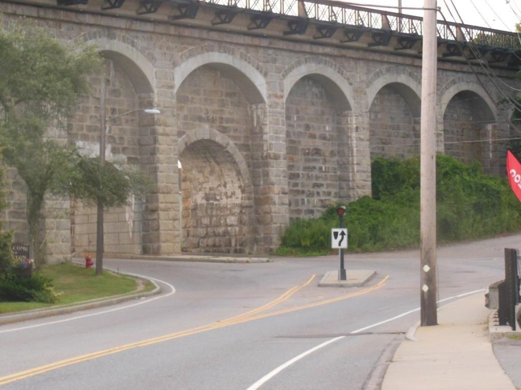
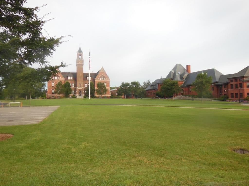
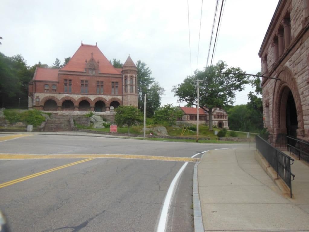
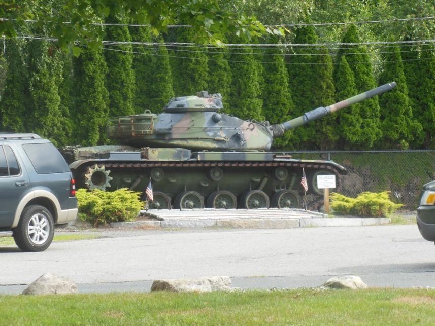
This is the sector to which I commute, and today�s ride was a worthy one. To stay within my defined perimeter I did an L-shaped ride from Norwood through Canton to Braintree; back to Canton; South to Easton, and back to Norwood through Foxboro and Walpole
Canton viaduct
Thayer Academy, Braintree
.
Histroric Ames Shovel Works, Easton
(? VFW) Post, Easton
Back side of Gillette Stadium, Foxboro

Originally Posted by
sherbornpeddler
Jim,
Great Canton-Easton report and impressive ride. I learned a lot and my next ride through that area will be much better for it...
Last edited by Jim from Boston; 05-24-20 at 03:40 PM.
Reason: added photos and two quotes by sherbornpeddler, then quotes about getting lost