
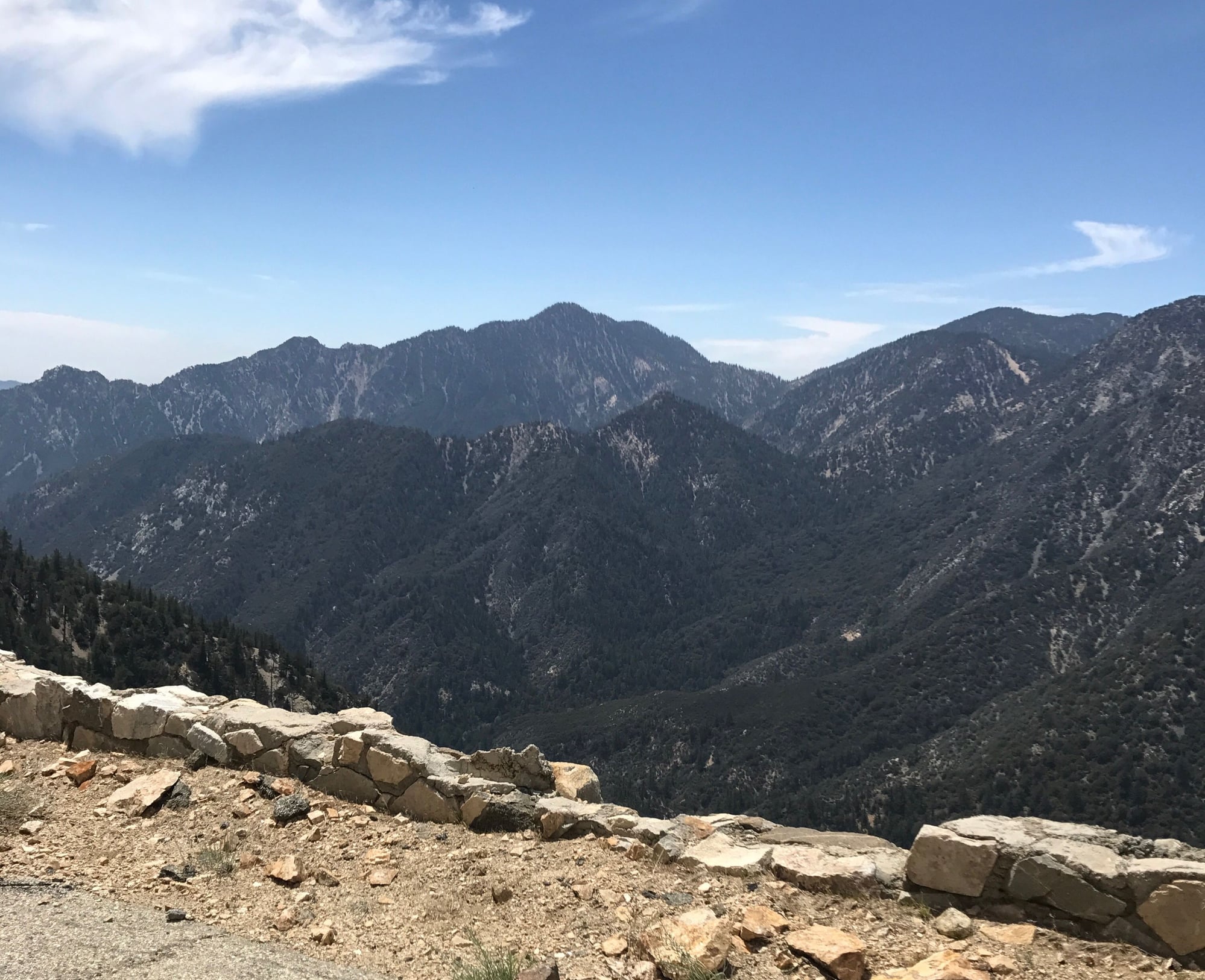
ca hwy 39 north of azusa (near pasadena) between crystal lake and ca hwy 2 (angeles crest highway-aka ach) in the san gabriel mountains/angeles national forest.
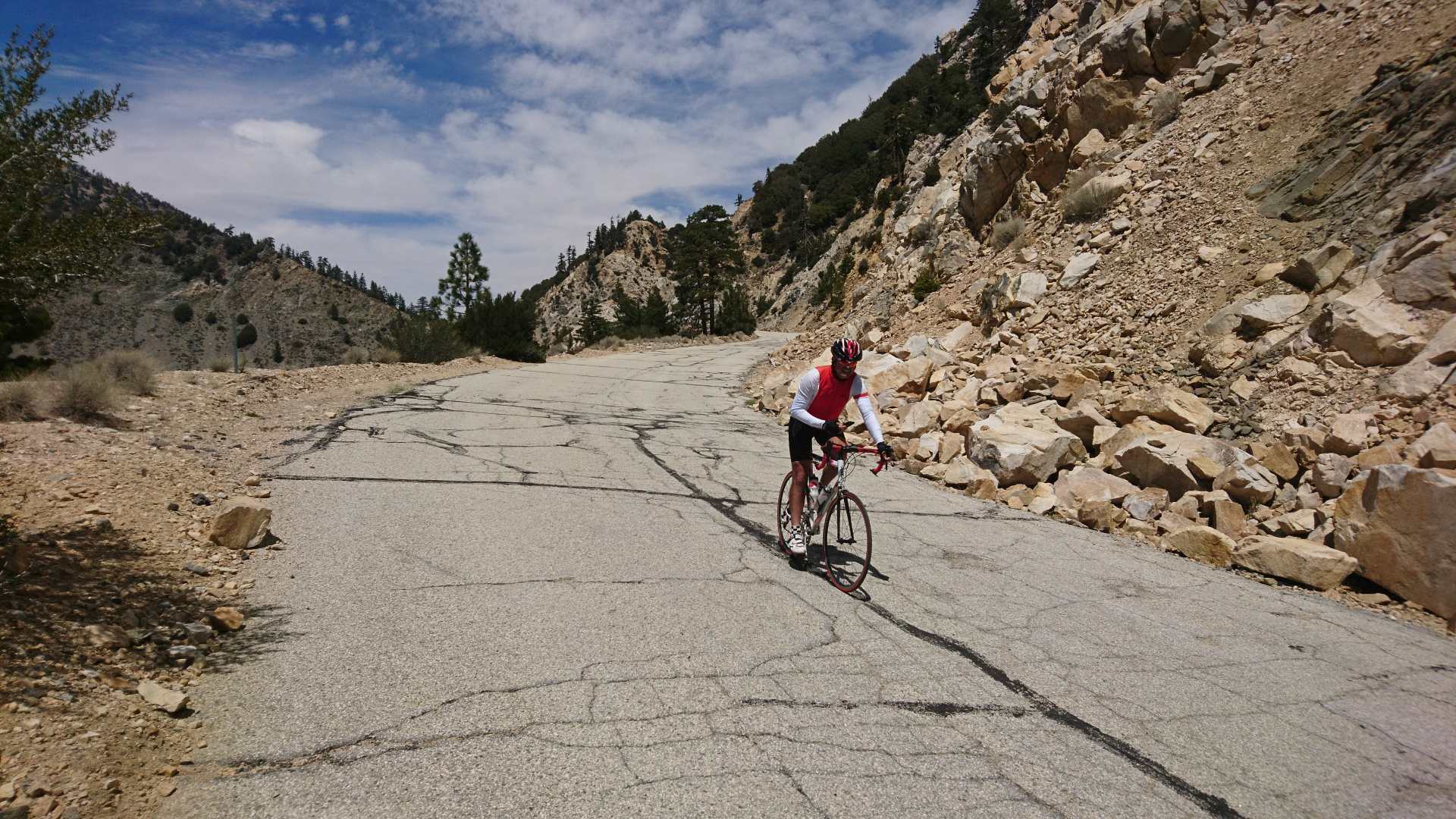
signed as closed to all traffic including peds and cyclists but i've done it 5-6x's and in both directions. it's approx 5 miles closed off to auto traffic. there is always
rockfall on the road plus plenty of little divots from said rockfall. heading north/uphill, it's not an issue as you're at altitude and it's a deceptive grade. the divots and rocks on the road
are a bigger problem heading downhill as it's easy to hit 35+ mph within seconds. don't be surprised to see the caltrans snowplows working that stretch moving rocks.
have never had any issues cycling through the area in regards to "trespassing." it's gorgeous up there with great views and a must-do for every capable socal cyclist
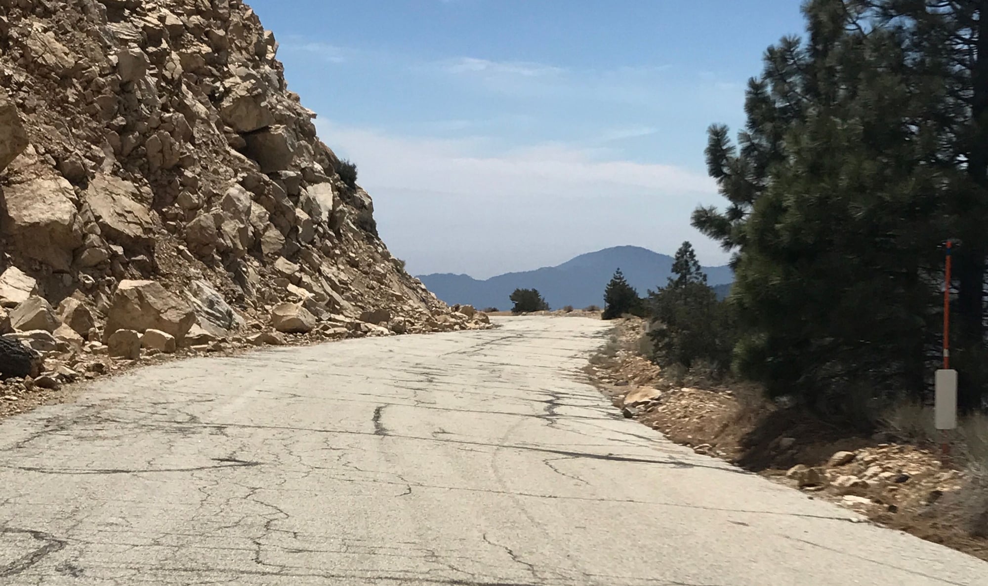
at least once. road surface is generally decent and paved the entire way but some mixed blah spots here and there. ***edit-rode this up and down in may...there is a section
of pavement broken up/washed out at approx the halfway point. the section is approx 30 yards long. rode it both ways on 23's w/o dismounting-end edit***
just ride your brakes heading downhill and you'll be fine.
i think this road got closed in 1938 or so after the crazy rains that year but the state somewhat maintains it as an obvious fire/evacuation road. not an inexpensive endeavor.