


Corona/Ontario/Pomona street help
 02-15-21, 08:07 PM
#1
Senior Member
Thread Starter
Join Date: May 2001
Location: Sunny so. cal.
Posts: 904
Mentioned: 1 Post(s)
Tagged: 0 Thread(s)
Quoted: 136 Post(s)
Liked 57 Times
in
31 Posts
Corona/Ontario/Pomona street help
Are any of you familiar with River Road/Archibald from Corona into Ontario and then Mission Blvd thru Ontario over to Pomona? I know S Diamondbar Blvd that Mission turns into. Are those streets I mentioned ok for bike, bike lanes, etc.? Thanks!
EDIT: I zoomed on a map--it looks like ugly inland sprawl--I thought it be more farm fields. maybe south of Corona is better for more rural/undeveloped roads? If so, any recos?
EDIT: I zoomed on a map--it looks like ugly inland sprawl--I thought it be more farm fields. maybe south of Corona is better for more rural/undeveloped roads? If so, any recos?
Last edited by bikeme; 02-15-21 at 08:18 PM.
 02-15-21, 08:40 PM
#3
Senior Member
Join Date: May 2017
Location: Hacienda Hgts
Posts: 2,105
Bikes: 1999 Schwinn Peloton Ultegra 10, Kestrel RT-1000 Ultegra, Trek Marlin 6 Deore 29'er
Mentioned: 3 Post(s)
Tagged: 0 Thread(s)
Quoted: 822 Post(s)
Liked 1,960 Times
in
943 Posts
I can only vouch for the roads in Chino Hills and Diamond Bar which are bike friendly with bike lanes and decent roads. I am sure someone can route you a quicker route but what major cross-streets in Pomona is your destination?
https://ridewithgps.com/routes/35195228
https://ridewithgps.com/routes/35195228
Likes For CAT7RDR:
02-15-21, 11:31 PM
#4
velo-dilettante
Join Date: Apr 2009
Location: insane diego, california
Posts: 8,316
Bikes: 85 pinarello treviso steel, 88 nishiki olympic steel. 95 look kg 131 carbon, 11 trek madone 5.2 carbon
Mentioned: 26 Post(s)
Tagged: 0 Thread(s)
Quoted: 1628 Post(s)
Liked 3,114 Times
in
1,683 Posts
i can vouch for a few of the roads around/near lake mathews just east/southeast of corona. a little less traffic and a bit more rural. enjoyed riding some of cajalco rd. (decent amount of traffic but shoulders mostly and good sightlines). lake mathews dr, la sierra ave, el sobrante rd, mockingbird canyon rd, and santa rosa mine rd which are all either surrounding lake mathews or lead to/from roads around the lake. some rollers. some flats, some solid hills but nice winter/spring views. the summer/early fall too hot unless you're done before 11am. just typing this makes me want to hit it soon. it's been a while since i hit that area. not a ton of support around lake mathews but plenty just off the 15 fwy and after mockingbird canyon rd merges with van buren blvd.
if you're considering driving to a destination, redlands (and san timoteo canyon) area to the northeast, lake elsinore are to the south, whittier hills/la habra heights area to the west
and also villa park rd/east chapman ave/jamboree dr/serrano ave/santiago canyon rd area are all a fairly short drive from corona and expand your possibilities.
there's also the norco area just north of corona, east of the 15 fwy, north of the 91 fwy, south of the santa ana river and west of la sierra ave but it's pretty small.
you'd be done with all the roads in that postage stamp sized area within two hours. lots of horses and eucalyptus/pepper trees tho.
Last edited by diphthong; 02-16-21 at 12:05 AM.
Likes For diphthong:
02-16-21, 08:59 AM
#5
Senior Member
Thread Starter
Join Date: May 2001
Location: Sunny so. cal.
Posts: 904
Mentioned: 1 Post(s)
Tagged: 0 Thread(s)
Quoted: 136 Post(s)
Liked 57 Times
in
31 Posts
I can only vouch for the roads in Chino Hills and Diamond Bar which are bike friendly with bike lanes and decent roads. I am sure someone can route you a quicker route but what major cross-streets in Pomona is your destination?
https://ridewithgps.com/routes/35195228
https://ridewithgps.com/routes/35195228
02-16-21, 09:04 AM
#6
Senior Member
Thread Starter
Join Date: May 2001
Location: Sunny so. cal.
Posts: 904
Mentioned: 1 Post(s)
Tagged: 0 Thread(s)
Quoted: 136 Post(s)
Liked 57 Times
in
31 Posts
i can vouch for a few of the roads around/near lake mathews just east/southeast of corona. a little less traffic and a bit more rural. enjoyed riding some of cajalco rd. (decent amount of traffic but shoulders mostly and good sightlines). lake mathews dr, la sierra ave, el sobrante rd, mockingbird canyon rd, and santa rosa mine rd which are all either surrounding lake mathews or lead to/from roads around the lake. some rollers. some flats, some solid hills but nice winter/spring views. the summer/early fall too hot unless you're done before 11am. just typing this makes me want to hit it soon. it's been a while since i hit that area. not a ton of support around lake mathews but plenty just off the 15 fwy and after mockingbird canyon rd merges with van buren blvd.
if you're considering driving to a destination, redlands (and san timoteo canyon) area to the northeast, lake elsinore are to the south, whittier hills/la habra heights area to the west
and also villa park rd/east chapman ave/jamboree dr/serrano ave/santiago canyon rd area are all a fairly short drive from corona and expand your possibilities.
there's also the norco area just north of corona, east of the 15 fwy, north of the 91 fwy, south of the santa ana river and west of la sierra ave but it's pretty small.
you'd be done with all the roads in that postage stamp sized area within two hours. lots of horses and eucalyptus/pepper trees tho.
if you're considering driving to a destination, redlands (and san timoteo canyon) area to the northeast, lake elsinore are to the south, whittier hills/la habra heights area to the west
and also villa park rd/east chapman ave/jamboree dr/serrano ave/santiago canyon rd area are all a fairly short drive from corona and expand your possibilities.
there's also the norco area just north of corona, east of the 15 fwy, north of the 91 fwy, south of the santa ana river and west of la sierra ave but it's pretty small.
you'd be done with all the roads in that postage stamp sized area within two hours. lots of horses and eucalyptus/pepper trees tho.
02-18-21, 11:56 AM
#7
Full Member
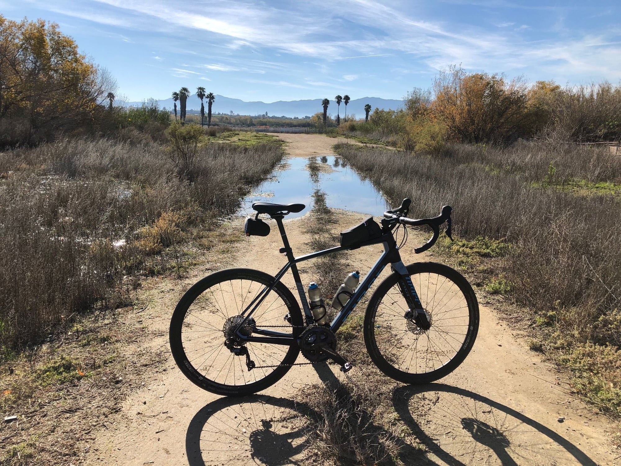
I live right near Archibald/River Road in Eastvale and ride it frequently. Eastvale has great bike lanes around the city and on Archibald. The newly redone bike lines on Archibald have a buffer lane between the bike lane and traffic. Once you cross the River Road Bridge into Corona, the bike lanes are nill and the road is narrow and in rough shape. There's a MUP trail from Archibald that goes 3 miles over to Hamner avenue. It has both paved and gravel options. I ride that frequently to avoid all cars and get some gravel miles in. Look up "riverwalk trail Eastvale". You'll even get to see Desi Arnez's restored ranch along the river! The pics below are all from Riverwalk trail.


Likes For csrpenfab:
