


2018 Century-A-Month Club
 05-22-18, 12:06 PM
#26
Full Member
Seeing this thread I thought I should check how many century rides I have done this year. Pleasantly surprised to see that I have been doing a century a month in each month of March, April and May! In fact, April and May I have done 2 centuries each month.
Let me start with the first century of 2018, which was also the first 200K New England Randonneur ride of 2018 as well as the first 200K ever to start from Providence RI.
NER Narragansett Bay and Bridges
The ride started at 7AM on 24th March, which meant there was plenty of daylight to start the ride. I was in the company of 44 other riders, which must be some sort of record for a NER ride. First 15 miles or so were on a bike path which meant no worrying about traffic, although we did have to negotiate a truck trying to make a u-turn using the bike path. After the bike path, came the monster called Mt Hope bridge. Busy traffic, not much of a shoulder and a long climb. Boy was I glad when it was behind me.
Rest of the ride was pretty uneventful. There were occasional gentle rollers and nice vistas along the way. However, it being the month of March, there wasn't much to stop and photograph. I had already seen the castles along Newport enough number of times. But riding on those roads on a bike was a much more pleasant experience.
Another memorable event was the surprise control near Newport, RI where our brevet cards were signed by none other than RUSA's very first member as well as a founder, Jennifer Wise. Can't wait to get my brevet card back with her stamp on it.
This ride had remarkably less climbing when compared with other NER rides. They have 100K rides that have similar amount of climbing.
But for me, this was the first time when I had ridden solo for so long.
Will post about other rides later.
Cheers
 06-16-18, 06:11 PM
#27
Junior Member
Join Date: Dec 2016
Posts: 24
Bikes: Specialized Tarmac, Epic HT and Langster
Mentioned: 0 Post(s)
Tagged: 0 Thread(s)
Quoted: 9 Post(s)
Likes: 0
Liked 0 Times
in
0 Posts
Century a month: June.
Barely made it today, I had to complete some kilometers near my house in the pouring rain to complete 100 miles, haha. Some friends planned a ride so I took advantage of that and followed them for half the way, then I parted ways and tackled a 15 kms mountain followed by some undulating terrain and completed the loop back home. I felt great today and pulled strong almost all day and even finished the ride feeling well. I was worried about the big climb because the last time I suffered a lot on it but today it was a bliss! The ride was on a central province named Cartago, that province is believed to be the best one to ride in Costa Rica because of its relatively high altitude, various terrain (a lot of hills, some flat terrain), nice weather and less traffic than the capital province.
Distance 100 miles (161 kms)
Elevation 9842 feet (3000 meters) ...living in an inter mountainous valley its really hard not to find a lot of elevation, the only way for me to ride some long stretch of flat roads would be on the northern part of the country or the coasts. By I am not complaining, I love mountains!
Avg speed (moving time) 15.3 mph (24.6 kph)
Bike: Specialized Tarmac SL6
Strava: https://www.strava.com/activities/1642775677
Pics: https://www.instagram.com/p/BkGon60H...ken-by=cyrmanj
06-17-18, 07:56 PM
#28
Senior Member
Thread Starter

CAM month #70 complete. Yesterday I rode 166 km (103 mi) with 1512 m (~5000 ft) of elevation gain.
I left for a business trip to Germany on June 1 and didn't return until June 14, as I also visited family and friends there. For the first time I took my Bike Friday Pocket Rocket folding bike with me, disassembled and packed into a cardboard box I had scrounged off a bike shop. I re-assembled it in my hotel room and for the next 6 days used it for rides in and around Munich, including a 116 km ride to visit and ride with an old friend, who was the one who got me started on cycling 40 years ago. Afterwards I also rode around my home village. It was nice to do that on my own bike that I normally use to explore Japan.
Anyway, with business and family to attend to, I didn't have enough time to do a full century ride in those two weeks and needed to catch up and also burn off my jet lag when I arrived back in Tokyo before the weekend.
June is the rainy season in Tokyo. If you're unlucky, it can rain all week, so grabbing any almost dry day when it presents itself is of essence if you want to get a ride in without getting soaked. It's also the time when ajisai (hydrangeas) bloom. I love seeing those blossoms as I feel cool air on my skin before the summer heat.

The upside is that it's overcast most of the time, which keeps the temperatures down. Once the rainy season ends, the weather flips into full on greenhouse mode, with 35+ C (97+ F) and extreme humidity. Yesterday the temperature ranged from only 16 C to 21 C (61 F to 70 F). Ironically the warmest temperature was in the evening, when I got back to Tokyo, while the coolest was around mid-day when I cycled high up in the mountains.
I did want to get my century in but was suffering from jet lag, which made me wake up or fall asleep at odd hours. I felt low on energy when I left home a little after 07:00. The legs didn't really want to move much. I had brought along my SLR camera and made ample stops for taking shots of mostly flowers and mist-covered mountain tops.
The first 47 km were relatively flat, along the Tamagawa and Akigawa rivers. After a coffee break at a convenience store in Akiruno I headed up the mountain valley to Hinohara. The road splits at a t-junction between the main road to the Tomin no Mori hiking trail head and an isolated valley with only small forest roads leading out of it. That's where I headed.
At a famous tofu shop I took a mountain road that a friend had mentioned a couple of weeks ago. It was very quiet, except for hikers for a nearby famous waterfall. I passed mostly forest and a few farm houses. Everything was very green, with lots of moss growing because of plenty of rain fall and shade. At the top there was a small chaya (tea and noodle shop), but it was closed. The descent on the other side was very steep, 16% and more.
After re-joining the main road in the valley, I continued climbing up the valley floor to the final village.
Sometimes people here hang old CDs in their gardens in an attempt to scare off the birds with the reflections off the dangling shiny bits. This farmer here took the (probably equally ineffective) analog approach:

I filled up my water bottles from a tap at a public toilet before heading up the Kazahari Rindo, an infamously steep forest road. Around its bottom third there's a mushroom farm. The gradient was 15-17%. Visibility was only about 50 m (160 ft) due to the fog, which was really low clouds covering the mountains.
Finally I reached the top, at a little over 1100 m (my start in Tokyo was near sea level). I rested at the gate that closes the forest road to traffic and had a banana or two.

After putting on my wind breaker, I descended 11 km to Lake Okutama which is a really fun ride, even if it was a little chilly. I didn't stop at the noodle shops near the lake but continued on to the city of Okutama, a little downstream from the Okutama dam. There are several bridges across parts of the lake, all painted in different colours and I took pictures. When the dam was built, cement for its construction was supplied from a cement factory in Okutama via a small railway line, the remains of which can still be seen. What's left of the track is overgrown with bushes and weeds. The cement factory gets its limestone from the nearby Nippara quarry via a railway track inside a 10 km long tunnel. I had visited Nippara on a recent century ride.
There used to be a convenience store in Okutama that was know as the last the one when you head out west into the mountains, marking Okutama's status as a frontier town. Alas, it is no more. I found its shutters closed, with a note stuck to it that it had closed down after 37 years of service.
From Okutama it was about 20 km (12 mi) downhill to Oume. There I stopped for a Nepalese curry at 'Sherpa'. Nepalese restaurants have been popping up all over the place in Japan. They're friendly, cheap and tasty.
Another 2 2/12 hours later I got back to my part of Tokyo, did some grocery shopping and got home. If I also ride centuries in July and August, I will have completed 6 years of CAM, which would be a nice mile stone to achieve
(Kazahari Rindo ride on Strava)
I left for a business trip to Germany on June 1 and didn't return until June 14, as I also visited family and friends there. For the first time I took my Bike Friday Pocket Rocket folding bike with me, disassembled and packed into a cardboard box I had scrounged off a bike shop. I re-assembled it in my hotel room and for the next 6 days used it for rides in and around Munich, including a 116 km ride to visit and ride with an old friend, who was the one who got me started on cycling 40 years ago. Afterwards I also rode around my home village. It was nice to do that on my own bike that I normally use to explore Japan.
Anyway, with business and family to attend to, I didn't have enough time to do a full century ride in those two weeks and needed to catch up and also burn off my jet lag when I arrived back in Tokyo before the weekend.
June is the rainy season in Tokyo. If you're unlucky, it can rain all week, so grabbing any almost dry day when it presents itself is of essence if you want to get a ride in without getting soaked. It's also the time when ajisai (hydrangeas) bloom. I love seeing those blossoms as I feel cool air on my skin before the summer heat.
The upside is that it's overcast most of the time, which keeps the temperatures down. Once the rainy season ends, the weather flips into full on greenhouse mode, with 35+ C (97+ F) and extreme humidity. Yesterday the temperature ranged from only 16 C to 21 C (61 F to 70 F). Ironically the warmest temperature was in the evening, when I got back to Tokyo, while the coolest was around mid-day when I cycled high up in the mountains.
I did want to get my century in but was suffering from jet lag, which made me wake up or fall asleep at odd hours. I felt low on energy when I left home a little after 07:00. The legs didn't really want to move much. I had brought along my SLR camera and made ample stops for taking shots of mostly flowers and mist-covered mountain tops.
The first 47 km were relatively flat, along the Tamagawa and Akigawa rivers. After a coffee break at a convenience store in Akiruno I headed up the mountain valley to Hinohara. The road splits at a t-junction between the main road to the Tomin no Mori hiking trail head and an isolated valley with only small forest roads leading out of it. That's where I headed.
At a famous tofu shop I took a mountain road that a friend had mentioned a couple of weeks ago. It was very quiet, except for hikers for a nearby famous waterfall. I passed mostly forest and a few farm houses. Everything was very green, with lots of moss growing because of plenty of rain fall and shade. At the top there was a small chaya (tea and noodle shop), but it was closed. The descent on the other side was very steep, 16% and more.
After re-joining the main road in the valley, I continued climbing up the valley floor to the final village.
Sometimes people here hang old CDs in their gardens in an attempt to scare off the birds with the reflections off the dangling shiny bits. This farmer here took the (probably equally ineffective) analog approach:
I filled up my water bottles from a tap at a public toilet before heading up the Kazahari Rindo, an infamously steep forest road. Around its bottom third there's a mushroom farm. The gradient was 15-17%. Visibility was only about 50 m (160 ft) due to the fog, which was really low clouds covering the mountains.
Finally I reached the top, at a little over 1100 m (my start in Tokyo was near sea level). I rested at the gate that closes the forest road to traffic and had a banana or two.
After putting on my wind breaker, I descended 11 km to Lake Okutama which is a really fun ride, even if it was a little chilly. I didn't stop at the noodle shops near the lake but continued on to the city of Okutama, a little downstream from the Okutama dam. There are several bridges across parts of the lake, all painted in different colours and I took pictures. When the dam was built, cement for its construction was supplied from a cement factory in Okutama via a small railway line, the remains of which can still be seen. What's left of the track is overgrown with bushes and weeds. The cement factory gets its limestone from the nearby Nippara quarry via a railway track inside a 10 km long tunnel. I had visited Nippara on a recent century ride.
There used to be a convenience store in Okutama that was know as the last the one when you head out west into the mountains, marking Okutama's status as a frontier town. Alas, it is no more. I found its shutters closed, with a note stuck to it that it had closed down after 37 years of service.
From Okutama it was about 20 km (12 mi) downhill to Oume. There I stopped for a Nepalese curry at 'Sherpa'. Nepalese restaurants have been popping up all over the place in Japan. They're friendly, cheap and tasty.
Another 2 2/12 hours later I got back to my part of Tokyo, did some grocery shopping and got home. If I also ride centuries in July and August, I will have completed 6 years of CAM, which would be a nice mile stone to achieve
(Kazahari Rindo ride on Strava)
Last edited by joewein; 06-17-18 at 08:02 PM.
07-13-18, 09:41 PM
#29
Junior Member
Join Date: Dec 2016
Posts: 24
Bikes: Specialized Tarmac, Epic HT and Langster
Mentioned: 0 Post(s)
Tagged: 0 Thread(s)
Quoted: 9 Post(s)
Likes: 0
Liked 0 Times
in
0 Posts
Hello,
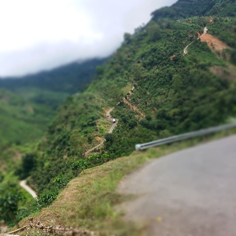
Did a great ride today, CAM for July completed! I had a very well thought out route (at least on my mind and on my garmin) that would take me from my house to a river dam deep in the mountains and back. However the plan changed just at the kilometer 40, I thought it was all tarmac road but I faced some nasty gravel with big gradients:
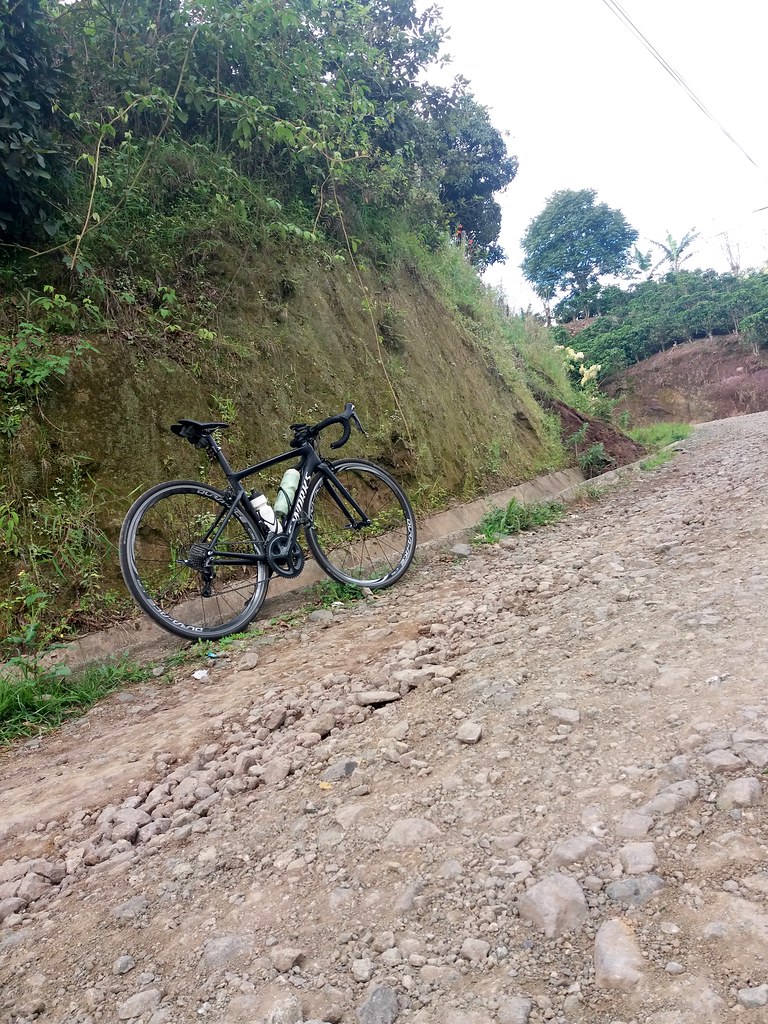
grava by Abraham Cyrman, on Flickr
pendiente by Abraham Cyrman, on Flickr
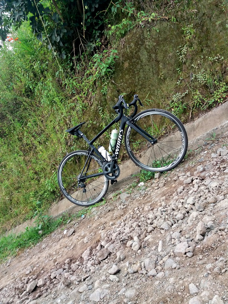
So, turned around and Plan B began. At the end of the day I managed to make the same kilometers I planned but with more altitude which was kind of insane. In retrospective this ride was more suited for a MTB than a road bike, the slopes gradients was nasty:
rampas by Abraham Cyrman, on Flickr
Some scenery and the river dam itself:
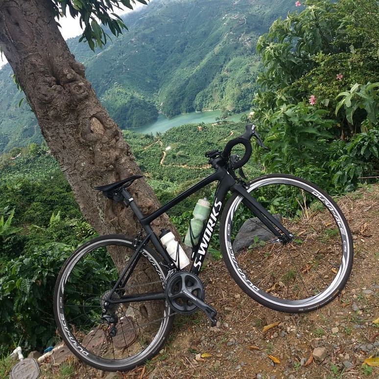
paisaje by Abraham Cyrman, on Flickr
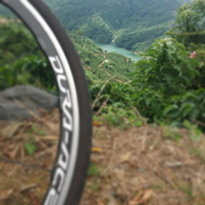
el embalse al fondo by Abraham Cyrman, on Flickr
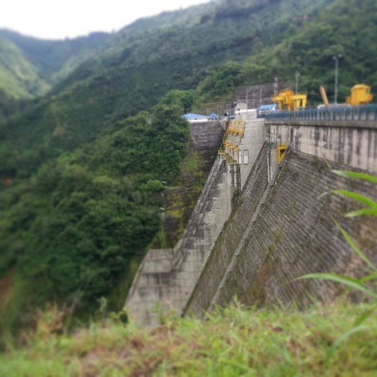
PH Pirris by Abraham Cyrman, on Flickr
Talking about horrible climbs:
cuestas poco amigables by Abraham Cyrman, on Flickr
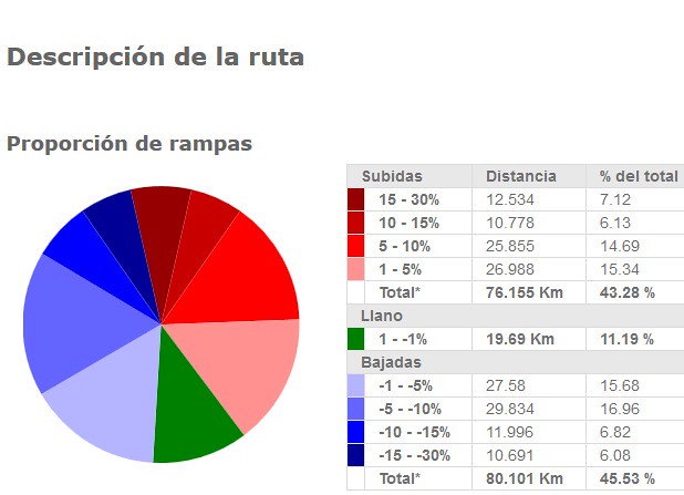
When I uploaded the ride it stated 5500 meters of elevation, but with the strava elevation correction it shows now 6579 meters, not sure about which one is accurate, either way is a lot!
Summary:
Distance 108.7 miles (175 kms)
Elevation 21584.7 feet (6579 meters)
Avg speed 10.7 mph (17.2 kph)
Moving time 10:09
Elapsed time: 12:03
Bike: Specialized Tarmac SL6
https://www.strava.com/activities/17...ts/42619810466
And this is the uphill segment from the bottom of river dam, 3 kilometers at 14% average with (according to strava) a 33% ramp. Actually the highest I recall from the garmin was 24%.
https://www.strava.com/segments/10517955?filter=overall
Did a great ride today, CAM for July completed! I had a very well thought out route (at least on my mind and on my garmin) that would take me from my house to a river dam deep in the mountains and back. However the plan changed just at the kilometer 40, I thought it was all tarmac road but I faced some nasty gravel with big gradients:
grava by Abraham Cyrman, on Flickr
pendiente by Abraham Cyrman, on Flickr
So, turned around and Plan B began. At the end of the day I managed to make the same kilometers I planned but with more altitude which was kind of insane. In retrospective this ride was more suited for a MTB than a road bike, the slopes gradients was nasty:
rampas by Abraham Cyrman, on Flickr
Some scenery and the river dam itself:
paisaje by Abraham Cyrman, on Flickr
el embalse al fondo by Abraham Cyrman, on Flickr
PH Pirris by Abraham Cyrman, on Flickr
Talking about horrible climbs:
cuestas poco amigables by Abraham Cyrman, on Flickr
When I uploaded the ride it stated 5500 meters of elevation, but with the strava elevation correction it shows now 6579 meters, not sure about which one is accurate, either way is a lot!
Summary:
Distance 108.7 miles (175 kms)
Elevation 21584.7 feet (6579 meters)
Avg speed 10.7 mph (17.2 kph)
Moving time 10:09
Elapsed time: 12:03
Bike: Specialized Tarmac SL6
https://www.strava.com/activities/17...ts/42619810466
And this is the uphill segment from the bottom of river dam, 3 kilometers at 14% average with (according to strava) a 33% ramp. Actually the highest I recall from the garmin was 24%.
https://www.strava.com/segments/10517955?filter=overall
Last edited by cyrmanj; 07-14-18 at 12:25 PM.
07-16-18, 08:51 AM
#30
Senior Member
Thread Starter

On Monday, July 9 I rode my first century of the month with 167 km and about 1500 m of elevation gain. This extends my streak to 71 consecutive months. It was extremely hot in the morning. Even by 09:00 the temperature reached 32 C (90 F). Saturday afternoon and Sunday I had been working on a major DIY project with my son, out in the heat all day. So I joked to my wife that on Monday I was doing a 100+ mile ride to recover from that. I shared the ride plan with some friends but wasn't too surprised that no one else would join me on a Monday, most of them having to work or having done a ride on Sunday.
The legs were not feeling particularly fresh on the ride to what would have been the meeting point, had somebody joined me. I took my time, knowing that nobody would be waiting at the train station near the mountains.
Cycling up the mountain valley at Ogose, I stopped at a bus stop near the elementary school. The shelter at the bus stop had been painted inside by a school class as an art project under the supervision of a teacher.
As the valley narrowed, I felt cooler air emanating from the edge of the forest. The temperature finally dropped to 30 C (86 F) and below. Near the Kuroyamasantaki Falls some old men struck up a conversation with me, where I had cycled from, where I was from originally, etc. Just below the souvenir shops I met some guys with cameras, obviously coming for a photo shoot. One told his friend to not wait for him while we had a chat. He asked questions about my bicycle. He had also owned a bike and used to be cycling, but switched to running because of health issues (I more commonly hear the opposite story). The SLR he carried was two generations older than mine, but the same product family. So we talked a bit about taking pictures. Finally I visited the water falls and took some snaps.
I heard some rumbling above and soon raindrops started to fall. I covered up the saddle and put on my jacket. It was raining as I descended down to the main road. On the way up I had passed a turnoff to an alternate route to climb the Greenline ridge road than the one I usually rode. I wanted to give that a try. After a few minutes of climbing, I encountered a road cyclist, also a Westerner, who was just coming down that road. By now the rain was fairly strong. He stopped to warn me, not to continue any further because of conditions up there. As he was speaking, he fell over and knocked me off my bike too. He apologized and told me he had crashed up on the mountain road and showed me the road rash on his elbow. He probably suffered some concussion too. He said the road was wet and slippery with moss and the surface had many cracks. I urged him to ride carefully on his way home, but my 42 mm tires would do much better with the cracks than his narrow racing tires and I was familiar with the road at the top, just not this climb.

The rain soon stopped but left the air much cooler. I saw steam rising above the hot road in some places. There really was no problem riding, but I have crashed on mountain roads in the past and know what to look out for.
I encountered very few vehicles and almost no bikes on the ridge road. On the Yamabushi pass descent I had absolutely no cars in front of me, which was really fun. I had dinner at a Nepalese restaurant in Oume again, before riding the last 40+ km home.
When I uploaded the ride to Strava I found my average power output about 20% lower than on most of my century rides, or 30% below rides I do with other people (I tend to have to do more keeping up on those). But that's OK: It was a recovery ride for the DIY project and I brought back a few nice pictures.
Last edited by joewein; 07-16-18 at 02:59 PM.
07-16-18, 04:37 PM
#31
Senior Member
Thread Starter
In this thread I had mentioned my 400 km ride in May that I had been training for with several century rides, but never posted the ride report. It went very well and you can read a detailed ride report here.
Last weekend I rode a second century for July, a full loop around Mt Fuji:


It was a ride with my friend Jochem and his neighbour, Mr Miyasaki. It was going to be a counter-clockwise loop starting from Gotemba. They were planning to descend to the coastal town of Kozu after the loop, but skipped that in the end.
I can't take my Elephant NFE bike on the train and Gotemba is too far to ride out from Tokyo before a 09:00 ride start, so I decided to drive out to Matsuda, from where it's a 2 hour climb by bike to Gotemba. With that climb and the descent after the full Fuji loop from and to Gotemba I would end up with a full century distance.
Traffic on Tomei expressway out of Tokyo even in the early morning (05:40-06:55) was denser than expected, probably because it was the first day of a three day weekend. I was worried I would have to struggle uphill to make the meeting time, but then got a text message that my friends were also running late because they had suffered triple punctures on their way to the station. Consequently they were going to be on a later train, which gave me more time to cycle to the meeting point. I arrived at Gotemba station well before them without having to get drenched in sweat.

When my friends arrived, they mentioned they had used up all their spare tubes: They had suffered triple snakebite punctures when they hit an expansion joint on a bridge that couldn't keep up with the extreme summer heat. Jochem suggested only getting tubes at a bike shop in Fujiyoshida, a town 35 km into the 120 km ride but I strongly preferred getting some before setting off. I checked my phone and found two bike shops nearby, but neither was open. Then we tried two DIY centers and got lucky at the second one. Now we had spares again.
As we climbed towards Kagosaka Pass (1100 m) from Gotemba (465 m), traffic initially was very dense. Riding on the sidewalk we passed a lot of cars heading to the Fuji Five Lakes for the long weekend. That was around the stretch of road where there's still a gap in the expressway between Tomei at Gotemba and the bypass near Mt Fuji. When I finally reached where the back road for the pass split off from the main road heading for the bypass, I got a text message from Jochem: Puncture #4 ! Just as well we had gotten those fresh spare tubes. I turned back and found my friends about 200 m downhill, in a shaded spot. After the repair we resumed the climb.
We had a plan for lunch at a German restaurant and brewery on the south-west side of Mt Fuji, about 3/4 the way around Mt Fuji which I though was going to be tight with all the punctures and in this heat. Still, we took the scenic route past Lake Yamanaka and visited Oshino Hakkai, a historic village with thatched roofs that's on the UNESCO world heritage site list as part of the Mt Fuji listing.
After that we returned to the main road though, to still make it to the restaurant for a late lunch. Climbing the road through the Aokigahara Forest (better known as the "suicide forest") I fell behind my friends but they waited for me at the view point at the top where you can overlook Lake Motosu. I didn't stop for pictures and instead we launched into the fast descent towards Fujinomiya. In little over half an hour we covered the 17 km to the restaurant as it was almost all downhill.

This brewery supplies beer for events at the German Embassy in Tokyo. There were pictures of the brew master with several German presidents. After a well deserved break there we visited the nearby Shiraito Falls, also part of the World Heritage listing.
The last part of the ride back to Gotemba was a bit of a slog, first with ups and downs then another 14 km climb. It gradually got dark as we started descending to Gotemba. That's why my friends decided to catch the train home from there rather than descending to the coast as originally planned. I still rode another 28 km in the dark back to Matsuda to the car park and then drove home, after 181 km of cycling with 2057 m of elevation gain.
Last weekend I rode a second century for July, a full loop around Mt Fuji:
It was a ride with my friend Jochem and his neighbour, Mr Miyasaki. It was going to be a counter-clockwise loop starting from Gotemba. They were planning to descend to the coastal town of Kozu after the loop, but skipped that in the end.
I can't take my Elephant NFE bike on the train and Gotemba is too far to ride out from Tokyo before a 09:00 ride start, so I decided to drive out to Matsuda, from where it's a 2 hour climb by bike to Gotemba. With that climb and the descent after the full Fuji loop from and to Gotemba I would end up with a full century distance.
Traffic on Tomei expressway out of Tokyo even in the early morning (05:40-06:55) was denser than expected, probably because it was the first day of a three day weekend. I was worried I would have to struggle uphill to make the meeting time, but then got a text message that my friends were also running late because they had suffered triple punctures on their way to the station. Consequently they were going to be on a later train, which gave me more time to cycle to the meeting point. I arrived at Gotemba station well before them without having to get drenched in sweat.
When my friends arrived, they mentioned they had used up all their spare tubes: They had suffered triple snakebite punctures when they hit an expansion joint on a bridge that couldn't keep up with the extreme summer heat. Jochem suggested only getting tubes at a bike shop in Fujiyoshida, a town 35 km into the 120 km ride but I strongly preferred getting some before setting off. I checked my phone and found two bike shops nearby, but neither was open. Then we tried two DIY centers and got lucky at the second one. Now we had spares again.
As we climbed towards Kagosaka Pass (1100 m) from Gotemba (465 m), traffic initially was very dense. Riding on the sidewalk we passed a lot of cars heading to the Fuji Five Lakes for the long weekend. That was around the stretch of road where there's still a gap in the expressway between Tomei at Gotemba and the bypass near Mt Fuji. When I finally reached where the back road for the pass split off from the main road heading for the bypass, I got a text message from Jochem: Puncture #4 ! Just as well we had gotten those fresh spare tubes. I turned back and found my friends about 200 m downhill, in a shaded spot. After the repair we resumed the climb.
We had a plan for lunch at a German restaurant and brewery on the south-west side of Mt Fuji, about 3/4 the way around Mt Fuji which I though was going to be tight with all the punctures and in this heat. Still, we took the scenic route past Lake Yamanaka and visited Oshino Hakkai, a historic village with thatched roofs that's on the UNESCO world heritage site list as part of the Mt Fuji listing.
After that we returned to the main road though, to still make it to the restaurant for a late lunch. Climbing the road through the Aokigahara Forest (better known as the "suicide forest") I fell behind my friends but they waited for me at the view point at the top where you can overlook Lake Motosu. I didn't stop for pictures and instead we launched into the fast descent towards Fujinomiya. In little over half an hour we covered the 17 km to the restaurant as it was almost all downhill.
This brewery supplies beer for events at the German Embassy in Tokyo. There were pictures of the brew master with several German presidents. After a well deserved break there we visited the nearby Shiraito Falls, also part of the World Heritage listing.
The last part of the ride back to Gotemba was a bit of a slog, first with ups and downs then another 14 km climb. It gradually got dark as we started descending to Gotemba. That's why my friends decided to catch the train home from there rather than descending to the coast as originally planned. I still rode another 28 km in the dark back to Matsuda to the car park and then drove home, after 181 km of cycling with 2057 m of elevation gain.
Last edited by joewein; 07-17-18 at 12:58 AM.
07-23-18, 05:13 AM
#32
Senior Member
Thread Starter
I rode a third century for July with 163 km and 1570 m of elevation gain. At up to 38 C (100 F) it was the hottest this year.
My wife was very worried about heat stroke before I left, but I was determined to protect myself and not do anything unreasonable. I always kept my two 700 ml bidons topped up and also bought 500 ml bottles of cold milk tea at two convenience stores. Every time I refilled my bidons with tap water I also soaked the long sleeves of my jersey for evaporation cooling.


Because the weather forecast was extremely hot, my friend Peter announced a start as early as 07:30, which for me meant leaving home at around 05:00 to meet the rest of the cyclists at Takao station at the foot of the mountains. Starting from around 150 m elevation we were going to ride three passes of 750 m, 650 m and 850 m of elevation, respectively.
Altogether 10 people showed up at the start, two of them women. Three of the guys were very fast while the rest of us were well matched speed-wise. It was a social ride, nobody was riding for speed, especially not in this heat.
Even at 07:00 the mercury already hit 31 C (88 F). Tree cover was going to be very important to protect us from the worst of the heat. The first climb, Daigo rindo, a closed forest road had a reasonable amount of shade but was very steep. I soon fell back to the end of the group and took several short breaks to let my pulse drop and my face to cool off.
From the top we descended a little to Wada pass, where we bought water from the shop there to refill our bidons. After some rest we descended on Wada West for about 5 km, giving up 420 elevation meters. When we reassembled at the bottom, one of my friends realized she had left both of her bidons as well as her wallet on a bench in front of the shop. Uh, oh... It can be hard to think clearly in the heat.
The fastest guy and I volunteered to help her. He set off to the shop to secure the belongings while the two of us climbed together. I had the route on GPS, so that later we could follow the rest of the group and meet up with them again. We climbed about 2/3 to the top when we were met by our faster friend, who had retrieved the bottles and the wallet for her. He already had another appointment later, so he dropped out there while we headed back down again, following the original route.
At a convenience store at the next town we again filled up our bottles before heading to the next climb via shaded back roads. The second climb of the original route but now our third turned out to be the hardest. It wasn't as steep as Daigo Rindo or Wada West, but this south facing slope with less tree cover was much more exposed to the sun than either and it was getting closer to noon, when the sun is high in the sky. If there was one place to watch out for heat stroke, this was it. We took it slow and stopped a few times to catch our breath. We even walked about 1 km towards the end. 38 C during a climb is really insane.
Once I recovered I started cycling again. Soon the entrance of Kobu tunnel, the highest point of this climb, came into sight. As we stopped in front of it to switch on the bike lights, cool air engulfed us. Riding through the two tunnels was wonderful. The contrast to the extreme heat on this climb made us appreciate it even more.
It was cooler on the north facing Hinohara side of the tunnel than the south facing Uenohara side. The descent down to the main road was very enjoyable as the wind was drying the sweaty clothes. At the t-junction we turned downhill instead of uphill to the third pass as on the initial ride plan. We had agreed on that when we split up at the base of Wada West, as that would make up for the double climb at Wada.
The rest of the group replied to us via instant messenger and relayed their position. It seemed they had taken the same shortcut. Twenty minutes later we were reunited. They had stopped at a restaurant half an hour earlier and just received their food as we parked our bikes. We ordered too, but it then took over an hour before our food was served, because there was that much of a backlog in the kitchen. I had never experienced that in Japan before. At the very least I would expect a heads-up when ordering if it's going to take as much as half an hour or more.
Two of the group had split off before the restaurant and one bailed out back to the station after the meal. Six of us headed up the valley to ride to Kanoto Iwa, a scenic canyon with a small river about 6 km from the restaurant. We hiked through the canyon. I took off my jersey and immersed myself into the cool water. Others also stepped into the stream and cooled themselves. It was sheer bliss
After playing at the canyon, we cruised 15 km mostly downhill to Musashiitsukaichi station, where most of the group got on a train back to Tokyo. I saw off the group, then cycled the last 48 km back home. 20 km before my goal I stopped at a coffee shop for some ice cream and caffe latte as a "Get Me Home" set It made a huge difference and I could actually feel fairly comfortable again for that last section.
For me the key to dealing with intense summer heat and humidity is to watch how you feel and back right off if you get too uncomfortable. Slow down, walk or take a break, preferably in the shade. Pouring water on your limbs or head helps too. Drinking enough water is a given, but that alone will not keep you safe if you work too hard while you're already feeling hot.
My wife was very worried about heat stroke before I left, but I was determined to protect myself and not do anything unreasonable. I always kept my two 700 ml bidons topped up and also bought 500 ml bottles of cold milk tea at two convenience stores. Every time I refilled my bidons with tap water I also soaked the long sleeves of my jersey for evaporation cooling.
Because the weather forecast was extremely hot, my friend Peter announced a start as early as 07:30, which for me meant leaving home at around 05:00 to meet the rest of the cyclists at Takao station at the foot of the mountains. Starting from around 150 m elevation we were going to ride three passes of 750 m, 650 m and 850 m of elevation, respectively.
Altogether 10 people showed up at the start, two of them women. Three of the guys were very fast while the rest of us were well matched speed-wise. It was a social ride, nobody was riding for speed, especially not in this heat.
Even at 07:00 the mercury already hit 31 C (88 F). Tree cover was going to be very important to protect us from the worst of the heat. The first climb, Daigo rindo, a closed forest road had a reasonable amount of shade but was very steep. I soon fell back to the end of the group and took several short breaks to let my pulse drop and my face to cool off.
From the top we descended a little to Wada pass, where we bought water from the shop there to refill our bidons. After some rest we descended on Wada West for about 5 km, giving up 420 elevation meters. When we reassembled at the bottom, one of my friends realized she had left both of her bidons as well as her wallet on a bench in front of the shop. Uh, oh... It can be hard to think clearly in the heat.
The fastest guy and I volunteered to help her. He set off to the shop to secure the belongings while the two of us climbed together. I had the route on GPS, so that later we could follow the rest of the group and meet up with them again. We climbed about 2/3 to the top when we were met by our faster friend, who had retrieved the bottles and the wallet for her. He already had another appointment later, so he dropped out there while we headed back down again, following the original route.
At a convenience store at the next town we again filled up our bottles before heading to the next climb via shaded back roads. The second climb of the original route but now our third turned out to be the hardest. It wasn't as steep as Daigo Rindo or Wada West, but this south facing slope with less tree cover was much more exposed to the sun than either and it was getting closer to noon, when the sun is high in the sky. If there was one place to watch out for heat stroke, this was it. We took it slow and stopped a few times to catch our breath. We even walked about 1 km towards the end. 38 C during a climb is really insane.
Once I recovered I started cycling again. Soon the entrance of Kobu tunnel, the highest point of this climb, came into sight. As we stopped in front of it to switch on the bike lights, cool air engulfed us. Riding through the two tunnels was wonderful. The contrast to the extreme heat on this climb made us appreciate it even more.
It was cooler on the north facing Hinohara side of the tunnel than the south facing Uenohara side. The descent down to the main road was very enjoyable as the wind was drying the sweaty clothes. At the t-junction we turned downhill instead of uphill to the third pass as on the initial ride plan. We had agreed on that when we split up at the base of Wada West, as that would make up for the double climb at Wada.
The rest of the group replied to us via instant messenger and relayed their position. It seemed they had taken the same shortcut. Twenty minutes later we were reunited. They had stopped at a restaurant half an hour earlier and just received their food as we parked our bikes. We ordered too, but it then took over an hour before our food was served, because there was that much of a backlog in the kitchen. I had never experienced that in Japan before. At the very least I would expect a heads-up when ordering if it's going to take as much as half an hour or more.
Two of the group had split off before the restaurant and one bailed out back to the station after the meal. Six of us headed up the valley to ride to Kanoto Iwa, a scenic canyon with a small river about 6 km from the restaurant. We hiked through the canyon. I took off my jersey and immersed myself into the cool water. Others also stepped into the stream and cooled themselves. It was sheer bliss
After playing at the canyon, we cruised 15 km mostly downhill to Musashiitsukaichi station, where most of the group got on a train back to Tokyo. I saw off the group, then cycled the last 48 km back home. 20 km before my goal I stopped at a coffee shop for some ice cream and caffe latte as a "Get Me Home" set
It made a huge difference and I could actually feel fairly comfortable again for that last section.For me the key to dealing with intense summer heat and humidity is to watch how you feel and back right off if you get too uncomfortable. Slow down, walk or take a break, preferably in the shade. Pouring water on your limbs or head helps too. Drinking enough water is a given, but that alone will not keep you safe if you work too hard while you're already feeling hot.
Last edited by joewein; 07-23-18 at 08:04 AM.
08-02-18, 08:37 AM
#33
Senior Member
Thread Starter

(Sarusuberi tree (Lagerstroemia, Crape Myrtle) in bloom)
Two friends invited me to a ride on August 1, to help me complete my Century of the Month early :-) Their planned loop was about 100 km long, but with riding to the meeting point and back home afterwards I knew I'd get over 170 km.
With August already done, I am now up to 72 consecutive months: I rode at least one Century every calendar month from September 2011 to August 2018 (six years).

(JPN Taxi: This new hybrid model is being launched before the 2020 Tokyo Olympics)
The weather forecast was for 23-33 C (73-91 F), but the hottest our GPS units recorded was 42 C (108 F). We rode out from Takao to Tsuru via Rt35 near Akiyama. This route was very exposed, with almost no shade on the climb at Akiyama.

After a break at a convenience store at Tsuru we climbed Rt24 over to Doshi village. The road has a tunnel at the top, at over 1000 m elevation. There is more shade and a river by the side of the road, also it's on the north side of a mountain, but it was still insanely hot (this is where I saw the 42 C).
At one point I stopped the bike and climbed down into a concrete-lined ditch that had cool water running in it that seeped out of the side of the mountain a little up the road. I soaked my jersey sleeves and my sweat towel in cool water to help cool myself, then continued the climb.

(A goat guarding the tunnel at Akiyama)
The cold air inside the tunnel at the top was great. I enjoyed the long descent down to Doshi village on the other side. We stopped at a restaurant for lunch and had some coffee too. The road from Doshi back towards Tokyo was mostly downhill. About 40 km from my home we parted at a t-junction and I rode back home alone.

After a shower I stretched out on the sofa and soon went to sleep (I had only slept 4 hours the night before, because I had to leave home at 05:30 to be at the meeting point by 08:00).
I would say the ride ranks in the top 4 of my least pleasant rides in the heat. Still, I can put up with long rides in the heat, as long as I have enough water and time. What I can't do is ride fast when it's hot.
Last edited by joewein; 08-02-18 at 07:17 PM.
08-05-18, 07:53 PM
#34
Senior Member
Thread Starter

Days after my century of the month on August 1, I rode 181 km with temperatures of up to 43 C (109 F). It turned into a bit of an adventure.
Friends of mine organized a ride to a waterfall up a mountain valley behind Miyagase-ko (Lake Miyagase), a lake behind a hydroelectric dam in the Tanzawa mountains near Tokyo. This is near the Yabitsu pass featured in multiple Bicycle Quartely articles by now. Yabitsu is currently closed after a landslide that severed the northern access road, a route very popular in the summer because of its tree cover that offers relief from the sun. My friends offered this as a Yabitsu alternative. Before the lake we were going to ride on two forest roads (rindo), also with good tree cover.
The ride start was at Isehara station, about 50 km from Tokyo. Everybody else took a train to Isehara (it lies on the Odakyu line), but I instead opted to ride out on Rt246. This is a major artery across the Kanto plain to the west and south-west of Tokyo that I don't particularly enjoy driving on even by car. Lots of traffic, lots of trucks... A couple of times I had to get off it at a flyover or underpass closed to bicycles, but usually via a pair off and on ramps across a green traffic light, so I wasn't slowed down by much. On some flat stretches I was cruising at around 40 km/h, not much slower than the rest of the Saturday morning traffic.

I arrived at Isehara at 07:45, 2 1/2 hours after I had left Tokyo and including two convenience store stops. At Isehara there were five of us altogether. I was definitely the slowest rider on the climbs. The forest roads we rode were new to me. They were quiet and enjoyable, but I had to work pretty hard not to fall behind too much. I was soon soaked in sweat. We all drank plenty of water and stopped at vending machines to buy more drinks as needed.
2 1/2 hours after we left Isehara, we reached Miyagase dam. It was there that I realized my mobile phone was no longer on my handlebar :-( I usually secure it to the phone holder with rubber bands, but even then it sometimes works its way loose.
After a brief discussion with my friends I loaded up Google's phone tracking page on my other phone (I carry a personal phone on the handle bar and a business phone in the front bag). It could not contact the lost phone. I guessed it must have dropped off on a part of the road without mobile network coverage.
I urged my friends to continue on without me and headed back to look for my phone. I carefully retraced the route we had followed here, climbing back up to the second of the forest roads and down the other side, then back on the main road to the first forest road. I could climb more slowly this time, as I had to keep my eyes open for the phone, so it was easier. Unfortunately, there was no sign of it.
After 17 km of backtracking and before embarking on the last forest road, I checked the online status again. This time the phone responded with a position! It was now located near an ice cream shop in Hanbara, near the dam. I had not been there on this ride. Therefore somebody must have found the phone and picked it up. I tried ringing it, but no one picked up.
I abandoned my search of the road and cycled towards Hanbara, 18 km away. On the way I checked again: The phone had already moved on. It was now somewhere in the town of Hanbara itself. I still continued to the ice cream shop, which turned out to be part of a dairy farm that sells pretty good ice cream from the milk of their own cows :-)

Before I got to the farm, the latest tracking attempt showed the phone no longer responding. It must have been turned off. At the ice cream shop I zoomed into the map near the latest reported position and found a "koban" not far from it - a tiny neighbourhood police box, usually manned by 1-3 officers. My heart jumped with joy. The finder must have turned it in there!
The road was all downhill from the farm to the koban. I parked my bike outside and entered. A female officer was on duty. I explained that I had lost my phone and hoped that someone had found it and turned it in. First I filled out a lost property report with my personal details and details of the phone and the place and time where I lost it. Then she went into the back room and came back with my phone. We powered it up and it showed my picture on the home screen. Nothing broken, not even a visible scratch! I filled in a second form to acknowledge receipt of my returned property and to promise a finders fee to the finder, should he/she request one.
Turning in lost property at police stations is the universal custom in Japan. If you drop your wallet in Tokyo, the odds are it will be returned to you with all bank notes, credit cards, etc. still inside. This visit to a koban was actually only my second time inside a koban in the quarter of a century I've lived in Japan. The first time was about 5 years ago, when I myself found a dropped mobile phone on the road while cycling and also turned it in. There's karma for you!

After I was reunited with my phone, I cycled back up to Miygase dam once more. I followed the forest road on the lake shore that would have led up to the water fall, but turned around before it started climbing steeply to the falls, instead heading back towards Tokyo. I got home about an hour after sunset. Seeing the pictures of my friends who had made it to the falls, splashing around in the river below it, I do want to go back there and complete the route as planned.

Last edited by joewein; 08-05-18 at 08:04 PM.
09-04-18, 10:55 PM
#35
Senior Member
Thread Starter

After a record-breaking heat wave in July that saw the highest temperatures ever recorded in Japan, August continued with blistering heat and the high humidity that's typical for Tokyo summers. Imagine the heat of Las Vegas combined with the humidity of Singapore and you've got the idea. On most of my recent century rides I've seen the thermometer of my GPS top 40 deg C (104 F) even while the bike was in motion.
After losing and later retrieving my mobile phone on my second century ride of August, I went back to the intended course with a friend on August 26. Together we rode to a waterfall up in a mountain valley above Lake Miyagase, a lake that supplies Tokyo and Kanagawa with drinking water and power from a hydroelectric dam.
This time the temperature reached a maximum of 39 deg C (102 F). We took it slowly, more slowly than on the previous ride which was led by stronger cyclists. Before the lake we climbed two forest roads. Even though we took a couple of breaks, I was feeling slightly sick by the time we reached the second summit. I sat down on a bench for a while and rested until I felt better.
With my phone securely secured with gaffer tape and extra rubber bands this time, I managed to make it to the dam without losing the phone. We filled up our water bottles at the public restrooms there, then continued to the forest road on the opposite side of the lake. By then it was close to noon. From there the road climbed for 6 km (4 mi) following a river.

The heat was extreme. Once I stopped at a roadside waterfall to shower my head to cool off. I was so glad when we finally neared the end of the surfaced road, near the waterfall. There were some cars parked by the roadside and I saw some people sit by the riverside a little downstream from us, but nobody was at the falls.
I had brought some shorts that I changed into from my cycling clothes while hiding behind a boulder. Then I took a dip in the ice cold water. It felt so refreshing! :-) The current was very strong due to recent rainfalls and it was really too cold to swim. So after my friend took some pictures, I got changed back into my cycling wear and we headed back to the bikes.
I enjoyed the descent down to the lake, knowing the next 20+ km would be almost all downhill. We stopped at a roadside restaurant near the lake for lunch, before riding to Isehara station. My friend caught a rain home from there while I cycled back to Tokyo on Rt246, a busy highway.
Altogether I rode 166 km (103 mi) with 1,660 m (5,400 ft) of elevation gain.
With typhoon Jebi approaching, I did not go out for a long ride last weekend. I'm planning my first century ride for September for tomorrow, since the typhoon has passed and the rain has stopped again.
09-15-18, 07:35 AM
#36
Senior Member
Thread Starter
On Thursday, September 6 I rode my first century for this month. I would have done it on the weekend already, but the forecast was for rain, as a typhoon was approaching.

First I rode 37 km to the meeting point. There were just two of us, well matched in speed and taste for taking photographs.
I had picked a course that first took us to a forest road closed to all traffic, then to two mountain valleys where all roads end in dead ends or hiking trails. We saw plenty of streams and waterfalls, but very few other cyclists. That was also because it was mid-week, not on a weekend.

Many of the views were like picture post cards.
At the best of the waterfalls, I was completely alone - not a soul in sight. At the first waterfall we were all alone until we had finished taking pictures and started our hike back, only then other hikers showed up.
Talking about hiking, at the first fall I hiked barefoot on sharp edged gravel because I had forgotten to bring alternative shoes even though I had asked my friend to brings shoes beside the cycling shoes for the 20 minute hike from the end of the road to the waterfall. It wasn't pleasant but doable.
Some of the roads were quite steep, some of them covered in gravel or debris from land slides. I was OK on my Elephant NFE, but my friend on a narrow tire road bike was sweating it.
In the early afternoon I dropped off my friend at the train station after having lunch. The cafe turned out to be run by a bike enthusiast who was a Bicycle Quarterly reader, who personally knew some of Jan Heine's friends here in Japan. he showed me several of Jan's books.
After dropping off my friend I did one last mountain valley and one water fall, which was actually my favourite of the day.
Altogether I rode 166 km with 1570 m of elevation gain for CaM#73.
First I rode 37 km to the meeting point. There were just two of us, well matched in speed and taste for taking photographs.
I had picked a course that first took us to a forest road closed to all traffic, then to two mountain valleys where all roads end in dead ends or hiking trails. We saw plenty of streams and waterfalls, but very few other cyclists. That was also because it was mid-week, not on a weekend.
Many of the views were like picture post cards.
At the best of the waterfalls, I was completely alone - not a soul in sight. At the first waterfall we were all alone until we had finished taking pictures and started our hike back, only then other hikers showed up.
Talking about hiking, at the first fall I hiked barefoot on sharp edged gravel because I had forgotten to bring alternative shoes even though I had asked my friend to brings shoes beside the cycling shoes for the 20 minute hike from the end of the road to the waterfall. It wasn't pleasant but doable.
Some of the roads were quite steep, some of them covered in gravel or debris from land slides. I was OK on my Elephant NFE, but my friend on a narrow tire road bike was sweating it.
In the early afternoon I dropped off my friend at the train station after having lunch. The cafe turned out to be run by a bike enthusiast who was a Bicycle Quarterly reader, who personally knew some of Jan Heine's friends here in Japan. he showed me several of Jan's books.
After dropping off my friend I did one last mountain valley and one water fall, which was actually my favourite of the day.
Altogether I rode 166 km with 1570 m of elevation gain for CaM#73.
10-03-18, 05:53 PM
#37
Senior Member
Thread Starter

After a typhoon passed through Japan over the weekend, Monday was still windy, but on Tuesday I set out for a century ride from Tokyo to Miura peninsula and back for my October Century a Month (CAM). On Friday I will leave on a business trip that will swallow the first two weekends of the month. Doing centuries rides on the earliest possible opportunity every month is part of my strategy to extend my CAM streak, which now stands at 74 consecutive months.
It was a sunny day that was warm but not as hot as it had been in the summer. There were barely any clouds, but enough haze in the distance that I never managed a glimpse of Mt Fuji from the western side of Miura. I got great views of Tokyo bay (above) and Boso peninsula on the opposite side of the bay entrance. There are always oil tankers, container ships, bulk carriers or fishing boats to be seen on this busy stretch of water. The US 7th Fleet is based in nearby Yokosuka.
The peninsula is sometimes called the vegetable plot of Tokyo, as many cabbages and daikon (radishes) are grown on its rich soil. I saw farmers at work sowing daikon seeds on neat furrows of soil in their fields.
I ate relatively little on this morning to evening ride of 186 km (115 mi): 3 bananas, 2 sandwiches, one cone of ice cream at a dairy farm and I also drank a small bottle of sweet milk tea and of cocoa. With only about 800 m of elevation gain, this ride had less than half the climbing of most of my century rides that include mountains.

On the southwestern corner of Miura I crossed the bridge to Jogashima island and followed a hiking trail along the cliffs, stopping for some views. I loved the sun glittering on the ocean. I explored small fishing towns with numerous restaurants and small shops waiting for customers on this quiet weekday after the main season. After an ice cream stop at a dairy farm I headed north through the coastal towns of Hayama and Zushi to Kamakura.

For my return route I picked a fairly direct route that was anything but pretty. Much of it was multi-lane bypasses, with stretches of it closed to bicycles which forced me to find detours. It was evening rush hour by then. Much of that terrain was also quite hilly. Still, I made it home within 20 minutes of the time I had told my wife as an estimate.
I will try to do another weekday ride between the upcoming business trip and the next trip 5 days later, to maintain my fitness. Plus, I'll probably get to do quite a bit of walking in the cities that I'll be visiting on those trips.
I don't know yet if I'll be able to do the now already traditional Ghost Town ride in Chichibu with friends on the first weekend of November, as several tunnels on that road have been closed for repairs for months already. I may have to explore a different autumn leaves viewing route for the November century.
2018-10-02 It's Miura time (Strava)
11-13-18, 05:44 AM
#38
Senior Member
Thread Starter
On Sat, Nov 3 I completed my first century ride of November, extending the CaM streak to 75 months (on Strava):

I planned a group ride of 97 km through the mountains near Chichibu/Japan. To get there I loaded my bike in the car and drove to Ogawamachi, 40 km from Seibu-Chichibu train station and cycled there. After the group ride I cycled back to the car and drove home. The total came to 173 km with 1734 m of elevation gain.
There were four of us on the ride. I have done the Chichibu autumn foliage ride with my friend Jack for a few years. We were joined by two female cyclists, one that ride with regularly and another who lives in the US and who rode with us for the first time.
In previous years we had always headed up a mountain valley with a ghost town (a deserted mining village), but this year several tunnels on the access road were closed for repairs because they were in dangerous condition. So I changed the route around and we only headed up to the canyon right below those tunnels, then turned around and climbed the road leading up to Mitsumine shrine.

That Saturday was a public holiday, which contributed to high visitor numbers at the shrine. To our horror we found a 5 km traffic jam below the shrine car park, moving just one car at a time as other cars exited from the car park. We had to pass all those cars to get beyond the shrine. The last 3 km of the climb and the long descent on the other (traffic-free) side of the mountain were very scenic.

Unfortunately we were running so late (due to the traffic jam, two punctures but mostly because of taking it too easy early on) that the sun set before we were half way down. The last hour or so of the ride was very chilly, even with putting on all the extra layers we had brought. Still, we had a great day and took lots pictures.
The ride back to the car was uneventful, but I was really tired by the time I got home.
I planned a group ride of 97 km through the mountains near Chichibu/Japan. To get there I loaded my bike in the car and drove to Ogawamachi, 40 km from Seibu-Chichibu train station and cycled there. After the group ride I cycled back to the car and drove home. The total came to 173 km with 1734 m of elevation gain.
There were four of us on the ride. I have done the Chichibu autumn foliage ride with my friend Jack for a few years. We were joined by two female cyclists, one that ride with regularly and another who lives in the US and who rode with us for the first time.
In previous years we had always headed up a mountain valley with a ghost town (a deserted mining village), but this year several tunnels on the access road were closed for repairs because they were in dangerous condition. So I changed the route around and we only headed up to the canyon right below those tunnels, then turned around and climbed the road leading up to Mitsumine shrine.
That Saturday was a public holiday, which contributed to high visitor numbers at the shrine. To our horror we found a 5 km traffic jam below the shrine car park, moving just one car at a time as other cars exited from the car park. We had to pass all those cars to get beyond the shrine. The last 3 km of the climb and the long descent on the other (traffic-free) side of the mountain were very scenic.
Unfortunately we were running so late (due to the traffic jam, two punctures but mostly because of taking it too easy early on) that the sun set before we were half way down. The last hour or so of the ride was very chilly, even with putting on all the extra layers we had brought. Still, we had a great day and took lots pictures.
The ride back to the car was uneventful, but I was really tired by the time I got home.
12-13-18, 05:07 AM
#39
Senior Member
Thread Starter
I have completed the challenge for 2018 by riding at least one century every calendar month. In total I rode 29 of them: One each in February, June and December; two in May and September; four in April and three in each of the other 6 months. I also rode 4 metric centuries.

Last Saturday I headed back to the west coast of Izu peninsula, one of my favourite areas of eastern Japan. A year ago I had also done a west Izu ride in December, with fellow Bikeforums.net member @Lightchop who was visiting from the US. The route this year was similar.
My friend Ikuyo will be leaving Japan next month, so a couple of friends organised a farewell ride for her. It was going to be from Mishima in the north to Shimoda near the southern tip of the peninsula, about 110 km. I had to head back up to Mishima because I took the car to the start, not the high speed bullet train (Shinkansen) like everybody else.
I was in the second week of a cold and had been coughing my lung out, but still went on the ride. I figured, if I started feeling any worse I could always turn around, but if I didn't go at all I would forever regret it.
The views were spectacular. Now Ikuyo regrets she didn't ride in Izu sooner
We had three punctures, all on the same bike (not mine).
We also had a sit down sea food lunch in Toi, 60 km into the ride.
It was a cold but mostly sunny day, not quite as chilly as I had expected. I brought slightly more layers than I ultimately needed, but that's better than the opposite. It really only got cold after sunset. We got close to Matsuzaki less than an hour before sunset and bid each other farewell. Originally I had planned to head to Mishima from Shimoda via a mountain road up the center of the peninsula, but due to how long it had taken us to get to Matsuzaki I changed my plans. While everyone else turned inland, towards Shimoda, I headed a little bit further down the coast to Iwachi Onsen and then to Kumomi port, then up the coast again.
Throughout the day the wind had been getting stronger and stronger. Towards sunset it was so fierce, I was almost blown off the road.
Matsuzaki to Kumomi is my favourite part of the coast. In Kumomi there is one towering rock, Mount Eboshi (162 m / 531 ft), with a shrine at its foot and another at the top. Passing there many times in the last 20 years I had always wanted to climb that. This day day was my chance.
Arriving around sunset, I parked the bike at the bottom of the steps leading up the mountain, running up as quickly as I could with 90 km already in my legs, in my SPD shoes. The steps ended and I continued up a hiking path, rushing against the fading daylight. At the very top, side by side with the shrine, was a viewing platform made of concrete, with handrails, that gives you a 360 degree panorama of the entire coastline: Mt Fuji far to the north on the opposite side of Suruga bay and the wild cliffs without any road to the south. It was like viewing the coast from an airplane, especially with the fierce wind. It reminded me of a flight down the California coast to Big Sur in my friend Tom's aerobatic plane.


After taking pictures with my DSLR and my phone camera I descended again. I knew I had 80 km in the dark ahead of me, first up to Toi, then 8 km up the mountains away from the coast, then a descent towards Shuzenji in the center of the peninsula. I only arrived back at Mishima at 23:30.
The total distance came to 173 km with 2295 m of elevation gain (107 mi / 7530 ft).
This was my 76th consecutive month with at least one 100 mile ride. Next week I'll be leaving for a family visit until after Christmas, so probably no more centuries until January!
Last Saturday I headed back to the west coast of Izu peninsula, one of my favourite areas of eastern Japan. A year ago I had also done a west Izu ride in December, with fellow Bikeforums.net member @Lightchop who was visiting from the US. The route this year was similar.
My friend Ikuyo will be leaving Japan next month, so a couple of friends organised a farewell ride for her. It was going to be from Mishima in the north to Shimoda near the southern tip of the peninsula, about 110 km. I had to head back up to Mishima because I took the car to the start, not the high speed bullet train (Shinkansen) like everybody else.
I was in the second week of a cold and had been coughing my lung out, but still went on the ride. I figured, if I started feeling any worse I could always turn around, but if I didn't go at all I would forever regret it.
The views were spectacular. Now Ikuyo regrets she didn't ride in Izu sooner
We had three punctures, all on the same bike (not mine).
We also had a sit down sea food lunch in Toi, 60 km into the ride.
It was a cold but mostly sunny day, not quite as chilly as I had expected. I brought slightly more layers than I ultimately needed, but that's better than the opposite. It really only got cold after sunset. We got close to Matsuzaki less than an hour before sunset and bid each other farewell. Originally I had planned to head to Mishima from Shimoda via a mountain road up the center of the peninsula, but due to how long it had taken us to get to Matsuzaki I changed my plans. While everyone else turned inland, towards Shimoda, I headed a little bit further down the coast to Iwachi Onsen and then to Kumomi port, then up the coast again.
Throughout the day the wind had been getting stronger and stronger. Towards sunset it was so fierce, I was almost blown off the road.
Matsuzaki to Kumomi is my favourite part of the coast. In Kumomi there is one towering rock, Mount Eboshi (162 m / 531 ft), with a shrine at its foot and another at the top. Passing there many times in the last 20 years I had always wanted to climb that. This day day was my chance.
Arriving around sunset, I parked the bike at the bottom of the steps leading up the mountain, running up as quickly as I could with 90 km already in my legs, in my SPD shoes. The steps ended and I continued up a hiking path, rushing against the fading daylight. At the very top, side by side with the shrine, was a viewing platform made of concrete, with handrails, that gives you a 360 degree panorama of the entire coastline: Mt Fuji far to the north on the opposite side of Suruga bay and the wild cliffs without any road to the south. It was like viewing the coast from an airplane, especially with the fierce wind. It reminded me of a flight down the California coast to Big Sur in my friend Tom's aerobatic plane.
After taking pictures with my DSLR and my phone camera I descended again. I knew I had 80 km in the dark ahead of me, first up to Toi, then 8 km up the mountains away from the coast, then a descent towards Shuzenji in the center of the peninsula. I only arrived back at Mishima at 23:30.
The total distance came to 173 km with 2295 m of elevation gain (107 mi / 7530 ft).
This was my 76th consecutive month with at least one 100 mile ride. Next week I'll be leaving for a family visit until after Christmas, so probably no more centuries until January!
Last edited by joewein; 12-15-18 at 03:17 AM.
12-13-18, 03:59 PM
#40
Senior Member

Join Date: Mar 2016
Location: Northern Chicago Suburbs
Posts: 62
Bikes: Trek Domane S 5, Trek 1.1, Trek 8.2 DS
Mentioned: 5 Post(s)
Tagged: 0 Thread(s)
Quoted: 29 Post(s)
Likes: 0
Liked 0 Times
in
0 Posts
Wow, 29 centuries - great riding Joewin! I have to say that Izu ride was my favorite, by far the best scenery of any century I've done. Thanks again for showing taking me along last year.
Speaking of which - your photos on your Izu post are not showing up for me, but your other posts are fine. I gotta see the Izu pictures!
Speaking of which - your photos on your Izu post are not showing up for me, but your other posts are fine. I gotta see the Izu pictures!
12-14-18, 09:27 AM
#41
Senior Member
Thread Starter
Hi Lightchop,
I have redone the Izu pictures in the post, after confirming they were also not showing when I browsed the forum in Chrome incognito mode; they should now look OK!
I am glad you enjoyed the views on our ride last year - it was what inspired me to suggest the ride to my friends again this year!
I have redone the Izu pictures in the post, after confirming they were also not showing when I browsed the forum in Chrome incognito mode; they should now look OK!
I am glad you enjoyed the views on our ride last year - it was what inspired me to suggest the ride to my friends again this year!
12-14-18, 12:25 PM
#42


Randomhead
Join Date: Aug 2008
Location: Happy Valley, Pennsylvania
Posts: 24,387
Mentioned: 0 Post(s)
Tagged: 0 Thread(s)
Quoted: 4 Post(s)
Liked 3,687 Times
in
2,510 Posts
I liked them better as red x's because now I have to go ride in Japan.
j/k, thanks for fixing them
j/k, thanks for fixing them

Thread
Thread Starter
Forum
Replies
Last Post
joewein
Long Distance Competition/Ultracycling, Randonneuring and Endurance Cycling
24
01-30-20 07:25 AM
joewein
Long Distance Competition/Ultracycling, Randonneuring and Endurance Cycling
60
12-31-17 07:53 PM
joewein
Long Distance Competition/Ultracycling, Randonneuring and Endurance Cycling
75
01-06-14 08:04 AM
rhm
Classic & Vintage
97
10-27-10 09:29 AM
