


Garmin Etrex 20x
 12-10-23, 05:47 PM
#26
Count Orlok Member
Thread Starter
Possibly, or perhaps because I created the commute by clicking on the map in RWGPS, and the commute home by clicking "reverse," and letting RWGPS create it?
No matter; I'll experiment.
No matter; I'll experiment.
 12-10-23, 05:50 PM
#27
Count Orlok Member
Thread Starter
Looks good. When you download files from RWGPS be sure to download a GPX Track not a Route. Import it into Basecamp then use Basecamp to transfer it to the E-20..hopefully you have the usb cord that goes with the E-20.
If you any questions on setting it up..ask. It's pretty simple if you know how to use it. Loading up a track for a ride and starting the ride takes 4 toggle entries and about 3 seconds(not including turning the unit on). ..that can be pared down to 3 toggle entries if you choose to set up your home screen as the Track Manager.
If you any questions on setting it up..ask. It's pretty simple if you know how to use it. Loading up a track for a ride and starting the ride takes 4 toggle entries and about 3 seconds(not including turning the unit on). ..that can be pared down to 3 toggle entries if you choose to set up your home screen as the Track Manager.
12-10-23, 05:53 PM
#28
Senior Member
Join Date: Sep 2007
Location: Far beyond the pale horizon.
Posts: 14,278
Mentioned: 31 Post(s)
Tagged: 0 Thread(s)
Quoted: 4260 Post(s)
Liked 1,363 Times
in
945 Posts
How the route is created in RWGPS is irrelevant. When you export the file, you are given a bunch of options. One of those options is "GPX Track" and another is "GPX Route".

Likes For njkayaker:
12-10-23, 05:56 PM
#29
Senior Member
Join Date: Sep 2007
Location: Far beyond the pale horizon.
Posts: 14,278
Mentioned: 31 Post(s)
Tagged: 0 Thread(s)
Quoted: 4260 Post(s)
Liked 1,363 Times
in
945 Posts
If you use RWGPS, you don't need BaseCamp at all.
You might want to avoid trying to "do everything" right now. Dealing with BaseCamp now isn't really going to help you.
-----------------------------------------------------------
BaseCamp is its own route planner (it does some other things too). One advantage of it is that it doesn't need internet access. Another advantage is that it can use the maps on the device. Though, that really isn't a big deal if you are using OSM maps since all the route planners provide OSM maps.
A downside is that it's a bit fussy to use for route planning (it's much easier to use RWGPS or one of the other web-based route planners).
Last edited by njkayaker; 12-10-23 at 06:03 PM.
12-10-23, 06:31 PM
#30
Count Orlok Member
Thread Starter
12-12-23, 07:50 AM
#31
Senior Member
Join Date: Jan 2009
Location: Central New Jersey
Posts: 427
Bikes: Burley Tandem
Mentioned: 0 Post(s)
Tagged: 0 Thread(s)
Quoted: 29 Post(s)
Likes: 0
Liked 11 Times
in
10 Posts
Here is my new Garmin Etrex20x:
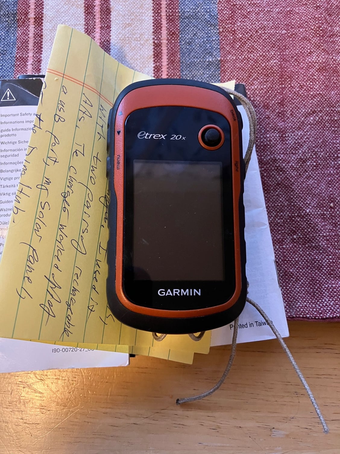
Pratt very generously sent me his Garmin, as 'tis the season. Thanks Pratt!
I will experiment with it on my commutes, and see if I can figure it out before touring next Summer. As asked above, I am really not a gadget person, but I've already found routes on RWGPS (US Bike Route 20, say) that I am interested in riding.
Likes For DCwom:
12-12-23, 06:22 PM
#32
Count Orlok Member
Thread Starter
Ok, I managed to save some tracks and mount the etrex to my handlebars. I tried a few different versions of the display, but automotive seems to work.
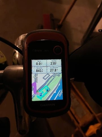
leaving work
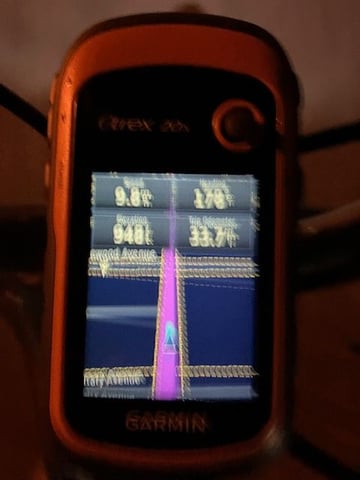
on the wheel
I do need the backlight, though, because it's dark on my way to work and dark on my way home.
Seems to be pretty straightforward. C'mon spring!
leaving work
on the wheel
I do need the backlight, though, because it's dark on my way to work and dark on my way home.
Seems to be pretty straightforward. C'mon spring!
Likes For gna:
