I-8 through the Sonoran Desert.
 02-23-20, 02:41 PM
#26
Partially Sane.
Thread Starter
Join Date: Jan 2016
Location: Sunny Sacramento.
Posts: 3,559
Bikes: Soma Saga, pre-disc
Mentioned: 22 Post(s)
Tagged: 0 Thread(s)
Quoted: 972 Post(s)
Likes: 0
Liked 643 Times
in
468 Posts
After you cross the Imperial Sand Dunes west of Yuma in CA, I-8 crosses over the All-American Canal shortly before Holtville. There is an artesian hot well there with a pool and BLM undeveloped camping area:
https://www.tripadvisor.com/Attracti...alifornia.html
https://www.tripadvisor.com/Attracti...alifornia.html
 02-26-20, 05:12 PM
#27
Senior Member
Further west along I-8, the mobile home park in Ocotillo allows cyclists to stay overnight in the rec room for an optional donation, the last time I checked the ACA route. There is also an option to head north from there and to hit a developed San Diego County campground at Agua Caliente hot springs--at one time they had a hike & bike program where you could camp overnight in the picnic area, and still may have it, but you can also camp for free anywhere in the surrounding State Park a quarter mile away. You could then follow these tourists' route back toward San Diego, which is longer, but I think better than the ACA route along I-8. https://www.crazyguyonabike.com/doc/...id=599049&v=4M
There aren't any H & B sites around San Diego proper until you get to San Elijo Beach about 20 miles north of downtown, so your options may be warm showers hosts, expensive private campsites, rather expensive hostels, a county campground inland called Sweetwater Summit, or a city campground which only allows camping on weekends: https://mtrp.org/campground/
There aren't any H & B sites around San Diego proper until you get to San Elijo Beach about 20 miles north of downtown, so your options may be warm showers hosts, expensive private campsites, rather expensive hostels, a county campground inland called Sweetwater Summit, or a city campground which only allows camping on weekends: https://mtrp.org/campground/
02-26-20, 07:34 PM
#28
Partially Sane.
Thread Starter
Join Date: Jan 2016
Location: Sunny Sacramento.
Posts: 3,559
Bikes: Soma Saga, pre-disc
Mentioned: 22 Post(s)
Tagged: 0 Thread(s)
Quoted: 972 Post(s)
Likes: 0
Liked 643 Times
in
468 Posts
Do you think Ride Angel Terri would be willing to come & carry my bags awhile. 🤔😁😉 I can hardly ride my bike now, when it’s unloaded, it’s just too light. I just unloaded it good today, for my once a month cleaning, and nearly flipped onto my back, trying to test ride it. 🙄😉
Boy, that Imperial Highway is just scary looking. 😲 I guess I’ve become pretty spoiled, by the nice wide berms on Arizona’s roads.
I just realized today, how close to both Mexico and California I am. Probably about a mile from either border, from the Western Wetlands Park. I noticed the Hummingbird Garden here right away, but apparently, it’s the wrong time of year for them. 🤔 But there are plenty of quail, doves, & the ever-present long-tailed blackbirds around. And last night, I saw a gang of 7 rabbits, out & looking for trouble. 😁
In case anyone’s wondering, I’ve been resting & trying to fatten myself up, here in Yuma. I doubt if I’ll gain any real weight, but it’s fun trying. 😁
Again, thanks for the info above. 👍
02-27-20, 03:01 PM
#29
Senior Member
The frontage roads along I-8 in the Imperial Valley are often in very bad condition, with wide cracks every meter or so, since the vast majority of traffic is on the interstate, and the frontage roads are allowed to disintegrate (Evan Hewes Hwy, for example) You'll find this out yourself after crossing the Imperial Dunes on the excellent freeway shoulder, and then being forced onto the frontage road. Traffic isn't really an issue on those roads.
If it's bad enough, you can avoid the bad roads by heading north from Holtville through the Imperial Valley. If you go up the east side of the Salton Sea, there are interesting recent volcanic domes and mud volcano fields near Niland, the odd Slab City informal camping town, hot spring resorts, and hike and bike sites at the Salton Sea SRA on its northeast shore. Assuming the highway is still there...https://www.latimes.com/local/lanow/...101-story.html You'd then have to loop around most of rest of the Sea until you reach S22 at Salton City and head off west toward Borrego Springs, which has H&B sites at its Palm Canyon Campground.
The more direct route from Holtville passes the Weist Lake campground just east of Brawley and heads more directly on Highway 86 to the intersection with 78, which you can then take to Borrego Springs, or explore other options.
02-27-20, 04:01 PM
#30
Partially Sane.
Thread Starter
Join Date: Jan 2016
Location: Sunny Sacramento.
Posts: 3,559
Bikes: Soma Saga, pre-disc
Mentioned: 22 Post(s)
Tagged: 0 Thread(s)
Quoted: 972 Post(s)
Likes: 0
Liked 643 Times
in
468 Posts
Hey, you must be from the future! 😲 I have about 2:50 on my screen, but you posted at just after 3:00. 😁😉
That’s some weird stuff, in that article, alright. Maybe they’ve been saving “the big one”, until I got out here. 🤔😉
It’s especially weird too, because I was just looking at the map yesterday, considering the possibility of going along the Eastern shore of the Salton Sea. But most of those towns aren’t really towns, except in name. 🤔 That wouldn’t do much good, for replenishing supplies, huh. 🙄😉
EDIT: To make matters worse, the thread shows me posting this a little after 4:00. Maybe I’m from the future too, and didn’t know it till now. 😲🤔😉
Last edited by stardognine; 02-27-20 at 04:05 PM.
02-28-20, 01:53 AM
#31
velo-dilettante
Join Date: Apr 2009
Location: insane diego, california
Posts: 8,316
Bikes: 85 pinarello treviso steel, 88 nishiki olympic steel. 95 look kg 131 carbon, 11 trek madone 5.2 carbon
Mentioned: 26 Post(s)
Tagged: 0 Thread(s)
Quoted: 1628 Post(s)
Liked 3,114 Times
in
1,683 Posts
not sure which part(s) of san diego you wanna hit but there are three main ways to directly get there from the imperial valley:
the 8 freeway corridor, california hwy 78 into julian (or splinters off to borrego springs) and county highway s22 from california hwy 86
(west coast salton sea) into borrego springs. all three involve significant climbing. 8 freeway will have the most traffic and lots of it filled
with trucks. climbing up montezuma grade just west of borrego springs is 11+ miles of 5%+ uphill (longest sustained grade in san diego county).
scenic, epic and with good sightlines except for a small stretch just uphill from the big turnout viewpoint on the other side of the road about halfway up the climb.
personally, i'd aim for julian. can resupply, camp or motel it and your directional and scenic options are the best of the three routes. banner grade (about 5.5% for 6 miles)
isn't easy but it's your shortest option along with plenty of turnouts and a some shade in the last two, uphill miles if you stop to rest.
between the salton sea and the towns of julian or borrego springs, i wouldn't count on a place to resupply. there are a handful of places but they are too iffy to recommend.
may necesssitate climbing with more food/water weight up the escarpment into the san diego backcountry mountains from the desert but it beats running low/out.
gawd...you survived that stretch of arizona, you can survive anything in california.
Last edited by diphthong; 02-28-20 at 01:57 AM.
02-28-20, 10:36 AM
#32
Partially Sane.
Thread Starter
Join Date: Jan 2016
Location: Sunny Sacramento.
Posts: 3,559
Bikes: Soma Saga, pre-disc
Mentioned: 22 Post(s)
Tagged: 0 Thread(s)
Quoted: 972 Post(s)
Likes: 0
Liked 643 Times
in
468 Posts
Actually, I seem to handle the desert pretty well, as long as there are water stops here & there. Same with mountains, I’ve crossed so many, they don’t really bother me now. 😉
The only issue is, I have bad knees, and ride mostly for physical therapy. I walk most uphills, so I’m way slower than most folks. But even there, I’m still getting stronger. I can ride an uphill grade much better than I used to.
03-01-20, 03:32 PM
#33
Partially Sane.
Thread Starter
Join Date: Jan 2016
Location: Sunny Sacramento.
Posts: 3,559
Bikes: Soma Saga, pre-disc
Mentioned: 22 Post(s)
Tagged: 0 Thread(s)
Quoted: 972 Post(s)
Likes: 0
Liked 643 Times
in
468 Posts
Welp, I got across the Colorado River and into California yesterday. Just did lunch, just South of the Dunes a bit. Got this signpost awhile back, for Felicity. I wonder if someone tampered with that sign. 🤔😁😉


03-01-20, 06:28 PM
#34
Partially Sane.
Thread Starter
Join Date: Jan 2016
Location: Sunny Sacramento.
Posts: 3,559
Bikes: Soma Saga, pre-disc
Mentioned: 22 Post(s)
Tagged: 0 Thread(s)
Quoted: 972 Post(s)
Likes: 0
Liked 643 Times
in
468 Posts
And I finally found those dunes, right after lunch. 😎 They were hiding in plain sight, lol.
There’s actually a pretty sharp transition, at both ends, from the “normal” desert.
BTW, be careful, kids. When these guys say Soft Shoulder, they really mean it. 😲😁😉


There’s actually a pretty sharp transition, at both ends, from the “normal” desert.
BTW, be careful, kids. When these guys say Soft Shoulder, they really mean it. 😲😁😉
03-02-20, 02:45 PM
#35
Partially Sane.
Thread Starter
Join Date: Jan 2016
Location: Sunny Sacramento.
Posts: 3,559
Bikes: Soma Saga, pre-disc
Mentioned: 22 Post(s)
Tagged: 0 Thread(s)
Quoted: 972 Post(s)
Likes: 0
Liked 643 Times
in
468 Posts
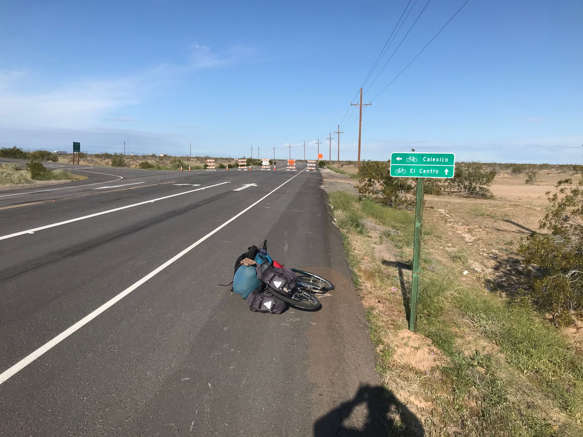
See, I told you guys I was good at finding detours. 🙄😉 Mostly, I wanted to show youse how they put these nice bike route signs out, by 1-8 & it’s frontage roads. Mostly, they try to keep you on the frontage road, but there’s a pretty long stretch, where they’re working on the frontage road, so they actually steer you onto the freeway. 🤔
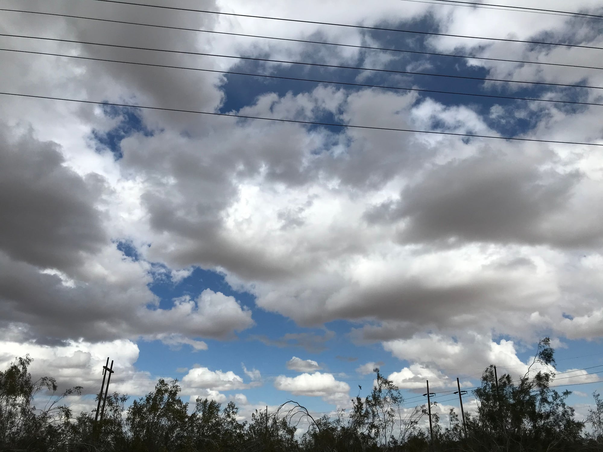
They were calling for rain here today, & we got it. I counted 18 drops, that hit me. 😲 Just look at these scary clouds!!! 🤪😁😉
They were calling for rain here today, & we got it. I counted 18 drops, that hit me. 😲 Just look at these scary clouds!!! 🤪😁😉
03-03-20, 06:52 PM
#36
Partially Sane.
Thread Starter
Join Date: Jan 2016
Location: Sunny Sacramento.
Posts: 3,559
Bikes: Soma Saga, pre-disc
Mentioned: 22 Post(s)
Tagged: 0 Thread(s)
Quoted: 972 Post(s)
Likes: 0
Liked 643 Times
in
468 Posts
In case anyone’s wondering, I did NOT fall off the planet, lol. 😁😉 I got to the Holtville hot springs last night, but chose NOT to use those facilities. Too many scary older folks there, and the whole thing just doesn’t have much room to move. Besides which, I wasn’t too sure how clean that water was. 🤔
I did camp there though, at the BLM (Bureau of Land Management), then looked at the springs again this morning. It was even more crowded, so I got on up to Holtville itself, had lunch, then proceeded to El Centro. ✌️
So, I’m calling break, and this time it really might last a month, maybe. 😉 But I dunno, I can see the mountains pretty well again, and the last mileage sign said about 120 miles to San Diego!!! 😎 No pic this time, but that’s definitely another “motivational” sign. 😁
BTW, it was super windy here today, and I’m exhausted, hence the open timetable, for proceeding. 😉
03-04-20, 08:38 PM
#37
Partially Sane.
Thread Starter
Join Date: Jan 2016
Location: Sunny Sacramento.
Posts: 3,559
Bikes: Soma Saga, pre-disc
Mentioned: 22 Post(s)
Tagged: 0 Thread(s)
Quoted: 972 Post(s)
Likes: 0
Liked 643 Times
in
468 Posts
And today, I finally had fish tacos. 😘😍😘 I passed a little restaurant that sells them for $1.00 apiece, on Wednesdays & Saturdays, with a sign out front, and a very busy drive thru. When I saw all that traffic, I said, “This must be the place”. 😁
I was expecting little tacos, so ordered four, but these were soft-shell, and huge. Plus fresh lemon wedges, salsa, and chopped lettuce, and two different sauces, all in separate containers, so you can customize them yourself.
I know what’s for lunch and/or dinner, on Saturday. 😁😉
I was expecting little tacos, so ordered four, but these were soft-shell, and huge. Plus fresh lemon wedges, salsa, and chopped lettuce, and two different sauces, all in separate containers, so you can customize them yourself.
I know what’s for lunch and/or dinner, on Saturday. 😁😉
03-04-20, 09:37 PM
#38
bicycle tourist
Mostly comparing notes with some of the extended travels I've done. Most recently it was 18 months on the road and travels from Alaska to Argentina. Like yourself I had a few extended breaks in that time:
- six weeks once I hit San Diego to take breather before crossing into Latin America
- a month in Bariloche at language school and let seasons catch up
- a few weeks in Mendoza followed by short trip home
- a week in Panama City followed by two weeks home to get my taxes done
- a further week here and there for various reasons
So I'm familiar with idea of not changing sleeping places every single night and occasionally taking a break during an extended trip.
What might be different was that I had structured my travels around a goal - namely crossing 125 degrees of latitude. So I also measured incremental changes along the way as in how far south I had come. This gave my trip a mix of goal driven - but also serendipity to adjust things along the way or sometimes take breaks.
As I think about my next extended trip, I am more likely to have somewhat open-ended travels. Essentially "retiring" before starting. Perhaps I'll work again after the trip, but I don't need a specific date to finish. Where it might be different is I find myself enjoying weaving in a particular goal as well. Perhaps not degrees of latitude but something strange like visiting all the US state capitol buildings or something like that...
So I am curious how much you weave things like that into your travels - and more generally how you view more extended travels...
03-05-20, 09:39 AM
#39
Partially Sane.
Thread Starter
Join Date: Jan 2016
Location: Sunny Sacramento.
Posts: 3,559
Bikes: Soma Saga, pre-disc
Mentioned: 22 Post(s)
Tagged: 0 Thread(s)
Quoted: 972 Post(s)
Likes: 0
Liked 643 Times
in
468 Posts
^^ I originally just aimed for Colorado, then Arizona, then my current goal of California. So nothing is really “planned” in the traditional sense. I’m on disability, and largely just riding for physical therapy, so have no time constraints.
Which is part of the reason I’m so slow, but I also change my mind a lot, about where I’m going, lol. 😁😉 I aimed for San Diego this trip, because I just wasn’t up to crossing the Mojave Desert, as “planned” last year. I hung around Needles awhile, but water’s just too scarce, to try living there. 😉 You can’t drink the Pacific Ocean, but you can sure swim in it, and I plan to. 😁😎✌️
EDIT: I probably won’t wait a month, after all. I’d like to at least get to the mountains, before it gets really hot. 😉 It’s supposed to be in the 80s F today and tomorrow, when most days are in the 70s. Anything hotter than about 85 just makes me lazy. 🙄😉 That’s why I started this desert trip stuff in February, to beat the heat. 😎
Last edited by stardognine; 03-05-20 at 09:51 AM.
03-05-20, 06:04 PM
#40
Senior Member
Have you made a decision yet about which route through the mountains? Having done them all, 5-6% Banner Grade up to Julian is probably the one I'd do, though you can take an even longer and less steep climb up to Ranchita to the NW instead from Scissors Crossing. Montezuma Grade from Borrego Springs to Ranchita has some 8-9% sections on the insides of sharp switchbacks, no shade, and no businesses or water along the grade.
03-05-20, 07:18 PM
#41
Partially Sane.
Thread Starter
Join Date: Jan 2016
Location: Sunny Sacramento.
Posts: 3,559
Bikes: Soma Saga, pre-disc
Mentioned: 22 Post(s)
Tagged: 0 Thread(s)
Quoted: 972 Post(s)
Likes: 0
Liked 643 Times
in
468 Posts
Have you made a decision yet about which route through the mountains? Having done them all, 5-6% Banner Grade up to Julian is probably the one I'd do, though you can take an even longer and less steep climb up to Ranchita to the NW instead from Scissors Crossing. Montezuma Grade from Borrego Springs to Ranchita has some 8-9% sections on the insides of sharp switchbacks, no shade, and no businesses or water along the grade.
Heck, this stretch will seem easy, because the Specific Ocean is calling me. 😎 I’ve seen several seagulls here in El Centro, although I imagine they were more likely to have come up from the Gulf of Mexico. 🤔
But as noted in my last previous post, I change my mind a lot, so we shall see. 😁😉
03-05-20, 08:03 PM
#42
bicycle tourist
I’m probably going to just stay on I-8, as originally planned. I’m not too worried about steep grades, I’ve walked up mountains before, lol. 😁😉 As for water stops, I can carry 7 liters of pop fairly easily, and there are several places on the map, I see, to restock if needed. And 120 miles just isn’t all that far. And not even really in the desert.
BTW thanks for helping my curiosity on your travels and wish you good travels from here...
03-06-20, 09:42 AM
#43
Partially Sane.
Thread Starter
Join Date: Jan 2016
Location: Sunny Sacramento.
Posts: 3,559
Bikes: Soma Saga, pre-disc
Mentioned: 22 Post(s)
Tagged: 0 Thread(s)
Quoted: 972 Post(s)
Likes: 0
Liked 643 Times
in
468 Posts
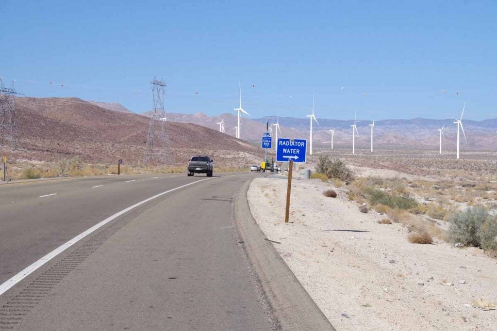
I’m not sure what you mean, about radiator water, don’t recall seeing those before. 🤔 But it sounds like a plan, to stay cool as needed. 👍 I noticed awhile back, that dunking my baseball cap (I wear one under my helmet, for the visor) in water really helps. 😎
03-06-20, 12:20 PM
#44
bicycle tourist

 03-06-20, 11:04 PM
#46
Partially Sane.
Thread Starter
Join Date: Jan 2016
Location: Sunny Sacramento.
Posts: 3,559
Bikes: Soma Saga, pre-disc
Mentioned: 22 Post(s)
Tagged: 0 Thread(s)
Quoted: 972 Post(s)
Likes: 0
Liked 643 Times
in
468 Posts
Yeah, I’m sure you’re right about that. I just meant, I’ve never seen those barrel thingies before, even on fairly major mountain roads. 🤔
I don’t particularly trust ANY water to be potable (safe to drink) anymore, unless it’s bottled or comes from a coin-operated dispenser. I’ve seen way too many signs, especially for irrigation or sprinklers, that say they use “reclaimed” water. In other words, sewer water. 😲🙄 There’s really nothing wrong with watering the lawn with it, but things tend to smell a little funny, to put it nicely. 😉
I think they might be also doing it, to deter stealth camping. It puts a whole new spin on getting caught under a sprinkler. You don’t just get wet, you get “tainted”, lol. Don’t ask me how I know. 🙄🙁
03-07-20, 03:47 PM
#47
Partially Sane.
Thread Starter
Join Date: Jan 2016
Location: Sunny Sacramento.
Posts: 3,559
Bikes: Soma Saga, pre-disc
Mentioned: 22 Post(s)
Tagged: 0 Thread(s)
Quoted: 972 Post(s)
Likes: 0
Liked 643 Times
in
468 Posts
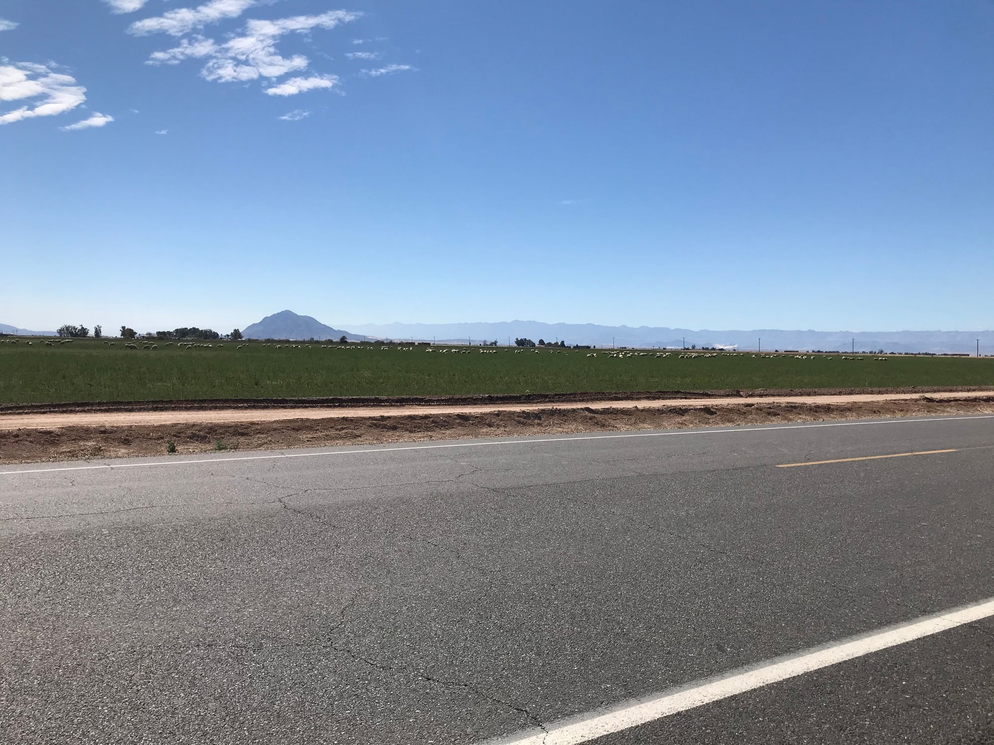
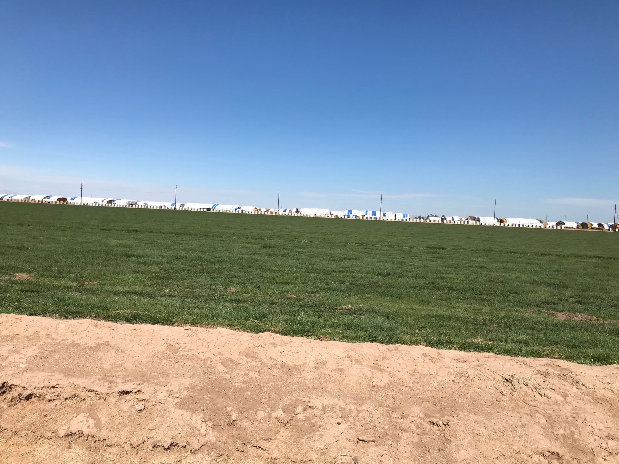
Back on the road today after all, though I got a really late start. 🙄😉 I just thought you folks ought to see what those silly sheep are doing, out near Seeley. And right across the road, there’s quite a bit of hay and/or straw. I dunno the difference, don’t ask me. 🤔 That’s only about half of it, in the pic, these guys really grew more than they needed. 😁
03-07-20, 09:25 PM
#48
Senior Member
Well, if you go due north a few miles from Ocotillo, you hit the Coyote Mountains, where my field geology class from San Diego State did some mapping in '79. We just drove out and camped in the side branches of Fossil (Shell) Canyon, since it wasn't flash flood season. The active Elsinore fault, which had its extension in Baja create the big magnitude 7 quake Easter 2010, runs right along the mountain front, creating the range, and is pretty easy to spot on Google Earth and in the field. Maybe you'll be lucky and have it break right when you're there, and see the land carry you one meter NW for free!
03-08-20, 12:39 PM
#49
Partially Sane.
Thread Starter
Join Date: Jan 2016
Location: Sunny Sacramento.
Posts: 3,559
Bikes: Soma Saga, pre-disc
Mentioned: 22 Post(s)
Tagged: 0 Thread(s)
Quoted: 972 Post(s)
Likes: 0
Liked 643 Times
in
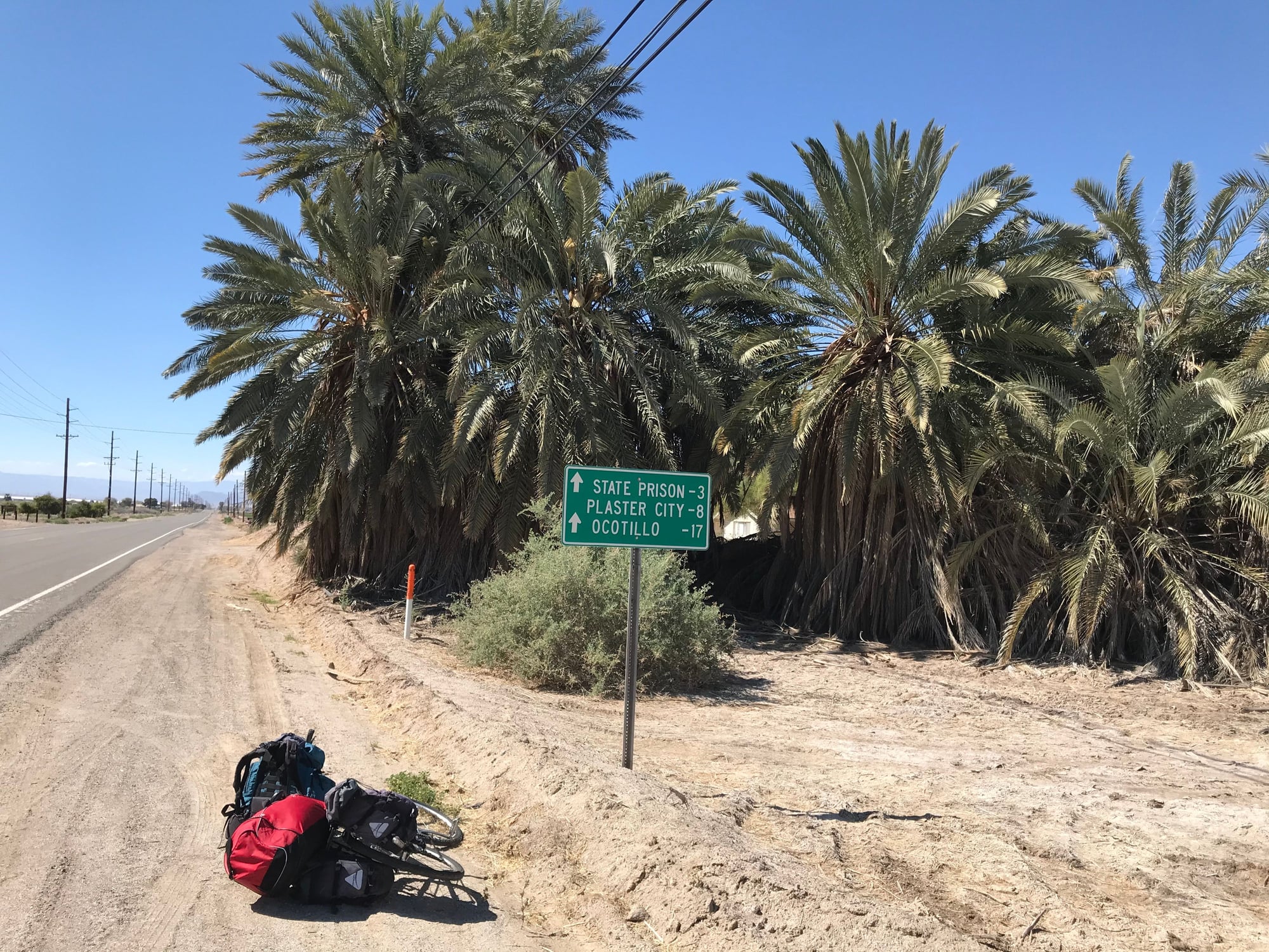
468 Posts
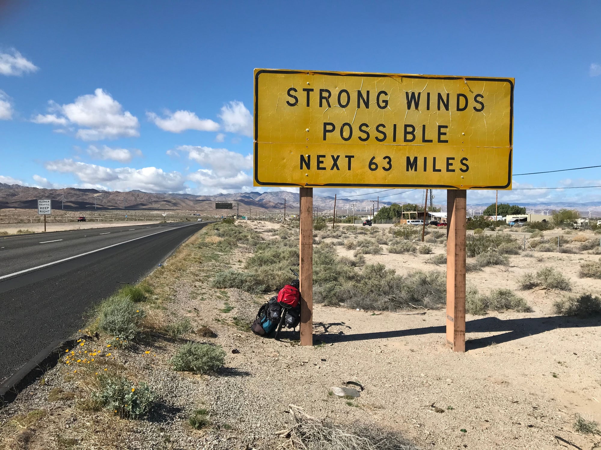
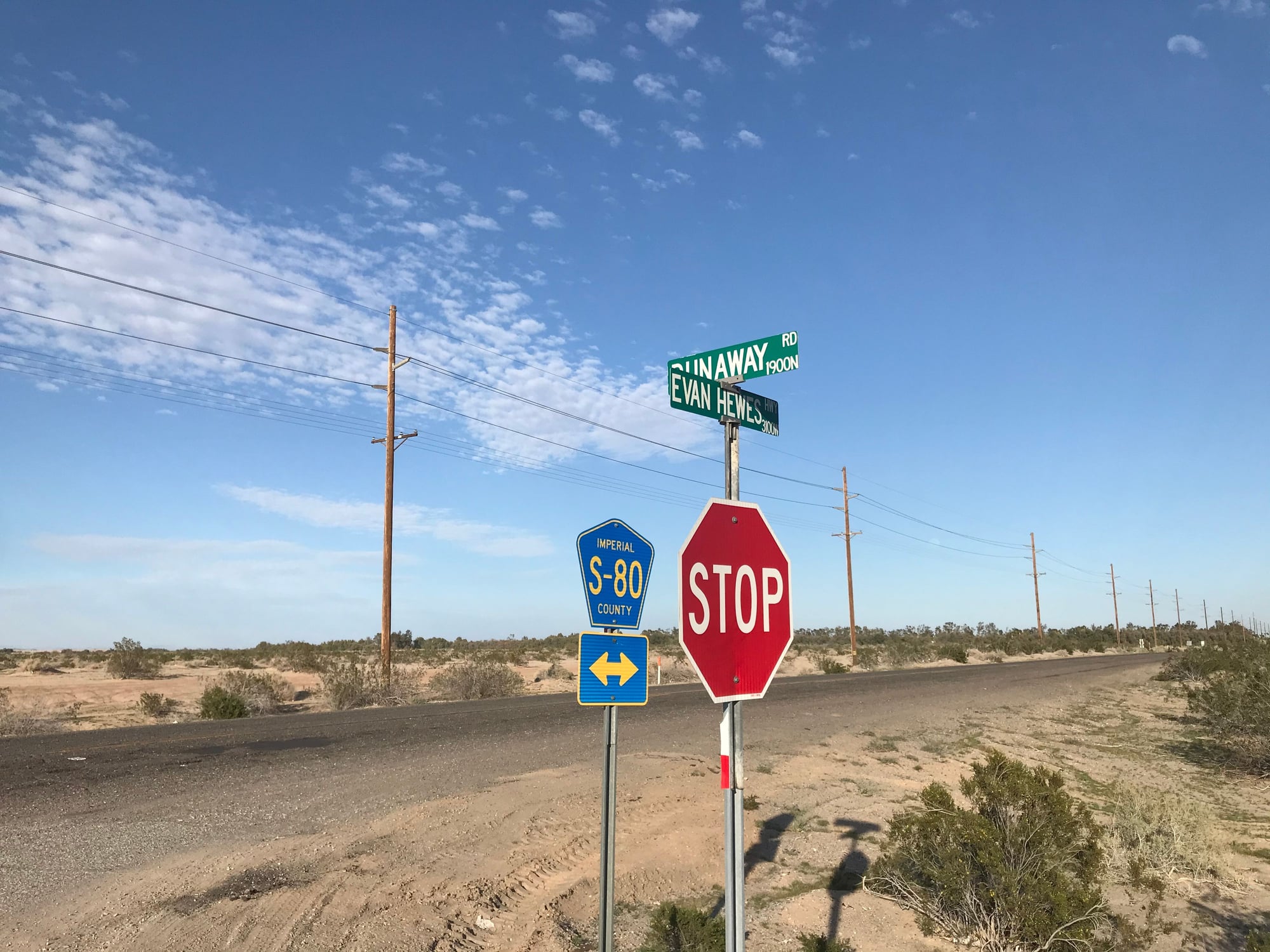
Well, I just now got to Ocotillo. I had to fight some hard winds, yesterday and today, plus I found another detour, lol. 🙄😉 I was coming along old S80, but someone broke a bridge, and the signs sent right back out on I-8 after all. I’m blaming all these wind turbines, for the strong wind. 🤔😉


03-08-20, 12:42 PM
#50
Partially Sane.
Thread Starter
Join Date: Jan 2016
Location: Sunny Sacramento.
Posts: 3,559
Bikes: Soma Saga, pre-disc
Mentioned: 22 Post(s)
Tagged: 0 Thread(s)
Quoted: 972 Post(s)
Likes: 0
Liked 643 Times
in
468 Posts
Apparently, strong winds are normal here. So I guess those turbines are pretty sensible. 🙂