


Routing?
 10-24-19, 09:45 PM
#1
Senior Member
Thread Starter
Join Date: Apr 2013
Posts: 1,173
Bikes: Surly Disk Trucker, 2014 w/Brooks Flyer Special saddle, Tubus racks - Duo front/Logo Evo rear, 2019 Dahon Mariner D8, Both bikes share Ortlieb Packer Plus series panniers, Garmin Edge 1000
Mentioned: 2 Post(s)
Tagged: 0 Thread(s)
Quoted: 405 Post(s)
Liked 115 Times
in
99 Posts
Routing?
I'm way behind the times in bicycle tech so I hope you don't look at my questions cross-eyed. Well, if you do, I won't know so just keep the riff raff out of the thread LOL.
In any event, I use a Garmin Edge 1000, and have used it for a few years, but I've never done any route planning on it aside from looking at roads on the map and riding down them manually (no directions, just look at the map and go). I have route planned in Google Maps to figure out a ride, but I still have never used electronic directions/live routing.
The last day trip I went on (55 miles) I tried the route planner in my Edge 1000. It will let me set a point on the map then it will give me a route to take to get there. However, I do not want to go the way the GPS automatically calculates - I want to go my own way.
So I cleared out the route and I built a route plan with waypoints. Each waypoint was sequentially further along in my "route" then the overall route calculation appeared to have set the correct route. So I used it.
When I rode along the route the first waypoint I got to wouldn't register. The waypoint showed to be something like 50 feet away from the road I was on and would not advance to the next waypoint. So I cancelled the navigation. I tried to reset it but I couldn't start from a point along the route, only the beginning.
Am I missing something with the routing? What I don't want to do is have to ride in circles at each waypoint for the unit to register that I have "arrived" and then make up it's mind that it can then start guidance to the next waypoint. Yet, at the same time, I want to be able to have my own route plan created - and not simply tap on the map where I want to go (that may be 20-30-40 miles away) and get very few options as to how to get there when I already have laid out the route I want to go?
For what it is worth - I did (finally) register with Garmin Connect and linked it to my Strava account. I got on Strava back in 2014 but the only thing I have ever used it for is the "heat map". When I got done with my short ride last night the data uploaded to Connect and Strava automatically when I saved the ride. So that was cool. What I don't use, and I don't think I ever will, are the "courses" and "segments" that others have been on - as in take someone elses' ride and upload it in to my unit. However, that having been said - being aware that is possible - can I create my own "course" somehow on the computer ahead of time and then use that to upload instead of trying to do waypoint routing on the unit?? If so - how do I avoid the "riding in circles to arrive at a waypoint" syndrome? If I am off-course by 100ft (say, the route is on the east side of a road but there is a bike trail that parallels the road on the west side and I am on the bike trail and not the road) will it register that I am correctly on-course and continue to navigate?
 10-25-19, 04:49 AM
#2
Senior Member
Join Date: Aug 2010
Location: Madison, WI
Posts: 11,207
Bikes: 1961 Ideor, 1966 Perfekt 3 Speed AB Hub, 1994 Bridgestone MB-6, 2006 Airnimal Joey, 2009 Thorn Sherpa, 2013 Thorn Nomad MkII, 2015 VO Pass Hunter, 2017 Lynskey Backroad, 2017 Raleigh Gran Prix, 1980s Bianchi Mixte on a trainer. Others are now gone.
Mentioned: 48 Post(s)
Tagged: 0 Thread(s)
Quoted: 3461 Post(s)
Liked 1,467 Times
in
1,144 Posts
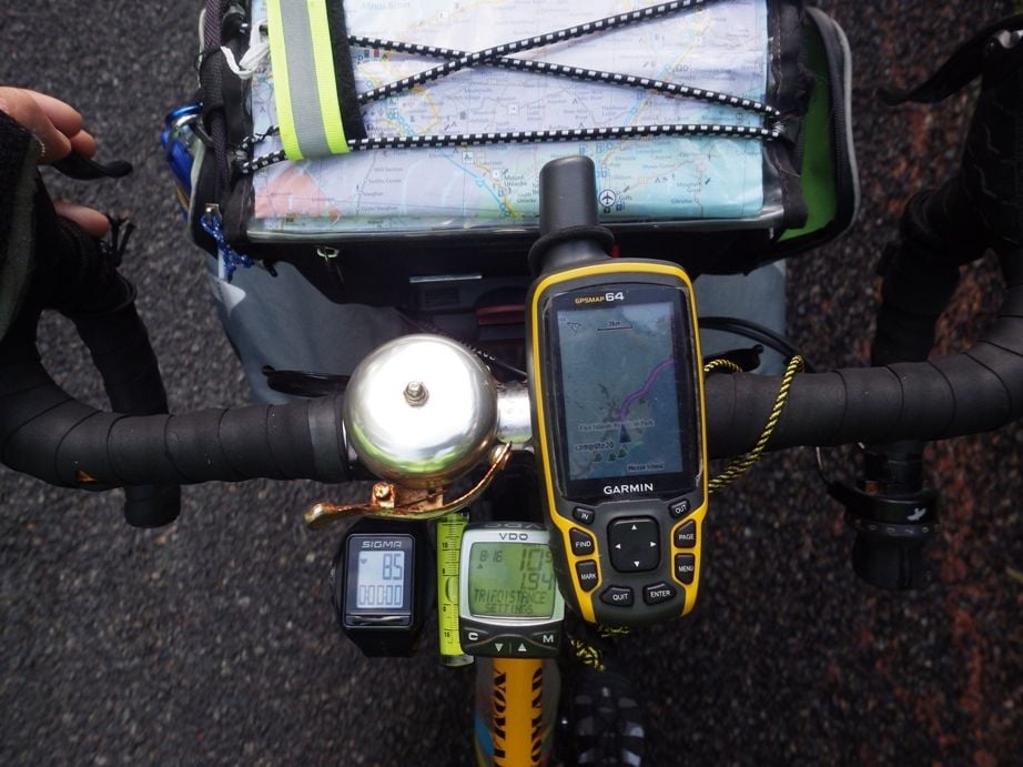
I do not use the same Garmin you use, mine is not a cycling one so I can't really say anything about that. I use a Garmin 64 and I have no clue how it compares to yours.
Each tour I seem to do things a bit differently. I will describe my route planning on the tour I took this past June and July, five weeks in the Canadian Maritimes.
While at home before I went there, I put all the grocery stores and campgrounds that I could find on the internet into the GPS map. I also put those into Maps.Me (an Android app).
Each day I plan out my route. For the route that I take for a specific day, I usually pick a campground as my final destination. If I am running low on food, I might instead pick a destination that is a grocery store that I plan to stop at on the way to the camp ground. To pick that destination I rely mostly on paper map and the Android app Maps.Me for my initial planning. To use that app, I download the maps at home on wifi before I go to where ever I will be because Maps.Me will work off line as long as the maps are in the phone memory. I use that Android app instead of my Garmin for initial planning because my Garmin screen is tiny compared to my phone that has a 5.5 inch screen.
https://play.google.com/store/apps/d...s.pro&hl=en_US
I then tell my Garmin to plot a route to that planed destination, my Garmin has different options for tour cyling, road cycling, car driving, etc. I usually picked tour cycling first. But if the route that the Garmin gave me looked like it would take me off of a route that made sense, then I might pick car driving route to see what that route looked like instead.
If my phone with the Maps.Me route looked to make more sense than my Garmin routing, I would start on that route instead of the Garmin route. But I relied on memory to know where to make the first few turns instead of creating waypoints in the Garmin. Thus, I had my Garmin turned on and mounted on the handlebar, relied on that instead of my phone while riding. My phone on a sunny day is impossible to see, but not the Garmin, so the phone is packed away while I am riding.
If those routes did not look good to me, I might try the Andorid app Komoot. That app only works when connected to the internet. Usually my tours are places where cell service is unreliable at best. Or if there is, I usually do not have a functioning sim card or if I have one that functions it is on a limited data plan. On my Maritimes tour, I did not have a Candian sim card, thus my phone was a wifi only device. Thus, I only used this app on wifi when planning, I never used this app during day to day riding. Also as noted above, my screen is not good enough on a sunny day to see anything on my phone.
https://play.google.com/store/apps/d...droid&hl=en_US
If the Komoot route looked better, I took that route instead of the route my Garmin or Maps.Me route, but again, I just remember where to turn instead of creating way points in the Garmin.
While riding I have the Garmin turned on and it keeps updating my route while I am riding. That way I can see where I am on the screen map. I also have a paper map on top of my handlebar bag to refer to. If I decided to go off of my Garmin route and instead follow a Maps.Me route or a Komoot route, the Garmin re-calculates a new route once I leave the route that the Garmin planned. It might keep recalculating for hours, but I usually leave it on and it keeps updating in the background if I am not following its route.
There are times that none of the electronics works right for the route I wanted to take. Last tour, one day all of the electronic devices told me to take a 15 km road to an intersection, then take a different 15 km road to the next intersection for a total of 30 km. But the electronic devices and the paper map were all clear that there was a 15 km road that would go straight to that endpoint, thus half the distance. So, I disregarded all electronics and took the 15 km road. And it was a great road. I suspect that the electronics were telling me to avoid the road because it was a local road, not a national or provincial highway. After I had gone down that road maybe 10 km, my Garmin finally decided that I was on the best route and quit telling me to turn around and go back to take the long way.
Another example, I decided to ride mostly on the Confederation Trail (gravel rail to trails type of trail) from Charlottetown PEI to the Confederation Bridge which is the only bridge to leave PEI (there also is a ferry on the other end of the island). I made this decision to take the trail system based on paper road map, the trail map, etc. Almost the entire day my Garmin kept telling me to turn onto the highway each time I crossed a highway instead of staying on the trail. It was not until I got off of the gravel trail within maybe 10 km of the bridge that I started to follow the route my Garmin gave me. On this day, I just relied on the Garmin map to show me where the trail was and I followed the trail that was on the screen instead of suggesting routing.
My point is that often I deviate from all of the suggested electronic routes and just use the Garmin to display the map on the screen so I can see where I am relative to where the roads and trails are. On that five week tour, I suspect that I did not follow the Garmin route completely on one out of three days, instead looked at the screen while I was riding and went where it made sense to go.
In other words, sometimes just use the paper map for planning and only use the GPS to tell you were you are on a map on the screen at any given point in time.
Last edited by Tourist in MSN; 10-25-19 at 04:53 AM.
10-25-19, 06:22 AM
#3
Junior Member
Join Date: Aug 2019
Posts: 22
Mentioned: 0 Post(s)
Tagged: 0 Thread(s)
Quoted: 4 Post(s)
Likes: 0
Liked 4 Times
in
3 Posts
Have used Garmin GPS units for 20 years and over that time frame have learned a couple of things:
1) When you plan a route with waypoints or just successive points on the roads when you are done. ZOOM WAY IN on the route and verify that each and every point is ON THE ROAD, not in an adjacent parking lot or field. If the point is off the road, move it onto the road while zoomed way in. That will solve your waypoint issue. Note for auto navigating, this applies to INTERSTATE HIGHWAYS, be sure your point is on the CORRECT side of the road for your desired direction of travel.
2) If designing a route on your computer and copying to a device, BE SURE the maps on each are the same version. Otherwise the computer and the Garmin MIGHT calculate different routes.
3) Sharing of routes from one Garmin to the next is technically tricky. A route is transferred to the Garmin unit as a series of points. First, I found even TWO IDENTICAL models might recalculate the route differently. Why the difference: through trial and error: A) map version is different, B) software version is different, C) data sets for roads that connect or even points on the same road are different.
4) These situations are even more complicated between different Garmin models and even worse between different GPS brands.
HTH
10-25-19, 07:47 AM
#4
Senior Member
Join Date: Jul 2007
Location: South shore, L.I., NY
Posts: 6,883
Bikes: Flyxii FR322, Cannondale Topstone, Miyata City Liner, Specialized Chisel, Specialized Epic Evo
Mentioned: 18 Post(s)
Tagged: 0 Thread(s)
Quoted: 3240 Post(s)
Liked 2,086 Times
in
1,181 Posts
You can use Strava to create routes, I don't use Strava so cannot advise.
I have used RideWithGPS and prefer that as it is also my cycling fitness tracker. Its pretty easy to create a course, as Garmin calls it, or a route, as RWGPS calls it, using the on-line website. It's free, though I'm paying for a subscription as I like the service it provides. Once you create a route, you save it.
The easiest method to get that saved route to the 1000 is to install a Garmin iQ app on the 1000 called RideWithGPS, it's in the iQ store. Note that you need to have the Garmin Connect Mobile app installed on a smartphone, you then download from the GCM iQ store. GCM will install that app to the 1000. Once that iQ app is on the 1000 you access the iQ apps, RWGPS and select to view and download the routes, then go to navigate on the 1000 and start.
 10-25-19, 08:49 AM
#5
Senior Member
Thread Starter
Join Date: Apr 2013
Posts: 1,173
Bikes: Surly Disk Trucker, 2014 w/Brooks Flyer Special saddle, Tubus racks - Duo front/Logo Evo rear, 2019 Dahon Mariner D8, Both bikes share Ortlieb Packer Plus series panniers, Garmin Edge 1000
Mentioned: 2 Post(s)
Tagged: 0 Thread(s)
Quoted: 405 Post(s)
Liked 115 Times
in
99 Posts
Have used Garmin GPS units for 20 years and over that time frame have learned a couple of things:
1) When you plan a route with waypoints or just successive points on the roads when you are done. ZOOM WAY IN on the route and verify that each and every point is ON THE ROAD, not in an adjacent parking lot or field. If the point is off the road, move it onto the road while zoomed way in. That will solve your waypoint issue. Note for auto navigating, this applies to INTERSTATE HIGHWAYS, be sure your point is on the CORRECT side of the road for your desired direction of travel.
2) If designing a route on your computer and copying to a device, BE SURE the maps on each are the same version. Otherwise the computer and the Garmin MIGHT calculate different routes.
3) Sharing of routes from one Garmin to the next is technically tricky. A route is transferred to the Garmin unit as a series of points. First, I found even TWO IDENTICAL models might recalculate the route differently. Why the difference: through trial and error: A) map version is different, B) software version is different, C) data sets for roads that connect or even points on the same road are different.
4) These situations are even more complicated between different Garmin models and even worse between different GPS brands.
HTH
1) When you plan a route with waypoints or just successive points on the roads when you are done. ZOOM WAY IN on the route and verify that each and every point is ON THE ROAD, not in an adjacent parking lot or field. If the point is off the road, move it onto the road while zoomed way in. That will solve your waypoint issue. Note for auto navigating, this applies to INTERSTATE HIGHWAYS, be sure your point is on the CORRECT side of the road for your desired direction of travel.
2) If designing a route on your computer and copying to a device, BE SURE the maps on each are the same version. Otherwise the computer and the Garmin MIGHT calculate different routes.
3) Sharing of routes from one Garmin to the next is technically tricky. A route is transferred to the Garmin unit as a series of points. First, I found even TWO IDENTICAL models might recalculate the route differently. Why the difference: through trial and error: A) map version is different, B) software version is different, C) data sets for roads that connect or even points on the same road are different.
4) These situations are even more complicated between different Garmin models and even worse between different GPS brands.
HTH
I, too, have lots of Garmin units - 2x marine chart plotters (one with autoguidance, just no hydraulic autosteer on the boat, the routing ability with manual steering), a truck unit (780 model), and a handheld one I used for boating and hiking back in the early 2000's.
The 780 is android-based and it does a nice job of interpreting map detail/scale for the waypoints. If I am zoomed out to show 1/2 a state and tap close to a state route (what I think is right over top of it, but could be several miles off by scale) it will pick the route I was trying to hit. The chart plotter that has the routing (older of the 2 - has Bluechart G2 Vision cartography, maybe the new one will do it, I just haven't tried) will guide both to the track and the waypoint. If I have a 15 mile path in there that weaves through islands and channels and I am fishing 1/2 mile away from the path it will tell me how far off-course I am, but it will keep navigating to the waypoint. Just sitting here thinking - I am not sure what it does with the next waypoint if I'm too far from it, though it does separate the end point from each consecutive "waypoint" along the route.
In any event, the base of where my "routing" question is coming from is normal riding for me - not multi-day, several week, "tours". So if I am out for a day trip, for example, of 40-80 miles and have a route I want to stick to it would be nice to have the directions for it. One of the towns I went through the other day, for example, had me go east in to the town, go through town going north, then meet back up with a road going northwest. I went several blocks too far east in town when I could have cut up through a closer road to get to the one going north west but I wasn't watching the map that close. Not a big deal, at the end of the day, but it was still a deviation from the route I had planned out. If I had turn-by-turn directions to spot the first road I could take all the way through town going north I would have caught it.
10-25-19, 09:09 AM
#6
Junior Member
Join Date: Aug 2019
Posts: 22
Mentioned: 0 Post(s)
Tagged: 0 Thread(s)
Quoted: 4 Post(s)
Likes: 0
Liked 4 Times
in
3 Posts
Most of my routing was done for Motorcycle rides / trips. Creating a route for a area close to home really wasn't a problem because I had already been on most of the surrounding roads and only wanted to try connecting via a "new way". It did get trickier when going to places I had not been. But I did not find issues with points or waypoints on roads (we liked country roads) as long as the point was on the road. I.E. if I was on extreme right side of road but GPS point was actually on left side of road, the GPS figured out that we got to the waypoint and went on to the next one.
Having said that, in some cases, we HAD TO TAKE A DETOUR around where a waypoint was. The following depends if your GPS unit has this (these) abilities.
1) while on the detour, I would recalculate the route from my current location. I.E. try to get to the next waypoint.
2) Some GPS until would automatically recalculate, but always trying to get back to the point that was LOCATED ON THE DETOUR. In this case, I would tell the GPS to SKIP THAT POINT and it would recalculate the route.
3) I had one occasion on REALLY back roads in West Virginia where several waypoints had to be skipped. We had NO IDEA where we wound up once we got to a major highway about 30 miles later. I took a guess, and told the GPS to go to a waypoint further down the route. This is like starting over from your current position. Once I got to the waypoint, I switch back to the route we wanted.
Having to quit motorcycling, I'm now into Trikes and have acquired a Edge 1030. But do not have the experience with it as yet to tell if any or all of those things are possible. Sorry.
10-25-19, 10:39 AM
#7
Full Member
Join Date: Nov 2006
Posts: 235
Mentioned: 0 Post(s)
Tagged: 0 Thread(s)
Quoted: 48 Post(s)
Likes: 0
Liked 10 Times
in
10 Posts
I use RideWithGPS to create my routes. I then send it to my Garmin Edge Explore. If I get off route it will not change the route but will try to direct me back to it, however if I ignore it and get beak on route at a later point it will pick it up and navigate from there. While off route depending on how far off I am and zoom level I can see the route on the screen.
I have also done this with a Garmin GPSMAP 64s and eTrix 20. You can also use the RideWithGPS phone app I think this is what I will do when my Garmin needs replacing.
I have also done this with a Garmin GPSMAP 64s and eTrix 20. You can also use the RideWithGPS phone app I think this is what I will do when my Garmin needs replacing.
10-25-19, 11:47 AM
#8
Senior Member
Join Date: Mar 2010
Location: Seattle, WA
Posts: 23,208
Mentioned: 89 Post(s)
Tagged: 0 Thread(s)
Quoted: 18883 Post(s)
Liked 10,646 Times
in
6,054 Posts
Try what you did, touch part of the map, let it generate a route for you. If it's not the way you want to go, just start riding the one you prefer. Your Garmin will re-route when it realizes you're not doing the one it calculated. It will keep re-routing, so eventually it should give you an acceptable route from where you are at the time to where you want to be.
10-25-19, 03:25 PM
#9
Senior Member
Thread Starter
Join Date: Apr 2013
Posts: 1,173
Bikes: Surly Disk Trucker, 2014 w/Brooks Flyer Special saddle, Tubus racks - Duo front/Logo Evo rear, 2019 Dahon Mariner D8, Both bikes share Ortlieb Packer Plus series panniers, Garmin Edge 1000
Mentioned: 2 Post(s)
Tagged: 0 Thread(s)
Quoted: 405 Post(s)
Liked 115 Times
in
99 Posts
Try what you did, touch part of the map, let it generate a route for you. If it's not the way you want to go, just start riding the one you prefer. Your Garmin will re-route when it realizes you're not doing the one it calculated. It will keep re-routing, so eventually it should give you an acceptable route from where you are at the time to where you want to be.
I tried the latter on a ride today just for a 3/4 mile test (25 mile ride total) and it seemed to work OK but I didn't get too ambitious with it. I just didn't want to mess with it much - was racing the clock too.
10-25-19, 03:34 PM
#10
Senior Member
Join Date: Mar 2010
Location: Seattle, WA
Posts: 23,208
Mentioned: 89 Post(s)
Tagged: 0 Thread(s)
Quoted: 18883 Post(s)
Liked 10,646 Times
in
6,054 Posts
Newer Garmins (including yours) have a neat feature where it will generate a random, round-trip route for you to follow. (This is a digression but bear with me.) I had an Edge 800 for almost a decade, it didn't have that feature, but, to basically get the same thing, I'd tell it to route me "back to start" and then just start riding in whatever direction the spirit would carry me. It was constantly rerouting, and I would mostly ignore it, but check before I decided to see what was down some road, to make sure I wasn't making a dumb mistake. When I'd start getting tired of it, I would follow whatever route it had at that point back to my home or car. This isn't a conventional way to use them, but it worked pretty well in practice.
You said on a recent 55 mile ride, you set a point on the map and it generated a route to get there, but not one you liked. What I'm suggesting is that you do that, but then start riding the way you'd prefer to go. Leave it in navigation mode and it will keep re-adjusting the route. At the point where you need it for directions, it will still know where you're going and where you are, and it will have a plan for how to get from A to B, it'll be ready to guide you.
You said on a recent 55 mile ride, you set a point on the map and it generated a route to get there, but not one you liked. What I'm suggesting is that you do that, but then start riding the way you'd prefer to go. Leave it in navigation mode and it will keep re-adjusting the route. At the point where you need it for directions, it will still know where you're going and where you are, and it will have a plan for how to get from A to B, it'll be ready to guide you.
10-25-19, 09:35 PM
#11
Senior Member
Thread Starter
Join Date: Apr 2013
Posts: 1,173
Bikes: Surly Disk Trucker, 2014 w/Brooks Flyer Special saddle, Tubus racks - Duo front/Logo Evo rear, 2019 Dahon Mariner D8, Both bikes share Ortlieb Packer Plus series panniers, Garmin Edge 1000
Mentioned: 2 Post(s)
Tagged: 0 Thread(s)
Quoted: 405 Post(s)
Liked 115 Times
in
99 Posts
You said on a recent 55 mile ride, you set a point on the map and it generated a route to get there, but not one you liked. What I'm suggesting is that you do that, but then start riding the way you'd prefer to go. Leave it in navigation mode and it will keep re-adjusting the route. At the point where you need it for directions, it will still know where you're going and where you are, and it will have a plan for how to get from A to B, it'll be ready to guide you.
I will have to try that.
I did get 25 miles in today - mostly trails that I have been on a bit, but some new. I didn't use the routing through the new part much, but I did get a mile or so in of routing through a neighborhood - and it worked to get me back to where I normally pick up the next trail. So that was good, it just wasn't a long test.
I did try to route with minimal waypoints at the start of the ride but it wouldn't get past the neighborhood. It told me "calculation error" every time. I zoomed in and a trail that connects a dead-end in the neighborhood with a trail that parallels a main throughway was physically there, but the map detail in the Edge 1000 did not have it complete for some reason. So the Edge 1000 couldn't route through the gap in the trail. Oh well. I tried.
10-26-19, 06:31 AM
#12
Junior Member
Join Date: Aug 2019
Posts: 22
Mentioned: 0 Post(s)
Tagged: 0 Thread(s)
Quoted: 4 Post(s)
Likes: 0
Liked 4 Times
in
3 Posts
I did try to route with minimal waypoints at the start of the ride but it wouldn't get past the neighborhood. It told me "calculation error" every time. I zoomed in and a trail that connects a dead-end in the neighborhood with a trail that parallels a main throughway was physically there, but the map detail in the Edge 1000 did not have it complete for some reason. So the Edge 1000 couldn't route through the gap in the trail. Oh well. I tried.
10-29-19, 08:29 PM
#13
Senior Member
Thread Starter
Join Date: Apr 2013
Posts: 1,173
Bikes: Surly Disk Trucker, 2014 w/Brooks Flyer Special saddle, Tubus racks - Duo front/Logo Evo rear, 2019 Dahon Mariner D8, Both bikes share Ortlieb Packer Plus series panniers, Garmin Edge 1000
Mentioned: 2 Post(s)
Tagged: 0 Thread(s)
Quoted: 405 Post(s)
Liked 115 Times
in
99 Posts
I tried the routing again on a day trip today. I was going to loop through a few towns out in the Ohio countryside but a flat tire about 8 miles in tied me up (didn't have a tube but I had a patch kit - I just had to find where the tube was leaking and that took me way longer than it should have).
In any event, the first thing I did before I rolled out was set a waypoint where I was going - about 26-27 ride miles away (not sure what the line of sight distance was, maybe 15-18?). The routing was absolutely worthless all the way to within 1/2 mile of the waypoint. The waypoint was in a state park and there is only one road in to the park and one way to navigate the roads - once in the park - to get back to where I was going, but the route guidance wanted me to go another 1/2-1 mile north.
In any event, I'll keep the route guidance off. I suppose I can try it in other areas to see what happens, but as for route planning my rides/trips - I'll keep doing things the old fashioned way.
10-29-19, 09:47 PM
#14
Senior Member
Join Date: Sep 2015
Location: QC Canada
Posts: 1,971
Bikes: Custom built LHT & Troll
Mentioned: 12 Post(s)
Tagged: 0 Thread(s)
Quoted: 846 Post(s)
Liked 149 Times
in
106 Posts
1. You indicated that you've used your Edge for a few years -- have you updated your maps? I mean, Garmin's routing is far from perfect but not that bad. (btw, maps and routing tables are two different beasts).
2. You may not want to give up -- routing and turn-by-turn (tbt) navigation can be a godsend. But there are a couple of things to keep in mind:

2. You may not want to give up -- routing and turn-by-turn (tbt) navigation can be a godsend. But there are a couple of things to keep in mind:
- There are many routers, and routing options. Try a few. Google maps is very useful to explore a route on your computer. But until you learn how to move a route to your Edge, it may not be the best option. Garmin Connect provides a simple/decent interface and will sync it to your Edge. Personally, I like to explore on gMaps and finalize with Locus Pro/Android (making it possible to generate new routes offline and send them to your device. Invaluable). Wrt options, try car/bike/foot and see how they differ. Some routers impose strict rules that may add lots of miles to avoid a highway that you'd be perfectly capable of riding.
- Routing softwares are far from perfect. They sometimes think there's a road whereas it's been closed or is impossible to ride, or will think that a footpath with stairs is fun to ride with a loaded bike. It is a good idea to check, although eyeballing a route is no guarantee that your route will be the best.
- TBT navigation on Garmin Edge (I've used the Touring model) was a nightmare. Be sure to check off the "update route" option (or whatever the name is now). Otherwise your carefully planned route may be replaced by something that will not make any sense, the moment you stray from your initial plan.
- If/when you ride off a planned route, your Edge can no longer suggest a direction (although, it may depend on the model. Some do not have maps+routing tables and will become useless if you drift away). Normally, if/when you return on a planned segment though, tbt nav should resume.
10-30-19, 07:44 AM
#15
Senior Member
Thread Starter
Join Date: Apr 2013
Posts: 1,173
Bikes: Surly Disk Trucker, 2014 w/Brooks Flyer Special saddle, Tubus racks - Duo front/Logo Evo rear, 2019 Dahon Mariner D8, Both bikes share Ortlieb Packer Plus series panniers, Garmin Edge 1000
Mentioned: 2 Post(s)
Tagged: 0 Thread(s)
Quoted: 405 Post(s)
Liked 115 Times
in
99 Posts
If I had turn-by-turn directions that could route me the way I had planned beforehand, in an ideal world, the turn-by-turn would have prompted me to make the correct turn - and not carry the trail 2 blocks further out of the way. In the grand scheme of things, this is small potatoes, but that is exactly where I would want that technology to "help" me. And to that point on my ride yesterday - all the turn-by-turn directions did was tell me I was off course, do a U-turn, backtrack, and go several miles out of the way. In that example - it is too far off in left field for me to give it another go there. That ride is a mix of trail (paved municipal multi-use paths - I've noticed they are calling them "multi-use" instead of "bike paths" these days - more "like dog-squat n' stroller" paths) and road.
Now, what I have done with my older Garmin Chart Plotter (boat GPS) is import a track. I used Google Earth to create a KML file, then converted the KML to the Garmin format (I forget what it is off the top of my head). Then I loaded that on an SD card to open up in the chart plotter. I mapped a ~200 mile run around our lake doing that. The way it started was using the routing feature on Google Earth to weave a "path" through islands and channels. It was pretty darn cool just to make the path, but to get it to convert to the Garmin format and actually work on the plotter was awesome. I followed the route once and it was about as you would have expected - not perfect - but, then again, the plotter wouldn't tell me to back-track. It would just show I was off-course and if I steered back towards it the course would always advance.
As for the turn-by-turn directions - if I could plan a route that was more precise, like the plotter/boat example above (however precise you want to call that), then upload it - that might be my best idea. It takes the "brain" (or lack-there-of) of routing algorithms out of the equation and lets me be the brain of the route. The hard part, though, is like my opening post for the thread - when I did the waypoint routing the unit would not register that I had arrived at a waypoint and advance to the next one when I passed right by the first waypoint. So if I create a route and it ends up registering 50ft away from a trail or road - is the unit going to trip out saying I'm not on the route? or that I haven't hit the waypoint/destination? If that happens my manually created route is all for not anyway - so I am back to the same boat I am in as I type this now - just forgetting about turn-by-turn and doing all manual routing and guidance.
If I could tell you all the presentations and classes I've done over the years on GPS, and associated technology (mostly associated technology - including Telematics), in other industries you'd be floored. That's one reason why this Edge 1000 perplexes me.
10-30-19, 09:17 AM
#16
Senior Member
Join Date: Sep 2015
Location: QC Canada
Posts: 1,971
Bikes: Custom built LHT & Troll
Mentioned: 12 Post(s)
Tagged: 0 Thread(s)
Quoted: 846 Post(s)
Liked 149 Times
in
106 Posts
Interesting. I now understand that you are quite sophisticated wrt nav.
Two things come to mind. First, I would suggest that marine TBT nav is fundamentally different. Marine routes are typically made of few waypoints (20 or less) and you navigate in a straight line, often for hours, between waypoints. In my experience, once you've reached a waypoint, your GPS asks you to confirm that you want to move to the next. Hit a button and you get the new bearing displayed on your MFD (and likely sent to your autopilot as well). This process wouldn't make sense for bike/car routes, where there are many more points (because we follow twisting roads) -- you do not want to press <next> at every turn or twist of the road. So your nav app must make a determination as to where you are headed. As long as you stick to your planned route, it more or less works. But if you stray, your nav app (typically) makes no assumption as to where you should be headed -- it has to recompute a new route to your destination.
Which brings the second point. When touring, we often improvise because we want to explore/take a side trip/made a wrong turn/etc. The dilemma is that automatic routing is underwhelming. If you leave the auto-recompute on, more often than not the new route isn't what you want it to be. If auto-recompute is off, not at all clear that nav can resume once you get back to your planned route (my experience is that newer units resume TBT not long after you've returned close to the planned route, but I wouldn't bet the farm -- Google maps wasn't able to resume. It may have been fixed. Don't know for sure. Just to be clear, Google Maps TBT works offline as long as you stick to your route. If you stray, I believe that you're toast.).
I've purchased the Edge Touring a few years ago, and ditched it. When I need complex routing (eg. navigating a large city), I use a smartphone. Google Maps would do, but prefer Locus Pro/Android (fully functional offline, possible to do reasonable manual edits of your planned route, option to overly data fields, etc.). If I ride on open roads or trails where TBT is fairly obvious (time between waypoints is several minutes, and not too subtle such as five tracks fanning from a given point) I prefer to push my route to a smartwatch (F5 in my case). Battery will last for several days and there's less hypnosis (I tend to stare at my nav screen....).
So, back to your concern. I'd try (driving) a simple route with and without recalculate to determine how your Edge recovers. Ideally, do not recalculate -- if you stray, TBT will stop working; what happens once you've returned to your route? Increase the complexity and see if your previous conclusions still hold. Eventually, compare your Edge to your phone's behavior.
Likes For gauvins:
10-31-19, 08:26 AM
#17
Senior Member
Join Date: Sep 2007
Location: Far beyond the pale horizon.
Posts: 14,277
Mentioned: 31 Post(s)
Tagged: 0 Thread(s)
Quoted: 4259 Post(s)
Liked 1,361 Times
in
943 Posts
I did try to route with minimal waypoints at the start of the ride but it wouldn't get past the neighborhood. It told me "calculation error" every time. I zoomed in and a trail that connects a dead-end in the neighborhood with a trail that parallels a main throughway was physically there, but the map detail in the Edge 1000 did not have it complete for some reason. So the Edge 1000 couldn't route through the gap in the trail. Oh well. I tried.
The "reason" it wasn't there was because no human put it there. Maps aren't perfect (all of them are missing things).
(If you PM me with the location on Google maps, I'll add it to OSM).
Historically, the maps used on the Edges were those Garmin created for automobiles (the City Navigator (CN) maps). These only had roads.
Now, the units come with Openstreetmap (OSM). These maps have roads and paths (and cycleways) but they aren't perfect).
The "lock on road" feature only effects the display of the cursor anyway. It just moves the location cursor to the nearest way.
Last edited by njkayaker; 10-31-19 at 09:17 AM.
10-31-19, 08:45 AM
#18
Senior Member
Join Date: Sep 2007
Location: Far beyond the pale horizon.
Posts: 14,277
Mentioned: 31 Post(s)
Tagged: 0 Thread(s)
Quoted: 4259 Post(s)
Liked 1,361 Times
in
943 Posts
- TBT navigation on Garmin Edge (I've used the Touring model) was a nightmare. Be sure to check off the "update route" option (or whatever the name is now). Otherwise your carefully planned route may be replaced by something that will not make any sense, the moment you stray from your initial plan.
- If/when you ride off a planned route, your Edge can no longer suggest a direction (although, it may depend on the model. Some do not have maps+routing tables and will become useless if you drift away). Normally, if/when you return on a planned segment though, tbt nav should resume.
The unit won't "suggest a direction" with it Off (that's kind of the point).
The newer units can "suggest a direction" back to the track (but Recalculate has to be enabled). This works OK.
The units seem to have a strong preference to get you back to the track as soon as it can. U-turns are generally going to be the fastest way back to the track,
(On the 800, the recalculation abandoned the loaded route and calculated the shorted route to the end point.)
In any case, the map shows the track. You can use the track for navigation even if you aren't on it.
So, back to your concern. I'd try (driving) a simple route with and without recalculate to determine how your Edge recovers. Ideally, do not recalculate -- if you stray, TBT will stop working; what happens once you've returned to your route? Increase the complexity and see if your previous conclusions still hold.
This works reasonably-well for my 1030 (the 1000 might be different).
Anyway, if you want to mostly follow the track, you don't really need the recalculation enabled. It's easy and simple enough to do a U-turn.
Last edited by njkayaker; 10-31-19 at 08:52 AM.
10-31-19, 09:15 AM
#19
Senior Member
Join Date: Sep 2007
Location: Far beyond the pale horizon.
Posts: 14,277
Mentioned: 31 Post(s)
Tagged: 0 Thread(s)
Quoted: 4259 Post(s)
Liked 1,361 Times
in
943 Posts
In any event, I use a Garmin Edge 1000, and have used it for a few years,...
....
...as in take someone elses' ride and upload it in to my unit. However, that having been said - being aware that is possible - can I create my own "course" somehow on the computer ahead of time and then use that to upload instead of trying to do waypoint routing on the unit??
....
...as in take someone elses' ride and upload it in to my unit. However, that having been said - being aware that is possible - can I create my own "course" somehow on the computer ahead of time and then use that to upload instead of trying to do waypoint routing on the unit??
This is how people usually navigate with these units.
You can use Garmin Connect for this but you might be better off using "Ride with GPS" (RWGPS) https://ridewithgps.com/
The free account is fine.
Last edited by njkayaker; 10-31-19 at 09:36 AM.
10-31-19, 12:22 PM
#20
Junior Member
Join Date: Aug 2019
Posts: 22
Mentioned: 0 Post(s)
Tagged: 0 Thread(s)
Quoted: 4 Post(s)
Likes: 0
Liked 4 Times
in
3 Posts
To get TBT on the roads you wish to travel, the easiest thing to do is to put route-points on those roads each in succession. If you do not do that, the DEVICE itself will create the route for you, based upon what criteria has been setup (road, cycling, walking, etc). Some newer GPS units designed for motorcycles have "curvy roads".
Way back when Zumo 550 was "state of the art", I designed a route for a trip in WV. I had to put a route-point on each of the roads I wanted to travel. Otherwise, the GPS calculated the "fastest" route.
I do not know (yet) if the EDGE 1030 I have will give me precedence to bike paths or not. As indicated by njkayaker, I use RideWithGPS to route my rides. Once you figure it out (tutorial OK, but not sufficient), it works well for street and off-road trails. Then it is easy via Garmin Connect to DL to the EDGE.
10-31-19, 01:25 PM
#21
Senior Member
Join Date: Jul 2007
Location: South shore, L.I., NY
Posts: 6,883
Bikes: Flyxii FR322, Cannondale Topstone, Miyata City Liner, Specialized Chisel, Specialized Epic Evo
Mentioned: 18 Post(s)
Tagged: 0 Thread(s)
Quoted: 3240 Post(s)
Liked 2,086 Times
in
1,181 Posts
I'm very sceptical of the devices ability to create a bike route on the roads that are on the map in the device. Garmin used to get their maps for road devices from NavTeq, which had technicians in the field checking conditions, additions to the data base, etc.... as well as developing routing that car units could recommend. That's changed a bit with the Google model to generate routing from the millions of smartphones it tracks and from which it generates routing. Bike computers can somewhat do that by using Strava's Heat Map or Garmins Popularity routing, which searches the data base of completed and uploaded rides. I have used the Garmin Return To Start function, which will give an option to retrace a recorded ride. Works very well the times I've played with it.
Would I let a device recommend a route otherwise ?, not likely as I don't think the devices are smart enough to make good choices and I KNOW that the bike option in Google cannot do this to my requirements,. Thus I (and most folks I assume) use the online systems of Garmin Connect, RQGPS, Strava, etc... to generate a route that is then downloaded to the device. It's feasible to develop a route if you have internet access (WiFi or cell data) via a smartphone (easier on a tablet, best yet on a computer) to use RWGPS (my choice) to trace a new route/course, then use the iQ connection to dump to the phone. The limit on a smartphone to trace a route is the accuracy of the finger press on a map. It's more accurate the larger the screen, IME. The Garmin Connect Mobile isn't terrible at course creation. Getting the route/course to the device is very easy in Garmin Connect Mobile or using the RWGPS iQ app.
Would I let a device recommend a route otherwise ?, not likely as I don't think the devices are smart enough to make good choices and I KNOW that the bike option in Google cannot do this to my requirements,. Thus I (and most folks I assume) use the online systems of Garmin Connect, RQGPS, Strava, etc... to generate a route that is then downloaded to the device. It's feasible to develop a route if you have internet access (WiFi or cell data) via a smartphone (easier on a tablet, best yet on a computer) to use RWGPS (my choice) to trace a new route/course, then use the iQ connection to dump to the phone. The limit on a smartphone to trace a route is the accuracy of the finger press on a map. It's more accurate the larger the screen, IME. The Garmin Connect Mobile isn't terrible at course creation. Getting the route/course to the device is very easy in Garmin Connect Mobile or using the RWGPS iQ app.
Last edited by Steve B.; 10-31-19 at 01:28 PM.
10-31-19, 01:38 PM
#22
Senior Member
Join Date: Mar 2010
Location: Seattle, WA
Posts: 23,208
Mentioned: 89 Post(s)
Tagged: 0 Thread(s)
Quoted: 18883 Post(s)
Liked 10,646 Times
in
6,054 Posts
I let my watch generate routes for me based on its onboard maps. I've generally been happy with what it comes up with. I'm not under the mindset that there's one correct route, I just want something good. Occasionally it doesn't work out, I had to cover an extra 20 miles once because it suggested a dirt road that wasn't there, but for the most part it comes up with good routes for me.
10-31-19, 01:44 PM
#23
Senior Member
Join Date: Sep 2007
Location: Far beyond the pale horizon.
Posts: 14,277
Mentioned: 31 Post(s)
Tagged: 0 Thread(s)
Quoted: 4259 Post(s)
Liked 1,361 Times
in
943 Posts
Usually, drivers of cars only car about getting there the shortest/fastest way. And cars can use "any" roads. If the routing is not quite optimal, the driver might not even notice.
It's easy and fast to develop maps for driving. You just have to drive around recording data.
Also, cyclists have different opinions about what roads are reasonable or preferable to use.
===============
Routing on the device is almost certainly never going to be ideal. The device is too small and slow to plan the route. It's hard to review the route to make sure there aren't wacky things about it.
I've used device routing (not often) and it's worked OK.
Last edited by njkayaker; 10-31-19 at 02:01 PM.
10-31-19, 02:03 PM
#24
Senior Member
Join Date: Sep 2007
Location: Far beyond the pale horizon.
Posts: 14,277
Mentioned: 31 Post(s)
Tagged: 0 Thread(s)
Quoted: 4259 Post(s)
Liked 1,361 Times
in
943 Posts
I let my watch generate routes for me based on its onboard maps. I've generally been happy with what it comes up with. I'm not under the mindset that there's one correct route, I just want something good. Occasionally it doesn't work out, I had to cover an extra 20 miles once because it suggested a dirt road that wasn't there, but for the most part it comes up with good routes for me.
Likes For njkayaker:
10-31-19, 02:34 PM
#25
Senior Member
Join Date: Mar 2010
Location: Seattle, WA
Posts: 23,208
Mentioned: 89 Post(s)
Tagged: 0 Thread(s)
Quoted: 18883 Post(s)
Liked 10,646 Times
in
6,054 Posts
I have a friend who does the same. I need to learn to do it, too. I know you can feed a recording in to OSM to say there's a road or trail here, is it easy to tell it that a road doesn't really exist or has become too overgrown to be useable?