


Icefield Parkway tour advice needed
 10-26-12, 09:52 AM
#1

just another gosling
Thread Starter
Join Date: Feb 2007
Location: Everett, WA
Posts: 19,534
Bikes: CoMo Speedster 2003, Trek 5200, CAAD 9, Fred 2004
Mentioned: 115 Post(s)
Tagged: 0 Thread(s)
Quoted: 3889 Post(s)
Liked 1,938 Times
in
1,383 Posts
Icefield Parkway tour advice needed
Thanks to all who posted photos on the AONB thread. That Icefield Highway looks good to me. I'm wondering how to arrange a tour on it. I have a few questions.
Services and camping? Good, possible, take lots of food and water, etc?
North to south or the reverse?
What is the best part of it?
I see that Lake Louise to Jasper is about 142 miles, so either an out and back or a loop. One could make a loop from Lake Louise of about 410 miles using 11 and 735. Is that a good idea? Roads on the west side better? 300-400 miles is about what we'd like.
South of Lake Louise it becomes Hwy 1, which I've been told is not good for cycling. I see that it is paralleled by the Bow Valley Parkway for a distance. Is that a good/better choice?
I wonder about bus service. We'll drive to the tour start. Perhaps it would be possible to leave one's car at one point, ride to a second point, leave the bike at a hotel and take a bus back to the car, then retrieve the bike. We'll be on our tandem, so probably not possible to take that on a bus unboxed?
Riders on this year's Rocky Mountain 1200 reported large trucks heading for the tar sands at speeds way over the speed limit and giving no room to cyclists, but I don't remember which roads they were on. Map of the 1200 here:
https://www.randonneurs.bc.ca/rockymo...-Route-Map.pdf
Thanks, folks.
 10-26-12, 12:03 PM
#2
Senior Member

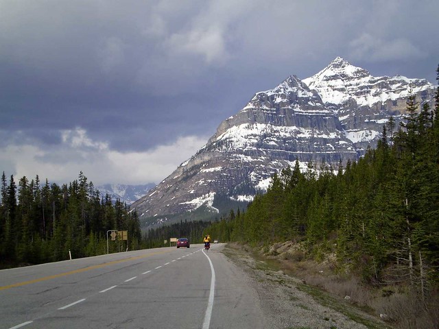
My girlfriend April and I rode the Icefields as part of a bigger bike tour last year. We really loved the Icefields, and I think you'd have a great time!
As for logistics, you can ride the whole Parkway in 2 or 3 days, but we took longer than that in order to soak up the ambiance and do things along the way. Remember there are two passes on the Parkway, Sunwapta is the northernmost and Bow the southernmost. Both are around 7,000 feet (2,100 m) in elevation, but the elevation doesn't drop below 4,000 feet at any point on the route. The Parkway is 140 miles long and only goes between Jasper and Lake Louise. Banff is about 40 miles away via the Bow River Parkway. While the ride is not as "epic" as the Icefields Pkwy. it's still a nice ride and gets you off of busy Hwy 1/Trans-Canada Hwy for that section.
We took five days on the Icefields, which I thought was an appropriate amount of time, though we could have taken longer. There's places to stay about every 20-40 miles along the route. We opted to use the primitive hostels along the way. These are also spaced about 20-40 miles apart, and if one were to use them, one could make a credit card/inn-to-inn tour the whole way from Jasper to Banff. Most of these hostels are bunks only, most don't have electricity or phones (though one has internet via satellite!), nor hot water or showers. There is running water and propane heating, and a few within Banff Nat'l Park have saunas! These hostels are very popular during the summer, so you'd need to book them in advance to guarantee a spot.
https://hihostels.ca/
We had no trouble with the passes. The climbs are not that long, I remember the climb northward to Sunwapta was about 3 miles at 8% grade. I've heard that biking southward (Jasper to Lake Louise/Banff) is tougher but can't speak from first-hand experience.
My tips:
I don't know about roads east or west of the Icefields to do a loop, so I can't help you there. As for transportation logistics, Via Rail stops at Jasper on the northern end of the route, and I believe Greyhound stops in Lake Louise and Banff. There should be car rental companies and other transportation options in the big towns.
As for what's the "best" part, there were so many great parts I can't exactly say what's my favorite. If you ride the Icefields, you're going to see them all. Here's some photo inspiration.
As for logistics, you can ride the whole Parkway in 2 or 3 days, but we took longer than that in order to soak up the ambiance and do things along the way. Remember there are two passes on the Parkway, Sunwapta is the northernmost and Bow the southernmost. Both are around 7,000 feet (2,100 m) in elevation, but the elevation doesn't drop below 4,000 feet at any point on the route. The Parkway is 140 miles long and only goes between Jasper and Lake Louise. Banff is about 40 miles away via the Bow River Parkway. While the ride is not as "epic" as the Icefields Pkwy. it's still a nice ride and gets you off of busy Hwy 1/Trans-Canada Hwy for that section.
We took five days on the Icefields, which I thought was an appropriate amount of time, though we could have taken longer. There's places to stay about every 20-40 miles along the route. We opted to use the primitive hostels along the way. These are also spaced about 20-40 miles apart, and if one were to use them, one could make a credit card/inn-to-inn tour the whole way from Jasper to Banff. Most of these hostels are bunks only, most don't have electricity or phones (though one has internet via satellite!), nor hot water or showers. There is running water and propane heating, and a few within Banff Nat'l Park have saunas! These hostels are very popular during the summer, so you'd need to book them in advance to guarantee a spot.
https://hihostels.ca/
We had no trouble with the passes. The climbs are not that long, I remember the climb northward to Sunwapta was about 3 miles at 8% grade. I've heard that biking southward (Jasper to Lake Louise/Banff) is tougher but can't speak from first-hand experience.
My tips:
- Stock up on supplies in the bigger towns like Jasper, Lake Louise, Banff, and Canmore, as there are few restaurants and stores on the Parkway. (There's just enough, however, so that you'll pass something daily.) Prices along the Parkway and in the towns are going to be steep!
- Take your time, stop at all the things you can stop at.
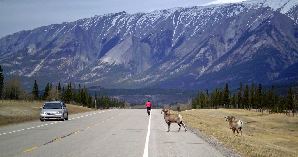
- There is a good chance you will see bears, even on the side of the highway. We saw a combined number of seven during our time on Bow River Pkwy, Icefields Pkway, and 93A.
I don't know about roads east or west of the Icefields to do a loop, so I can't help you there. As for transportation logistics, Via Rail stops at Jasper on the northern end of the route, and I believe Greyhound stops in Lake Louise and Banff. There should be car rental companies and other transportation options in the big towns.
As for what's the "best" part, there were so many great parts I can't exactly say what's my favorite. If you ride the Icefields, you're going to see them all. Here's some photo inspiration.
10-26-12, 12:59 PM
#3
just another gosling
Thread Starter
Join Date: Feb 2007
Location: Everett, WA
Posts: 19,534
Bikes: CoMo Speedster 2003, Trek 5200, CAAD 9, Fred 2004
Mentioned: 115 Post(s)
Tagged: 0 Thread(s)
Quoted: 3889 Post(s)
Liked 1,938 Times
in
1,383 Posts
Thanks, pdx. Keep those cards and letters coming.
10-26-12, 01:45 PM
#4
Senior Member
Join Date: Jul 2003
Location: Boulder, CO
Posts: 8,546
Mentioned: 83 Post(s)
Tagged: 0 Thread(s)
Quoted: 163 Post(s)
Likes: 0
Liked 2 Times
in
2 Posts
Good advice above.
The best part is Lake Louise to Jasper, for sure. It doesn't matter which direction, both are good.
It is more than worth it to explore around Lake Louise the lake itself, don't just stay in the touristy/services part of town, go up to the lake, and there's another lake up there too that is supposed to be worth going to, but I missed it.
Bannf to LL use the Bow Valley Parkway / 1a, don't ride Hwy 1 there. Bow valley pkwy is pleasant, hilly but not mountainous, tree lined and low traffic.
Loop opportunity is there, I've only been on the west-side roads. Generally in the Canadian rockies, the west side is wetter and the east side is drier and windier.
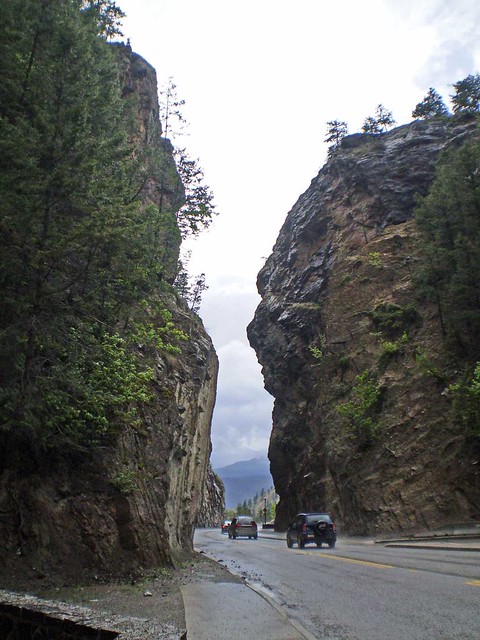
Hwy 93 from Radium to Castle Junction is very nice, the part right by Radium is a little challenging with some steep hills and narrow shoulders. Low traffic, pleasant scenery, becoming very nice as you get nearer to Castle Junction. BIg hill going up from Radium, then back down into a valley, then another climb/descent to Castle Junction.
Hwy 1 from Golden to LL is OK - the part right near GOlden was under construction when I was there last, hopefully they have widened it, but the 2 times I did it there was minimal shoulder and a lot of truck traffic, so a bit scary. once you get a few miles east of Golden, though, it widens out and is pleasant. THere is an old abandoned back road for part of that , Hwy 1a, you can see it on the google map near Lake L. - not sure how you pick it up if you are going east, but it's worth figuring out. Kicking Horse Pass is very easy.
Hwy 95 from Radium Hot Springs to Golden kind of sucks - it's flat, with a narrow/non-existent shoulder. Traffic is normally not too heavy, but you need to be careful. Views are pleasant, plenty of services.
Hwy 1 from Golden to Revelstoke is ok, but it's the TransCan hwy and carries a lot of traffic, including trucks. Glacier National Park is pretty nice - there is a small part on top that is very beautiful. Revelstoke is a cool town.
West of Jasper, Hwy 16 is very nice, Hwy 5 is ... well, I did it but I remember nothing. And I haven't done the Kamloops to Revelstoke bit.
If you want to maximize your time in the most spectacular parts, and don't mind out-and-backs, I would just do Bannf-Jasper-Bannf with side trips out to Radium HS and/or Golden if you have extra time to fill. If you don't like out-and-back, the loop on the west side would be nice, but you spend more time on busy highways. Food is expensive in the parks, and you have to buy a daily park pass, so perhaps that would influence your choices.
Hope that helps.
The best part is Lake Louise to Jasper, for sure. It doesn't matter which direction, both are good.
It is more than worth it to explore around Lake Louise the lake itself, don't just stay in the touristy/services part of town, go up to the lake, and there's another lake up there too that is supposed to be worth going to, but I missed it.
Bannf to LL use the Bow Valley Parkway / 1a, don't ride Hwy 1 there. Bow valley pkwy is pleasant, hilly but not mountainous, tree lined and low traffic.
Loop opportunity is there, I've only been on the west-side roads. Generally in the Canadian rockies, the west side is wetter and the east side is drier and windier.
Hwy 93 from Radium to Castle Junction is very nice, the part right by Radium is a little challenging with some steep hills and narrow shoulders. Low traffic, pleasant scenery, becoming very nice as you get nearer to Castle Junction. BIg hill going up from Radium, then back down into a valley, then another climb/descent to Castle Junction.
Hwy 1 from Golden to LL is OK - the part right near GOlden was under construction when I was there last, hopefully they have widened it, but the 2 times I did it there was minimal shoulder and a lot of truck traffic, so a bit scary. once you get a few miles east of Golden, though, it widens out and is pleasant. THere is an old abandoned back road for part of that , Hwy 1a, you can see it on the google map near Lake L. - not sure how you pick it up if you are going east, but it's worth figuring out. Kicking Horse Pass is very easy.
Hwy 95 from Radium Hot Springs to Golden kind of sucks - it's flat, with a narrow/non-existent shoulder. Traffic is normally not too heavy, but you need to be careful. Views are pleasant, plenty of services.
Hwy 1 from Golden to Revelstoke is ok, but it's the TransCan hwy and carries a lot of traffic, including trucks. Glacier National Park is pretty nice - there is a small part on top that is very beautiful. Revelstoke is a cool town.
West of Jasper, Hwy 16 is very nice, Hwy 5 is ... well, I did it but I remember nothing.
And I haven't done the Kamloops to Revelstoke bit.If you want to maximize your time in the most spectacular parts, and don't mind out-and-backs, I would just do Bannf-Jasper-Bannf with side trips out to Radium HS and/or Golden if you have extra time to fill. If you don't like out-and-back, the loop on the west side would be nice, but you spend more time on busy highways. Food is expensive in the parks, and you have to buy a daily park pass, so perhaps that would influence your choices.
Hope that helps.
10-26-12, 01:46 PM
#5
In Real Life

Join Date: Jan 2003
Location: Down under down under
Posts: 52,152
Bikes: Lots
Mentioned: 141 Post(s)
Tagged: 0 Thread(s)
Quoted: 3203 Post(s)
Liked 596 Times
in
329 Posts
Having lived in Alberta most of my life, and having cycled on the Icefield Parkway and surrounding area numerous times in my life, I could almost describe entire possible routes to you, detailing each tree you'll see. 
However, to start with, I'll address your questions.
1. How to arrange a tour on it, and North or South or reverse -- if you are planning to drive, drive to Nordegg, and leave your car there.
From Nordegg, cycle Hwy 11 to Saskatchewan River Crossing (93 km). You do not want to miss this section of road ... in my opinion, it is much better than the Icefield Parkway. It has a beautiful, wide, smooth shoulder and hardly any traffic at all ... plus gorgeous scenery. You will be able to pick up a few supplies in Nordegg, and also at the David Thompson Resort. And you'll be able to get more supplies at Saskatchewan River Crossing when you get there. There are several campgrounds on this road, including a couple near Nordegg (I recommend Goldeye - we've stayed there). There is also a hostel (nice, but with lots of rules last time we were there) and a few other resorts. So there are places to stay at the beginning of the tour.
Saskatchewan River Crossing has resorts, but no camping, so you'll either want to camp before or after. There is campground called Two O'clock Creek near the David Thompson Resort, and I think there's another one on the other side of the road ... I forget the name. A good map will have them listed. If you opt to camp after Saskatchewan River Crossing, there's Rampart Creek hostel and camping 12 km to the north, and Waterfowl Lakes Campground 20 km to the south (we've stayed there).
You could go either direction from Saskatchewan River Crossing. SRC to Jasper is 153 km, and has quite a climb in the middle to reach the Columbia Icefields, and then a shorter, steeper descent after. You can get supplies at the Columbia Icefields, and you can stay there as well. There are various campgrounds along the way, and again, a good road map will show you where they are.
Jasper, of course, has lots of camping and other places to stay, and you can get supplies there. I'd recommend staying at least a couple nights there to have a look around. Go visit some of the nearby lakes, walk around the town.
Then head back to SRC (153 km). Again, you'll have quite a relatively short, quite steep climb up to the Columbia Icefields, and then a long descent. Do you have good brakes on your tandem?
Go south from SRC to Lake Louise (83 km). You'll find supplies and camping and other places to stay at Lake Louise. I'd recommend getting up to the lake itself. That's about a 4 km climb, if I recall correctly. I've walked a portion of it, but have never cycled it. If you want to treat yourself, stay at one of the cabins or at Lake Louise lake hotel, and do the hike up to Lake Agnes where you'll find beautiful views, and a little cabin where you can get tea.
Continue south from Lake Louise to Castle Junction on the Bow Valley Parkway (30 km), where there are places to stay, and where you can pick up a few supplies, then turn westward and cycle up Hwy 93 to Radium Hot Springs. It is 105 km to Radium Hotsprings, and there is one place in the middle of that road where you can get supplies (and where you can stay in cabins or camp) ... Vermillion Crossing. Hwy 93 is a very remote, but beautiful road. Every time I've ridden it, there has been next to no traffic ... but be warned, there's no cell phone coverage either. You'll have a long, long gradual climb out of Castle Junction, and then quite a steep descent into Radium where you can spend some time in the Hotsprings. And of course, there are lots of places to stay and places to get supplies. I'd recommend a couple nights in Radium ... maybe take a little jaunt to Invermere and back.
Return on Hwy 93 to Castle Junction ... you'll have a very steep climb out of Radium, but after that the road is good, and you'll have a long, long, long gradual descent down to Castle Junction.
From Castle Junction, you've got two choices ... you can either cycle the Bow Valley Parkway, which is quite nice or Hwy 1. Either is good. The Bow Valley Parkway will take you past Johnson's Canyon where you can get a few supplies or stay for the night, and maybe do some hiking up to the falls. But the Bow Valley Parkway is also quite hilly. Hwy 1 is less hilly and a much faster road to cycle. So Castle Junction to Banff is about 33 km. There's lots of camping and other places to stay in Banff and area. I'd recommend spending at least a couple nights in Banff ... check out the hotsprings, cycle the Minnewanka loop, check out the town. You could also do a ride out to Canmore and back.
And then, return from Banff to SRC, and from SRC to Nordegg.
Type Nordegg, Jasper, Lake Louise, Radium Hot Springs, Banff, and Nordegg into the directions in Google, and you'll have 979 km all up (and a maps of it all). If that's more than you want, I suppose you could leave out the Radium leg of the journey.
2. Services and Camping -- There are regular services and lots of camping. Get a good road map of the area, and that information will all be there. You should be able to buy one at a bookstore in Calgary or Red Deer on your way to Nordegg.
But be warned ... things are expensive. People always seem surprised by that, but really when you think about it, of course things are expensive ... it's a remote area and a tourist attraction. So what do you expect. Therefore you may want to bring some basic staples in the way of food like a large bag of pasta or rice or something. And if you are planning to stay in a cabin or resort, expect prices in the neighbourhood of $200/night.
Also look up Hostelling International Canada ... there are lots of hostels along the way, and they are signficantly less expensive. They are also often rather rustic. If you go in July and the early part of August, they'll be full. You're probably already too late to book for next year. But if you go in June or late-August/early-September, you might be in luck.
3. Hwy 1 vs Bow Valley Parkway -- Either/or ... as mentioned above, either are good. Bow Valley Parkway is narrow and hilly and you'll see lots of wildlife. Hwy 1 is flatter and faster. So whichever you want. If you follow the route I mentioned above, you could do both.
4. Bus service -- Don't count on it. There are some busses, but you'll have to have your bicycle boxed, and even then, it may have to go cargo with the possibility of arriving later.
5. Fast moving tar sands trucks -- I have an idea where Rocky Mountain 1200 riders would have encountered those, but you shouldn't encounter them on the route I've listed above. For one thing, there are fairly strict speed limits along the way. And is is a national park, and not really conducive to truck traffic.
Lots and lots of photos: https://www.flickr.com/photos/machka-...7619203595712/
__________________
Rowan
My fave photo threads on BF
Century A Month Facebook Group
Machka's Website
Photo Gallery
Rowan
My fave photo threads on BF
Century A Month Facebook Group
Machka's Website
Photo Gallery
10-26-12, 01:55 PM
#6
In Real Life
Join Date: Jan 2003
Location: Down under down under
Posts: 52,152
Bikes: Lots
Mentioned: 141 Post(s)
Tagged: 0 Thread(s)
Quoted: 3203 Post(s)
Liked 596 Times
in
329 Posts
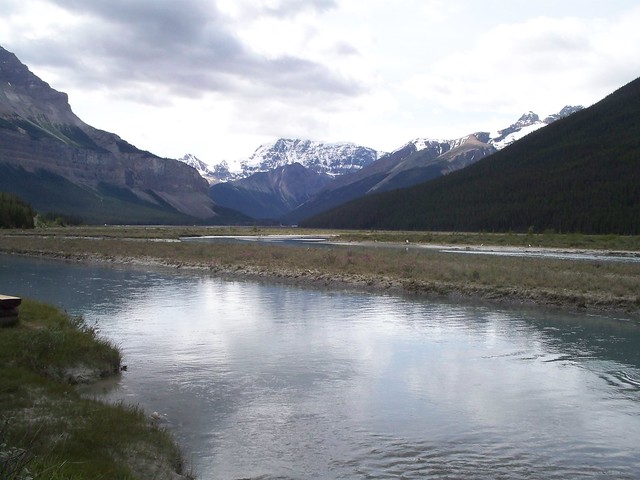
On Hwy 11 between Nordegg and Saskatchewan River Crossing ...
Saskatchewan River Crossing ...
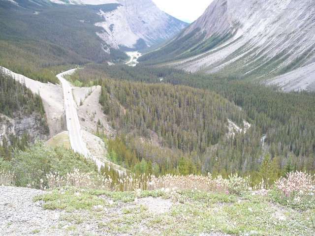
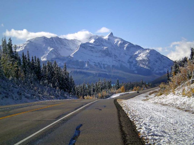
Climb to Columbia Icefield, to the north of Saskatchewan River Crossing ...
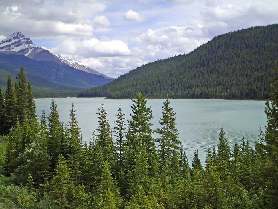
Waterfowl Lakes to the south of Saskatchewan River Crossing ...
And, as I said, lots more photos of the areas I've mentioned here: https://www.flickr.com/photos/machka-...7619203595712/
Saskatchewan River Crossing ...
Climb to Columbia Icefield, to the north of Saskatchewan River Crossing ...
Waterfowl Lakes to the south of Saskatchewan River Crossing ...
And, as I said, lots more photos of the areas I've mentioned here: https://www.flickr.com/photos/machka-...7619203595712/
__________________
Rowan
My fave photo threads on BF
Century A Month Facebook Group
Machka's Website
Photo Gallery
Rowan
My fave photo threads on BF
Century A Month Facebook Group
Machka's Website
Photo Gallery
10-26-12, 02:00 PM
#7
In Real Life
Join Date: Jan 2003
Location: Down under down under
Posts: 52,152
Bikes: Lots
Mentioned: 141 Post(s)
Tagged: 0 Thread(s)
Quoted: 3203 Post(s)
Liked 596 Times
in
329 Posts
Hostelling International Canada ... the Alberta page ...
https://www.hihostels.ca/1084/Home/Ca...ex.hostel?p=ab
https://www.hihostels.ca/1084/Home/Ca...ex.hostel?p=ab
__________________
Rowan
My fave photo threads on BF
Century A Month Facebook Group
Machka's Website
Photo Gallery
Rowan
My fave photo threads on BF
Century A Month Facebook Group
Machka's Website
Photo Gallery
10-26-12, 02:06 PM
#8
In Real Life
Join Date: Jan 2003
Location: Down under down under
Posts: 52,152
Bikes: Lots
Mentioned: 141 Post(s)
Tagged: 0 Thread(s)
Quoted: 3203 Post(s)
Liked 596 Times
in
329 Posts
Banff National Park Camping and Accommodation information ...
https://www.pc.gc.ca/pn-np/ab/banff/visit/visit9b.aspx
https://www.pc.gc.ca/pn-np/ab/banff/visit/visit3.aspx
PS. Banff is spelled BANFF (one N, double F), just like it is in Scotland)
Jasper National Park Camping and Accommodation information ...
https://www.pc.gc.ca/pn-np/ab/jasper/visit/camping.aspx
https://www.pc.gc.ca/eng/pn-np/ab/jas...it/visit2.aspx
And just generally, the Parks Canada website is a good one to browse through ...
https://www.pc.gc.ca/eng/index.aspx
__________________
Rowan
My fave photo threads on BF
Century A Month Facebook Group
Machka's Website
Photo Gallery
Rowan
My fave photo threads on BF
Century A Month Facebook Group
Machka's Website
Photo Gallery
10-26-12, 03:43 PM
#9
just another gosling
Thread Starter
Join Date: Feb 2007
Location: Everett, WA
Posts: 19,534
Bikes: CoMo Speedster 2003, Trek 5200, CAAD 9, Fred 2004
Mentioned: 115 Post(s)
Tagged: 0 Thread(s)
Quoted: 3889 Post(s)
Liked 1,938 Times
in
1,383 Posts
Thank you, Machka. I'm thinking 2014. I'm a severe planner. Plus we already have a full schedule for 2013.
This is looking better and better. We tour with an Arai drum brake.
Plus we already have a full schedule for 2013.This is looking better and better. We tour with an Arai drum brake.
10-26-12, 05:37 PM
#10
Every day a winding road

I looked at the Icefields Parkway as a possible tour. One of our party does not like to camp so with that out it left few options. I did put together a pretty good itinerary that included hostels. We had either a hostel or a hotel every night. But mostly hostels. Rooms along the Parkway can be expensive.
After crunching all the numbers I decided to put the tour on hold. I found a fairly reasonable alternative called the Selkirk Loop. Not nearly as awesome as the Parkway but there are tons of services along the way. You can pretty much do the whole loop without camping, if you plan carefully.
One thing I did not like was the starting point in Spokane. Spokane itself is wonderful and we even have a bike forum member there that is a really great guy but it is about a days ride to Idaho, if you go counterclockwise and that ride is pretty uninspiring. Te good thing is that it is a loop with a number of alternate routes.
10-26-12, 05:37 PM
#11
In Real Life
Join Date: Jan 2003
Location: Down under down under
Posts: 52,152
Bikes: Lots
Mentioned: 141 Post(s)
Tagged: 0 Thread(s)
Quoted: 3203 Post(s)
Liked 596 Times
in
329 Posts
Well, like I said, think in terms of any time after the May long weekend and the last weekend in June ... or mid-August to the end of September. Chances are you'll get some cool weather, and possibly even some snow, toward the end of May and end of September, but you won't be fighting with so many tourists.
__________________
Rowan
My fave photo threads on BF
Century A Month Facebook Group
Machka's Website
Photo Gallery
Rowan
My fave photo threads on BF
Century A Month Facebook Group
Machka's Website
Photo Gallery
10-26-12, 06:48 PM
#13
Every day a winding road
That is sort of like saying Pl�cido Domingo is a horrible singer compared to Pavarotti. Ok maybe the difference is a bit bigger than that comparision but you get the point.
I agree the vistas on the Parkway can't compare to the Selkirk loop but the Loop is a great choice for someone seeking a few creature comforts and still get a pretty decent ride.
Besides, I'll bet the Parkway does not have a tram car where you hang you bike on the car and pull yourself across. That was very cool.
I agree the vistas on the Parkway can't compare to the Selkirk loop but the Loop is a great choice for someone seeking a few creature comforts and still get a pretty decent ride.
Besides, I'll bet the Parkway does not have a tram car where you hang you bike on the car and pull yourself across.
That was very cool.
10-26-12, 07:00 PM
#14
In Real Life
Join Date: Jan 2003
Location: Down under down under
Posts: 52,152
Bikes: Lots
Mentioned: 141 Post(s)
Tagged: 0 Thread(s)
Quoted: 3203 Post(s)
Liked 596 Times
in
329 Posts
If you're after creature comforts, slightly better prices, and a relatively easy route ... but still with beautiful scenery ... do the Golden Triangle loop.
Start at Castle Junction
Day 1 - ride to Radium Hotsprings
Day 2 - ride to Golden (this is probably the easiest day)
Day 3 - ride from Golden, by Lake Louise, back to Castle Junction.
Of course you could add other legs to the journey to make it longer. There are lots of places to stay indoors in both Radium and Golden. Castle Junctions is a bit more limited, but Banff and Lake Louise aren't far away.
__________________
Rowan
My fave photo threads on BF
Century A Month Facebook Group
Machka's Website
Photo Gallery
Rowan
My fave photo threads on BF
Century A Month Facebook Group
Machka's Website
Photo Gallery
10-26-12, 07:46 PM
#15
In Real Life
Join Date: Jan 2003
Location: Down under down under
Posts: 52,152
Bikes: Lots
Mentioned: 141 Post(s)
Tagged: 0 Thread(s)
Quoted: 3203 Post(s)
Liked 596 Times
in
329 Posts
Another campground site: https://www.albertawow.com/
__________________
Rowan
My fave photo threads on BF
Century A Month Facebook Group
Machka's Website
Photo Gallery
Rowan
My fave photo threads on BF
Century A Month Facebook Group
Machka's Website
Photo Gallery
10-27-12, 02:13 PM
#16
In Real Life
Join Date: Jan 2003
Location: Down under down under
Posts: 52,152
Bikes: Lots
Mentioned: 141 Post(s)
Tagged: 0 Thread(s)
Quoted: 3203 Post(s)
Liked 596 Times
in
329 Posts
A few more photos ...
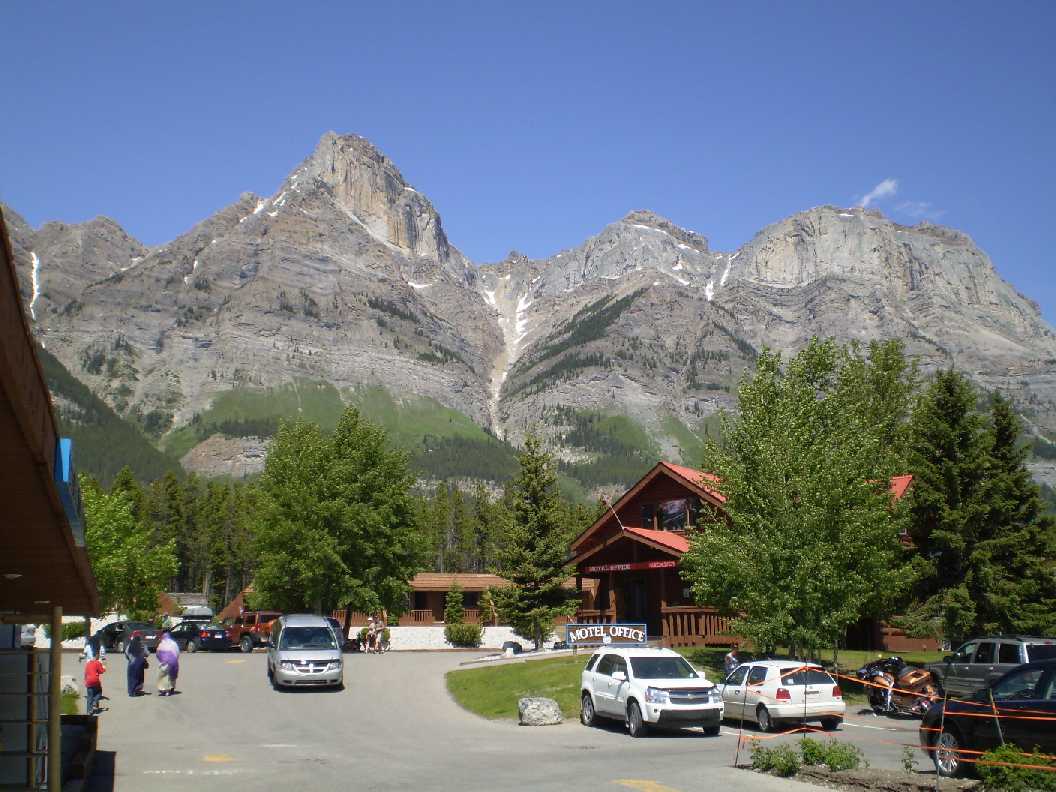
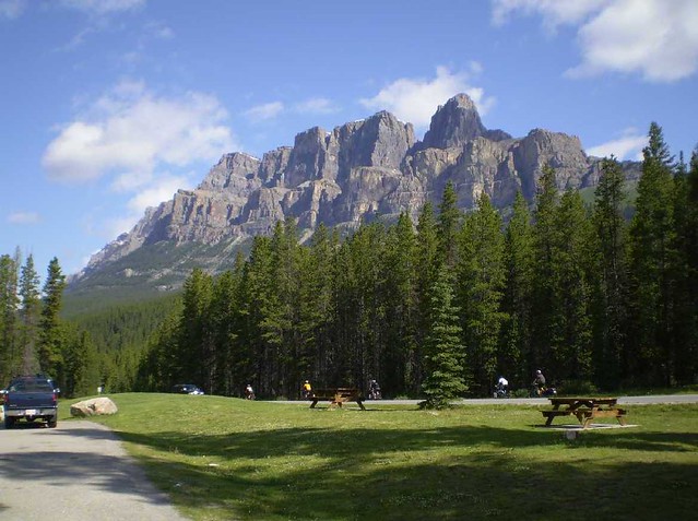
Castle Junction, with Castle Mountain looming over ..
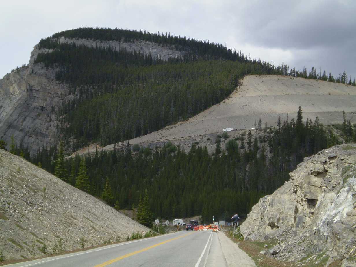
Climbing from Castle Junction toward Radium ...
About to descend into Radium ...
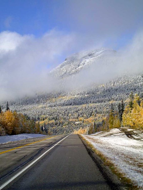
Hwy 11 between Nordegg and Saskatchewan River Crossing in late September ...
We're hoping to travel through some of these areas in the next few days ... hopefully there won't be too much snow.
Climbing from Castle Junction toward Radium ...
About to descend into Radium ...
Hwy 11 between Nordegg and Saskatchewan River Crossing in late September ...
We're hoping to travel through some of these areas in the next few days ... hopefully there won't be too much snow.
__________________
Rowan
My fave photo threads on BF
Century A Month Facebook Group
Machka's Website
Photo Gallery
Rowan
My fave photo threads on BF
Century A Month Facebook Group
Machka's Website
Photo Gallery
10-27-12, 06:36 PM
#17
just another gosling
Thread Starter
Join Date: Feb 2007
Location: Everett, WA
Posts: 19,534
Bikes: CoMo Speedster 2003, Trek 5200, CAAD 9, Fred 2004
Mentioned: 115 Post(s)
Tagged: 0 Thread(s)
Quoted: 3889 Post(s)
Liked 1,938 Times
in
1,383 Posts
Wow. It's on our must-do list.
10-28-12, 08:42 AM
#18
Senior Member
Join Date: Dec 2005
Posts: 108
Mentioned: 0 Post(s)
Tagged: 0 Thread(s)
Quoted: 0 Post(s)
Likes: 0
Liked 0 Times
in
0 Posts
10-28-12, 09:57 AM
#19
Senior Member
But be warned ... things are expensive. People always seem surprised by that, but really when you think about it, of course things are expensive ... it's a remote area and a tourist attraction. So what do you expect. Therefore you may want to bring some basic staples in the way of food like a large bag of pasta or rice or something.
10-28-12, 12:50 PM
#20
In Real Life
Join Date: Jan 2003
Location: Down under down under
Posts: 52,152
Bikes: Lots
Mentioned: 141 Post(s)
Tagged: 0 Thread(s)
Quoted: 3203 Post(s)
Liked 596 Times
in
329 Posts
Fees for entry into beautifully kept, well maintained national parks ...
https://www.pc.gc.ca/apps/tarifs-fees...e_E.asp?park=1
And the Discovery Pass includes ...
https://www.pc.gc.ca/eng/kiosk/index/dp.aspx
However ... Hwy 11, to within about 3 km of Saskatchewan River Crossing, is outside any national park. You do not have to pay to ride any portion of that highway. So, when I lived next to the Rockies, I (or my father and I) would drive out to Nordegg or somewhere along there, park the car, ride to SRC, or even further, and then back to where we had parked. Since we were just cycling in, riding around a little bit, and cycling back out again, they'd wave us through without paying anything.
The Two O'Clock Creek campground and Thompson Campground (and maybe others) are outside the park boundaries. If you wanted to be really cost effective, you could cycle from Nordegg to one of those campgrounds, then do a couple day trips ... maybe one up toward Jasper and back; one down toward Lake Louise and back.
__________________
Rowan
My fave photo threads on BF
Century A Month Facebook Group
Machka's Website
Photo Gallery
Rowan
My fave photo threads on BF
Century A Month Facebook Group
Machka's Website
Photo Gallery
10-28-12, 01:02 PM
#21
In Real Life
Join Date: Jan 2003
Location: Down under down under
Posts: 52,152
Bikes: Lots
Mentioned: 141 Post(s)
Tagged: 0 Thread(s)
Quoted: 3203 Post(s)
Liked 596 Times
in
329 Posts
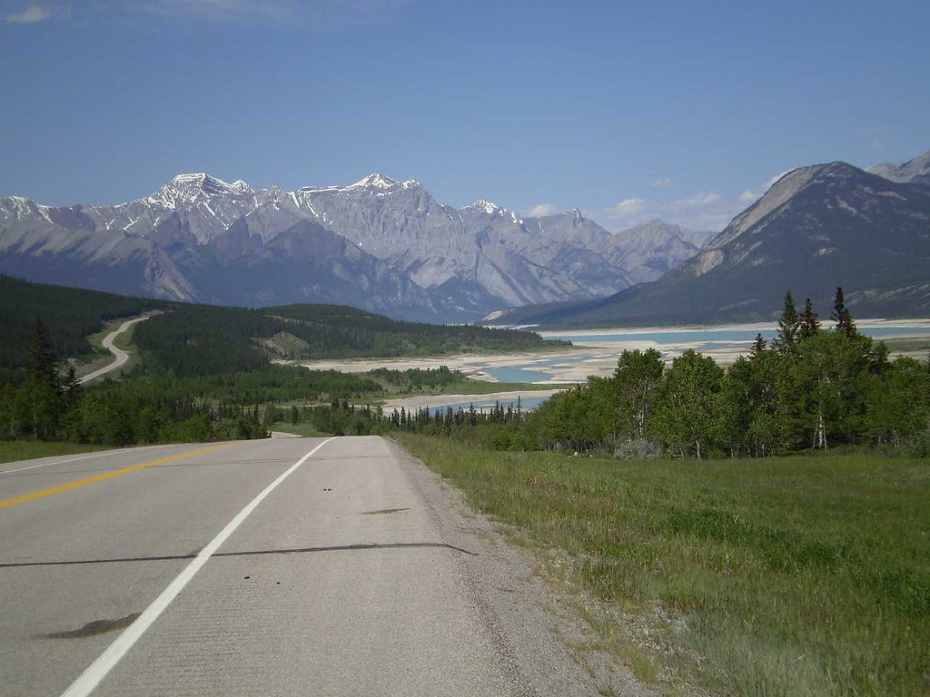
Hwy 11 in mid-May ...
__________________
Rowan
My fave photo threads on BF
Century A Month Facebook Group
Machka's Website
Photo Gallery
Rowan
My fave photo threads on BF
Century A Month Facebook Group
Machka's Website
Photo Gallery
10-28-12, 02:29 PM
#22
Lentement mais s�rement

Join Date: Jan 2003
Location: Montr�al
Posts: 2,253
Mentioned: 0 Post(s)
Tagged: 0 Thread(s)
Quoted: 78 Post(s)
Likes: 0
Liked 4 Times
in
3 Posts
North to south or the reverse?
What is the best part of it?
What is the best part of it?
Most people say it's easier going south to north. Jasper is at lower elevation so it makes sense. I went northbound and remember three good downhills while I felt the approach to Sunwapta pass was the only real climb. Even then, I kept thinking the overpass on my commute was steeper, only much shorter.
I prefer the change in scenery going north more than going south.
Finally, driving to Jasper and biking the road you just drove on kinda kills the surprise.
I see that Lake Louise to Jasper is about 142 miles, so either an out and back or a loop. One could make a loop from Lake Louise of about 410 miles using 11 and 735. Is that a good idea? Roads on the west side better? 300-400 miles is about what we'd like.
South of Lake Louise it becomes Hwy 1, which I've been told is not good for cycling. I see that it is paralleled by the Bow Valley Parkway for a distance. Is that a good/better choice?
There's another small road between Athabasca Falls and Jasper. I drove it years ago and it's very quiet. On my bike trip, I wanted to get in town for food and the sign "bad pavement for x kilometers" convinced me to stay on the main road.
I wonder about bus service. We'll drive to the tour start. Perhaps it would be possible to leave one's car at one point, ride to a second point, leave the bike at a hotel and take a bus back to the car, then retrieve the bike. We'll be on our tandem, so probably not possible to take that on a bus unboxed?
Riders on this year's Rocky Mountain 1200 reported large trucks heading for the tar sands at speeds way over the speed limit and giving no room to cyclists, but I don't remember which roads they were on. Map of the 1200 here:
https://www.randonneurs.bc.ca/rockymo...-Route-Map.pdf
https://www.randonneurs.bc.ca/rockymo...-Route-Map.pdf
Some random thoughts...
- It's freakin amazing!!!
- There's a bike path from Canmore to Banff so you might want to add that.
- Put of Banff, take the road to Vermillon Lakes. There's a bike path at the end that connect to the Bow Valley Parkway.
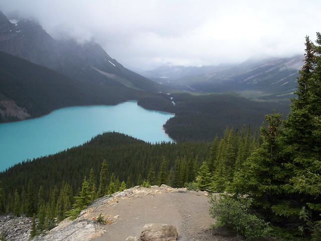
- At Peyto lake (pee-toe), you can ride up to the bus parking lot.
- After Peyto lake, I stayed at the first campsite, which was an overflow site. There were a gravelly parking lot for RVs, some tent sites in the back, then a walk-in section. There were 2-3 RVs in the parking lot and had the whole tent and walk-in for myself and cougars (so the signs said). Waterfowl campground was just a few more km away but thought it might be full.
- I was very lucky to get a campsite in Lake Louise. It was full when I got there and while I was telling the ladies at the registration booth that they should have a biker section where cyclists wouldn't turned back (I always suggest that), one found out that a reservation had not showed up so I got the site. So you might want to reserve
- I've hiked the Johnston Canyon trail on a previous trip (not biking). It was crowded, very crowded. This year, I rode passed the trail head and there were even more parked cars than last time.
- A motorcycle helmet might help with the dropped jaw problem. I used duct tape.
- Give yourself lots of time for pictures, other roads and hiking trails. Maligne lake road is good for wildlife. If the weather forecasts calls for a clear morning, try mount Edith Cavell road. There's also Moraine Lake road in Lake Louise.
Some pics...
Bow Valley Parkway

Hector Lake in background

Crowfoot glacier

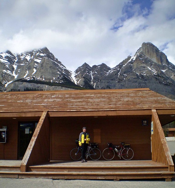
Icefield Center

Endless Chain. Around there are also the Endless Cracks in the shoulder, but it was hard to complain with a duct taped jaw full of chocolate ice cream.

The whole trip is here: Calgary to Vancouver. For better viewing, click on the slideshow, pause it and put the mouse out of the way. Then you can browse the pictures with the left and right arrow keys.
10-28-12, 04:19 PM
#23
Other Worldly Member

Join Date: May 2012
Location: The old Northwest Coast.
Posts: 1,540
Bikes: 1973 Motobecane Grand Jubilee, 1981 Centurion Super LeMans, 2010 Gary Fisher Wahoo, 2003 Colnago Dream Lux, 2014 Giant Defy 1, 2015 Framed Bikes Minnesota 3.0, several older family Treks
Mentioned: 5 Post(s)
Tagged: 0 Thread(s)
Quoted: 194 Post(s)
Liked 136 Times
in
53 Posts
A great ride that deserves longer than the 4 days days we spent. We enterted from Jasper off the Yellowhead highway as part of a cross continent tour in '76. Rode north to south and the nights were down right chilly (freezing) even at the end of June, I barely had enough clothes for the morning starts. Fabulous scenery. We stayed in campgrounds and hostels, plenty of them. What we did not do was take any long day hikes into the higher country and I would add at least two days for side trips. Despite freezing nights, still plenty of bugs in the daytime. I remember grinding up Sunwapta with my friend Art, then being passed by a very slow tour bus (gag), then passing the tour bus and upon reaching the top, the bus pulled up behind us and 50 camera toting Japanese tourist hopped out and took our picture. Barely noticed Bow pass, just a long constant grade. Back in the day, the commercial truck drivers would give you as much room as possible. It was the RV's that were dangerous.
__________________
Make ******* Grate Cheese Again
Make ******* Grate Cheese Again
10-28-12, 05:17 PM
#24
In Real Life
Join Date: Jan 2003
Location: Down under down under
Posts: 52,152
Bikes: Lots
Mentioned: 141 Post(s)
Tagged: 0 Thread(s)
Quoted: 3203 Post(s)
Liked 596 Times
in
329 Posts
Johnson's Canyon has a little grocery store/gift shop where you can get snack foods etc.
Castle Junction has a little grocery store/gift shop where you can get snack foods, bread, and a few canned things. I've purchased cheezies and something to drink there during randonnees. Alberta Randonneurs, who I rode with for several years, had a mountain series and their 400K and 600K went through Castle Junction (I think the shorter distances did too, but I particularly remember those).
Saskatchewan River Crossing has quite a large grocery store/gift shop/restaurant. I've purchased several things there, but mostly ice cream. One door is around the corner to the right of the photo, another door is just out of the photo to the left.
As for direction, I've ridden all the way from Jasper to Banff twice, and in that direction ... Jasper to Banff, north to south. I believe the prevailing winds are meant to be behind you that way. Rowan and I have also ridden from SRC to Banff. And I've done rides back and forth from about the top of Bow pass to the base of the Columbia Icefields climb.
I have contacted Brewster about carrying bicycles, and they indicated they really didn't want to carry bicycles, but very reluctantly told me that they might if the bicycles were boxed.
I agree with Erick that "The parks are a hiking paradise and it isn't always practical to bike to the trailhead, hike and bike out. It's easier done with a car." Lake Louise is one example of this. It is quite a climb to Lake Louise, and then you could spend all day hiking to Lake Agnes. I'd highly recommend the hike to Lake Agnes, and even further up into the mountains, but it would make more sense to drive up there, and then hike rather than cycling and hoping to find some place to store the bicycles once you get there.
Yes ... "and lots of houses on wheels, some with portable driveways" ... on the Icefield Parkway you may have to tangle with monster RVs. But this is part of the reason why I suggest going early or late and not between July 1 and August 15. It's better if you avoid those time ... less traffic, fewer people.
And the prospect of full campgrounds and other accommodation is another reason why I would advise against cycling between July 1 and August 15. There is a very good chance you'll end up fighting for accommodation then. But I've been through the area outside that time period and have found campgrounds half empty.
Rowan and I cycled from Red Deer to Banff via SRC in 2005, and had no trouble at all finding camping sites. At Waterfowl Lakes, were were the only ones in the tent/cycling/hiker area. Waterfowl Lakes campground has a tent/cycling/hiking specific area that you cannot take a car into. It also has bear ropes and pulleys for your food. At Johnson's Canyon, we had our pick of many places.
[HR][/HR]
Incidentally, Rowan and I were married just outside Jasper in 2008. We drove from Red Deer to Goldeye Lake, near Nordegg, and stayed there a few days (that was an experience ... food poisoning from something I ate before we left Red Deer, and a rather startling, very close lightening strike in the night. Rowan talked about it in the Scariest Night Camping thread. While there, we did a day trip (driving to Crescent Falls, and wandering around that area). Crescent Falls is a bit south of Goldeye Lake, but then about 6 km in, on a gravel road. So again, this is one place where having a car helps.
Then we drove to Jasper and camped in the campground there. That was late August, and the campground was reasonably full, but no need for reservations. We cycled around the area, here and there for a couple days checking things out and deciding where we wanted the wedding.
On our wedding day, we cycled down the Icefield Parkway to Athabasca Falls and back to Jasper, then westward on Hwy 16 (Yellowhead) for a while, and then finally eastward on Hwy 16 (Yellowhead) to Lake Annette (and actually a little bit up Maligne Canyon Rd and back to make up distance) ... total distance 100 miles. When we finished, we rested a bit till family arrived, then we changed and were married on a dock on Lake Annette.
Wedding Photos: https://www.flickr.com/photos/machka-...7607097344648/
__________________
Rowan
My fave photo threads on BF
Century A Month Facebook Group
Machka's Website
Photo Gallery
Rowan
My fave photo threads on BF
Century A Month Facebook Group
Machka's Website
Photo Gallery
Last edited by Machka; 10-28-12 at 05:44 PM.