


Rails to Trails database
 12-18-18, 04:19 PM
#1
Newbie
Thread Starter
Join Date: Nov 2018
Location: KC metro
Posts: 35
Bikes: '76 ROMIC Touring Pro 100
Mentioned: 1 Post(s)
Tagged: 0 Thread(s)
Quoted: 16 Post(s)
Likes: 0
Liked 0 Times
in
0 Posts
Rails to Trails database
Looking for a database of Rails to Trails that list distance ....
 12-18-18, 04:37 PM
#3
Senior Member
Join Date: Feb 2016
Location: SE Wisconsin
Posts: 1,851
Bikes: Lemond '01 Maillot Jaune, Lemond '02 Victoire, Lemond '03 Poprad, Lemond '03 Wayzata DB conv(Poprad), '79 AcerMex Windsor Carrera Professional(pur new), '88 GT Tequesta(pur new), '01 Bianchi Grizzly, 1993 Trek 970 DB conv, Trek 8900 DB conv
Mentioned: 12 Post(s)
Tagged: 0 Thread(s)
Quoted: 759 Post(s)
Likes: 0
Liked 810 Times
in
471 Posts
Would be nice to have. The data exists in pieces (wiki rail trails USA) is a good, comprehensive list, but distance isn't listed in an easy format..it would have to be looked up for each trail.
Someone in the conservancy has this data (guaranteed) on an excel sheet with name, distance, surface, etc.. characteristics listed. Maybe send them an email and see if they'd share it.
edit..I just sent them an email requesting their spreadsheet, or spreadsheet extract from the database they use.
Someone in the conservancy has this data (guaranteed) on an excel sheet with name, distance, surface, etc.. characteristics listed. Maybe send them an email and see if they'd share it.
edit..I just sent them an email requesting their spreadsheet, or spreadsheet extract from the database they use.
Last edited by fishboat; 12-18-18 at 04:48 PM.
12-18-18, 04:50 PM
#4
Newbie
Thread Starter
Join Date: Nov 2018
Location: KC metro
Posts: 35
Bikes: '76 ROMIC Touring Pro 100
Mentioned: 1 Post(s)
Tagged: 0 Thread(s)
Quoted: 16 Post(s)
Likes: 0
Liked 0 Times
in
0 Posts
Trail database
Would be nice to have. The data exists in pieces (wiki rail trails USA) is a good, comprehensive list, but distance isn't listed in an easy format..it would have to be looked up for each trail.
Someone in the conservancy has this data (guaranteed) on an excel sheet with name, distance, surface, etc.. characteristics listed. Maybe send them an email and see if they'd share it.
Someone in the conservancy has this data (guaranteed) on an excel sheet with name, distance, surface, etc.. characteristics listed. Maybe send them an email and see if they'd share it.
12-18-18, 04:55 PM
#5
Senior Member
Join Date: Feb 2016
Location: SE Wisconsin
Posts: 1,851
Bikes: Lemond '01 Maillot Jaune, Lemond '02 Victoire, Lemond '03 Poprad, Lemond '03 Wayzata DB conv(Poprad), '79 AcerMex Windsor Carrera Professional(pur new), '88 GT Tequesta(pur new), '01 Bianchi Grizzly, 1993 Trek 970 DB conv, Trek 8900 DB conv
Mentioned: 12 Post(s)
Tagged: 0 Thread(s)
Quoted: 759 Post(s)
Likes: 0
Liked 810 Times
in
471 Posts
I think that is about the best way, since I am a member, will start there and see what develops.....one idea I am looking into is to combine Amtrak Service to the longer trails....The katy trail in Mo, has service all along the trail so, that got me to looking into what other trails might be aa good hookup with Amtrak
12-18-18, 05:09 PM
#6
Newbie
Thread Starter
Join Date: Nov 2018
Location: KC metro
Posts: 35
Bikes: '76 ROMIC Touring Pro 100
Mentioned: 1 Post(s)
Tagged: 0 Thread(s)
Quoted: 16 Post(s)
Likes: 0
Liked 0 Times
in
0 Posts
I found a work around that is interesting: Ride with gps has a search function and just imput a Amtrak station and set the RWGPS site search to starts within say 10 miles and use "Rails to Trails" in the search for...a little work but quickly will build a list in you rides tab
12-18-18, 07:22 PM
#7
Senior Member
Join Date: Feb 2016
Location: SE Wisconsin
Posts: 1,851
Bikes: Lemond '01 Maillot Jaune, Lemond '02 Victoire, Lemond '03 Poprad, Lemond '03 Wayzata DB conv(Poprad), '79 AcerMex Windsor Carrera Professional(pur new), '88 GT Tequesta(pur new), '01 Bianchi Grizzly, 1993 Trek 970 DB conv, Trek 8900 DB conv
Mentioned: 12 Post(s)
Tagged: 0 Thread(s)
Quoted: 759 Post(s)
Likes: 0
Liked 810 Times
in
471 Posts
I found a work around that is interesting: Ride with gps has a search function and just imput a Amtrak station and set the RWGPS site search to starts within say 10 miles and use "Rails to Trails" in the search for...a little work but quickly will build a list in you rides tab
12-18-18, 10:51 PM
#8

don't try this at home.

Join Date: Jan 2006
Location: N. KY
Posts: 5,939
Mentioned: 10 Post(s)
Tagged: 0 Thread(s)
Quoted: 973 Post(s)
Liked 511 Times
in
351 Posts
Some trails link to others. So it's hard to rank by distance. For instance, Xenia OH is a hub with 5 different spoke trails, which then connect to even more trails. And still more trails with a short road connection.
Google Maps Bicycle map for browsing
Xenia OH as an example: google map link.
I pick an area, then use the "Bicycling" setting on google maps to see bike routes. Dark green are trails -- either paved or crushed stone. They won't show until you zoom to about the "10 mile" zoom, displaying maybe 100-200 miles wide areas at a time. Zoom way in to see the path name repeated down the green line.
(The dashed lines aren't defined and seem to be new. Some trails show dashes where it's no different from the rest of the trail nearby. )
Last edited by rm -rf; 12-18-18 at 11:01 PM.
12-19-18, 12:12 AM
#9

In Real Life

Join Date: Jan 2003
Location: Down under down under
Posts: 52,152
Bikes: Lots
Mentioned: 141 Post(s)
Tagged: 0 Thread(s)
Quoted: 3203 Post(s)
Liked 596 Times
in
329 Posts
__________________
Rowan
My fave photo threads on BF
Century A Month Facebook Group
Machka's Website
Photo Gallery
Rowan
My fave photo threads on BF
Century A Month Facebook Group
Machka's Website
Photo Gallery
12-19-18, 05:56 AM
#10
Senior Member
Join Date: Feb 2016
Location: SE Wisconsin
Posts: 1,851
Bikes: Lemond '01 Maillot Jaune, Lemond '02 Victoire, Lemond '03 Poprad, Lemond '03 Wayzata DB conv(Poprad), '79 AcerMex Windsor Carrera Professional(pur new), '88 GT Tequesta(pur new), '01 Bianchi Grizzly, 1993 Trek 970 DB conv, Trek 8900 DB conv
Mentioned: 12 Post(s)
Tagged: 0 Thread(s)
Quoted: 759 Post(s)
Likes: 0
Liked 810 Times
in
471 Posts
Google Maps Bicycle map for browsing
Xenia OH as an example: google map link.
I pick an area, then use the "Bicycling" setting on google maps to see bike routes. Dark green are trails -- either paved or crushed stone. They won't show until you zoom to about the "10 mile" zoom, displaying maybe 100-200 miles wide areas at a time. Zoom way in to see the path name repeated down the green line.
(The dashed lines aren't defined and seem to be new. Some trails show dashes where it's no different from the rest of the trail nearby. )
12-19-18, 09:41 AM
#11
Newbie
Thread Starter
Join Date: Nov 2018
Location: KC metro
Posts: 35
Bikes: '76 ROMIC Touring Pro 100
Mentioned: 1 Post(s)
Tagged: 0 Thread(s)
Quoted: 16 Post(s)
Likes: 0
Liked 0 Times
in
0 Posts
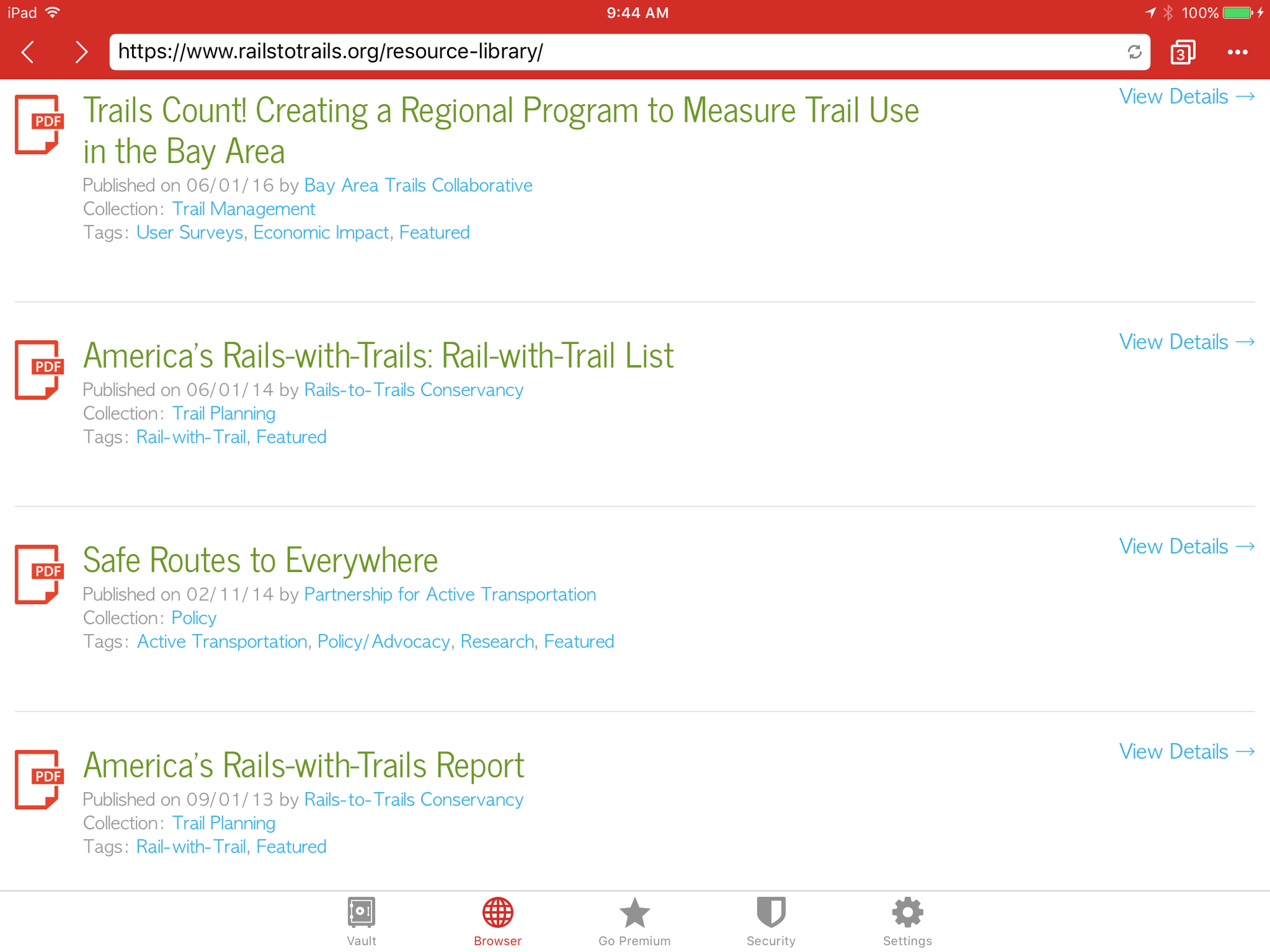
Bingo....found a complete list on the Rails to Trails Trail link site... list total trail length and Rails 2 Trails length It is a PDF file with trails by State ...look on the resourse tab ...lots of great info there to explore besides the trails list....WOW

 12-19-18, 09:49 AM
#13
Newbie
Thread Starter
Join Date: Nov 2018
Location: KC metro
Posts: 35
Bikes: '76 ROMIC Touring Pro 100
Mentioned: 1 Post(s)
Tagged: 0 Thread(s)
Quoted: 16 Post(s)
Likes: 0
Liked 0 Times
in
0 Posts
The resourse tab is located on the contact us page....man, they sure need to work on the website....but tons of neat info there.
12-19-18, 12:47 PM
#14
Senior Member
Join Date: Jul 2008
Location: 25 miles northwest of Boston
Posts: 29,549
Bikes: Bottecchia Sprint, GT Timberline 29r, Marin Muirwoods 29er, Trek FX Alpha 7.0
Mentioned: 112 Post(s)
Tagged: 0 Thread(s)
Quoted: 5224 Post(s)
Liked 3,581 Times
in
2,342 Posts
dunno if this is exactly what you are looking for but I've used this site to find trails near me. paved & unpaved
https://www.traillink.com/
https://www.traillink.com/
12-19-18, 01:30 PM
#15
Newbie
Thread Starter
Join Date: Nov 2018
Location: KC metro
Posts: 35
Bikes: '76 ROMIC Touring Pro 100
Mentioned: 1 Post(s)
Tagged: 0 Thread(s)
Quoted: 16 Post(s)
Likes: 0
Liked 0 Times
in
0 Posts
Thanks rumrunn6, just did a bit more searching on the trail link site and found a great resource....did a search by the tabs EXPLORE TRAILS then BY MAP and there is a feature to FILTER the maps and thus a great resource
12-19-18, 02:36 PM
#16
Senior Member
Join Date: Jul 2008
Location: 25 miles northwest of Boston
Posts: 29,549
Bikes: Bottecchia Sprint, GT Timberline 29r, Marin Muirwoods 29er, Trek FX Alpha 7.0
Mentioned: 112 Post(s)
Tagged: 0 Thread(s)
Quoted: 5224 Post(s)
Liked 3,581 Times
in
2,342 Posts
 wow, impressive! how/why would one use that feature/technique? maybe you can help me find trails more efficiently ...
12-19-18, 02:42 PM
wow, impressive! how/why would one use that feature/technique? maybe you can help me find trails more efficiently ...
12-19-18, 02:42 PM
#17
Senior Member
Join Date: Feb 2016
Location: SE Wisconsin
Posts: 1,851
Bikes: Lemond '01 Maillot Jaune, Lemond '02 Victoire, Lemond '03 Poprad, Lemond '03 Wayzata DB conv(Poprad), '79 AcerMex Windsor Carrera Professional(pur new), '88 GT Tequesta(pur new), '01 Bianchi Grizzly, 1993 Trek 970 DB conv, Trek 8900 DB conv
Mentioned: 12 Post(s)
Tagged: 0 Thread(s)
Quoted: 759 Post(s)
Likes: 0
Liked 810 Times
in
471 Posts
I looked at Wisconsin as I'm most familiar with trails in the state. They're missing a number of the major WI trails..White River Trail, Eisenbahn, Badger, "The 400", Great River Trail, the first rail trail (I think) the Sparta-Elroy, and another 4-5 major trails farther up north. All of these are 20 miles+. The 4-Trails Tour is a no-gap combination of the Great River Trail, La Crosse River Trail, Sparta-Elroy, & The 400, 101 miles combined. No idea why there's so many missing trails listed. All of these trails are on the Traillink site.
12-19-18, 03:04 PM
#18
Senior Member
Join Date: Feb 2016
Location: SE Wisconsin
Posts: 1,851
Bikes: Lemond '01 Maillot Jaune, Lemond '02 Victoire, Lemond '03 Poprad, Lemond '03 Wayzata DB conv(Poprad), '79 AcerMex Windsor Carrera Professional(pur new), '88 GT Tequesta(pur new), '01 Bianchi Grizzly, 1993 Trek 970 DB conv, Trek 8900 DB conv
Mentioned: 12 Post(s)
Tagged: 0 Thread(s)
Quoted: 759 Post(s)
Likes: 0
Liked 810 Times
in
471 Posts
I received a reply to the R2T email I sent yesterday. The R2T Research Director replied and indicated a spreadsheet with trails, lengths, cities, along with additional info is proprietary info and they don't share it. Understandable.
I asked him/her why so many of Wisconsin's major trails are missing from the PDF file mentioned above. I expect I hear from him/her before long.
Edit: oops..my mistake. The PDF file mentioned above refers to rails WITH trails, not all rail trails themselves. This explains why the WI trails are missing..they don't meet the criteria of (I assume) traveling right next to an active rail road track. However..many of the WI trails I mention above are within a few miles of Amtrak's Empire Builder passenger train, so the rail WITH trail list is lacking relative to the OP original question.
Also..The Director sent the following link..looks like a good read:
https://www.railstotrails.org/resour...s-with-trails/
Last edited by fishboat; 12-19-18 at 04:09 PM.
12-19-18, 03:18 PM
#19
Newbie
Thread Starter
Join Date: Nov 2018
Location: KC metro
Posts: 35
Bikes: '76 ROMIC Touring Pro 100
Mentioned: 1 Post(s)
Tagged: 0 Thread(s)
Quoted: 16 Post(s)
Likes: 0
Liked 0 Times
in
0 Posts
The RWGPS has tons of trails/rides etc ....these two resources will keep my bucket list full for a very long time. Also, here is a link to Amtrak trains that allow bikes....https://www.amtrak.com/bring-your-bicycle-onboard
12-19-18, 03:27 PM
#20
Newbie
Thread Starter
Join Date: Nov 2018
Location: KC metro
Posts: 35
Bikes: '76 ROMIC Touring Pro 100
Mentioned: 1 Post(s)
Tagged: 0 Thread(s)
Quoted: 16 Post(s)
Likes: 0
Liked 0 Times
in
0 Posts
Hey fishboat, check the filter on the Trails Link site...found your missing trails ...FYI: there is 190 trails shown on the map....hope this helps....https://www.traillink.com/trail-maps/400-state-trail/
Last edited by halfmile; 12-19-18 at 03:29 PM. Reason: added info
12-19-18, 03:33 PM
#21
Newbie
Thread Starter
Join Date: Nov 2018
Location: KC metro
Posts: 35
Bikes: '76 ROMIC Touring Pro 100
Mentioned: 1 Post(s)
Tagged: 0 Thread(s)
Quoted: 16 Post(s)
Likes: 0
Liked 0 Times
in
0 Posts
ooops my bad fishboat....sorry, not sure why the list that I referenced does not include all the trails....sorry I misunderstood your post
12-19-18, 11:00 PM
#22
Senior Member

The MTB Project app from REI is a good resource for trails. Doesn’t do what the OP is looking for, but I’ve found many trails that I never knew existed with the app. Just thought I would add it to this discussion.
12-20-18, 01:54 AM
#23
In Real Life
Join Date: Jan 2003
Location: Down under down under
Posts: 52,152
Bikes: Lots
Mentioned: 141 Post(s)
Tagged: 0 Thread(s)
Quoted: 3203 Post(s)
Liked 596 Times
in
329 Posts
Does what you've found include Australia, Japan, South Korea, Canada and Europe?
Those are the places I'm interested in touring.
Those are the places I'm interested in touring.
__________________
Rowan
My fave photo threads on BF
Century A Month Facebook Group
Machka's Website
Photo Gallery
Rowan
My fave photo threads on BF
Century A Month Facebook Group
Machka's Website
Photo Gallery

