


US Route 83 - the road to nowhere
 06-20-18, 10:20 AM
#1
bicycle tourist
Thread Starter
US Route 83 - the road to nowhere
Any experiences with US Route 83? Route 83 goes from the Mexican border (Brownsville, TX) to the Canadian border (Westhope, ND) and is one of the longer north/south routes in the US. It is also a route that for the most part, hasn't been replaced by Interstates. From the maps at least, it looks like long stretches of wide open great plains cycling. Nice if you like that type of thing and boring if you don't. I'm one who has enjoyed cycling the Great Plains in the US and Canada as well as wide open spaces elsewhere.
I've done the southernmost bits of the Rio Grande Valley to Laredo, but not further north than that on US 83. I was looking at the maps, CGOAB (not much) and otherwise exploring what it would take to do this route. It looks like on average winds come from the south more often than from the north so I'd favor cycling from Texas to North Dakota and taking Amtrak back. I'd probably break this into two pieces [TX] and [OK,KS,NE,SD,ND] partially because it would otherwise take me six weeks and partially because prime season to do this in one shot looks better in April than July. So roughly speaking: Amarillo to Minot in July or August and go back to do Brownsville to Amarillo in either fall or spring.
Any experiences or other thoughts on cycling US route 83? Except for some short bits also flagged as Interstate, I'd favor staying on US 83 rather than going to nearby places like the Badlands or Black Hills.
 06-20-18, 10:55 AM
#2

2-Wheeled Fool

Join Date: Sep 2016
Location: New Hampshire
Posts: 2,346
Bikes: Surly Ogre, Brompton
Mentioned: 18 Post(s)
Tagged: 0 Thread(s)
Quoted: 1385 Post(s)
Liked 677 Times
in
457 Posts
Interested.
There's a nice wiki for it that I just found:
https://en.wikipedia.org/wiki/U.S._Route_83
Would you ride South-to-North, @mev ?
There's a nice wiki for it that I just found:
https://en.wikipedia.org/wiki/U.S._Route_83
Would you ride South-to-North, @mev ?
06-20-18, 12:59 PM
#4
bicycle tourist
Thread Starter
I would most likely ride from south to north. My experience on the Great Plains has been winds come from the south more often than the north - and occasionally there is a front pushing down from the north/northwest with both cooler temperatures and more severe weather. With those fronts and sometimes just other times, there can be thunderstorms sometimes severe - as well as more winds from the north. Route 83 is roughly close to the 100th meridian where there is a transition between more humid/more precipitation and drier areas. In any case, I'd ride from the south hoping that averages pan out and I end up with more tailwinds than headwinds - and avoid the worst of hail storms.
If I were to ride it all in one go, I'd pick a time that is cooler in south Texas but still not too cold in North Dakota. An April departure seems about right. Probably also some time in the fall - though in that case, the seasons are working against you (too early is too hot in TX, too late increases risk of more severe fall storms in ND).
However, I've been thinking more about doing the northern half now, this summer, from Amarillo to Minot - and following up later with the southern half.
06-20-18, 12:59 PM
#5
Senior Member

Join Date: Apr 2011
Posts: 782
Mentioned: 1 Post(s)
Tagged: 0 Thread(s)
Quoted: 226 Post(s)
Liked 45 Times
in
32 Posts
There is also 183 and 283.
I've been on 83, 183 and 283 at various times in Kansas. I barely remember it except for the brutal south to north wind in the middle of a summer day.
I'm sure you could string together several 100 mile days in a row with the wind. I doubt it would take you six weeks if you don't mind the heat.
I've been on 83, 183 and 283 at various times in Kansas. I barely remember it except for the brutal south to north wind in the middle of a summer day.
I'm sure you could string together several 100 mile days in a row with the wind. I doubt it would take you six weeks if you don't mind the heat.
06-20-18, 01:11 PM
#6
2-Wheeled Fool
Join Date: Sep 2016
Location: New Hampshire
Posts: 2,346
Bikes: Surly Ogre, Brompton
Mentioned: 18 Post(s)
Tagged: 0 Thread(s)
Quoted: 1385 Post(s)
Liked 677 Times
in
457 Posts
I would most likely ride from south to north. My experience on the Great Plains has been winds come from the south more often than the north - and occasionally there is a front pushing down from the north/northwest with both cooler temperatures and more severe weather. With those fronts and sometimes just other times, there can be thunderstorms sometimes severe - as well as more winds from the north. Route 83 is roughly close to the 100th meridian where there is a transition between more humid/more precipitation and drier areas. In any case, I'd ride from the south hoping that averages pan out and I end up with more tailwinds than headwinds - and avoid the worst of hail storms.
If I were to ride it all in one go, I'd pick a time that is cooler in south Texas but still not too cold in North Dakota. An April departure seems about right. Probably also some time in the fall - though in that case, the seasons are working against you (too early is too hot in TX, too late increases risk of more severe fall storms in ND).
However, I've been thinking more about doing the northern half now, this summer, from Amarillo to Minot - and following up later with the southern half.
If I were to ride it all in one go, I'd pick a time that is cooler in south Texas but still not too cold in North Dakota. An April departure seems about right. Probably also some time in the fall - though in that case, the seasons are working against you (too early is too hot in TX, too late increases risk of more severe fall storms in ND).
However, I've been thinking more about doing the northern half now, this summer, from Amarillo to Minot - and following up later with the southern half.
06-20-18, 01:15 PM
#7
Senior Member

Join Date: Apr 2015
Location: Metro Detroit/AA
Posts: 8,207
Bikes: 2016 Novara Mazama
Mentioned: 63 Post(s)
Tagged: 0 Thread(s)
Quoted: 3640 Post(s)
Liked 81 Times
in
51 Posts
Only concern I would have is when there are no highway alternatives to such a road, IME it becomes busy as the only throughput. Never been on that one though.
06-20-18, 01:47 PM
#9
Senior Member
Join Date: Jan 2010
Posts: 39,217
Mentioned: 211 Post(s)
Tagged: 1 Thread(s)
Quoted: 18398 Post(s)
Liked 15,495 Times
in
7,317 Posts
Have done Washburn, ND to Minot during two separate trips. Remember some headwinds, but I think that was out of the norm.
If heading north, hang a left on ND 37 to Garrison, ND, the self-proclaimed Walleye Capital of the World. In the city park you find Wally the Walleye.
https://www.google.com/maps/place/Ga...176394!9m1!1b1
The town it cute. At 21 N. Main there is a cool old pharmacy with a Rexall Drugs sign.
Just south of town via CR 15 is Ft. Stevenson State Park on the damned up Missouri River. Nice place to camp. Leaves an easy day to Minot.
06-20-18, 01:49 PM
#10
bicycle tourist
Thread Starter
This year, I left El Paso on May 1st and cycled to Austin arriving back in Austin on May 14th. So I was paying attention a fair amount to the weather. By about the 5th of May or so it was reaching mid 90s near Laredo with a few days predicted right around 100F. However, that was perhaps 5F warmer than normal and the hottest parts of the day didn't really arrive until after noon. May itself seemed to be a transition month with a much muggier end than a beginning.
So I think if you are OK with getting cycling done early and taking slightly shorter days in the Rio Grande Valley if it turns out to be one of those years with above average early May temperatures, then I'd definitely ride it May 1st. After the first week or two as one gets further inland, the humidity will also go down, so it is a matter of adjusting the starting weeks to the weather.
06-20-18, 02:23 PM
#11
bicycle tourist
Thread Starter
The Brownsville/McAllen area is pretty populated and I've already cycled that on other routes and wouldn't take US83. I've also been through the next largest city on US 83 (Laredo, population 250,000) and driven through one of the other larger ones (Abilene, population 120,000) where I'd probably take alternate routes. Otherwise not sure there are other big population centers over 100,000 (Bismark has 70,000, Minot has 50,000) - so hopefully the lack of population centers also limits how busy the road becomes...
06-20-18, 03:24 PM
#12

don't try this at home.

Join Date: Jan 2006
Location: N. KY
Posts: 5,933
Mentioned: 10 Post(s)
Tagged: 0 Thread(s)
Quoted: 972 Post(s)
Liked 509 Times
in
349 Posts
I'd think it's not too busy, there's just not that much population out there. I don't have first hand experience, though.
Heat Map
The Strava Heat Map for the Plains area is interesting. A lot riders are riding east and west instead of north and south. Makes sense for cross country rides.
The map updates the road colors as you zoom in, since rural areas have less riding than cities, so the rural roads are dim on a state sized view, but get recolored for local popularity on a detailed view. Even zoomed way in, a lot of these roads in Nebraska or S Dakota have little or no activity -- there's few cyclists out there.
On the map, click the Labels button and the Bicycle icon. As you pan and zoom, the URL changes, so you can bookmark that view.
Here's the S Dakota and Nebraska Heat Map link. You can see US 83 from N Platte Nebraska to Pierre SD. (US 83 tends to not be labeled when zoomed in. Strava's labeling is hit & miss.)
The Heat Map is two years of uploaded Strava GPS recordings, with roads color coded by popularity. I use it to verify a route, to ride in unfamiliar areas, and to avoid roads that are dim compared to roads nearby -- riders are avoiding those.
Strava will show gravel roads and mountain bike trails, so you need to verify the routes.
06-21-18, 07:18 AM
#13
Life Feeds On Life

Join Date: Jan 2018
Location: Hondo,Texas
Posts: 2,143
Bikes: Too many Motobecanes
Mentioned: 11 Post(s)
Tagged: 0 Thread(s)
Quoted: 4409 Post(s)
Liked 4,521 Times
in
3,023 Posts
[QUOTE=mev;20403713]Any experiences with US Route 83? Route 83 goes from the Mexican border (Brownsville, TX) to the Canadian border (Westhope, ND) and is one of the longer north/south routes in the US. It is also a route that for the most part, hasn't been replaced by Interstates. From the maps at least, it looks like long stretches of wide open great plains cycling. Nice if you like that type of thing and boring if you don't. I'm one who has enjoyed cycling the Great Plains in the US and Canada as well as wide open spaces elsewhere.
I've done the southernmost bits of the Rio Grande Valley to Laredo, but not further north than that on US 83. I was looking at the maps, CGOAB (not much) and otherwise exploring what it would take to do this route. It looks like on average winds come from the south more often than from the north so I'd favor cycling from Texas to North Dakota and taking Amtrak back. I'd probably break this into two pieces [TX] and [OK,KS,NE,SD,ND] partially because it would otherwise take me six weeks and partially because prime season to do this in one shot looks better in April than July. So roughly speaking: Amarillo to Minot in July or August and go back to do Brownsville to Amarillo in either fall or spring.
Any experiences or other thoughts on cycling US route 83? Except for some short bits also flagged as Interstate, I'd favor staying on US 83 rather than going to nearby places like the Badlands or Black Hills.[/QUOTE
After the Mickleson Trail ride last summer I caught US 83 in South Dakota I drove all the way to South Texas and it was well maintained highway. No distractions and made good time. On a bicycle it mostly has a good shoulder to ride on and the towns are frequent enough to resupply. I rode parts of 83 in the Texas Hillcountry with no problems.
06-21-18, 09:43 AM
#14
Hooked on Touring
There are better options than US 83.
Just because it is a number and a red line doesn't mean you have to ride it.
In Kansas, Hwy 23 roughly parallels US 83 to the east and has far less traffic.
In Nebraska, Hwy 97 parallels US 83 through the Sandhills and is magical.
If you can have completely empty roads to ride in the Great Plains, why not use them?
Also, US 83 has a disproportionate percentage of truck trafffic - bull racks, heavy ag.
06-21-18, 04:08 PM
#15
bicycle tourist
Thread Starter
Following up on my own post for a few items:
1. I found a ride report from a group of students that rode largely on US83: Mexico to Canada 2017 Bike Ride Report - All up to date 2018 Texas bicycle rides in one location As jamawani suggest, they found a few busy parts and rumble strips in parts of Kansas.
2. Fans of Route 83 facebook group gave a few suggestions on busy bits near I-90 and I-94 and ways to better avoid them.
3. Also noticed the Adventure Cycling Louis & Clark route passes between Pierre SD and Bismarck SD, both towns on US 83.
At point I finalize this ride, I'll put together a CGOAB report along with some of the pieces I found. Despite being a "red line", I'll probably largely along this route making local variations as it makes sense. There are some nice little towns and places to stop through on the way.
06-21-18, 05:33 PM
#16
Hooked on Touring
Here is the Kansas DOT traffic volume map:
https://www.ksdot.org/Assets/wwwksdo...untmap2016.pdf
Do compare US 83 with Hwy 23.
In southern Kansas the traffic on US 83 is, at times 8X that of Hwy 23.
Not quite as busy on US 83 in northern Kansas - more like 4X.
https://www.ksdot.org/Assets/wwwksdo...untmap2016.pdf
Do compare US 83 with Hwy 23.
In southern Kansas the traffic on US 83 is, at times 8X that of Hwy 23.
Not quite as busy on US 83 in northern Kansas - more like 4X.
06-21-18, 09:04 PM
#17
Junior Member
Join Date: Jun 2018
Location: Abilene, Texas
Posts: 13
Bikes: Specialized Roubaix, Specialized Rockhopper
Mentioned: 0 Post(s)
Tagged: 0 Thread(s)
Quoted: 5 Post(s)
Likes: 0
Liked 0 Times
in
0 Posts
Good, Bad, and Pretty
MEV - I found where you found me! Yes, we rode Route 83 last summer from La Pryor, Texas to the border with Canada north of Westhope, North Dakota. The vast majority of the ride was clean with nice shoulders and easy riding conditions. There are some sections with narrow shoulders and rumble strips. Sections in Kansas between Oakley and the Nebraska border have narrow shoulders. The first miles in South Dakota are also pretty narrow as well as a section north of Pierre. The final section of South Dakota between Herreid and the North Dakota border is also narrow and our local cycling experts told us to avoid it if possible. You'll also want to take the alternate route between Murdo and (almost) Vivian, South Dakota rather than get on I-90 for the 20-ish combined miles. County Road 10, rather than 83, going into Bismarck is a better route. There are also a couple of short sections with narrow shoulders between Minot and the border, but the traffic was really light on our Sunday morning riding to the border.
If doing a similar journey again, I would find a better road from Oakley, Kansas to Nebraska and find some alternatives around the bad spots in South Dakota. We did a Mexico-to-Canada ride in 2016 that took us through the central part of Kansas. We similarly experienced narrow shoulders on busy roads with rumble strips. Jumping off of our planned route to less-traveled roads made things a lot safer and more enjoyable.
U.S. Route 83 runs through our hometown (Abilene, Texas) and we wanted to take it all the way up to Canada. We opted to start in Eagle Pass and pick up 83 at La Pryor instead of Brownsville--primarily because of the traffic on 83 down south. And since we made an earlier ride from Brownsville to Liberal, Kansas, we felt like we had already seen that part of the state. The "Fans of Route 83 - The Great Plains Highway" Facebook group is a great resource for people and places along the road. Stew Magnuson's book series, "The Last American Highway", is a great resource to learn about local history along the route. It is written from a north to south perspective, however.
If you visit our BikeRideAcrossTexas.com website, you can see the routes of our previous rides. And as you found, we have a series of video blogs from the days on the road that will help give indications of the road conditions along the routes.
Last edited by CEPP1; 06-26-18 at 02:58 PM.
06-21-18, 10:27 PM
#18
Life Feeds On Life
Join Date: Jan 2018
Location: Hondo,Texas
Posts: 2,143
Bikes: Too many Motobecanes
Mentioned: 11 Post(s)
Tagged: 0 Thread(s)
Quoted: 4409 Post(s)
Liked 4,521 Times
in
3,023 Posts
MEV - I found where you found me! Yes, we rode Route 83 last summer from La Pryor, Texas to the border with Canada north of Westhope, North Dakota. The vast majority of the ride was clean with nice shoulders and easy riding conditions. There are some sections with narrow shoulders and rumble strips. Sections in Kansas between Oakley and the Nebraska border have narrow shoulders. The first miles in South Dakota are also pretty narrow as well as a section north of Pierre. The final section of South Dakota between Herreid and the North Dakota border is also narrow and our local cycling experts told us to avoid it if possible. You'll also want to take the alternate route between Murdo and (almost) Vivian, South Dakota rather than get on I-90 for the 20-ish combined miles. County Road 10, rather than 83, going into Bismarck is a better route. There are also a couple of short sections with narrow shoulders between Minot and the border, but the traffic was really light on our Sunday morning riding to the border.
If doing a similar journey again, I would find a better road from Oakley, Kansas to Nebraska and find some alternatives around the bad spots in South Dakota. We did a Mexico-to-Canada ride in 2016 that took us through the central part of Kansas. We similarly experienced narrow shoulders on busy roads with rumble strips. Jumping off of our planned route to less-traveled roads made things a lot safer and more enjoyable.
U.S. Route 83 runs through our hometown (Abilene, Texas) and we wanted to take it all the way up to Canada. We opted to start in Eagle Pass and pick up 83 at La Pryor instead of Brownsville--primarily because of the traffic on 83 down south. And since we made an earlier ride from Brownsville to Liberal, Kansas, we felt like we had already seen that part of the state. The "Fans of Route 83 - The Great Plains Highway" Facebook group is a great resource for people and places along the road. Stew Magnuson's book series, "The Last American Highway", is a great resource to learn about local history along the route. It is written from a north to south perspective, however.
If you visit our Bike Ride Across Texas website, you can see the routes of our previous rides. And as you found, we have a series of video blogs from the days on the road that will help give indications of the roads conditions along the routes.
Will be taking US 83 from Uvalde Texas to South Dakota then I believe I80 to Rapid City then to Deadwood to catch the Mickelson Trail. I find US 83 very interesting as it takes you to the heartland of the USA. Very cool you traveled the route all the way to Canada by bike.
06-22-18, 07:43 AM
#19
Senior Member
Join Date: Jan 2010
Posts: 39,217
Mentioned: 211 Post(s)
Tagged: 1 Thread(s)
Quoted: 18398 Post(s)
Liked 15,495 Times
in
7,317 Posts
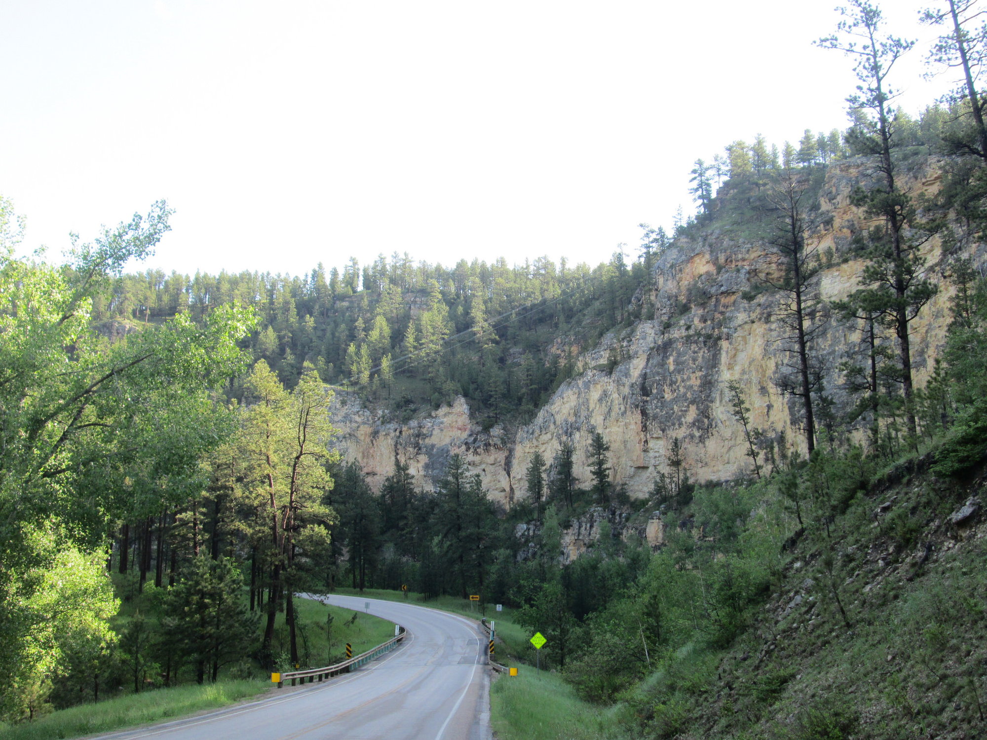
You gots to take Nemo Road from Rapid City. Great ride, although maybe not on a Friday afternoon. I did it in 2015 on a Thursday morning. Virtually all of the traffic (what little there was) was headed towards Rapid City. At Roubaix, I took unpaved Elk Creek Rd. and Big Lead Hill Rd. to get to U.S. 385. Wild Bill's Campground just up U.S. 385 makes a good burger. The trail crosses U.S. 385 just before Pluma, so there is no need to go all the way into Deadwood unless you want to see the town.
If you have the time and want a real treat, continue past Deadwood to Spearfish via U.S. 85 then a few miles on I-90. (There is a frontage road, but it has no shoulder, and there is traffic as you close in on the town.) There is a fabulous municipal campground there. It's right next to a national fish hatchery museum that is also a working hatchery. From there, ride Spearfish Canyon Hwy (U.S. 14A) up to Savoy (restaurant there) then Cheyenne Crossing (also food and drinks). From there, bang a left onto U.S. 85/14A, climb the hill and descend to N. Rochford Rd. Make a right onto N. Rochford and the first left onto unpaved Brownsville Rd. That takes you the Englewood trailhead, where there is water. Spearfish Canyon Hwy. features a waterfall along the way. If you continue a short way up the dirt road past Savoy there is a another set of waterfalls (Roughlock) that is worth a visit.
06-22-18, 04:04 PM
#20
Junior Member
Join Date: Jun 2018
Location: Abilene, Texas
Posts: 13
Bikes: Specialized Roubaix, Specialized Rockhopper
Mentioned: 0 Post(s)
Tagged: 0 Thread(s)
Quoted: 5 Post(s)
Likes: 0
Liked 0 Times
in
0 Posts
Will be taking US 83 from Uvalde Texas to South Dakota then I believe I80 to Rapid City then to Deadwood to catch the Mickelson Trail. I find US 83 very interesting as it takes you to the heartland of the USA. Very cool you traveled the route all the way to Canada by bike.
It is a great ride. We also rode 83 from Uvalde to Liberal on a previous ride. It was then that we realized with our actual starting point in Brownsville, we were half way to Canada. That discovery is what planted the seed for last summer’s ride. When do you plan to go?
Last edited by CEPP1; 06-22-18 at 04:06 PM. Reason: wording
06-22-18, 10:07 PM
#21
Life Feeds On Life
Join Date: Jan 2018
Location: Hondo,Texas
Posts: 2,143
Bikes: Too many Motobecanes
Mentioned: 11 Post(s)
Tagged: 0 Thread(s)
Quoted: 4409 Post(s)
Liked 4,521 Times
in
3,023 Posts
I will be in a car until I get to the Mickelson Trail so only trail riding. I’m very intrigued by all of your adventures on riding 83 cross country and I’m taking in all the information you guys are providing. I always thought that 83 would be a great cross country route via bicycle so it is cool that you all have chimed in about riding this route.
06-23-18, 05:28 AM
#22
Senior Member
Join Date: Jan 2010
Posts: 39,217
Mentioned: 211 Post(s)
Tagged: 1 Thread(s)
Quoted: 18398 Post(s)
Liked 15,495 Times
in
7,317 Posts
I'd still drive Nemo Rd. Quite scenic. And if you need a place to stay in Rapid City the Lazy U Motel is nice. Quiet despite being close to the highway. And it's close enough that you can walk into the center of town.
06-23-18, 09:06 AM
#23
Life Feeds On Life
Join Date: Jan 2018
Location: Hondo,Texas
Posts: 2,143
Bikes: Too many Motobecanes
Mentioned: 11 Post(s)
Tagged: 0 Thread(s)
Quoted: 4409 Post(s)
Liked 4,521 Times
in
3,023 Posts
Thanks for the information. I will ride this road you suggested the Mickelson trail is only around 110 miles so some additional routes will be welcomed. Last year I went the uphill direction this year I�m going from Deadwood to Edgemont which after the initial climb is all downhill.
06-24-18, 01:43 PM
#24
bicycle tourist
Thread Starter
Thanks for all your input.
06-25-18, 05:51 AM
#25
Senior Member
Join Date: Jan 2010
Posts: 39,217
Mentioned: 211 Post(s)
Tagged: 1 Thread(s)
Quoted: 18398 Post(s)
Liked 15,495 Times
in
7,317 Posts
https://ridewithgps.com/routes/8789349
If you have never seen Mt. Rushmore, take a day off in Hill City and do this loop:
https://ridewithgps.com/users/365150/routes
That back way to Keystone is really pretty and was virtually car-free. Leave shortly before the tourist train from Hill City to Keystone and wait for it to pass by. The road crosses the tracks several times.
Another day off option is the Needles Highway loop from Custer:
https://ridewithgps.com/routes/8771954
Stunning views.
If I ever have a do-over, I will stay at French Creek RV Park and campground. It's right off the trail by the old caboose. Looked nice and shady.
BTW...Check your profile. There is a climb out of Deadwood, a climb from the Englewood Trailhead and a climb from Mystic before the run into Hill City.