


Pecatonica Prairie Trail
 03-20-21, 08:50 PM
#1
Senior Member
Thread Starter
Pecatonica Prairie Trail
It's tough to get up-to-date information on this path. For those who don't know, the Pecatonica Prairie Trail (formerly the Pecatonica Prairie Path) follows the right-of-way of a railroad line that was abandoned back in 1972, more-or-less between Rockford and Freeport Illinois. The path was established not long afterwards, but was never fully completed and some sections reverted back to nature over the years. I remember hiking a portion of it about forty years ago (my mom's family lived in Rockford, and we'd visit often) but I've been meaning to get back there with a bike for the last several years. Some of the reports of the trail's highly-variable condition really made me wonder! But considering most reports dated back a decade or more, so I really had no idea.
So today I drove all the way out there and rode over most of the path in its middle section; roughly between Winnebago IL and the Pecatonica River bridge in Stephenson County.
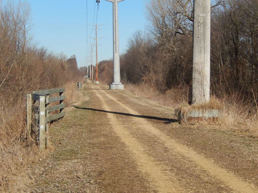
The better portions of the path looked like this. Coarse sand and gravel (natural, not crushed) interspersed with grass.... Surface was a little soft but that is not surprising considering the ground has only recently thawed following the snowmelt. A gravel bike might've been a good choice here but I did it on a mountain bike.
Of course there were plenty of spots like this. I even saw a few places where there was still snow; hard to believe with the lack of leaves that there would be enough shade to keep it from melting, but that must've been what was happening. Rather than ride through the snow, I turned around and went back to the car to jump ahead.
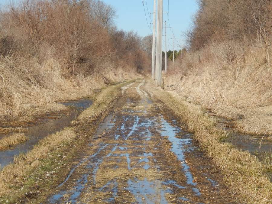
Moving into Stephenson County, the gravel became less and less prevalent and soon it was just dark mud with grass. It made for slow progress because it was soft. A slow plod on the mountain bike!

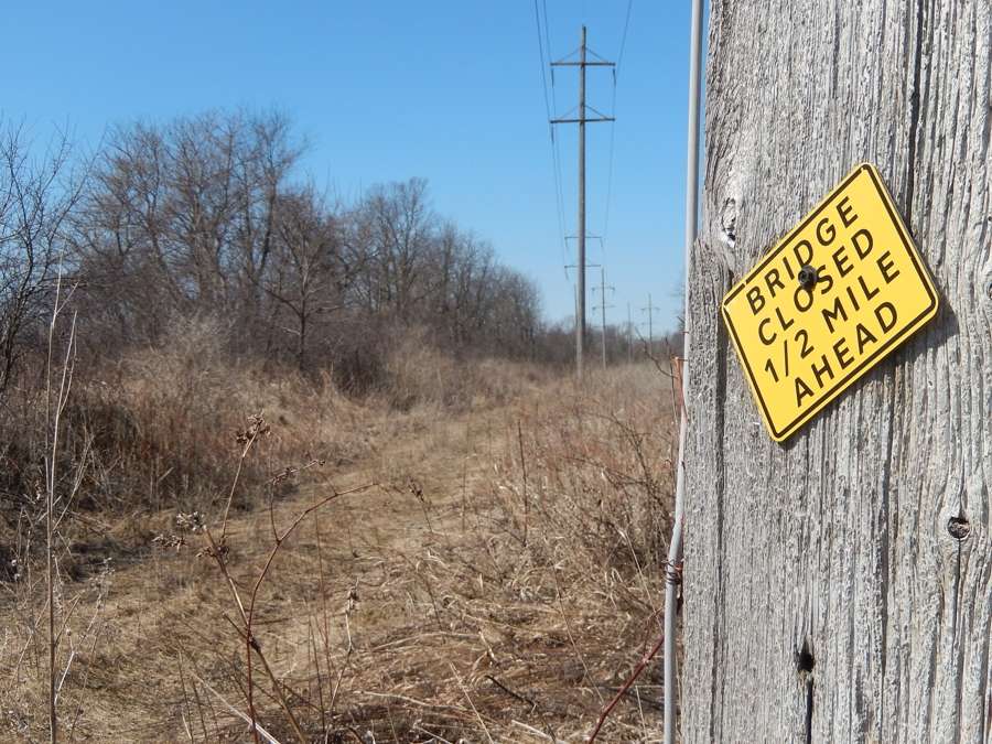
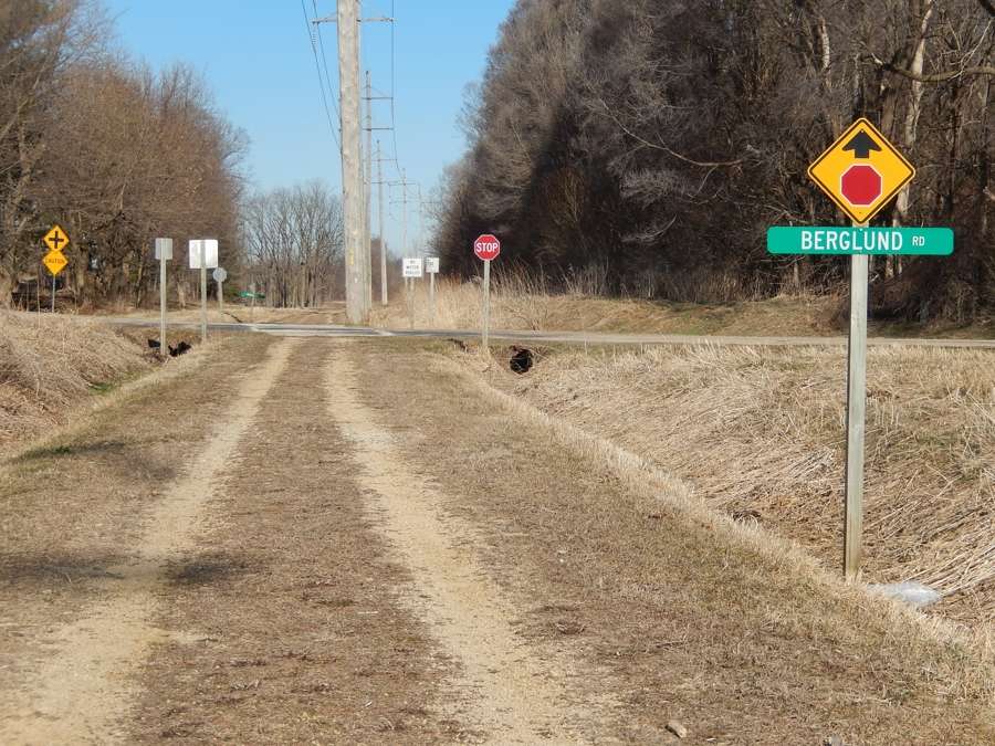
West of Ridott IL the path was really just a couple ruts through the weeds. The reason I decided to come here in March is because I am sure these areas become completely overgrown come summer. Even here, I had to beware of the blackberry plants lining the path; they have prickers, so more slow progress. The sign here warns of the bridge ahead being closed.
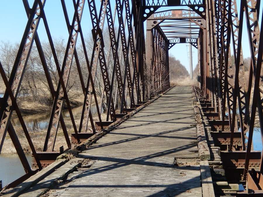
Sure would have been nice to be able to ride across this bridge, but both ends were fenced. The path beyond where was just more weeds anyway though.
So today I drove all the way out there and rode over most of the path in its middle section; roughly between Winnebago IL and the Pecatonica River bridge in Stephenson County.
The better portions of the path looked like this. Coarse sand and gravel (natural, not crushed) interspersed with grass.... Surface was a little soft but that is not surprising considering the ground has only recently thawed following the snowmelt. A gravel bike might've been a good choice here but I did it on a mountain bike.
Of course there were plenty of spots like this. I even saw a few places where there was still snow; hard to believe with the lack of leaves that there would be enough shade to keep it from melting, but that must've been what was happening. Rather than ride through the snow, I turned around and went back to the car to jump ahead.
Moving into Stephenson County, the gravel became less and less prevalent and soon it was just dark mud with grass. It made for slow progress because it was soft. A slow plod on the mountain bike!
West of Ridott IL the path was really just a couple ruts through the weeds. The reason I decided to come here in March is because I am sure these areas become completely overgrown come summer. Even here, I had to beware of the blackberry plants lining the path; they have prickers, so more slow progress. The sign here warns of the bridge ahead being closed.
Sure would have been nice to be able to ride across this bridge, but both ends were fenced. The path beyond where was just more weeds anyway though.

Likes For Reflector Guy:
03-20-21, 09:01 PM
#2
Senior Member
Thread Starter
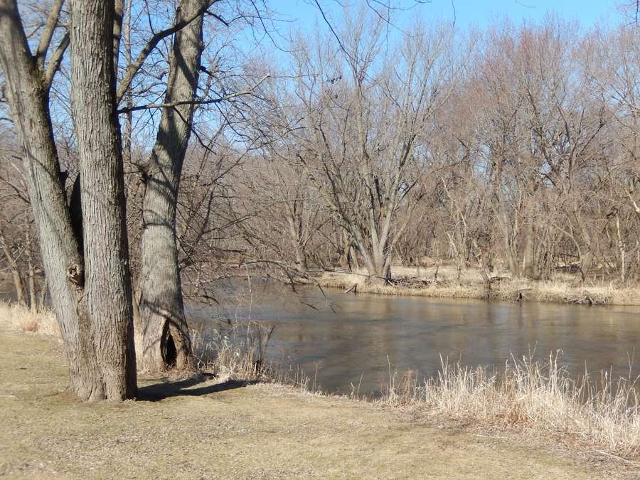
I suppose the wet areas should be no surprise, with the right-of-way never far from the Pecatonica River, and never very far above it! This was in an area where the path makes a circuitous detour around the perimeter of the Winnebago County Fairgrounds, which I think was done to allow the fairgrounds people to close the gates on each end when the property is closed, thus requiring the path users to go around.
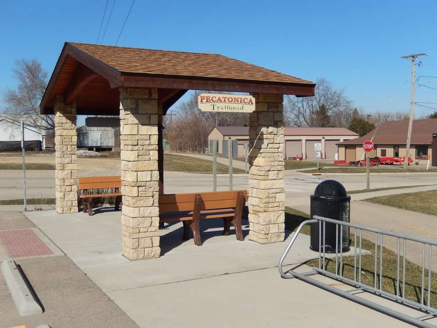
Pecatonica had an actual welcoming gazebo at the trail head!
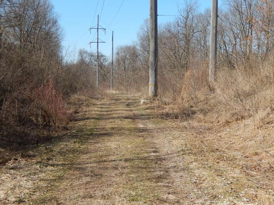
More of the Stephenson County grassland path....
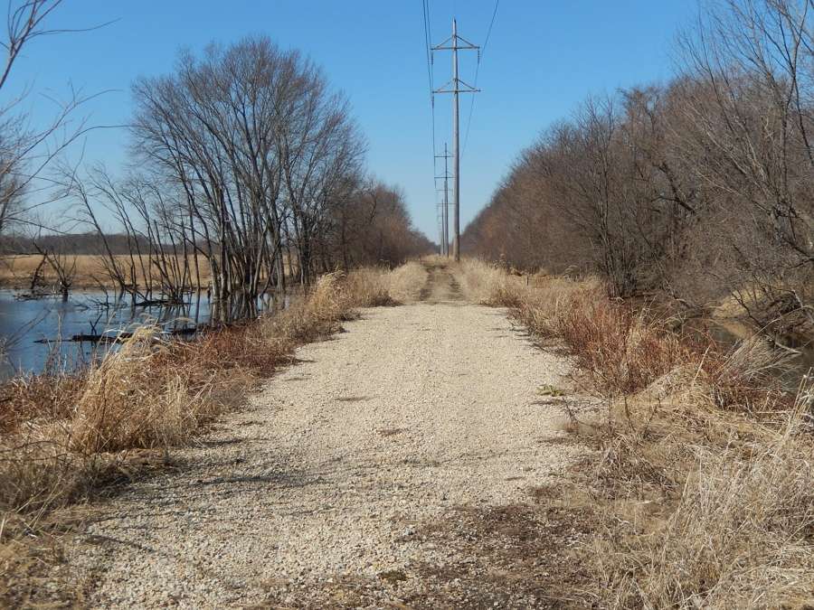
At this location, they replaced a small bridge with a corrugated metal culvert, and filled it in with gravel
Pecatonica had an actual welcoming gazebo at the trail head!
More of the Stephenson County grassland path....
At this location, they replaced a small bridge with a corrugated metal culvert, and filled it in with gravel
03-20-21, 09:21 PM
#3
Senior Member
Thread Starter
The Winnebago County section of the path was well-marked with signs, including mileposts. This is a couple miles east of Pecatonica.
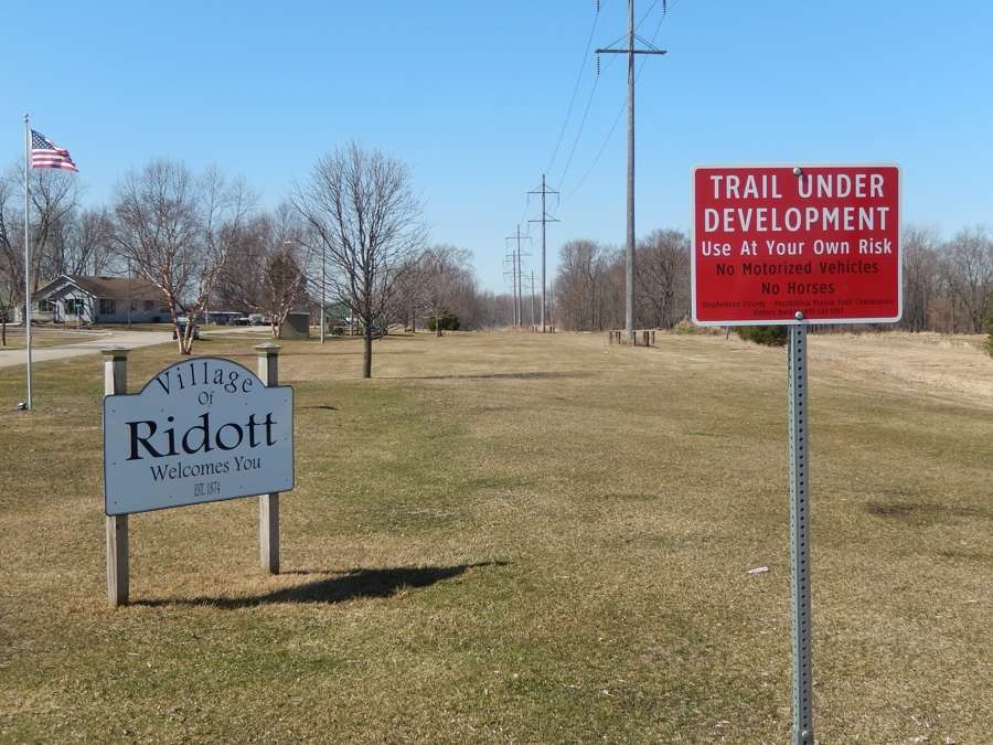
In contrast, Stephenson County had almost no signs, just a few of these "Trail Under Development" signs: (the trail goes straight through this grassy park)
It is crazy to realize I saw just one other trail user the whole day. This path goes through some real sparsely populated areas, even though Rockford itself is pretty big. I think one of biggest drawbacks to this trail is that it begins and ends almost in the middle of nowhere; the Rockford end starts at Meridian Road which is west of town and there isn't any good place to park the car there. If they can someday extend it a couple miles further east it might attract a whole lot more people. Until then, it is nearly deserted. Maybe in summer it is busier?
03-21-21, 06:47 AM
#4

Senior Member
Join Date: Aug 2007
Location: Evanston, IL
Posts: 5,093
Bikes: many
Mentioned: 63 Post(s)
Tagged: 0 Thread(s)
Quoted: 1444 Post(s)
Liked 1,392 Times
in
760 Posts
Thanks for the scouting expedition. That's a bit far west for me (still plenty for me to explore nearer to Chicago), but it's nice to get a read out on new ride possibilities.
03-29-21, 12:24 PM
#5
Senior Member
Join Date: Oct 2013
Location: Mich
Posts: 7,389
Bikes: RSO E-tire dropper fixie brifter
Mentioned: 0 Post(s)
Tagged: 0 Thread(s)
Quoted: 6 Post(s)
Liked 2,969 Times
in
1,918 Posts
neat. I'd most likely never explore it as I'm a road cyclists, but I've been known to road ride a compact gravel surface for many dozens of miles.
__________________
-Oh Hey!
-Oh Hey!
03-30-21, 08:20 AM
#6
Senior Member
Thread Starter
Me too, actually. Normally I'd never come out all this way to ride such a rustic trail, but being a railroad buff I like to explore all the rail trails. I've been curious about this one for years. With that out of the way, I probably won't be back, at least not until this one gets some better surfacing. I'm more used to Illinois' better rail-trails which road bikes are great on.
03-30-21, 02:05 PM
#7
Senior Member
Join Date: Oct 2013
Location: Mich
Posts: 7,389
Bikes: RSO E-tire dropper fixie brifter
Mentioned: 0 Post(s)
Tagged: 0 Thread(s)
Quoted: 6 Post(s)
Liked 2,969 Times
in
1,918 Posts
