


rules of thumb to assess a route profile
 01-31-17, 06:58 PM
#26
Senior Member
Join Date: Jun 2011
Location: Jasper Alberta
Posts: 469
Bikes: Surly Ogre
Mentioned: 1 Post(s)
Tagged: 0 Thread(s)
Quoted: 19 Post(s)
Likes: 0
Liked 0 Times
in
0 Posts
I use this for my long distance rides ...
(Elevation in metres/Distance in metres) * 100
If the total is 0.5 or less ... it's a flat ride.
If the total is 0.75 or less ... the ride has some hills but nothing unmanageable.
If the total is 1 or less ... still doable.
If the total is 1 - 1.25 ... I'll do it, but I'm not sure I'd want the ride length to be anything over 100 km.
If the total is 1.25 - 1.5 ... I might give it a go if the ride is quite short, like, say 50 km.
If the total is over 1.5 ... I probably wouldn't be considering it unless it is a hill climbing event and I had been training for that.

1= Easy
2= Medium
3= Hard
4= Crying on the side of the road.
5+= Good times.... Good times...
I guess I could also this method to determine the amount of extra calories I eat that day
 01-31-17, 08:20 PM
#27
bicycle tourist
I've found more than 1000m of climb (3300ft) makes for a reasonably full day when fully loaded, regardless of distance. I've done more, but it definitely adds up and a >1000m day is often reason to trim the distance for that day.
I find it not too difficult to ride 5-6% grades for extended periods (e.g. 10km) and ride short distances of ~8% (e.g. 100m) particularly when I am fresh in the morning. If it gets much steeper, then unless the hill is very short (e.g. <50m) then I will often walk.
In general, I would much rather tackle a 500m+ climb first thing in the morning. I am fresher and better able to climb than late in the day. Also depends a bit on temperatures, e.g. if it is hot region than I might prefer to be a little higher overnight and in a colder region might prefer to sleep lower down.
02-01-17, 10:43 PM
#28
Senior Member
Join Date: Mar 2011
Posts: 3,150
Bikes: 2013 Surly Disc Trucker, 2004 Novara Randonee , old fixie , etc
Mentioned: 3 Post(s)
Tagged: 0 Thread(s)
Quoted: 671 Post(s)
Likes: 0
Liked 49 Times
in
43 Posts
Thanks everyone for your input. Will read again -- there are a couple of interesting nuggets.
FWIW -- I've looked at the power output of a professional cyclist. I came across this entry that pegs the figure at 247W. I would assume that this rider is much more fit than I am, and didn't ride merely for the joy of riding. I would therefore expect my personal average to be a bit above 100W. Now, on a 10% grade, 100W translates into a speed of 2 miles per hour (3kmh). I'd have to raise my effort to 150W, in the lowest gear (22x32), at 60rpm, to be able to climb a 10% grade. At 100W, I can climb a 5% grade in the lowest gear. These maths ring true to me, based on my limited experience -- for me, anything above 5% is a challenge. Anything above 10% cannot be sustained for more than a few meters.
FWIW -- I've looked at the power output of a professional cyclist. I came across this entry that pegs the figure at 247W. I would assume that this rider is much more fit than I am, and didn't ride merely for the joy of riding. I would therefore expect my personal average to be a bit above 100W. Now, on a 10% grade, 100W translates into a speed of 2 miles per hour (3kmh). I'd have to raise my effort to 150W, in the lowest gear (22x32), at 60rpm, to be able to climb a 10% grade. At 100W, I can climb a 5% grade in the lowest gear. These maths ring true to me, based on my limited experience -- for me, anything above 5% is a challenge. Anything above 10% cannot be sustained for more than a few meters.
02-02-17, 07:09 AM
#29
Senior Member
Join Date: Feb 2012
Location: Golden, CO and Tucson, AZ
Posts: 2,836
Bikes: 2016 Fuji Tread, 1983 Trek 520
Mentioned: 13 Post(s)
Tagged: 0 Thread(s)
Quoted: 675 Post(s)
Liked 741 Times
in
430 Posts
(It seemed I was the only cyclist on that popular route truly enjoying myself. Why someone would invest so much (money, family time, career time) into the trip of a lifetime and not get ready for it, or know one's limits as you said, is beyond me.)
And in my case, that preparation not only included gaining fitness, but also reducing packed weight. I'm not as young as I once was and I got some free wattage by carrying less stuff.
02-02-17, 10:40 AM
#30
Senior Member
Join Date: Sep 2015
Location: Left Coast, Canada
Posts: 5,126
Mentioned: 24 Post(s)
Tagged: 0 Thread(s)
Quoted: 2236 Post(s)
Liked 1,314 Times
in
707 Posts
I agree.
Before my last trip I made a point to spend time working my way into greater fitness. I live 45 minutes drive away from Hope which is the gateway to 3 big mountain routes, and would do weekend day trips up the passes. It made for fun training and social activities as some friends wanted a challenge but could not do a whole trip.
Before my last trip I made a point to spend time working my way into greater fitness. I live 45 minutes drive away from Hope which is the gateway to 3 big mountain routes, and would do weekend day trips up the passes. It made for fun training and social activities as some friends wanted a challenge but could not do a whole trip.
02-02-17, 11:17 AM
#31
Senior Member
I use this for my long distance rides ...
(Elevation in metres/Distance in metres) * 100
If the total is 0.5 or less ... it's a flat ride.
If the total is 0.75 or less ... the ride has some hills but nothing unmanageable.
If the total is 1 or less ... still doable.
If the total is 1 - 1.25 ... I'll do it, but I'm not sure I'd want the ride length to be anything over 100 km.
If the total is 1.25 - 1.5 ... I might give it a go if the ride is quite short, like, say 50 km.
If the total is over 1.5 ... I probably wouldn't be considering it unless it is a hill climbing event and I had been training for that.
As for percentages ... under 10%, it's OK (maybe under 8% with a loaded touring bike). Between 10 and 15%, I might do the occasional short climb in that range. Over 15% and I probably won't do it (maybe walking) because my joints just don't stand up to that kind of pressure.
02-02-17, 04:49 PM
#32
old fart
Join Date: Dec 2007
Location: PA-US
Posts: 379
Mentioned: 1 Post(s)
Tagged: 0 Thread(s)
Quoted: 119 Post(s)
Likes: 0
Liked 1 Time
in
1 Post
Pardon my question - it is not meant as a challenge or criticism, but rather I am trying to figure out your method above. Isn't the formula you posted at the top actually computing grade percentages? For example, if I have an elevation gain of 100 m in 1 km, that's 100m/1000m*100% = 10% grade. You mention 10% grade as being challenging at the bottom of the post, so I am trying to figure out what the other numbers above mean (e.g., <1, 1 - 1.25, 1.25 - 1.5, >1.5). Thanks.
Most of us cope well with occasional 10-12% and even short 20% slopes, but I dislike rides/trips with more than 100 ft/mile averages.
Last edited by IK_biker; 02-02-17 at 04:52 PM.
02-02-17, 07:04 PM
#33
Senior Member
Correct, those were grade percentages, but Machka meant them as averages for the entire trip/ride (as was the intent in the 1st post in this thread), while her mention of 10% being too harsh was meant for a single climb during the ride.
Most of us cope well with occasional 10-12% and even short 20% slopes, but I dislike rides/trips with more than 100 ft/mile averages.
Most of us cope well with occasional 10-12% and even short 20% slopes, but I dislike rides/trips with more than 100 ft/mile averages.
 02-02-17, 07:39 PM
#34

In Real Life

Join Date: Jan 2003
Location: Down under down under
Posts: 52,152
Bikes: Lots
Mentioned: 141 Post(s)
Tagged: 0 Thread(s)
Quoted: 3203 Post(s)
Liked 596 Times
in
329 Posts
Pardon my question - it is not meant as a challenge or criticism, but rather I am trying to figure out your method above. Isn't the formula you posted at the top actually computing grade percentages? For example, if I have an elevation gain of 100 m in 1 km, that's 100m/1000m*100% = 10% grade. You mention 10% grade as being challenging at the bottom of the post, so I am trying to figure out what the other numbers above mean (e.g., <1, 1 - 1.25, 1.25 - 1.5, >1.5). Thanks.
Correct, those were grade percentages, but Machka meant them as averages for the entire trip/ride (as was the intent in the 1st post in this thread), while her mention of 10% being too harsh was meant for a single climb during the ride.
Most of us cope well with occasional 10-12% and even short 20% slopes, but I dislike rides/trips with more than 100 ft/mile averages.
Most of us cope well with occasional 10-12% and even short 20% slopes, but I dislike rides/trips with more than 100 ft/mile averages.
But for me, something that averages a "1" or less indicates that there's enough flat ground or descents that I'll be able to rest up and make up some time.
So, for example, if I were to do a ride I used to do in the Canadian Rockies fairly frequently ... Nordegg to Saskatchewan River Cross and back to Nordegg ...
According to Google Maps, that's 184 km with 1407 metres of climbing in total.
(1407/184,000)*100 = 0.76 ... that's a nice doable ride for me.
And indeed, was. I miss that road.If I were to map that in Ride with GPS, so I could see the elevation profile and elevation details ... I see that it does basically consist of rolling hills, with the steepest climb being just over 6%. And that's good too.
I've got another route here in Tasmania ... out and back like the one I've just mentioned in Canada. It's 161 km with 1272 metres of climbing = 0.77 ... so about the same as the ride above, which is good.
However the elevation profile is quite different ... steeper climbs with flatter sections in between. The steepest climb is 10% with a couple 8%s in there too. Those will be a challenge, but because the overall route is a 0.77, there should be enough flat stuff in between those climbs for me to recover.
__________________
Rowan
My fave photo threads on BF
Century A Month Facebook Group
Machka's Website
Photo Gallery
Rowan
My fave photo threads on BF
Century A Month Facebook Group
Machka's Website
Photo Gallery
02-02-17, 09:02 PM
#35
Senior Member
Ah, now I understand. It is not really average gradient for the entire trip, but rather just the climbs (i.e., uphill gradients) normalized by the distance. That makes perfect sense now - I'll have to try this out. Many thanks.
And yes, Highway 11 (David Thompson Highway) into the Rockies is a wonderful ride - I live at the far northwest part of Calgary, so I have easy access to that region and know that area well - I always enjoy exploring the highways and backcountry roads all in that area for biking and fly fishing.
And yes, Highway 11 (David Thompson Highway) into the Rockies is a wonderful ride - I live at the far northwest part of Calgary, so I have easy access to that region and know that area well - I always enjoy exploring the highways and backcountry roads all in that area for biking and fly fishing.
02-02-17, 09:31 PM
#36
In Real Life
Join Date: Jan 2003
Location: Down under down under
Posts: 52,152
Bikes: Lots
Mentioned: 141 Post(s)
Tagged: 0 Thread(s)
Quoted: 3203 Post(s)
Liked 596 Times
in
329 Posts
Ah, now I understand. It is not really average gradient for the entire trip, but rather just the climbs (i.e., uphill gradients) normalized by the distance. That makes perfect sense now - I'll have to try this out. Many thanks.
And yes, Highway 11 (David Thompson Highway) into the Rockies is a wonderful ride - I live at the far northwest part of Calgary, so I have easy access to that region and know that area well - I always enjoy exploring the highways and backcountry roads all in that area for biking and fly fishing.
And yes, Highway 11 (David Thompson Highway) into the Rockies is a wonderful ride - I live at the far northwest part of Calgary, so I have easy access to that region and know that area well - I always enjoy exploring the highways and backcountry roads all in that area for biking and fly fishing.
Yes, that's it.
Someone in the Road forum mentioned that formula a couple years ago and I too was sceptical about it, but I needed some way of figuring out whether or not I could do the rides here in Tasmania, where it is very hilly. I was attempting some, but was going way over the time limits and really struggling. So I started experimenting with that formula and discovered what I could do and what was too challenging for me.
And I lived much of my life in Alberta, most recently 5 years in Red Deer ... great for accessing Hwy 11.
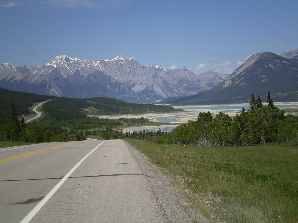
I've got to toss this in here ... one of my favourite photos I took of one of my favourite roads ...
__________________
Rowan
My fave photo threads on BF
Century A Month Facebook Group
Machka's Website
Photo Gallery
Rowan
My fave photo threads on BF
Century A Month Facebook Group
Machka's Website
Photo Gallery
Last edited by Machka; 02-02-17 at 11:40 PM.
02-02-17, 11:59 PM
#37
Senior Member
Join Date: Oct 2014
Location: Portland, OR
Posts: 12,902
Bikes: (2) ti TiCycles, 2007 w/ triple and 2011 fixed, 1979 Peter Mooney, ~1983 Trek 420 now fixed and ~1973 Raleigh Carlton Competition gravel grinder
Mentioned: 129 Post(s)
Tagged: 0 Thread(s)
Quoted: 4802 Post(s)
Liked 3,922 Times
in
2,551 Posts
Thanks everyone for your input. Will read again -- there are a couple of interesting nuggets.
FWIW -- I've looked at the power output of a professional cyclist. I came across this entry that pegs the figure at 247W. I would assume that this rider is much more fit than I am, and didn't ride merely for the joy of riding. I would therefore expect my personal average to be a bit above 100W. Now, on a 10% grade, 100W translates into a speed of 2 miles per hour (3kmh). I'd have to raise my effort to 150W, in the lowest gear (22x32), at 60rpm, to be able to climb a 10% grade. At 100W, I can climb a 5% grade in the lowest gear. These maths ring true to me, based on my limited experience -- for me, anything above 5% is a challenge. Anything above 10% cannot be sustained for more than a few meters.
FWIW -- I've looked at the power output of a professional cyclist. I came across this entry that pegs the figure at 247W. I would assume that this rider is much more fit than I am, and didn't ride merely for the joy of riding. I would therefore expect my personal average to be a bit above 100W. Now, on a 10% grade, 100W translates into a speed of 2 miles per hour (3kmh). I'd have to raise my effort to 150W, in the lowest gear (22x32), at 60rpm, to be able to climb a 10% grade. At 100W, I can climb a 5% grade in the lowest gear. These maths ring true to me, based on my limited experience -- for me, anything above 5% is a challenge. Anything above 10% cannot be sustained for more than a few meters.
Take it from someone who has climbed hundreds of hills in a bottom gear that was too high. Racing back in the day when I geared my 5 cogs on back so I could hang on flat ground and not get dropped. Usually a 13-19 FW. Even as a hard 25 yo mountain goat, there was no way I was spinning that gear (42-19) up any hard hill. Plus I have ridden fix gear up gain hundreds of hills. RPMs get very low!
I'm not saying do what I do. Pick your gears carefully. But once you leave, you are ridding what you got. If you are doing real hills that you do not know, you WILL hit one that tests that bottom gear. Just ride it. Again, watch your breathing. Too hard - slow down. Starting to get ragged. You are well past redline and you will pay. Better yet, do some hard practice hills that are too much for your bottom gear and touring load (or without the touring load on your other bike with a higher gear. Do this to get acquainted with your breathing and your body so you know what is too hard and will hurt you later. (A heartrate monitor is actually better but you have to practice with it too. And your breathing is always there. It does change as the ride goes on but if you know it you have a guide as to how close to "redline" you are riding.)
Now, how deeply you can breath and not go over the edge will change as your conditioning improves. (THat's fun to observe.)
Above all, remember to have fun!
Ben
02-05-17, 12:22 PM
#38
Banned
Yup, Just ride, enjoy the day see the Scenery, when its evening find a place to stay/camp.
Paper maps with topographic marking have been published for decades.. with Aerial /Sattellite Photos, Maps are better than in the 19th Century..
Paper maps with topographic marking have been published for decades.. with Aerial /Sattellite Photos, Maps are better than in the 19th Century..
02-05-17, 10:29 PM
#39
Senior Member
Join Date: Mar 2011
Posts: 3,150
Bikes: 2013 Surly Disc Trucker, 2004 Novara Randonee , old fixie , etc
Mentioned: 3 Post(s)
Tagged: 0 Thread(s)
Quoted: 671 Post(s)
Likes: 0
Liked 49 Times
in
43 Posts
& I see that one can download topo maps for free now. Haven't used them myself but seems like they could give some good quick info about terrain.
03-24-17, 08:12 AM
#40
Junior Member
Join Date: Jan 2017
Posts: 17
Bikes: '97 Marin Eldridge Grade, '21 Kona Dr. Dew
Mentioned: 0 Post(s)
Tagged: 0 Thread(s)
Quoted: 9 Post(s)
Likes: 0
Liked 0 Times
in
0 Posts
I'm a bit late to this thread but...We live in a flat country and while we do occasional local touring we have very little experience on real hill climbing.
We are now planning our first tour in a hilly country and are a bitscared excited about hard it will be? I created one potential route with elevation profiles here: https://www.bikemap.net/en/routecoll...an-adventures/ (Start in Pula, route is split in three parts).
Could someone help and make a bit of an assessment about what to expect? We are both average fitness cyclists and like to relaxed cycling with old MTB's and camping gear. I am bit concerned about having the wrong expectations for the tour.
We are now planning our first tour in a hilly country and are a bit
Could someone help and make a bit of an assessment about what to expect? We are both average fitness cyclists and like to relaxed cycling with old MTB's and camping gear. I am bit concerned about having the wrong expectations for the tour.
03-24-17, 08:26 AM
#41
In Real Life
Join Date: Jan 2003
Location: Down under down under
Posts: 52,152
Bikes: Lots
Mentioned: 141 Post(s)
Tagged: 0 Thread(s)
Quoted: 3203 Post(s)
Liked 596 Times
in
329 Posts
I'm a bit late to this thread but...We live in a flat country and while we do occasional local touring we have very little experience on real hill climbing.
We are now planning our first tour in a hilly country and are a bitscared excited about hard it will be? I created one potential route with elevation profiles here: https://www.bikemap.net/en/routecoll...an-adventures/ (Start in Pula, route is split in three parts).
Could someone help and make a bit of an assessment about what to expect? We are both average fitness cyclists and like to relaxed cycling with old MTB's and camping gear. I am bit concerned about having the wrong expectations for the tour.
We are now planning our first tour in a hilly country and are a bit
Could someone help and make a bit of an assessment about what to expect? We are both average fitness cyclists and like to relaxed cycling with old MTB's and camping gear. I am bit concerned about having the wrong expectations for the tour.
Croatia 2 is 293 km with 2170 metres of climbing
Croatia 3 is 326 km with 3120 metres of climbing
According to the calculation I mentioned earlier in the thread,
Croatia 1 is 1.03 (1740/168000)*100
Croatia 2 is 0.74
Croatia 3 is 0.96
What does this mean? Well, it kind of depends on you.
For me, right now, anything around the 1 mark is doable within the Audax/Randonneuring minimum time limit of 15 km/h. It may be somewhat difficult, but it is doable.
Down around the 0.75 range is close to a flat ride ... for me, a flatlander who has recently learned how to climb.
Once a ride gets up around 1.25 or so, I know it's going to be a tough and fairly slow ride.
The way to find out what it means for you is to map out a reasonably challenging ride in your local area and do the calculation above on the route to see what number you get. Then go ride it and see how you feel. Try it with other routes. Soon you'll discover what number is a reasonably doable ride for you, and you can use that as a comparison with other routes.
That said ... all routes are different. A 1.03 route could contain one big hill and the rest flat, or a whole series of rollers. So you would want to use the calculation above with an elevation profile. I also look at grade percentages. I can handle 1 or 2 hills with grades around 10% or slightly over, but too many of them, and I'm not happy.
But start with the calculation and then have a look at elevation and grade ... and compare it with what you know in your local area.
__________________
Rowan
My fave photo threads on BF
Century A Month Facebook Group
Machka's Website
Photo Gallery
Rowan
My fave photo threads on BF
Century A Month Facebook Group
Machka's Website
Photo Gallery
03-24-17, 09:11 AM
#42

don't try this at home.

Join Date: Jan 2006
Location: N. KY
Posts: 5,936
Mentioned: 10 Post(s)
Tagged: 0 Thread(s)
Quoted: 973 Post(s)
Liked 511 Times
in
351 Posts
Thanks everyone for your input. Will read again -- there are a couple of interesting nuggets.
FWIW -- I've looked at the power output of a professional cyclist. I came across this entry that pegs the figure at 247W. I would assume that this rider is much more fit than I am, and didn't ride merely for the joy of riding. I would therefore expect my personal average to be a bit above 100W. Now, on a 10% grade, 100W translates into a speed of 2 miles per hour (3kmh). I'd have to raise my effort to 150W, in the lowest gear (22x32), at 60rpm, to be able to climb a 10% grade. At 100W, I can climb a 5% grade in the lowest gear. These maths ring true to me, based on my limited experience -- for me, anything above 5% is a challenge. Anything above 10% cannot be sustained for more than a few meters.
FWIW -- I've looked at the power output of a professional cyclist. I came across this entry that pegs the figure at 247W. I would assume that this rider is much more fit than I am, and didn't ride merely for the joy of riding. I would therefore expect my personal average to be a bit above 100W. Now, on a 10% grade, 100W translates into a speed of 2 miles per hour (3kmh). I'd have to raise my effort to 150W, in the lowest gear (22x32), at 60rpm, to be able to climb a 10% grade. At 100W, I can climb a 5% grade in the lowest gear. These maths ring true to me, based on my limited experience -- for me, anything above 5% is a challenge. Anything above 10% cannot be sustained for more than a few meters.
(For steep hills, there's a limit of how slow you can ride without falling over, so that determines a lower limit on your power required there.)
I have a few recent rides recorded with a power meter. The free Golden Cheetah software has a power curve graph, showing my maximum power over different time periods.
Now, in early springtime, my best 1-hour average power on those rides is 119 watts. On flat ground, that's a little more than 17 mph / 28 kph riding in the drops on a road bike.
For two hours, it's 109 watts, and I didn't record any rides where I was pedaling much longer than that .
The best 10 minutes is 144 watts.
The best 1 minute is 280 watts.
The 1 to 15 second readings are from standing up, pushing hard on the pedals, while pulling on the bars.
It's interesting how flat the power curve is for time periods over 30 minutes or so. And high power efforts have to be quite short (but can later repeat after a recovery).
Even somewhat higher power efforts have to be a fairly short time period. A long, steep climb will be difficult, and needs rest stops along the way.
The graph. The shaded-in parts are actual best watts, the dashed line is the fitted power curve.
Last edited by rm -rf; 03-24-17 at 09:22 AM.
03-24-17, 10:56 AM
#43
Senior Member
Thread Starter
Join Date: Sep 2015
Location: QC Canada
Posts: 1,966
Bikes: Custom built LHT & Troll
Mentioned: 12 Post(s)
Tagged: 0 Thread(s)
Quoted: 842 Post(s)
Liked 149 Times
in
106 Posts
Now, in early springtime, my best 1-hour average power on those rides is 119 watts. On flat ground, that's a little more than 17 mph / 28 kph riding in the drops on a road bike.
For two hours, it's 109 watts, and I didn't record any rides where I was pedaling much longer than that .
The best 10 minutes is 144 watts.
The best 1 minute is 280 watts.
I hope to be in a position to do something similar (i.e. capturing + analyzing data) this spring. But our schedule being what it is, I may have to wait until September. My expectation is that my power curve will look quite a bit like yours.
03-24-17, 10:57 AM
#44
Senior Member

Join Date: Apr 2015
Location: Metro Detroit/AA
Posts: 8,207
Bikes: 2016 Novara Mazama
Mentioned: 63 Post(s)
Tagged: 0 Thread(s)
Quoted: 3640 Post(s)
Liked 81 Times
in
51 Posts
Out of curiosity, are there any sites (whether bike specific or not) that show elevation profiles for regular roads, for areas that lie outside of Google Map's bike option? Or am I just stuck with looking at topo maps if I want a clue on the detailed elevation profile?
EDIT: Nevermind, answered my own question, never realized Strava could be used to plot routes that were a couple hundred miles long!
EDIT: Nevermind, answered my own question, never realized Strava could be used to plot routes that were a couple hundred miles long!
Last edited by jefnvk; 03-24-17 at 12:53 PM.
03-24-17, 11:11 AM
#45
Junior Member
Join Date: Jan 2017
Posts: 17
Bikes: '97 Marin Eldridge Grade, '21 Kona Dr. Dew
Mentioned: 0 Post(s)
Tagged: 0 Thread(s)
Quoted: 9 Post(s)
Likes: 0
Liked 0 Times
in
0 Posts
Try bikemap.net I linked above. It gives bicycle routing and elevation profile on locations not yet in google maps bike routing.
03-24-17, 11:19 AM
#47
Junior Member
Join Date: Jan 2017
Posts: 17
Bikes: '97 Marin Eldridge Grade, '21 Kona Dr. Dew
Mentioned: 0 Post(s)
Tagged: 0 Thread(s)
Quoted: 9 Post(s)
Likes: 0
Liked 0 Times
in
0 Posts
[..]
That said ... all routes are different. A 1.03 route could contain one big hill and the rest flat, or a whole series of rollers. So you would want to use the calculation above with an elevation profile. I also look at grade percentages. I can handle 1 or 2 hills with grades around 10% or slightly over, but too many of them, and I'm not happy.
But start with the calculation and then have a look at elevation and grade ... and compare it with what you know in your local area.
 03-24-17, 06:30 PM
#48
In Real Life
Join Date: Jan 2003
Location: Down under down under
Posts: 52,152
Bikes: Lots
Mentioned: 141 Post(s)
Tagged: 0 Thread(s)
Quoted: 3203 Post(s)
Liked 596 Times
in
329 Posts
Out of curiosity, are there any sites (whether bike specific or not) that show elevation profiles for regular roads, for areas that lie outside of Google Map's bike option? Or am I just stuck with looking at topo maps if I want a clue on the detailed elevation profile?
EDIT: Nevermind, answered my own question, never realized Strava could be used to plot routes that were a couple hundred miles long!
EDIT: Nevermind, answered my own question, never realized Strava could be used to plot routes that were a couple hundred miles long!
Also have a look at Ride with GPS.
__________________
Rowan
My fave photo threads on BF
Century A Month Facebook Group
Machka's Website
Photo Gallery
Rowan
My fave photo threads on BF
Century A Month Facebook Group
Machka's Website
Photo Gallery
03-24-17, 06:36 PM
#49
In Real Life
Join Date: Jan 2003
Location: Down under down under
Posts: 52,152
Bikes: Lots
Mentioned: 141 Post(s)
Tagged: 0 Thread(s)
Quoted: 3203 Post(s)
Liked 596 Times
in
329 Posts
Thanks! So on average not too hardcore but it's kinda hard to grasp the grade difficulties as for example route 1 elevation chart shows many 5km+ long 10%+ hills and we have nothing even close here
From what I can see in the elevation profile, the routes starts with a long gradual climb ... 300 metres in elevation gain over 40 km.
The next climb is 200 metres over 20 km.
Then it is flat for quite a while.
Then you've got a 150 metre climb over about 7 km.
Then some rollers.
I'm not seeing anything that is 5 km long with 10% grade all the way. 10% over 5 km would involve a 500 metre elevation gain in 5 km.
Are we looking at the same elevation profile?
__________________
Rowan
My fave photo threads on BF
Century A Month Facebook Group
Machka's Website
Photo Gallery
Rowan
My fave photo threads on BF
Century A Month Facebook Group
Machka's Website
Photo Gallery
Last edited by Machka; 03-24-17 at 06:40 PM.