


I can still get it up
 09-04-14, 11:37 PM
#1
Senior Member
Thread Starter
Join Date: Jul 2012
Location: Bay Area
Posts: 349
Mentioned: 0 Post(s)
Tagged: 0 Thread(s)
Quoted: 0 Post(s)
Likes: 0
Liked 0 Times
in
0 Posts
I can still get it up
Up hills that is.
I'm not shy about saying what a fan of biker395's photos I am. His pictures of the eastern Sierra are so captivating that they have moved me to travel there in 2013 for the mammoth fall century and again this year for the same event. This time I decided to add some extra riding beforehand.
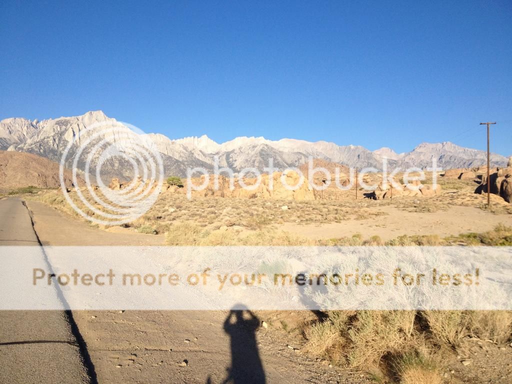
The eastern Sierra are like a huge wall dropping down into the Owens valley. Any roads up into them are bound to be steep and wild. I'm not sure when I first heard about roads like Onion valley, Horseshoe and Whitney Portal but over the last year the idea of riding these roads took hold.
I arrived in Independence on the 30th. I had made a reservation at grays meadow campground. The campground is on the Onion Valley road and I thought it would be a good base the first few days out.
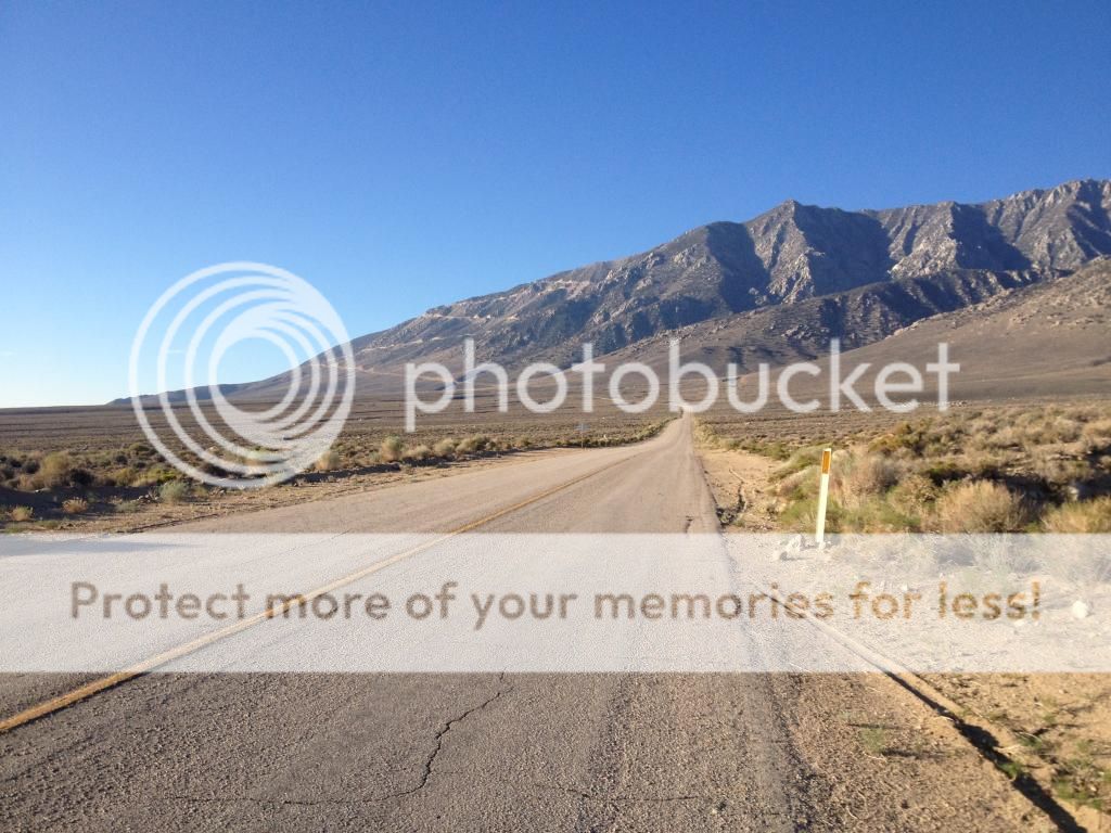
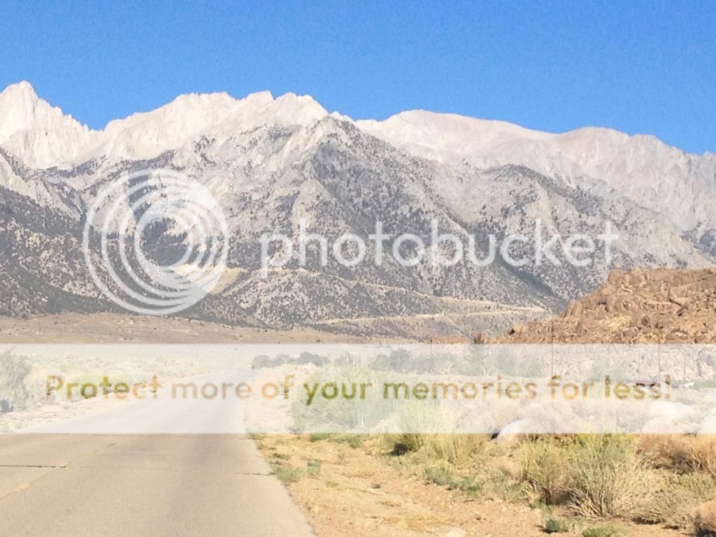
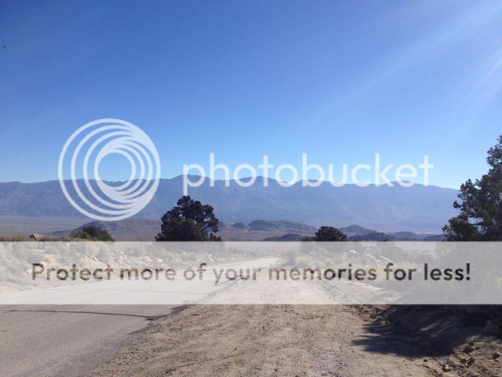
For my first ride I chose Onion Valley. It was close and claims(Climbing by bike in California � John Summerson) are that it is the hardest ride. I started the climb at highway 395. The first 5 miles up to the campground are a soul crushing climb up the alluvial fan at the base of the mountain. Climbing up it looks like it should be flat, but it actually climbs more than 2000 feet.
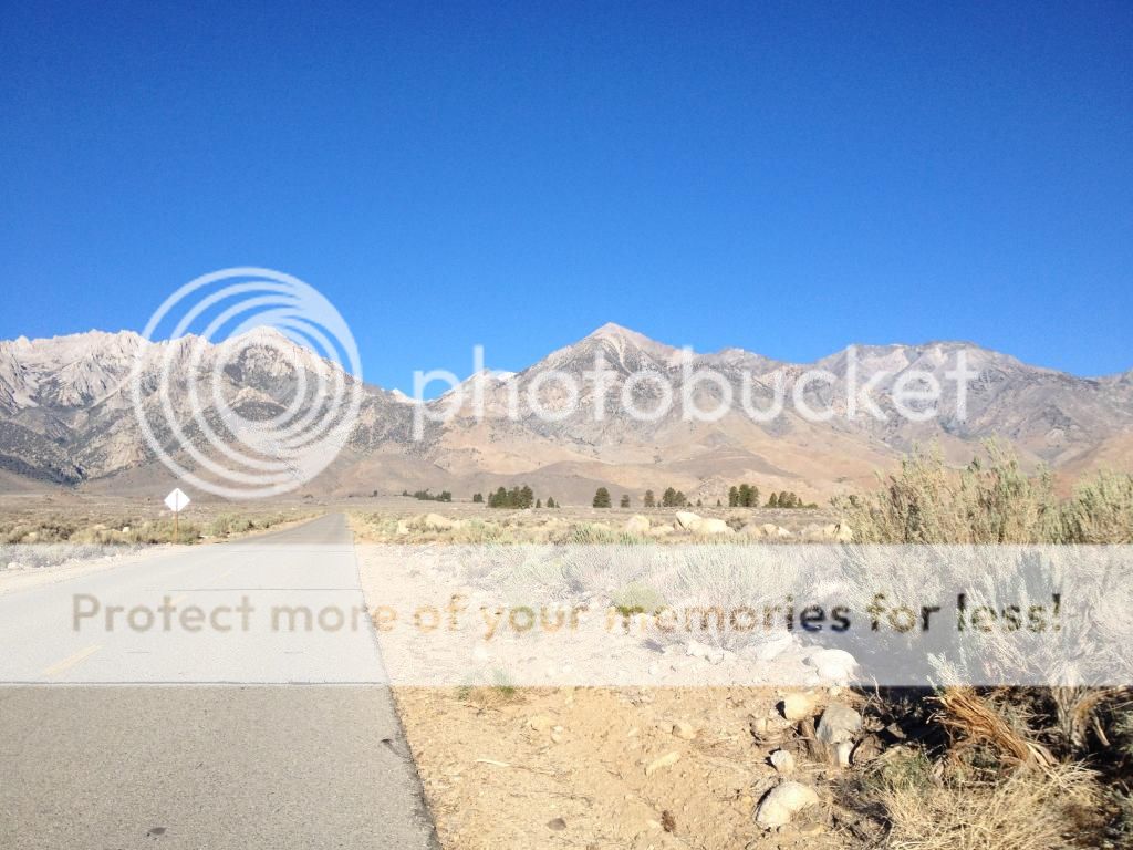
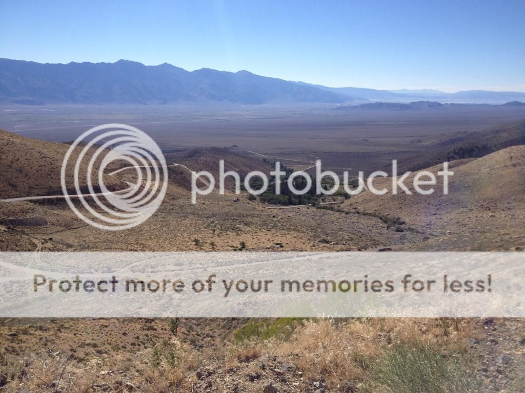
At the campground I stopped for a snack and to refill the water bottles. From here it was on to the heart of the climb, a series of switchbacks. The first one seemed to be the steepest of them all. Compared to the first half do the ride, the second half was a joy as the scenery crept changing with every turn. Occasional the views would open up to see the lower switchbacks and the Owen valley. I stopped a few times for pictures, but other than that kept chugging up switchback after switchback.
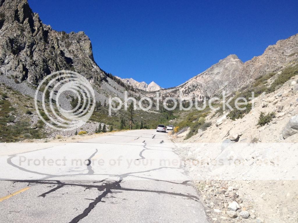
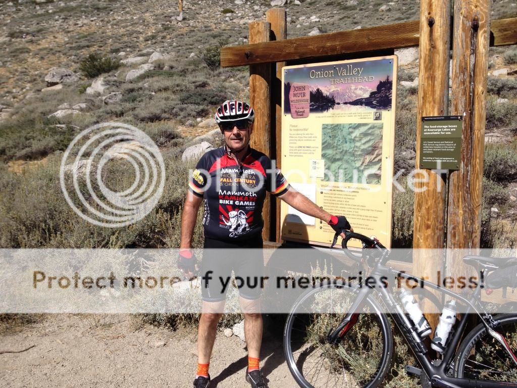
I reached the top in about 3 hours, not fast, but fast enough to reach the top! There were a few hikers at the top getting ready to head out and they were all generous in their praise of having conquered the hill.
Then it was back down. I kept the speed below 30 most of the way as I was worried about pinch flatting on the expansion joints. In less than 30 minutes I was back at the bottom. One hill checked off! Tomorrow Horseshoe Meadow
I'm not shy about saying what a fan of biker395's photos I am. His pictures of the eastern Sierra are so captivating that they have moved me to travel there in 2013 for the mammoth fall century and again this year for the same event. This time I decided to add some extra riding beforehand.
The eastern Sierra are like a huge wall dropping down into the Owens valley. Any roads up into them are bound to be steep and wild. I'm not sure when I first heard about roads like Onion valley, Horseshoe and Whitney Portal but over the last year the idea of riding these roads took hold.
I arrived in Independence on the 30th. I had made a reservation at grays meadow campground. The campground is on the Onion Valley road and I thought it would be a good base the first few days out.
For my first ride I chose Onion Valley. It was close and claims(Climbing by bike in California � John Summerson) are that it is the hardest ride. I started the climb at highway 395. The first 5 miles up to the campground are a soul crushing climb up the alluvial fan at the base of the mountain. Climbing up it looks like it should be flat, but it actually climbs more than 2000 feet.

At the campground I stopped for a snack and to refill the water bottles. From here it was on to the heart of the climb, a series of switchbacks. The first one seemed to be the steepest of them all. Compared to the first half do the ride, the second half was a joy as the scenery crept changing with every turn. Occasional the views would open up to see the lower switchbacks and the Owen valley. I stopped a few times for pictures, but other than that kept chugging up switchback after switchback.


I reached the top in about 3 hours, not fast, but fast enough to reach the top! There were a few hikers at the top getting ready to head out and they were all generous in their praise of having conquered the hill.

Then it was back down. I kept the speed below 30 most of the way as I was worried about pinch flatting on the expansion joints. In less than 30 minutes I was back at the bottom. One hill checked off! Tomorrow Horseshoe Meadow
 09-04-14, 11:41 PM
#2
Senior Member
Thread Starter
Join Date: Jul 2012
Location: Bay Area
Posts: 349
Mentioned: 0 Post(s)
Tagged: 0 Thread(s)
Quoted: 0 Post(s)
Likes: 0
Liked 0 Times
in
0 Posts
Horseshoe Meadows
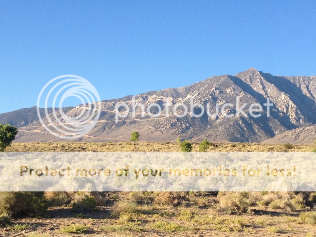
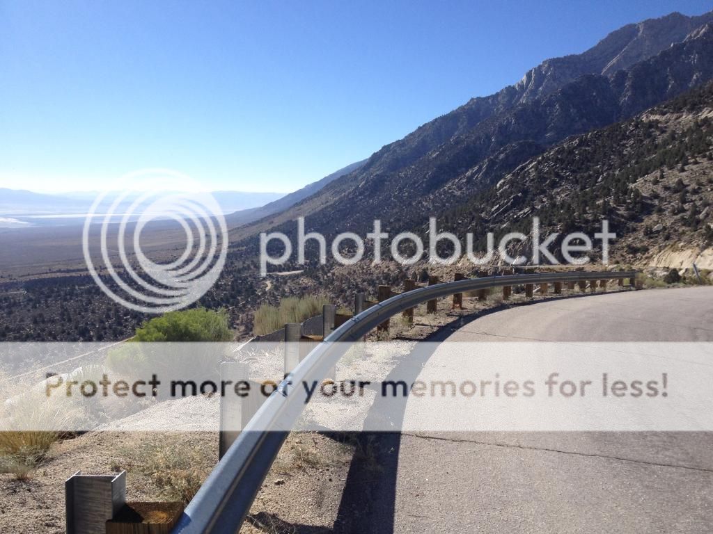
This was supposed to be the second hardest climb, but I found it harder than Onion Valley. It was longer, and my legs were still tired from the day before. The climb again starts from 395 up through Lubken Canyon then on to the alluvial plain, which I now officially despise.
It looks like it is level, but rises at a deceptive 3-7% grade. After a few agonizing miles of this it was on to the first switchback. Which kept going and going and going.
The first leg went on for 2 miles before finally doubling back and going a slightly more tolerable 1.7 miles. I like switch backs because the scenery changes every time you double back. As these roads meandered along the cliff face I wondered if they would ever loop back.
Worried about hydration I had brought along a camelback. I almost dumped it at the car because it leaked all over me, but after dropping the water level some it worked out fine. I was glad I had brought it along. It lasted until about mile 12 where I cached it to pick up on the way back down. Shortly before that I was passed by another cyclist who had clearly had a lot of experience on this mountain! We exchanged greeting and he tooled on ahead. He was "wearing" his helmet on his handlebars. Normally I am anal about wearing my helmet, but after wiping the sweat from my eyes one more time I took it off and found it a lot cooler going. At about mile 14 I started dragging and came close to turning back but forged ahead. At mile 16 the road took its first and only downhill for about 1/2 a mile.
I enjoyed the downhill but knew I would pay for it on the way back up. The last stretch was a little more shallow and through beautiful pine forest. The "official" climb ends at the pack station at a little over 10000 feet so that is what I did. I rested a little, took on water (sweet mountain water).
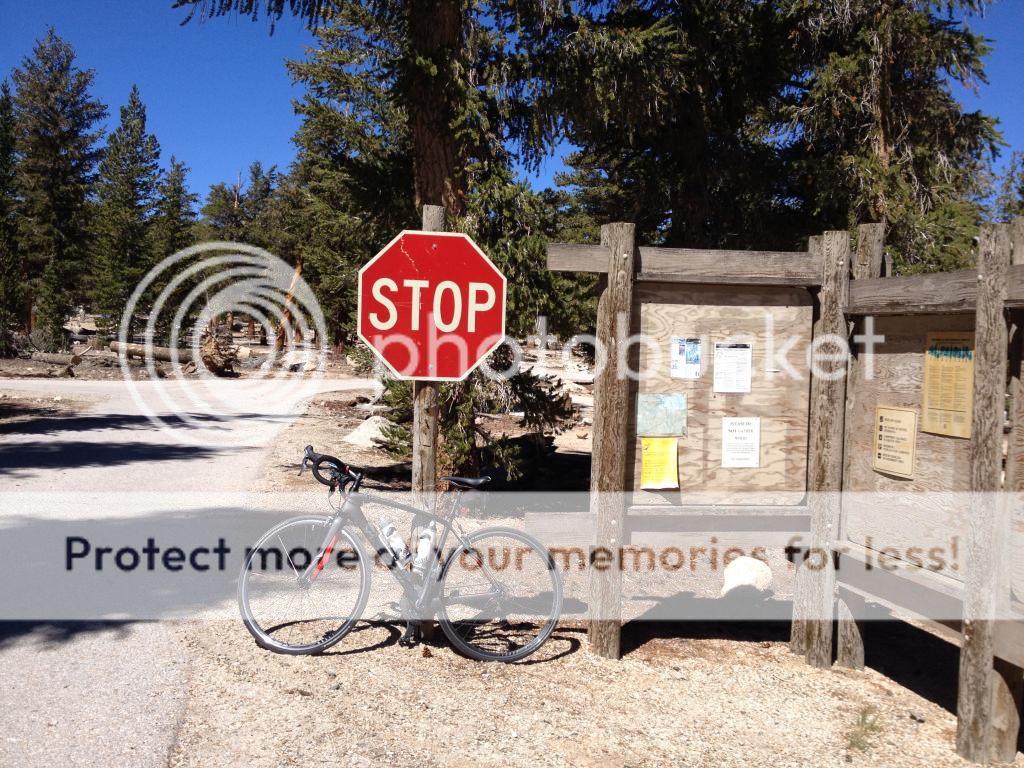
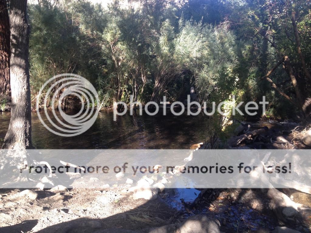
Got a pic of my bike in front of a stop sign (unlike the day before, no one was close by to snap a pic) and headed down. I kept my speed down to 30 most of the ways, and stopped a few times to snap some photos and rest my hands which were now cramping from using the brakes. You would think going down a big hill would be a bad time to have a flat, but when I had mine it wasn't serious. I flatted just after turning on to the last switchback so my speed was still slow coming out of the corner. I replaced the tire (had 3 cars stop and ask if I needed help, which was nice) and headed on down. I hit my highest speed on the alluvial section (I still hate them though) and shortly after was back at the car. Due to stopping at the top, the flat and my general slowness, it was now noon and over 95degrees. I hightailed it back to camp to soak my feet in the stream and write this installment!
This was supposed to be the second hardest climb, but I found it harder than Onion Valley. It was longer, and my legs were still tired from the day before. The climb again starts from 395 up through Lubken Canyon then on to the alluvial plain, which I now officially despise.

It looks like it is level, but rises at a deceptive 3-7% grade. After a few agonizing miles of this it was on to the first switchback. Which kept going and going and going.

The first leg went on for 2 miles before finally doubling back and going a slightly more tolerable 1.7 miles. I like switch backs because the scenery changes every time you double back. As these roads meandered along the cliff face I wondered if they would ever loop back.

Worried about hydration I had brought along a camelback. I almost dumped it at the car because it leaked all over me, but after dropping the water level some it worked out fine. I was glad I had brought it along. It lasted until about mile 12 where I cached it to pick up on the way back down. Shortly before that I was passed by another cyclist who had clearly had a lot of experience on this mountain! We exchanged greeting and he tooled on ahead. He was "wearing" his helmet on his handlebars. Normally I am anal about wearing my helmet, but after wiping the sweat from my eyes one more time I took it off and found it a lot cooler going. At about mile 14 I started dragging and came close to turning back but forged ahead. At mile 16 the road took its first and only downhill for about 1/2 a mile.

I enjoyed the downhill but knew I would pay for it on the way back up. The last stretch was a little more shallow and through beautiful pine forest. The "official" climb ends at the pack station at a little over 10000 feet so that is what I did. I rested a little, took on water (sweet mountain water).

Got a pic of my bike in front of a stop sign (unlike the day before, no one was close by to snap a pic) and headed down. I kept my speed down to 30 most of the ways, and stopped a few times to snap some photos and rest my hands which were now cramping from using the brakes. You would think going down a big hill would be a bad time to have a flat, but when I had mine it wasn't serious. I flatted just after turning on to the last switchback so my speed was still slow coming out of the corner. I replaced the tire (had 3 cars stop and ask if I needed help, which was nice) and headed on down. I hit my highest speed on the alluvial section (I still hate them though) and shortly after was back at the car. Due to stopping at the top, the flat and my general slowness, it was now noon and over 95degrees. I hightailed it back to camp to soak my feet in the stream and write this installment!
 09-04-14, 11:48 PM
#3
Senior Member
Thread Starter
Join Date: Jul 2012
Location: Bay Area
Posts: 349
Mentioned: 0 Post(s)
Tagged: 0 Thread(s)
Quoted: 0 Post(s)
Likes: 0
Liked 0 Times
in
0 Posts
Day three Whitney Portal.
I debated taking a rest day but decided to do this last one before heading up towards Mammoth. If I waited another day that would put me too close to the century ride coming up on Saturday. I again tried to head out before the sun was up, but to no avail. The ride out of lone pine started nicely with a route through the Alabama Hills - location shooting for a lot of old time westerns. Once you've seen the hills you will immediately connect them with movies you've seen.
I really enjoyed this instead of the damn alluvial fan, but alas as I rounded a bend, there it was between me and Whitney.
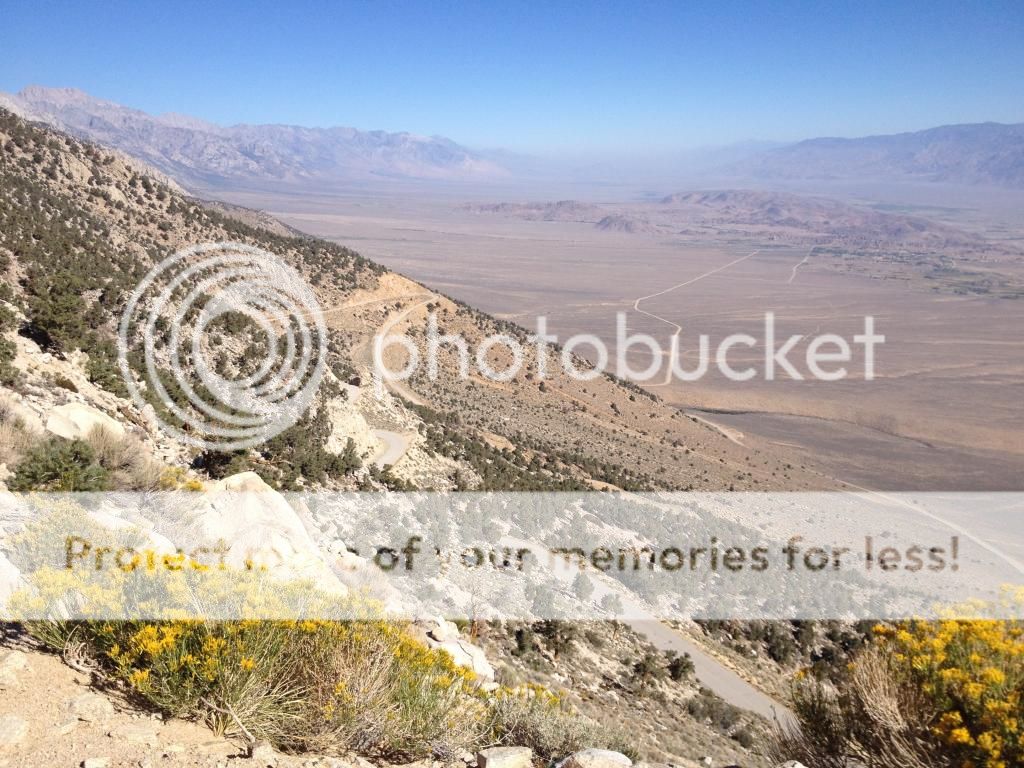
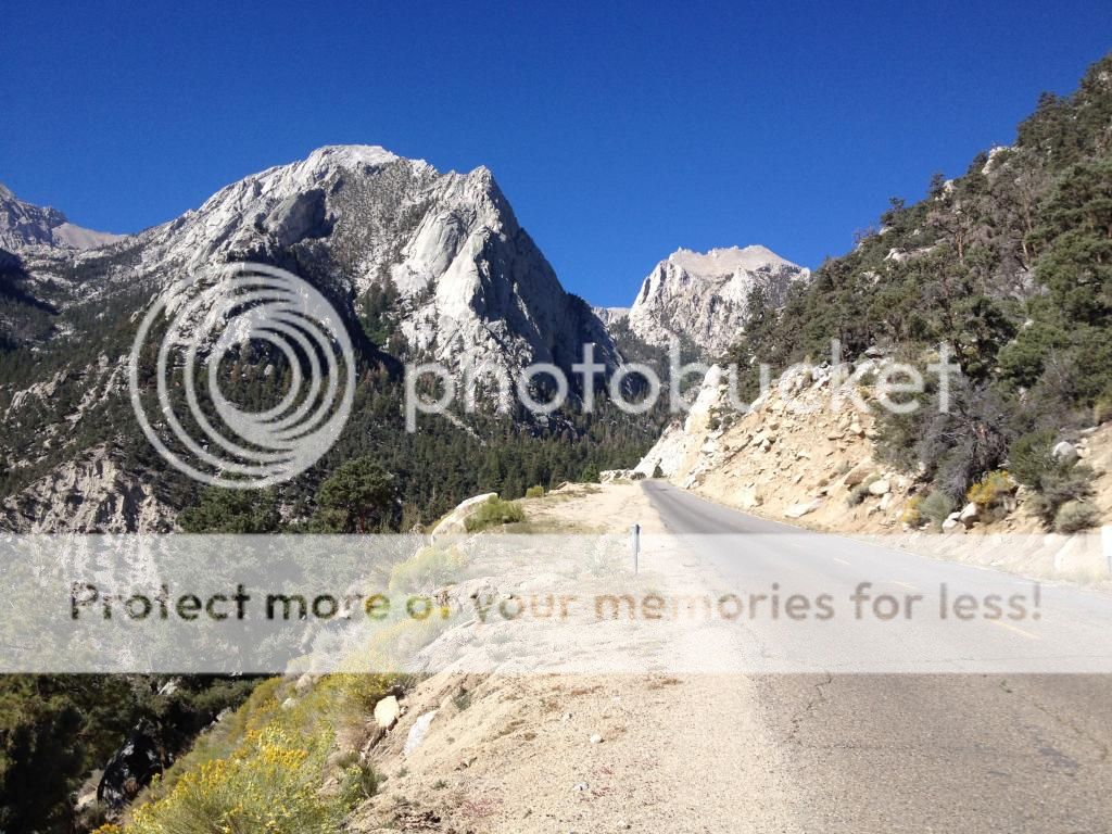
I think the worst part is you keep seeing the switchbacks ahead but they never get closer. Unlike the other rides, Whitney seemed to only have one switchback. And it was a doozy. The guidebook had said the real climbing starts "when the road turns right" and starts up the switchback. The steep section actually starts about 1 mile before that when the road decides to stop meandering across the plain and shoots straight for the base of the mountain. My garmin was showing 10-12% grades on this section.
Did I mention I was getting worn out from all the climbing I had been doing over the last few days? I was taking a lot more breaks today, but kept plodding along. I realized as I started up the first switchback I would make it, purely because I never wanted to do the lower section again. By the way, this "lower" section takes up more than half the total ride.
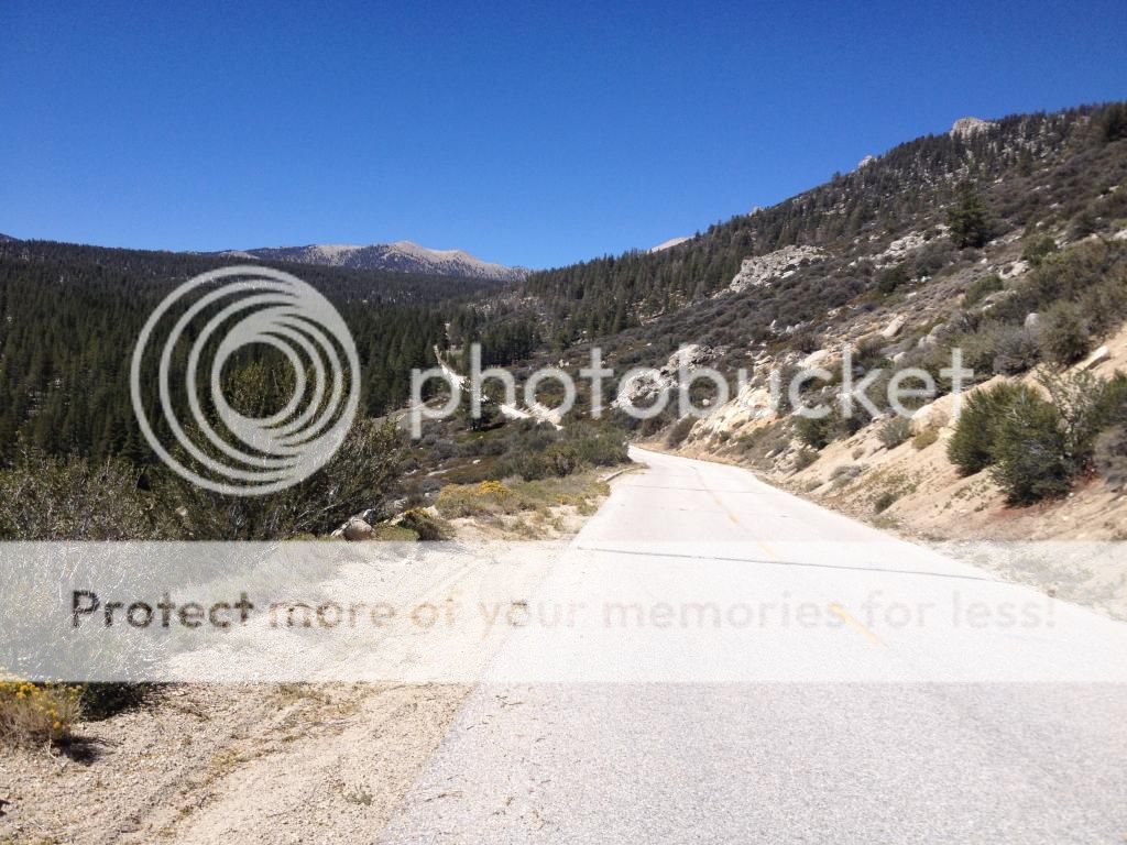
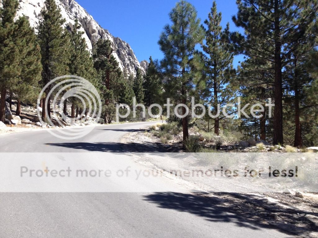
Once on the switchback I put my head down and kept going forward....slowly. At the top of the second leg, the road turns up a canyon and eases off a I bit.
About 2/3rd of the way up the canyon a couple in a car stopped, got out and started cheering me on. That was awesome! At this point I was ten miles into the ride, and shortly thereafter started seeing signs of civilization. I couldn't let that couple down so I vowed to keep going to the end without stopping. Since I was already at the 10 mile mark I didn't think it would be that bad. Before the end though the mountain threw one other surprise at me with another switchback.
Shortly after I rolled past the sign for the Mount Whitney trail and finally the top at the Whitney portal store.
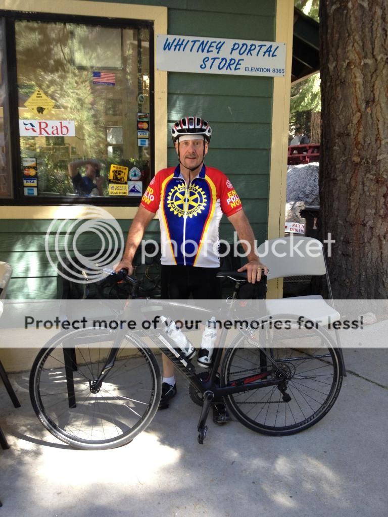
There was a fair crowd of hikers there and I got a few attaboys when I stopped. Because they were still serving breakfast I treated myself to hash browns and eggs and a coke. I dallied a little bit after that, reluctant to leave, just wanting to take in what I had done a little longer. Eventually though I clipped up and headed back down. It took less than 30 minutes to get back down and to the car.
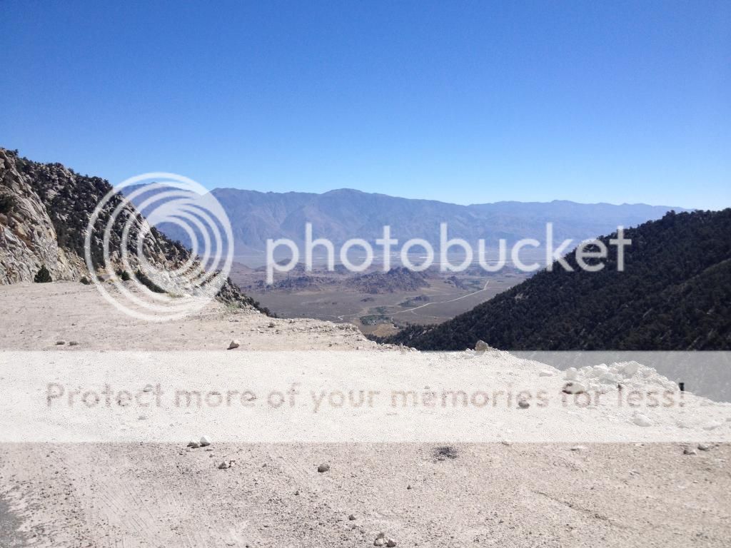
I still have some hills for future trips � White Mountains, Rock Creek, South Lake and Sabrina are on the list but this was enough of an adventure for this time. In doing these rides I learned a lot about will power, perseverance, and positive visualization. I focused on hydration and not bonking, and just decided to take whatever time it took to go up. The pictures don�t do justice to just how huge these climbs are, they are truly epic, but also possible for a very average climber such as myself to achieve. Next up, Mammoth Fall Century!
I debated taking a rest day but decided to do this last one before heading up towards Mammoth. If I waited another day that would put me too close to the century ride coming up on Saturday. I again tried to head out before the sun was up, but to no avail. The ride out of lone pine started nicely with a route through the Alabama Hills - location shooting for a lot of old time westerns. Once you've seen the hills you will immediately connect them with movies you've seen.

I really enjoyed this instead of the damn alluvial fan, but alas as I rounded a bend, there it was between me and Whitney.

I think the worst part is you keep seeing the switchbacks ahead but they never get closer. Unlike the other rides, Whitney seemed to only have one switchback. And it was a doozy. The guidebook had said the real climbing starts "when the road turns right" and starts up the switchback. The steep section actually starts about 1 mile before that when the road decides to stop meandering across the plain and shoots straight for the base of the mountain. My garmin was showing 10-12% grades on this section.

Did I mention I was getting worn out from all the climbing I had been doing over the last few days? I was taking a lot more breaks today, but kept plodding along. I realized as I started up the first switchback I would make it, purely because I never wanted to do the lower section again. By the way, this "lower" section takes up more than half the total ride.

Once on the switchback I put my head down and kept going forward....slowly. At the top of the second leg, the road turns up a canyon and eases off a I bit.

About 2/3rd of the way up the canyon a couple in a car stopped, got out and started cheering me on. That was awesome! At this point I was ten miles into the ride, and shortly thereafter started seeing signs of civilization. I couldn't let that couple down so I vowed to keep going to the end without stopping. Since I was already at the 10 mile mark I didn't think it would be that bad. Before the end though the mountain threw one other surprise at me with another switchback.

Shortly after I rolled past the sign for the Mount Whitney trail and finally the top at the Whitney portal store.

There was a fair crowd of hikers there and I got a few attaboys when I stopped. Because they were still serving breakfast I treated myself to hash browns and eggs and a coke. I dallied a little bit after that, reluctant to leave, just wanting to take in what I had done a little longer. Eventually though I clipped up and headed back down. It took less than 30 minutes to get back down and to the car.

I still have some hills for future trips � White Mountains, Rock Creek, South Lake and Sabrina are on the list but this was enough of an adventure for this time. In doing these rides I learned a lot about will power, perseverance, and positive visualization. I focused on hydration and not bonking, and just decided to take whatever time it took to go up. The pictures don�t do justice to just how huge these climbs are, they are truly epic, but also possible for a very average climber such as myself to achieve. Next up, Mammoth Fall Century!
09-04-14, 11:50 PM
#4
Senior Member
Thread Starter
Join Date: Jul 2012
Location: Bay Area
Posts: 349
Mentioned: 0 Post(s)
Tagged: 0 Thread(s)
Quoted: 0 Post(s)
Likes: 0
Liked 0 Times
in
0 Posts
For those interested, here are the Strava records of the rides:
Bike Ride Profile | Onion Valley near Independence | Times and Records | Strava
Bike Ride Profile | Horseshoe Meadow near Lone Pine | Times and Records | Strava
Bike Ride Profile | Whitney Portal near Lone Pine | Times and Records | Strava
Bike Ride Profile | Onion Valley near Independence | Times and Records | Strava
Bike Ride Profile | Horseshoe Meadow near Lone Pine | Times and Records | Strava
Bike Ride Profile | Whitney Portal near Lone Pine | Times and Records | Strava
09-05-14, 04:36 AM
#7
Senior Member
Join Date: Jul 2004
Location: northern michigan
Posts: 13,318
Bikes: '77 Colnago Super, '76 Fuji The Finest, '88 Cannondale Criterium, '86 Trek 760, '87 Miyata 712
Mentioned: 19 Post(s)
Tagged: 0 Thread(s)
Quoted: 660 Post(s)
Liked 600 Times
in
314 Posts
Is this California? Beautiful scenery and great ride!
09-05-14, 05:34 AM
#8

Semper Fi
Join Date: Jan 2008
Posts: 12,943
Mentioned: 89 Post(s)
Tagged: 0 Thread(s)
Quoted: 1172 Post(s)
Liked 358 Times
in
241 Posts
Outstanding report and pictures Dalameda, Kudos on making those climbs.
Bill
Bill
__________________
Semper Fi, USMC, 1975-1977
I Can Do All Things Through Him, Who Gives Me Strength. Philippians 4:13
Semper Fi, USMC, 1975-1977
I Can Do All Things Through Him, Who Gives Me Strength. Philippians 4:13
09-05-14, 05:46 AM
#9
Senior Member

1st class! I could read threads like this all day. Some days I do.
__________________
Momento mori, amor fati.
Momento mori, amor fati.
09-05-14, 06:43 AM
#11

Senior Member
Thanks a lot for sharing. I would sure like to get out that way and do some of the riding you've done. Congratulations on a great ride.
__________________
George
George
09-05-14, 09:06 AM
#13
Senior Member
Join Date: Jun 2006
Location: Walnut Creek, CA
Posts: 109
Bikes: Seven Alaris custom road bike
Mentioned: 0 Post(s)
Tagged: 0 Thread(s)
Quoted: 2 Post(s)
Likes: 0
Liked 1 Time
in
1 Post
Thanks, great story and pictures! I want to get out there for a ride someday.
09-05-14, 10:27 AM
#14
Senior Member
WOW!
Thanks for the pictures!
I gotta get out more.
Not saying I could do that climb... But maybe someday!
oh, and love the bike!
Thanks for the pictures!
I gotta get out more.
Not saying I could do that climb... But maybe someday!
oh, and love the bike!
09-05-14, 10:59 AM
#15
www.ocrebels.com
Join Date: Aug 2006
Location: Los Angeles area
Posts: 6,186
Bikes: Several bikes, Road, Mountain, Commute, etc.
Mentioned: 1 Post(s)
Tagged: 0 Thread(s)
Quoted: 83 Post(s)
Likes: 0
Liked 5 Times
in
2 Posts
Excellent photos and reports! I've done the Mt. Whitney climb but none of the others you did; great work!
I have done White Mountain, as the first 30 miles of the White Mountain Double, and it is a beautiful climb . . . but not easy! I remember getting to the summit and thinking, "After all that, only 170 miles to go today."
Rick / OCRR
I have done White Mountain, as the first 30 miles of the White Mountain Double, and it is a beautiful climb . . . but not easy! I remember getting to the summit and thinking, "After all that, only 170 miles to go today."
Rick / OCRR
09-05-14, 11:57 AM
#16
Beicwyr Hapus

Dalameda: Marvellous achievement and thanks for sharing it with us via those great photos.
I've driven up that Whitney Portal ride and would never have the guts to try it on a bike.
I've driven up that Whitney Portal ride and would never have the guts to try it on a bike.
09-05-14, 12:42 PM
#17
Seat Sniffer

Join Date: Sep 2007
Location: SoCal
Posts: 5,633
Bikes: Serotta Legend Ti; 2006 Schwinn Fastback Pro and 1996 Colnago Decor Super C96; 2003 Univega Alpina 700; 2000 Schwinn Super Sport
Mentioned: 18 Post(s)
Tagged: 0 Thread(s)
Quoted: 945 Post(s)
Liked 2,008 Times
in
572 Posts
First ... let me say that you picked a great title for that thread. 
Second ... thanks for the kudos for the Eastern Sierra pix. I love the place and love to share it with people.
Third ... we get a group together and ride up there once or twice a summer. Gimme your contact info, and I'll make sure you're invited next time.
Fourth ... Kudos to you! I've done the Horseshoe Meadow climb, but neither Whitney or Onion Valley. I know what you mean about those alluvial fans ... they're killers! The top of the fan near Grays Meadow is tough in a car, let alone a bike. Oh, and BTW ... great choice for a camping spot. Grays Meadow is one of my favorites. I have great memories of campfiring out there at night with the kids, watching the distant car lights crawling through the valley on US395.
And finally ... Have a great time on the High Sierra Fall Century this weekend! As I mentioned before, I do recommend that you stray from the official route and take in the June Lake Loop. It takes you 10 miles further, but you only have to backtrack a few hundred yards. It's the best part!
__________________
Proud parent of a happy inner child ...
Proud parent of a happy inner child ...
09-05-14, 01:10 PM
#18
Beicwyr Hapus
That whole area is beautiful and looks fantastic for cycling, but one question - is it possible to go for a relatively flat ride other than a very short one?
09-05-14, 01:45 PM
#19
www.ocrebels.com
Join Date: Aug 2006
Location: Los Angeles area
Posts: 6,186
Bikes: Several bikes, Road, Mountain, Commute, etc.
Mentioned: 1 Post(s)
Tagged: 0 Thread(s)
Quoted: 83 Post(s)
Likes: 0
Liked 5 Times
in
2 Posts
Rick / OCRR
09-05-14, 01:56 PM
#20
Seat Sniffer
Join Date: Sep 2007
Location: SoCal
Posts: 5,633
Bikes: Serotta Legend Ti; 2006 Schwinn Fastback Pro and 1996 Colnago Decor Super C96; 2003 Univega Alpina 700; 2000 Schwinn Super Sport
Mentioned: 18 Post(s)
Tagged: 0 Thread(s)
Quoted: 945 Post(s)
Liked 2,008 Times
in
572 Posts
Flat Owens Valley Tour - Inyo County, CA
Or, you could start in Bishop and do some riding on the surrounding roads. Something like this:
Bishop Loop - Inyo County, CA
That route takes you through some nice scenery and a narrow gauge railroad museum at Laws.
__________________
Proud parent of a happy inner child ...
Proud parent of a happy inner child ...
09-05-14, 03:23 PM
#21
Beicwyr Hapus
I stayed in Lone Pine for a few days 10 years ago and did a fair bit of hiking. In those days I hadn't got back into cycling but if I ever get that way again I'd like to try some riding - but not the hills ridden by dalameda, I'd need an oxygen cylinder!
09-06-14, 08:56 PM
#22
Senior Member
Thread Starter
Join Date: Jul 2012
Location: Bay Area
Posts: 349
Mentioned: 0 Post(s)
Tagged: 0 Thread(s)
Quoted: 0 Post(s)
Likes: 0
Liked 0 Times
in
0 Posts
Epilogue
i finished the week with the Mammoth Fall Century. 90 miles of awe inspiring views, and 5 miles of horrid uphill into the wind back to Mammoth Lakes. I forgot to charge my garmin so tried to use the iPhone instead but it idea day about mile 80. I didn't do the June lake detour but did do it last year as a training ride, and yes it is absolutely glorious. Gerryatkrick, it would make for a pleasant ride with one uphill south on 395.
thanks for all the great responses, and biker395, thanks for allowing me to play in your backyard!
09-07-14, 09:53 AM
#23
Senior Member

Great ride report. Reading this while my legs are still feeling the hills I rode yesterday makes your descriptions seem so much more life like.
Congrats on the Century too.
Congrats on the Century too.
09-07-14, 11:09 AM
#25
Let's do a Century

Join Date: Oct 2004
Location: North Carolina
Posts: 8,316
Bikes: Cervelo R3 Disc, Pinarello Prince/Campy SR; Cervelo R3/Sram Red; Trek 5900/Duraace, Lynskey GR260 Ultegra
Mentioned: 59 Post(s)
Tagged: 0 Thread(s)
Quoted: 651 Post(s)
Liked 879 Times
in
408 Posts
Outstanding! Gotta love the hills.
__________________
Ride your Ride!!
Ride your Ride!!

Thread
Thread Starter
Forum
Replies
Last Post
Rick@OCRR
Fifty Plus (50+)
31
05-14-14 08:02 AM
david58
Road Cycling
8
08-07-12 10:12 PM
Rick@OCRR
Fifty Plus (50+)
30
09-27-10 07:44 AM
Ben FR
Southern California
13
06-23-10 08:03 PM
Ben FR
Road Cycling
2
06-14-10 11:25 PM
