


Cycling over the Rocky Mountains
 02-20-19, 12:42 PM
#1
Junior Member
Thread Starter
Join Date: Jan 2019
Posts: 17
Mentioned: 0 Post(s)
Tagged: 0 Thread(s)
Quoted: 8 Post(s)
Likes: 0
Liked 18 Times
in
1 Post
Cycling over the Rocky Mountains
Hey friends. This summer I'll be cycling from NYC to San Francisco. My main concern (apart from the headwinds I will face due to heading east > west) is the rocky mountains. I plan on going through the rocky mountains west of Denver via the bike paths along i70. Has anybody done this? How is it? I expect it to be very challenging given the +5000 feet elevation gain over the course of 60 miles.
 02-20-19, 02:40 PM
#2
Senior Member
Join Date: Dec 2010
Location: northern Deep South
Posts: 8,903
Bikes: Fuji Touring, Novara Randonee
Mentioned: 36 Post(s)
Tagged: 0 Thread(s)
Quoted: 2604 Post(s)
Liked 1,931 Times
in
1,212 Posts
While I may be mistaken, I believe you'll have to find an alternate route for the first leg out of Denver. I-70 goes through the Eisenhower tunnel for about 12 miles, and you have a choice of going north through Granby, south through Colorado Springs, or over some gravel passes.
FWIW, the Adventure Cycling Trans America route goes through Canon City and turns north, running under I-70 around Silverthorne.
FWIW, the Adventure Cycling Trans America route goes through Canon City and turns north, running under I-70 around Silverthorne.
02-20-19, 02:42 PM
#3

Hooked on Touring
Looks as though you are new around here.
Unless you have a really big reason to cycle through Denver,
You should consider crossing the Rockies west of Fort Collins. (60 miles north of Denver)
East to west - - Use Colorado Hwy 14 to Walden, then US 40 to Utah.
This is a much safer route with less traffic and ample services.
Hwy 14 thru the Poudre Canyon is stunning.
You can bike on a canal service road deep into the wilderness at Cameron Pass if you wish.
Walden is on the TransAm with bike friendly camping at the park.
Steamboat is a upscale ski/summer town that is hip & pricey.
Gets pretty darn empty west of Craig.
Highly suggest jaunt from Jensen, Utah into Dinosaur National Monument - fabulous sheer wall scenery.
02-20-19, 05:01 PM
#4
Senior Member
Join Date: Apr 2016
Location: Ontario
Posts: 558
Bikes: HP Velotechnik Streetmachine GTE, 2015 Devinci Silverstone SL4, 2012 Cannondale Road Tandem 2, Circe Morpheus, 2021 Rose Backroad, 2017 Devinci Hatchet
Mentioned: 5 Post(s)
Tagged: 0 Thread(s)
Quoted: 181 Post(s)
Liked 14 Times
in
12 Posts
From reading along in this forum, it seems that this is not as obviously the case as it seems. Local prevailing winds can be very different and this might be good news for you. You should be able to find a few recent posts (past few weeks/months) on this in this sub-forum.
02-20-19, 07:28 PM
#5
Senior Member
Join Date: Feb 2012
Location: Golden, CO and Tucson, AZ
Posts: 2,837
Bikes: 2016 Fuji Tread, 1983 Trek 520
Mentioned: 13 Post(s)
Tagged: 0 Thread(s)
Quoted: 676 Post(s)
Liked 741 Times
in
430 Posts
I cycle over the Divide at Loveland Pass regularly and enjoy the trip. The bike routes along I-70 are great.
The grades are not difficult, 6% max in a few places. Altitude is noticeable at 12,000'. Wind is often as much a factor as the grade. You may need to time the Loveland Pass ascent to avoid afternoon electrical storms above tree line.
You may want to break the climb up over two days. Camping spots are kind of rare. There may be a warmshowers host in Idaho Springs or nearby. There are rustic cabins at a rafting and ziplining place past Idaho Springs. You might be able to find a campsite off trail along the Bakerville Loveland Trail on National Forest land.
02-20-19, 07:48 PM
#6
bicycle tourist
For what it is worth, you have quite a few paved passes over the continental divide in addition to following the I-70 corridor all the way.
Roughly speaking in Northern Colorado these include:
I-70 corridor until the tunnel where you don't go through but take US-6 over Loveland Pass instead.
I-70 corridor to Berthoud Pass where you follow US 40 over.
Trail Ridge Road where you follow US34 through Rocky Mountain National Park ending in Granby with US 40
CO-14 over Cameron Pass and then down to Walden (meeting the Adventure Cycling route coming from the south)
You can also come from the south via roughly the Arkansas Valley and cross over to Breckenridge on Hoosier Pass (Adventure Cycling Route), between Leadville/Copper via Fremont Pass or via Leadville/Vail via Tennessee Pass or Leadville/Aspen via Independence Pass. There are also passes a bit further south...
It depends a bit where you are coming from before Colorado and where you are headed afterwards...but my personal experience/biases include:
* Trail Ridge Pass is pretty awesome, though one has to watch for RVs and at time narrow roads. It is the highest crossing (barely, a little over 200ft higher than Loveland and also slightly higher than Independence Pass)
* Cameron Pass would be one of the easier passes, both total elevation and fairly gradual grades. If your previous travels brought you along the Platte in Nebraska there is a natural cutover from Sterling CO via Fort Collins.
* I wouldn't normally follow the I-70 corridor through rest of CO but instead find my way further north (US 40 via Steamboat/Craig/Vernal/etc) so if I got into the I-70 corridor, I would then head north via Willow Creek Pass or similar directions to head north...
02-20-19, 08:15 PM
#7
Senior Member

Join Date: Mar 2016
Location: Texas Hill Country
Posts: 276
Bikes: Invictus, Valeria, Jackie, and Vanguard
Mentioned: 0 Post(s)
Tagged: 0 Thread(s)
Quoted: 92 Post(s)
Likes: 0
Liked 10 Times
in
7 Posts
Colorado's hills pale in comparison to places like Utah, Nevada, and California. A day of riding in Texas Hill Country or in the Ozarks will provide you with more elevation gain. On a recent coast-to-coast ride, I had two days in eastern Kansas that had more climbing than the median day in Colorado.
Yes, parts of Colorado are at high elevation, but its mountains aren't particularly steep, and the roads are graded the opposite of aggressively. You'll be fine.
Yes, parts of Colorado are at high elevation, but its mountains aren't particularly steep, and the roads are graded the opposite of aggressively. You'll be fine.
02-20-19, 09:06 PM
#8
Senior Member

Join Date: May 2008
Location: Zang's Spur, CO
Posts: 9,083
Mentioned: 11 Post(s)
Tagged: 0 Thread(s)
Quoted: 3375 Post(s)
Liked 5,513 Times
in
2,856 Posts
Effective a couple years ago, you can now ride from Denver to Glenwood Springs following I-70 w/o actually riding on it!
Here is a Google Maps link of the route: https://www.google.com/maps/dir/Denv...39.5505376!3e1
At first glance it looks like a route down I-70, but note the bicycle mode is selected in the upper left of the screen, and when you zoom in, you will see either a MUP, or a parallel local road, or a detour up over Loveland Pass on US 6.
02-20-19, 11:05 PM
#9
Palmer

Join Date: Mar 2007
Location: Parts Unknown
Posts: 8,625
Bikes: Mike Melton custom, Alex Moulton AM, Dahon Curl
Mentioned: 37 Post(s)
Tagged: 0 Thread(s)
Quoted: 1667 Post(s)
Liked 1,820 Times
in
1,058 Posts
Hey, rdrumm729!
As shimangolo sez, it is no longer necessary to ride on any portion of the I70 shoulder between Denver and Glenwood Springs. Because of the narrow tunnels, Hwy6 is still off limits to bicycle travel west of Golden to I70, so cyclists have to take Hwy40 from ~Lookout Mountain to the I70/Hwy6 junction. From there it's an amazing ride on some of N.A.'s best paths, quiet side roads and of course the breathless Hwy6 over Loveland Pass. Dillon Reservoir, Ten Mile Canyon, Red Canyon, Hanging Lake, Glenwood Canyon! I'm jealous.
The east side of Loveland Pass is 4.5 miles at an average of 5.4% (but a maximum grade of ~9%). Depending on whether it was early or late in the stage, it would rate a cat1 or cat2. But, and it's a big but, the west side (downhill in your direction) is a loooooong 8.2 mile, 5.8% avg. downhill. Schweet.
If this was a single pathway, with just one name, and it was built on an old rail bed, it would be hailed as one of the premier trails in the country. Great ride!
02-21-19, 12:06 AM
#10

staring at the mountains

Join Date: Mar 2005
Location: Castle Pines, CO
Posts: 4,560
Bikes: Obed GVR, Fairdale Goodship, Salsa Timberjack 29
Mentioned: 6 Post(s)
Tagged: 0 Thread(s)
Quoted: 394 Post(s)
Liked 197 Times
in
112 Posts
check out the Triple Bypass route. While there may be easier ways, the route along i70 is pretty.
https://triplebypass.org/maps/
https://triplebypass.org/maps/
02-21-19, 07:26 AM
#11
Senior Member

Join Date: Apr 2011
Posts: 782
Mentioned: 1 Post(s)
Tagged: 0 Thread(s)
Quoted: 226 Post(s)
Liked 45 Times
in
32 Posts
Hey friends. This summer I'll be cycling from NYC to San Francisco. My main concern (apart from the headwinds I will face due to heading east > west) is the rocky mountains. I plan on going through the rocky mountains west of Denver via the bike paths along i70. Has anybody done this? How is it? I expect it to be very challenging given the +5000 feet elevation gain over the course of 60 miles.
02-21-19, 09:29 AM
#12
Senior Member
Join Date: Jan 2010
Posts: 39,237
Mentioned: 211 Post(s)
Tagged: 1 Thread(s)
Quoted: 18413 Post(s)
Liked 15,536 Times
in
7,328 Posts
Did you soak in the public pool in Saratoga? I went from there to Walden. Much of the day was into a vicious headwind. The four of us who ended up camping in the town park were all spent. But it was a pretty ride.
02-21-19, 12:23 PM
#13
Junior Member
Join Date: Jan 2016
Location: Long Island, NY
Posts: 17
Bikes: SURLY LHT, 1984 Pinarello (Vintage Campy Nuovo Record), Jamis XAM-1 MTB
Mentioned: 0 Post(s)
Tagged: 0 Thread(s)
Quoted: 10 Post(s)
Likes: 0
Liked 2 Times
in
2 Posts
Its funny I never see US Highway 50 posted as a cross country route. Used that from CA-NV border straight across middle of USA to Delaware. An abolutely great rouite that avoids modern interstate and goes through the heart of small town (some big) America. Crossed the Rockies west to east at Sargents , over Monarch Pass, and followed it through Pueblo on the other side. Hell of a climb matched by Hell of a downhill into Kansas.
02-21-19, 12:51 PM
#14
Senior Member
Join Date: Jan 2010
Posts: 39,237
Mentioned: 211 Post(s)
Tagged: 1 Thread(s)
Quoted: 18413 Post(s)
Liked 15,536 Times
in
7,328 Posts
Portions of it are discussed here from time to time. Some of it is used by Adventure Cycling's Western Express and Great Parks South routes. BITD I rode it from Poncha Springs to Montrose, CO while riding part of the latter.
02-21-19, 01:39 PM
#15
Banned
My Colorado raised friends, I met in California said , because it snows there every winter, the highway engineers got the roads graded less steep ..
than they are on the Coast range that never sees snow..
than they are on the Coast range that never sees snow..
02-21-19, 02:04 PM
#16
Palmer
Join Date: Mar 2007
Location: Parts Unknown
Posts: 8,625
Bikes: Mike Melton custom, Alex Moulton AM, Dahon Curl
Mentioned: 37 Post(s)
Tagged: 0 Thread(s)
Quoted: 1667 Post(s)
Liked 1,820 Times
in
1,058 Posts
Funny I never see the easiest crossing of North America's Great Continental Divide, New Mexico Hwy 9, mentioned as a cross country route. Maybe 'easier' and 'easiest' don't override ipso facto other considerations? 
02-21-19, 03:27 PM
#17
Full Member
Join Date: Jul 2018
Posts: 374
Mentioned: 2 Post(s)
Tagged: 0 Thread(s)
Quoted: 132 Post(s)
Liked 126 Times
in
87 Posts
Ironically, I just ordered a couple of books from Amazon about road biking in Colorado.
Also, I recently drove to Colorado on I-70 from Salina Kansas into Denver. Curious as to where to access the bike trails that follow I-70.
Also, I recently drove to Colorado on I-70 from Salina Kansas into Denver. Curious as to where to access the bike trails that follow I-70.
02-21-19, 05:38 PM
#18
20+mph Commuter

Join Date: Jul 2007
Location: Greenville. SC USA
Posts: 7,517
Bikes: Surly LHT, Surly Lowside, a folding bike, and a beater.
Mentioned: 31 Post(s)
Tagged: 0 Thread(s)
Quoted: 1434 Post(s)
Liked 331 Times
in
219 Posts
Both are good routes. Beautiful. You should consider a 3-day rest break immediately upon reaching between 5000-8000 ft to acclimate, and drink PLENTY of water. Other than the 3-days to let your blood get in shape for altitude, you will already be a freaking MONSTER from crossing the steep-a$$ed Appalachians and the Great Plains - uphill and against the wind! You will be fine in the Rocky Mountains, I promise! Other than typical mountain weather the Rockies will be a welcome mental relief from all that never-ending horizon through Kansas and Eastern Colorado that make you feel like you are getting nowhere.
Last edited by JoeyBike; 02-21-19 at 05:45 PM.
02-21-19, 05:46 PM
#19
Senior Member

Join Date: Nov 2015
Location: Dublin, Ireland
Posts: 1,268
Bikes: Bianchi Ti Megatube; Colnago Competition; Planet-X EC-130E; Klein Pulse; Amp Research B4; Litespeed Catalyst; Trek Y11
Mentioned: 8 Post(s)
Tagged: 0 Thread(s)
Quoted: 605 Post(s)
Liked 480 Times
in
260 Posts
check out the Triple Bypass route. While there may be easier ways, the route along i70 is pretty.
https://triplebypass.org/maps/
https://triplebypass.org/maps/
Well done on taking this on. There's gotta be books out there on the subject. You may need more tyres than you think. Maybe try to hook up with local sportives/events as you go?
Great adventure, I hope you can make a book out of it or something. Good luck!
02-21-19, 05:57 PM
#20
Senior Member
Join Date: May 2008
Location: Zang's Spur, CO
Posts: 9,083
Mentioned: 11 Post(s)
Tagged: 0 Thread(s)
Quoted: 3375 Post(s)
Liked 5,513 Times
in
2,856 Posts
Its funny I never see US Highway 50 posted as a cross country route. Used that from CA-NV border straight across middle of USA to Delaware. An abolutely great rouite that avoids modern interstate and goes through the heart of small town (some big) America. Crossed the Rockies west to east at Sargents , over Monarch Pass, and followed it through Pueblo on the other side. Hell of a climb matched by Hell of a downhill into Kansas.
02-21-19, 09:45 PM
#21
Senior Member
Join Date: Feb 2012
Location: Golden, CO and Tucson, AZ
Posts: 2,837
Bikes: 2016 Fuji Tread, 1983 Trek 520
Mentioned: 13 Post(s)
Tagged: 0 Thread(s)
Quoted: 676 Post(s)
Liked 741 Times
in
430 Posts
Heading eastbound, there's a tricky spot west of Idaho Springs, where there's a nice path to nowhere, but that's only a mile or so. You can either bushwhack down to the USFS office on Mt Evan Rd and a nice picnic area, or backtrack to the road. It's a fun area to explore--colorful old drinking towns with a mining problem.
02-21-19, 09:49 PM
#22
Senior Member
Join Date: May 2008
Location: Zang's Spur, CO
Posts: 9,083
Mentioned: 11 Post(s)
Tagged: 0 Thread(s)
Quoted: 3375 Post(s)
Liked 5,513 Times
in
2,856 Posts
 02-22-19, 06:33 AM
#23
Junior Member
Join Date: Jan 2016
Location: Long Island, NY
Posts: 17
Bikes: SURLY LHT, 1984 Pinarello (Vintage Campy Nuovo Record), Jamis XAM-1 MTB
Mentioned: 0 Post(s)
Tagged: 0 Thread(s)
Quoted: 10 Post(s)
Likes: 0
Liked 2 Times
in
2 Posts
Sheer coincidence; I just saw this article posted today: https://www.nationalgeographic.com/t...rica-route-50/
02-22-19, 08:57 AM
#24
Hooked on Touring
US 6 south of US 50 is far emptier. 168 miles between services.
US 50 has traffic counts of 600 daily vehicles in eastern Nevada.
US 6 has traffic counts in the 200 range east of Warm Springs.
Decades ago there used to be a scattering of cafe/bars on both US 50 & US 6.
On US 6, the ones at Warm Springs, Lockes, and Currant are long closed.
On US 50, Cold Springs and Major's Place are sometimes open, sometimes not.
I suspect that in another 5 or 10 years they will be gone, too.
Which makes cycling Nevada even harder.
I have been in touch with Nevada DOT to provide water for cyclists at DOT shops.
These are scattered across Nevada in very remote locations. Ideal for cyclists.
I have gotten all kinds of legalistic reasons why this cannot be done - -
but I am persisting and believe that some accommodations may soon be available.
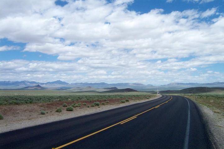
Pic - Stone Cabin Valley on US 6
 02-22-19, 09:04 AM
#25
Senior Member
Join Date: Apr 2008
Location: Salt Lake City, UT (Formerly Los Angeles, CA)
Posts: 1,145
Bikes: 2008 Cannondale Synapse -- 2014 Cannondale Quick CX
Mentioned: 5 Post(s)
Tagged: 0 Thread(s)
Quoted: 212 Post(s)
Likes: 0
Liked 83 Times
in
54 Posts
I would reconsider doing I-70 through Utah in the summer unless you're ready to ride through a desert where you will travel about 120 miles with no services whatsoever. Heading West from Green River there's a sign, "Next Services 117 Miles". On the other hand you'll pass near Moab, which is hard to pass up, except it is quite hot in the summer time.
I would prefer a route that goes through Utah along I-80 instead.
I would prefer a route that goes through Utah along I-80 instead.