


Concerns about using a mounted phone while touring
 08-01-20, 05:08 AM
#51
Senior Member
I don't recall how long ago it was that I carried and used one on a tour and am not sure where mine even is, but... It was really nice to be able to use rechargeable AA or AAA batteries and throw in some alkaline ones in a pinch.

 08-01-20, 07:39 AM
#52
Senior Member
Join Date: Aug 2010
Location: Madison, WI
Posts: 11,177
Bikes: 1961 Ideor, 1966 Perfekt 3 Speed AB Hub, 1994 Bridgestone MB-6, 2006 Airnimal Joey, 2009 Thorn Sherpa, 2013 Thorn Nomad MkII, 2015 VO Pass Hunter, 2017 Lynskey Backroad, 2017 Raleigh Gran Prix, 1980s Bianchi Mixte on a trainer. Others are now gone.
Mentioned: 47 Post(s)
Tagged: 0 Thread(s)
Quoted: 3452 Post(s)
Liked 1,452 Times
in
1,131 Posts
***
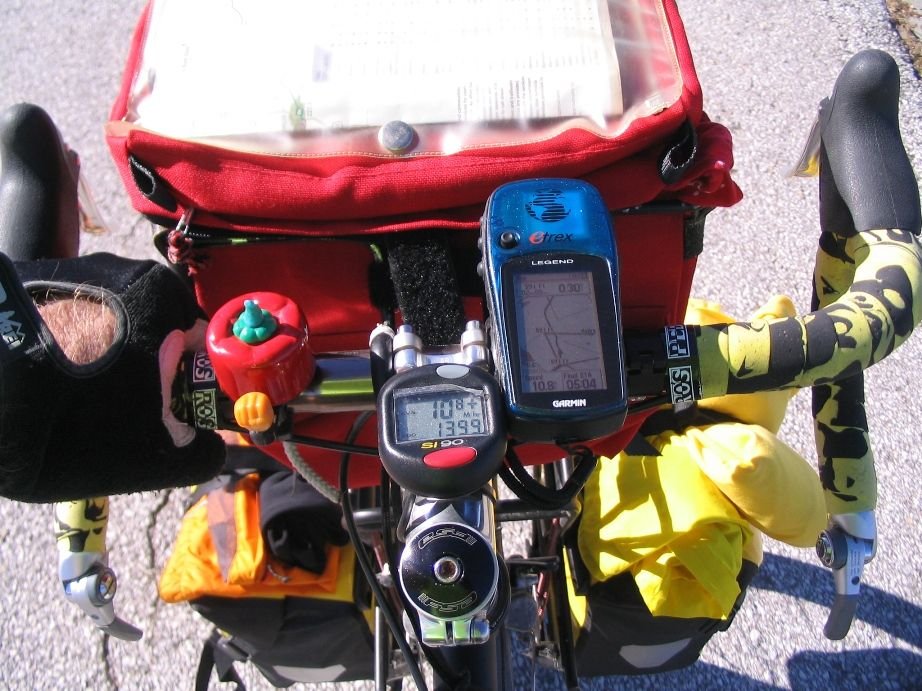
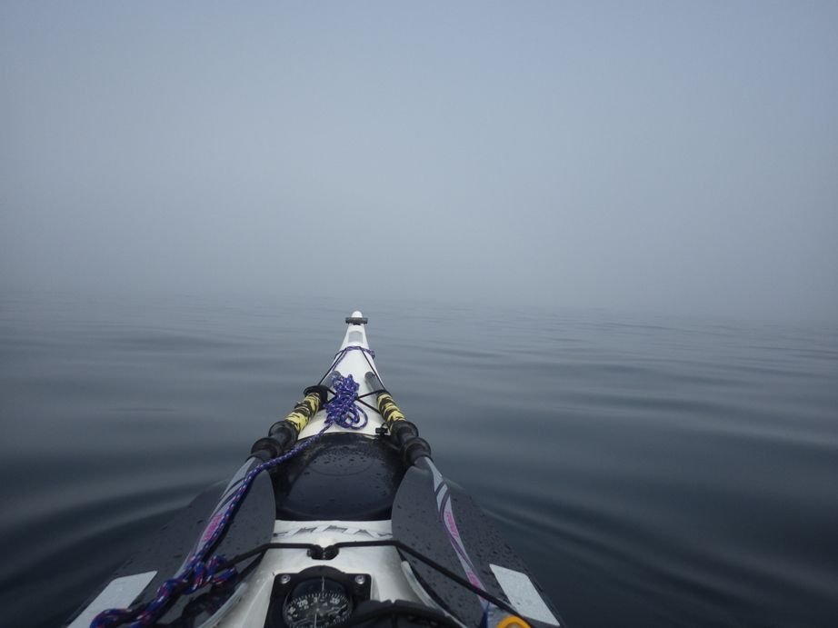
I prefer those old black and white screen models for kayaking and canoeing, screen stays on and I would have to take my hand off a paddle to push a button on it to wake up the screen if I had one of my color display ones. Has a long battery life and the black and white screens are quite readable in all light conditions. I used that same GPS on the day I paddled for several hours through the heavy fog on Lake Superior three years ago.
 08-01-20, 08:11 AM
#53
Senior Member
 08-01-20, 10:05 AM
#54
Sierra

or this....
Last edited by ChrisWagner; 08-12-20 at 11:18 AM.
08-01-20, 10:21 AM
#55
Senior Member
here's a general observation---generally I find it sufficiently useful even with google maps or whatever that gives you rough estimate of total gain during a days ride.
If I know for instance that a days ride over 75kms I'll be climbing 300 meters, that gives me an idea of how hard the day will be. If its 250 or 350 , then it is what it is and its close enough.
If a day is 50 kms and you'll be climbing 2000 meters, then you know you'll be getting your arse kicked all day and your average speed is going to be a lot slower.
to the fellow asking about this topic, you'll see that if you end up doing this trip,, pretty soon you get a feel for how a day is going to be. You learn to factor in wind, heat, how you are feeling that day etc, and while it can be nice to know that during the next day there is a big climb that tops out at 50kms from where yoiu start, then at least you can watch your bike computer distance and be mentally prepared for the climb and reasonably know when its going to end.
going over a next days ride the evening before when you have access to wifi or simply the time before sleeping if you have data, will at least give you a heads up of the next day. Specifically to this topic, if you make some notes like "climb starts at 30k and finishes at 45k" then this generally will lessen how much you need to use your phone for riding info. Less time phone is on, less time in the sun etc.
but like I said, you'll work it out on the road. And if you are terrible at planning or directionally challenged, well, you're going to have lots of time to improve if you do this trip, so it will all work out.
08-03-20, 10:55 PM
#56
Senior Member

I've tried to read every comment, so correct me if I'm wrong, but why is everyone talking about Google Maps? In Europe it is not much help at all. It does not show most bicycle routes or bike friendly roads. There are so many offline, downloadable apps available for free.
I use Maps.Me and it works very well, it even shows MTB and hiking trails.
I use Maps.Me and it works very well, it even shows MTB and hiking trails.
Likes For MarcusT:
08-09-20, 06:18 AM
#57
Senior Member
Get a quad lock phone mount system along with the poncho to make it water proof. The poncho has a whitish color to it and that will help reflect solar gain. However, it's a another layer wrapped around the phone, so it might retain heat. You can always wrap the phone in white cloth to reflect solar gain, and just listen to the voice prompts. The complete setup from quad lock is about $75.
We have quad locks on all of our bikes.
08-09-20, 08:27 AM
#58
bicycle tourist
I've tried to read every comment, so correct me if I'm wrong, but why is everyone talking about Google Maps? In Europe it is not much help at all. It does not show most bicycle routes or bike friendly roads. There are so many offline, downloadable apps available for free.
I use Maps.Me and it works very well, it even shows MTB and hiking trails.
I use Maps.Me and it works very well, it even shows MTB and hiking trails.
1. Maps.ME is offline, very useful in places without cell coverage. I found the bicycle route choices to generally be unusable since they often go way out of the way and adopt paths that may not even be allowed. The bicycle routes do show an elevation choice so if I can constrain them enough for a short distance, I can get an idea. Otherwise the auto instructions are good.
2. Google Map is online so that doesn't help when I don't have cell coverage - unless I have downloaded in advance. Still don't rely on bicycle route instructions but picking google maps auto instructions w/o interstates is pretty good. Unlike North America, bicycle instructions don't have elevation profiles, but they are better than Maps.ME. In the cities, Google maps is also better at indicating one-way streets.
For Canada+USA, I've found Maps.ME bicycle instructions to still be worse than Google Maps and often prefer the auto instructions in either case. Here it is often a difference between offline and online instructions where I prefer Google maps when online and think Maps.ME is a good solution for offline.


