


Pleasant and Scenic Rides in the United States
 11-26-23, 10:01 AM
#1

Junior Member
Thread Starter
Join Date: Sep 2015
Location: St. Louis, Missouri
Posts: 152
Bikes: Trek �monda SL 5, Trek Checkpoint SL 5, Giant Trance X 2, Trek Farley
Mentioned: 0 Post(s)
Tagged: 0 Thread(s)
Quoted: 77 Post(s)
Liked 95 Times
in
53 Posts
Pleasant and Scenic Rides in the United States
I am thinking about vacations for next year, and I want to plan more around cycling. Someone I follow on Strava posted a ride along the coast (in Spain), and that got me thinking about destinations in the US where I could ride scenic rides like that. Please reply with your suggestions. I am mainly thinking of road rides, but I'm certainly open to scenic bike trails. I'm not up for massive amounts of climb, especially at altitude, but I do appreciate a mountain view.
 11-26-23, 10:34 AM
#2
-------
Join Date: Jul 2020
Location: Tejas
Posts: 12,795
Mentioned: 2 Post(s)
Tagged: 0 Thread(s)
Quoted: 9653 Post(s)
Liked 6,365 Times
in
3,505 Posts
Lots in California, but 17 Mile Drive comes to my mind.
Likes For Mojo31:
11-26-23, 11:19 AM
#3
Senior Member
Join Date: Jan 2010
Posts: 39,246
Mentioned: 211 Post(s)
Tagged: 1 Thread(s)
Quoted: 18420 Post(s)
Liked 15,564 Times
in
7,333 Posts
Do you have a bike that can handle thing like unpaved Forest Service road?
Where are you located, and how far are you willing to travel?
How would you travel (car, plane, etc.)?
Presumably day rides?
How many miles/ride?
Where are you located, and how far are you willing to travel?
How would you travel (car, plane, etc.)?
Presumably day rides?
How many miles/ride?
11-26-23, 01:54 PM
#4
Junior Member
Thread Starter
Join Date: Sep 2015
Location: St. Louis, Missouri
Posts: 152
Bikes: Trek �monda SL 5, Trek Checkpoint SL 5, Giant Trance X 2, Trek Farley
Mentioned: 0 Post(s)
Tagged: 0 Thread(s)
Quoted: 77 Post(s)
Liked 95 Times
in
53 Posts
Where are you located, and how far are you willing to travel?
How would you travel (car, plane, etc.)?
Presumably day rides?
How many miles/ride?
11-26-23, 02:10 PM
#5
Senior Member
Join Date: Jan 2010
Posts: 39,246
Mentioned: 211 Post(s)
Tagged: 1 Thread(s)
Quoted: 18420 Post(s)
Liked 15,564 Times
in
7,333 Posts
Bitterroot 300K route. You could even start in Missoula and do and out an back to the loop.
Highlights include the CdA Trail, the Olympian Trail (assuming you ride to the loop from Missoula), the NorPac Trail and the Hiawatha Trail, which is arguably the most scenic in the country. The two mountain passes you cross are via rail miles, so no killer hills, but not flat. The Hiawatha and the continuation on the former Milwaukee Road right of way is mostly downhill hill for about 25 miles. Maximum elevation (Lookout Pass) is 4,711�.
The CdA is paved. The remaining trail miles are not. I can give you a map to get between Missoula and the loop. Requires a couple of relatively short segments of I-90 riding (legal), but they aren�t bad.
https://friendsofcdatrails.org/route...oot-300k-loop/
From Missoula you could also do an out and back on the 45 mile paved trail to Hamilton. Basically flat with some nice Mountain views.
Last edited by indyfabz; 11-26-23 at 02:21 PM.
11-26-23, 03:55 PM
#6
Senior Member
Join Date: Aug 2009
Location: Minneapolis
Posts: 5,752
Bikes: 2022 Salsa Beargrease Carbon Deore 11, 2020 Salsa Warbird GRX 600, 2020 Canyon Ultimate CF SLX disc 9.0 Di2, 2020 Catrike Eola, 2016 Masi cxgr, 2011, Felt F3 Ltd, 2010 Trek 2.1, 2009 KHS Flite 220
Mentioned: 20 Post(s)
Tagged: 0 Thread(s)
Quoted: 4392 Post(s)
Liked 3,016 Times
in
1,865 Posts
Bitterroot 300K route. You could even start in Missoula and do and out an back to the loop.
Highlights include the CdA Trail, the Olympian Trail (assuming you ride to the loop from Missoula), the NorPac Trail and the Hiawatha Trail, which is arguably the most scenic in the country. The two mountain passes you cross are via rail miles, so no killer hills, but not flat. The Hiawatha and the continuation on the former Milwaukee Road right of way is mostly downhill hill for about 25 miles. Maximum elevation (Lookout Pass) is 4,711�.
The CdA is paved. The remaining trail miles are not. I can give you a map to get between Missoula and the loop. Requires a couple of relatively short segments of I-90 riding (legal), but they aren�t bad.
https://friendsofcdatrails.org/route...oot-300k-loop/
From Missoula you could also do an out and back on the 45 mile paved trail to Hamilton. Basically flat with some nice Mountain views.
Highlights include the CdA Trail, the Olympian Trail (assuming you ride to the loop from Missoula), the NorPac Trail and the Hiawatha Trail, which is arguably the most scenic in the country. The two mountain passes you cross are via rail miles, so no killer hills, but not flat. The Hiawatha and the continuation on the former Milwaukee Road right of way is mostly downhill hill for about 25 miles. Maximum elevation (Lookout Pass) is 4,711�.
The CdA is paved. The remaining trail miles are not. I can give you a map to get between Missoula and the loop. Requires a couple of relatively short segments of I-90 riding (legal), but they aren�t bad.
https://friendsofcdatrails.org/route...oot-300k-loop/
From Missoula you could also do an out and back on the 45 mile paved trail to Hamilton. Basically flat with some nice Mountain views.
11-26-23, 03:56 PM
#7
Senior Member
Join Date: Aug 2009
Location: Minneapolis
Posts: 5,752
Bikes: 2022 Salsa Beargrease Carbon Deore 11, 2020 Salsa Warbird GRX 600, 2020 Canyon Ultimate CF SLX disc 9.0 Di2, 2020 Catrike Eola, 2016 Masi cxgr, 2011, Felt F3 Ltd, 2010 Trek 2.1, 2009 KHS Flite 220
Mentioned: 20 Post(s)
Tagged: 0 Thread(s)
Quoted: 4392 Post(s)
Liked 3,016 Times
in
1,865 Posts
11-26-23, 03:56 PM
#8
Full Member
Join Date: Mar 2017
Location: Franklin, TN
Posts: 423
Bikes: 2016 Cervelo R3 & 1999 Litespeed Tuscany
Mentioned: 0 Post(s)
Tagged: 0 Thread(s)
Quoted: 159 Post(s)
Liked 138 Times
in
79 Posts
Check out the Natchez Trace Parkway, a National Park running from Nashville, TN -> Natchez, MS. It's a low traffic (no commercial traffic allowed), beautiful road. It's within a day's drive from St. Louis so it shouldn't be too hard for you to get there.
Likes For MidTNBrad:
11-26-23, 06:52 PM
#9
Senior Member
Blue Ridge Parkway in Virginia/North Carolina.
I have not ridden ON it, but have done a number of rides that cross it. The climbs up to it are really tough, but once on the Parkway I am told not too bad. Beautiful area with scenic views.
I have not ridden ON it, but have done a number of rides that cross it. The climbs up to it are really tough, but once on the Parkway I am told not too bad. Beautiful area with scenic views.
Likes For bblair:
11-27-23, 12:02 PM
#10
Senior Member
Sonoma, CA. Santa Rosa to the coast, along the old Levi’s GranFondo route (pre pandemic) is breathtaking. Miles along the coast in Sonoma State Park, along the Russian River, and through vineyards.
Pescadero, CA, and along the SF Bay peninsula. Start in Pescadero, heading inland on Pescadero Creek Rd, climb (and then descend) to La Honda Rd. Head back to the coast. Stop in San Gregorio. Head north to tackle Tunitas Rd, one of the biggest climbs in the area - at the top you hit Skyline, and if you make it to a gap in the trees you can see the SF Bay on one side of the hills, and the foothills cascading to the Pacific on the other. If you decline to tackle Tunitas, head south from San Gregorio (again, on the PCH) for some great views. I haven’t done this but, but I’ve been told Duarte’s is a good spot for a post ride pie.
New York Five Boro bike tour. it’s not fast, and you have to deal with thousands of other cyclists (who all signed up for the 5Boro within a week of tickets becoming available), but you get to ride up 6th Ave, on the BQE, and across the Queensboro and Verrazano, while all the car traffic gets to wait for you. Of course, of the three times I did it, it rained twice…
11-28-23, 05:41 AM
#11
Senior Member
Join Date: Jan 2023
Location: Eastern Shore MD
Posts: 884
Bikes: Lemond Zurich/Trek ALR/Giant TCX/Sette CX1
Mentioned: 1 Post(s)
Tagged: 0 Thread(s)
Quoted: 569 Post(s)
Liked 772 Times
in
404 Posts
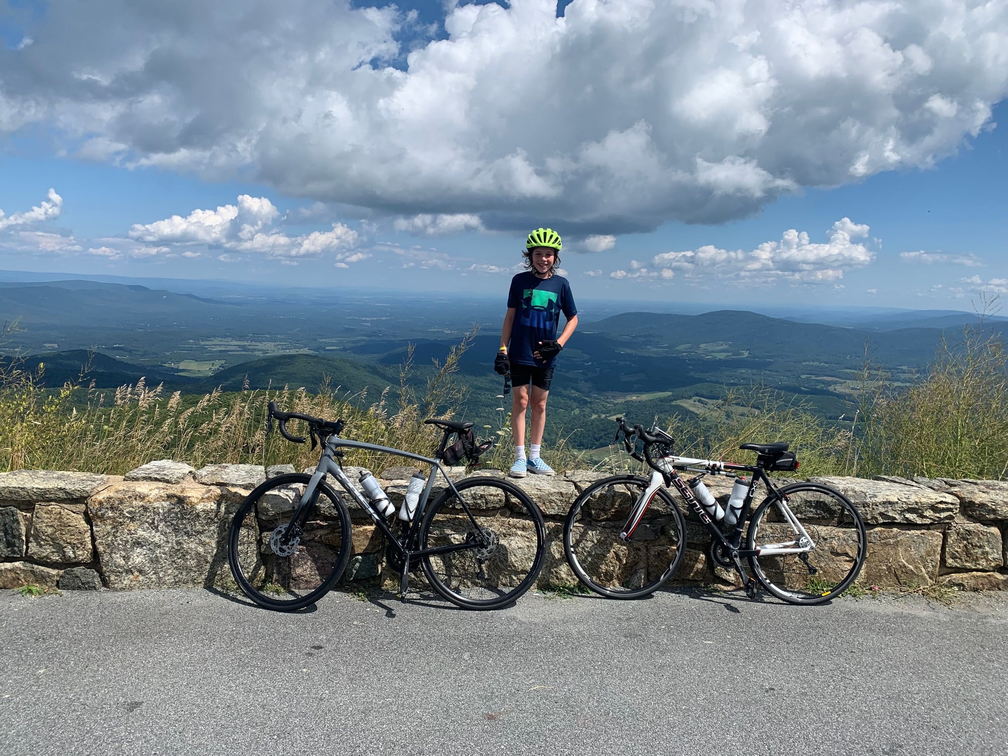
Second on the Blue Ridge Parkway, but I will also add its connector to the north - Skyline Drive.
Skyline Drive, starting at Front Royal - is one of the best rides I've ever been on. Light/courteous traffic, near perfect roads, 6%+/- max grades with long steady climbs, perfect moderate grades and sweeping turns on the descents - and great views. It's a national park, so traffic is limited to sightseers.
Skyline Drive, starting at Front Royal - is one of the best rides I've ever been on. Light/courteous traffic, near perfect roads, 6%+/- max grades with long steady climbs, perfect moderate grades and sweeping turns on the descents - and great views. It's a national park, so traffic is limited to sightseers.
11-28-23, 06:39 AM
#12
Tinker-er
Join Date: Oct 2007
Location: Mid-Atlantic
Posts: 450
Bikes: 1956 Rudge Sports; 1983 Univega Alpina Uno; 1981 Miyata 610; 1973 Raleigh Twenty; 1994 Breezer Lightning XTR; V4 Yuba Mundo aka "The Schlepper"; 1987 Raleigh "The Edge" Mountain Trials; 1952 R.O. Harrison "Madison"
Mentioned: 2 Post(s)
Tagged: 0 Thread(s)
Quoted: 165 Post(s)
Liked 267 Times
in
183 Posts
Most of the roads in New Mexico. The eastern part of the state is less inspiring but there are great rides all over. Down south, the Organ Mountains, Ruidoso, Carlsbad, White Sands. In the middle of the state you have the Manzano Mountains, Sandia Mountains, and the southern end of the Sangre De Cristo up towards the north into Colorado. Out west you have Mt. Taylor and getting towards the Mogollon Rim in Arizona. Northwest you are getting towards Mesa Verde across the state line in Colorado. If you start at the Four Corners, you can't fail to ride anywhere beautiful in any direction.
Likes For PhilFo:
11-28-23, 07:45 AM
#13

don't try this at home.

Join Date: Jan 2006
Location: N. KY
Posts: 5,940
Mentioned: 10 Post(s)
Tagged: 0 Thread(s)
Quoted: 974 Post(s)
Liked 512 Times
in
352 Posts
Blue Ridge Parkway
I don't like climbing up the Parkway from Asheville, either NE or SW. There's more traffic and lots of curves, making it difficult for cars to pass. Too annoying for me. The area near Grandfather Mountain was quite busy on the two times I was riding near there. A really nice ride except for the annoying traffic. There's quieter places to ride.
It can be difficult to make longer BRP routes that have water stops, which can be rare on the parkway. I usually need more than two bottles of water during a ride.
Ashville is fun to visit. There's lots of hiking trails all over the area, too.
Pisgah - Richland high country on the Parkway
Here's my favorite route on the Parkway. It's SW of Asheville. Way less traffic than near Asheville. The road follows the ridge lines there, with fantastic alternating views to the north or the south--zoom way in on the rwgps map to see the mountains. The Pisgah Inn at the halfway point has a restaurant with big windows overlooking a wide valley. I get a carryout box lunch and sit on the back deck. Richland Balsam is the highest point on the Blue Ridge Parkway, at 6050 feet.
Doubletop overlook to the Pisgah Inn.
This route has a mix of climbing and descending, good. The route link shows the overlooks along the route -- I stop at, or at least roll through each one! The biggest climb up past Graveyard Fields at mile 36 -- it's 1200 feet and almost 4 miles. There's overlooks at halfway up and again at the 80% point, and it's a steady 6%-8% grade. I have gearing that lets me stay seating with a reasonably fast cadence, and I'm in no hurry on this ride, with a 10-11 mph average speed. It's a lot more climbing than I do on local rides, which are 2000,2500, or 3000 feet typically.
The 2018 ride recording: Doubletop-RIchland Balsam-Pisgah Inn
This is an out and back and could be shortened. For example, parking at the Wolf Mountain overlook (mile 11 on this the route) is 33 miles and 3300 feet of climbing. Then make an optional climb up to Richland Balsam if you still have energy left after returning to the car -- that's 7 miles and 980 feet to Richland, 7 miles and 450 feet on the return, with the 980 feet of downhill too.
The longest version starts at the Pinnacle Ridge tunnel overlook, for 62 miles and 6800 feet of climbing. At the end, past RIchland, it's 1500 feet downhill along with 200 feet of climbing.
~~~
The North Carolina section of the Parkway:
This part of the Parkway has shorter climbs, and low traffic. It's fewer grand vistas, but there are some very nice ones. It's more small scale scenery closer to the road.I liked it.
Cumberland Knob to the Doughton cafe
47 miles, 3700 feet.
I used to ride this route a lot when I was traveling to NC. The Bluffs restaurant was a good water, restrooms and food refueling stop.
This is an interesting route, starting with rolling forests and rhododendron bushes. Then farmland vistas, then climbing up to long views in the mountains.
The 6 miles of climbing starting at mile 13 is mostly moderate grades, with 300-350 foot climbing followed by short downhills, then climb again. That's great for riding.
The final 19 miles are 2000 feet descending, with 900 feet of climbing along the way, mostly on 100 foot or shorter climbs. Nice!
Moses Cone area
This was the first BRP ride I did, years ago. I trained for the 1000 foot climb, which seemed intimidating back then. But with the steady grade and interesting views, I reached the top quite easily. Surprising to me back then. (Now I know that a 1200 foot climb is much easier than 4 local climbs of 300 feet each -- on long climbs, I just settle into a maintainable pace.)
I haven't been back here for years. It might have more traffic than I like?
Raven Rock - Moses Cone - Linn Cove Viaduct
The Moses Cone mansion is a crafts center, very interesting.
The Viaduct is that famous curving bridge along the side of Grandfather Mountain, designed to minimally impact the terrain below the bridge.
~~~
In Virginia, I liked the riding near the famous Mabry Mill too.
Last edited by rm -rf; 11-28-23 at 08:10 AM.
11-28-23, 12:05 PM
#14
climber has-been
Join Date: Dec 2004
Location: Palo Alto, CA
Posts: 7,111
Bikes: Scott Addict R1, Felt Z1
Mentioned: 10 Post(s)
Tagged: 0 Thread(s)
Quoted: 3432 Post(s)
Liked 3,567 Times
in
1,793 Posts
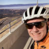
Can't fail to mention the Big Sur area. Some of the coastal views are pretty spectacular.
Climbing away from the coast is Nacimiento-Fergusson Road. Not a terribly long or hard climb, and the views are nuts. And forget about traffic--the road ends at the Hunter Liggett military base.
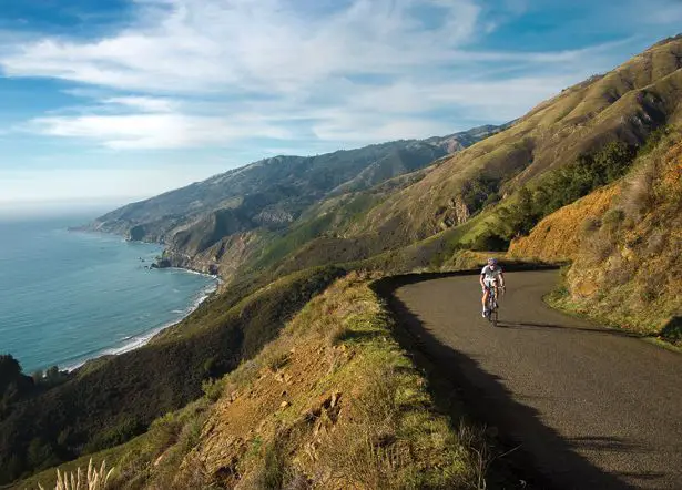
But don't head out there just now. Nacimiento-Fergusson, and some other roads in the area, are closed. No estimate of when it will be reopened.
Climbing away from the coast is Nacimiento-Fergusson Road. Not a terribly long or hard climb, and the views are nuts. And forget about traffic--the road ends at the Hunter Liggett military base.
But don't head out there just now. Nacimiento-Fergusson, and some other roads in the area, are closed. No estimate of when it will be reopened.
__________________
Ride, Rest, Repeat. ROUVY: terrymorse

Ride, Rest, Repeat. ROUVY: terrymorse
11-29-23, 02:22 PM
#15
Full Member
Join Date: Jul 2018
Posts: 374
Mentioned: 2 Post(s)
Tagged: 0 Thread(s)
Quoted: 136 Post(s)
Liked 128 Times
in
88 Posts
Check out The Silver Comet Trail. Dedicated Rail/Trail bike path. Begins in Atlanta/Smyrna Georgia for about 50 miles to Cedartown GA at the GA Alabama line. Then becomes Chief Ladega Trail for another 50 miles to Anniston AL.
Plenty of lodging and food accommodations.
Plenty of lodging and food accommodations.
11-29-23, 08:16 PM
#16
Senior Member
Join Date: May 2014
Location: Treasure Coast, FL
Posts: 987
Bikes: 2014 Cannondale Supersix EVO 3, 2015 Trek 520, 2017 Bike Friday Pocket Rocket, 2022 Moots Vamoots Disc RSL
Mentioned: 8 Post(s)
Tagged: 0 Thread(s)
Quoted: 285 Post(s)
Liked 267 Times
in
140 Posts
Key Largo to Key West. I organized a century ride for four friends and me back in February 2018. We live about 2.5- 3 hours from Key Largo, so we left our area VERY EARLY and drove down to Key Largo. Five of us got out and rode 107 miles to Key West while one friend drove the van and was our SAG support. At the end of the ride, we showered in a public beach access park, climbed in the van, had dinner back in Key Largo and drove the home. It was a 23 hour day by the time I got home, but it was so much fun. You could do it in 2 or three days if you want too. You just need to figure out how you get back. One of the good things about this is you could do it in the dead of winter.
11-29-23, 11:26 PM
#17
velo-dilettante
Join Date: Apr 2009
Location: insane diego, california
Posts: 8,316
Bikes: 85 pinarello treviso steel, 88 nishiki olympic steel. 95 look kg 131 carbon, 11 trek madone 5.2 carbon
Mentioned: 26 Post(s)
Tagged: 0 Thread(s)
Quoted: 1628 Post(s)
Liked 3,114 Times
in
1,683 Posts
Sonoma, CA. Santa Rosa to the coast, along the old Levi’s GranFondo route (pre pandemic) is breathtaking. Miles along the coast in Sonoma State Park, along the Russian River, and through vineyards.
Pescadero, CA, and along the SF Bay peninsula. Start in Pescadero, heading inland on Pescadero Creek Rd, climb (and then descend) to La Honda Rd. Head back to the coast. Stop in San Gregorio. Head north to tackle Tunitas Rd, one of the biggest climbs in the area - at the top you hit Skyline, and if you make it to a gap in the trees you can see the SF Bay on one side of the hills, and the foothills cascading to the Pacific on the other. If you decline to tackle Tunitas, head south from San Gregorio (again, on the PCH) for some great views. I haven’t done this but, but I’ve been told Duarte’s is a good spot for a post ride pie.
New York Five Boro bike tour. it’s not fast, and you have to deal with thousands of other cyclists (who all signed up for the 5Boro within a week of tickets becoming available), but you get to ride up 6th Ave, on the BQE, and across the Queensboro and Verrazano, while all the car traffic gets to wait for you. Of course, of the three times I did it, it rained twice…
Pescadero, CA, and along the SF Bay peninsula. Start in Pescadero, heading inland on Pescadero Creek Rd, climb (and then descend) to La Honda Rd. Head back to the coast. Stop in San Gregorio. Head north to tackle Tunitas Rd, one of the biggest climbs in the area - at the top you hit Skyline, and if you make it to a gap in the trees you can see the SF Bay on one side of the hills, and the foothills cascading to the Pacific on the other. If you decline to tackle Tunitas, head south from San Gregorio (again, on the PCH) for some great views. I haven’t done this but, but I’ve been told Duarte’s is a good spot for a post ride pie.
New York Five Boro bike tour. it’s not fast, and you have to deal with thousands of other cyclists (who all signed up for the 5Boro within a week of tickets becoming available), but you get to ride up 6th Ave, on the BQE, and across the Queensboro and Verrazano, while all the car traffic gets to wait for you. Of course, of the three times I did it, it rained twice…
11-30-23, 07:16 AM
#18
Senior Member
Join Date: Oct 2010
Posts: 8,515
Mentioned: 69 Post(s)
Tagged: 0 Thread(s)
Quoted: 3241 Post(s)
Liked 2,512 Times
in
1,510 Posts
The Blue Ridge Parkway goes through Virginia as well. If climbing is not your thing, Virginia also has the Virginia Capital Trail and the Colonial Parkway. The new Fall Line Trail is also under construction. Those 3 all connect. Richmond hosted the UCI Road Cycling Championships in 2015. Those rides would be available also. That's a weeks worth of cycling/adventure/things to do there.
https://www.virginiacapitaltrail.org/#gsc.tab=0
https://www.nps.gov/colo/planyourvisit/maps.htm
https://www.falllineva.org/
https://www.virginiacapitaltrail.org/#gsc.tab=0
https://www.nps.gov/colo/planyourvisit/maps.htm
https://www.falllineva.org/
Last edited by seypat; 11-30-23 at 07:22 AM.
Likes For seypat:
11-30-23, 07:32 AM
#20
Senior Member
Join Date: Oct 2010
Posts: 8,515
Mentioned: 69 Post(s)
Tagged: 0 Thread(s)
Quoted: 3241 Post(s)
Liked 2,512 Times
in
1,510 Posts
Another possible destination with a video from the company above. I am not connected in any way, just happened to be on the playlist with the previous video.
11-30-23, 08:30 AM
#21
Senior Member
Join Date: Jan 2023
Location: Eastern Shore MD
Posts: 884
Bikes: Lemond Zurich/Trek ALR/Giant TCX/Sette CX1
Mentioned: 1 Post(s)
Tagged: 0 Thread(s)
Quoted: 569 Post(s)
Liked 772 Times
in
404 Posts
Another possible destination with a video from the company above. I am not connected in any way, just happened to be on the playlist with the previous video.
https://www.youtube.com/watch?v=dhj0NcWeUbM
https://www.youtube.com/watch?v=dhj0NcWeUbM
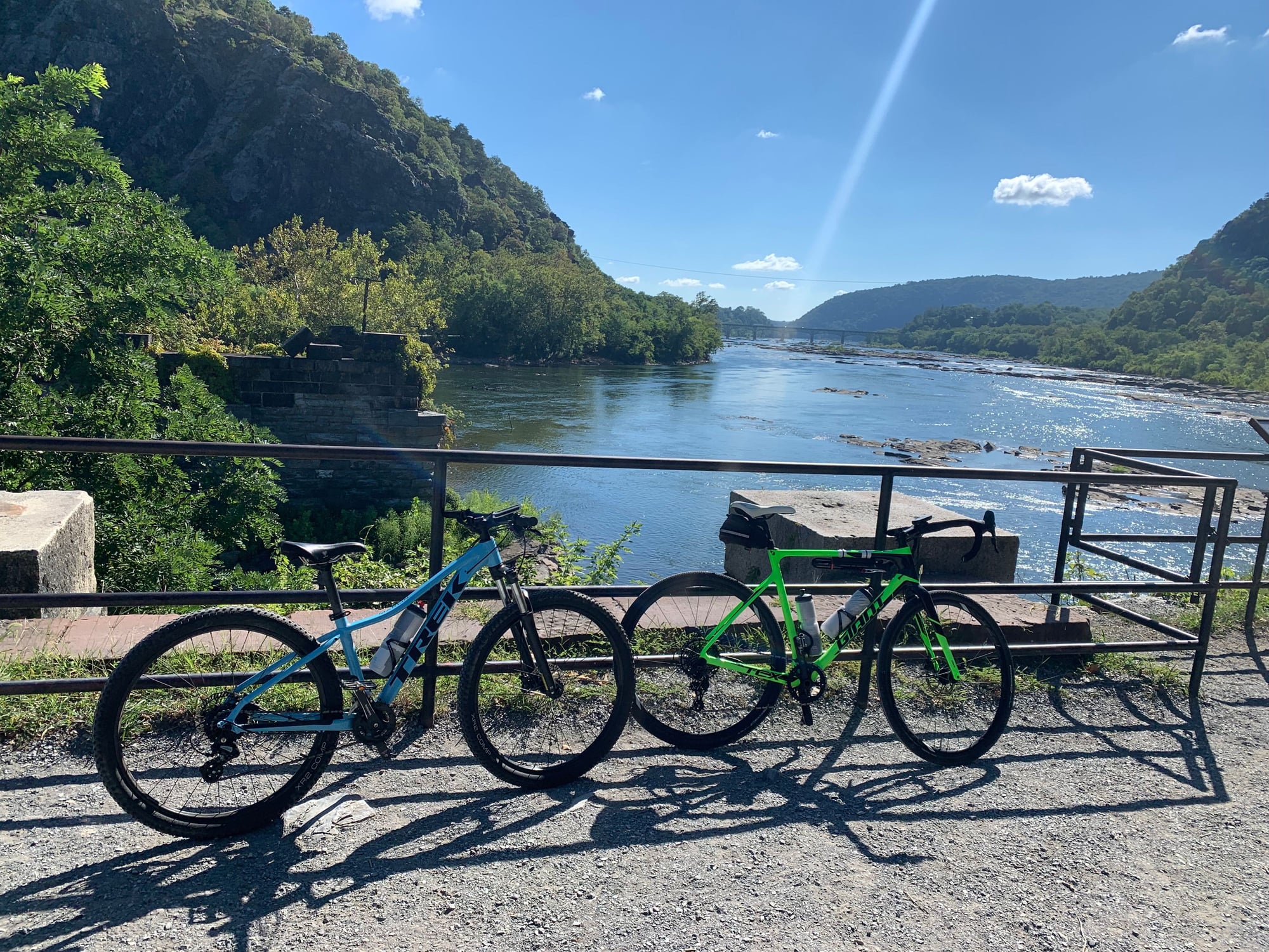
We hit the C&O at Harpers Ferry and ride east or west depending on the day - beautiful flat trail, very well maintained in that area, very scenic.
Front Royal is about 1 hour car ride from Harpers Ferry, plenty of places to stay. Can be on Skyline Drive one day (or two), and on the C&O the next...
Harpers Ferry is a great place to visit as well.
Skyline Drive:
Harpers Ferry @ the C&O
Last edited by Jughed; 11-30-23 at 08:34 AM.
11-30-23, 08:47 AM
#22
Senior Member
Join Date: Mar 2022
Location: Missoula MT
Posts: 1,767
Bikes: Handsome xoxo, Serotta atx, Canyon Endurace CF8
Mentioned: 1 Post(s)
Tagged: 0 Thread(s)
Quoted: 904 Post(s)
Liked 1,899 Times
in
849 Posts
Bitterroot 300K route. You could even start in Missoula and do and out an back to the loop.
Highlights include the CdA Trail, the Olympian Trail (assuming you ride to the loop from Missoula), the NorPac Trail and the Hiawatha Trail, which is arguably the most scenic in the country. The two mountain passes you cross are via rail miles, so no killer hills, but not flat. The Hiawatha and the continuation on the former Milwaukee Road right of way is mostly downhill hill for about 25 miles. Maximum elevation (Lookout Pass) is 4,711�.
The CdA is paved. The remaining trail miles are not. I can give you a map to get between Missoula and the loop. Requires a couple of relatively short segments of I-90 riding (legal), but they aren�t bad.
https://friendsofcdatrails.org/route...oot-300k-loop/
From Missoula you could also do an out and back on the 45 mile paved trail to Hamilton. Basically flat with some nice Mountain views.
Highlights include the CdA Trail, the Olympian Trail (assuming you ride to the loop from Missoula), the NorPac Trail and the Hiawatha Trail, which is arguably the most scenic in the country. The two mountain passes you cross are via rail miles, so no killer hills, but not flat. The Hiawatha and the continuation on the former Milwaukee Road right of way is mostly downhill hill for about 25 miles. Maximum elevation (Lookout Pass) is 4,711�.
The CdA is paved. The remaining trail miles are not. I can give you a map to get between Missoula and the loop. Requires a couple of relatively short segments of I-90 riding (legal), but they aren�t bad.
https://friendsofcdatrails.org/route...oot-300k-loop/
From Missoula you could also do an out and back on the 45 mile paved trail to Hamilton. Basically flat with some nice Mountain views.
11-30-23, 09:51 AM
#23
ignominious poltroon

Join Date: Jan 2022
Posts: 4,045
Mentioned: 3 Post(s)
Tagged: 0 Thread(s)
Quoted: 2241 Post(s)
Liked 3,443 Times
in
1,802 Posts
Ride the West Coast, starting in the NW corner (eg: Port Angeles, Washington) and head South on the 101/CA1 as far as you can get. You might have to head inland at Lucia, South of Big Sur, but there are currently work-arounds, and it is possible that Cal Trans will have finished the repair by the time you get there. Apart from that, you should be able to get to San Diego on the coast. Fly into Seattle and out of San Diego. I would allow six weeks. There is a big hill near Legget, but other than that it is gently rolling. Less than 70 miles/day is realistic unless you are in your prime.
11-30-23, 09:56 AM
#24
Senior Member
Join Date: Jan 2010
Posts: 39,246
Mentioned: 211 Post(s)
Tagged: 1 Thread(s)
Quoted: 18420 Post(s)
Liked 15,564 Times
in
7,333 Posts
Done Thompson Pass going in the other direction twice. I call it the Dr. Jeckyl & Mr. Hyde Pass. 9 miles to the summit from Murray. The first 4.5 miles are easy. The second 4.5 miles, not so much. IIRC, the average over the second 4.5 miles is around 7.2%. The average over the last 2 miles of that is 7.8%. In 2019, I hit the steep part and immediately felt like I had an anchor tied to the back of my bike. I actually started to think something was physically wrong with me. Then a thought went through my head, and I said to myself "Please don't tell me I am doing what I think I might be doing." I look down and discover that I am. I am in the middle chainring from riding the easy part. Coming from Thompson Falls is a long slog, but I don't think the grades are nearly as steep.
Likes For indyfabz:
11-30-23, 10:10 AM
#25
Full Member
Join Date: Jul 2018
Posts: 374
Mentioned: 2 Post(s)
Tagged: 0 Thread(s)
Quoted: 136 Post(s)
Liked 128 Times
in
88 Posts
Ride the West Coast, starting in the NW corner (eg: Port Angeles, Washington) and head South on the 101/CA1 as far as you can get. You might have to head inland at Lucia, South of Big Sur, but there are currently work-arounds, and it is possible that Cal Trans will have finished the repair by the time you get there. Apart from that, you should be able to get to San Diego on the coast. Fly into Seattle and out of San Diego. I would allow six weeks. There is a big hill near Legget, but other than that it is gently rolling. Less than 70 miles/day is realistic unless you are in your prime.