Here is another interesting example. This is part of a future long tour idea I have to get out to the East Coast. It bridges the Ohio to Erie and the Panhandle Trail, that leads (thru the S end of the Montour route in PA) to the GAP - that is the terminus of this route so far (McKeesport, PA).
The start is the Ohio to Erie Trail in Westerville. However, there are about 15-20 miles of roads that pass through several river valleys. That I have rode before on a couple trips - and I can say for certainty the climbs through the valleys are actually pretty hard because they are steep. Keeping the miles "short" through there over the course of a day is a good idea - that works a lot better for me (I did a hair under 20mi on my Ohio to Erie trip that leg and, with the load, that was about as much as I'd want to do through there).
If you look at the peak near the 25 mile mark - that is a really high "point" on the route. I think it is one of the highest, if not the highest, on the Ohio to Erie. That, at first glance, seems to be blatantly obvious as being a "hard spot" to get through. I can say with certainty that is a much easier ride to get through there than what appear to be short climbs through all the valleys on the route I have to get to the trail. The reason being is what appears to be a huge elevation in the graph is a much shallower grade. You can't see it on the screen shot, but on the RWGPS page you can scroll around the routes and it shows you both elevation and grade. This "peak" has less than a 2% grade. Yeah, you're going up going north in to it so it will slow you down - but it isn't 15 miles of "get off the bike and walk". The valleys at the start run
are "get off the bike and walk" in some places. The condensed, if you will, elevation chart for a long trip squeezes the grades and distorts them so they need drilling in to for a better mind's eye of what you're up against.
The 85-115 mile area is ride #3 in the 1st post - a pretty rough segment, for me.
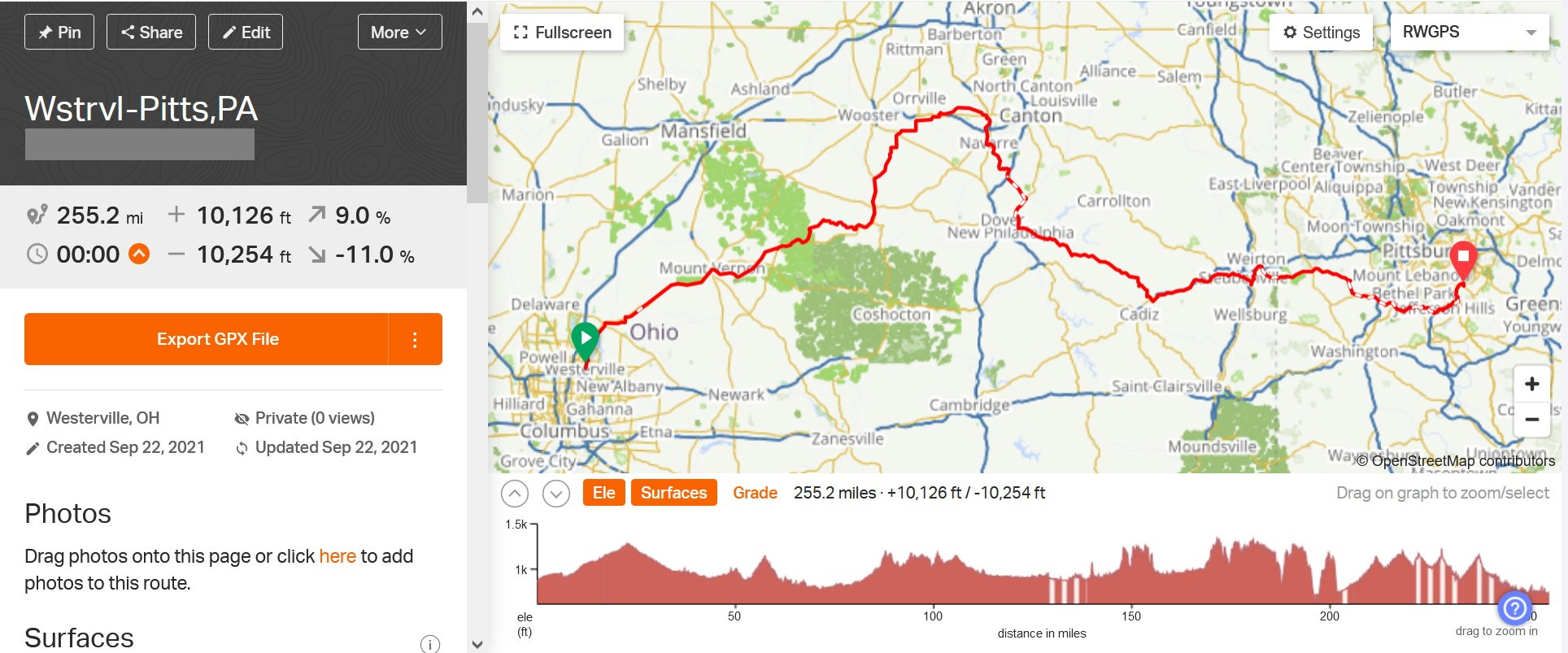
The total elevation gain on this segment is 10,126ft. Most of that is in the steep climbs you see in the graph. At around the 185mi mark there is a sharp dip, then again at 195mi. That is a road segment that passes through, pretty obviously, a couple ridges and valleys. 195mi is the Ohio River passing from OH to WV. The climb @ 205mi is the Panhandle Trail - the low point is where I would jump on that trail. The climb up is the Panhandle Trail in to PA. After that climb on the Panhandle the elevation mellows out quite a bit, overall.
However, the sharp peak you see at about the 225mi mark I am showing as much as a 6.4% grade (the tip is through National Tunnel, so you don't get to the ridge top - they tunneled thru it). Those "high peaks", going back to the earlier example at around the 25mi mark, aren't necessarily hard to get through. Its just when you compress the mileage of a "long tour" any elevation that is there shows up as a "peak". You have to drill down and check either the grade (as RWGPS does), check a topographic map, or check the street level view of the area - in person or google/other mapping provider.
Here is a good example
Tourist in MSN posted earlier that goes right along with the subject of the grades:
Originally Posted by
Tourist in MSN
Photo below, different trip, when I see that I have to go for several km up a hill with 13 percent grade, I grimmace, get off the bike and start walking as I know that grade would push my heart rate too high if I tried to pedal.
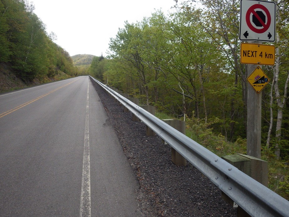
I can't imagine how you would ever get the load you are considering up a hill like that.
As to his last point - that is the purpose of the thread - route plan. You have to know your numbers in order to do that. Then if you study the routes that grade would be found.
Then you have 2 choices.
1. If there are other routes available that let you bypass the grade and are ride-able (use your judgement - traffic, road conditions, detour mileage, etc) - go another route;
2. Find a way to deal with it. Break up mileage and do just the climb in a day, or find somewhere in between the climb to shut down and split it over a couple days.
Just for grins I ran the numbers on that grade. If it was a steady 13% grade over 4km that would be 2.48 miles and 1700' of elevation gain, straight up basically. That's a heck of a climb. I can't imagine 13% being the continuous grade, though. Maybe in places it gets that steep. Even if the average grade is 1/2 that at 6.5% (still a challenging grade) - that would be 850' gain.