In a lot of the USA, winds are more
S-->N than
W-->E.
This
Wind History Map site is interesting. It's more useful to click the Jan-Dec tool to see one month's averages instead of the whole year.
Click a station to see frequency of winds by direction, and speeds of winds by direction.
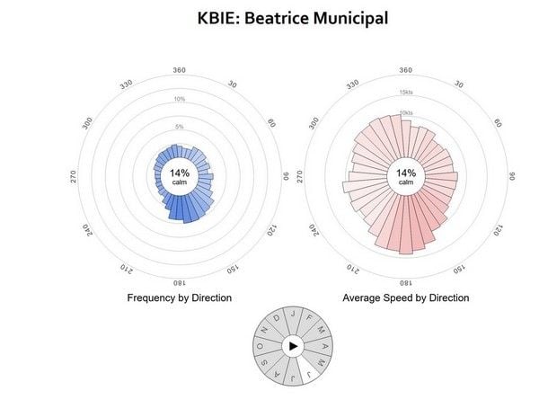
For example: Beatrice, Kansas, in June:
Most often, south or southeast, and those are the strongest winds. And more east winds than west!
 Weatherspark
For even more weather details, I like
weatherspark.com. I look at seasonal averages, but also rain, wind, clouds charts. And looking at previous years actual charts gives a better idea of variability, instead of just seeing averages.
The chart of avg temperatures over the whole 24 hour day is useful, too: are the mornings very cold? what's the afternoon look like?