At mid-season, I feel like I've worn a groove in all the usual routes. Today I decided to check out a new "loop within a loop" that I discovered on Google Earth. The loop seemed to dead-end at a major highway with no way to complete the last leg.
From the satellite view, I could see a trail that went through a wooded area, with what looked like bridges crossing RR tracks and the North Branch of the Chicago River that would allow me to close the loop. Bridges are circled.
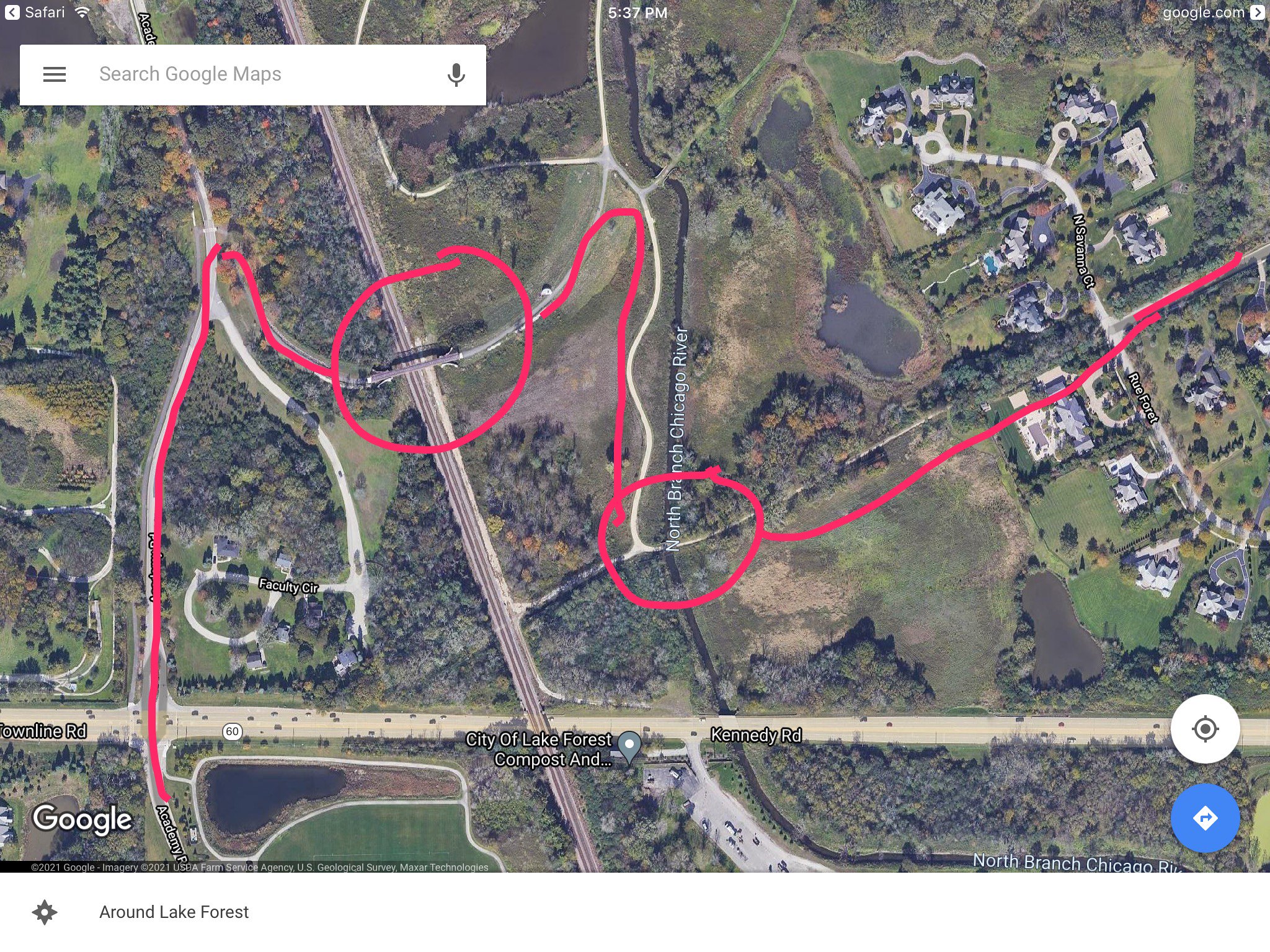
When I arrived, I was happy to discover that the wooded area was
the Mellody Farm Nature Preserve - public land! I was initially worried that the land was one of the many estates in Lake County. In this case, a former estate turned over to the public. Here's an old bridge.

The trail was crushed limestone and easy to navigate, even with 700x23. Here's the second bridge crossing the river.

All in all, I was only on the trail for a quarter mile where it spits out in a sub-division. Trail narrowed a bit at the end, but was still easy to ride. Totally worth it, since it opens up some new routes.

Very happy to find a new loop! Ended up with 64 miles on the day.
