Here are a couple random examples of heat map routing.
Part of why I bring these up is these are major state routes. They have regulations for the grades that are acceptable on these routes. The grades are going to be a lot shallower than those of small 2 lane roads weaving through the countryside.
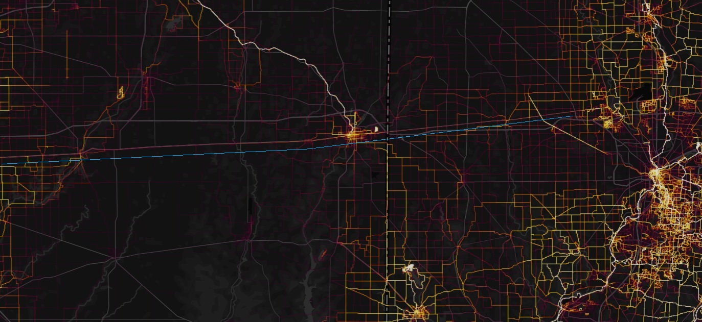
The first is US40 through Indiana and Ohio. The section of this I've rode is 4 lane west of Columbus with a large shoulder which is nice - an extra lane for people to use to get around you, and if not theres a wide shoulder to stay on so you don't have to hit the ditch.
From the heat map you can see it is a fairly traveled E/W route for cyclists.
Rt 40 is the heat line above the blue line (the dark gray line in the background map is I-70 - Rt 40 sort of parallels the S side of 70 in IN and then 70 crosses over and 40 is N of 70 in to Springfield).
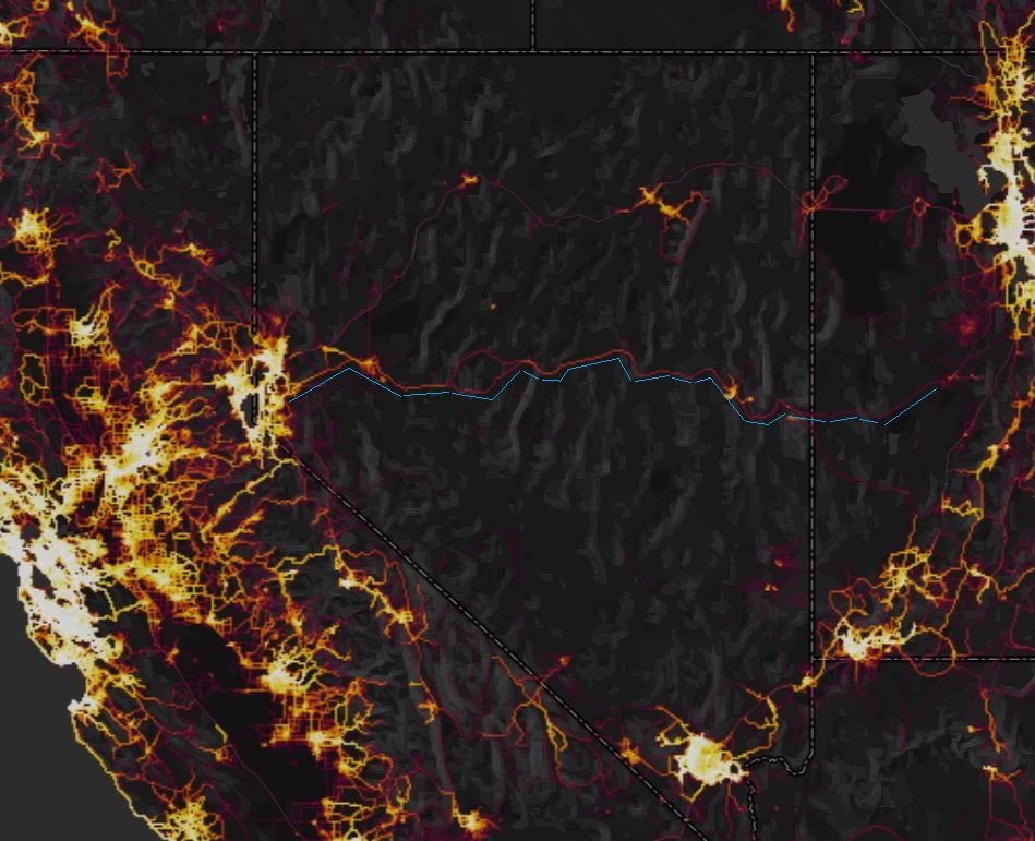
2nd example is Nevada and Utah.
The major route is US50. The south end of the split you see (traced) is Rt 722, but blends back in to US50.
Considering NV is part of the Rocky Mountains I would expect more elevation out that way than OH/IN. That's just common sense there. The point is, though - at a glance this is a pretty easy way to visualize potential routes across certain areas. If it doesn't give you an exact route immediately it can certainly be a starting point.
Same deal, heat map routes are the pink to yellow lines. I traced the US50 route in blue (heat map lines above the blue line).
On the opposite end of the perspective of "starting point" - if there is a "black hole" of no cycling traffic - that is probably an area to stay away from, but not necessarily. Eastern/South Eastern Ohio is a great example. It is part of Appalachia - the foot hills to the Appalachian Mountains. There are a lot of routes through there that are hilly as all get out - it puts the road segment of the Ohio to Erie Route (ride number 3 above in the 1st post) look like a cake walk.
That gets back to the 2 examples here of major state routes - state routes have regulations that restrict the grades. That doesn't mean they don't exist, especially out West, but they are going to generally be easier routes to get through than getting off the beaten path. Of course, the obvious drawback to major state routes is traffic and speed limit - especially with much semi truck traffic.
We discussed Rt 22 through Steubenville, OH in another thread. Although portions of that are bicycle-legal, the segment through Steubenville and across the river to WV is NOT. So that brings in another complexity - are you legally allowed to ride on said state/us highway/route? If it is limited access (on/off ramps, not intersections with stop signs or traffic lights) that is a good give-away it isn't bicycle-legal.