A few updates with regard to the northern half of the trail based on things I've learned in preparing for and pedaling out a ride in summer 2020.
Between Westfield and Northampton
The historic terminus of the canal and rail line is Northampton, MA and not Westfield, however the tracks between Westfield and Southampton are still in use. Riding the gap on roads isn't too bad however. From Northampton take the Manhan trail trail segment south, one could take it to the end and get on route 10 but that is a bit windy and hilly and sometimes without shoulder in those spots. I find it better to leave the Manhan at a cut-through to the parking lot of the Williston School and get on Park Street, then follow that as it becomes Line Street and County Rd. At the intersection with 202 one could go west and then south along the eastern side of the airport, and while that is sun-exposed it has a decent shoulder most of the way, unfortunately after crossing I90 the shoulder disappears and you have sharrows on a fairly busy four lane road to the Westfield River. So I prefer to stay on the same road which becomes East Mountain Rd after crossing 202 and gets a little narrower but remains fairly calm and residential as it runs down the east side of the airport. Then head southwest on Papermill (recently repaved) and eventually take Union (a bit busier but not bad) over to intersect Elm/10/202 just north of the river. There is a trail bridge over the river but it's a bit hard to get to and does not yet connect to anything on the south side though work to replace the missing bridges of the elevated route down to the trailhead on main street is in progress. Staying on the main road isn't too bad, and after the rotary you can turn left at the fire department and enter the stop and shop lot from the side. Or right after the river take a left on Bartlett (just before passing under the trestle bridge that will some day carry the trail again) to Mechanic street.
A caution though: East Mountain Rd can be busy and fast. Past rides I found it great, but returning north around 4:30 on a holiday weekend it would get bursts of many cars at a time. Interestingly they then seem to turn on 202 as County Rd, etc continuing that line north of 202 seems to have less traffic even though it has more width to comfortably accommodate it.
Water
The trail follows a rail line that tends to run through more out of the way parts of town, so even in nominally dense areas it can be a bit far from services meaning that hot day rides can require some planning.
North of Westfield, convenience store where County Rd / East Mountain Rd cross 202. The nominal grocery store in the shopping center is closed.
Westfield trailhead is beside Stop & Shop though they may not be open early, Cumberland Farms just east of the missing rail bridge on Main Street should be
At Congamond Rd and Turkey Hills Rd it looks possible to detour a mile west to services on 202
Floydville Rd above the nursery detour runs out to 202, at that point it's a half mile up 202 to a large grocery store
North Simsbury, Kane's Market has signage on the trail but limited hours, Pride gas station next to them should be open though
Drake Hill Mall in Simsbury grocery store where the trail jogs up to the street, there is sometimes a water fountain along Iron Hose Blvd, too. Someone was trying it when I rode by, I think with success but not sure. There's another in the children's playground just north that might be on if the trail one isn't, it has a bad angle but in 2019 I was able to use one bottle to repeatedly collect enough to fill another. Getting a big jug at the grocery store is probably less bother.
Simsbury between Old Canal way and Hopmeadow, back entrace to a Cumberland Farms with a gazibo to sit in
Down in Farmington below Red Oak Hill Rd someone with a seasonal farm stand had put out a sign temptingly advertising cold drinks but it wasn't clear how far west of the route they were. There is a gas station mart on route 4 in sight of the trail just north of the river, but it's elevated and fenced there and the rabbit trail that exists looks a bit steep.
Sperry Park Turn
Southbound it's important to remember that the main trail takes a hard right in Avon at Sperry Park, unfortunately the route you need to take looks like some minor local feature, but it's actually the main one as the trail leaves the former rail corridor to threads its way through Avon via industrial park drives as best it can. Continuing straight will get you to a dead end at ballfields or such.
The Conclave of Worms ?
Last summer on two rides there was a short segment of trail alongside a farm field that was densely carpeted with worms drying in the sun, and I even recall a strava segment called "where worms go to die" or something like that. This year I didn't see it, and can't find that segment in the summary of my past rides either. I felt like I passed through an area matching my recollection near the Simsbuy/Avon line in between the crossing of Hopmeadow Street and the turn at Sperry Park. After getting them on my water bottles last year, this time in preparation I deployed a grocery bag over the rear mount and trunk pouch after Hopmeadow, but when I removed it at the turnaround in Plainville it hadn't collected more than a small amount of general trail slime.
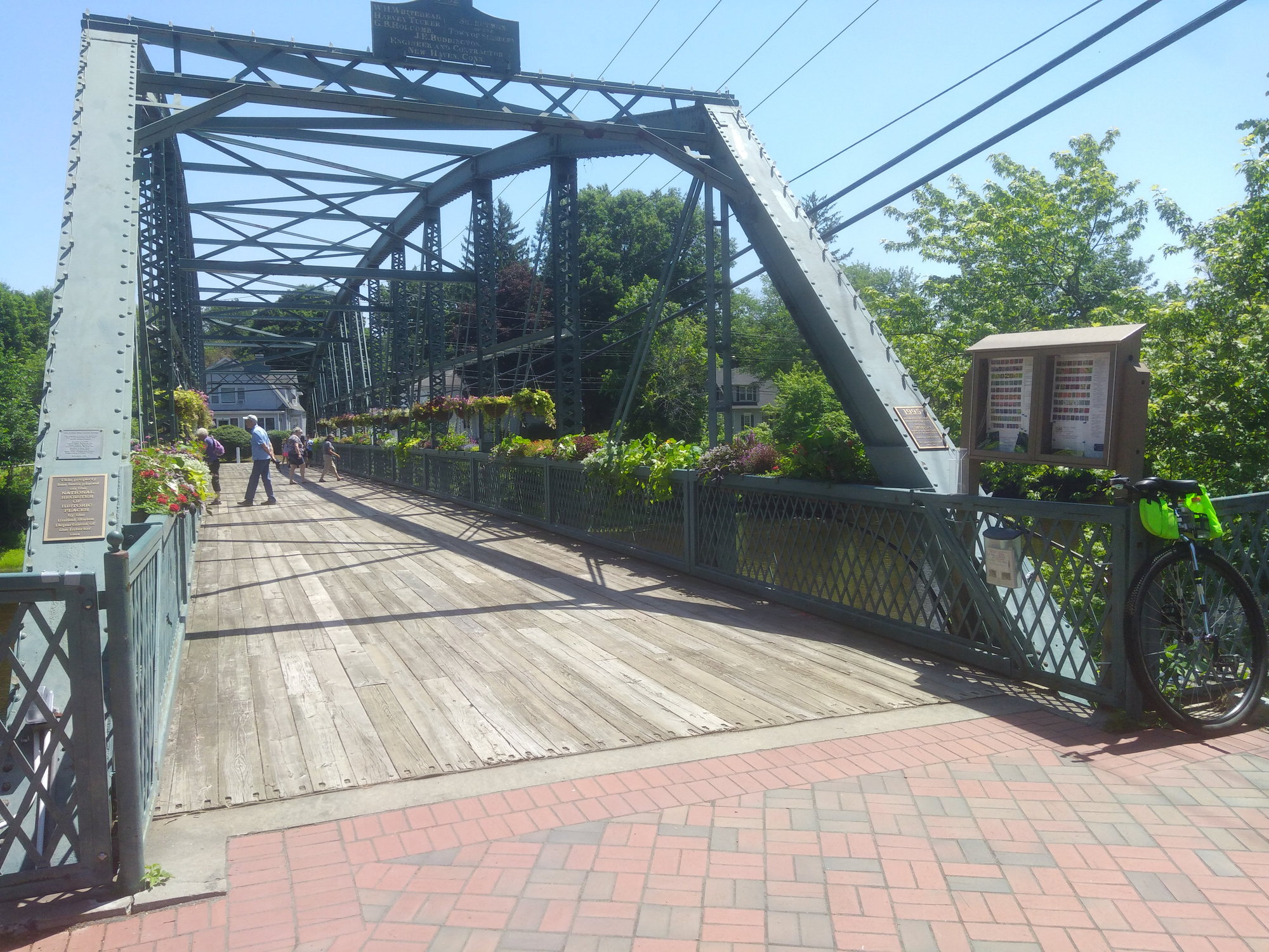
Simsbury Flower Bridge
It's open again after 2019's rehab. Worth the one-minute detour east from where the trail jumps up to a widened Hopmeadow St. sidewalk at Drake Hill Mall.
 The Simsbury Flower Bridge is open again, worth the short detour from the dogleg at Drake Hill Mall unless you're short on time