I am planning a possible trip to Corsica and I am trying to plan some managable day routes - managable daily distances and vertical.
On a recent trip to the Azores I became well aware of my limitations. One day ride was "only" 83kms / 52miles and shows in Google Maps as being 1306m / 4300ft vertical but on that day, I barely made it back to the hotel. I was exhausted and lost all feeling in my fingers (though that might have been hypoglycemia as I didn't really stop to refuel correctly. and it was VERY early in my season, early March. I had zero 2022 miles under my belt at that point. ).
So I (I am 64 years old) am thinking benchmark days of 100kms and 1000m vertical should be managable.
But different route planning services - I am trying Google Maps, Route You and Ride with GPS - are showing VERY different Vertical stats.
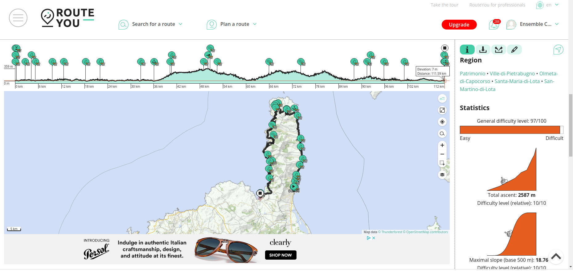
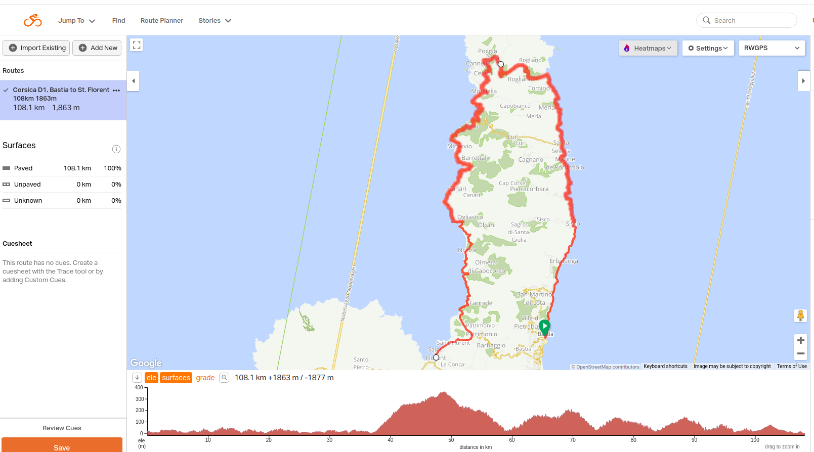
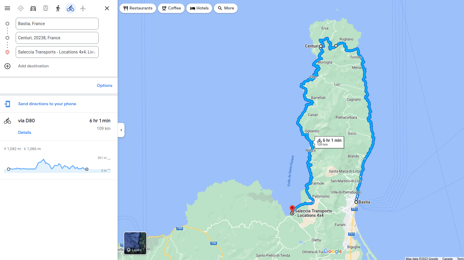
For example, on one Day Route.
Google maps calls it 108kms (67miles) and 1082m (3550ft) vertical. I figure I can do that.
Ride with GPS calls it: 1863m (6113ft) vertical which would be a stretch.
and But Route You calls the same route: 2687m (8587ft) vertical which would be I figure impossible. (especially since my riding companion will be even less strong that I am)
How could these maping services be so different in their calculation of vertical?
which would you trust? which do you trust to be reasonably accurate?