Like axoloti, I prefer paper maps. The Michelin maps of France are almost as much fun as the ride! A few years ago I rode the western coast of Corsica from Calvi to Porto and Evisa. Here's a blow up of just one small section ...
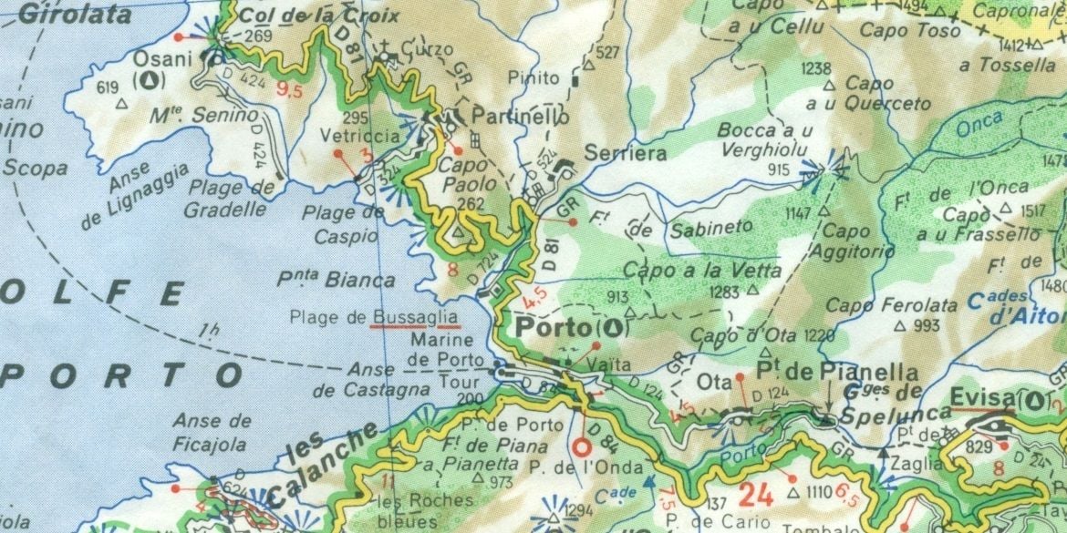
chevron = direction of climb
single chevron > = 5-9% grade
double chevron >> = 9-13%
triple chevron >>> = +13%
yellow D road = secondary
white D road = smaller secondary
green highlight = scenic route
blue beams = scenic view point
black blocks = layout of buildings in small villages
green overlay = forested area
triangle icon = municipal campgrounds to be found in Osani, Porto and Evisa
twisty turns = you're on a fun road!