Originally Posted by
firebird854
Fascinating! To my knowledge, most of these groups are using the same underlying dataset for the routing that we use, which is simply
https://www.openstreetmap.org/. Some of these groups, such as Strava and Garmin use a custom weighting algorithm to help keep cyclists on popular routes using their heatmaps, which, is a double-edged sword, because the brightest heatmaps are often times people's commutes, which don't always take the most scenic routes...
Most of these groups use the same routing engine we do, Graphhopper, it's a super robust engine that we host locally and I've edited a bit to send back the different surface types.
All I can imagine is that that bike path has perhaps been a recent addition to Open Street Map and the dataset we fed to Graphhopper hasn't included it. (it takes a week to build that program, and around 600gigs of ram)
I'd love to do some querying in my osm database to see what the situation might be, would happen to know the name of that bike path? or have a coordinate point on it so I could take a look?
Also, frankly, I appreciate any feedback! It's how I know what to prioritize. Cool addition I made today too if you clear you feel like clearing your cache and reloading the page, I added a "AI Route Insight" button that uses Chat GPT API to retrieve information about the area your route is in.
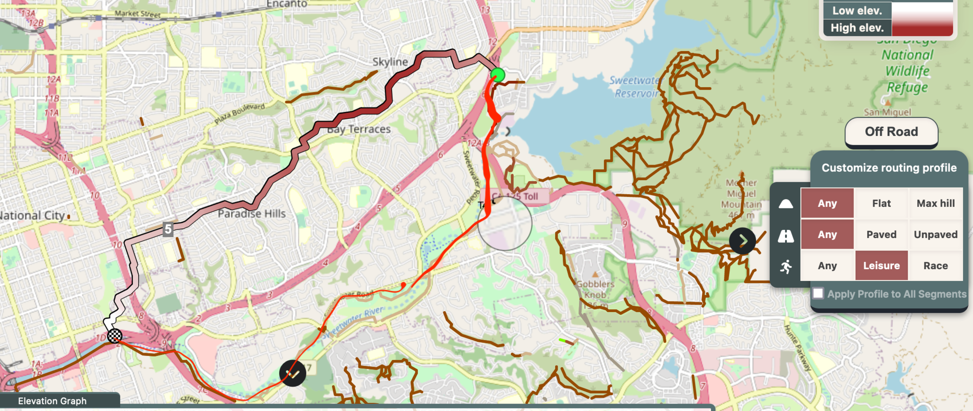
I am going to have to apologize now because my Garmin session timed out without my saving the route. When I go back in, it is NOT routing me on the trail. It may be that the road route I am now getting was close enough to the trail that I assumed it was on the trail but the new road route I'm getting is 5.47 miles vs. what I thought was a trail route at 7? Maybe this is more indicative of my competence?
At any rate, here is a screenshot of what Sherpa gave me with my rough trail route marked in red. It is, basically, the Sweetwater Bikeway (
https://www.traillink.com/trail/sweetwater-bikeway/) and Sweetwater Park Trail in San Diego County. Neither is new or obscure. There is also Sweetwater River Trail and, honestly, I'm not sure what is what. Sherpa seems to show most of them but I just can't get it to route me on them.
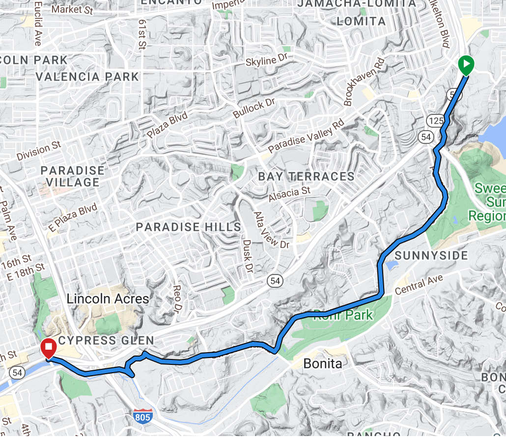
OK, here is another Garmin redo. It gets some of the trail but not all. It starts on a trail (I don't know if it has a name) that Sherpa ignores (though shows) but seems to bypass the Sweetwater Park Trail before connecting with the Sweetwater Bikeway. The Sweetwater Park Trail may be considered more of a hiking and running trail but it is biked, legally as far as I know.
And here is my Strava heatmap that picks up more of the Sweetwater Park Trail.
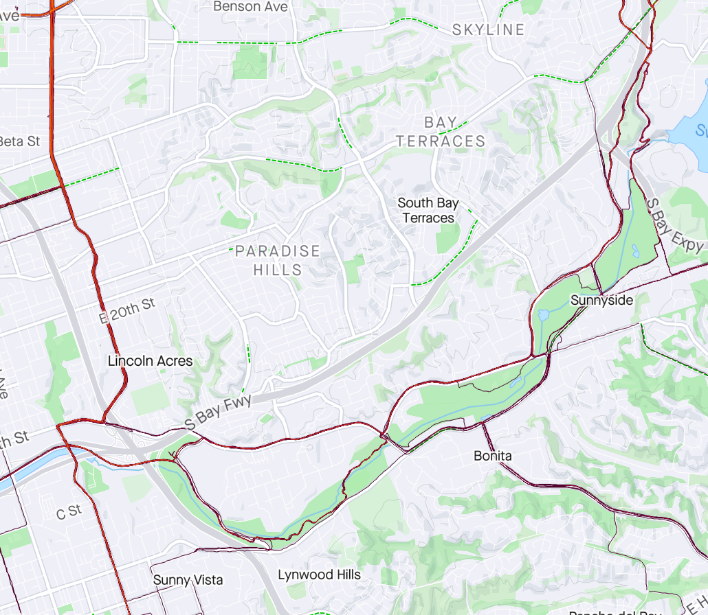
You can see that I've never ridden the Sherpa route, which in itself doesn't mean a whole lot. Maybe I'll give it a try sometime but, usually, I would be riding in this area for the purpose of being on the trail. Mostly, I picked starting and ending points which I knew could be connected by trail rather than roads to see what the software would do. Neither point is somewhere I would actually ever start or end a ride.
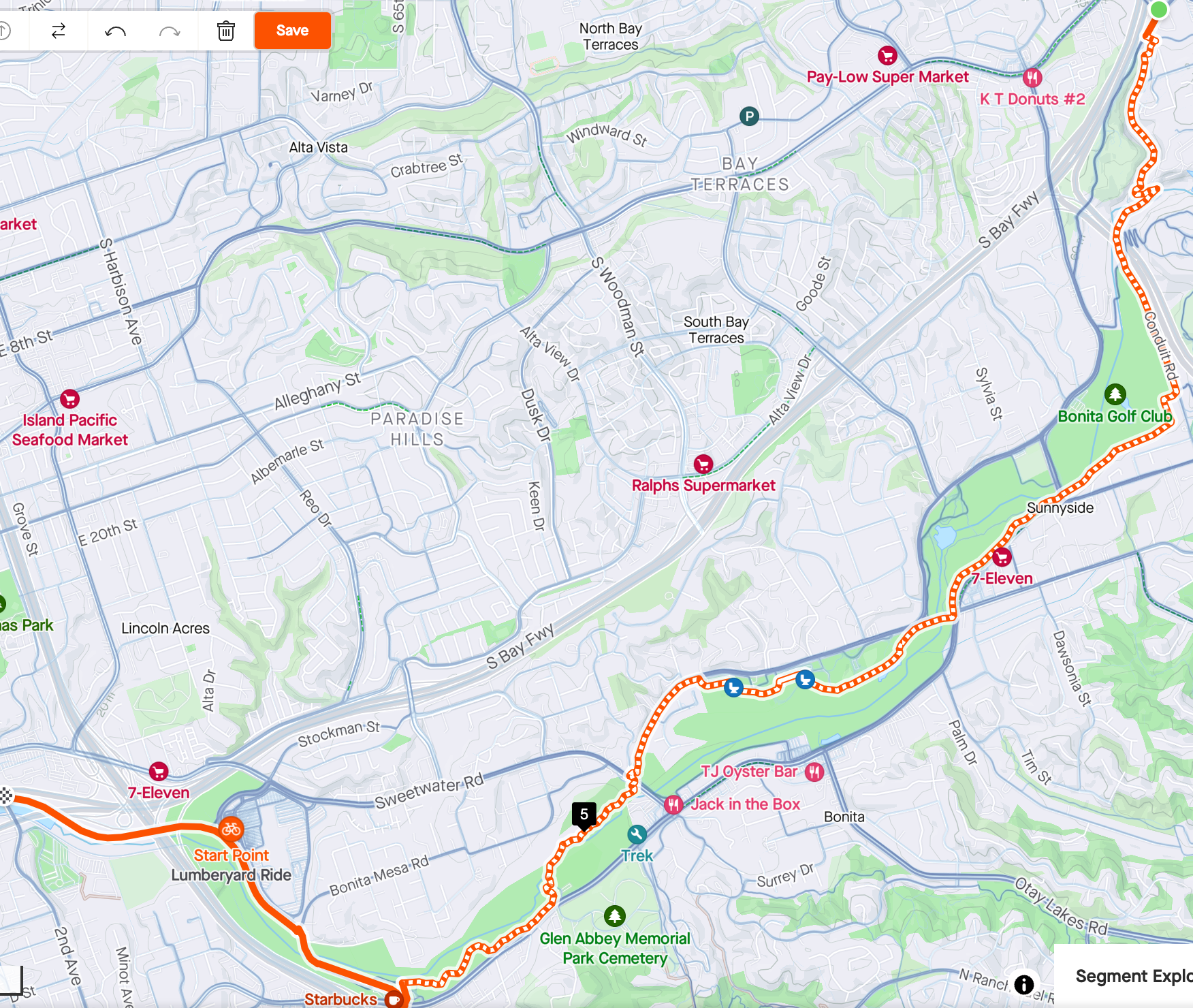
Finally, finally, here is what Strava gives me following most popular and prefer dirt. It would be pretty much exactly what I had in mind:
Hope I didn't get too carried away...