Originally Posted by
Moe Zhoost
Well, it turns out that it's not noise at all. I reviewed my rowing track to check where the elevation changes were occurring and discovered that the highest elevations were close to shore. Apparently the elevation data are referenced to the lake bottom, not the actual surface.
I suppose that's possible, but unlikely. Is this at one end of your recording? It could be barometer related.
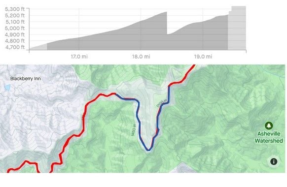
Here's an extreme example: on my ride up to Mt Mitchell in NC, I stopped at the Craggy Gardens visitor center for about 3-4 minutes. A dark summer cloud passed by, and the wind picked up. The barometric pressure went up, making my Garmin 705 think the elevation had dropped by 350 feet. (Those Garmins are stupid. It could easily get new vertical GPS readings while I'm stopped, but it never did. It just did differentials off the initial elevation, and even that could be way off. I think the newer ones are better.)
Visitor center stop at mile 18.4: