Originally Posted by
keithdunlop
The 2021 poster has been released! I'm a local so this may not mean much to some, but the organizers have seemed to have wildly confused the Morro Bay (and the rock) with Cambria (which is a good 20 minute drive north), and the course doesn't approach Morro Bay by any measure. And the pier in the foreground must be Cayucos, which again is many miles south of Cambria. This isn't even anywhere near where the Eroica CA courses go, except for the turn up to Santa Rita. If the imagery had captured Moonstone Beach, or the Piedras Blancas lighthouse, or the descent down Cypress Canyon to the coast, it would have better represented the region that the course covers.
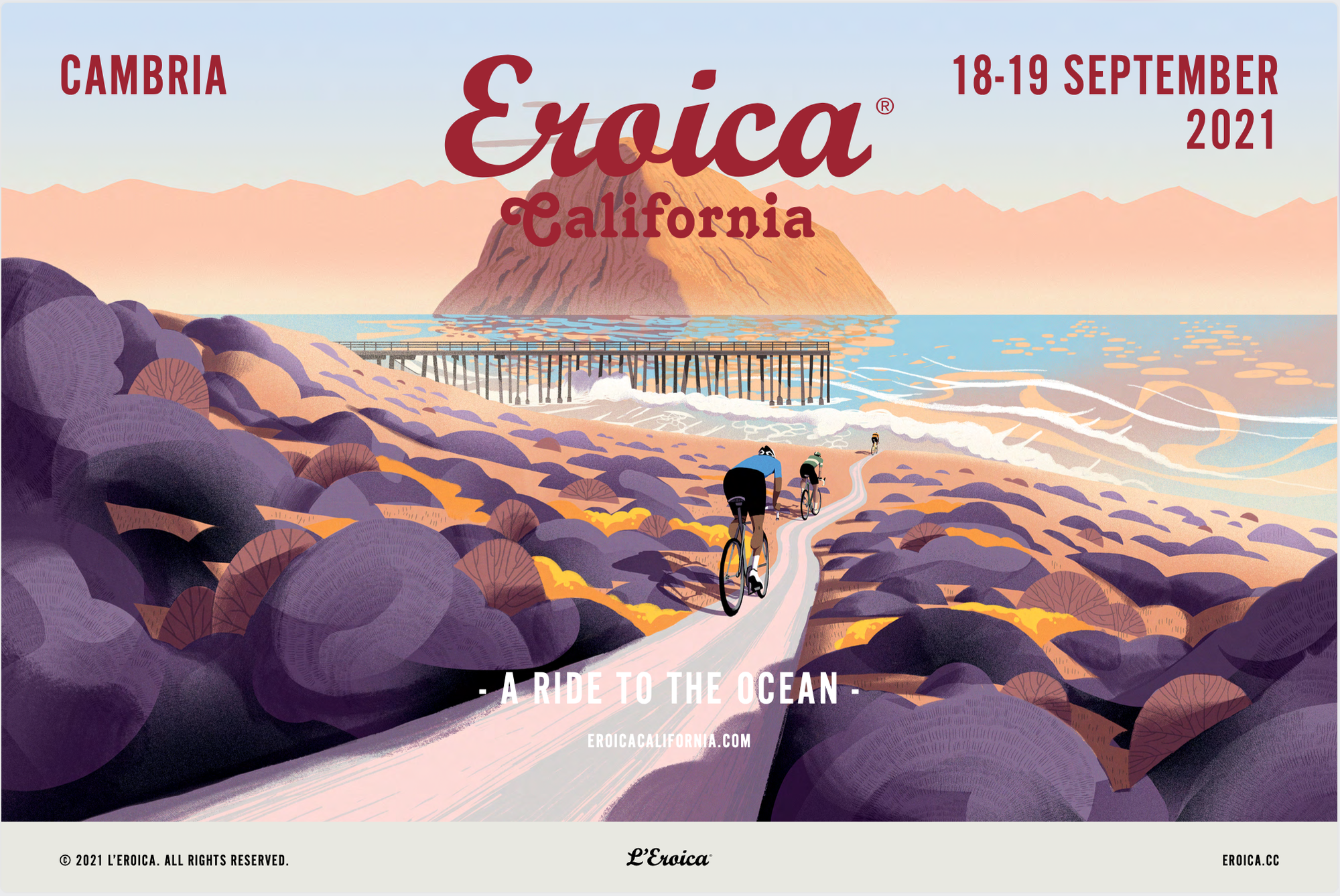 Eroica CA doesn't head to Morro Bay, but OK.
Ummm . . . this isn't Cambria!
Its artistic license, showing the California Central Coast landmarks that could spark interest to participants. Besides, looking at Cambria and its surroundings from an Apple or Google Maps perspective, everything seems “close by”, be it Big Sur, Hearst Castle, Paso Robles, Morro Bay, SLO, etc. To EC's Italian organizers, maybe it does.
Morro Bay (really only 22 miles from Cambria and 6.9 miles from Cayucos) can be clearly seen from Cayucos and Cayucos pier. And consider if it was the Southern “short ride” of say 45 miles, or a 12-14 mile extension of the longer rides before turning back north and heading east - Cambria-Cayucos-Morro Rock-back north to Old Creek Road and then to Santa Rita summit? That would make the 72 mile ride 84-86 miles, the 81 mile into 93-95, and the 108 mile to 120-122, truly heroic.


Here's the view from the turn into Cayucos from Highway 1 to N. Ocean Ave. looking southward. Morro Rock is clearly visible. This view would be on 3 routes (Santa Lucia, Via Dello Scalatore, and Heroic Routes) which comprises almost 2/3rd of the riders.
https://www.google.com/maps/@35.4494...8i8192!5m1!1e4
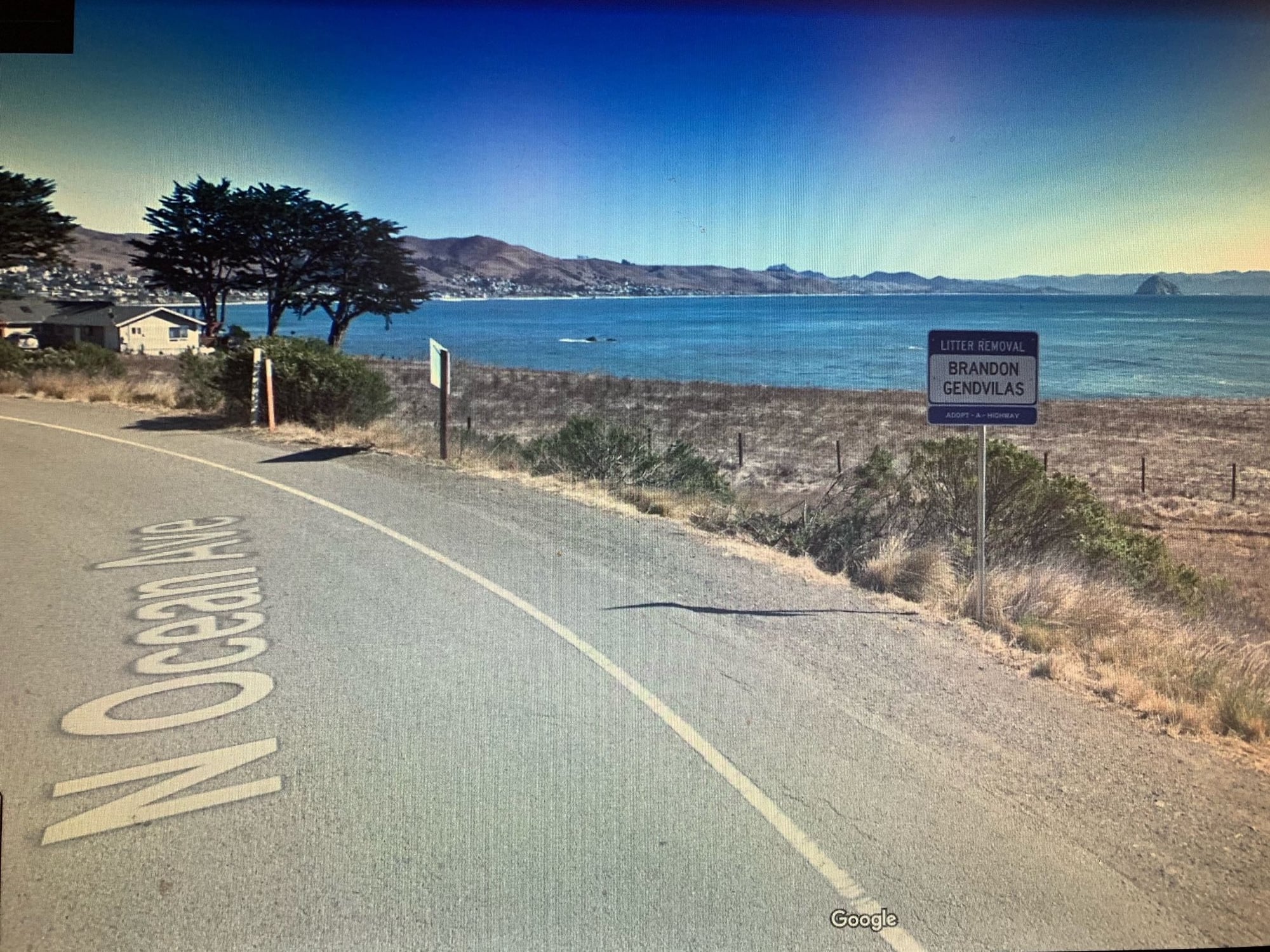 Google Street View from Ocean Ave and PCH looking south as we turn into Cayucos, snapped from monitor
Here's the view from Ocean Ave just before reaching the Cayucos Pier:
https://www.google.com/maps/@35.4499...8i8192!5m1!1e4
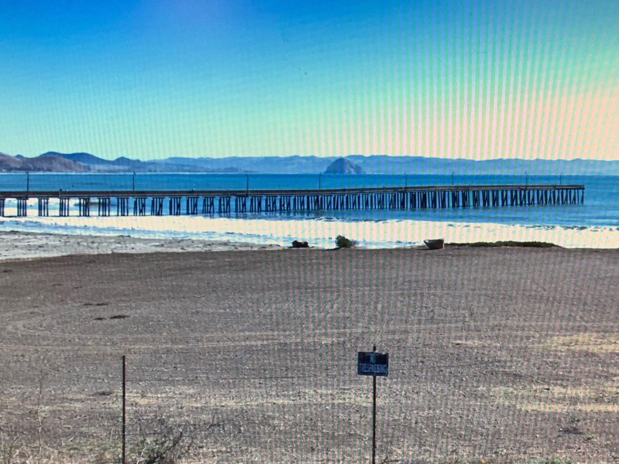 View from Ocean Ave, Cayucos just before reaching Cayucos Pier, snapped from monitor
I think we could say the EC 2021 poster does represent a reality view from most of the EC routes except the short route.