My wife and I just completed our first ever multi-day tour. Here's a brief summary...
Day # From/To Strava Distance Milepost Distance
1 Pitts to W. Newton 36.39 34
2 W. Newton to Ohiopyle 44.70 43
3 Ohiopyle to Meyersdale,PA 41.01 39
4 Meyersdale to Paw Paw, WV 62.99 60.7
5 Paw Paw to Williamsport, MD 59.85 56.2
6 Williamsport to Harpers Ferry, WV 40.29 38.9
7 Harpers Ferry to Washington, DC 67.04 60.7
Pittsburgh to DC 352.27 332.5
We both rode stock Trek FX2 hybrids with 700x35 tires. We were credit card touring so I carried just 28lbs total (including bags) in Ortlieb BackRoller Classics. Truth is we could have left a few more things behind, but the load was not too bad.
Pitts to W. Newton: We left Sat June 19 under dark overcast skies. We stayed at the Downtown Hampton Inn on Smallman Street the night before starting out and the night of our return 7 days later. They allowed us to leave our car all week at no charge in their secure parking lot. We could access the the Three Rivers Heritage trail from their parking lot and made our way to the Point and the official start.
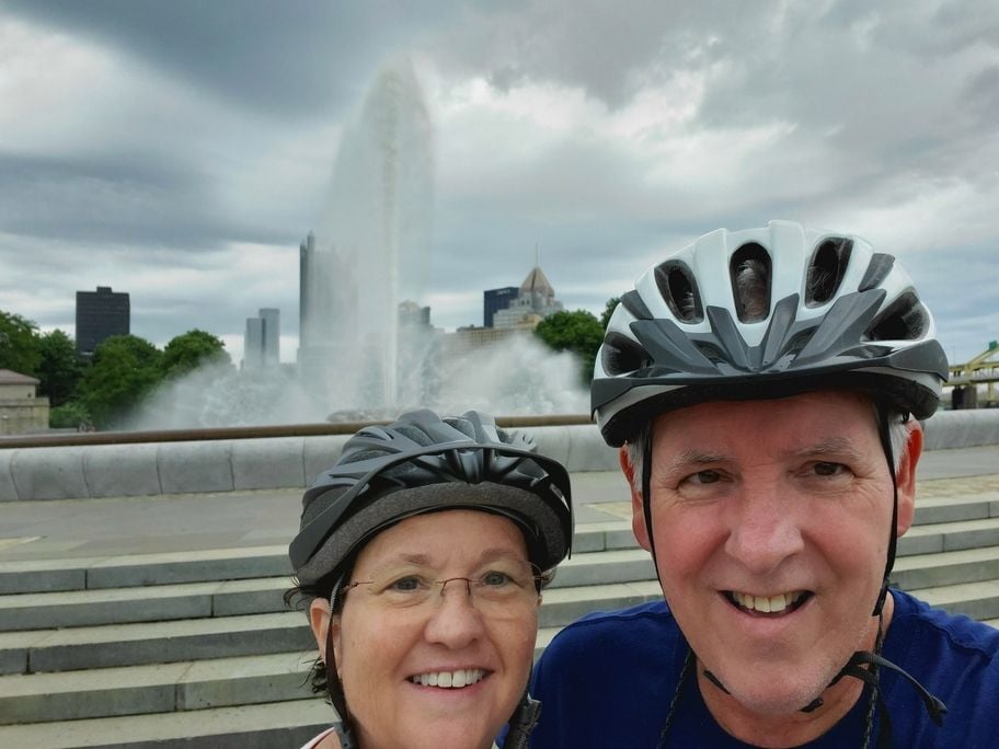 At the start Point State Park in Pittsburgh. Dark overcast meant rain was soon to fall.
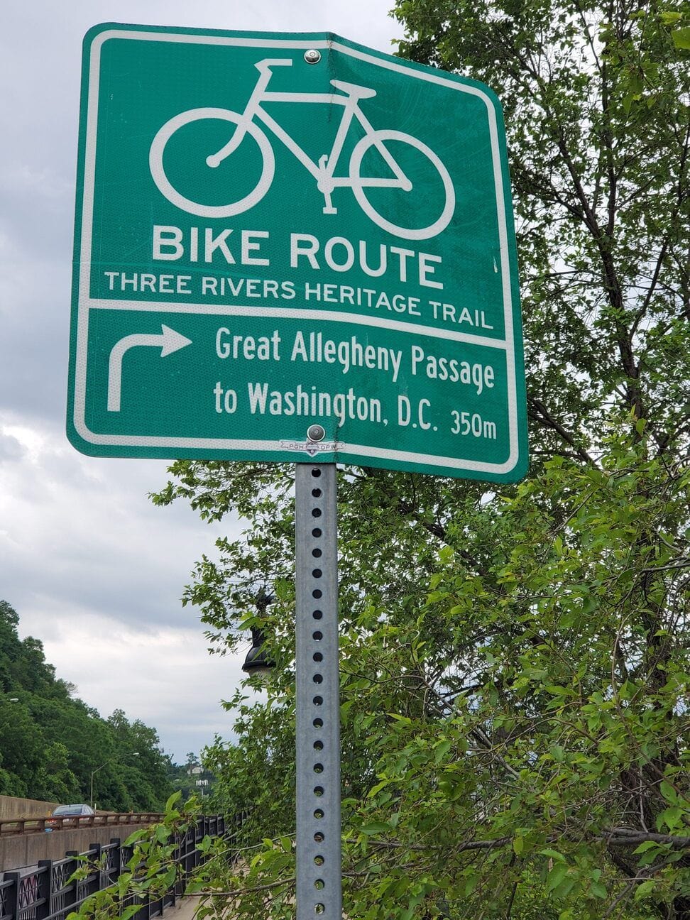
Making sure we followed the trail properly out of downtown took us a little longer but worked out fine in the end. We met folks on the trail that missed turns, went the wrong direction or otherwise had a false start or 2. I'm a Western PA native that hasn't lived there in 40 years, but I do know my way around Pittsburgh. I think the GAP could use a few more signs, or signage that more clearly shows the way out of town.
We measured our miles so that our mileage includes any side trips off trail. It explains the Strava vs Milepost discrepancy and was very consistent with the mileage sign at the Hot Metal Bridge.
 The 350 mile distance seems more representative of actual mileage. But whether it's 333 or 350 it's a long way.
We had a real downpour while on the South Side that continued off and on until we were east of Boston, PA. Good practice getting our rain gear out of the bags and on to us. We must have put the rain gear on/off 10x that morning. Leaving McKeesport we were a bit surprised by the short and steep climb out of Port Vue. We had lunch in Boston (sandwiches at the Tea Shoppe) and they gave me double cookies to celebrate upcoming Fathers Day.
W. Newton to Ohiopyle: It was a nice sunny and scenic ride (Sun 6/20) as we were now fully out of the metro area. We were surprised by how few people we saw on the trail.
We had to recognize and confront a problem that we were having with hydration and nutrition. Long story short, we weren't getting enough of either in a timely fashion. We ended up planning stops about every 10 miles for a snack or meal and a drink. We bought snacks the day before so we always had enough for at least the next day, and never passed a water source ( fountain, pump or food stop) without filling up. Also I love looking at the historical markers so it gave me a built-in excuse to do so. That's probably not for everybody but it worked for us.
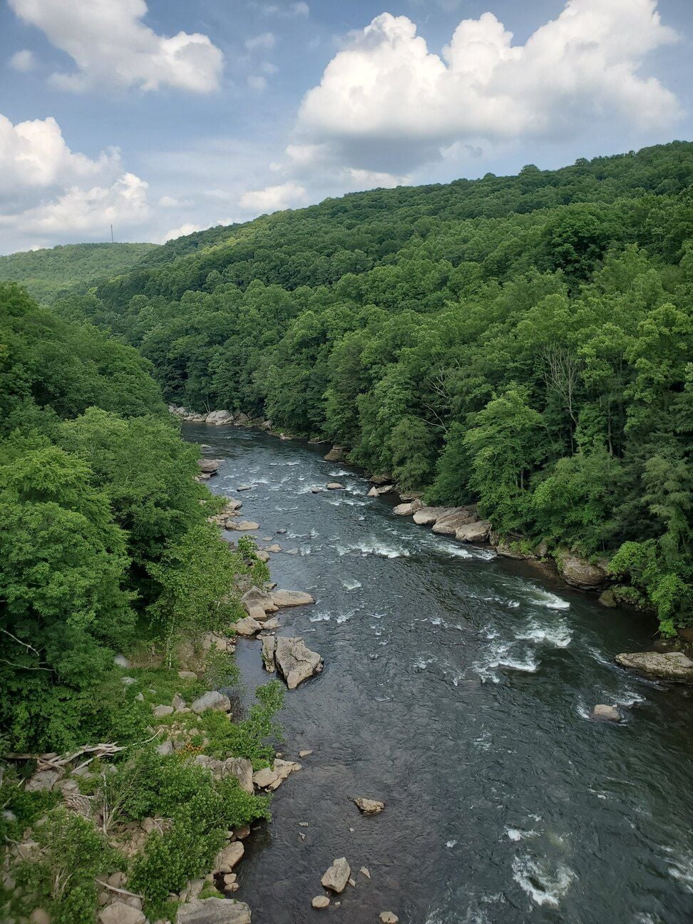
 Typical scenery in this area...mountains, rivers, and rocks.
Biggest problem we had was finding food in Connellsville on a Sunday. Had to go off-trail and into town searching for someplace open. And we quickly found out that anyplace off-trail meant steep up/downgrades with unpredictable traffic.
Ohiopyle to Meyersdale: Early start (Mon June 21) as we knew we had lots of climbing to do, plus we wanted to rest up before our big day on Tuesday. To me this part of the trail is probably the most scenic, and we had a great day to see it.
 The photos really don't capture the full beauty.
I'm so proud of Mrs MidLife as she chugged right up all those 950 ft of elevation gained. Loved the viaducts, tressels, and tunnels. Ran into an uproaching thunderstorm as we got to the Salisbury Viaduct and made our way in without getting completely soaked. We both wolfed down almost a whole pizza each as we loaded up for tomorrow.
Meyersdale to Paw Paw: Another early start Tuesday June 22 as we planned our longest ever ride (previous long ride was 45 miles) so we could get to Paw Paw. Our intention when we made our plans was to wake up in Paw Paw so if we had to push our bikes up and over the tunnel detour, we'd do it first thing in the morning.
We woke to lower temperatures and rain showers and wasted no time getting a big breakfast, packing up and heading out. We had about 8 miles to climb yet to the Eastern Continental Divide, a 20+ mile ride down into Cumberland to hit the end of the GAP, and another 32 miles on the C&O to get us to Paw Paw.
Unfortunately when I checked my bike I had a low rear tire. I thought to myself "probably just lost some air from the past few days riding" so I pumped it up and we took off. The rain started coming down harder and then about 5 miles out of town we had our best ever wildlife encounter. A bear cub galloped across the trail in front of us. We were too stunned to take pictures as we were franticly ringing our bike bells to hopefully ward off Momma Bear. We never did see Momma, so that's a victory in our book.
We crossed the high point of the trail (those windmills we saw way up on top of those mountains yesterday became up close and personal today) and then started down towards Cumberland. It was cold. Low 50s plus rain and wind. We wore gloves and another top layer most of the morning. Our rain jackets never came off. This part of the trail (Meyersdale to Cumberland) has the most packed into it each and every mile. From the high point, to Big Savage Tunnel, to Mason/Dixon, Frostburg and into Cumberland itself.
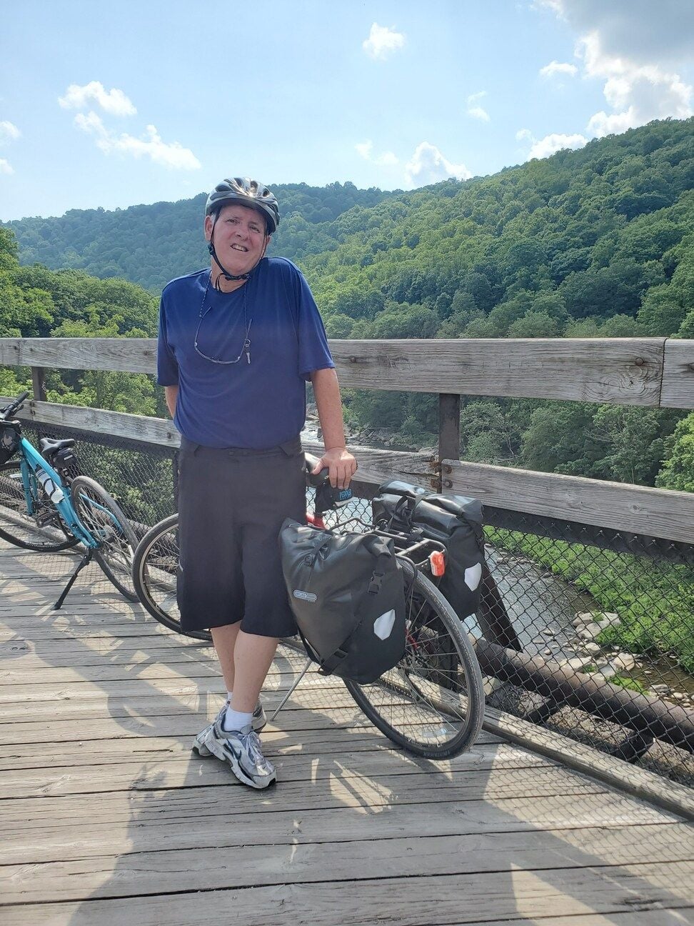
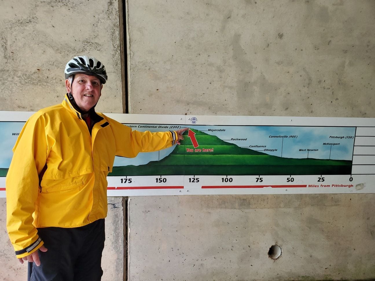 It was good to take a break and dry off in the underpass at the Eastern Continental Divide. We're going from right to left in this picture so our climbing is pretty much over and we have a long downhill ahead.
All down the mountain, my brakes were squealing in the rain. I mentioned it to my wife and Mrs MidLife pointed out that her disk brakes made no such noise. I had always said that I appreciated the theoretical benefits of disk brakes but unless you were roaring downhill in a rainstorm they really wouldn't make a practical difference to us (we live in a flat area and pretty much never ride in the rain). Now I was confronted with the reality that we were roaring down a mountain, in a rainstorm and there is no doubt disk brakes could have helped.
About 5 miles outside Cumberland, Mrs MidLife observed that the low rear tire of mine had indeed lost air since we started out. I made the executive decision to air up with CO2 and see if I could find a bike shop convenient to the trail in town, which I did. The Cumberland Trail Connection is right on the C&O in downtown Cumberland. They stopped what they were doing, replaced my tube and gave us a much needed complimentary bike wash all in about 15 minutes.
Once more, finding things "open" in this post-COVID environment was tough. We had planned on lunch at the Crabby Pig, but it was closed. For future reference there are very nice public restrooms open behind the Crabby Pig. We cleaned up a bit and found a sandwich to fortify us and topped off our water bottles as we started out on the C&O mid-day.
After 3 1/2 days on the GAP (nice well-maintained crushed limestone), the C&O was a total slop bucket. It was a mess of mud puddles, slippery mud, roots, and stones designed to both jar us to our souls as well as threaten to dump us unceremoniously into a mud bog. Plus, it was not at all scenic (at least in these early miles) and even if it was the undergrowth was untrimmed so you couldn't possibly see any sights along the way. Riding side-by-side was impossible in these early miles, and we passed several pumps without handles. Word to the wise...plan your water carefully. If we had not become water-misers earlier we would have had big problems. As it was, we simply developed a taste for iodized well water.
These 32 miles on the C&O were our slowest of the entire tour. Part of it was the trail condition, but more of it was our trying to figure out how to change our riding style. While we started trying to skirt the puddles and avoid the bogs we ended up embracing the slop and riding right through the middle. After all, what kid doesn't like to play in the mud? We had to keep very attentive to our speed, balance and steering. And we got plenty dirty in the process.
We finally made it to Paw Paw and our home-away-from home at Canal Cabins. Nice basic accommodations with running water, air conditioning, heat (Did we mention it was cold? We ran the heat all night), laundry and a bike wash. A good deal for all. Our bikes got their 2nd wash of the day and we actually had to hose ourselves off prior to going in to the showers.
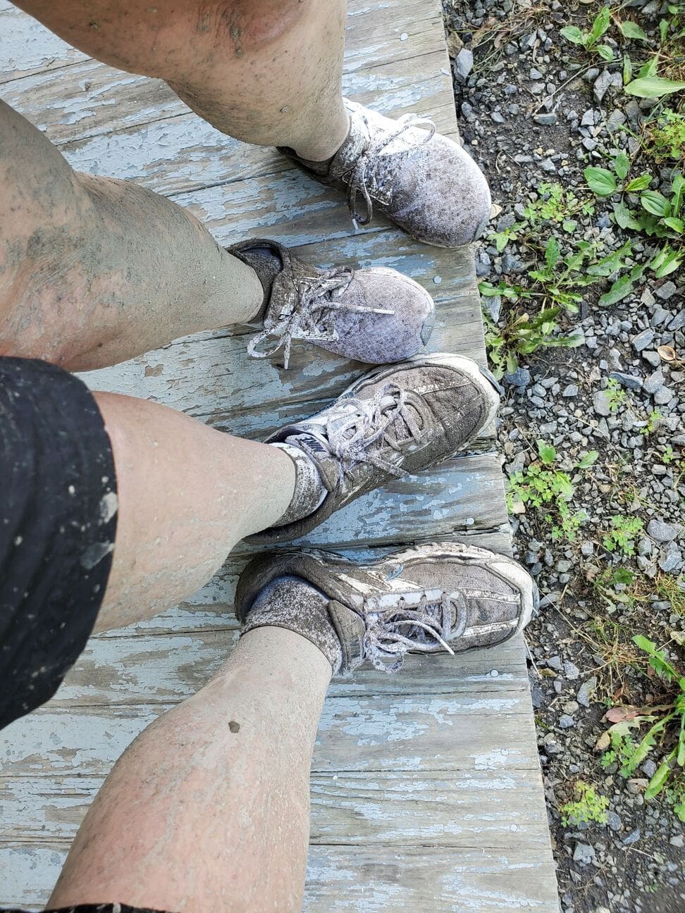 The mud covered us up above the knees. Of course we also had a big muddy stripe up our backs as well.
The good news in Paw Paw was that the Tunnel and towpath downstream were open. The bad news is that was about all that was open in Paw Paw. We had recommendations of 3 places to eat...All closed. So it was the gas station for both dinner on Tuesday and breakfast the next morning.
Paw Paw to Williamsport, MD: Wed June 23 we started off early for Williamsport. The good news (other than going through the Tunnel...Yay!) is that a mere 15-20 miles down the trail we could hit the paved Western Maryland Rail Trail (WMRT). After 50 miles of the worst C&O had to offer, a paved rail trail was like heaven. Even going uphill seemed like coasting. Mrs MidLife was cruising uphill a good 20% faster than her normal flatland cruising speed. We chalked it up to how much stronger she was after all the climbing.
The WMRT has a continuous segment of about 26 miles almost all the way to Fort Frederick State Park. The secret to the WMRT is to NOT go up the first WMRT ramp you see, That leads to the tunnel closed as a bat habitat. Go to the 2nd on ramp 2 miles further downstream on the C&O. We had a great lunch in Hancock (great biker park with permanent restrooms and public water right off the trail and across street from Sheetz, our go-to stop for trail snacks and sandwiches) and even visited the bike shop in town to restock... C&O Bicycle (also right on the trail).
Fort Frederick is a must see if you're a history buff...Stone fort from the French and Indian War. Just a mile (uphill) off trail and it has nice clean permanent restrooms and water fountains.
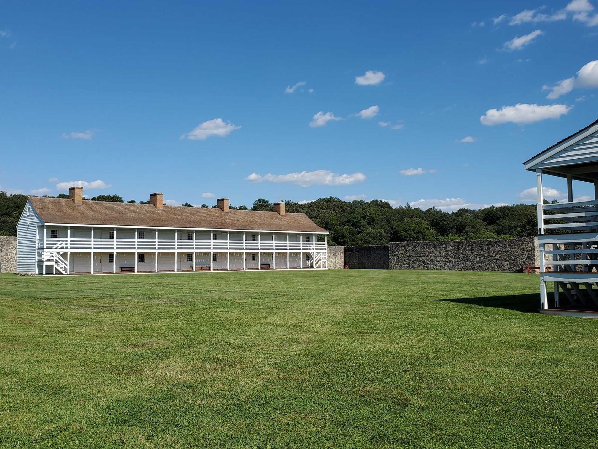 The fort is huge, with high and thick stone walls all around.
Williamsport is also a great trail town. Again, same issue as most things in town were closed or reduced hours. 2 quick examples...We wanted some pasta and there was a restaurant a block away. So we cleaned up, dressed up, and got ready to be waited on for once. We go in and while the place didn't close until 9:30pm, they shut the dining room early so it was only takeout. Next morning I went to a coffee shop / bakery also 1 block away. Unfortunately they didn't open until 10am. Coffee place not open until 10am? Makes no sense to me. Luckily the local Sheetz was right down the block.
Williamsport to Harpers Ferry, WV: This (Thursday June 24) is the payoff for a longest ever ride 2 days earlier into Paw Paw. Only a 40 mile ride today and then relax in Harpers Ferry. Have an actual meal served and maybe even a cold beverage. Harpers Ferry is a very attractive and historical town. Good place to visit. And a good day to recharge before tomorrow's wild 65 mile dash into DC. Even if you have to haul your bikes up/down the bridge stairs to get across the river.
The best news of all (my perspective) is that about 12 miles of towpath upstream from Harpers Ferry has indeed been resurfaced. That portion is very GAP-like. But don't believe the idea about towpath resurfacing all along the C&O. It's better, particularly about 50 miles (out of 185 total C&O miles) from Shepherdstown to Seneca, but otherwise it's still roots, rocks and mostly grass medians. Not comparable to the GAP.
Harpers Ferry to Wash DC: Our new longest ever ride (67 miles). Not only is it long, but we're meeting our daughter in DC for dinner, and she's made an early dinner reservation so there's self-imposed time pressure. Nothing's open when we leave HF so we plan to go to Beans in the Belfry in Brunswick (5 miles down the trail) for breakfast and sandwiches to pack for lunch.
What could possibly go wrong? I get a flat tire pulling into Brunswick. So I sit outside, eating my breakfast sandwich, drinking coffee and ice water as I replace my tube and check for tire problems (couldn't find any). But it's a mental downer as we start a long and hectic dash into DC.
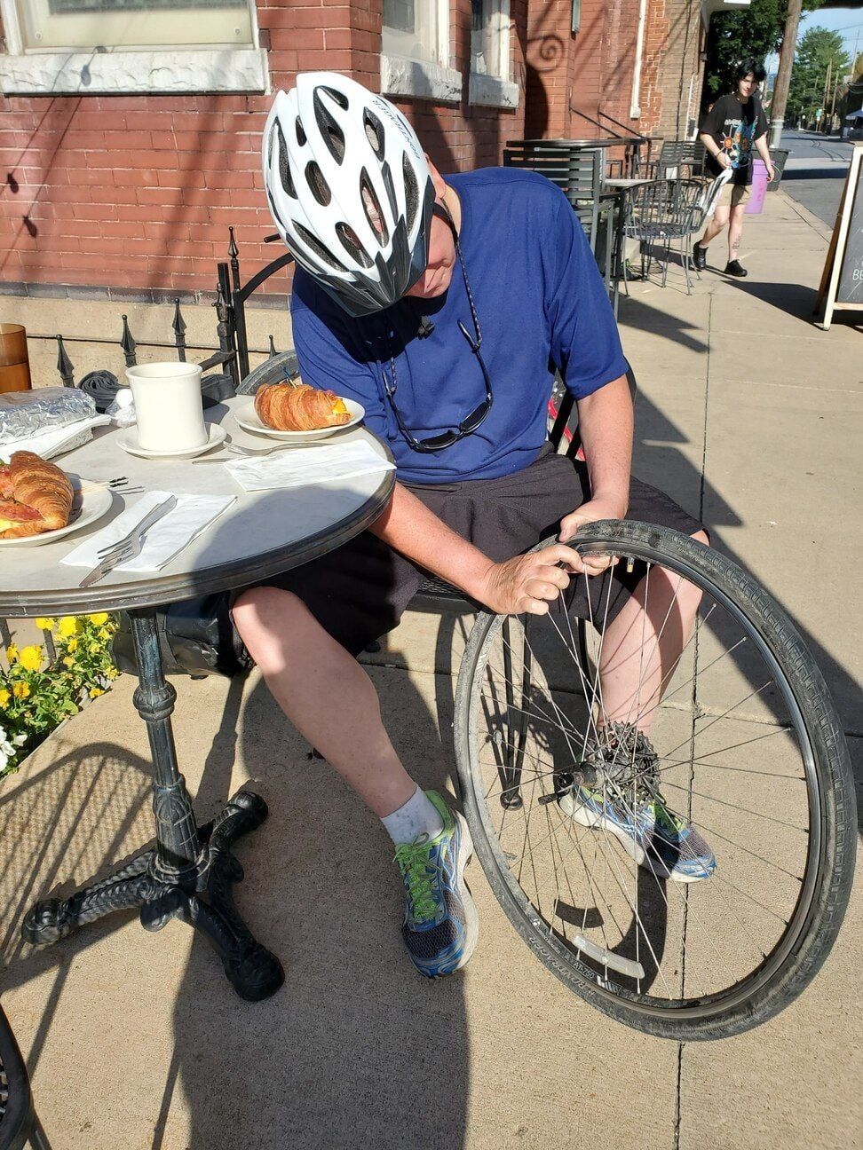 The comfy chair, delicious breakfast sandwich, ice water, and coffee made this flat tire experience as pleasant as it could be. Always better not to have a flat, but if you must this is the way to do it.
The C&O does become some more attractive downstream of HF. I especially recommend the Great Falls area.
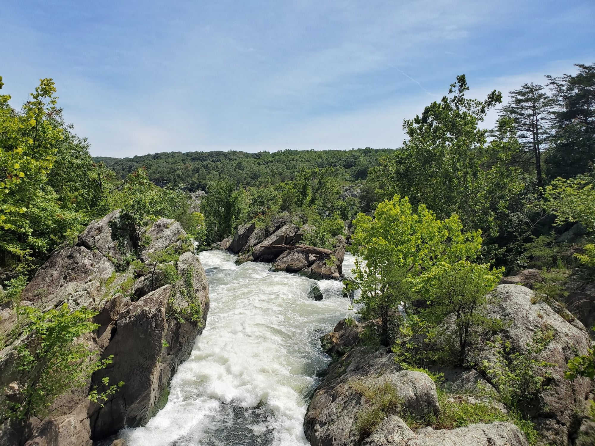 The mild Potomac turns wild about 14 miles upstream from DC. This is why they dug the canal.
Too bad the C&O's poor surface and lack of undergrowth maintenance means that you can't really see and appreciate all the natural beauty. In my opinion it's really an embarrassment for the trail to be in this condition, especially with 2021 being the 50th anniversary of the C&O's addition to the National Park Service.
Once we approach DC proper it's a maze into the zero milepost, a cruise by the monuments and along the National Mall, and then another mile or so to our hotel near Union Station. It was a great ride, lots of fun, and we're looking forward to more touring ahead.
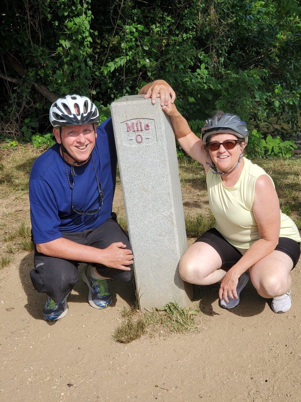 We're officially done here at Mile 0, but practically we had an enjoyable cool down of about 3 miles to the hotel.
Amtrak back to Pittsburgh completes the loop.