Originally Posted by
jgwilliams
Take a look at this
Ride with GPS link. If you look at the distance trace you can see I apparently climbed a vertical hill. The time trace smooths it out but you can see the speed at the top part of the hill is registered as 0mph. It messes up the record and would mean, for example,
that I couldn't have got a PR on that trail I mentioned above.
PR's, at least for me are time based. So I'm not sure why if you make a segment out of that stretch why you wouldn't get a PR if you bested your previous times. Have you made a segment out of that section? I see a Hurst Lane Short segment, but I don't think that is the area on the profile you are talking about.
I might be wrong, but I think if you make a segment of that area, it will pull in all your past rides of that area. Though it might take a day or so to pick them up. And you can see if you do or don't get a PR for that ride or if in fact there is some incorrect way RWGPS is tallying times. I've always imagined that for such they use the GPS timestamp in the file. However it is interesting that there is a jump in the elevation right at the time the cadence craps out. I'll have to ponder that for a while. Maybe some others that mess with this stuff more seriously might know a possible reason.
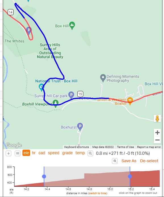 distance
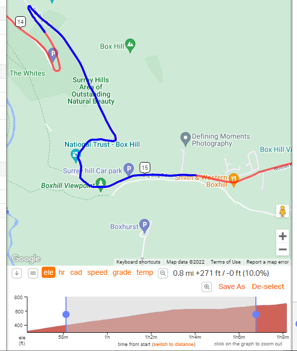 time
time
As for the profile looking wonky, they always do and I don't put much into them when I'm looking at what in this case is almost 121,440 feet (37.5 km) of x axis scaled against roughly 500 feet (150 metres) of elevation on the y axis. I always select out just the portion I'm curious about and look at it in both distance and then against time.