


N.W. Pa
 08-09-21, 05:52 PM
#1
Senior Member
Thread Starter
Join Date: Aug 2004
Location: Baltimore/DC
Posts: 2,930
Mentioned: 0 Post(s)
Tagged: 0 Thread(s)
Quoted: 170 Post(s)
Liked 156 Times
in
99 Posts
N.W. Pa
Hey all, I am thinking about bike touring in this area later this year, perhaps early fall, maybe sooner. Seems there are a lot of scenic trails in this area. Red Bank, Oil Creek, Rail Trail 66, 5 Bridges, Allegeheny, Clarion River to mention a few. I put together this ridewithgps map, trying to connect them while minimizing out and back. I have not spent a long time doing this but am looking for initial feedaback. Any trails not worth including, which trails are most scenic, better ways to connect the trails, cool small towns kinda info.
I am also wondering about the overall elevation change. 300 miles and 15K of climbing does not sound big but a lot of the riding is relatively flat so 15k might be a little more serious.
So if anyone here has some info or experience please send my way.
Thanks
https://ridewithgps.com/routes/36839217
I am also wondering about the overall elevation change. 300 miles and 15K of climbing does not sound big but a lot of the riding is relatively flat so 15k might be a little more serious.
So if anyone here has some info or experience please send my way.
Thanks
https://ridewithgps.com/routes/36839217
 08-10-21, 05:19 AM
#2
Senior Member
Join Date: Jan 2010
Posts: 39,229
Mentioned: 211 Post(s)
Tagged: 1 Thread(s)
Quoted: 18409 Post(s)
Liked 15,518 Times
in
7,324 Posts
I�ll look at it later, but will say now that the Allegheny River Trail is really nice. I�ve ridden it from Franklin to Emlenton. Except for a relatively short section where you have get off the former rail bed, it�s paved. North of Franklin it goes by another name. Samuel Juustus or something like that. Just south of Franklin there may still be a primitive campsite. Right along the river. No water, but a porta-pottie, a couple of lean tos and at least one tent pad. Saw a pair of bald eagles while drinking my morning coffee. You will need a good light as there are two tunnels between Franklin and Emlenton. Last I read, the portion south of Emlenton was relatively undeveloped. But that was 7 years ago. Maybe conditions have improved since then.
And there is a private campground just off US 322 in Shipenville. Decent enough. Almost no one there on the first Sunday following Labor Day.
And there is a private campground just off US 322 in Shipenville. Decent enough. Almost no one there on the first Sunday following Labor Day.
Last edited by indyfabz; 08-10-21 at 05:42 AM.
Likes For indyfabz:
08-10-21, 09:11 AM
#3
Senior Member
Join Date: Nov 2010
Location: Along the Rivers of Pittsburgh
Posts: 1,255
Bikes: 2011 Novara Forza Hybrid, 2005 Trek 820, 1989 Cannondale SR500 Black Lightning, 1975 Mundo Cycles Caloi Racer
Mentioned: 0 Post(s)
Tagged: 0 Thread(s)
Quoted: 258 Post(s)
Liked 291 Times
in
157 Posts
I agree with Indyfabz about the Allegheny River Trail. I rode it, out and back, from Emlenton to Indian God Rock some years ago. The section that was off the original rail bed was a bit rough on the bike (I got the impression that the area was left that way on purpose). I'll second the advice to have good lights - the tunnels are curved so you cannot see one end from the other.
The Red Bank Trail has been on my "to do" list for awhile. I've ridden past the Allegheny River end of the Red Bank on the Armstrong Trail that runs from East Brady to Kittanning - it looks interesting on the trail's website. The Armstrong Trail is a crushed stone surface that is well-maintained.
The Red Bank Trail has been on my "to do" list for awhile. I've ridden past the Allegheny River end of the Red Bank on the Armstrong Trail that runs from East Brady to Kittanning - it looks interesting on the trail's website. The Armstrong Trail is a crushed stone surface that is well-maintained.
08-10-21, 09:36 PM
#4
Full Member
Join Date: Feb 2015
Location: Pittsburgh, PA
Posts: 400
Bikes: Schwinn, Nishiki, Santana, Trek, Rodriguez
Mentioned: 0 Post(s)
Tagged: 0 Thread(s)
Quoted: 189 Post(s)
Likes: 0
Liked 106 Times
in
69 Posts
It would be great to make a loop as you have suggested from perhaps Ridgeway (Red Bank north) to Titusville (Oil creek north). On roads this connector would involve 948 and 666, but those roads are narrow, winding, and not sure about traffic volume, so perhaps the trails you have suggested are better. I know too little of the trails through Allegheny National Forest and we are not fond of on single track.
08-11-21, 07:36 AM
#5
Senior Member
Join Date: Jan 2010
Posts: 39,229
Mentioned: 211 Post(s)
Tagged: 1 Thread(s)
Quoted: 18409 Post(s)
Liked 15,518 Times
in
7,324 Posts
Only additional things I can add at this point are:
Transitioning from the Sandy Creek Trail to the ART is doable, but you will have to walk and likely unload your bike unless improvements have been made. That's because the Sandy Creek Trail is elevated high above the ART at that point. The former crosses the latter and then the river heading west. When I rode the ART there was some sort of stairway up. I wanted to go up and walk out onto the bridge for the view. It was really steep. Even without my bike, I was having trouble with footing and eventually gave up. It having rained heavily the night before did not help.
The section of U.S. 322 east of Shippenville is uninspiring. Guess it's necessary unless you want to loop down PA 208 and then up to PA 38 via Nickelville, which looks like a neat, small road. I did Emlenton to Shippenville via PA 38 and PA 208. Nice stretch. There is a decent grocery store on PA 338 just south of the intersection with PA 208 in Knox.
08-11-21, 06:29 PM
#6
Senior Member
Join Date: Jan 2010
Posts: 39,229
Mentioned: 211 Post(s)
Tagged: 1 Thread(s)
Quoted: 18409 Post(s)
Liked 15,518 Times
in
7,324 Posts
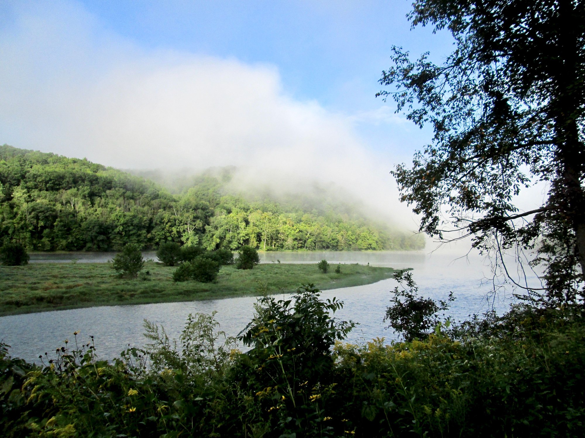
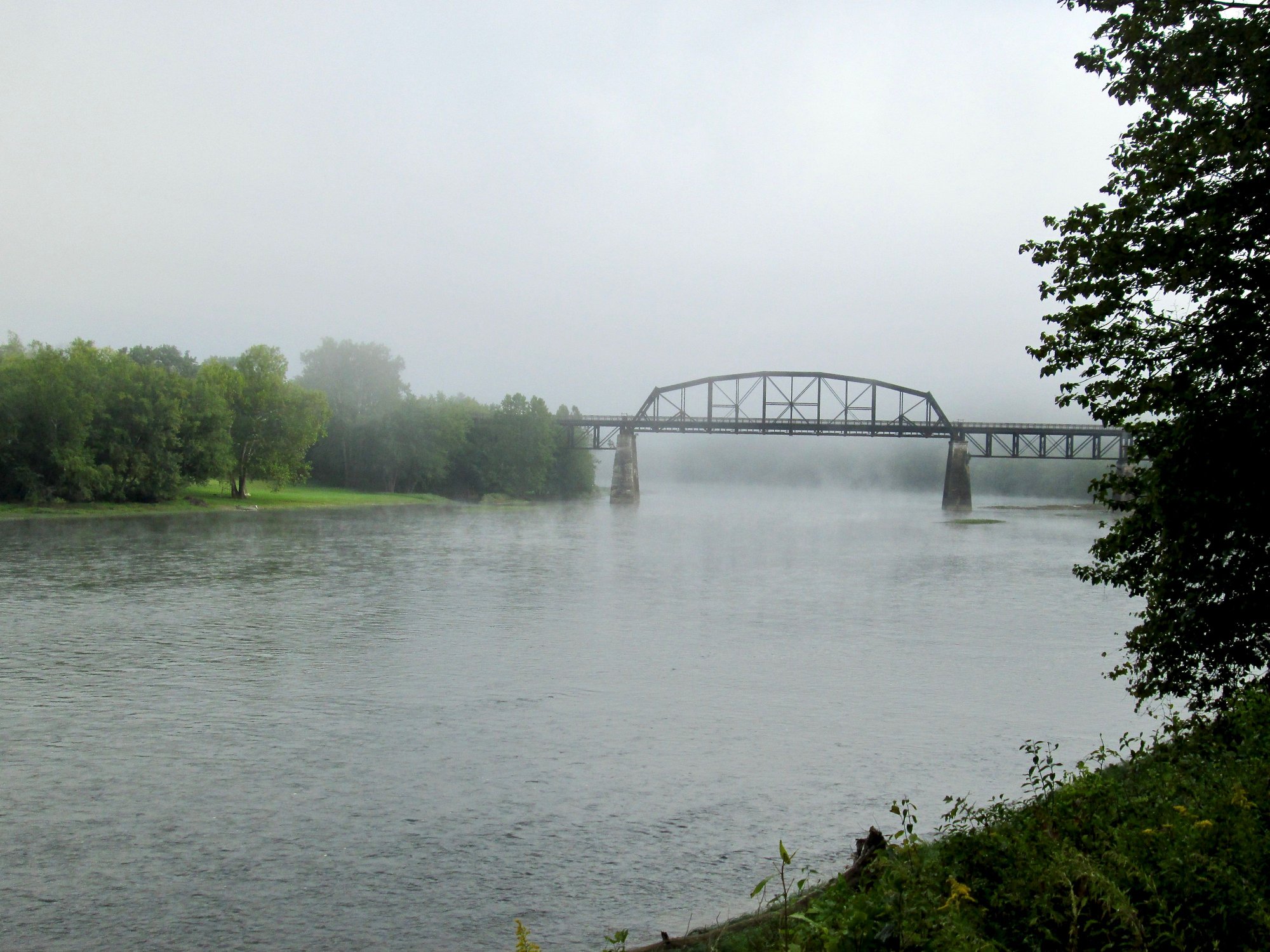
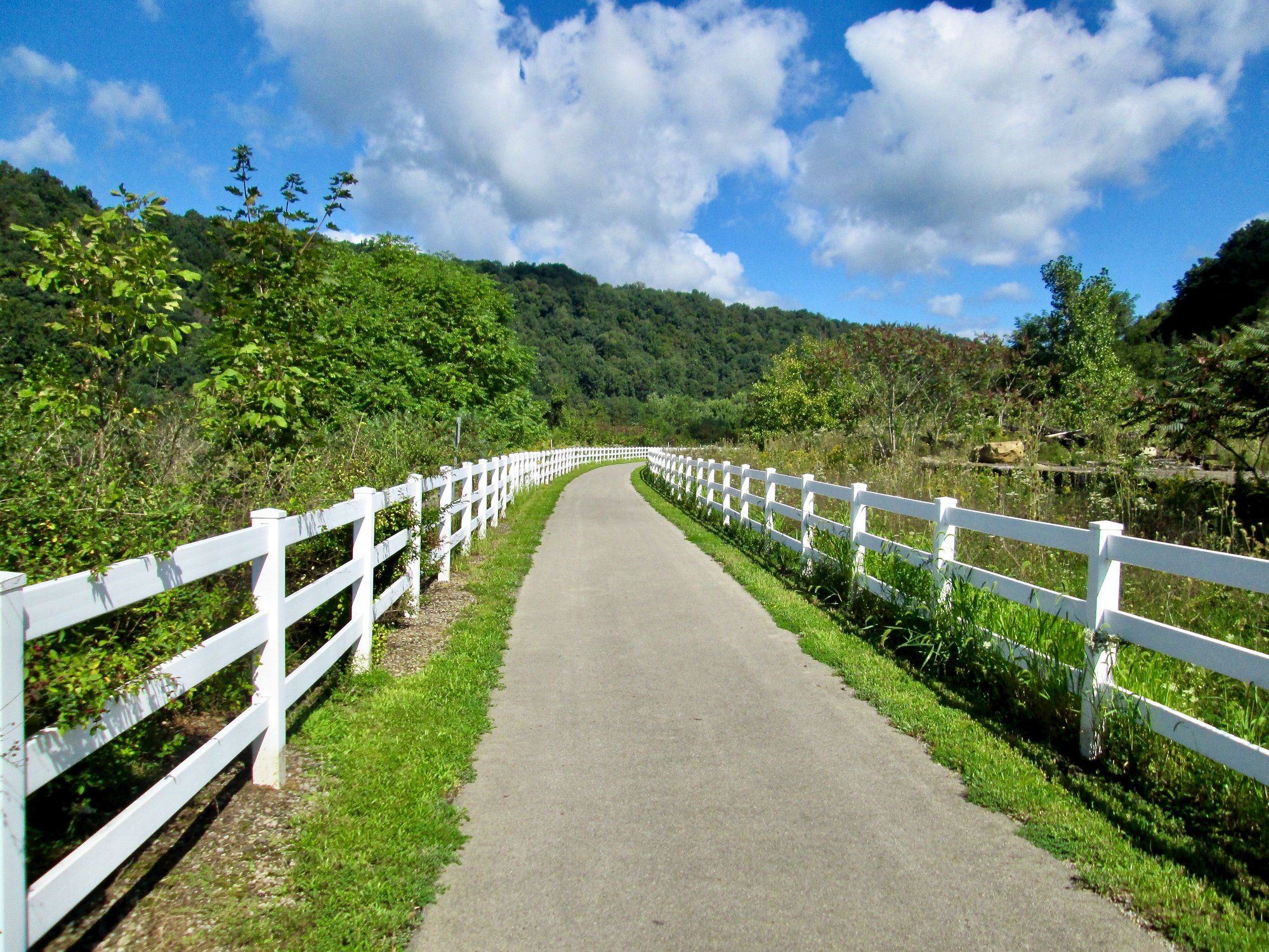
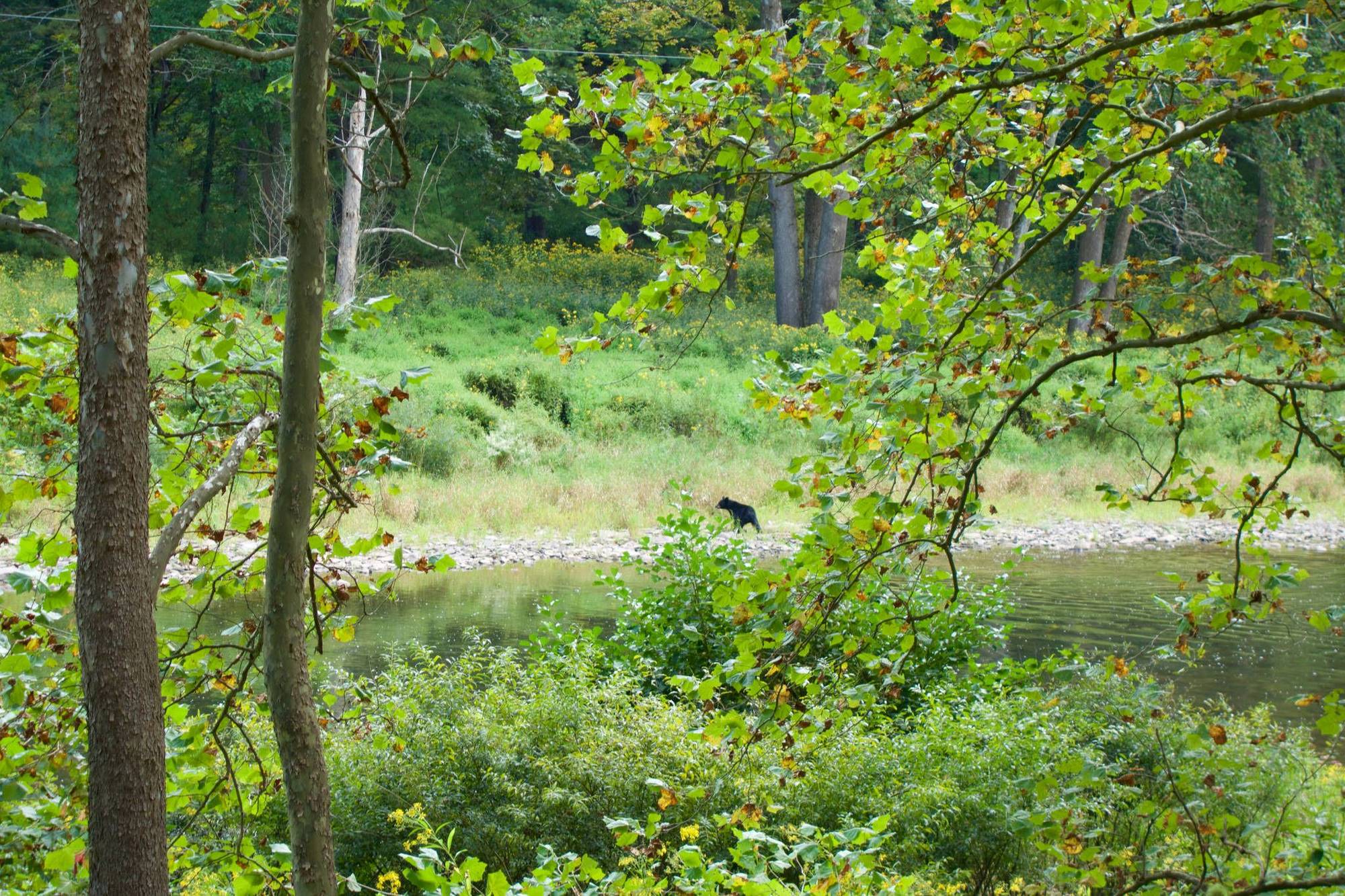
Some photos from the ART. It was foggy in the morning, but the day turned out to be gorgeous. The bridge across the river is the Sandy Creek Trail. If you look closely you can see the deer had recently shed his antler fuzz. The fence is at Emlenton. IIRC, there was an old Pennzoil plant there that is an environmental site.


Likes For indyfabz:
08-12-21, 03:49 AM
#7
Junior Member
Join Date: Sep 2013
Location: North Georgia Mountains
Posts: 19
Bikes: Trek 7.5 Hybrid, Specialized
Mentioned: 1 Post(s)
Tagged: 0 Thread(s)
Quoted: 3 Post(s)
Likes: 0
Liked 1 Time
in
1 Post
Following this thread
I too am planning a trip to PA, perhaps a little sooner than you. Thanks for posting your info so I can follow along with the responses.
Dee
Dee
08-12-21, 05:27 AM
#8
Senior Member
Join Date: Jan 2010
Posts: 39,229
Mentioned: 211 Post(s)
Tagged: 1 Thread(s)
Quoted: 18409 Post(s)
Liked 15,518 Times
in
7,324 Posts
08-12-21, 07:30 AM
#9
Senior Member
Join Date: Nov 2010
Location: Along the Rivers of Pittsburgh
Posts: 1,255
Bikes: 2011 Novara Forza Hybrid, 2005 Trek 820, 1989 Cannondale SR500 Black Lightning, 1975 Mundo Cycles Caloi Racer
Mentioned: 0 Post(s)
Tagged: 0 Thread(s)
Quoted: 258 Post(s)
Liked 291 Times
in
157 Posts
NIce photos, Indyfabz!
08-12-21, 08:23 AM
#10
Senior Member
Thread Starter
Join Date: Aug 2004
Location: Baltimore/DC
Posts: 2,930
Mentioned: 0 Post(s)
Tagged: 0 Thread(s)
Quoted: 170 Post(s)
Liked 156 Times
in
99 Posts
Thanks indyfabz , great picture and info. Makes one want to bike there. East of Shipenville on 322 is not on the map, so that's good. Sandy Creek to ART, I will look this over, not rreally certain about this area.
Also thanks to Altair 4 , thanks for the recomendations.
and IPassGas , hmmm did I include single track? I did that on my last bikepack trip through W. Va., the single track kicked my ass.
I will look this over on the weekend. I am also starting to look into the Allengeheny National Forest. While not trails, I am certain some splendid scenery.
08-12-21, 12:22 PM
#11
Senior Member
Join Date: Jan 2010
Posts: 39,229
Mentioned: 211 Post(s)
Tagged: 1 Thread(s)
Quoted: 18409 Post(s)
Liked 15,518 Times
in
7,324 Posts
Thanks indyfabz , great picture and info. Makes one want to bike there. East of Shipenville on 322 is not on the map, so that's good. Sandy Creek to ART, I will look this over, not rreally certain about this area.
08-13-21, 06:17 AM
#12
Senior Member
We did the Allegheny River Trail in 2017, unloaded bikes on day trips from Franklin - very nice. I really liked the Sandy Creek extension - as other mentioned, steep stairs but there was a plank ramp to push the bike up, getting back down was actually harder.
It rained the first day when we did the northern end, the surface stayed in good shape. Doing the sourthern end the next day, the tunnels were really dripping inside - more like mini-waterfalls!
I did a blog posting back then, has pictures of the stairs/ramp from the ART to the Sandy Creek trail and the tunnels here.
08-13-21, 09:03 PM
#13
Senior Member
Some photos from the ART. It was foggy in the morning, but the day turned out to be gorgeous. The bridge across the river is the Sandy Creek Trail. If you look closely you can see the deer had recently shed his antler fuzz. The fence is at Emlenton. IIRC, there was an old Pennzoil plant there that is an environmental site.
08-19-21, 06:56 AM
#14
Senior Member
Thread Starter
Join Date: Aug 2004
Location: Baltimore/DC
Posts: 2,930
Mentioned: 0 Post(s)
Tagged: 0 Thread(s)
Quoted: 170 Post(s)
Liked 156 Times
in
99 Posts
I could bypass 322 using the map below but would lose Sandy Creek trail. Or would have to do an up and back on it. 322 looks rideable though so might keep it.
Thanks
https://ridewithgps.com/routes/37140258
08-19-21, 07:00 AM
#15
Senior Member
Thread Starter
Join Date: Aug 2004
Location: Baltimore/DC
Posts: 2,930
Mentioned: 0 Post(s)
Tagged: 0 Thread(s)
Quoted: 170 Post(s)
Liked 156 Times
in
99 Posts
We did the Allegheny River Trail in 2017, unloaded bikes on day trips from Franklin - very nice. I really liked the Sandy Creek extension - as other mentioned, steep stairs but there was a plank ramp to push the bike up, getting back down was actually harder.
It rained the first day when we did the northern end, the surface stayed in good shape. Doing the sourthern end the next day, the tunnels were really dripping inside - more like mini-waterfalls!
I did a blog posting back then, has pictures of the stairs/ramp from the ART to the Sandy Creek trail and the tunnels here.
It rained the first day when we did the northern end, the surface stayed in good shape. Doing the sourthern end the next day, the tunnels were really dripping inside - more like mini-waterfalls!
I did a blog posting back then, has pictures of the stairs/ramp from the ART to the Sandy Creek trail and the tunnels here.
I'm startinng to see rain in people's posts in this area
 Note to self: pack rain gear.
08-19-21, 07:03 AM
Note to self: pack rain gear.
08-19-21, 07:03 AM
#16
Senior Member
Thread Starter
Join Date: Aug 2004
Location: Baltimore/DC
Posts: 2,930
Mentioned: 0 Post(s)
Tagged: 0 Thread(s)
Quoted: 170 Post(s)
Liked 156 Times
in
99 Posts
FWIW: I also rerouted from PArker to East Brady. Relatively flat until it isn't. One huge climb for about 1 mile but it is steep. Keeps me along the river for a longer period. The original routing is 7 miles longer but less climbing.
https://ridewithgps.com/routes/37133575
https://ridewithgps.com/routes/37133575
08-19-21, 08:12 AM
#17
Senior Member
Join Date: Jan 2010
Posts: 39,229
Mentioned: 211 Post(s)
Tagged: 1 Thread(s)
Quoted: 18409 Post(s)
Liked 15,518 Times
in
7,324 Posts
Sounds like a tough wet trip.
I could bypass 322 using the map below but would lose Sandy Creek trail. Or would have to do an up and back on it. 322 looks rideable though so might keep it.
Thanks
https://ridewithgps.com/routes/37140258
I could bypass 322 using the map below but would lose Sandy Creek trail. Or would have to do an up and back on it. 322 looks rideable though so might keep it.
Thanks
https://ridewithgps.com/routes/37140258
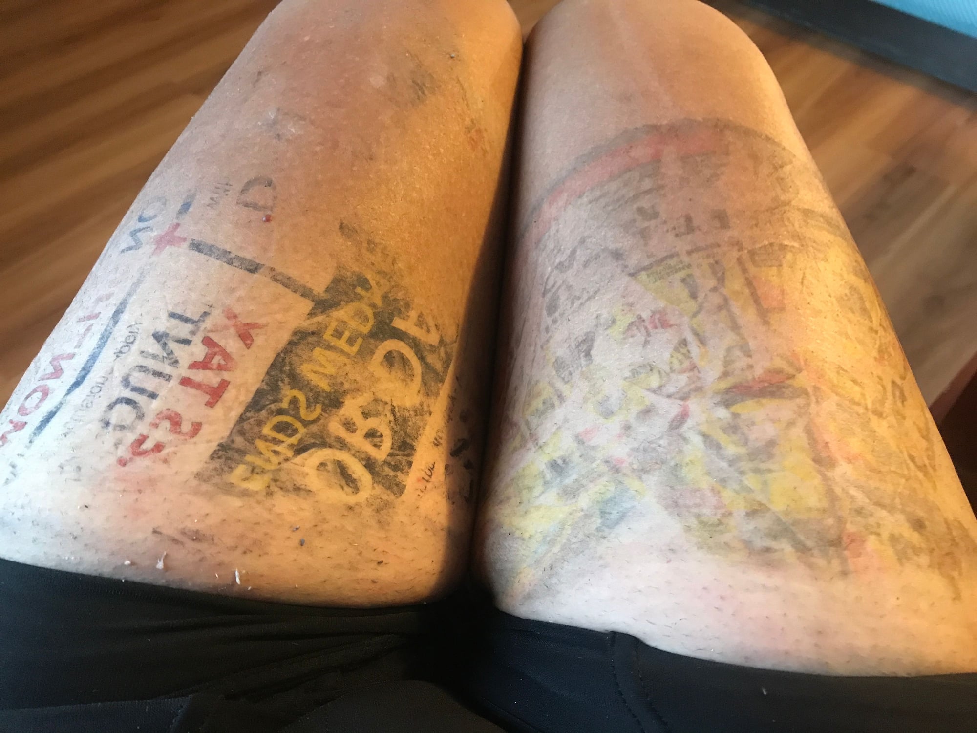
Pro tip: Don�t use the Sunday paper circulars to line your leg warmers:
Yes. 322 is definitely rideable. But as noted, you can still get to the Sandy Creek trailhead via 208, Nickleville, 38, a short stretch on 322 and then Tarklin Hill Rd. Just adds miles.
Last edited by indyfabz; 08-19-21 at 08:29 AM.
Likes For indyfabz:
08-19-21, 09:58 AM
#18
Senior Member
Join Date: Nov 2010
Location: Along the Rivers of Pittsburgh
Posts: 1,255
Bikes: 2011 Novara Forza Hybrid, 2005 Trek 820, 1989 Cannondale SR500 Black Lightning, 1975 Mundo Cycles Caloi Racer
Mentioned: 0 Post(s)
Tagged: 0 Thread(s)
Quoted: 258 Post(s)
Liked 291 Times
in
157 Posts
I took a look at Google Maps to see what they show for the transition between the Allegheny River trail and the Sandy Creek trail:
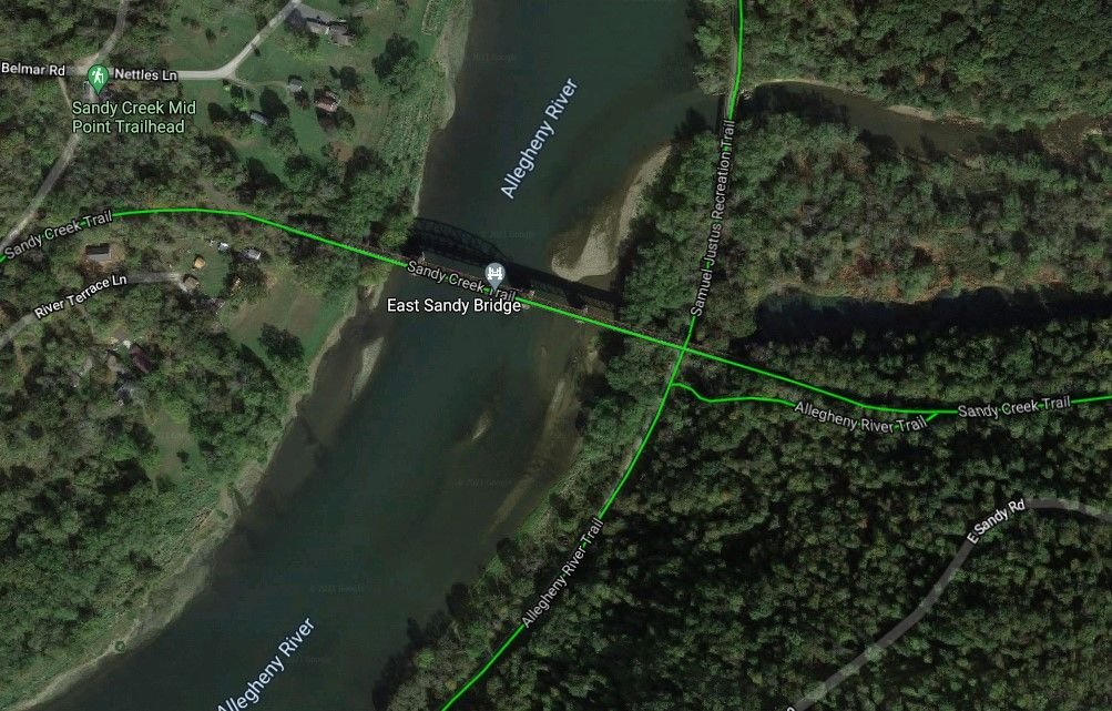
So it looks like there's actually a trail on the south side to transition from the ART to Sandy Creek. Or is that the stairs you folks are talking about? Dunno if it's actually there or not, though, having never ridden that section.
So it looks like there's actually a trail on the south side to transition from the ART to Sandy Creek. Or is that the stairs you folks are talking about? Dunno if it's actually there or not, though, having never ridden that section.
08-19-21, 02:57 PM
#19
Senior Member
Thread Starter
Join Date: Aug 2004
Location: Baltimore/DC
Posts: 2,930
Mentioned: 0 Post(s)
Tagged: 0 Thread(s)
Quoted: 170 Post(s)
Liked 156 Times
in
99 Posts
I took a look at Google Maps to see what they show for the transition between the Allegheny River trail and the Sandy Creek trail:
So it looks like there's actually a trail on the south side to transition from the ART to Sandy Creek. Or is that the stairs you folks are talking about? Dunno if it's actually there or not, though, having never ridden that section.
So it looks like there's actually a trail on the south side to transition from the ART to Sandy Creek. Or is that the stairs you folks are talking about? Dunno if it's actually there or not, though, having never ridden that section.
08-24-21, 06:29 AM
#20
Senior Member
4 years ago, there was no trail up to the Sandy Trail - just that ramp up to the eastern/southern end of the bridge. Could be just a Google maps interpretation of the ramp, or a hiking trail at best unless some new construction happened.
08-25-21, 11:52 AM
#21
Senior Member
Join Date: Oct 2009
Location: upstate NY
Posts: 161
Bikes: Jamis renegade, surly big dummy, giant talon 29er
Mentioned: 0 Post(s)
Tagged: 0 Thread(s)
Quoted: 62 Post(s)
Likes: 0
Liked 42 Times
in
22 Posts
If you can get into the pine creek area the rail trail is great. There are a ton of forest rd in that area too. I'll post a link below to the triple divide bike route. While not exactly western PA it could be a good resource.
https://www.mtbproject.com/trail/705...il-system-tdts
https://www.mtbproject.com/trail/705...il-system-tdts
08-25-21, 12:24 PM
#22
Senior Member
Join Date: Jan 2010
Posts: 39,229
Mentioned: 211 Post(s)
Tagged: 1 Thread(s)
Quoted: 18409 Post(s)
Liked 15,518 Times
in
7,324 Posts
Rode most of it (Ansonia/U.S. 322) to the southern terminus in Jersey Shore back in 2017 while riding across the state. Most of it is quite nice. Saw a bear the first day. He was just below the trail. He must have heard me coming, jumped in the creek and swan across. Went north off route at Waterville. Ended up camping at Happy Acres because I was unsure how much farther the entrance to the Little Pine S.P. camping area was. Walked down to the restaurant that evening and saw that the entrance is literally a stone's throw from the north end of the restaurant building. The corner of the building had blocked my view of the campground sign. Doh!
08-25-21, 12:36 PM
#23
Senior Member
Join Date: Apr 2013
Posts: 1,173
Bikes: Surly Disk Trucker, 2014 w/Brooks Flyer Special saddle, Tubus racks - Duo front/Logo Evo rear, 2019 Dahon Mariner D8, Both bikes share Ortlieb Packer Plus series panniers, Garmin Edge 1000
Mentioned: 2 Post(s)
Tagged: 0 Thread(s)
Quoted: 405 Post(s)
Liked 115 Times
in
99 Posts
Up front I don't have experience with the trails and specific roads in that area, however:
If you look at the elevation chart:
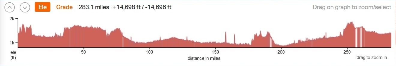
There are some serious climbs on the route - the sharper taller peaks and the sharp climbs to higher average elevation. Look around the following approximate mileages: 40, 155, 160, 175-185, 240.
Average elevation going up isn't necessarily a bad thing, but it will noticeably slow you down over a day - the heavier you are the slower you'll be. So be very careful with how you plan your target miles each day.
It may assist you in route planning to break down your route by elevation gain first and mileage 2nd. If you are not sure how to do this, but you keep records of your rides that include elevation, then look back at your rides and determine what your comfort level is. Keep in mind, a fitness ride or even a day trip with a bit of gear is going to be a world of difference from a long-term loaded tour (long-term meaning multi-day, maybe 4+ days). However, your past rides will give you a base line.
The worst thing you can do to yourself is to over-shoot what you are actually able to do. If you are crammed for time (if you have a week of vacation time from work, for example - or what ever amount of time vs what ever amount of miles you intend to do) and you route-plan on miles to keep things "on track" with the time you have available, not taking in to account your fitness ability to actually pound those miles (don't forget the elevation) - you are setting yourself up for a phone call or hitch-hike exit from your grand cycle touring plan. Take a step back and really analyze what you're getting in to vs your fitness level so you don't set yourself up for failure. Go out to enjoy the trip, not beat yourself up - physically and mentally.
08-25-21, 06:00 PM
#24
Senior Member
Join Date: Jan 2010
Posts: 39,229
Mentioned: 211 Post(s)
Tagged: 1 Thread(s)
Quoted: 18409 Post(s)
Liked 15,518 Times
in
7,324 Posts
I looked at your route.
Up front I don't have experience with the trails and specific roads in that area, however:
If you look at the elevation chart:
There are some serious climbs on the route - the sharper taller peaks and the sharp climbs to higher average elevation. Look around the following approximate mileages: 40, 155, 160, 175-185, 240.
Look the profile for this, which is the old Milwaukee Road railroad right-of-way from Avery, ID and the Hiawatha Trail:
https://ridewithgps.com/routes/37288266
The spikes represent the numerous tunnels. Some of the grades shown are over 30%. A railroad, obviously, would not have been feasible. That last big "climb" tops out at at nearly 5,200' ASL. That's the1.66 mile St. Paul Pass Tunnel at the eastern end of the trail. That tunnel actually tops out at 4,150 ASL inside. That equals more than 1,000 of "fake climbing" right there. Those steep dips represent the very high trestles. RWGPAS makes it look like you plunge down to the ground below and then climb back up.
His overall route, at around 50'/mile, is quite reasonable.
Last edited by indyfabz; 08-25-21 at 06:10 PM.
09-06-21, 06:11 PM
#25
Senior Member
Thread Starter
Join Date: Aug 2004
Location: Baltimore/DC
Posts: 2,930
Mentioned: 0 Post(s)
Tagged: 0 Thread(s)
Quoted: 170 Post(s)
Liked 156 Times
in
99 Posts
I looked at your route.
Up front I don't have experience with the trails and specific roads in that area, however:
If you look at the elevation chart:
There are some serious climbs on the route - the sharper taller peaks and the sharp climbs to higher average elevation. Look around the following approximate mileages: 40, 155, 160, 175-185, 240.
Average elevation going up isn't necessarily a bad thing, but it will noticeably slow you down over a day - the heavier you are the slower you'll be. So be very careful with how you plan your target miles each day.
It may assist you in route planning to break down your route by elevation gain first and mileage 2nd. If you are not sure how to do this, but you keep records of your rides that include elevation, then look back at your rides and determine what your comfort level is. Keep in mind, a fitness ride or even a day trip with a bit of gear is going to be a world of difference from a long-term loaded tour (long-term meaning multi-day, maybe 4+ days). However, your past rides will give you a base line.
The worst thing you can do to yourself is to over-shoot what you are actually able to do. If you are crammed for time (if you have a week of vacation time from work, for example - or what ever amount of time vs what ever amount of miles you intend to do) and you route-plan on miles to keep things "on track" with the time you have available, not taking in to account your fitness ability to actually pound those miles (don't forget the elevation) - you are setting yourself up for a phone call or hitch-hike exit from your grand cycle touring plan. Take a step back and really analyze what you're getting in to vs your fitness level so you don't set yourself up for failure. Go out to enjoy the trip, not beat yourself up - physically and mentally.
Two of those big spikes aftr mile 150 are the tunnels on the ART. GPS data comes from the tops of tunnels. Crossing high bridges also adds "fake climbing."
Look the profile for this, which is the old Milwaukee Road railroad right-of-way from Avery, ID and the Hiawatha Trail:
https://ridewithgps.com/routes/37288266
The spikes represent the numerous tunnels. Some of the grades shown are over 30%. A railroad, obviously, would not have been feasible. That last big "climb" tops out at at nearly 5,200' ASL. That's the1.66 mile St. Paul Pass Tunnel at the eastern end of the trail. That tunnel actually tops out at 4,150 ASL inside. That equals more than 1,000 of "fake climbing" right there. Those steep dips represent the very high trestles. RWGPAS makes it look like you plunge down to the ground below and then climb back up.
His overall route, at around 50'/mile, is quite reasonable.