


Karakoram / Pamir / Umling La
 08-25-22, 08:59 AM
#1
Senior Member
Thread Starter
Join Date: Sep 2015
Location: QC Canada
Posts: 1,960
Bikes: Custom built LHT & Troll
Mentioned: 12 Post(s)
Tagged: 0 Thread(s)
Quoted: 837 Post(s)
Liked 149 Times
in
106 Posts
Karakoram / Pamir / Umling La
At this time, this is purely armchair touring. Yet... I am semi-seriously considering a RTW trip, probably over a few years (fly to/from endpoints). America and Europe are no brainers, Asia is more complicated. I assume that loosely following the Silk Road (which in itself is a very fuzzy concept) would be a reasonable starting point. OTOH, riding "top-of-the-world" roads has a strong appeal.
Based on very superficial search, it looks like the Karakoram highway (Islamadad - Kashgar) is a better option (good tarmac, reasonable number of facilities, no crazy elevations requiring bottled oxygen, etc.). Then there is the Pamir highway, but since it goes through Afghanistan it may not be ideal (although it could be quite the opposite -- worth looking into). And then there is the Guinness record holder, Umling La pass (5 800M !) , which doesn't connect useful points on an eastbound trip, but may be worth the detour.
So...
1. If you have done Mount Evans (4 300M), I'd like to head about oxygen deprivation (e.g.taking rest days, carry oxygen, etc.)
2. If you have done the Karakoram, I'll read with considerable interest. [One first hand account met this past summer said that food was the bigger problem -- everyone gets sick.]
3. If you have considered/done Umling La -- I can't figure out if westerners can get the required permit... If you have clues to share, please do
Last edited by gauvins; 08-25-22 at 09:06 AM.
 08-25-22, 11:58 AM
#2
bicycle tourist
I haven't done Mt Evans on a bicycle. I have done the road from Arequipa to Puno Peru which tops out at 4528m. A few things I learned on that as far as elevation goes:
-- The general guidelines are to "climb high, sleep low" - i.e. climb over a pass during the day and sleep lower down. Also where possible, have your nightly gains increase by 1000ft/300m or so per day and take days to adjust.
-- That can be tough and on my ride I went up a bit quicker. Spent a few days in Arequipa (2600m) before climbing up and over in five days. I climbed to ~4100m and slept outside a toll booth without feeling too much elevation - but then spending a night in Imata at 4450m, I felt a light headache. Next day, I went over the 4528m point and after that down slightly and to Puno at 3800m. I didn't have problems at that point or later.
My guess is a key challenge will be getting through western China on a bicycle:
- Multiple years ago, I had read journals where a cyclist wasn't allowed to ride on the Chinese part of the border and put on a bus instead.
- My bicycle (but not me) cycled the Pamir Highway in 2009. This was because I had stashed the bicycle in Russia in 2007 and my brother and a friend went to ride the Pamir Highway including retrieving my bike for the trip. As I recall from 2009, they were able to cycle through Xinxiang - though in one of the towns they had arranged a "homestay" before having the police figure this out - and get them into a hotel instead. In this case, my brother started in Dushanbe, so didn't traverse Afghanistan to get there but came from the Russian side and flying in.
- I don't have more recent experience, but agree getting a permit or other ability to travel in Xinxiang in China (whether via Karakoram or Pamir) might be the largest challenge.
08-25-22, 04:46 PM
#3
Pennylane Splitter
Join Date: Sep 2012
Location: Orange County, California
Posts: 1,878
Bikes: Yes
Mentioned: 13 Post(s)
Tagged: 0 Thread(s)
Quoted: 1776 Post(s)
Liked 1,433 Times
in
983 Posts
I've been up as high as 6900m while mountain climbing in the Andes so can only comment about the oxygen. First thing is have you ever been at altitude to experience how your body reacts? The basics are you go up slowly and your body can adjust to the lessening oxygen content. for most persons it is not a problem if done slowly, but some folks just don't have the physiology to adapt to altitudes. You can also improve your ability to adjust to altitude by working out and getting in better aerobic/anerobic shape. Try hiking on some high peaks and see how you react; your info states you're in Quebec, so you'd have to travel to get to some higher peaks (maybe 3500m-4000m or higher).
And no matter what activity you are doing at those altitudes you're going to be doing it a lot slower that at sea level. I did White Mtn (14200ft, starting from 11,000ft) on the California/Nevada border on an old rigid MTB on a gravel road and I was in the lowest three gears the entire time. Exhausting!!
Never needed supplemental oxygen at altitude, even at 6900m, and I never saw anyone else using it. Supplemental O2 usually isn't needed until you get up to the 7500m-8000m range. and some folks have done Mt. Everest (8800m) without it.
Last edited by skidder; 08-25-22 at 04:52 PM.
08-25-22, 05:54 PM
#4
Senior Member
Thread Starter
Join Date: Sep 2015
Location: QC Canada
Posts: 1,960
Bikes: Custom built LHT & Troll
Mentioned: 12 Post(s)
Tagged: 0 Thread(s)
Quoted: 837 Post(s)
Liked 149 Times
in
106 Posts
But I keep in mind that you never needed oxygen (at significantly higher altitudes than those I'll ever be exposed to).
Before venturing in exotic locations, I'll probably try Denver
 08-25-22, 06:05 PM
#5
Senior Member
Thread Starter
Join Date: Sep 2015
Location: QC Canada
Posts: 1,960
Bikes: Custom built LHT & Troll
Mentioned: 12 Post(s)
Tagged: 0 Thread(s)
Quoted: 837 Post(s)
Liked 149 Times
in
106 Posts
Thanks for the data point.
Yup. The situation appears to be fluid. From what I understand, China has invested massively in a modern version of the silk road. This has a limited impact on the scenery, but changes the experience radically.
WRT visa/customs, there seems to be a consensus that this is hell.
I'll get in touch with my Chinese contacts. Not clear what I'll learn. One fellow from Urumqi never got back to me when he learned that I wanted to bike in this area (and there are abundant anecdotes that authorities forbid locals to interact with foreigners in Western China...)
As I said, strictly armchair touring for now
WRT visa/customs, there seems to be a consensus that this is hell.
I'll get in touch with my Chinese contacts. Not clear what I'll learn. One fellow from Urumqi never got back to me when he learned that I wanted to bike in this area
(and there are abundant anecdotes that authorities forbid locals to interact with foreigners in Western China...)As I said, strictly armchair touring for now
08-25-22, 06:48 PM
#6
Senior Member
Join Date: Aug 2010
Location: Madison, WI
Posts: 11,172
Bikes: 1961 Ideor, 1966 Perfekt 3 Speed AB Hub, 1994 Bridgestone MB-6, 2006 Airnimal Joey, 2009 Thorn Sherpa, 2013 Thorn Nomad MkII, 2015 VO Pass Hunter, 2017 Lynskey Backroad, 2017 Raleigh Gran Prix, 1980s Bianchi Mixte on a trainer. Others are now gone.
Mentioned: 47 Post(s)
Tagged: 0 Thread(s)
Quoted: 3450 Post(s)
Liked 1,449 Times
in
1,130 Posts
When you are exerting yourself, you are breathing hard and it does not seem to help much, you just have to get used to it and reduce your expectations for what you can accomplish. I use a heart rate monitor to tell me when to stop pedaling up hills and get off the bike to push it up instead.
Denver is not very high. I do not recall if you rode Going to the Sun Road, that is roughly the same as Denver. In other words, not very high.
If you are exerting yourself a lot and that evening do not feel very hungry, force yourself to eat. I do not know what it is about high elevation but losing appetite is something I saw more than I expected and if you reduce your nutrition at times like that you probably will regret it.
Somewhere in storage I have a book, Medicine for Mountaineering, had a good section on high elevation. But that book has to be 50 years old, I am sure there are much better resources out there that are more recent on what goes wrong at high elevation and what symptoms to watch for and preparation for it. That said, if you are planning an around the world trip, don't get bogged down by worries about elevation, you will have lots of other things that will give you more grief later.
If I was thinking around the world, I would be looking at Crazy Guy website, and taking notes on what went wrong for people in remote areas. I recall years ago reading a trip log of a couple that were in some remote part of asia and in the middle of nowhere they met a cyclist that had lost or broke his pump. He had been stranded for days. As a couple, they had two and gave him one. I would be working on my list of spares, and after reading that I would have a tiny little bail out pump. I have a small Zefal pump, about 25 cm long and about 90 grams. My trips have not been so remote that I would worry about a spare pump, but after reading your comment about your Road Morph G on your recent trip, maybe?
08-25-22, 06:57 PM
#7

Senior Member

I did the China section of the Silk Road in 2019. Access to Xinjiang is unpredictable. When I was there I had a 24 hour secret police tailing. Car driving slowly behind me in the desert, in the distance. 24 hours a day. Crazy stuff.
The whole area south of Kashgar was off limits to foreigners. I got thrown on a truck by the police and driven past the section, which was a bummer because I really wanted to visit Yengisar. Your mileage may vary today, but it would be a shame to fly to Kashgar and then find out access is forbidden. Do your homework.
On the Pakistan side the ride ends in Islamabad. That's where Bin laden was hiding. If you are American maybe keep your head on a swivel.
The ride itself, I hear, is excellent and popular with local Chinese cyclists. You'll have no problem with it. Acclimatize slowly to avoid pulmonary edema.
If China is too much of a headache you could always go to Tajikistan and do the Pamirs there. You can ride on the border with Afghanistan and look across the river at it. Very exciting.
08-26-22, 06:12 AM
#8
Senior Member
re altitude sickness, eons ago I did an exchange program where I was in Central America, but the program participated in countries all over the world. I met a fellow who did it the same year I did, but in South America. He was a super fit, strong dude, but in his group of Canadians where they quite high up in Ecuador or somewhere, he was the one who got pretty serious altitude sickness and had to be hospitalized.
That is when I learned what others have mentioned here, that yes you should do the gradual acclimatization thing etc, but some people get affected and others a lot less so.
I've not biked as high as the others (max was a bit over 3000, 3200 maybe?) but the gradual increase to that altitude over a few weeks meant that I didnt feel anything really.
The one experience I've had that gives me hope for being less affected from altitude sickness is after I spent about three weeks biking down the west coast of the states, so pretty much sea level the whole time--I then was taken by a friend in California hiking in the Sierra Nevadas for maybe three days. I recall the trailhead was at about 10,000 ft (just over 3000m) and the highest we got to was a bit over 12,000ft ( 3700m?)
I was ok at 3000m but as we climbed, and especially up at 3700m, I certainly had to slow things down a lot, stop and recover for a few minutes often, and had a slight headache--but it wasn't too bad, so I hope that given this trip had no gradual acclimatization, I might be less inclined to have issues at higher altitudes.
but who knows, would have to find out I guess, but really follow conservative acclimatization recommendations.
on a diff topic, and as Yan brought up, I have to say that I would be very apprehensive as a westerner in Pakistan, especially in rural areas with pretty conservative views to say the least of the west.
08-26-22, 08:02 AM
#9
Pennylane Splitter
Join Date: Sep 2012
Location: Orange County, California
Posts: 1,878
Bikes: Yes
Mentioned: 13 Post(s)
Tagged: 0 Thread(s)
Quoted: 1776 Post(s)
Liked 1,433 Times
in
983 Posts
re altitude sickness, eons ago I did an exchange program where I was in Central America, but the program participated in countries all over the world. I met a fellow who did it the same year I did, but in South America. He was a super fit, strong dude, but in his group of Canadians where they quite high up in Ecuador or somewhere, he was the one who got pretty serious altitude sickness and had to be hospitalized.
That is when I learned what others have mentioned here, that yes you should do the gradual acclimatization thing etc, but some people get affected and others a lot less so.
I've not biked as high as the others (max was a bit over 3000, 3200 maybe?) but the gradual increase to that altitude over a few weeks meant that I didnt feel anything really.
The one experience I've had that gives me hope for being less affected from altitude sickness is after I spent about three weeks biking down the west coast of the states, so pretty much sea level the whole time--I then was taken by a friend in California hiking in the Sierra Nevadas for maybe three days. I recall the trailhead was at about 10,000 ft (just over 3000m) and the highest we got to was a bit over 12,000ft ( 3700m?)
I was ok at 3000m but as we climbed, and especially up at 3700m, I certainly had to slow things down a lot, stop and recover for a few minutes often, and had a slight headache--but it wasn't too bad, so I hope that given this trip had no gradual acclimatization, I might be less inclined to have issues at higher altitudes.
.
08-26-22, 08:06 AM
#10
Pennylane Splitter
Join Date: Sep 2012
Location: Orange County, California
Posts: 1,878
Bikes: Yes
Mentioned: 13 Post(s)
Tagged: 0 Thread(s)
Quoted: 1776 Post(s)
Liked 1,433 Times
in
983 Posts
Hmmm highest has probably been 4000M - a rather short walk starting from the Aconcagua's viewpoint on the road between Mendoza and Santiago. No problem whatsoever, but frankly no exertion either...
But I keep in mind that you never needed oxygen (at significantly higher altitudes than those I'll ever be exposed to).
Before venturing in exotic locations, I'll probably try Denver
But I keep in mind that you never needed oxygen (at significantly higher altitudes than those I'll ever be exposed to).
Before venturing in exotic locations, I'll probably try Denver
As for what others say above about traveling in the southern Asia area, I'd be quite wary of venturing there right now. I've seen reports on climbing sites of groups in the Karakorum region of Pakistan needing to keep a low profile, some suggesting military escort, and Americans are really encouraged not to go there right now (not sure about Canadians, check with the Foreign Ministry). China might be the same as relations seem to be deteriorating with the COVID pandemic, the South China Sea dust-up, and now the Taiwan situation.
Last edited by skidder; 08-26-22 at 08:16 AM.
08-26-22, 08:28 AM
#11
Senior Member
Thread Starter
Join Date: Sep 2015
Location: QC Canada
Posts: 1,960
Bikes: Custom built LHT & Troll
Mentioned: 12 Post(s)
Tagged: 0 Thread(s)
Quoted: 837 Post(s)
Liked 149 Times
in
106 Posts
This being said, your point is well taken and if I were to move from armchair to actual RTW, I'll certainly spend some time listing critical components and proper measures (e.g. carrying spares; repair potential; etc.). For the top of my head I'd think that the most likely difference between extended summer tours in developed countries and extended tours in LDCs might be clothing related. I came across many anecdotes of sub-freezing temperatures for which I have no experience. Warm clothes tend to be bulky (synthetics) or negatively affected by rain (down). And quality (technical) clothing unlikely to be found in the middle of the stans.
Last, and totally unrelated, I realised that my mind was instinctively set on an west>east trip (i.e. Istanbul - Shanghai). A very superficial search on Weatherspark suggests that the wind is usually from the east, suggesting an east>west route... So I'll be looking for the equivalent of pilot charts for overlanders, if such a thing does exist... Winter can come -- plenty to do
Last edited by gauvins; 08-26-22 at 09:18 AM.
08-26-22, 09:14 AM
#12
bicycle tourist
One acclimatization anecdote, not directly cycling related.
I was living in northern Colorado when I had a friend come from LA for a short visit. Our not well thought out plan was to go hike up Longs Peak (4346m/14256ft) shortly after arrival. I picked him up from the airport on a Thursday afternoon and before sunrise we were at the trailhead. At the trailhead (2866m/9405ft) he was initially a stronger hiker than me as we went up the trail. However, by time we reached timberline ~3400m/11200ft, he was slowing down a lot and not much later we got to point it was clear we needed to turn back. We did get up to Boulder Field at 3840m/12600ft but it was clear we weren't going to make it to the summit.
The following year we were smarter about things. I again picked him up at the airport. However, instead of hitting the hiking trail within 12 hours, we went up to Summit County at 2750m/9000ft and stayed overnight. The next day, we actually did some easy 14ers such as Mount Bross and were OK. The following weekend we went back to Longs Peak. This time, no problems getting up to Boulder Field. In this case, we had different issues (abnormal amounts of snow left the trough still on the backside as technical and we weren't prepared for that so turned around).
This same friend eventually did hike up Kilamanjaro (5895m/19341ft) with a guided trip - so at least in his case it definitely was a situation of proper acclimatization being the key issue. That can be challenging to find enough resting points along the way to allow a gradual climb and adjustment to altittude.
As far as critical components like pumps go. My cycling partner across Russia did have a pump stolen from her bike. She had parked the bike outside a small shop in Siberia and on coming out noticed some hoodlum making off with her pump. She chased him but wasn't able to catch him. As it turned out, I had two normal road morph pumps with me and one mini pump so it wasn't a big issue to give her one of mine. However, we wouldn't have been stranded for days in those cases since there was still occasional traffic on the road.
08-26-22, 09:43 AM
#13
Senior Member
Thread Starter
Join Date: Sep 2015
Location: QC Canada
Posts: 1,960
Bikes: Custom built LHT & Troll
Mentioned: 12 Post(s)
Tagged: 0 Thread(s)
Quoted: 837 Post(s)
Liked 149 Times
in
106 Posts
Based on superficial search for recent travelogues, Western China (Xinjiang) is said to be peppered with road blocks (I read somewhere every 10-20 kms), tons of surveillance roadside cameras (every 100m !
, mandatory motorised transit in order to avoid towns, etc., etc. One review was more positive (police is helpful, we felt safe). But accounts tend to emphasize surveillance rather than scenery or random encounters with people.My very uneducated feeling is that the situation has worsen significantly (older travelogues made little or no mention of police surveillance or of lengthy border crossings). Will read caravanistan
08-26-22, 09:53 AM
#15
Member
I want to echo points made by skidder & djb. It's impossible to predict how any individual will react to high altitude. Being in great or lousy shape doesn't seem to be a predictor. A couple of days after I biked east to west over Trail Ridge Road (3,713 m) in Rocky Mountain National Park in Colorado, I came upon an Adventure Cycling group biking from the Pacific coast to the Atlantic coast. Someone in the group told me that 2 of the cyclists had to go home due to altitude sickness because their bodies couldn't handle the higher altitudes in Colorado. These were cyclists who were in good shape and had already biked from the coast of Oregon to Colorado.
I biked at similar altitudes in Ecuador, also without experiencing altitude sickness. I found that once I had biked over about 3,000m, I had to frequently stop to catch my breath. I've hiked at higher altitudes in the Andes without altitude sickness, but I certainly felt short of breath.
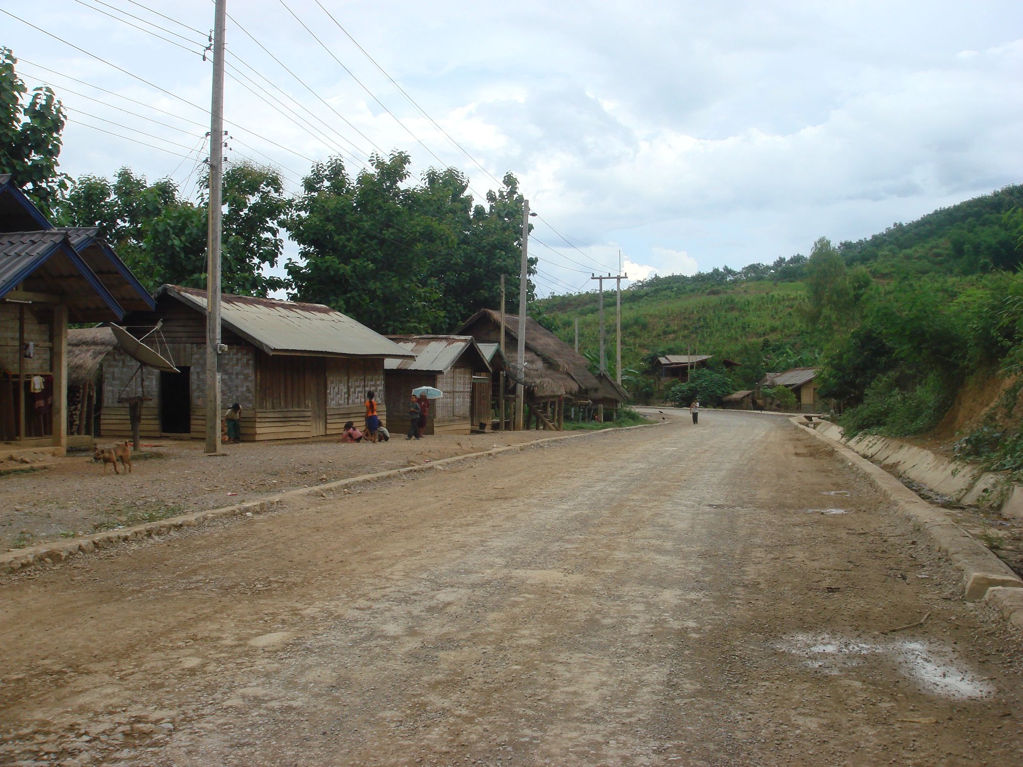
I met an Italian cyclist in a village in northern Laos. I was headed north, he was headed south. He had biked all the way from Italy to where we met. He biked across western China but I don't know his exact route. He told me that where we met in northern Laos (the gorgeous road between Luang Prabang & Vang Vieng) was the most challenging cycling of his entire trip. It's 3 days of long climbs and long descents, regardless of the direction you're headed.
I biked at similar altitudes in Ecuador, also without experiencing altitude sickness. I found that once I had biked over about 3,000m, I had to frequently stop to catch my breath. I've hiked at higher altitudes in the Andes without altitude sickness, but I certainly felt short of breath.
I met an Italian cyclist in a village in northern Laos. I was headed north, he was headed south. He had biked all the way from Italy to where we met. He biked across western China but I don't know his exact route. He told me that where we met in northern Laos (the gorgeous road between Luang Prabang & Vang Vieng) was the most challenging cycling of his entire trip. It's 3 days of long climbs and long descents, regardless of the direction you're headed.
08-26-22, 10:30 AM
#16
Senior Member
I want to echo points made by skidder & djb. It's impossible to predict how any individual will react to high altitude. Being in great or lousy shape doesn't seem to be a predictor. A couple of days after I biked east to west over Trail Ridge Road (3,713 m) in Rocky Mountain National Park in Colorado, I came upon an Adventure Cycling group biking from the Pacific coast to the Atlantic coast. Someone in the group told me that 2 of the cyclists had to go home due to altitude sickness because their bodies couldn't handle the higher altitudes in Colorado. These were cyclists who were in good shape and had already biked from the coast of Oregon to Colorado.
I biked at similar altitudes in Ecuador, also without experiencing altitude sickness. I found that once I had biked over about 3,000m, I had to frequently stop to catch my breath. I've hiked at higher altitudes in the Andes without altitude sickness, but I certainly felt short of breath.
I met an Italian cyclist in a village in northern Laos. I was headed north, he was headed south. He had biked all the way from Italy to where we met. He biked across western China but I don't know his exact route. He told me that where we met in northern Laos (the gorgeous road between Luang Prabang & Vang Vieng) was the most challenging cycling of his entire trip. It's 3 days of long climbs and long descents, regardless of the direction you're headed.
08-26-22, 10:38 AM
#17
Senior Member
WRT Pakistan and China, canadian advisories list both destination as places where you have to "exercise a high level of caution". There is a section devoted to the Xinjiang Uyghur Autonomous Region, where they warn against "arbitrary detention" and "invasive security measures".
Based on superficial search for recent travelogues, Western China (Xinjiang) is said to be peppered with road blocks (I read somewhere every 10-20 kms), tons of surveillance roadside cameras (every 100m !, mandatory motorised transit in order to avoid towns, etc., etc. One review was more positive (police is helpful, we felt safe). But accounts tend to emphasize surveillance rather than scenery or random encounters with people.
My very uneducated feeling is that the situation has worsen significantly (older travelogues made little or no mention of police surveillance or of lengthy border crossings). Will read caravanistan
Based on superficial search for recent travelogues, Western China (Xinjiang) is said to be peppered with road blocks (I read somewhere every 10-20 kms), tons of surveillance roadside cameras (every 100m !
, mandatory motorised transit in order to avoid towns, etc., etc. One review was more positive (police is helpful, we felt safe). But accounts tend to emphasize surveillance rather than scenery or random encounters with people.My very uneducated feeling is that the situation has worsen significantly (older travelogues made little or no mention of police surveillance or of lengthy border crossings). Will read caravanistan
But overall the police were polite and friendly. No rudeness, just carrying out their duties. The whole place is a police state. Felt bad for the Uyghurs.
I think the team that was shadowing me in the distance 24 hours a day is a separate department from the regular roadblock police. I tried to "catch" them by surprise a few times but they sped off. Eventually I just accepted them and let them be. When I got to Kashgar I did a couple of days of sightseeing and got the hell out of there by high speed train. It was a cool experience but once is enough. I wouldn't go through that again. Frankly if they're going to go through all that effort they should just ban foreigners altogether. Why bother putting up the facade of being open? I did the southern Xinjiang route. I hear the north side is a bit better.
Last edited by Yan; 08-26-22 at 10:45 AM.
08-26-22, 10:42 AM
#18
Senior Member
Thread Starter
Join Date: Sep 2015
Location: QC Canada
Posts: 1,960
Bikes: Custom built LHT & Troll
Mentioned: 12 Post(s)
Tagged: 0 Thread(s)
Quoted: 837 Post(s)
Liked 149 Times
in
106 Posts
In May 2019 when I was there, Xinjiang had road blocks on both sides of every oasis town. There is only one road in the desert, so there is no way to avoid the road blocks. At every road block I was taken in and interviewed for 10 to 20 minutes. I was probably spending two hours each day just processing through all the road blocks. They also forced me to install some spying app on my phone that fed the police all my phone activities. I was mandatory shuttled through many areas. SE Xinjiang on the border with Qinghai; the whole area several hundred km south of Kashgar. I guess these were sensitive areas. Sometimes I had a police car ride. Other times the police just flagged down some passing vegetable cargo truck and told the driver to give me a lift to the next town's checkpoint. Then they called ahead so the next checkpoint can grab me.
But overall the police were polite and friendly. No rudeness, just carrying out their duties. The whole place is a police state. Felt bad for the Uyghurs.
But overall the police were polite and friendly. No rudeness, just carrying out their duties. The whole place is a police state. Felt bad for the Uyghurs.
08-26-22, 10:51 AM
#19
Senior Member
It was highly worth it. The security aspect added to the adventure. I guess you could call it a dark adventure. You need the correct personality for it though. Some people may be freaked out.
The riding itself was also brutal. Massive desert. Big head winds, big sand storms. I love that kind of thing. Your milage may vary.
The cultural aspect, it was still there, but you could tell it was being massively wiped out in front of your eyes. Sad. I'm glad I could go when I did before it disappeared forever.
08-26-22, 11:23 AM
#20
Senior Member
Join Date: Aug 2010
Location: Madison, WI
Posts: 11,172
Bikes: 1961 Ideor, 1966 Perfekt 3 Speed AB Hub, 1994 Bridgestone MB-6, 2006 Airnimal Joey, 2009 Thorn Sherpa, 2013 Thorn Nomad MkII, 2015 VO Pass Hunter, 2017 Lynskey Backroad, 2017 Raleigh Gran Prix, 1980s Bianchi Mixte on a trainer. Others are now gone.
Mentioned: 47 Post(s)
Tagged: 0 Thread(s)
Quoted: 3450 Post(s)
Liked 1,449 Times
in
1,130 Posts
I really think that elevation acclimation ability is quite dependent on how old you are. In my early 20s, we lived at about 1,000 feet of elevation, would drive to about 10,000 feet, camp there for a night and start backpackin up above 13,000 feet. That was in an era before Gore Tex existed, we were too poor to afford freeze dried, packs were heavy. We certainly noticed that we had to breath more and walk slower, but we had no acclimation problems on multiple backpacking trips.
But when I was in my 50s, I would fly to see my sister, she lived at about 4,500 to 5,000 feet. And the first day there I would get mild headaches just sitting around in the house. So, if you are up in age, take much more care on altitude acclimation.
That said, you can't go far on a bike in a day, especially up tall hills, so that might be sufficient to control your steady elevation rise for acclimation.
I think you need to do some multi-hour bike rides in winter. Then find out what works for you and what does not. If it is below freezing, I usually wear hiking shoes or hiking boots instead of bike shoes, I do not want to be cleated in when I hit patches of ice. Ski goggles are very useful. I would often change between about three pairs of gloves or mittens. There were times that a couple of my finger tips were nearly numb but the palms of my hands were sweating.
Presumably you would be using a liquid fuel stove that can burn kerosene. And carrying the spares kit for that.
Some day when I get bored I will look at more of these videos, I have only looked at a few. They camp much heavier than I do. But they clearly have a lot of experience on the topic.
https://www.youtube.com/channel/UC8b...rhv1FL3hdP2VSA
But when I was in my 50s, I would fly to see my sister, she lived at about 4,500 to 5,000 feet. And the first day there I would get mild headaches just sitting around in the house. So, if you are up in age, take much more care on altitude acclimation.
That said, you can't go far on a bike in a day, especially up tall hills, so that might be sufficient to control your steady elevation rise for acclimation.
...
.... For the top of my head I'd think that the most likely difference between extended summer tours in developed countries and extended tours in LDCs might be clothing related. I came across many anecdotes of sub-freezing temperatures for which I have no experience. Warm clothes tend to be bulky (synthetics) or negatively affected by rain (down). And quality (technical) clothing unlikely to be found in the middle of the stans.
...
Presumably you would be using a liquid fuel stove that can burn kerosene. And carrying the spares kit for that.
Some day when I get bored I will look at more of these videos, I have only looked at a few. They camp much heavier than I do. But they clearly have a lot of experience on the topic.
https://www.youtube.com/channel/UC8b...rhv1FL3hdP2VSA
08-26-22, 01:20 PM
#21
Member
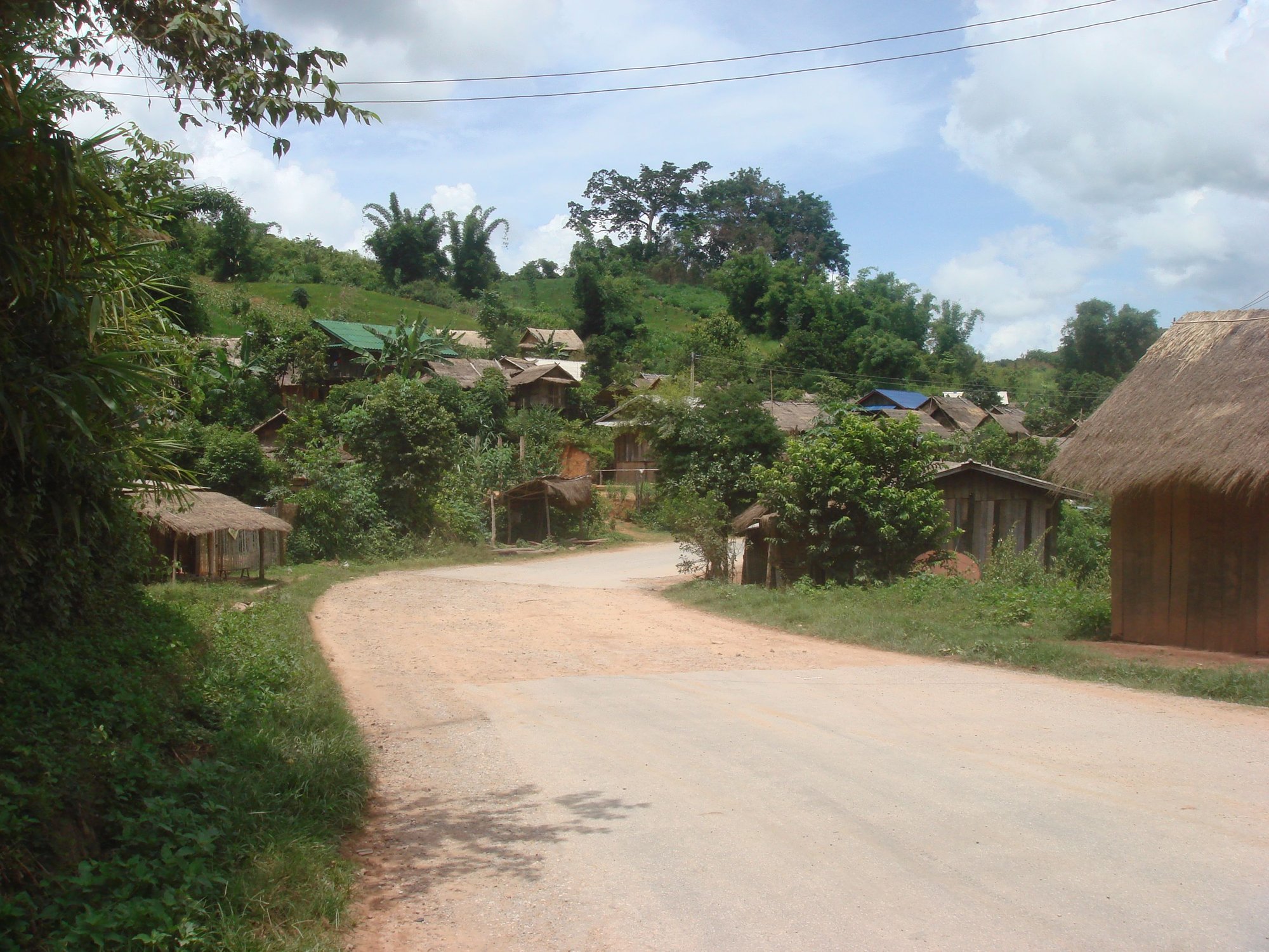
Which year did you do Laos? I did Laos in 2010 and at that point the whole road system north and south from Luang Prabang was mixed gravel. From the Chinese border to Vientiane, yeah, it was tough. Really hard climbing and impossible to enjoy the downhills due the poor road. It took me eleven days! A few years later I read some bike tourist journals that showed the Chinese have gone in and paved it for them.
08-26-22, 01:29 PM
#22
Senior Member
That's bizarre because I was there 2 years prior to you in early 2008 and the roads were excellent everywhere except on a portion of the road from Luang Namtha toward the Mekong river and the Thai border. There was a stretch of that good road which was being torn up for no apparent reason and repaved. I assume it was some sort of boondoggle and somebody was making a lot of money. The road quality between Vientiane and Luang Prabang was excellent in early 2008. I was told at that time that the Chinese & Thai governments had paved the road so travel between China & Thailand could avoid unstable Burma/Myanmar.
Also every few minutes there'd be a stretch there the surface was gone and the road foundation boulders were exposed. I thought that was weird. Did you have that too? The part near the capital was better, yes.
Last edited by Yan; 08-26-22 at 01:33 PM.
08-26-22, 01:42 PM
#23
Member
I was on the same road as you from Vientiane north to Pakmong. Excellent road quality that entire stretch, and minimal traffic, especially between Vang Vieng and Luang Prabang. From Pakmong west to Oudomxai, the paved road was rougher but very rideable.Then it improved again to Luang Namtha.
Link to old trip report I posted:
https://www.bikeforums.net/touring/3...ip-report.html
That's probably enough thread drift. Let's get back to the OP's topics.
Link to old trip report I posted:
https://www.bikeforums.net/touring/3...ip-report.html
That's probably enough thread drift. Let's get back to the OP's topics.
Last edited by axolotl; 08-26-22 at 01:54 PM.
08-26-22, 01:53 PM
#24
Senior Member
I was on the same road as you from Vientiane north to Pakmong. Excellent road quality that entire stretch, and minimal traffic, especially between Vang Vieng and Luang Prabang. From Pakmong west to Oudomxai, the paved road was rougher but very rideable.Then it improved again to Luang Namtha.
That's probably enough thread drift. Let's get back to the OP's topics.
That's probably enough thread drift. Let's get back to the OP's topics.

 08-26-22, 03:03 PM
#25
Senior Member
Thats pretty typical Guatemala, and why I will never tour again in these sort of varying conditions with anything less than the 2in tires I used. Thats the one downside to 26" wheels, is that some of the newer tires aren't available in 26, and there seem to be some great tires out there, like Almotions for instance.
but its always going to be a balance of figuring out what sort of tread pattern tires to use. On roads like these with diff stuff, as well as dirt that isn't too bad, I still find lightly treaded wide tires to work well for these situations, but also good and quieter for all the paved sections, no matter the quality of the pavement.
but its always going to be a balance of figuring out what sort of tread pattern tires to use. On roads like these with diff stuff, as well as dirt that isn't too bad, I still find lightly treaded wide tires to work well for these situations, but also good and quieter for all the paved sections, no matter the quality of the pavement.

