


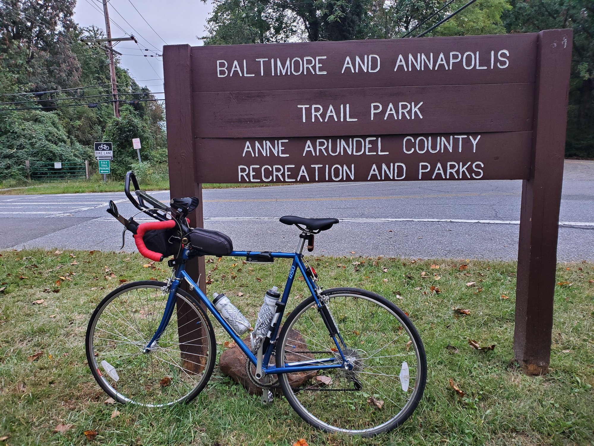
B&A Trail Scheduled
 10-10-21, 08:45 PM
#1
Observational Theorist
Thread Starter

Join Date: Jan 2021
Location: Baltimore
Posts: 71
Mentioned: 0 Post(s)
Tagged: 0 Thread(s)
Quoted: 26 Post(s)
Liked 20 Times
in
16 Posts
B&A Trail Scheduled Closure
Just a heads up, be advised a portion of the trail closes for FOUR MONTHS beginning 20 October. Now is your last chance to be able to ride through the trail from end to end till next year.
Why are "repairs" on a small footbridge taking 4 momths I have no idea.
~ Doc James
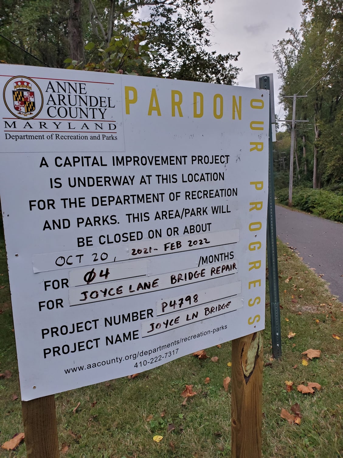
Why are "repairs" on a small footbridge taking 4 momths I have no idea.
~ Doc James
Last edited by DocJames; 10-10-21 at 09:20 PM. Reason: Typo in title
 10-11-21, 10:48 AM
#2
Senior Member
That bridge was closed back in 2019, and I did an ugly detour around it - taking Joyce Lane E to Balt/Annapolis and then a stretch on the shoulder over to where Naval Bagels is,. Severn Way I think. Not pretty.
There were a lot of work related closures in 2020, I found I could call the Earleigh Height's Ranger station at 410 222 6244 and ask if there were any closures before heading out. Bridge work does seem to take forever.
The good news is that the road grinding/repaving of 450 south of Rt. 50 (and Boulters Way) was completed - a very nice surface all the way into Annapolis. I have a loop I do from Earleigh Heights and over to Sandy Point Park and hit that stretch when it was ground down, yuck.
Last edited by jpescatore; 10-12-21 at 05:42 AM.
10-11-21, 02:22 PM
#3
Observational Theorist
Thread Starter
Join Date: Jan 2021
Location: Baltimore
Posts: 71
Mentioned: 0 Post(s)
Tagged: 0 Thread(s)
Quoted: 26 Post(s)
Liked 20 Times
in
16 Posts
That bridge was closed back in 2019
The good news is that the road grinding/repaving of 450 south of Rt. 50 (and Boulters Way) was completed - a very nice surface all the way into Annapolis. I have a loop I do from Earleigth Heights and over to Sandy Point Park and hit that stretch when it was ground down, yuck.
The good news is that the road grinding/repaving of 450 south of Rt. 50 (and Boulters Way) was completed - a very nice surface all the way into Annapolis. I have a loop I do from Earleigth Heights and over to Sandy Point Park and hit that stretch when it was ground down, yuck.
That newly repaved section of 450 is really sweet! Done it a few times recently.
11-05-21, 05:29 AM
#4
I think I know nothing.
Join Date: Aug 2004
Location: NE PA
Posts: 709
Mentioned: 6 Post(s)
Tagged: 0 Thread(s)
Quoted: 233 Post(s)
Liked 290 Times
in
204 Posts
That bridge was closed back in 2019, and I did an ugly detour around it - taking Joyce Lane E to Balt/Annapolis and then a stretch on the shoulder over to where Naval Bagels is,. Severn Way I think. Not pretty.
There were a lot of work related closures in 2020, I found I could call the Earleigh Height's Ranger station at 410 222 6244 and ask if there were any closures before heading out. Bridge work does seem to take forever.
The good news is that the road grinding/repaving of 450 south of Rt. 50 (and Boulters Way) was completed - a very nice surface all the way into Annapolis. I have a loop I do from Earleigh Heights and over to Sandy Point Park and hit that stretch when it was ground down, yuck.
There were a lot of work related closures in 2020, I found I could call the Earleigh Height's Ranger station at 410 222 6244 and ask if there were any closures before heading out. Bridge work does seem to take forever.
The good news is that the road grinding/repaving of 450 south of Rt. 50 (and Boulters Way) was completed - a very nice surface all the way into Annapolis. I have a loop I do from Earleigh Heights and over to Sandy Point Park and hit that stretch when it was ground down, yuck.
11-05-21, 06:05 AM
#5
Senior Member
Depends on where you are starting from in Millersville area.
I used to ride more in that area years ago - from Millersville Elementary School there is actually a paved trail (South Shore Trail) east to Waterbury to Millersville Rd.
From there you have to get around the Severn River and the only choice is Generals Highway which isn't great for biking but not that bad. Just a few miles on that and you can cut over to Bennefield Road and several options to get to the B&A trail, like at Earleigh Heights road where there is lots of parking, facilities.
So, maybe total roundtrip of 4 miles or so that isn't fun, the rest is fine.
If you are starting west of Rt. 3, getting to this route means riding on 175 which I haven't done in years but it had decent shoulders - not sure anymore. There might be other ways from that side of Millersville but there is a big nature reserve that gets in your way north of there.
OK I want to ask you about this trail. I have a sister that lives in Millersville of which I haven't see in 20 years. Long story. Anyway, I have been looking for a reason to stop in and say Hi so was considering using a ride on the B&A as the excuse. Assuming I ride out and back I guess that would be about 25 miles is this a pleasant ride or a horror story? May I have your thoughts please? It would be a next summer timeframe.
11-05-21, 10:08 AM
#6
I think I know nothing.
Join Date: Aug 2004
Location: NE PA
Posts: 709
Mentioned: 6 Post(s)
Tagged: 0 Thread(s)
Quoted: 233 Post(s)
Liked 290 Times
in
204 Posts
Depends on where you are starting from in Millersville area.
I used to ride more in that area years ago - from Millersville Elementary School there is actually a paved trail (South Shore Trail) east to Waterbury to Millersville Rd.
From there you have to get around the Severn River and the only choice is Generals Highway which isn't great for biking but not that bad. Just a few miles on that and you can cut over to Bennefield Road and several options to get to the B&A trail, like at Earleigh Heights road where there is lots of parking, facilities.
So, maybe total roundtrip of 4 miles or so that isn't fun, the rest is fine.
If you are starting west of Rt. 3, getting to this route means riding on 175 which I haven't done in years but it had decent shoulders - not sure anymore. There might be other ways from that side of Millersville but there is a big nature reserve that gets in your way north of there.
I used to ride more in that area years ago - from Millersville Elementary School there is actually a paved trail (South Shore Trail) east to Waterbury to Millersville Rd.
From there you have to get around the Severn River and the only choice is Generals Highway which isn't great for biking but not that bad. Just a few miles on that and you can cut over to Bennefield Road and several options to get to the B&A trail, like at Earleigh Heights road where there is lots of parking, facilities.
So, maybe total roundtrip of 4 miles or so that isn't fun, the rest is fine.
If you are starting west of Rt. 3, getting to this route means riding on 175 which I haven't done in years but it had decent shoulders - not sure anymore. There might be other ways from that side of Millersville but there is a big nature reserve that gets in your way north of there.
What about riding the trail only and not worrying about an exact starting point in Millersville?
11-05-21, 02:26 PM
#7
Senior Member
Today at lunch I took a chance that the B&A trail construction that above DocJames posted was scheduled to start 10/20 hadn't happened yet. Bzzzt - wrong. Big chainlink fence across the Trail at Glen Oban Drive.
So, Thomas15, to answer your question. The southern 2 miles of the trail aren't accessible right now from the north, if you start at the Earleigh Heights trailhead you can still do 5.5 miles south and 5 5 miles back, a short but very nice ride. But, used to be nice to continue south and ride to Annapolis or cut east to loop to Sandy Point State Park from the southern end.
You can go also go north on the trail, but the last few miles of the northern section has a lot of road crossings and intersections - stop and go riding. But after 7 miles you connect to the 10.5 mile loop around BWI airport. So, you can pretty much design your own adventure!
Last edited by jpescatore; 11-10-21 at 04:23 AM.
