


Glacier Park: Going-to-the Sun Road closed to cars for another week?
 06-08-21, 08:47 AM
#1
Junior Member
Thread Starter
Join Date: Apr 2021
Location: Portland
Posts: 99
Bikes: 1983 Woodrup Giro Touring w/ Huret Duopar, Campy high flange hubs, Deore Dyna-Drive crank pedals and brakes 1987 Bridgestone MB2 bafang mid-drive added in 2015
Mentioned: 0 Post(s)
Tagged: 0 Thread(s)
Quoted: 64 Post(s)
Liked 24 Times
in
17 Posts
Glacier Park: Going-to-the Sun Road closed to cars for another week?
Hello all,
I am going to make a spontaneous Amtrak trip to West Glacier with hopes of riding the Going-to-the-Sun road before it opens for cars for the season. I expect to arrive either Saturday or Sunday morning on the Empire Builder. Any locals have any information on whether the road will still be closed to cars at that time?
I'm not sure on my path back to Portland from there. Originally I thought I would ride to Sandpoint, ID from Glacier and then Amtrak back to Portland but I am not in the mood for that many nights of camping. Now I am thinking hanging out in Whitefish and Kalispell for a couple of day and then Amtrak to Libby and bicycle from Libby to Sandpoint or Spokane and then Amtrak back to Portland.
Going to the Sun closed to cars for another week?
What is the best part of the ride between Whitefish and Sandpoint? Is Amtrak from Whitefish to Libby a good plan?
Is the ride between Sandpoint and Spokane worth doing?
Thanks
What is the best part of the ride from
 06-08-21, 09:18 AM
#2
Senior Member
Join Date: Jun 2008
Location: Massachusetts
Posts: 74
Mentioned: 0 Post(s)
Tagged: 0 Thread(s)
Quoted: 14 Post(s)
Likes: 0
Liked 0 Times
in
0 Posts
06-08-21, 09:41 AM
#3
Junior Member
Thread Starter
Join Date: Apr 2021
Location: Portland
Posts: 99
Bikes: 1983 Woodrup Giro Touring w/ Huret Duopar, Campy high flange hubs, Deore Dyna-Drive crank pedals and brakes 1987 Bridgestone MB2 bafang mid-drive added in 2015
Mentioned: 0 Post(s)
Tagged: 0 Thread(s)
Quoted: 64 Post(s)
Liked 24 Times
in
17 Posts
Thanks. I have been watching the road status website which has daily updates but they don't give information on when it will finally open to cars for the season.
https://www.nps.gov/applications/gla...roadstatus.cfm
The link you provided is interesting with regards to reservations. Worst case it looks like I will need to camp at Fish Creek instead of Apgar to get road access without a reservation. Maybe that is not a bad thing but I like being close to a store and cafe so Apgar is probably my first choice.
06-08-21, 10:58 AM
#4
Senior Member
Join Date: Jan 2010
Posts: 39,229
Mentioned: 211 Post(s)
Tagged: 1 Thread(s)
Quoted: 18409 Post(s)
Liked 15,518 Times
in
7,324 Posts
Thanks. I have been watching the road status website which has daily updates but they don't give information on when it will finally open to cars for the season.
https://www.nps.gov/applications/gla...roadstatus.cfm
The link you provided is interesting with regards to reservations. Worst case it looks like I will need to camp at Fish Creek instead of Apgar to get road access without a reservation. Maybe that is not a bad thing but I like being close to a store and cafe so Apgar is probably my first choice.
https://www.nps.gov/applications/gla...roadstatus.cfm
The link you provided is interesting with regards to reservations. Worst case it looks like I will need to camp at Fish Creek instead of Apgar to get road access without a reservation. Maybe that is not a bad thing but I like being close to a store and cafe so Apgar is probably my first choice.
You don�t need an entry reservation if you enter on a bike.
Shop in W. Glacier if you will be cooking and camp at Sprague Creek. They let hikers/bikers camp in the infield of the loop. There are some tent pads and bear lockers. It�s an easy ride or walk to Lake McDonald Lodge, which is a must-see. The food in the dining room was quite good when I was last there in 2017. There is also a store there, but it mostly sell junk/snack food. Don�t know if the same campground host will be back again this year. If he is, he�s really nice. Last time his wife gave me cookies fresh out of their RV oven, and he offered me free firewood from his personal stash.
Start riding up very early. I usually left Sprague Creek around 5:30 am. Plenty of light. If the road is open to cars you have to summit by 11 am.
Definitely take the ACA route if you ride from W. Glacier to Whitefish. US 2 is very busy, and there is a stretch without a shoulder west of Hungry Horse. There is some gravel/dirt, but not much, and it�s easy.
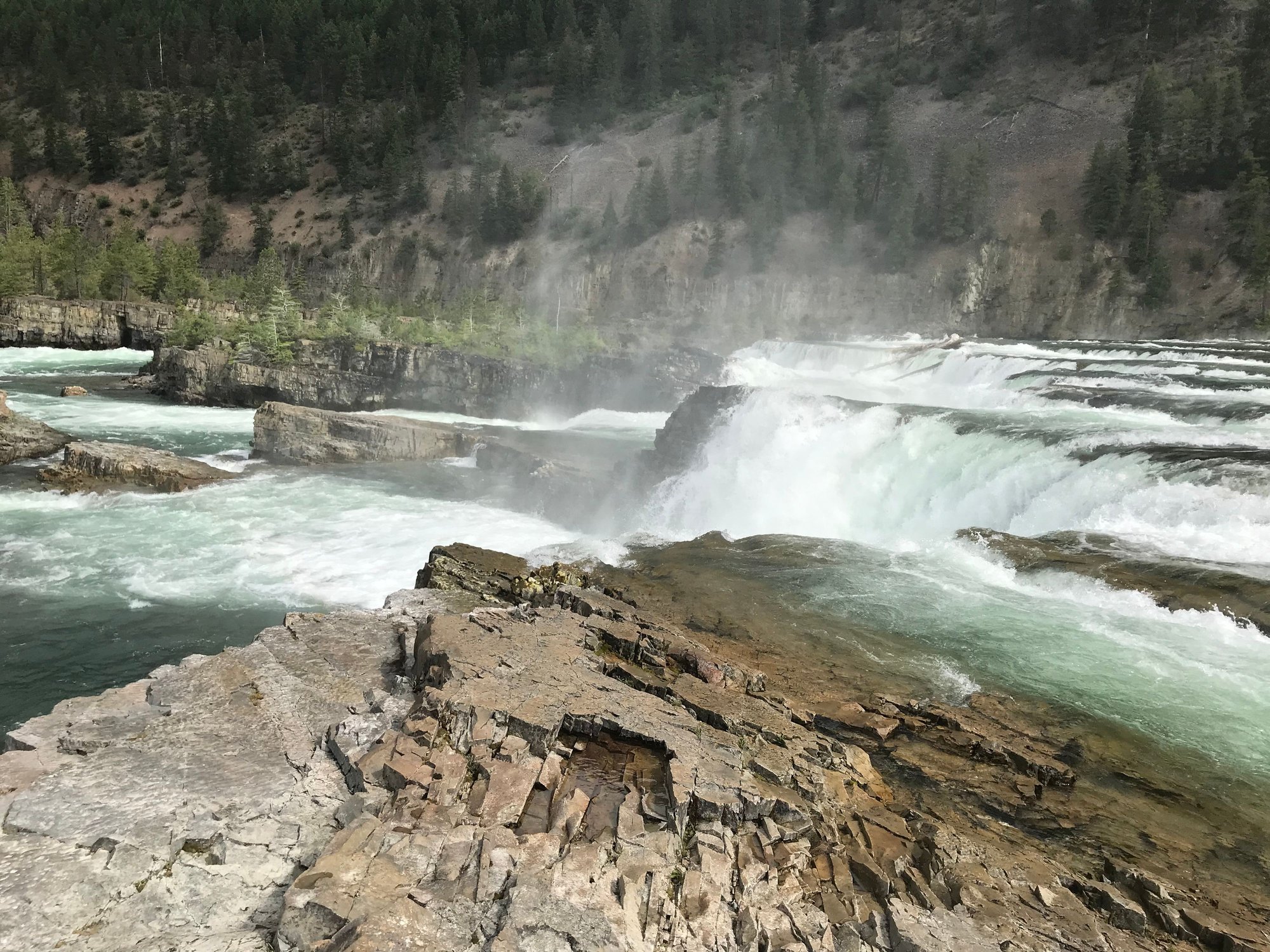
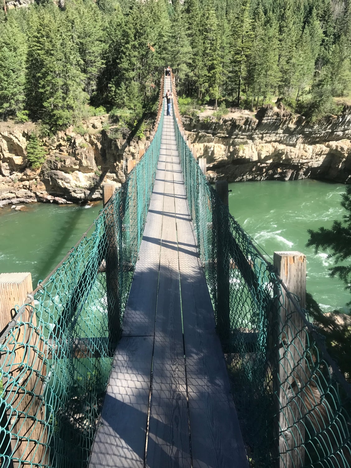
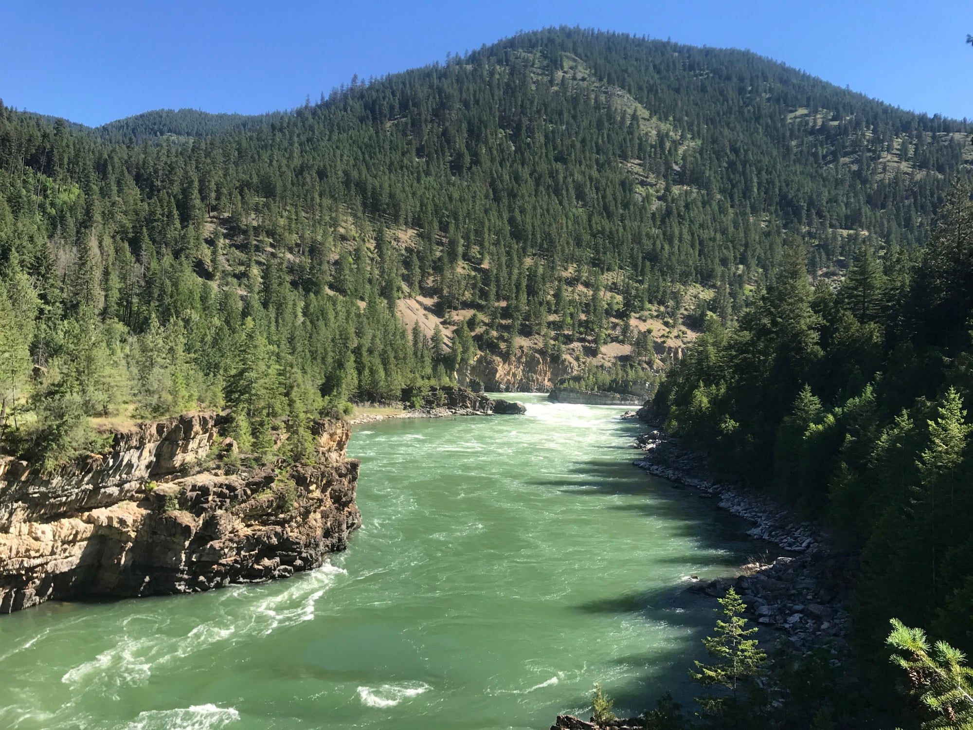
Whitefish to Eureka via US 93 can be hairy but might not be that bad going north. Make sure you stop at Kootenai Falls west of Libby. The walk to the falls is worth it. It�s where Leo floated in the film �The Revenant.� You can get as close as you want. There is also a path to a rope bridge over the gorge. MT 56 from US 2 to MT 200 is nice.
Let me know if you�d like some other camping options.
Kootenai Falls:
Bridge:
Last edited by indyfabz; 06-08-21 at 11:18 AM.
Likes For indyfabz:
06-08-21, 12:33 PM
#5
Junior Member
Thread Starter
Join Date: Apr 2021
Location: Portland
Posts: 99
Bikes: 1983 Woodrup Giro Touring w/ Huret Duopar, Campy high flange hubs, Deore Dyna-Drive crank pedals and brakes 1987 Bridgestone MB2 bafang mid-drive added in 2015
Mentioned: 0 Post(s)
Tagged: 0 Thread(s)
Quoted: 64 Post(s)
Liked 24 Times
in
17 Posts
They never give a firm opening date. I�ve ridden GTS 4 times.
Whitefish to Eureka via US 93 can be hairy but might not be that bad going north. Make sure you stop at Kootenai Falls west of Libby. The walk to the falls is worth it. It�s where Leo floated in the film �The Revenant.� You can get as close as you want. There is also a path to a rope bridge over the gorge. MT 56 from US 2 to MT 200 is nice.
Let me know if you�d like some other camping options.
Kootenai Falls:
Earlier this morning I was thinking about skipping Sandpoint and doing an out and back to Eureka from Whitehorse and then return home. After your notes I am leaning towards Amtrak Whitehorse to Libby then bicycle to Sandpoint. Do you remember any camping spots between Libby and Sandpoint? Any opinions on the ride from Sandpoint to Spokane or should I just Amtrak home from Sandpoint?
06-08-21, 12:59 PM
#6
Senior Member
Join Date: Aug 2010
Location: Madison, WI
Posts: 11,196
Bikes: 1961 Ideor, 1966 Perfekt 3 Speed AB Hub, 1994 Bridgestone MB-6, 2006 Airnimal Joey, 2009 Thorn Sherpa, 2013 Thorn Nomad MkII, 2015 VO Pass Hunter, 2017 Lynskey Backroad, 2017 Raleigh Gran Prix, 1980s Bianchi Mixte on a trainer. Others are now gone.
Mentioned: 47 Post(s)
Tagged: 0 Thread(s)
Quoted: 3458 Post(s)
Liked 1,465 Times
in
1,143 Posts
I camped in Apgar and in Sprague hiker biker sites, no reservation needed if you come in on muscle power to camp at a hiker biker site. But that was in 2012, so I do not know if they still have hiker biker campsites, you would have to check that yourself.
 06-08-21, 01:31 PM
#7
Junior Member
Thread Starter
Join Date: Apr 2021
Location: Portland
Posts: 99
Bikes: 1983 Woodrup Giro Touring w/ Huret Duopar, Campy high flange hubs, Deore Dyna-Drive crank pedals and brakes 1987 Bridgestone MB2 bafang mid-drive added in 2015
Mentioned: 0 Post(s)
Tagged: 0 Thread(s)
Quoted: 64 Post(s)
Liked 24 Times
in
17 Posts
https://www.nps.gov/glac/planyourvisit/camping.htm
06-08-21, 03:32 PM
#8
Senior Member
Join Date: Jan 2010
Posts: 39,229
Mentioned: 211 Post(s)
Tagged: 1 Thread(s)
Quoted: 18409 Post(s)
Liked 15,518 Times
in
7,324 Posts
He�s talking about reservations to get into the park itself. It�s a new thing this year because of the expected crowds. It�s the rule at several popular parks and very controversial, but it does not apply to people entering via their own power.
06-08-21, 03:45 PM
#9
Senior Member
Join Date: Jan 2010
Posts: 39,229
Mentioned: 211 Post(s)
Tagged: 1 Thread(s)
Quoted: 18409 Post(s)
Liked 15,518 Times
in
7,324 Posts
I went to the Amtrak station this morning to figure out some details. From Seattle they have bike hooks but from Portland I will need to box my bike and de-train in Whitehorse so I will need to bicycle from Whitehorse to W. Glacier. Thanks for the route tip.
Earlier this morning I was thinking about skipping Sandpoint and doing an out and back to Eureka from Whitehorse and then return home. After your notes I am leaning towards Amtrak Whitehorse to Libby then bicycle to Sandpoint. Do you remember any camping spots between Libby and Sandpoint? Any opinions on the ride from Sandpoint to Spokane or should I just Amtrak home from Sandpoint?
Earlier this morning I was thinking about skipping Sandpoint and doing an out and back to Eureka from Whitehorse and then return home. After your notes I am leaning towards Amtrak Whitehorse to Libby then bicycle to Sandpoint. Do you remember any camping spots between Libby and Sandpoint? Any opinions on the ride from Sandpoint to Spokane or should I just Amtrak home from Sandpoint?
Bring supplies from Libby. There is a store/bakery near the private campground that makes sandwiches, but I don�t think it�s open late.
If you want to meander, head east on MT 200 for about 8 miles and cross the river to the small town of Noxon. Camping in the city park with water and a vault toilet. $10. Check in at the small but adequate grocery store open until 5 pm. The bar stays open later. Great little town, and the park is right by the river and has covered picnic shelters.
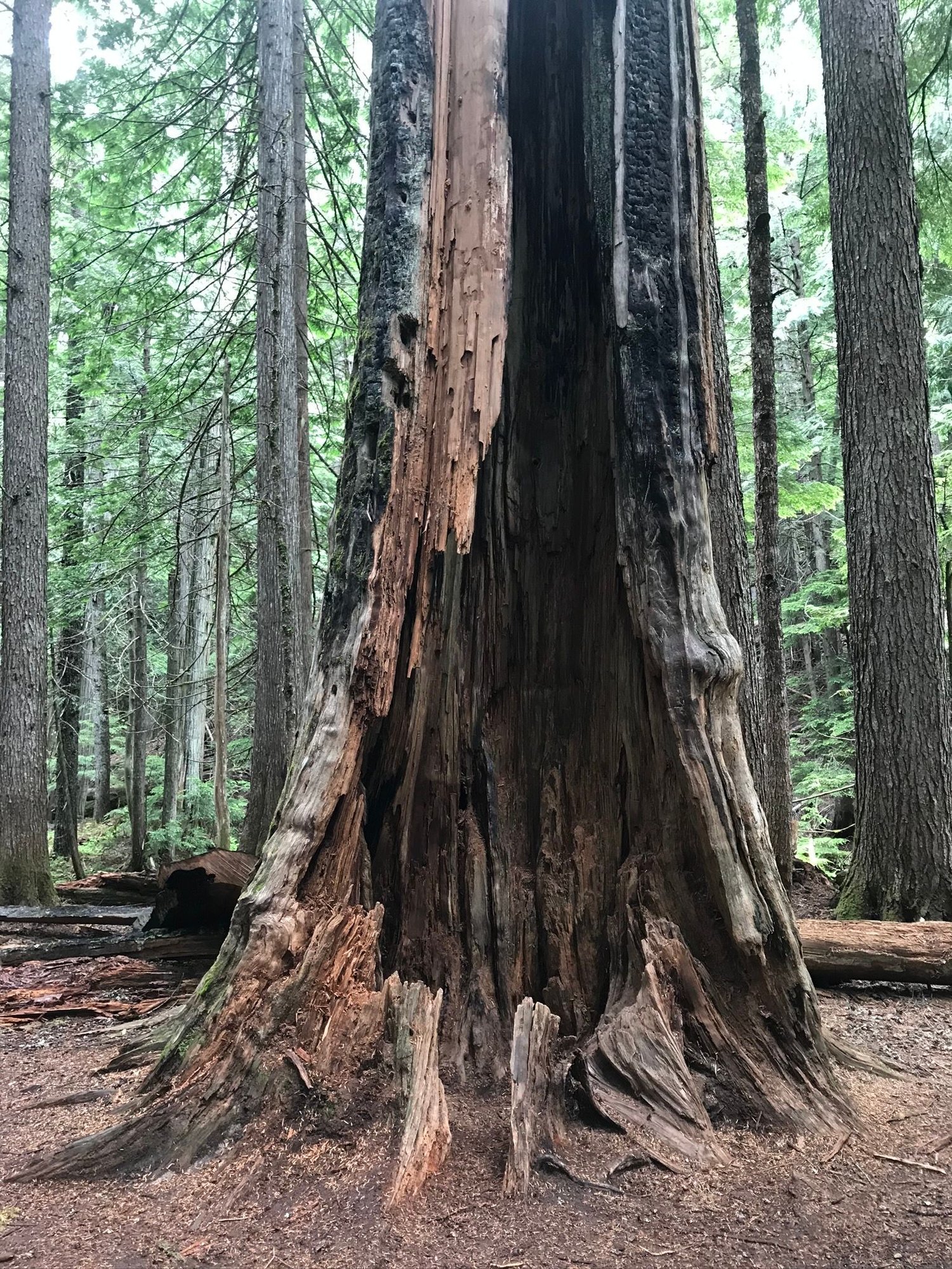
Dorr Skeels:
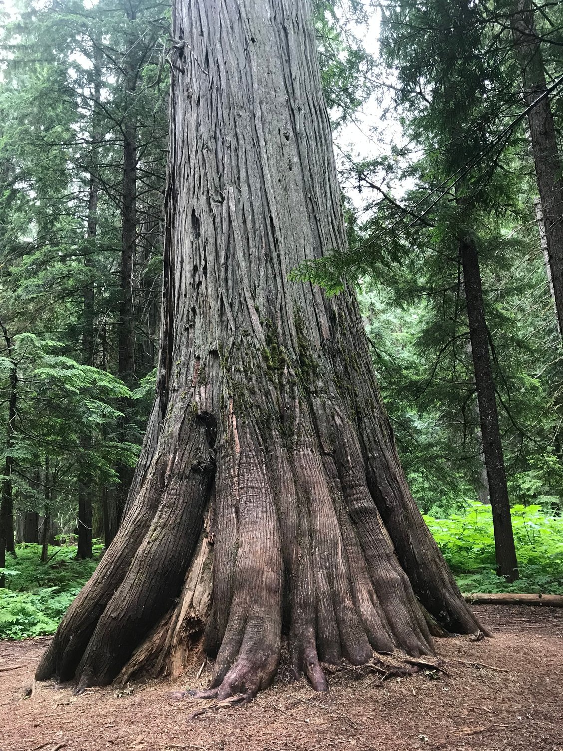
Ross Creek Cedars:
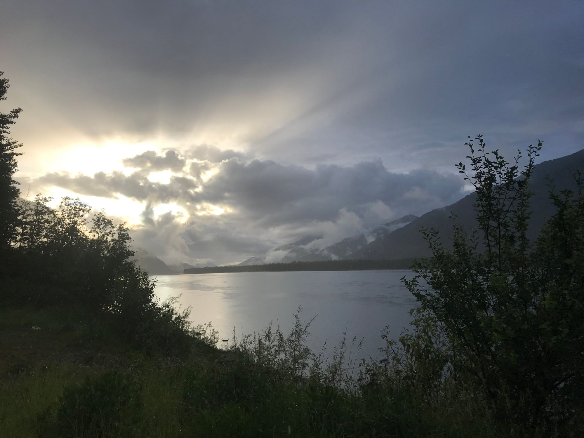
Noxon:
Last edited by indyfabz; 06-08-21 at 03:54 PM.
06-08-21, 04:47 PM
#10
Senior Member
Join Date: Aug 2010
Location: Madison, WI
Posts: 11,196
Bikes: 1961 Ideor, 1966 Perfekt 3 Speed AB Hub, 1994 Bridgestone MB-6, 2006 Airnimal Joey, 2009 Thorn Sherpa, 2013 Thorn Nomad MkII, 2015 VO Pass Hunter, 2017 Lynskey Backroad, 2017 Raleigh Gran Prix, 1980s Bianchi Mixte on a trainer. Others are now gone.
Mentioned: 47 Post(s)
Tagged: 0 Thread(s)
Quoted: 3458 Post(s)
Liked 1,465 Times
in
1,143 Posts
06-08-21, 05:38 PM
#11
Junior Member
Thread Starter
Join Date: Apr 2021
Location: Portland
Posts: 99
Bikes: 1983 Woodrup Giro Touring w/ Huret Duopar, Campy high flange hubs, Deore Dyna-Drive crank pedals and brakes 1987 Bridgestone MB2 bafang mid-drive added in 2015
Mentioned: 0 Post(s)
Tagged: 0 Thread(s)
Quoted: 64 Post(s)
Liked 24 Times
in
17 Posts
Thanks Indyfabz for the campsite info out of Libby. I'm going be "flying by the seat of my pants" and maybe I will ride the whole 250+ miles from W. Glacier to Sandpoint. The train from Whitefish to Libby arrives after 11pm and I would have to box my bike. I'll figure it out once I get to Whitefish.
06-08-21, 06:10 PM
#12
Senior Member
Join Date: Jan 2010
Posts: 39,229
Mentioned: 211 Post(s)
Tagged: 1 Thread(s)
Quoted: 18409 Post(s)
Liked 15,518 Times
in
7,324 Posts
Thanks Indyfabz for the campsite info out of Libby. I'm going be "flying by the seat of my pants" and maybe I will ride the whole 250+ miles from W. Glacier to Sandpoint. The train from Whitefish to Libby arrives after 11pm and I would have to box my bike. I'll figure it out once I get to Whitefish.
Are you planning to ride the ACA route from Whitefish? There is nice camping in Rexford, about 9 miles south of Eureka on MT 47. Plumbed bathrooms but no showers. However, you can buy a shower at the restaurant in town. The place has awesome fried chicken and jo jos and a full bar. Big grocery store in Eureka to stock up as there is almost nothing from Rexford to Libby.
Lake Koocanusa at Rexford, another filming location for The Revenant. Saw countless ospreys overhead, and deer wander around.
Last edited by indyfabz; 06-08-21 at 06:16 PM.
06-08-21, 07:10 PM
#13
Junior Member
Thread Starter
Join Date: Apr 2021
Location: Portland
Posts: 99
Bikes: 1983 Woodrup Giro Touring w/ Huret Duopar, Campy high flange hubs, Deore Dyna-Drive crank pedals and brakes 1987 Bridgestone MB2 bafang mid-drive added in 2015
Mentioned: 0 Post(s)
Tagged: 0 Thread(s)
Quoted: 64 Post(s)
Liked 24 Times
in
17 Posts
Yes, I will follow the ACA route if I ride it. I saw that ACA sells the Sandpoint to Cut Bank section for ~$15. I wasn't sure if it was worth buying because it just said it was a map.
06-08-21, 07:38 PM
#14
Senior Member
Join Date: Jan 2010
Posts: 39,229
Mentioned: 211 Post(s)
Tagged: 1 Thread(s)
Quoted: 18409 Post(s)
Liked 15,518 Times
in
7,324 Posts
Their maps have a lot of information about services along the route, but I can map Whitefish to the junction of MT 56 and 200 for you on RWGPS. There are not many turns. Haven�t done from there to Sandpoint since 2000.
06-08-21, 08:42 PM
#15
Junior Member
Thread Starter
Join Date: Apr 2021
Location: Portland
Posts: 99
Bikes: 1983 Woodrup Giro Touring w/ Huret Duopar, Campy high flange hubs, Deore Dyna-Drive crank pedals and brakes 1987 Bridgestone MB2 bafang mid-drive added in 2015
Mentioned: 0 Post(s)
Tagged: 0 Thread(s)
Quoted: 64 Post(s)
Liked 24 Times
in
17 Posts
I have a paper copy of a Montana state road map so it is easy to figure out where to make the turns.
The other value they could provide is recommended camping sites, grocery stores, water holes and warnings about long distances between services.
I like maps but for the items above I like to see them in text form and that is why I was hesitant to buy their map.
The other value they could provide is recommended camping sites, grocery stores, water holes and warnings about long distances between services.
I like maps but for the items above I like to see them in text form and that is why I was hesitant to buy their map.
06-08-21, 10:47 PM
#16
cyclotourist
Join Date: Jul 2002
Location: calgary, canada
Posts: 1,470
Mentioned: 2 Post(s)
Tagged: 0 Thread(s)
Quoted: 443 Post(s)
Liked 205 Times
in
130 Posts
Going to the Sun is one of my all time favourite rides, I've probably done it about half a dozen times, but not for at least 20 years.
Looks like the border might open to fully vaccinated travellers this summer, so it might be possible.
Starting to think about a 2-3 week circle tour AB-MT-ID-BC, starting from home. Thanks, guys.
Looks like the border might open to fully vaccinated travellers this summer, so it might be possible.
Starting to think about a 2-3 week circle tour AB-MT-ID-BC, starting from home. Thanks, guys.
06-09-21, 05:27 AM
#17
Senior Member
Join Date: Jan 2010
Posts: 39,229
Mentioned: 211 Post(s)
Tagged: 1 Thread(s)
Quoted: 18409 Post(s)
Liked 15,518 Times
in
7,324 Posts
I have a paper copy of a Montana state road map so it is easy to figure out where to make the turns.
The other value they could provide is recommended camping sites, grocery stores, water holes and warnings about long distances between services.
I like maps but for the items above I like to see them in text form and that is why I was hesitant to buy their map.
The other value they could provide is recommended camping sites, grocery stores, water holes and warnings about long distances between services.
I like maps but for the items above I like to see them in text form and that is why I was hesitant to buy their map.
Also, if you are talking about the state bicycle map (I have one), it doesn�t show the minor roads ACA uses that get you off the highway where possible. E.g., between Fortine and Eureka. Also just north of Whitefish the route uses some quiet roads for several miles instead of US 93.
06-09-21, 07:33 AM
#18
Junior Member
Thread Starter
Join Date: Apr 2021
Location: Portland
Posts: 99
Bikes: 1983 Woodrup Giro Touring w/ Huret Duopar, Campy high flange hubs, Deore Dyna-Drive crank pedals and brakes 1987 Bridgestone MB2 bafang mid-drive added in 2015
Mentioned: 0 Post(s)
Tagged: 0 Thread(s)
Quoted: 64 Post(s)
Liked 24 Times
in
17 Posts
OK. I'll buy it.
06-09-21, 07:58 AM
#19
Senior Member
Join Date: Jan 2010
Posts: 39,229
Mentioned: 211 Post(s)
Tagged: 1 Thread(s)
Quoted: 18409 Post(s)
Liked 15,518 Times
in
7,324 Posts
Here is a GPS map this better shows profile. I started at the main intersection in Whitefish. I did not want to go beyond Clark Fork due to lack of memory. IIRC, the ACA route spends some time off of MT 200 between there and Sandpoint due to traffic and lack of shoulder for a certain distance. All I remember is that part being a bit hilly.
Routes � Ride with GPS
Send me a PM is you want details about the camping options I mentioned. But if you zoom in enough you should be able to see places like Dorr Skeels and Bad Medicine.
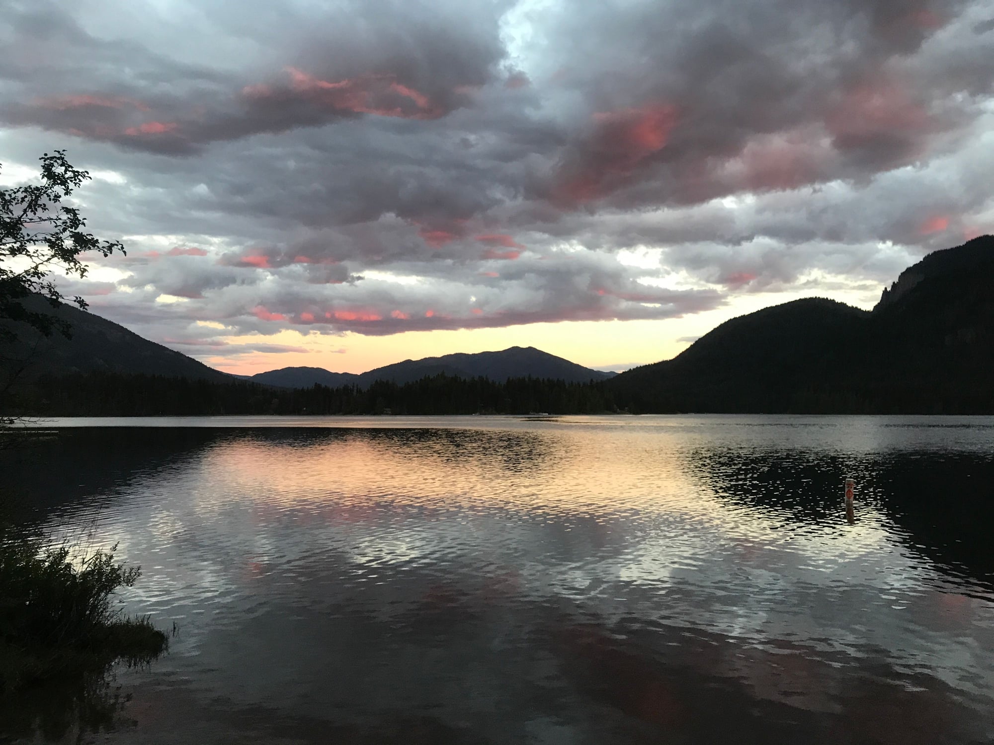
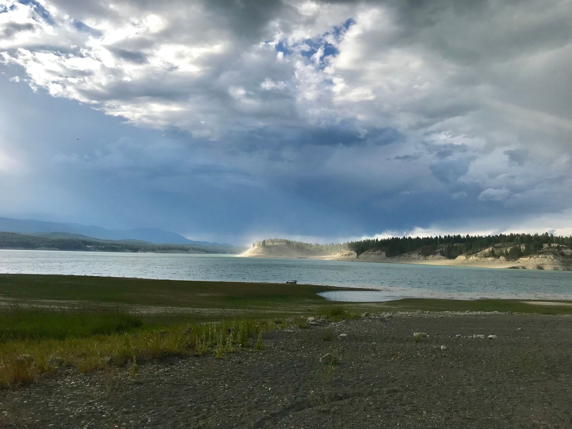
Couple of amendments to what I wrote earlier: It's MT 37, not MT 47, that runs south along Lake Koocanusa. (FYI, the lake's name is a combination of Kootenai River, Canada and U.S.A. The Libby Dam created the lake and backs water up into Canada. However, as you can see from one of my photos above, water levels are not what they once were.) Also, there is a USFS campground just east of the MT 200-MT 56 junction called Bull River. Stayed there way back in 2000. Decent enough.
Routes � Ride with GPS
Send me a PM is you want details about the camping options I mentioned. But if you zoom in enough you should be able to see places like Dorr Skeels and Bad Medicine.
Couple of amendments to what I wrote earlier: It's MT 37, not MT 47, that runs south along Lake Koocanusa. (FYI, the lake's name is a combination of Kootenai River, Canada and U.S.A. The Libby Dam created the lake and backs water up into Canada. However, as you can see from one of my photos above, water levels are not what they once were.) Also, there is a USFS campground just east of the MT 200-MT 56 junction called Bull River. Stayed there way back in 2000. Decent enough.
