


Unexpected trouble mapping x-c route
 12-23-21, 06:17 PM
#1
Senior Member
Thread Starter
Unexpected trouble mapping x-c route
Have run into an unexpected issue mapping out a cross country route. When routing through high population areas I have found that turn by turn instructions are not practical. I will not be using GPS, paper maps only. Others that travel this way, what suggestions do you have? Simply go by compass and general road names to look for?
 12-23-21, 06:49 PM
#2
bicycle tourist
Here is what I do with high population areas:
(1) prior to arrival, I spend some time with Strava heat maps and a copy of a map (electronic or paper). That typically gives me a rough route and often I can get one without too many turns
(2) I might write a few waypoints on a notecard which I put in my handlebar bag.
(3) I'll mostly cycle without stopping too much. Often there can be fairly obvious ways to get to a city center. Outbound can be more ambiguous. If I feel I'm completely lost, I will stop and get out my phone. I have MAPS.me installed and that lets me look up where I am at and course correct if necessary.
12-23-21, 11:11 PM
#3
Senior Member
if the city is too large to route around, and i gotta go straight through.....
do i plan to stop for a couple days of sightseeing, and want a central location?
do i need to stop for one night cause the city is so dang huge?
do some intertubes research:
is there a light rail or even regular train that covers all or part of the route?
are the direct highways restricted?
do interstate highways have frontage roads?
are there major rivers with restricted access bridges?
if rivers, where are the local ferry crossings?
if i'm in asia, can i load my bike into a tuktuk for $5 to cross the city?
check the "crazy guy on a bike" trip reports.
print off some google maps, mark your intended route with a highlighter.
if the route is complicated or there are spots with multiple turns,
print some zoomed-in maps of those specific areas.
take lotsa breaks for donuts and coffee to review your maps.
if you see some dudes (or dudettes!) in lycra while passing through,
slow down and ask for route advice.
-----------what cit(ies) are you having trouble with?
12-24-21, 05:21 AM
#4
Senior Member
Thread Starter
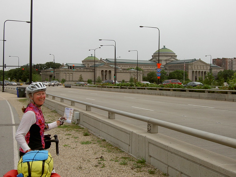
There are no particular cities that are causing problems, it is all cities in general. turn by turn instructions are getting really long and it simply seems an impractical way to go about navigating through a city. If a specific city is needed, use Chicago or Milwaukee as examples. Coming down from Green Bay or coming up from Gary (haven't decided yet).
12-24-21, 07:03 AM
#5
Senior Member
Join Date: Feb 2012
Location: Golden, CO and Tucson, AZ
Posts: 2,836
Bikes: 2016 Fuji Tread, 1983 Trek 520
Mentioned: 13 Post(s)
Tagged: 0 Thread(s)
Quoted: 675 Post(s)
Liked 741 Times
in
430 Posts
I seldom do turn-by-turn directions. I keep my paper map handy, either in a cue clip or a pocket. I also keep a ziplock bag handy in case of rain. I try to memorize the next three landmarks. I think it's a great mental exercise, and it's becoming a lost art. And look for cyclists to follow. I've cycled through Gary, Chicago, Milwaukee and Green Bay that way.
And don't worry too much about getting lost. Some excellent adventures and new friends happen that way.
And don't worry too much about getting lost. Some excellent adventures and new friends happen that way.
Likes For andrewclaus:
12-24-21, 07:13 AM
#6
Senior Member
A few possibilities:
- Is there a bike route through the city? Some have a canal tow path, rail trail, or other greenway.
- I have at times just used google maps directions live in the city on the fly with no pre-planning before the trip.
- Sometimes there is an old US designated route through the city that isn't bad as far as turns or riding conditions. In some cases a route like US40, US90, or US66 might work.
- Take a good look at options for just avoiding the city altogether. The best tours don't go through big cities at all IMO. The may start and end in them because there is a major airport, but other than that generally avoid them or at least skirt their edges.
12-24-21, 07:34 AM
#7
Senior Member
Join Date: Dec 2011
Location: NE Ohio
Posts: 2,595
Bikes: 1992 Serotta Colorado II,Co-Motion Speedster, Giant Escape Hybrid, 1977 Schwinn Super Le Tour
Mentioned: 4 Post(s)
Tagged: 0 Thread(s)
Quoted: 455 Post(s)
Likes: 0
Liked 112 Times
in
85 Posts
One thing we have done both here and in Europe is contact a loca bike shop or cycling group and ask for a route through the city.
Likes For Tandem Tom:
12-24-21, 09:54 AM
#8
Full Member
Join Date: Sep 2005
Location: Tulsa, OK
Posts: 451
Bikes: Co-Motion Americano Pinion P18; Co-Motion Americano Rohloff; Thorn Nomad MkII, Robert Beckman Skakkit (FOR SALE), Santana Tandem, ICE Adventure FS
Mentioned: 1 Post(s)
Tagged: 0 Thread(s)
Quoted: 169 Post(s)
Liked 64 Times
in
48 Posts
There are no particular cities that are causing problems, it is all cities in general. turn by turn instructions are getting really long and it simply seems an impractical way to go about navigating through a city. If a specific city is needed, use Chicago or Milwaukee as examples. Coming down from Green Bay or coming up from Gary (haven't decided yet).
That said, for those cities, use Google Maps showing the bike routes mode. When I created my routes from Chicago to Door County, the routes extensively used bike paths and signed bike routes between Chicago and Sheboygan making the cue sheet surprising relatively simple for such congested areas. I would say a simple cue sheet would be under 1 typed page between Kenosha and Chicago once you put your route together. That is not bad considering the congestion. I strongly prefer quieter or safer roads so if I have to do longer cue sheet that is fine.
As other have suggested, you can always take a train (roll bike on and off) from Milwaukee to Chicago or anyplace in between if you find there are too many turns for your liking. Also, when there are lots of turns, this is when a GPS or phone make things a lot easier but I too enjoy paper maps.
Tailwinds, John
12-24-21, 11:00 AM
#9
Senior Member
Join Date: Jul 2007
Location: South shore, L.I., NY
Posts: 6,872
Bikes: Flyxii FR322, Cannondale Topstone, Miyata City Liner, Specialized Chisel, Specialized Epic Evo
Mentioned: 18 Post(s)
Tagged: 0 Thread(s)
Quoted: 3230 Post(s)
Liked 2,079 Times
in
1,177 Posts
Not for nothing, but GPS is ideal for this scenario, giving you TBT directions for a route you have some control over creating, having done research as to what would be good and safe roads. You don't need a dedicated GPS cycling computer, running RWGPS on a smartphone would suffice.
Likes For Steve B.:
12-24-21, 11:18 AM
#10
Senior Member

Join Date: Nov 2014
Location: Eugene, Oregon, USA
Posts: 27,547
Mentioned: 217 Post(s)
Tagged: 0 Thread(s)
Quoted: 18369 Post(s)
Liked 4,507 Times
in
3,350 Posts
I've used live maps on my phone. But, the last time I was out on a long trip with my phone, keeping it charged was a major hassle. I'll probably eventually figure out how to charge with a hub generator.
Some apps have verbal turn by turn instructions. Ride with GPS? So, you just put the phone in your backpack, and listen for the instructions.
I had turn by turn instructions enabled with Google in my phone for driving a few days ago. It worked real nice. I think Google has "bike" mode which would be worth trying.
My biggest problem with cities is figuring out how to escape traffic, and the HEAT maps might help with that. If you are familiar with your route, you can force route planning apps like Strava to follow your route, but I have had issues that it periodically selects the WRONG route
12-24-21, 07:24 PM
#11
Senior Member
There are no particular cities that are causing problems, it is all cities in general. turn by turn instructions are getting really long and it simply seems an impractical way to go about navigating through a city. If a specific city is needed, use Chicago or Milwaukee as examples. Coming down from Green Bay or coming up from Gary (haven't decided yet).
that's now in the long ago times, with international airport sized high speed rail stations, and multi-level long distance bus stations being placed 20 km or so outside of the cities, often with few hotels nearby. and now with the largest, or second largest, automobile market, highways are being built for massive numbers of cars with restricted access.
i just don't go through cities any longer.
at least you have access to google maps! pick out a route and you can answer most of your questions with streetview. zoom in on the intersections to check for no bike signs, confirm shoulders on highways, look at the condition of bridges. even with them major cities, if you stick with the suburbs rather than trying to go directly through the center, you should be able to build a route without too much complexification. even if the suburban route is 30% longer, it'll likely be 50% faster.
"They've done studies, you know. 60% of the time, it works every time."
12-25-21, 06:32 AM
#12
Senior Member
Are you a purist about riding every mile on this ride? I am when riding coast to coast or something but maybe not always. Anyway, hopping on a bus or light rail system can be an easy way across metro areas.
12-25-21, 08:07 AM
#13
Senior Member
Thread Starter
Yes, a purist if that is what it is called. I am riding the bike as transport and figure that is what I ought to do. I like the advice of circumnavigating the big cities as I was thinking about going through Chicago South Side. Not a plan that makes sense for me.
Off topic here, but I also plan to avoid motels, warm showers, etc. Doing it as all tent all the time. Figure I'll stink, but will be by myself thus it won't matter much! If someone invites me into their home upon a random meeting, that will be the exception.
Off topic here, but I also plan to avoid motels, warm showers, etc. Doing it as all tent all the time. Figure I'll stink, but will be by myself thus it won't matter much! If someone invites me into their home upon a random meeting, that will be the exception.
12-25-21, 08:50 AM
#14
Senior Member
Join Date: Jul 2007
Location: South shore, L.I., NY
Posts: 6,872
Bikes: Flyxii FR322, Cannondale Topstone, Miyata City Liner, Specialized Chisel, Specialized Epic Evo
Mentioned: 18 Post(s)
Tagged: 0 Thread(s)
Quoted: 3230 Post(s)
Liked 2,079 Times
in
1,177 Posts
Yes, a purist if that is what it is called. I am riding the bike as transport and figure that is what I ought to do. I like the advice of circumnavigating the big cities as I was thinking about going through Chicago South Side. Not a plan that makes sense for me.
Off topic here, but I also plan to avoid motels, warm showers, etc. Doing it as all tent all the time. Figure I'll stink, but will be by myself thus it won't matter much! If someone invites me into their home upon a random meeting, that will be the exception.
Off topic here, but I also plan to avoid motels, warm showers, etc. Doing it as all tent all the time. Figure I'll stink, but will be by myself thus it won't matter much! If someone invites me into their home upon a random meeting, that will be the exception.
12-25-21, 11:03 AM
#15
Senior Member
Join Date: Feb 2016
Location: SE Wisconsin
Posts: 1,851
Bikes: Lemond '01 Maillot Jaune, Lemond '02 Victoire, Lemond '03 Poprad, Lemond '03 Wayzata DB conv(Poprad), '79 AcerMex Windsor Carrera Professional(pur new), '88 GT Tequesta(pur new), '01 Bianchi Grizzly, 1993 Trek 970 DB conv, Trek 8900 DB conv
Mentioned: 12 Post(s)
Tagged: 0 Thread(s)
Quoted: 759 Post(s)
Likes: 0
Liked 810 Times
in
471 Posts
It's not clear if you're actually looking for a route from Chicago to Milwaukee..or north from Milw..to DC?
If you are looking for a route..I have well-ridden routes from Zion, IL to Door County. Most of the route is comprised of MUPs with some low-traffic road connectors. There are campgrounds along the way. Getting through Milwaukee from Racine County to Milw Cty to Ozaukee County is easy and near all MUPs (Oak Leaf Trail to Interurban Trail).
If you are looking for a route..I have well-ridden routes from Zion, IL to Door County. Most of the route is comprised of MUPs with some low-traffic road connectors. There are campgrounds along the way. Getting through Milwaukee from Racine County to Milw Cty to Ozaukee County is easy and near all MUPs (Oak Leaf Trail to Interurban Trail).
12-25-21, 11:23 AM
#16
Senior Member
Join Date: Mar 2009
Location: Oregon
Posts: 6,489
Mentioned: 31 Post(s)
Tagged: 0 Thread(s)
Quoted: 1182 Post(s)
Liked 833 Times
in
435 Posts
My wife and I do not avoid large cities while touring. We often purposely ride through big cities, just to get a feel for the state, province or country we are riding through.
Riding through Chicago was relatively easy. There is a waterfront trail that will take you to the south side of Chicago.
Coming into Chicago, roughly following US Highway 20 through Illinois, from the west side. This was done in pre-smartphone days, and we just used the expanded section of Chicago on the Illinois state road map to "feel" our way through the city. We currently find Google Maps to be a helpful tool.

The waterfront trail will take you right down the lake to the south side of Chicago near Gary, Indiana. Just don't plan on moving very fast on the day they are having an airshow over Lake Michigan.
]
Riding through Chicago was relatively easy. There is a waterfront trail that will take you to the south side of Chicago.
Coming into Chicago, roughly following US Highway 20 through Illinois, from the west side. This was done in pre-smartphone days, and we just used the expanded section of Chicago on the Illinois state road map to "feel" our way through the city. We currently find Google Maps to be a helpful tool.
The waterfront trail will take you right down the lake to the south side of Chicago near Gary, Indiana. Just don't plan on moving very fast on the day they are having an airshow over Lake Michigan.
]
Last edited by Doug64; 12-25-21 at 08:02 PM.
Likes For Doug64:
12-25-21, 06:39 PM
#17
bicycle tourist
To use Chicago as an illustration, there is a riverfront trail and areas within a few miles of city center have a reasonable grid of streets.
I've found that it is two things in combination: high speed traffic and lots of traffic. Close to city centers you might have more traffic but it isn't high speed. That happens more in outlying suburbs.
To illustrate, I recall crossing Chicago, Miami, Detroit Memphis, LA and in all five it wasn't the city centers that were an issue but areas 10-20 miles away that were more harried mostly because of higher speed traffic on larger roads without shoulders.
Likes For mev:
12-26-21, 06:55 AM
#18
Senior Member
Join Date: Jan 2010
Posts: 39,229
Mentioned: 211 Post(s)
Tagged: 1 Thread(s)
Quoted: 18409 Post(s)
Liked 15,518 Times
in
7,324 Posts
For what it is worth, unless you circumnavigate with a large arc - you could end up worse off than just going through the city.
To use Chicago as an illustration, there is a riverfront trail and areas within a few miles of city center have a reasonable grid of streets.
I've found that it is two things in combination: high speed traffic and lots of traffic. Close to city centers you might have more traffic but it isn't high speed. That happens more in outlying suburbs.
To illustrate, I recall crossing Chicago, Miami, Detroit Memphis, LA and in all five it wasn't the city centers that were an issue but areas 10-20 miles away that were more harried mostly because of higher speed traffic on larger roads without shoulders.
Last edited by indyfabz; 12-26-21 at 06:59 AM.
12-26-21, 10:48 AM
#19
Senior Member
Join Date: Sep 2015
Location: QC Canada
Posts: 1,966
Bikes: Custom built LHT & Troll
Mentioned: 12 Post(s)
Tagged: 0 Thread(s)
Quoted: 842 Post(s)
Liked 149 Times
in
106 Posts
TiHabanero I understand the problem with cue-sheets. In a (large) city, there are too many instructions and when you get lost, finding your way back is hopeless. GPS navigation greatly simplify matters -- we were able to ride from Narita airport to Tokyo's down town train station without a sweat, which would have been impossible otherwise. A more extreme example, something like 20 years ago at a conference in Beijing, I had to show the directions to the cab driver using my GPS and hand gestures, despite having the business card of the hotel where I was staying -- the driver wouldn't attempt to drive in the older parts of the city, where streets are narrow and poorly, if at all, marked (hutong). GPS navigation doesn't have to be expensive. You can use your smartphone, and if you don't have one, you can get a used one, or a low-end model for less than $100.
CliffordK True, keeping phones/GPS-devices is a challenge. You can either focus on limiting energy requirements (I use a smart watch -- 200hrs of GPS navigation on a single charge) or on having more power at your disposal (solar, dynohub, wall charger) and buy yourself a safety margin with battery bank(s).
Back to the question of complex navigation -- other than carrying large-scale maps (cumbersome but would kinda work), I see no reasonable alternative to GPS-based navigation. Then the question becomes "how" (technical, practical, enonomics)
12-26-21, 05:01 PM
#20
Senior Member
Join Date: Mar 2009
Location: Oregon
Posts: 6,489
Mentioned: 31 Post(s)
Tagged: 0 Thread(s)
Quoted: 1182 Post(s)
Liked 833 Times
in
435 Posts
TiHabanero I understand the problem with cue-sheets. In a (large) city, there are too many instructions and when you get lost, finding your way back is hopeless. GPS navigation greatly simplify matters -- we were able to ride from Narita airport to Tokyo's down town train station without a sweat, which would have been impossible otherwise. A more extreme example, something like 20 years ago at a conference in Beijing, I had to show the directions to the cab driver using my GPS and hand gestures, despite having the business card of the hotel where I was staying -- the driver wouldn't attempt to drive in the older parts of the city, where streets are narrow and poorly, if at all, marked (hutong). GPS navigation doesn't have to be expensive. You can use your smartphone, and if you don't have one, you can get a used one, or a low-end model for less than $100.
CliffordK True, keeping phones/GPS-devices is a challenge. You can either focus on limiting energy requirements (I use a smart watch -- 200hrs of GPS navigation on a single charge) or on having more power at your disposal (solar, dynohub, wall charger) and buy yourself a safety margin with battery bank(s).
Back to the question of complex navigation -- other than carrying large-scale maps (cumbersome but would kinda work), I see no reasonable alternative to GPS-based navigation. Then the question becomes "how" (technical, practical, enonomics)
CliffordK True, keeping phones/GPS-devices is a challenge. You can either focus on limiting energy requirements (I use a smart watch -- 200hrs of GPS navigation on a single charge) or on having more power at your disposal (solar, dynohub, wall charger) and buy yourself a safety margin with battery bank(s).
Back to the question of complex navigation -- other than carrying large-scale maps (cumbersome but would kinda work), I see no reasonable alternative to GPS-based navigation. Then the question becomes "how" (technical, practical, enonomics)
I use all the modern navigation tools, but I believe that it has taken a lot of the adventure and serendipity away from bike touring. Do we really need cue sheets, and know the elevation profile of every hill on the route?
My wife and I got separated in a large city where we did not know the language. I stopped to take a picture, and she was riding in front of me and did not see me stop. She rode ahead and made a turn, which I did not see. We had one cell phone between us, and had not decided on our final destination for the day. We managed to find each other, and our way out of the city. We had an agreement on what to do if we ever got separated: return to the spot where we last saw the other person. It gets us close enough. However, we try to communicate better, and carry both our phones now.

We've ridden through a number of large cities (on purpose) in 11 countries. We have never been "hopelessly" lost, just a little mixed up a time or two.
")
Last edited by Doug64; 12-26-21 at 11:15 PM.
Likes For Doug64:
12-26-21, 11:13 PM
#21
Senior Member
Join Date: Sep 2015
Location: QC Canada
Posts: 1,966
Bikes: Custom built LHT & Troll
Mentioned: 12 Post(s)
Tagged: 0 Thread(s)
Quoted: 842 Post(s)
Liked 149 Times
in
106 Posts
Doug64 Well, as you said, travel predates GPS by a couple of millennia, so travelling without it is certainly possible; and perhaps more enjoyable, depending on the circumstances. But, as a matter of personal preference, GPS is preferable, for me.
FWIW, I've been to every city you mention, with the exception of Wroclaw, and never felt desperately lost, with or without GPS (although, interestingly, I've purchased my first GPS in Paris -- a Garmin eTrex, 21 years ago -- when I took a wrong turn which made a short afternoon stroll into a much longer one. Not a big deal, mind you -- Paris is a great city). This being said, we could never have found our AirBnB in Tokyo without electronics (no street number, basically no street name and if there are, very difficult to understand). And I mentioned the Beijing example because even a taxicab driver couldn't find the place where we wanted to go. Try (Tokyo, Bejing), Seoul, Istanbul or even Athens without a GPS and the lack of information will likely limit your freedom to explore. A GPS is like the rope that spelunkers use to find their way back, out of unfamiliar environments. Without it, you are less likely to explore as much. In my case, having a GPS, or now a GPS enabled phone has allowed me to wander out of the hotel without worrying about finding my way back. And to chuckle a couple of times (in China again) when the locals give you polite, but woefully inaccurate directions, which could be on purpose, mind you.
We sail -- well, we did prior to COVID -- and in the early days it meant a sextant at sea and bearing compass + tedious (and hazardous) calculations when close to shore, to plot a route. I know some nostalgic people who regret this "simpler" time, but the fact is that there were many more shipwrecks back then. GPS may not be essential, but certainly more reasonable.
Your approach is perhaps the best. i.e. navigate with minimal guidance in the knowledge that if needed, you can use your phone to find your way.
(but I still think that the OP's alternatives are either city maps, a smartphone, or learning to appreciate serendipity, whatever form it may take
FWIW, I've been to every city you mention, with the exception of Wroclaw, and never felt desperately lost, with or without GPS (although, interestingly, I've purchased my first GPS in Paris -- a Garmin eTrex, 21 years ago -- when I took a wrong turn which made a short afternoon stroll into a much longer one. Not a big deal, mind you -- Paris is a great city). This being said, we could never have found our AirBnB in Tokyo without electronics (no street number, basically no street name and if there are, very difficult to understand). And I mentioned the Beijing example because even a taxicab driver couldn't find the place where we wanted to go. Try (Tokyo, Bejing), Seoul, Istanbul or even Athens without a GPS and the lack of information will likely limit your freedom to explore. A GPS is like the rope that spelunkers use to find their way back, out of unfamiliar environments. Without it, you are less likely to explore as much. In my case, having a GPS, or now a GPS enabled phone has allowed me to wander out of the hotel without worrying about finding my way back. And to chuckle a couple of times (in China again) when the locals give you polite, but woefully inaccurate directions, which could be on purpose, mind you
.We sail -- well, we did prior to COVID -- and in the early days it meant a sextant at sea and bearing compass + tedious (and hazardous) calculations when close to shore, to plot a route. I know some nostalgic people who regret this "simpler" time, but the fact is that there were many more shipwrecks back then. GPS may not be essential, but certainly more reasonable.
Your approach is perhaps the best. i.e. navigate with minimal guidance in the knowledge that if needed, you can use your phone to find your way.
(but I still think that the OP's alternatives are either city maps, a smartphone, or learning to appreciate serendipity, whatever form it may take
12-27-21, 06:11 AM
#22
Senior Member
Thread Starter
You all have made excellent input and it is much appreciated. My agrees with taking a cell phone and stop being a stubborn ass. Damned if she is right again! I will proceed with mapping the route manually, but will take the cell phone as a backup. Turn by turn through large population areas is not practical, but I am going to give it a go to see how long the instructions become. I will listen to my smarter half and take the phone, too!
FWIW, in no way would I have attempted to navigate Tokyo back in the day without the map someone provided me before I got there. I cannot imagine how crazy it has become in the last 40 years.
FWIW, in no way would I have attempted to navigate Tokyo back in the day without the map someone provided me before I got there. I cannot imagine how crazy it has become in the last 40 years.
12-27-21, 08:32 AM
#23
bicycle tourist
I also can't recall getting lost or separated in a lot of touring, with one exception.
It was 2007 and I was cycling across Russia with a cycling partner. We were leaving the city of Kazan (~1 million). The route itself wasn't a problem. However, I hadn't been feeling 100% and let my riding partner know. She was ahead and our general pattern is she would occasionally stop and we'd catch up. Somehow in one of those sequences, I passed her and neither of us noticed the other.
We were now in a situation where I was ahead and thought I was behind - and she was behind and thought she might be ahead. It was a hot day and enough reason to keep moving - so I did. I was a little surprised she hadn't stopped but figured I would sort it out. Towards mid-afternoon, I had gone ~100km and decided to camp in a spot where I kept an eye on the road. I also asked around, but nobody had seen her.
Meanwhile, she stopped a few times and eventually decided to turn around and backtrack all the way back to our hotel the night before. She got there, but the electricity had gone for a while which snarled the street cars and traffic overall, so she ended up being back at that hotel that night. So now we were ~100km apart at end of the day. Neither had a cell phone.
Another 40km ahead for me was a spot where there was a ferry crossing. I figured I'd at least go to the ferry, ask around and sort things out. I got there and at that point wasn't quite sure what happened, so figured I'd keep going slowly and find a internet terminal - typically in the post offices at that time - and see if I could connect. Problem was in this part, I was heading towards the Urals and there were fewer post offices - and one or two I tried had terminals well-occupied with youths. There was also a potential split in the road with multiple routes. So I mostly went ahead and reached Ekaterinburg some 11 days later.
Normal pattern in large cities was to find a hotel, stay for two nights, do laundry, get to an internet cafe to connect with the world. So I did that in Ekaterinburg (population 1.5 million) and finally left a message of form "not sure how we missed, but I'm here and hope to hear from you". On the day after I arrived, I saw a familiar bike up against the hotel. My riding partner had arrived a day behind me and happenstance picked the same hotel I was already staying at. We connected and figured out what happened. She had been behind and while she didn't speak much Russian knew she was behind and via pantomime others mentioned they had seen someone who looked like me. She thought she was catching up, but then had a day where she had gone down a wrong direction and lost a day again.
That was the one case we missed each other. GPS and cell phones were technology then, but we didn't carry them then. In hindsight having a cell to send a text message would have helped.
12-27-21, 08:38 AM
#24
Senior Member
Join Date: Feb 2016
Location: SE Wisconsin
Posts: 1,851
Bikes: Lemond '01 Maillot Jaune, Lemond '02 Victoire, Lemond '03 Poprad, Lemond '03 Wayzata DB conv(Poprad), '79 AcerMex Windsor Carrera Professional(pur new), '88 GT Tequesta(pur new), '01 Bianchi Grizzly, 1993 Trek 970 DB conv, Trek 8900 DB conv
Mentioned: 12 Post(s)
Tagged: 0 Thread(s)
Quoted: 759 Post(s)
Likes: 0
Liked 810 Times
in
471 Posts
You all have made excellent input and it is much appreciated. My agrees with taking a cell phone and stop being a stubborn ass. Damned if she is right again! I will proceed with mapping the route manually, but will take the cell phone as a backup. Turn by turn through large population areas is not practical, but I am going to give it a go to see how long the instructions become. I will listen to my smarter half and take the phone, too!
FWIW, in no way would I have attempted to navigate Tokyo back in the day without the map someone provided me before I got there. I cannot imagine how crazy it has become in the last 40 years.
FWIW, in no way would I have attempted to navigate Tokyo back in the day without the map someone provided me before I got there. I cannot imagine how crazy it has become in the last 40 years.
12-27-21, 08:59 AM
#25
Senior Member
Join Date: Jan 2010
Posts: 39,229
Mentioned: 211 Post(s)
Tagged: 1 Thread(s)
Quoted: 18409 Post(s)
Liked 15,518 Times
in
7,324 Posts
If this can be done on paper, imaging what can be done with an electronic device like a phone. Indeed, I led a group on a modified version of this ride back in September. For a couple of reasons, including last minute detours due to Ida flooding damage, some of the route was unknown to me. A woman in my group had a device that literally spoke the upcoming turns, even through densely populated places like Linden, NJ and Staten Island, NY.
When I crossed the country in '99 we rode through The Twin Cities, The Quad Cities area (Davenport, IA and surroundings), Cleveland, OH and Buffalo, NY using only PGS--paper guidance system. It really wasn't a big deal.