


Air Line State Park Trail CT
 09-23-22, 12:39 PM
#101
meandering nomad
I recently completed two centuries using the Airline North and the SNETT as it is called after Thompson Ct. starting in Hartford and ending in Providence. From the start there are areas that suffer from the drainage ditches being clogged or plowed under by the state or town public works. Usually at the cuts where the water washes out the sand from the gravel or exposes cobblestones the reaction seems to be dump more large gravel where the ditch failed. These sections take a lot of attention to avoid the rocks and I would say that you need at least large tire, I use a Miyata 210 with Kenda Kross 1 3/8" or 37mm knobbies I wouldn't go smaller. There are a lot of washouts on the grade crossings that are technical and a few downed trees. From Putnam to Rt. 146 in Uxbridge Ma. a lot of sand and cobbles and straight up sand make going slow but because of the drought the mud holes are dry as I have seen them. Again if the ditches were cleaned there would be no mud holes. There is a lot of ATV damage and vandalism "watch this doughnut" I rode this route on a MTB and it was more fun where it sucked but 2mph slower than a touring bike. From Hartford to Providence with 50 miles of gravel and 35 miles of paved MUP and 15 miles of on road. I read that the trail in Douglas State Forest is going to be improved and I hope more people will use this system for long rides and get more improvement resources.

Likes For billew:
09-23-22, 01:05 PM
#102
Senior Member
Thread Starter
Join Date: Jul 2008
Location: 25 miles northwest of Boston
Posts: 29,546
Bikes: Bottecchia Sprint, GT Timberline 29r, Marin Muirwoods 29er, Trek FX Alpha 7.0
Mentioned: 112 Post(s)
Tagged: 0 Thread(s)
Quoted: 5223 Post(s)
Liked 3,577 Times
in
2,341 Posts
I've since switched bikes for these kinds of trail, from my hybrid to a low end 29er style MTB w. 2.25" Riddler tires & just play w/ the pressure depending on conditions. much more enjoyable
Likes For rumrunn6:

 03-03-23, 07:35 AM
#104
I don't know.

Join Date: May 2003
Location: South Meriden, CT
Posts: 2,007
Bikes: '90 B'stone RB-1, '92 B'stone RB-2, '89 SuperGo Access Comp, '03 Access 69er, '23 Trek 520, '14 Ritchey Road Logic, '09 Kestrel Evoke, '08 Windsor Tourist, '17 Surly Wednesday, '89 Centurion Accordo, '15 CruX, '17 Ridley X-Night, '89 Marinoni
Mentioned: 2 Post(s)
Tagged: 0 Thread(s)
Quoted: 315 Post(s)
Liked 850 Times
in
444 Posts
far as I know that map is correct, and I misspoke. The newly completed section north of Pomfret I rode does not continue all the way to Thompson, you have to ride the scenic road for a bit. So I should have stated the section north of Pomfret has been extended but is still under construction.
Depending on the current condition of the parts still be worked on, they may be mountain bike-able.
Depending on the current condition of the parts still be worked on, they may be mountain bike-able.
Likes For RB1-luvr:
03-06-23, 07:13 AM
#105
Newbie
That trail map is accurate, I ride it regularly. At this time of year the conditions may vary depending on weather and type of bike you use. I was there a week ago. Let me know if you have more questions. It also continues into Mass in East Thompson/Douglass Ma as the Trunkline Trail.
Last edited by 2metalhips; 03-06-23 at 07:17 AM.
Likes For 2metalhips:
03-06-23, 09:59 AM
#106
Join Date: Jun 2015
Location: Providence
Posts: 208
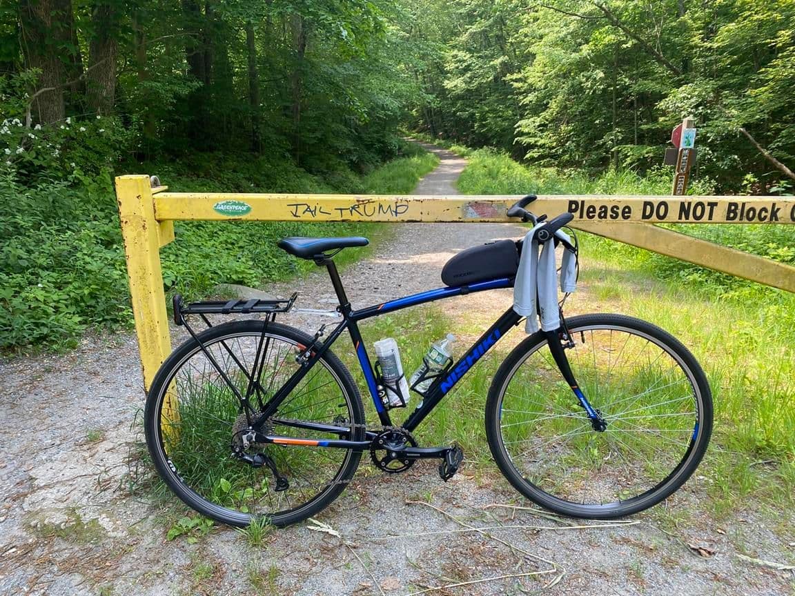
Bikes: FX Sport 4 Carbon, Nishiki Hybrid (1x9 mod), Raleigh Sport Comfort
Mentioned: 0 Post(s)
Tagged: 0 Thread(s)
Quoted: 47 Post(s)
Liked 189 Times
in
60 Posts
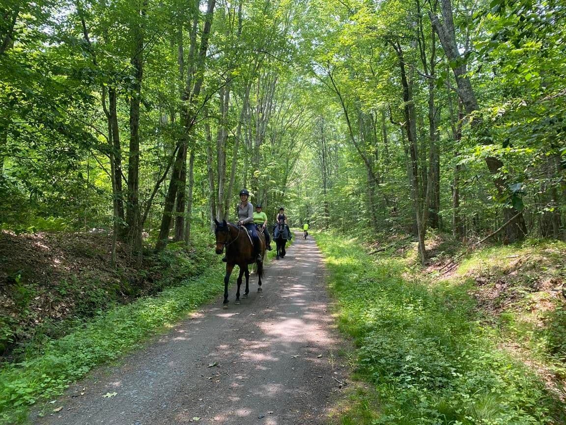
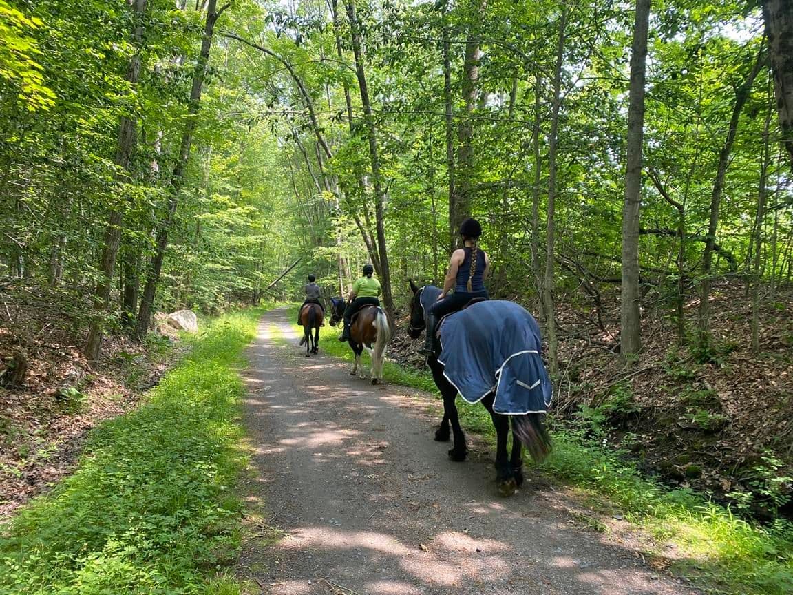
On my one-and-only time in the Pomfret area, the path headed north seemed more like a horse/atv trail than anything.
But that was in 2017. I had to turn around, then headed south which was fine until Rawson.
Do you guys have any pictures of the North-East? (Putnam/Thompson)
Here is my Pomfret ride: Air Line State Park Trail
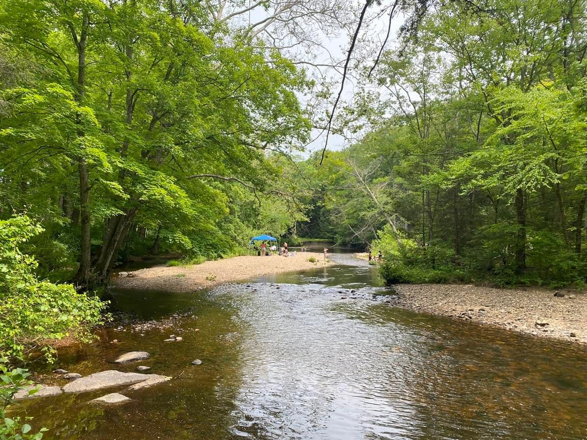
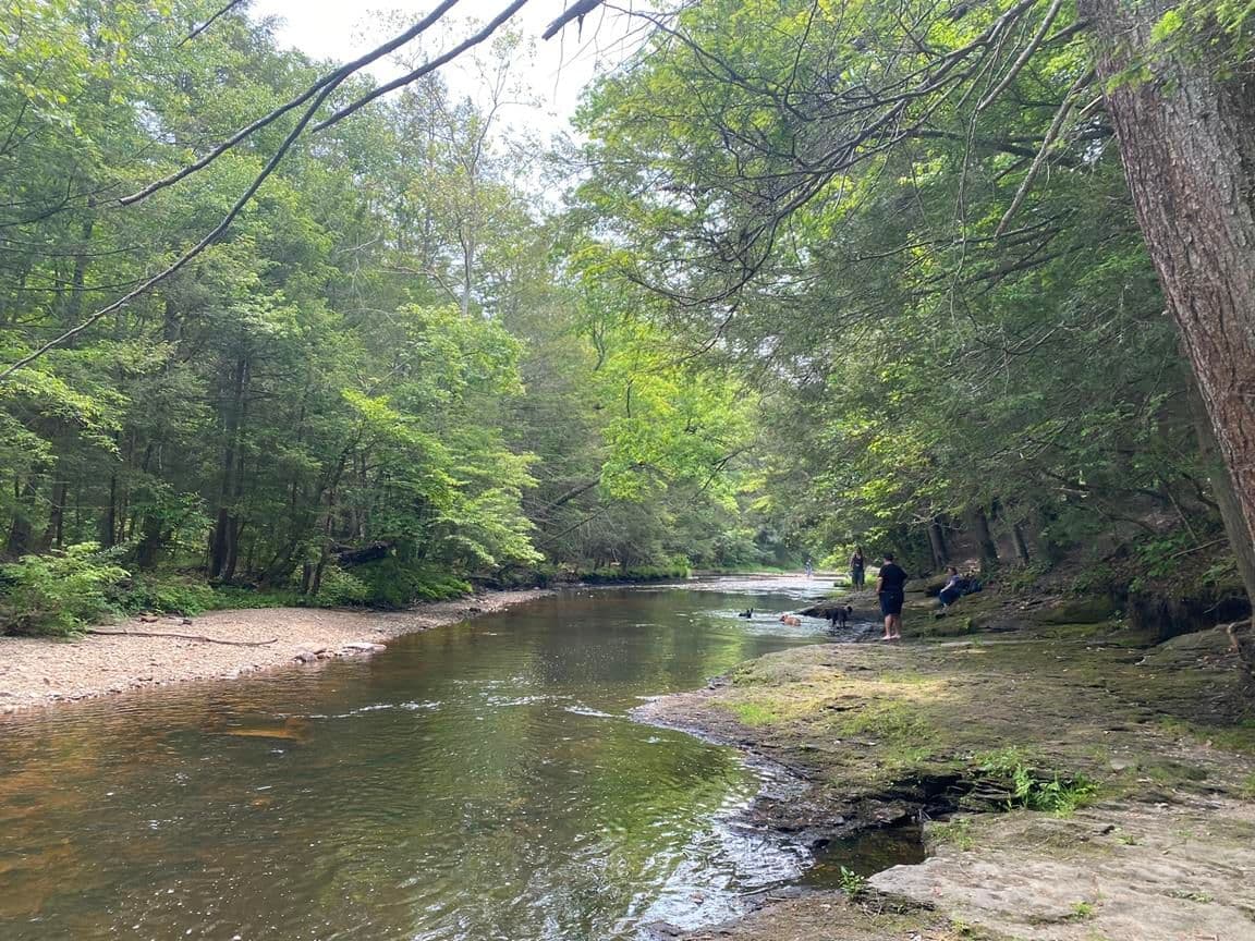
But the Salmon River / East Hampton areas appeal to me much more. It is beautiful out there.
And on a hot day, you can jump in the river.
This ride shows the trail conditions in many areas from 2016: Air Line State Park Trail
Less pictures, but a few alternate views in 2015: Air Line State Park Trail
More from 2017: Air Line State Park Trail
But that was in 2017. I had to turn around, then headed south which was fine until Rawson.
Do you guys have any pictures of the North-East? (Putnam/Thompson)
Here is my Pomfret ride: Air Line State Park Trail
But the Salmon River / East Hampton areas appeal to me much more. It is beautiful out there.
And on a hot day, you can jump in the river.
This ride shows the trail conditions in many areas from 2016: Air Line State Park Trail
Less pictures, but a few alternate views in 2015: Air Line State Park Trail
More from 2017: Air Line State Park Trail
Last edited by FrozenBiker; 06-12-23 at 05:19 AM. Reason: updated links
Likes For FrozenBiker:
03-07-23, 06:54 AM
#107
Newbie
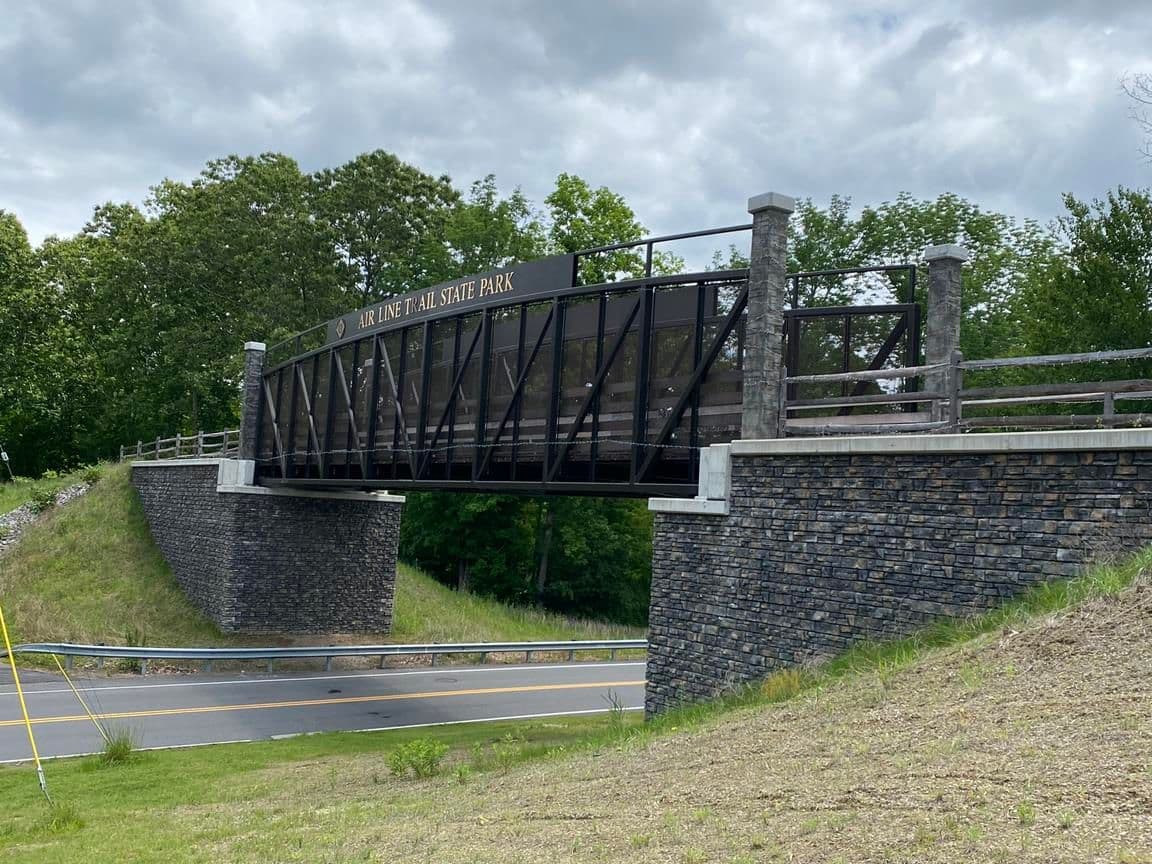
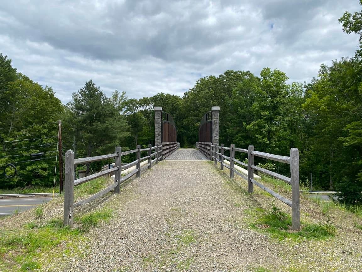
The northbound section from Pomfret Station has been improved since 2017 with 2 new bridges and 2 under passes, but it is not as well finished as southbound. The Thompson section is improved for about 4 miles then gets a bit rougher until East Thompson, then it gets a bit better into Douglass Mass. It all depends on what you are comfortable with. If you want super smooth then it is probably not for you.
Video of Thompson/Douglass
Video of Thompson/Douglass
Last edited by 2metalhips; 03-07-23 at 07:14 AM.
Likes For 2metalhips:
03-07-23, 10:22 AM
#108
Senior Member
Thread Starter
Join Date: Jul 2008
Location: 25 miles northwest of Boston
Posts: 29,546
Bikes: Bottecchia Sprint, GT Timberline 29r, Marin Muirwoods 29er, Trek FX Alpha 7.0
Mentioned: 112 Post(s)
Tagged: 0 Thread(s)
Quoted: 5223 Post(s)
Liked 3,577 Times
in
2,341 Posts
The northbound section from Pomfret Station has been improved since 2017 with 2 new bridges and 2 under passes, but it is not as well finished as southbound. The Thompson section is improved for about 4 miles then gets a bit rougher until East Thompson, then it gets a bit better into Douglass Mass. It all depends on what you are comfortable with. If you want super smooth then it is probably not for you.
Video of Thompson/Douglass
Video of Thompson/Douglass
July = nice dry conditions
06-12-23, 06:03 AM
#109
Join Date: Jun 2015
Location: Providence
Posts: 208
Bikes: FX Sport 4 Carbon, Nishiki Hybrid (1x9 mod), Raleigh Sport Comfort
Mentioned: 0 Post(s)
Tagged: 0 Thread(s)
Quoted: 47 Post(s)
Liked 189 Times
in
60 Posts
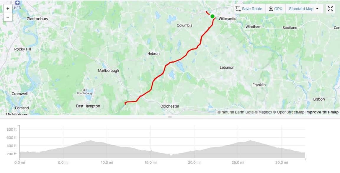
Another ride on the Air Line trail yesterday, beginning in Willimantic this time. The first six miles were on an incline, then it was mostly downhill to Salmon River. It was nice to be there again, but it felt like time to turn back. It has been decades since I've ridden this many miles, and the "ass bones" were quite painful at the end, and all last night.


Likes For FrozenBiker:
06-17-23, 03:01 PM
#110
meandering nomad
Just an update on Airline North. I ran into an archeologist surveying in Pomfret who was mapping the features left by the Railroad. This is the sections between the Pomfret Station and the Quinebaug River where they used really big trap rock to cover it. I told him the only thing left is the drainage ditches really no switches, boxes or telegraph poles are left. I said he should talk up the restoration of the ditches as a feature. The biggest problem is they were compromised when the first tie removal happened. This is why the trail floods in the cuts. I got off the trail at Wright's Crossing and took the road to Putnam. The trade off is quite a bit of climbing instead of chunky, muddy rock garden. It seems not many people involved with fixing these trails understand the drainage and answer every thing with a dump truck full of rocks.Instead of a backhoe to open the ditches. There is a section between Lowell Davis Rd. and Sand Dam Rd in Thompson that has trap rock or large gravel that is a pain to ride on. It is possible to ride from Hartford to Providence with 50 miles of pavement and 50 miles of dirt with only 15 miles on road. I've done several times now. Using the Charter Oak, Hop River, Airline, SNETT and the Blackstone River Greenway. I call it the 50-50 century.
Likes For billew:
06-21-23, 10:54 AM
#111
Newbie
The section from Pomfret Station to the Quinnebaug river is incomplete, it should get the finished surface in the next 2 years or so including a safe descent to the river.
Did a century on 6/19, Pomfret Station to Hop River trail in Willimantic to Bolton Notch, onto Charter Oak Greenway to Manchester, Cheney trail back to Charter Oak, took spur trail to Rockville 9 miles out and back to Charter Oak/Hop River back up to Bolton Notch back to Willimantic and Airline back to Pomfret. It was a few miles short of 100 so I added a few on the road to bring it up to 100. I used an old style bike computer but if you use a GPS type it may come up short because of tree cover in my experience.
Did a century on 6/19, Pomfret Station to Hop River trail in Willimantic to Bolton Notch, onto Charter Oak Greenway to Manchester, Cheney trail back to Charter Oak, took spur trail to Rockville 9 miles out and back to Charter Oak/Hop River back up to Bolton Notch back to Willimantic and Airline back to Pomfret. It was a few miles short of 100 so I added a few on the road to bring it up to 100. I used an old style bike computer but if you use a GPS type it may come up short because of tree cover in my experience.
Likes For 2metalhips:
06-22-23, 12:00 PM
#112
Senior Member
Thread Starter
Join Date: Jul 2008
Location: 25 miles northwest of Boston
Posts: 29,546
Bikes: Bottecchia Sprint, GT Timberline 29r, Marin Muirwoods 29er, Trek FX Alpha 7.0
Mentioned: 112 Post(s)
Tagged: 0 Thread(s)
Quoted: 5223 Post(s)
Liked 3,577 Times
in
2,341 Posts
The section from Pomfret Station to the Quinnebaug river is incomplete, it should get the finished surface in the next 2 years or so including a safe descent to the river.
Did a century on 6/19, Pomfret Station to Hop River trail in Willimantic to Bolton Notch, onto Charter Oak Greenway to Manchester, Cheney trail back to Charter Oak, took spur trail to Rockville 9 miles out and back to Charter Oak/Hop River back up to Bolton Notch back to Willimantic and Airline back to Pomfret. It was a few miles short of 100 so I added a few on the road to bring it up to 100. I used an old style bike computer but if you use a GPS type it may come up short because of tree cover in my experience.
Did a century on 6/19, Pomfret Station to Hop River trail in Willimantic to Bolton Notch, onto Charter Oak Greenway to Manchester, Cheney trail back to Charter Oak, took spur trail to Rockville 9 miles out and back to Charter Oak/Hop River back up to Bolton Notch back to Willimantic and Airline back to Pomfret. It was a few miles short of 100 so I added a few on the road to bring it up to 100. I used an old style bike computer but if you use a GPS type it may come up short because of tree cover in my experience.
06-22-23, 05:31 PM
#113
Join Date: Jun 2015
Location: Providence
Posts: 208
Bikes: FX Sport 4 Carbon, Nishiki Hybrid (1x9 mod), Raleigh Sport Comfort
Mentioned: 0 Post(s)
Tagged: 0 Thread(s)
Quoted: 47 Post(s)
Liked 189 Times
in
60 Posts
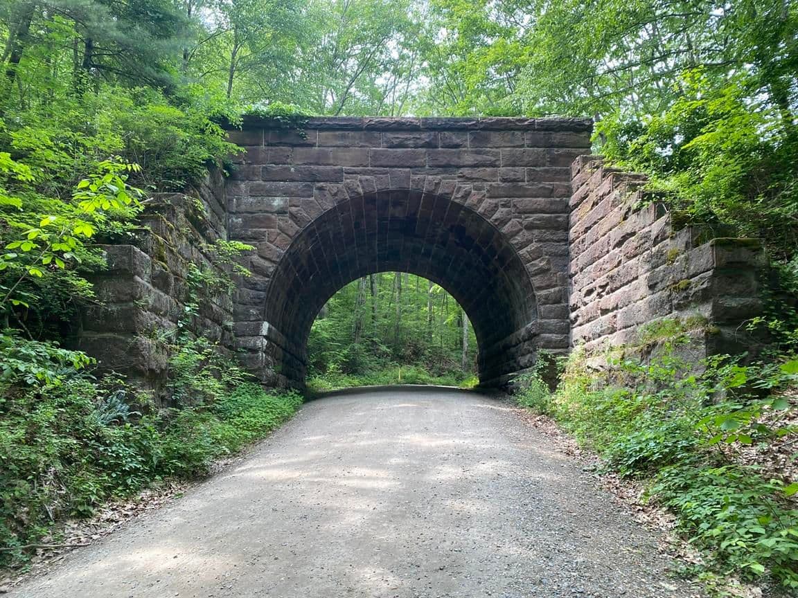
That is a beautiful bridge in Pomfret. Sister & I checked it out last week.
Likes For FrozenBiker:
06-23-23, 05:28 AM
#114
Newbie
Likes For 2metalhips:
Likes For 2metalhips:


