Groton, CT Summer '18 - Can I get from the Trolley Trail onto Neptune Road yet?
#1
Senior Member
Thread Starter
Groton, CT - Still Unanswered:Can I get from the Trolley Trail onto Neptune Road yet?
I do variations on a ride from the New London Ferry Terminal to Misquamicut Beach in Rhode Island every summer. In previous years, I was able to exit the Groton Trolley Trail onto Neptune Road and ride though Groton Long Point and Noank on my way up. More recently, Neptune Road has been gated off and I've had to cross the old AMTRAK bridge in Haley Farm State Park to continue toward Mystic. This is fine, but I remember GLP and Noank being highlights of those earlier rides.
By any chance, have the residents of these communities had a change of heart toward cyclists and opened up the gate for 2018?
By any chance, have the residents of these communities had a change of heart toward cyclists and opened up the gate for 2018?
Last edited by Papa Tom; 06-08-18 at 03:06 PM.
#2
Senior Member
Join Date: May 2017
Location: Northampton, MA
Posts: 1,909
Bikes: 36" Unicycle, winter knock-around hybrid bike
Liked 393 Times
in
282 Posts
I don't think your complaint is with Groton Long Point, or with Noank, but rather with the private-way subdivision of Mumford Cove which put up the fence - to the apparent annoyance of residents of the more open communities to the east as well.
#3
Senior Member
Thread Starter
I don't really have a "complaint." I'd like to suppose there was once a problem with cyclists cutting through the neighborhood and causing some type of problem. If that's the case, I can understand why the passage from the trail was gated off. If it was just an uneducated, misguided move made by a civic association that has nobody on board with any cycling background, then that's a shame.
Anyway, Bluff Point and Haley Farms Park are really nice places to ride through, so it wouldn't be a deal-breaker if that gate is still locked at Neptune. I just want to know so I can plan. Living on Long Island makes checking it out in advance kind of hard.
Hey, Uni...what are YOU doing in that part of CT on one wheel?
#5
Senior Member
Thread Starter
Well, if you own a bicycle and are ever looking for a good ride, take the Orient Point Ferry from the northeastern end of Long Island to New London, CT. Then bike your way over to Noank and on to Mystic. I can give you a route that keeps you off major roads most of the way.
#6
You can still sort of get through. There's a green DEP pipe gate to the left of the fence. Hop that and follow the grassy double track down to the pump station and take a right out to the street. The path is not private property. The town has some keep out signs around the pump station but by the time you see them you're almost on the street anyhow.
Don't miss cutting through Barn Island mgt area on the way to Westerly.
Don't miss cutting through Barn Island mgt area on the way to Westerly.
#7
Senior Member
Thread Starter
You can still sort of get through. There's a green DEP pipe gate to the left of the fence. Hop that and follow the grassy double track down to the pump station and take a right out to the street. The path is not private property. The town has some keep out signs around the pump station but by the time you see them you're almost on the street anyhow.
Don't miss cutting through Barn Island mgt area on the way to Westerly.
Don't miss cutting through Barn Island mgt area on the way to Westerly.

Also, if the residents are going to be hostile, I don't want to ruin the otherwise awesome vibe of this ride by sneaking into their neighborhood. My question was whether the gate is now open and cyclists are welcomed. I guess the answer is still no.
PS-Can you tell me more about Barn Island?
Last edited by Papa Tom; 06-09-18 at 06:05 AM.
#8
Senior Member
Join Date: Feb 2003
Location: Rhode Island
Posts: 234
Bikes: Lemond, Cannondale
Likes: 0
Liked 5 Times
in
4 Posts
No you cannot get on Neptune Drive from the trolley trail and that metal fence that they put up there to prevent that is still there and apparently that area is all private roads. Was just there. The trolley right of way goes on however, along a dirt/grass right of right and comes out at a road called Haley Crescent which is still- possibly part of the private enclave. This way is basically a narrow strip of dirt path that was not only completely passable, but surprisingly dry for me after a rainy spell. (was on my Surly Long Haul Trucker with 28s) The obstacles are that fore mentioned gate which I do not recall having any problem with, and a big rock that required slowing up for or dismounting and walking around. Not exactly sure of land status the end, but I am sure that if any of it was private land, that they would have put have up the same "keep out" signs that line the right of way.
#9
Senior Member
Thread Starter
cdale...
When I reach that sharp left turn that goes uphill and takes me over the AMTRAK bridge, I've seen that, if I were to continue straight instead, there is a narrow dirt trail that goes somewhere unknown. I have often wondered if it leads to a point further down Neptune or somewhere in that neighborhood. However, it is always overgrown and I've never wanted to risk tick bites or getting my loaded rig stuck in the grass somewhere, so I haven't explored it. Is this the "dirt/grass right-of-way" you described that leads to Haley Crescent (which is not shown on Google Maps, from what i can see)?
When I reach that sharp left turn that goes uphill and takes me over the AMTRAK bridge, I've seen that, if I were to continue straight instead, there is a narrow dirt trail that goes somewhere unknown. I have often wondered if it leads to a point further down Neptune or somewhere in that neighborhood. However, it is always overgrown and I've never wanted to risk tick bites or getting my loaded rig stuck in the grass somewhere, so I haven't explored it. Is this the "dirt/grass right-of-way" you described that leads to Haley Crescent (which is not shown on Google Maps, from what i can see)?
#10
Senior Member
Join Date: Feb 2003
Location: Rhode Island
Posts: 234
Bikes: Lemond, Cannondale
Likes: 0
Liked 5 Times
in
4 Posts
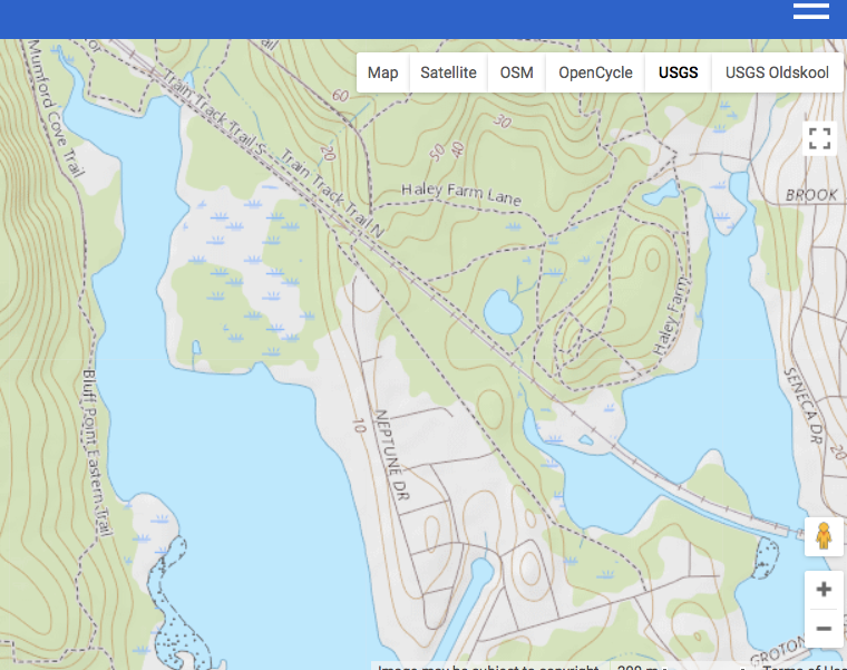
This is the way I go- the dashed line that is south of the AMTRAK RR tracks and kind of parallels Neptune southward. Gmaps pedometer site has USGS maps that show it. This map from that site.


Last edited by cdale56; 06-09-18 at 03:32 PM.
#11
Senior Member
Thread Starter
So I'm guessing that the fork just above where it says "Train Track Trail" is where I usually make the sharp left toward the AMTRAK bridge? If that's the case, you ride a pretty long way after that on grass and dirt, huh?
#12
Barn Island-
I'm assuming you're heading north on rt 1 through Mystic and Stonington. Turn right on Greenhaven rd. Then right again to follow the sign for barn island. Theres a gravel double track across the salt marshes (stay along the water and you can't go wrong) that runs you further down Greenhaven. You can just follow the coast around to Pawcatuck. This will add a few miles but is more scenic and gets you around a narrow strech of rt 1.
If you like Noank you might want to detour through Stonington borough down to the lighthouse.
If you're going through on on weekend Fort Griswold in Groton is worth a visit. The fort is open anytime but you can climb up into the monument on weekends and holidays.
Last edited by rangie; 06-09-18 at 10:24 PM.
#13
Senior Member
Thread Starter
Barn Island-
I'm assuming you're heading north on rt 1 through Mystic and Stonington. Turn right on Greenhaven rd. Then right again to follow the sign for barn island. Theres a gravel double track across the salt marshes (stay along the water and you can't go wrong) that runs you further down Greenhaven. You can just follow the coast around to Pawcatuck. This will add a few miles but is more scenic and gets you around a narrow strech of rt 1.
I'm assuming you're heading north on rt 1 through Mystic and Stonington. Turn right on Greenhaven rd. Then right again to follow the sign for barn island. Theres a gravel double track across the salt marshes (stay along the water and you can't go wrong) that runs you further down Greenhaven. You can just follow the coast around to Pawcatuck. This will add a few miles but is more scenic and gets you around a narrow strech of rt 1.
I will take a look at it. Thanks!
#14
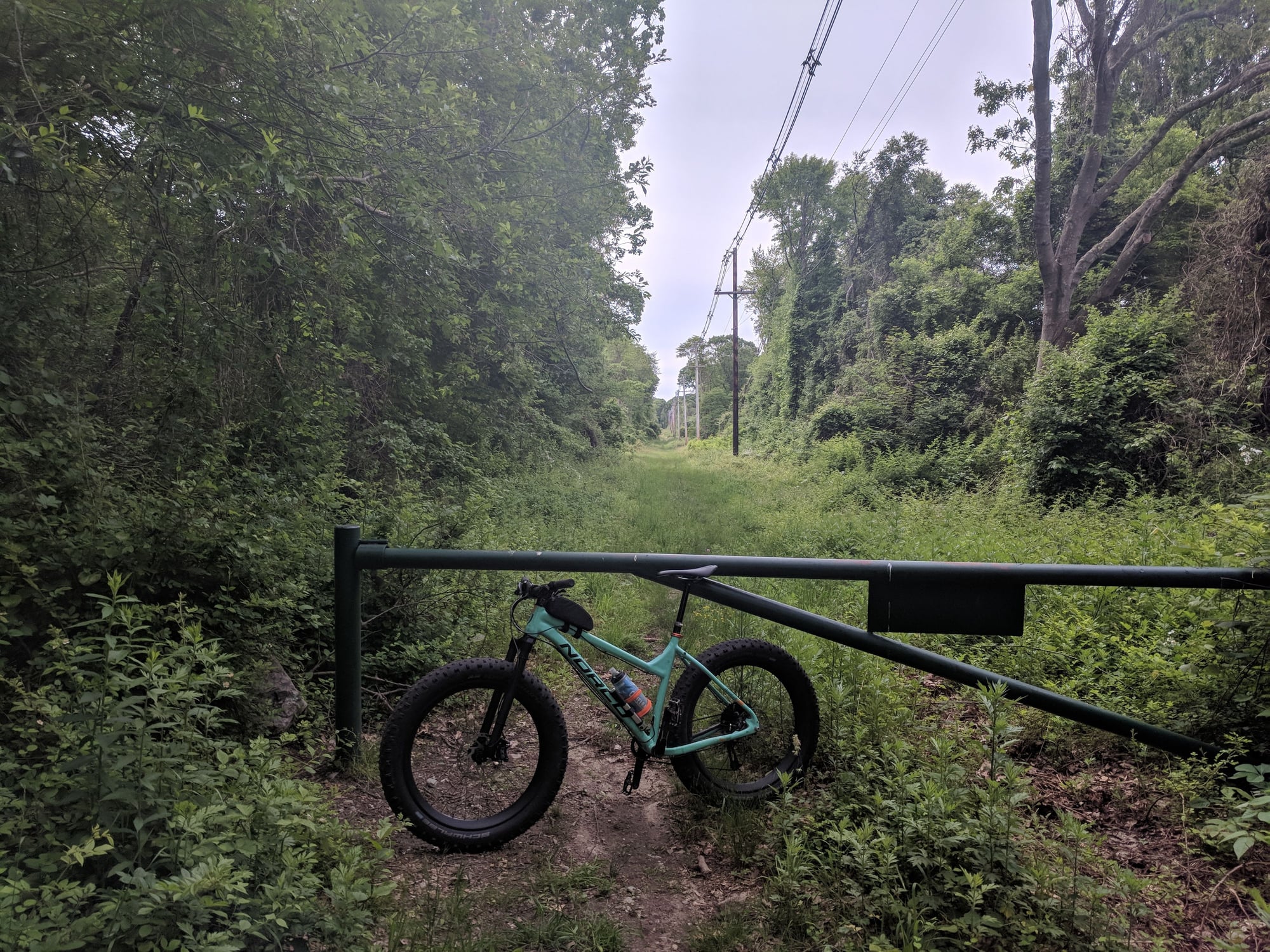
The trail is totally ridable. Check for ticks.
Anyone can view the heatmap and its a super useful tool for route planning. Strava Heatmap
Barn Island is a state management area with trails. The main one is gravel doubletrack across the salt marshes. Views of little Naragansett bay, sandy point island and Napatree point. Best part is, it gets you off a bad strech of Rt1 if you continue around Greenhaven rd to Mechanic st.
#15
Senior Member
Thread Starter
OK, now that I know where the dirt trail leads, maybe I will give it a shot this year.
I was unable to zoom past a certain point on the Strava Heat Map. Before I could get to any useful view, I got a pop-up message advising that only members could get beyond that zoom level. I'd rather get my info from real people in real English anyway.
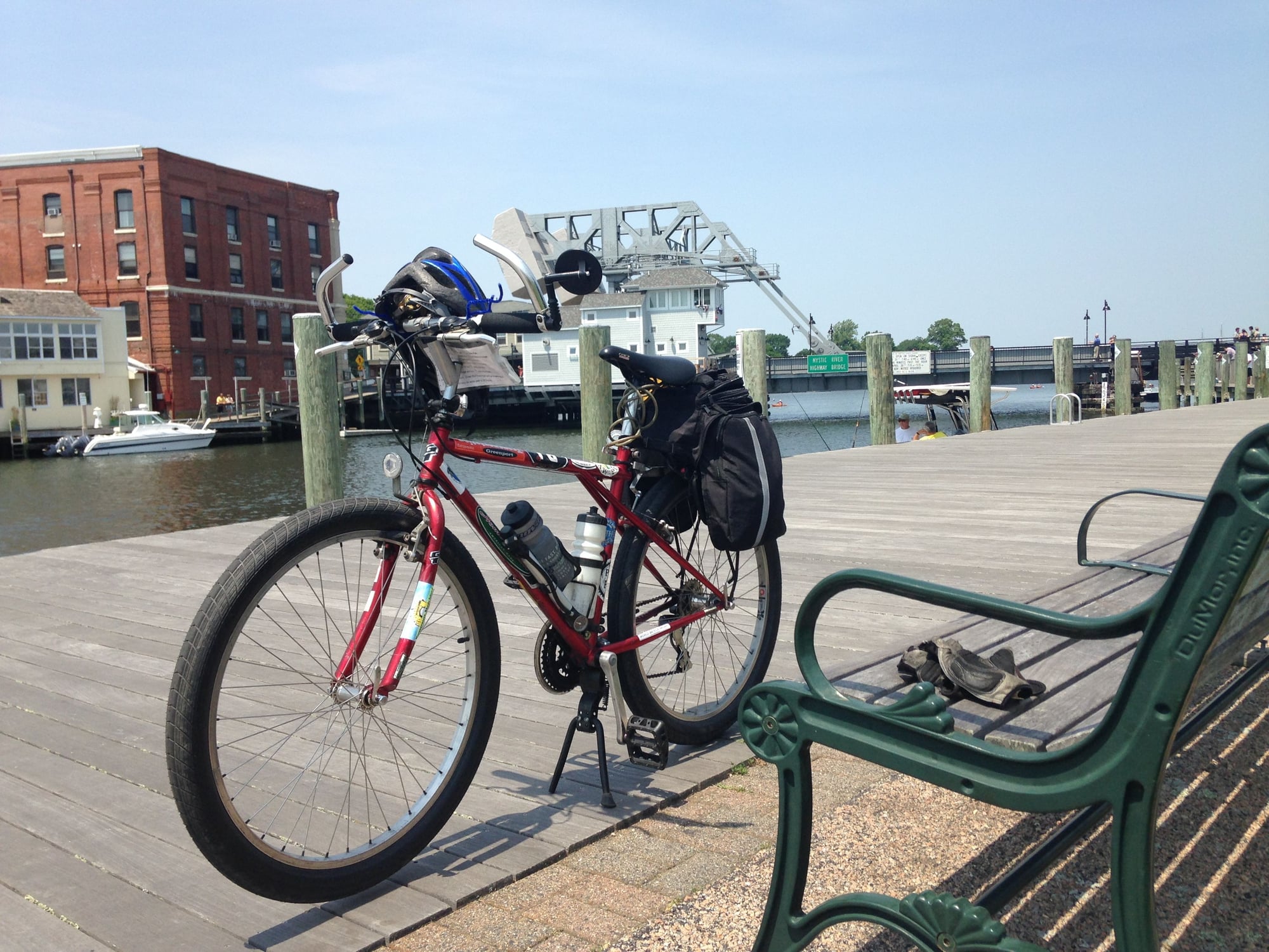
Barn Island sounds like a place for mountain biking. I'll be riding with a trunk bag and full panniers on both sides, day lighting, mp3 player and speakers, etc. No mountain biking for me. And the gravel along the train tracks is just about as much as I care to do on this kind of trip.
Thanks for all the info!
#17
Senior Member
Thread Starter
That's a VERY helpful photo, as it's just as I remember it from last summer. If I were riding my mountain bike unloaded with knobby tires, that'd be passable. But not on THIS thing (see below). And my new panniers hang about four inches lower.


