


Trail systems
 12-10-18, 11:18 PM
#1
Frequenchies
Thread Starter

Join Date: Nov 2014
Location: Omahole
Posts: 51
Bikes: Bianchi Portofino track conversion, +25ish builds under my belt.
Likes: 0
Liked 0 Times
in
0 Posts
Trail systems
No I’m not talking about local city trails that rin a dozen miles tops, I’m here to hear what trails you know of or have ridden that span more miles, rural, no motorized traffic, scenic, etc. I’ve heard of a few but have only gotten to experience one known as the Wabash Trace (65 miles from Council Bluffs/Omaha to Shenandoah). I’ve ridden it multiple times, makes for good day tripping, camping, and foraging, with its finely crushed limestone path, very few shallow hills to climb and bomb, and lined with streams and canopied tree lines to provide shade through rural farmland and rural woodland, ample wildlife (encountered a rogue mountain lion along it myself it was up in a tree but I startled it as I whizzed past), with small town treasures along the way and plenty of spots to have good robust fun an relax. It connects down to a highway that’ll go straight to KCMO. Anyone know of any trails like this? Long ones that would make interstate cycling a real pleasure?
 12-10-18, 11:26 PM
#2
Senior Member
Check out Michigan's Trail systems. They have about 2700 miles of trails; some of them meet your criteria. Also look at Idaho's Trail of the Coeur d' Alenes.
Rails to Trails
Rails to Trails
Last edited by Doug64; 12-10-18 at 11:38 PM.
12-11-18, 04:55 AM
#3

In Real Life

Join Date: Jan 2003
Location: Down under down under
Posts: 52,151
Bikes: Lots
Liked 601 Times
in
332 Posts
Australia's Rail Trails
https://www.railtrails.org.au/
https://www.railtrails.org.au/
__________________
Rowan
My fave photo threads on BF
Century A Month Facebook Group
Machka's Website
Photo Gallery
Rowan
My fave photo threads on BF
Century A Month Facebook Group
Machka's Website
Photo Gallery
12-11-18, 04:59 AM
#4
In Real Life
Join Date: Jan 2003
Location: Down under down under
Posts: 52,151
Bikes: Lots
Liked 601 Times
in
332 Posts
In this thread, I posted the story of our trip on the longest (or possibly second longest now) rail trail in Victoria. See posts 34, 37 and 38.
https://www.bikeforums.net/touring/1...t-tours-2.html
https://www.bikeforums.net/touring/1...t-tours-2.html
__________________
Rowan
My fave photo threads on BF
Century A Month Facebook Group
Machka's Website
Photo Gallery
Rowan
My fave photo threads on BF
Century A Month Facebook Group
Machka's Website
Photo Gallery
12-11-18, 06:05 AM
#5
Interstate is tough. But for long trails, there are some in MN.
Some specific ones are: The Katy Trail. The Mickelson Trail in SD, which is very scenic but not flat. The Olympian Trail in MT, which is less developed, not flat, but scenic. It connects with the Route of the Hiawatha Trail, which takes you into ID via St. Paul Pass. You can also transfer from the Olympian to the NorPac Trail that will take you across Lookout Pass into ID where you can connect with the Trail of the Couer d'Alene. The NorPac is also more rugged than your typical rail-trail and not flat, but also very pretty. It's technically open to vehicles since and is managed by the U.S.F.S. I saw one car when it rode the MT side. What little traffic there is moves very slowly. The Cd'A trail is paved. And let's not forget the GAP/C&O combination that will take you from Pittsburgh to D.C. In PA there is the D&L system, which has a few gaps in places.
Some specific ones are: The Katy Trail. The Mickelson Trail in SD, which is very scenic but not flat. The Olympian Trail in MT, which is less developed, not flat, but scenic. It connects with the Route of the Hiawatha Trail, which takes you into ID via St. Paul Pass. You can also transfer from the Olympian to the NorPac Trail that will take you across Lookout Pass into ID where you can connect with the Trail of the Couer d'Alene. The NorPac is also more rugged than your typical rail-trail and not flat, but also very pretty. It's technically open to vehicles since and is managed by the U.S.F.S. I saw one car when it rode the MT side. What little traffic there is moves very slowly. The Cd'A trail is paved. And let's not forget the GAP/C&O combination that will take you from Pittsburgh to D.C. In PA there is the D&L system, which has a few gaps in places.
12-11-18, 07:35 AM
#6
- Soli Deo Gloria -
Join Date: Aug 2015
Location: Northwest Georgia
Posts: 14,779
Bikes: 2018 Rodriguez Custom Fixed Gear, 2017 Niner RLT 9 RDO, 2015 Bianchi Pista, 2002 Fuji Robaix
Liked 738 Times
in
469 Posts
The Silver Comet Trail
Suburban Atlanta, Georgia to Anniston, Alabama
https://www.bikeforums.net/southeast...il-photos.html
-Tim-
Suburban Atlanta, Georgia to Anniston, Alabama
https://www.bikeforums.net/southeast...il-photos.html
-Tim-
12-11-18, 08:31 AM
#7
Lentement mais sűrement

Quebec has a few trails, the most famous being the 200km Le P'tit Train du Nord. You could make 400-500mile tour with very little road riding, with a shuttle at one end and a train the other. The solid lines are bike paths, the double lines are on road: https://carto.routeverte.com/en
Last edited by Erick L; 12-11-18 at 08:43 AM.
12-11-18, 09:27 AM
#8
Senior Member
BC has the KVR (Kettle Valley Railway), several hundred Km's of rail trail. https://bcrailtrails.com/
You can also travel across most of BC on a semi off road system of trails as noted in this race https://www.bcepic1000.com/
A pic from the KVR
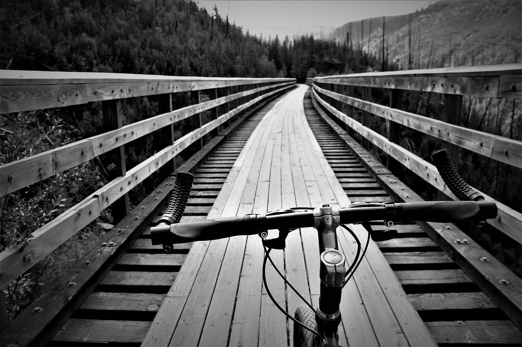
You can also travel across most of BC on a semi off road system of trails as noted in this race https://www.bcepic1000.com/
A pic from the KVR
12-11-18, 09:53 AM
#9

don't try this at home.

Google Maps bicycle option
google maps shows most every trail, from short ones in city parks to the longest ones.
Pull down the left side menu and select Bicycling.
You have to zoom in to at least the "10 mile" zoom level before the bike trails display.
Zoom way in on trail to see it's name repeated along the line, then you can google that trail name for more info.
For example, southern PA with the GAP trail heading SE from Pittsburgh.
https://www.google.com/maps/@40.2283.../data=!5m1!1e3
What are the solid or dotted lines?
The trail markings don't all have their previous meanings, and there's no info from google itself on the new markings.
previously,
solid green line: a paved trail
solid brown line: unpaved trail
dotted line: a bike lane on a road.
Now:
dashed green line: unpaved trail?
solid dark green line: might be paved or unpaved trail.. why! See the GAP trail around Ohiopyle, some of it is solid, some dashed, but it's all the same unpaved, crushed stone surface.
solid light green line: bike lane on a road
dotted line: bike friendly road. (some are more "friendly" than others, though.)
solid brown: unpaved trail or dirt path.
The current map legend. Doesn't show the dashed lines here.

Street View!
A few trails have Street View, from a bicycle towed camera.
zoom in, drag the yellow "street view guy" onto the map and see if the trail is included.
For example, the Little Miami Trail near Loveland OH:

google maps shows most every trail, from short ones in city parks to the longest ones.
Pull down the left side menu and select Bicycling.
You have to zoom in to at least the "10 mile" zoom level before the bike trails display.
Zoom way in on trail to see it's name repeated along the line, then you can google that trail name for more info.
For example, southern PA with the GAP trail heading SE from Pittsburgh.
https://www.google.com/maps/@40.2283.../data=!5m1!1e3
What are the solid or dotted lines?
The trail markings don't all have their previous meanings, and there's no info from google itself on the new markings.
previously,
solid green line: a paved trail
solid brown line: unpaved trail
dotted line: a bike lane on a road.
Now:
dashed green line: unpaved trail?
solid dark green line: might be paved or unpaved trail.. why! See the GAP trail around Ohiopyle, some of it is solid, some dashed, but it's all the same unpaved, crushed stone surface.
solid light green line: bike lane on a road
dotted line: bike friendly road. (some are more "friendly" than others, though.)
solid brown: unpaved trail or dirt path.
The current map legend. Doesn't show the dashed lines here.
Street View!
A few trails have Street View, from a bicycle towed camera.
zoom in, drag the yellow "street view guy" onto the map and see if the trail is included.
For example, the Little Miami Trail near Loveland OH:
Last edited by rm -rf; 12-11-18 at 09:59 AM.
12-11-18, 09:57 AM
#10
Senior Member

Join Date: Aug 2017
Location: Central Io-way
Posts: 2,738
Bikes: LeMond Zurich, Giant Talon 29er
Liked 691 Times
in
504 Posts
There's a huge expanse of rail trails in central Iowa, all interconnected. You could easily spend three days in central Iowa riding dedicated trail.
12-11-18, 10:13 AM
#11
don't try this at home.
Long trails not yet mentioned:
The Katy Trail
The GAP Trail, Great Allegheny Passage. There's more trails in the Pittsburgh area, too.
The C&O Canal Trail, connects to the GAP trail
The New River Trail, from Galax WV
The Erie Canal Trail, Rochester NY
The Little Miami Trail, Cincinnati to Xenia OH, with interconnects to many other trails. paved.
The Ohio & Erie Towpath trail, south of Cleveland, including Cuyahoga Valley National Park. And more trail south of Akron OH.
Scenic:
The Virginia Creeper Trail. AbingdonVA. 34 miles, extremely scenic, following a mountain creek valley, with whitewater and many bridge crossings. The round trip, 68 miles, is a full day ride, since there's a lot of elevation gain and many scenic stops along the way.
Last edited by rm -rf; 12-11-18 at 10:19 AM.
12-11-18, 01:13 PM
#12
Mad bike riding scientist

Join Date: Nov 2004
Location: Denver, CO
Posts: 27,700
Bikes: Some silver ones, a red one, a black and orange one, and a few titanium ones
Liked 4,537 Times
in
2,522 Posts
No I’m not talking about local city trails that rin a dozen miles tops, I’m here to hear what trails you know of or have ridden that span more miles, rural, no motorized traffic, scenic, etc. I’ve heard of a few but have only gotten to experience one known as the Wabash Trace (65 miles from Council Bluffs/Omaha to Shenandoah). I’ve ridden it multiple times, makes for good day tripping, camping, and foraging, with its finely crushed limestone path, very few shallow hills to climb and bomb, and lined with streams and canopied tree lines to provide shade through rural farmland and rural woodland, ample wildlife (encountered a rogue mountain lion along it myself it was up in a tree but I startled it as I whizzed past), with small town treasures along the way and plenty of spots to have good robust fun an relax. It connects down to a highway that’ll go straight to KCMO. Anyone know of any trails like this? Long ones that would make interstate cycling a real pleasure?
Further afield, there's the Katy/Rock Island over in Missouri and the Michelson Trail in South Dakota. There's also the Flint Hills, Kanza and Landon Trail in Kansas.
And, although not "rail trails", there's a rather extensive network here in Colorado. You can ride trail from Denver to Loveland Pass and then ride trails from Keystone to almost Grand Junction going west. South of Denver, there are trails that stretch almost to Colorado Springs and trails north along the Poudre and Platte River. You can also ride trail from Denver to Boulder.
And that just scratches the surface.
__________________
Stuart Black
Plan Epsilon Around Lake Michigan in the era of Covid
Old School…When It Wasn’t Ancient bikepacking
Gold Fever Three days of dirt in Colorado
Pokin' around the Poconos A cold ride around Lake Erie
Dinosaurs in Colorado A mountain bike guide to the Purgatory Canyon dinosaur trackway
Solo Without Pie. The search for pie in the Midwest.
Picking the Scablands. Washington and Oregon, 2005. Pie and spiders on the Columbia River!
12-11-18, 02:20 PM
#14
Sunshine

Join Date: Aug 2014
Location: Des Moines, IA
Posts: 17,037
Bikes: '18 class built steel roadbike, '19 Fairlight Secan, '88 Schwinn Premis , Black Mountain Cycles Monstercross V4, '89 Novara Trionfo
Liked 8,064 Times
in
4,472 Posts
Around you- Cowboy. Michelson. Katy.
or come to central Iowa and ride hundreds of miles of connected trail.
or come to central Iowa and ride hundreds of miles of connected trail.
12-11-18, 07:20 PM
#15
Senior Member
Join Date: Apr 2011
Location: Richmond, Virginia
Posts: 392
Bikes: 2018 Giant Stance 1, 2011 Trek Madone 3.1, 2004 LeMond Nevada City, 1980 Peugeot Course single speed, 1978 Peugeot AO-8
Likes: 0
Liked 1 Time
in
1 Post
The Capital Trail in Virginia connects Richmond and Jamestown. 53 miles long.
12-11-18, 07:25 PM
#16
Every day a winding road

BC has the KVR (Kettle Valley Railway), several hundred Km's of rail trail. https://bcrailtrails.com/
You can also travel across most of BC on a semi off road system of trails as noted in this race https://www.bcepic1000.com/
A pic from the KVR
You can also travel across most of BC on a semi off road system of trails as noted in this race https://www.bcepic1000.com/
A pic from the KVR
I have been very interested in this trail, I seem to get mixed reports on trail surface. Maybe because it is a mixed lot.

I really wouldn't be interested in rough trail. Something similar to the Katy or GAP if you have ever ridden them. Maybe even slightly less quality then that would be OK. Any good sections that fit that bill?
12-11-18, 08:46 PM
#17
Senior Member
The section around Myra Canyon is well maintained and most the rest is adequate. I haven't done those other trails you mention but this is dirt, rock, sand, ruts etc... but not singletrack or technical. I don't think I'd use a road bike perse as thin tires would wallow but a gravel bike or rigid mtb style tourer with 26x1.75 tires would do fine.
12-12-18, 01:24 AM
#18
Frequenchies
Thread Starter
Join Date: Nov 2014
Location: Omahole
Posts: 51
Bikes: Bianchi Portofino track conversion, +25ish builds under my belt.
Likes: 0
Liked 0 Times
in
0 Posts
Thank you! I’m gonna start looking into a few of these, the closer ones of corse as they would make good week long trips and I’ve got cabin fever ����
12-13-18, 02:41 PM
#19
Senior Member

Join Date: Apr 2015
Location: Metro Detroit/AA
Posts: 8,206
Bikes: 2016 Novara Mazama
Liked 81 Times
in
51 Posts
Check out Michigan's Trail systems. They have about 2700 miles of trails; some of them meet your criteria. Also look at Idaho's Trail of the Coeur d' Alenes.
Rails to Trails
Rails to Trails
That said, I still highly recommend them, and can't wait for the day the Airline Railway and the Iron Belle trail are fully complete.
12-20-18, 01:55 AM
#20
In Real Life
Join Date: Jan 2003
Location: Down under down under
Posts: 52,151
Bikes: Lots
Liked 601 Times
in
332 Posts
Australia's Rail Trails
https://www.railtrails.org.au/
https://www.railtrails.org.au/
I just wish Tasmania would get on board.
__________________
Rowan
My fave photo threads on BF
Century A Month Facebook Group
Machka's Website
Photo Gallery
Rowan
My fave photo threads on BF
Century A Month Facebook Group
Machka's Website
Photo Gallery

