


Route Safety Evaluation Tool?
 03-14-24, 05:47 AM
#1
Newbie
Thread Starter
Route Safety Evaluation Tool?
The Truckee Meadows Bicycle Alliance is working to follow through with a commitment to produce a ride in our community that could bring out 300 children and families. We had an enlightening experience last year with a pilot project with 20 novice riders. As a result, we would not take the same route on unprotected streets again. So we have chosen a new route that is on a "protected" path. But there are some concerns about this route as well. Is anyone aware of a route infrastructure evaluation tool we can use to determine the appropriate age and experience level for the route?
The route we were planning to use includes a rolling curb between the cycle track and traffic, and in some areas, cyclists must enter vehicle travel turn lanes (see attached satellite image). Also, the posted speed limit is 35. However, most traffic is traveling 40-45, which puts it in the protected path zone according to the FHWA bikeway selection guide. Street view maps are outdated, but I have included a screenshot of the path. We have tried to explain to our local officials that this design is not ideal as "protected" and offered some solutions, including candlesticks, to improve safety. But without those improvements, we are wondering if this is safe enough for elementary school kids.
My gut has some concerns, but it would be good if we had an official tool to mitigate or support our concerns, specifically about this rolling curb. If you are aware of a tool that could help us determine the appropriate age and experience level for this path, we would appreciate it.
Thank you!
Ky
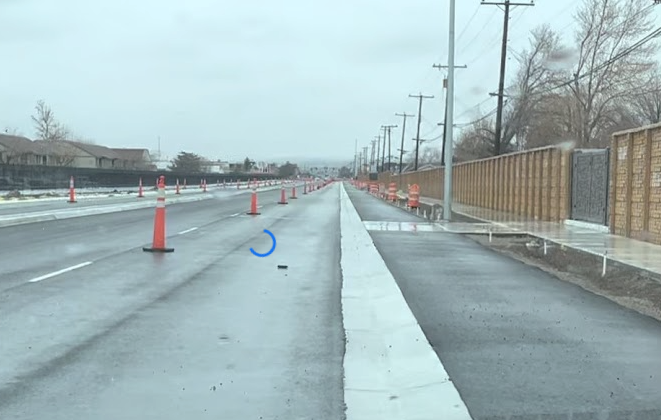
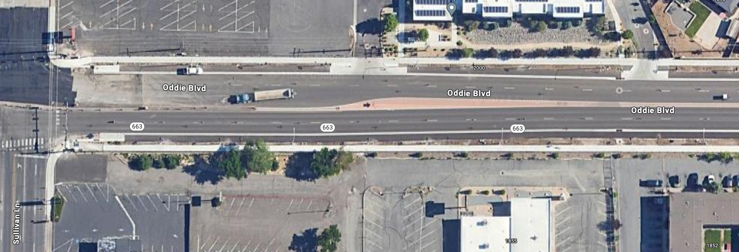
 03-14-24, 11:53 PM
#2

Senior Member
Join Date: Apr 2009
Location: New Rochelle, NY
Posts: 39,640
Bikes: too many bikes from 1967 10s (5x2)Frejus to a Sumitomo Ti/Chorus aluminum 10s (10x2), plus one non-susp mtn bike I use as my commuter
Liked 3,480 Times
in
1,911 Posts
I had many years of experience working with the NYC 5 boro ride going back to the beginning. IMO, based on what we did then, group rides for the general public and/or including children MUST be run on controlled roads. The police must be involved starting from the planning stages, and an effective plan to secure the route and every intersection has to be created.
Note the closures involved don't have to be long, more like what's done for parades, where intersections are closed as the lead approaches, and reopened after the last rider. Where an intersection cannot be closed long enough, a pulsed system of closing for an interval then holding riders so traffic can cross, then closing again.
We worked with a system of using police to close intersections, then once closed, they are secured by volunteers. This allowed a small cadre of police working forward of the ride to close intersections then leapfrog ahead, so they can keep pace with the approaching ride. For only 200 riders, where lanes are coned off, it might be OK to use the normal traffic signals and use volunteers to supervise that the riders adhere to them, rather than blocking traffic. But, you'll still need marshals to supervise anyplace the ride crosses an artery.
FWIW, 200 is the low end threshold for a "large" ride, so it shouldn't be hard to manage, but having children participate absolutely requires a real plan, because the families will expect that.
__________________
FB
Chain-L site
An ounce of diagnosis is worth a pound of cure.
Just because I'm tired of arguing, doesn't mean you're right.
�One accurate measurement is worth a thousand expert opinions� - Adm Grace Murray Hopper - USN
WARNING, I'm from New York. Thin skinned people should maintain safe distance.
FB
Chain-L site
An ounce of diagnosis is worth a pound of cure.
Just because I'm tired of arguing, doesn't mean you're right.
�One accurate measurement is worth a thousand expert opinions� - Adm Grace Murray Hopper - USN
WARNING, I'm from New York. Thin skinned people should maintain safe distance.

