


I got 2 weeks in August - perhaps I'll ride the west coast
 06-09-21, 07:13 AM
#26
Senior Member
Back then all we had for gradients on maps were on Michelin maps they had chevrons marked on map for climbs, 1 chevron=A bit steep, 2 for moderate, 3 for real steep. Nice in France but I don't recall them on the US maps I had for the West coast trip.
I just remember thinking, boy this trip has climbing at times!
didn't matter though, very cool route.
hope it works out.
 06-09-21, 08:04 AM
#27
Senior Member
Thread Starter
Join Date: Apr 2014
Location: Maine, USA
Posts: 1,612
Bikes: Corvid Sojourner, Surly Ice Cream Truck, Co-Motion Divide, Co-Motion Java Tandem, Salsa Warbird, Salsa Beargrease, Carver Tandem
Mentioned: 3 Post(s)
Tagged: 0 Thread(s)
Quoted: 534 Post(s)
Liked 435 Times
in
227 Posts
ok. I found a GPX track on ridewithgps for Astoria to Golden Gate Bridge - apparently 810 miles. Sounds like a reasonable distance for what I estimate is 3500 feet average elevation gain on a 60 mile day
06-09-21, 08:43 AM
#28
Senior Member
Join Date: Aug 2010
Location: Madison, WI
Posts: 11,207
Bikes: 1961 Ideor, 1966 Perfekt 3 Speed AB Hub, 1994 Bridgestone MB-6, 2006 Airnimal Joey, 2009 Thorn Sherpa, 2013 Thorn Nomad MkII, 2015 VO Pass Hunter, 2017 Lynskey Backroad, 2017 Raleigh Gran Prix, 1980s Bianchi Mixte on a trainer. Others are now gone.
Mentioned: 48 Post(s)
Tagged: 0 Thread(s)
Quoted: 3461 Post(s)
Liked 1,466 Times
in
1,144 Posts
... Pyrenees ... ... gradients on maps were on Michelin maps they had chevrons marked on map for climbs, 1 chevron=A bit steep, 2 for moderate, 3 for real steep. Nice in France but I don't recall them on the US maps I had for the West coast trip.
I just remember thinking, boy this trip has climbing at times!
...
I just remember thinking, boy this trip has climbing at times!
...
The Oregon cycle map had some alternative routes that routed you away from the main highway in some places with heavy traffic, some of those alternate back road were up to 12 percent grade. Main highway appeared to have a max grade of 8 percent.
Iceland had a cycling map, along the side of a road on the map there were two colors, yellow was a specific grade and brown was a steeper grade. I do not recall the specific numbers, but those colors were for specific percent gradients. And the color on the side of the road, you could tell which direction was uphill. In many ways that was the best cycling map I ever saw, and it was free. But printed on plain paper, and in rain and damp weather the map only lasts a bit over a week when you are careful. I should have picked up four copies instead of one in Reykjavik when I was there.
06-09-21, 10:14 AM
#29
Senior Member
What, you didn't have your plug in plastic laminator along with all the food and crap you had loaded?!
I've mentioned this before re gradients somewhere on the west coast trip, but I have a clear memory of serenely honking down a long downhill at 80kph 50mph.
Must have been one of those inland detours, I seem to recall looking down on the ocean from high up with a blanket of fog all over.
I've mentioned this before re gradients somewhere on the west coast trip, but I have a clear memory of serenely honking down a long downhill at 80kph 50mph.
Must have been one of those inland detours, I seem to recall looking down on the ocean from high up with a blanket of fog all over.
06-09-21, 03:55 PM
#30
Senior Member
Yeah, Pacific Coast, I also expected more of the road to be closer to sea level. That was a surprise.
The Oregon cycle map had some alternative routes that routed you away from the main highway in some places with heavy traffic, some of those alternate back road were up to 12 percent grade. Main highway appeared to have a max grade of 8 percent.
The Oregon cycle map had some alternative routes that routed you away from the main highway in some places with heavy traffic, some of those alternate back road were up to 12 percent grade. Main highway appeared to have a max grade of 8 percent.
06-09-21, 05:41 PM
#31
Full Member
Join Date: Jul 2013
Location: Southern California
Posts: 492
Bikes: Historical: Schwinn Speedster; Schwinn Collegiate; 1981 Ross Gran Tour; 1981 Dawes Atlantis; 1991 Specialized Rockhopper. Current: 1987 Ritchey Ultra; 1987 Centurion Ironman Dave Scott Master; 1992 Specialized Stumpjumper FS
Mentioned: 1 Post(s)
Tagged: 0 Thread(s)
Quoted: 209 Post(s)
Liked 178 Times
in
111 Posts
The Oregon Coast and northern California are the best part of the entire Coast Route, but I'm biased .
Have fun on your ride. You can't go wrong. We might see you on the road. My wife and I are planning a tour form Olympia, WA, around the Olympic Peninsula, down the WA and OR Coast, then home. We are starting sometime in August, but don't have it nailed down yet. Our route will change if Canada opens up.
Have fun on your ride. You can't go wrong. We might see you on the road. My wife and I are planning a tour form Olympia, WA, around the Olympic Peninsula, down the WA and OR Coast, then home. We are starting sometime in August, but don't have it nailed down yet. Our route will change if Canada opens up.
06-09-21, 07:41 PM
#32
Senior Member
06-10-21, 04:29 PM
#33
bicycle tourist

Edit: I guess "cattle guard" - https://en.wikipedia.org/wiki/Cattle_grid is more common.
https://thegate.boardingarea.com/wha...ational-parks/
Last edited by mev; 06-10-21 at 06:21 PM.
 06-11-21, 05:42 AM
#36
Senior Member
Cattle guard, thanks mev, haven't heard that term in years.
And interesting Doug, marked as an electric bear guard, must be only a west thing.
And interesting Doug, marked as an electric bear guard, must be only a west thing.
06-11-21, 09:41 AM
#37
Senior Member
Join Date: Dec 2010
Location: northern Deep South
Posts: 8,904
Bikes: Fuji Touring, Novara Randonee
Mentioned: 36 Post(s)
Tagged: 0 Thread(s)
Quoted: 2604 Post(s)
Liked 1,933 Times
in
1,213 Posts
Is that a big problem in Alberta, bears crossing bridges?
06-11-21, 11:30 AM
#38
Senior Member
06-11-21, 11:39 AM
#39
Senior Member
Join Date: Mar 2009
Location: Oregon
Posts: 6,489
Mentioned: 31 Post(s)
Tagged: 0 Thread(s)
Quoted: 1182 Post(s)
Liked 833 Times
in
435 Posts
If memory serves me right, It was on a road going into a campground. The campground was also enclosed in a high electric fence, but it was 8 years ago, and I am getting older

Cattle guards are a common thing in Oregon, especially the eastern half of the state. There are millions of acres of public land that are under "cattle allotments" (rented to the ranchers for grazing). I don't remember seeing any cattle guards on the coast route.
Cattle guards are a common thing in Oregon, especially the eastern half of the state. There are millions of acres of public land that are under "cattle allotments" (rented to the ranchers for grazing). I don't remember seeing any cattle guards on the coast route.
06-11-21, 05:54 PM
#40
Senior Member
Join Date: Aug 2010
Location: Madison, WI
Posts: 11,207
Bikes: 1961 Ideor, 1966 Perfekt 3 Speed AB Hub, 1994 Bridgestone MB-6, 2006 Airnimal Joey, 2009 Thorn Sherpa, 2013 Thorn Nomad MkII, 2015 VO Pass Hunter, 2017 Lynskey Backroad, 2017 Raleigh Gran Prix, 1980s Bianchi Mixte on a trainer. Others are now gone.
Mentioned: 48 Post(s)
Tagged: 0 Thread(s)
Quoted: 3461 Post(s)
Liked 1,466 Times
in
1,144 Posts
I was totally amazed at the giant trees. If you can fit your schedule so that you can camp at Elk Prairie Campground, they had a hiking trail through some of the trees, it was just amazing.
Unfortunately some of my photos are rotated, I can't figure out how to correct.
First photo was before I got to the campground.

They cut a hole through the trunk of a downed tree so that the hiking trail could go through that hole.


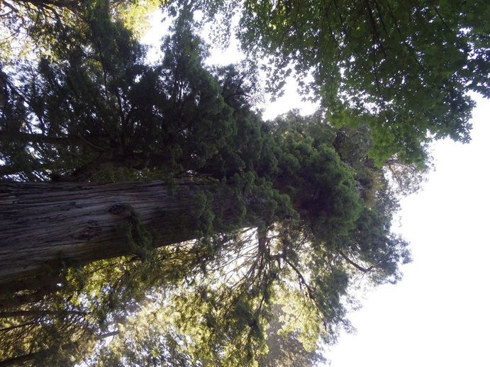
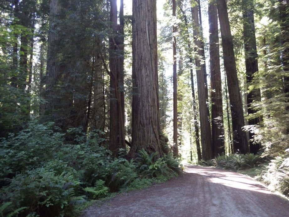
The trees were just amazing.
You are going to have a great time. Remember to bring a cork screw.
Unfortunately some of my photos are rotated, I can't figure out how to correct.
First photo was before I got to the campground.
They cut a hole through the trunk of a downed tree so that the hiking trail could go through that hole.
The trees were just amazing.
You are going to have a great time. Remember to bring a cork screw.
Likes For Tourist in MSN:
06-11-21, 06:31 PM
#41
Senior Member
Join Date: Mar 2009
Location: Oregon
Posts: 6,489
Mentioned: 31 Post(s)
Tagged: 0 Thread(s)
Quoted: 1182 Post(s)
Liked 833 Times
in
435 Posts
I was totally amazed at the giant trees. If you can fit your schedule so that you can camp at Elk Prairie Campground, they had a hiking trail through some of the trees, it was just amazing.
Unfortunately some of my photos are rotated, I can't figure out how to correct.
First photo was before I got to the campground.
They cut a hole through the trunk of a downed tree so that the hiking trail could go through that hole.
The trees were just amazing.
You are going to have a great time. Remember to bring a cork screw.

Last edited by Doug64; 06-13-21 at 10:39 PM.
06-11-21, 08:07 PM
#42
Senior Member
Join Date: Aug 2010
Location: Madison, WI
Posts: 11,207
Bikes: 1961 Ideor, 1966 Perfekt 3 Speed AB Hub, 1994 Bridgestone MB-6, 2006 Airnimal Joey, 2009 Thorn Sherpa, 2013 Thorn Nomad MkII, 2015 VO Pass Hunter, 2017 Lynskey Backroad, 2017 Raleigh Gran Prix, 1980s Bianchi Mixte on a trainer. Others are now gone.
Mentioned: 48 Post(s)
Tagged: 0 Thread(s)
Quoted: 3461 Post(s)
Liked 1,466 Times
in
1,144 Posts
06-11-21, 08:16 PM
#43
Senior Member
Join Date: Aug 2010
Location: Madison, WI
Posts: 11,207
Bikes: 1961 Ideor, 1966 Perfekt 3 Speed AB Hub, 1994 Bridgestone MB-6, 2006 Airnimal Joey, 2009 Thorn Sherpa, 2013 Thorn Nomad MkII, 2015 VO Pass Hunter, 2017 Lynskey Backroad, 2017 Raleigh Gran Prix, 1980s Bianchi Mixte on a trainer. Others are now gone.
Mentioned: 48 Post(s)
Tagged: 0 Thread(s)
Quoted: 3461 Post(s)
Liked 1,466 Times
in
1,144 Posts
If your trip is early August, not sure when fire season is.
https://www.npr.org/2021/06/11/10054...ildfire-season
I was there seven years ago, we often did not have cell coverage, maybe it has gotten better?
https://www.npr.org/2021/06/11/10054...ildfire-season
I was there seven years ago, we often did not have cell coverage, maybe it has gotten better?
06-11-21, 08:40 PM
#44

Hooked on Touring
90 Day % of Normal Precipitation as of 06-11-21
By August the wildfire risk in southern Oregon and northern California will be extreme.
It has been a record low precipitation in many areas of the West -
esp. since early March when almost no rain has fallen along the coast.
The end of the rainy season has never been this early before.
Be prepared for possible closures - roads & parks - and smoky conditions.
PS - California may run out of electricity by August, too.
06-13-21, 10:01 AM
#45
Senior Member
Thread Starter
Join Date: Apr 2014
Location: Maine, USA
Posts: 1,612
Bikes: Corvid Sojourner, Surly Ice Cream Truck, Co-Motion Divide, Co-Motion Java Tandem, Salsa Warbird, Salsa Beargrease, Carver Tandem
Mentioned: 3 Post(s)
Tagged: 0 Thread(s)
Quoted: 534 Post(s)
Liked 435 Times
in
227 Posts
Getting more and more excited to choose this route.
yesterday I did a long hike through the White Mountains. A colder front came through at night amd my summer sleeping bag was barely getting the job done.
that got me thinking: should I bring a summer bag or a shoulder season bag on this trip?
yesterday I did a long hike through the White Mountains. A colder front came through at night amd my summer sleeping bag was barely getting the job done.
that got me thinking: should I bring a summer bag or a shoulder season bag on this trip?
06-13-21, 10:20 AM
#46
bicycle tourist
It is cooler along the coast, than brief bits where you are inland. The ocean currents keep things cool, but also moderate against large temperature swings.
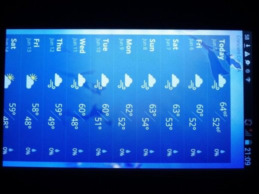
Using Fort Bragg as a proxy for climate averages: https://weatherspark.com/y/364/Avera...tes-Year-Round and Eureka to cross check: https://weatherspark.com/m/314/8/Ave...-United-States Suggests average highs of 72F (22C) and lows of 52F (11C) with a fairly tight range. I typically plan for extremes reaching about the 90th percentile or ~45F (7C) with what I bring just in case - so depends a bit on what sleeping bags you have. You could also have warmer than average nights, but I wouldn't expect much above 59F (15C) at night.
Expect some cool evenings, some fog and comfortable daytime temperatures. Nights should be cool along the coast, but not extremely cold.
Last edited by mev; 06-13-21 at 10:27 AM.
06-13-21, 10:26 AM
#47
Senior Member
Getting more and more excited to choose this route.
yesterday I did a long hike through the White Mountains. A colder front came through at night amd my summer sleeping bag was barely getting the job done.
that got me thinking: should I bring a summer bag or a shoulder season bag on this trip?
yesterday I did a long hike through the White Mountains. A colder front came through at night amd my summer sleeping bag was barely getting the job done.
that got me thinking: should I bring a summer bag or a shoulder season bag on this trip?
Best to look at record lows on weatherspark and decide based on your own experience. I look for comfort at average lows and surviving without injury or illness at record lows. That with all my clothes worn or piled on top of me.
06-13-21, 11:54 AM
#48
Senior Member
Join Date: Aug 2010
Location: Madison, WI
Posts: 11,207
Bikes: 1961 Ideor, 1966 Perfekt 3 Speed AB Hub, 1994 Bridgestone MB-6, 2006 Airnimal Joey, 2009 Thorn Sherpa, 2013 Thorn Nomad MkII, 2015 VO Pass Hunter, 2017 Lynskey Backroad, 2017 Raleigh Gran Prix, 1980s Bianchi Mixte on a trainer. Others are now gone.
Mentioned: 48 Post(s)
Tagged: 0 Thread(s)
Quoted: 3461 Post(s)
Liked 1,466 Times
in
1,144 Posts
I used a 40 degree down bag in May and June 2014. Also used a microfiber sleeping bag liner, but I mostly use a liner to keep my sleeping bag cleaner, not for extra warmth. And an air mattress.
I had three weather sites on my phone to use for forecasts, Crescent City was the location I used for mid-route. And of all my trips that I have ever done, I can't remember seeing a better forecast for so long a period of time. Not too hot, not too cold, no precip, but I was not there when you will be there.
I tested fate and packed my rain gear in the bottom of a pannier for the last half of my trip, and it stayed in the bottom of my pannier. That is the only trip I have done that, usually my rain gear is strapped on top of a front pannier where it is very handy very quickly.
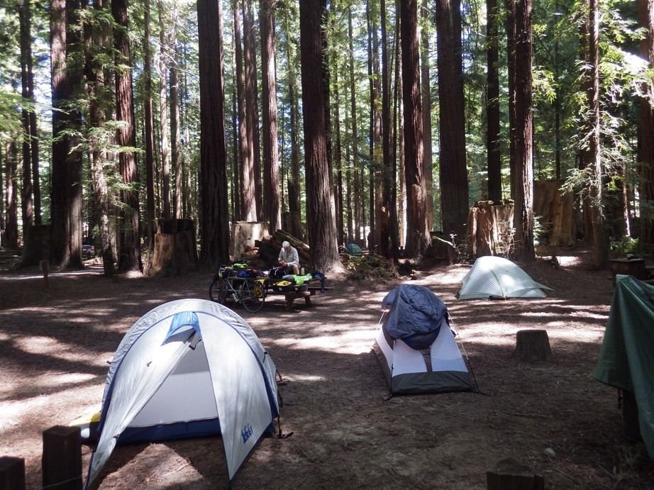
One of the hiker biker sites I was in, below.
I was there seven years ago, things may have changed but the Oregon State Parks had free showers, California State Parks had coin op showers. I made sure I always had a few days worth of quarters in California.
I had three weather sites on my phone to use for forecasts, Crescent City was the location I used for mid-route. And of all my trips that I have ever done, I can't remember seeing a better forecast for so long a period of time. Not too hot, not too cold, no precip, but I was not there when you will be there.
I tested fate and packed my rain gear in the bottom of a pannier for the last half of my trip, and it stayed in the bottom of my pannier. That is the only trip I have done that, usually my rain gear is strapped on top of a front pannier where it is very handy very quickly.
One of the hiker biker sites I was in, below.
I was there seven years ago, things may have changed but the Oregon State Parks had free showers, California State Parks had coin op showers. I made sure I always had a few days worth of quarters in California.
06-13-21, 10:48 PM
#49
Senior Member
Join Date: Mar 2009
Location: Oregon
Posts: 6,489
Mentioned: 31 Post(s)
Tagged: 0 Thread(s)
Quoted: 1182 Post(s)
Liked 833 Times
in
435 Posts
Presently most of the sate parks are open, but the showers in many of them are still closed. Hopefully this will change by August.
06-14-21, 06:17 AM
#50
Senior Member
no showers does make it tricky camping. Last summer when I did a four day trip, I camped twice where the shower situation was open, but they were single person showers where an open door and open general bathroom design allowed for very good ventilation.
I waa comfortable using them. And I'm very very safety minded.