


Pine Creek Rail Trail...
 04-28-11, 11:27 AM
#1
country city-girl
Thread Starter

Join Date: Oct 2010
Location: Western NY
Posts: 117
Bikes: Trek 7.5
Mentioned: 0 Post(s)
Tagged: 0 Thread(s)
Quoted: 0 Post(s)
Likes: 0
Liked 1 Time
in
1 Post
Pine Creek Rail Trail...
I'm just wondering if anyone has ridden the Pine Creek Rail Trail. My brother and I are planning on using it as part of a longer trip.
As I live nowhere near it, and have never seen it, I am open to any advice or suggestions...
As I live nowhere near it, and have never seen it, I am open to any advice or suggestions...
 04-28-11, 02:57 PM
#2
Senior Member
Join Date: Jan 2010
Posts: 39,238
Mentioned: 211 Post(s)
Tagged: 1 Thread(s)
Quoted: 18415 Post(s)
Liked 15,545 Times
in
7,329 Posts
Haven't done it myself, but I know a few who have and I have seen it from the West Rim Trail hiking trail on the other side of the creek. From what I hear, the surface is decent. Leonard Harrison State Park near the northern end was decent when I camped there several years ago. There is a viewing platform to look down into the "Grand Canyon" of PA. The Colton Point Motel on Rte. 6 near the north end is a basic, friendly place to stay. if you have a chance, check out Wellsboro. Several of the streets are lit with gas mantle lamps.
04-28-11, 06:11 PM
#3

Chepooka

Join Date: Sep 2006
Location: South Central PA
Posts: 1,179
Bikes: 1990 Trek 1400 7spd; 2001 Litespeed Arenberg 10 speed
Mentioned: 5 Post(s)
Tagged: 0 Thread(s)
Quoted: 1110 Post(s)
Liked 1,085 Times
in
669 Posts
I have never ridden it. But I canoe the creek on occasion. The water is "up" in April. Any other time of year, there isn't enough flow to canoe.
From N to S, the trail runs through the canyon. This part isn't too busy, but there is often equestrian traffic. Most of this section may be camped free (get a permit from the Tioga forest district). There may be slightly improved camping (pads/picnic tables, etc) partway down (9 or 10 miles from Ansonia).
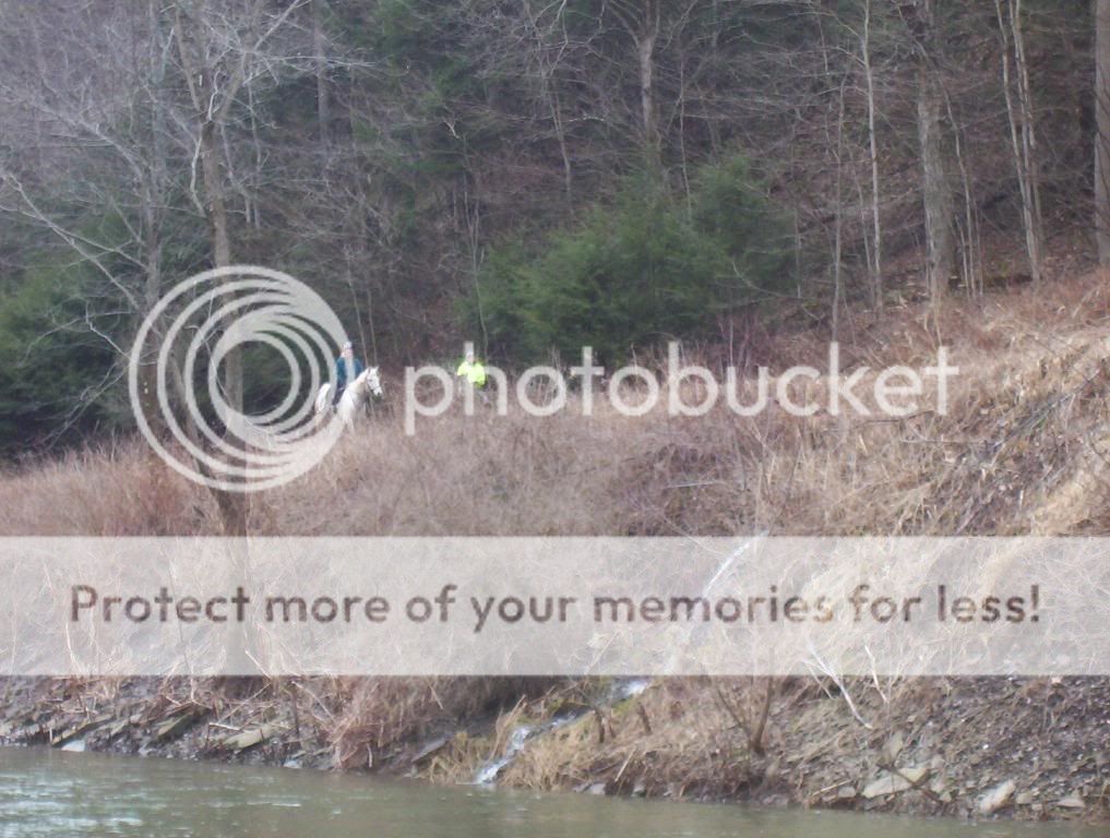
The equestrian traffic, in my experience, is just from Ansonia to Tiadaghton Camping area.
The trail exits the canyon in Blackwell (although not in the canyon, there are steep enough walls on both sides to prevent cell phone service). There used to be a hotel there, but the owner pissed off his neighbors and when he needed to utilize their land for septic purposes, they told him to go pound sand. Or maybe something else. In general, there are small villages every seven miles along the trail. Someone told me this is because the steam trains that ran this route needed water every seven miles. But I don't know if it's true.
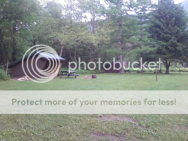
In Cedar Run there is a campground ($$), and a small general store (tourist-oriented, iirc). There is also a bed-and-breakfast.
In Slate Run, there is a larger store (and a great fly shop). There is also a somewhat upscale restaurant (Slate Run Manor) across the creek. There is free primitive camping at Black Walnut Bottom about a mile or two downstream from Slate Run (permits required from Tiadaghton state forest)
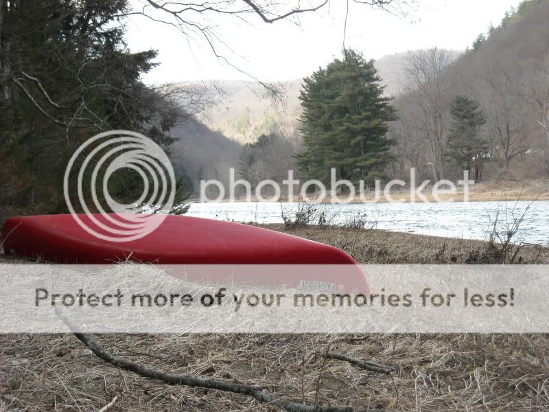
Black Walnut Bottom: (click for larger photo).
In Cammal, there is a dive bar called the Wagon Wheel. They have Labatts on tap.
I don't know much about Jersey Mills and Waterville, but I know one or the other has a small grocery.
In Bonnell Flats there are some Adirondack style shelters you can camp in (again, permit from Tiadaghton FD is required).
For all camping, assume there will be mice and black bear. I recommend hanging food, et cetera. I believe there are several "comfort stations" strategically placed along the trail. There are many springs that feed into the creek along the way, so water is generally plentiful. But it should be treated/filtered. Bald Eagle sightings are quite common.
From N to S, the trail runs through the canyon. This part isn't too busy, but there is often equestrian traffic. Most of this section may be camped free (get a permit from the Tioga forest district). There may be slightly improved camping (pads/picnic tables, etc) partway down (9 or 10 miles from Ansonia).
The equestrian traffic, in my experience, is just from Ansonia to Tiadaghton Camping area.
The trail exits the canyon in Blackwell (although not in the canyon, there are steep enough walls on both sides to prevent cell phone service). There used to be a hotel there, but the owner pissed off his neighbors and when he needed to utilize their land for septic purposes, they told him to go pound sand. Or maybe something else. In general, there are small villages every seven miles along the trail. Someone told me this is because the steam trains that ran this route needed water every seven miles. But I don't know if it's true.
In Cedar Run there is a campground ($$), and a small general store (tourist-oriented, iirc). There is also a bed-and-breakfast.
In Slate Run, there is a larger store (and a great fly shop). There is also a somewhat upscale restaurant (Slate Run Manor) across the creek. There is free primitive camping at Black Walnut Bottom about a mile or two downstream from Slate Run (permits required from Tiadaghton state forest)
Black Walnut Bottom:
 (click for larger photo).
In Cammal, there is a dive bar called the Wagon Wheel. They have Labatts on tap.
I don't know much about Jersey Mills and Waterville, but I know one or the other has a small grocery.
In Bonnell Flats there are some Adirondack style shelters you can camp in (again, permit from Tiadaghton FD is required).
For all camping, assume there will be mice and black bear. I recommend hanging food, et cetera. I believe there are several "comfort stations" strategically placed along the trail. There are many springs that feed into the creek along the way, so water is generally plentiful. But it should be treated/filtered. Bald Eagle sightings are quite common.
04-28-11, 07:11 PM
#4
country city-girl
Thread Starter
Join Date: Oct 2010
Location: Western NY
Posts: 117
Bikes: Trek 7.5
Mentioned: 0 Post(s)
Tagged: 0 Thread(s)
Quoted: 0 Post(s)
Likes: 0
Liked 1 Time
in
1 Post
Wow! thanks so much! I really appreciate all this... The camping info is very nice, I was wondering about camping along the trail...
I didn't know bears would be a risk, I guess I need to prepare for that.
Bald eagles! that would be amazing to see!
I would definitely like to check out quaint towns along the way, too....
I didn't know bears would be a risk, I guess I need to prepare for that.
Bald eagles! that would be amazing to see!
I would definitely like to check out quaint towns along the way, too....
04-28-11, 08:45 PM
#5
Chepooka
Join Date: Sep 2006
Location: South Central PA
Posts: 1,179
Bikes: 1990 Trek 1400 7spd; 2001 Litespeed Arenberg 10 speed
Mentioned: 5 Post(s)
Tagged: 0 Thread(s)
Quoted: 1110 Post(s)
Liked 1,085 Times
in
669 Posts
Bears are a minor nuisance there. It isn't so bad that you have to cook and eat meals away from your campsite. But it always helps to have a clean campsite and not discard food particles. Certain times of the year, we don't even bother to hang the food.
For hanging food, this is what I have:
- Two 50-75 foot lengths of parachute cord
- One inexpensive (i.e. not for climbing) caribiner
- One nylon pulley from a hardware store.
To use it, I find a tree limb at least 12 feet off the ground. I tie a rock or stick to one end of one cord and toss it over the limb at least 4 feet from the trunk. Then I tie the other end to the pulley and loop the second cord through it. Tie one end of the second cord to the caribiner and attach the food bag. Next, I pull the cord to elevate the pulley up to the limb and tie it off to another tree somewhere. Then I can pull the food bag up with the second cord and tie it off separately. In the morning, I can just untie the first cord and it all will come down (the weight of the food bag will overcome the friction of the cord over the limb). If, for whatever reason, it doesn't come down, I can lower the food with the second cord and lower the pulley by pulling on both ends of the second cord.
I keep this "kit" with my backpacking stuff, but I'll often take it canoeing as well.
That's the system I use and it works for me. There are other strategies as well and folks who swear by them.
04-29-11, 06:20 AM
#7
Registered User
Join Date: Sep 2008
Posts: 1
Bikes: Surly LHT and a Trek 7.3 FX Disc
Mentioned: 0 Post(s)
Tagged: 0 Thread(s)
Quoted: 0 Post(s)
Likes: 0
Liked 0 Times
in
0 Posts
My girlfriend and I rode it from end to end last July. We parked the car in the Jersy Shore terminus and rode up to Wellsboro, stayed the night at the Sherwood Inn and rode back to Jersey Shore the next day. It is a very well maintained and scenic trail. There are several "gates" at road crossings that you have to navigate around but, other than that it is worth the trip. My bike odometer showed about 62 total trail miles. We are looking forward to making the same trip again this summer. It's right up there with the Greenbrier River Trail in West Virginia which is also worth the trip.
04-29-11, 06:58 AM
#8
Senior Member
Join Date: Mar 2010
Posts: 70
Mentioned: 0 Post(s)
Tagged: 0 Thread(s)
Quoted: 0 Post(s)
Likes: 0
Liked 0 Times
in
0 Posts
I road a good part of it from the northern start to about 50 miles south last fall and enjoyed the views and the trail very much. I'm easy to please and didn't camp just a day trip. Starting at the northern end it would be worth the hike up the hill in the fall for the view but its almost as good in the "canyon". As mentioned before little to no cell service for a good part of the canyon and even in some towns depending on the area.
Watch those stupid double gates. One member of our party caught one and went down breaking his hip not fun!
Enjoy your Trip
Mike
Watch those stupid double gates. One member of our party caught one and went down breaking his hip not fun!
Enjoy your Trip
Mike
05-31-11, 07:54 PM
#9
Member
Join Date: Mar 2010
Posts: 32
Mentioned: 0 Post(s)
Tagged: 0 Thread(s)
Quoted: 0 Post(s)
Likes: 0
Liked 0 Times
in
0 Posts
the website written by touring bicyclists for touring bicyclists has a good write-up on pine creek trail -- camping, lodging, restaurants, food and water. it's at https://bicycletouringoncarfreepaths.org/
jeff
jeff
06-01-11, 06:32 AM
#11
country city-girl
Thread Starter
Join Date: Oct 2010
Location: Western NY
Posts: 117
Bikes: Trek 7.5
Mentioned: 0 Post(s)
Tagged: 0 Thread(s)
Quoted: 0 Post(s)
Likes: 0
Liked 1 Time
in
1 Post
the website written by touring bicyclists for touring bicyclists has a good write-up on pine creek trail -- camping, lodging, restaurants, food and water. it's at https://bicycletouringoncarfreepaths.org/
jeff
jeff
06-01-11, 07:13 AM
#12
Guest
Posts: n/a
Mentioned: Post(s)
Tagged: Thread(s)
Quoted: Post(s)
I've camped in the area and ridden parts of the trail in 2009 and 2010. Some thoughts:
1. Pettecote Junction Campground at Cedar Run was the grubbiest campsite I'd ever been at, but it's directly on the trail and on the water as well.
2. The PA State Forest sites are free with a permit, but when I used them in 2010 I never got a 'clean' one. Expect to find food and litter tossed and dropped around.
3. I never saw a bear, but they are around - which is why I was disturbed about getting unclean campsites. (My first night on my 2010 trip I camped 20 miles south of the trail next to some rednecks who assured me their Glock would protect them from the bears their messy campsite drew.)
4. If you want to try something different and don't mind climbing, Naval Run campsite isn't that far from the trail and is a couple hundred feet off the river. It's on the Naval Run hiking trail, so you might meet some backpackers:


5. There are 'general stores' along the way, but they can be touristy and pricy. The store in Waterville is popular, but I recall them as the only place I've ever been to that gave me dirty looks when I asked them if they would fill my water bottles for me.
6. The Bike Route G splits from the trail just north of Waterville. I suggest sticking to the trail and avoiding the road traffic and small rollers. The trail spends a few miles on the other side of Pine Creek, but much of the distance to Jersey Shore it runs parallel to the road.
7. The best views of the Pine Creek Gorge are from above, on one of the rims. That means climbing or getting a lift. The road leading to the west rim of the canyon is less than one mile from the trail, but the overlooks are about 3-4 miles up that road. If you ride, do so with care, since drivers are probably not looking for bikes.
8. If you ride, or get a ride, up to the west rim, take a short walk along the West Rim Trail, a 30 mile backpacking trail. Some of the views are spectacular.
9. Scott Brown - the photographer, not the MA Senator - in his book on Pennsylvania's Mountain Vistas says in dry weather it's safe to photograph beyond the safety barrier at Barbour Rock. He's right. But it's a little nerve wracking for someone afraid of heights.

10. While there are bald eagles nesting in the canyon and Little Pine State Park near Waterville, they aren't that easy to spot. You are more likely to see turkey vultures like these in this photo I took on the west rim:

1. Pettecote Junction Campground at Cedar Run was the grubbiest campsite I'd ever been at, but it's directly on the trail and on the water as well.
2. The PA State Forest sites are free with a permit, but when I used them in 2010 I never got a 'clean' one. Expect to find food and litter tossed and dropped around.
3. I never saw a bear, but they are around - which is why I was disturbed about getting unclean campsites. (My first night on my 2010 trip I camped 20 miles south of the trail next to some rednecks who assured me their Glock would protect them from the bears their messy campsite drew.)
4. If you want to try something different and don't mind climbing, Naval Run campsite isn't that far from the trail and is a couple hundred feet off the river. It's on the Naval Run hiking trail, so you might meet some backpackers:
5. There are 'general stores' along the way, but they can be touristy and pricy. The store in Waterville is popular, but I recall them as the only place I've ever been to that gave me dirty looks when I asked them if they would fill my water bottles for me.
6. The Bike Route G splits from the trail just north of Waterville. I suggest sticking to the trail and avoiding the road traffic and small rollers. The trail spends a few miles on the other side of Pine Creek, but much of the distance to Jersey Shore it runs parallel to the road.
7. The best views of the Pine Creek Gorge are from above, on one of the rims. That means climbing or getting a lift. The road leading to the west rim of the canyon is less than one mile from the trail, but the overlooks are about 3-4 miles up that road. If you ride, do so with care, since drivers are probably not looking for bikes.
8. If you ride, or get a ride, up to the west rim, take a short walk along the West Rim Trail, a 30 mile backpacking trail. Some of the views are spectacular.
9. Scott Brown - the photographer, not the MA Senator - in his book on Pennsylvania's Mountain Vistas says in dry weather it's safe to photograph beyond the safety barrier at Barbour Rock. He's right. But it's a little nerve wracking for someone afraid of heights.
10. While there are bald eagles nesting in the canyon and Little Pine State Park near Waterville, they aren't that easy to spot. You are more likely to see turkey vultures like these in this photo I took on the west rim:

