


Willipa Hills Trail pics
 09-27-16, 12:45 PM
#1
Senior Member
Thread Starter

Willipa Hills Trail pics
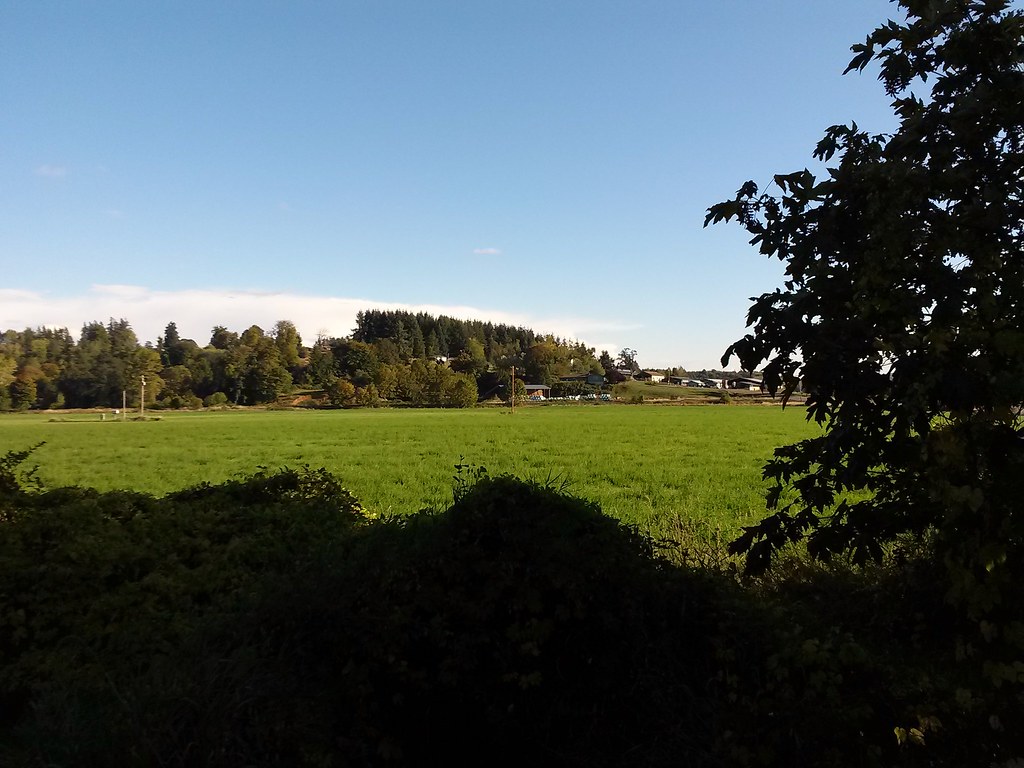
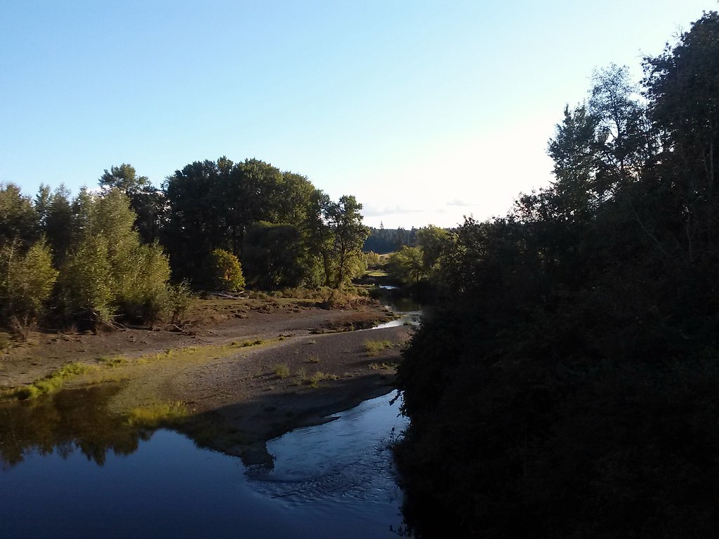
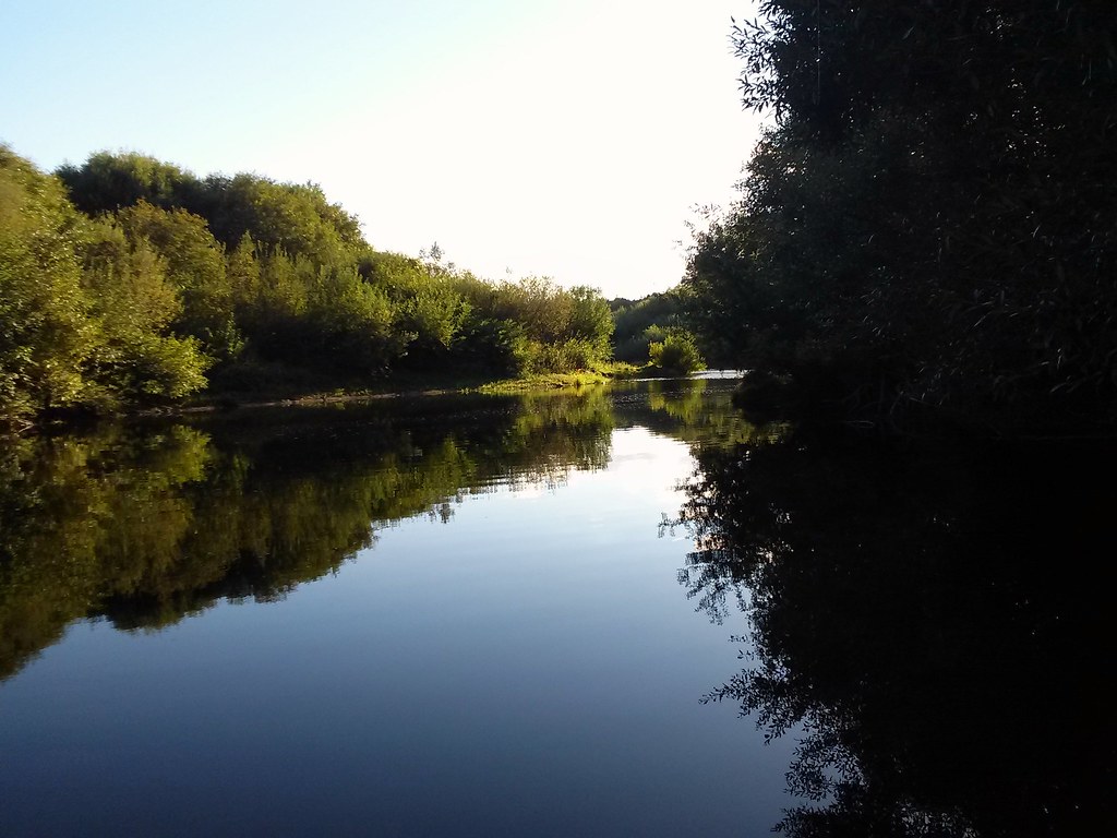
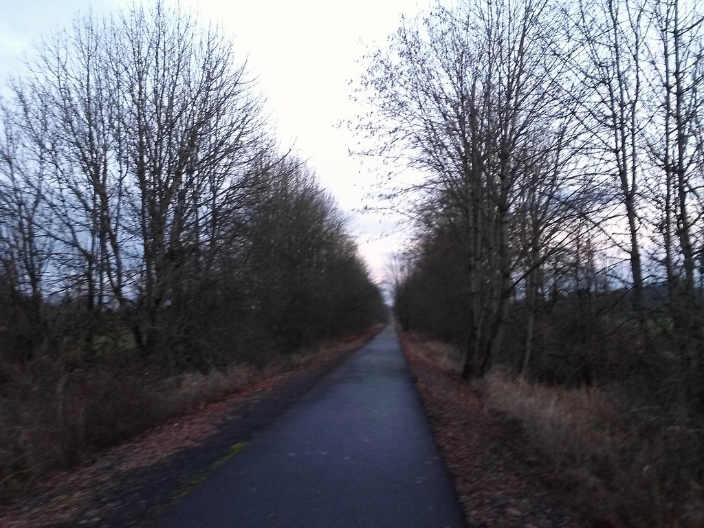
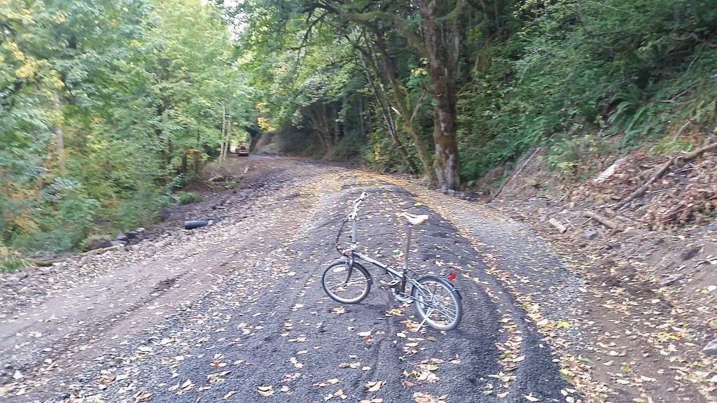
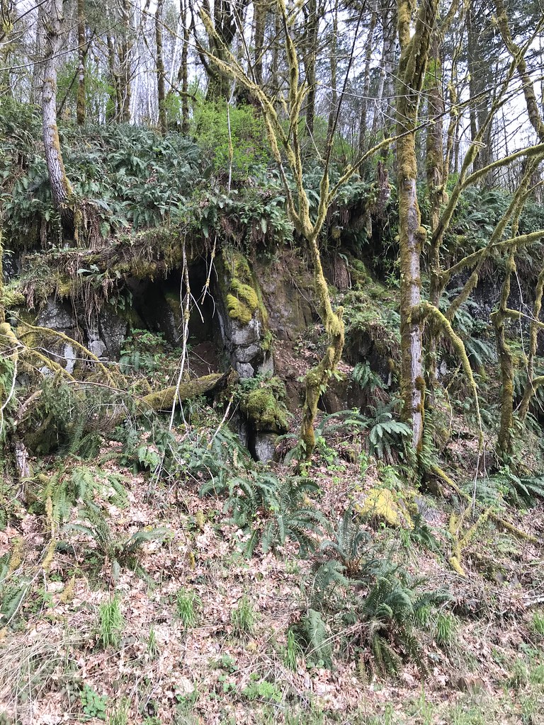
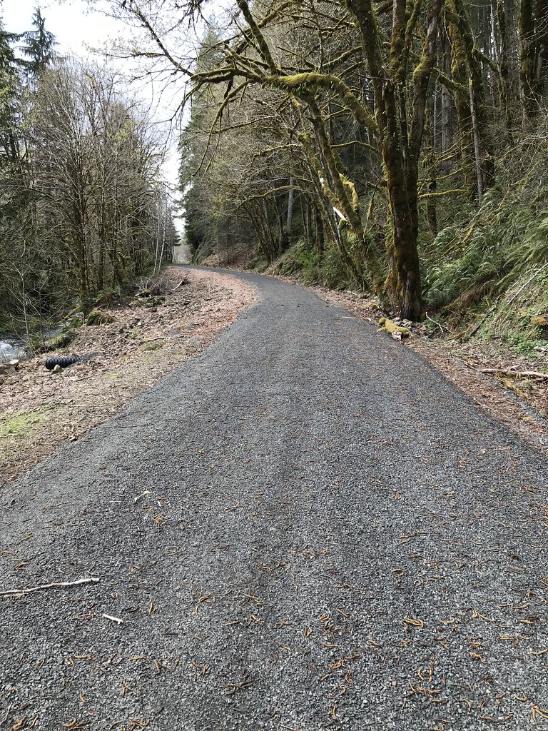
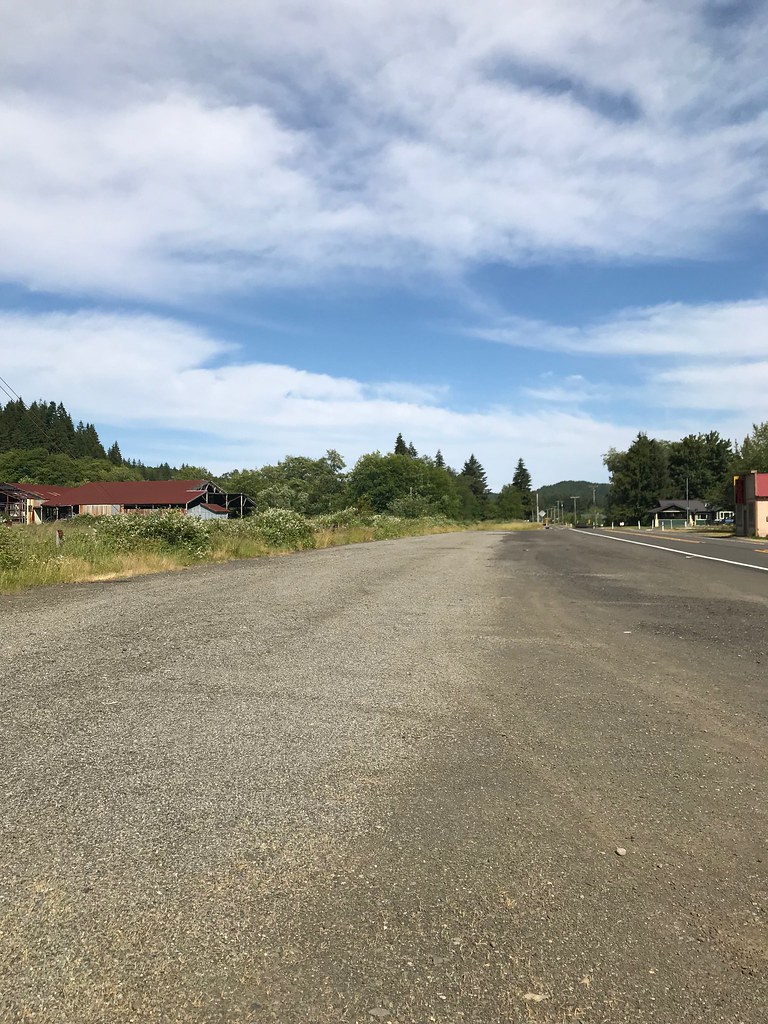
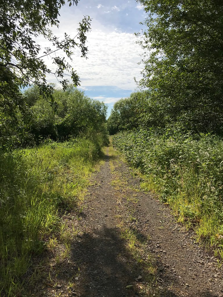
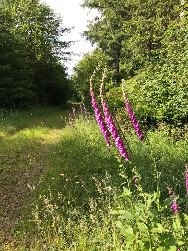
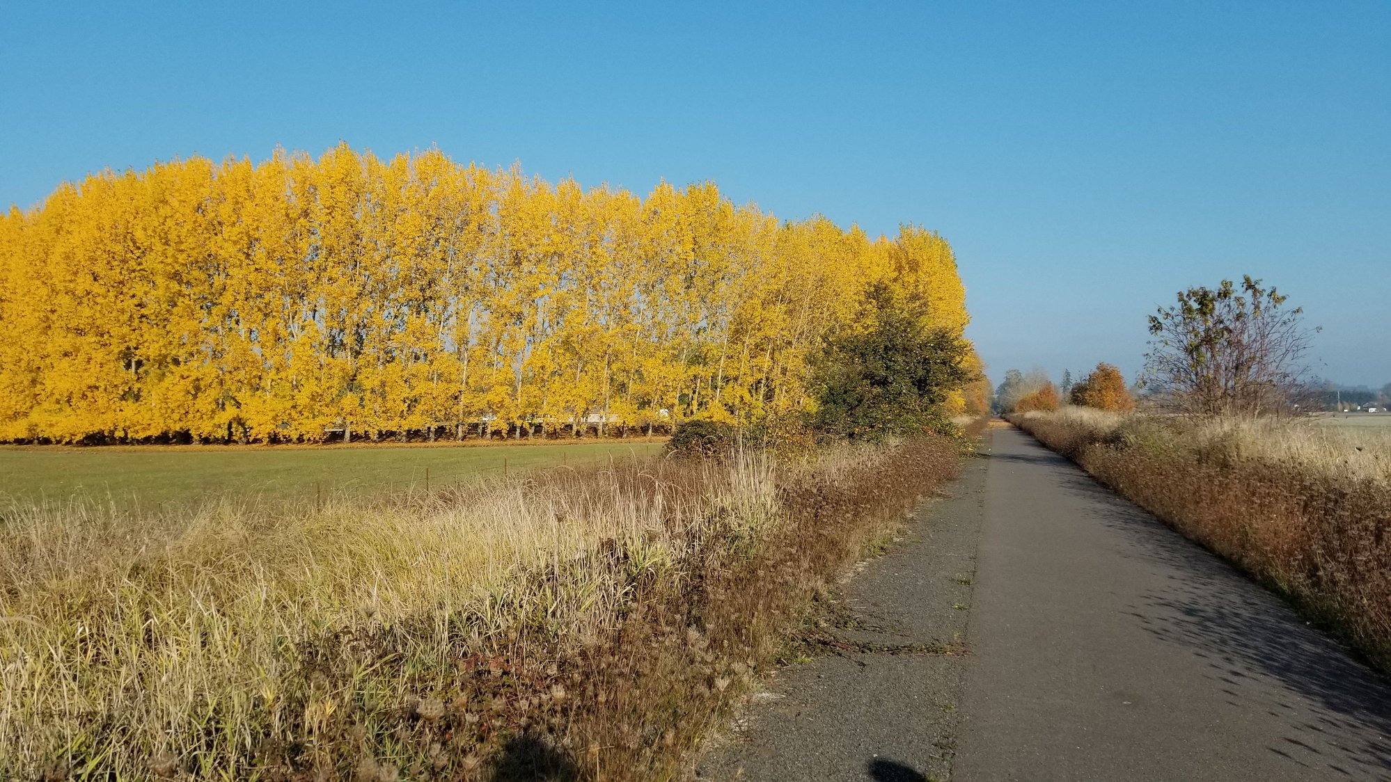
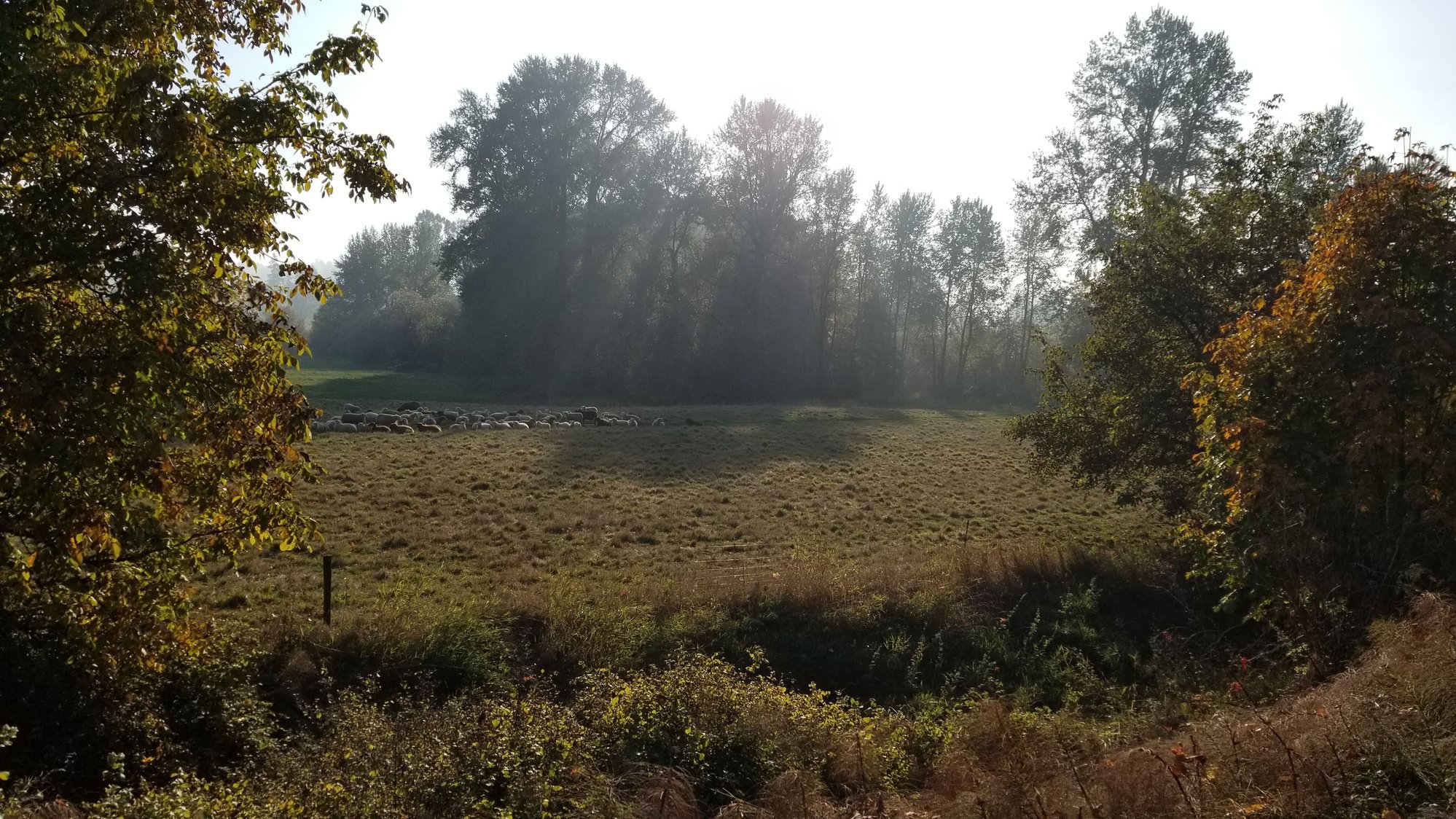
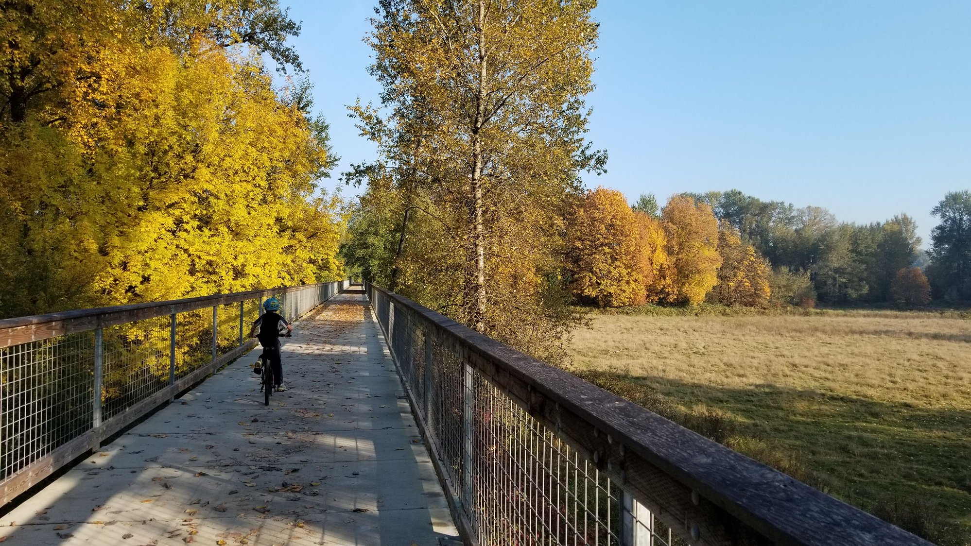
I've been stuck working up in Chehalis for two out of the past 3 weeks. The first week I took the road bike (Scott Speedster) I borrowed for my triathlon and rode the Chehalis Loop, a nice 16 mile ride around the south end of town. But last week I couldn't fit my mountain bike in my car (and I won't take the mpg hit I take driving that far with it on the rack) so I took my bike rack with me and borrowed one of the hotel's beach cruiser bikes to take the the Willipa Trail start, and I rode that bike about 6 or 7 miles out to where the pavement ends then back. I love that trail, at least the parts I've seen. It would be more fun to ride it one way and camp along the way. I could do it all in one day, I think it's only about 50 miles long.
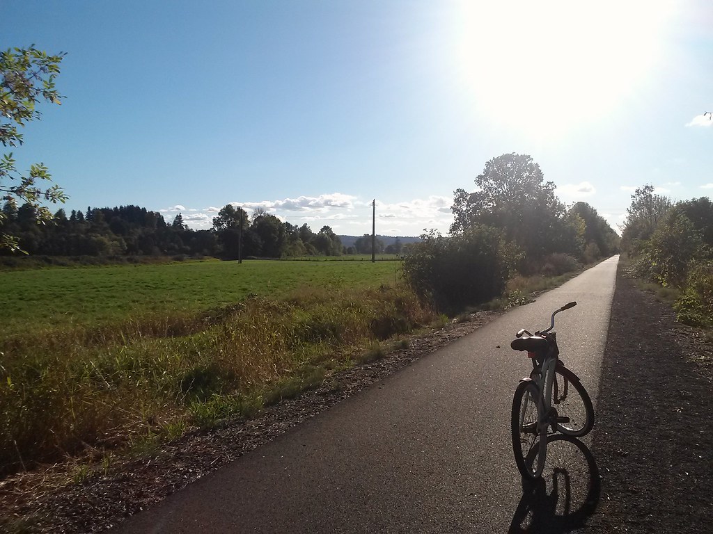
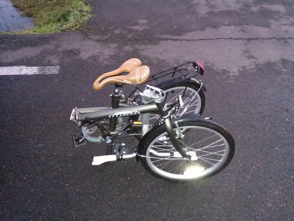
Anyway, pics from last week, including a bonus of the funny bike I borrowed. I couldn't get the seat high enough to not hurt my knees so I rode most of the way standing up.
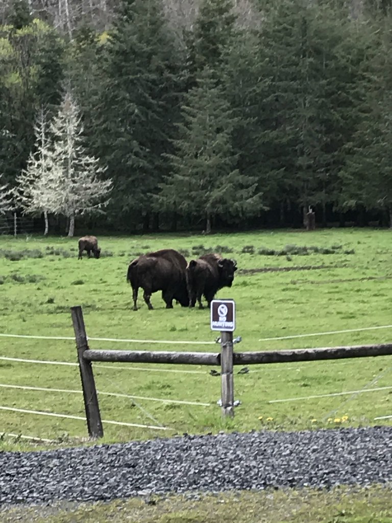
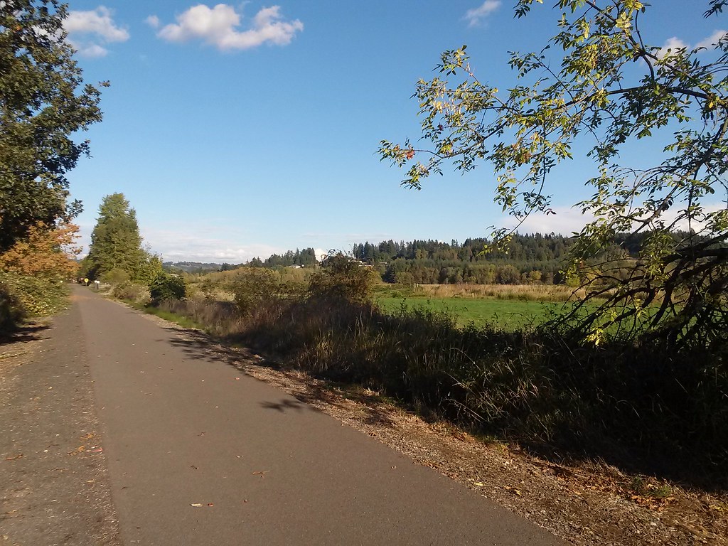 Willapa Hills Trail by Ed Miller, on Flickr
 Willapa Hills Trail by Ed Miller, on Flickr
 Willapa Hills Trail by Ed Miller, on Flickr
 Willapa Hills Trail by Ed Miller, on Flickr
 Willapa Hills Trail by Ed Miller, on Flickr
 Willapa Hills Trail by Ed Miller, on Flickr
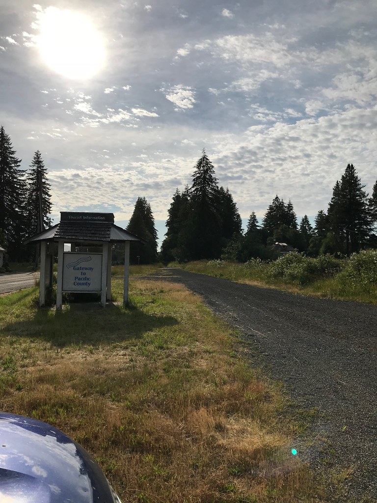
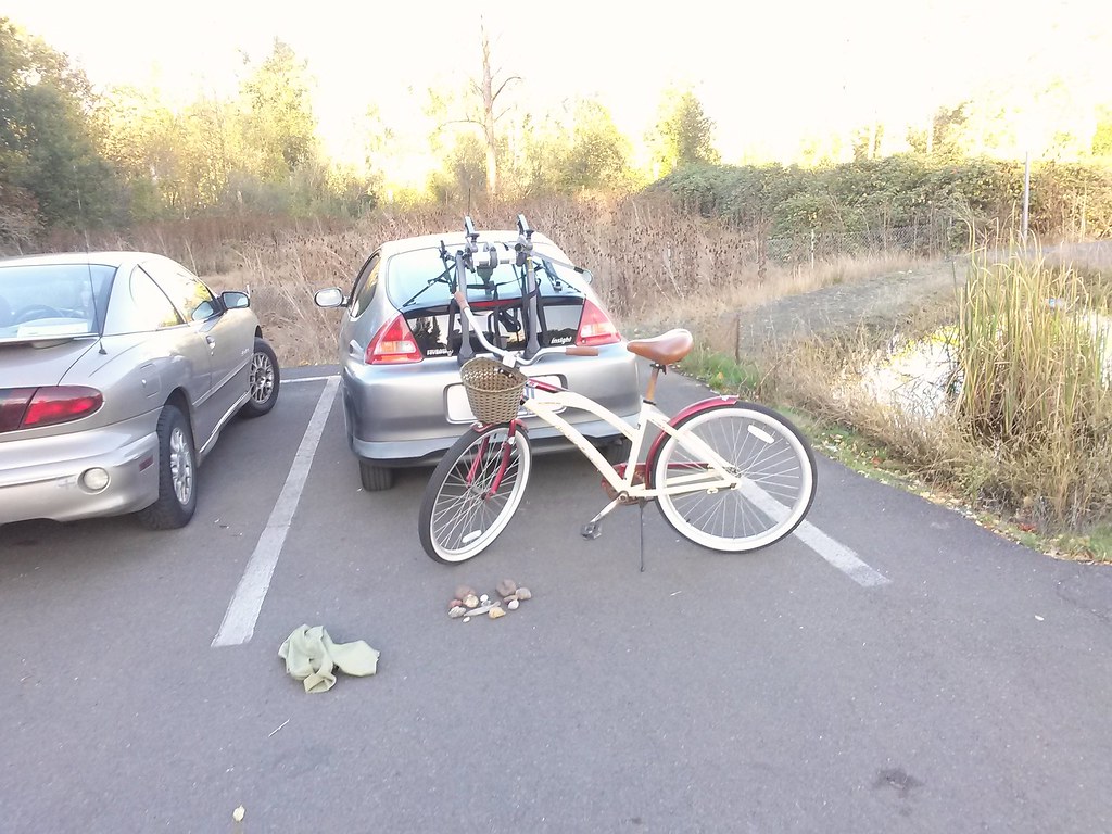 Willapa Hills Trailhead Chehalis by Ed Miller, on Flickr
Anyway, pics from last week, including a bonus of the funny bike I borrowed. I couldn't get the seat high enough to not hurt my knees so I rode most of the way standing up.
Willapa Hills Trail by Ed Miller, on FlickrWillapa Hills Trail by Ed Miller, on FlickrWillapa Hills Trail by Ed Miller, on FlickrWillapa Hills Trail by Ed Miller, on FlickrWillapa Hills Trail by Ed Miller, on FlickrWillapa Hills Trail by Ed Miller, on FlickrWillapa Hills Trailhead Chehalis by Ed Miller, on Flickr
 12-13-16, 08:03 PM
#4
Senior Member
Thread Starter
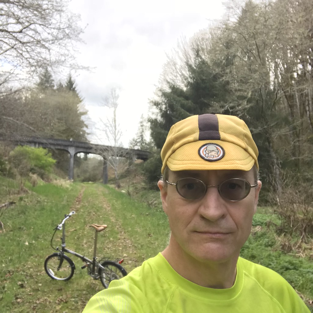
I rode it again on my new to me folding bike (Yeah!) yesterday evening. A few more pictures, but I have a question for the real photographers on this sub-forum: how do you get a cell phone to get pictures of things like the moon when it's not dark? Because in the one pic of the trail heading back toward Chehalis, the full moon looked huge framed in between the little trees lining the trail. But in my picture it looks small if you can see it at all. It was a nice ride, anyway.
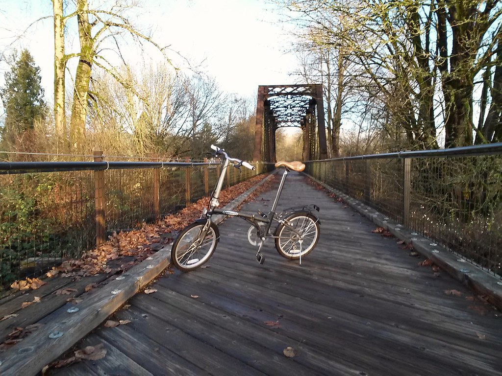 Yeah folding bike on Willapa trail. by Ed Miller, on Flickr
 Willapa trail again by Ed Miller, on Flickr
 Yeah bike by Ed Miller, on Flickr
Yeah folding bike on Willapa trail. by Ed Miller, on FlickrWillapa trail again by Ed Miller, on FlickrYeah bike by Ed Miller, on Flickr
12-13-16, 08:14 PM
#5
Senior Member
Join Date: Jul 2008
Location: 25 miles northwest of Boston
Posts: 29,658
Bikes: Bottecchia Sprint, GT Timberline 29r, Marin Muirwoods 29er, Trek FX Alpha 7.0
Liked 3,685 Times
in
2,385 Posts
brutal but beautiful
 12-16-16, 04:58 PM
#8
Senior Member
Thread Starter
09-13-17, 08:51 PM
#9
Senior Member
Thread Starter
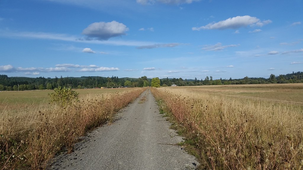
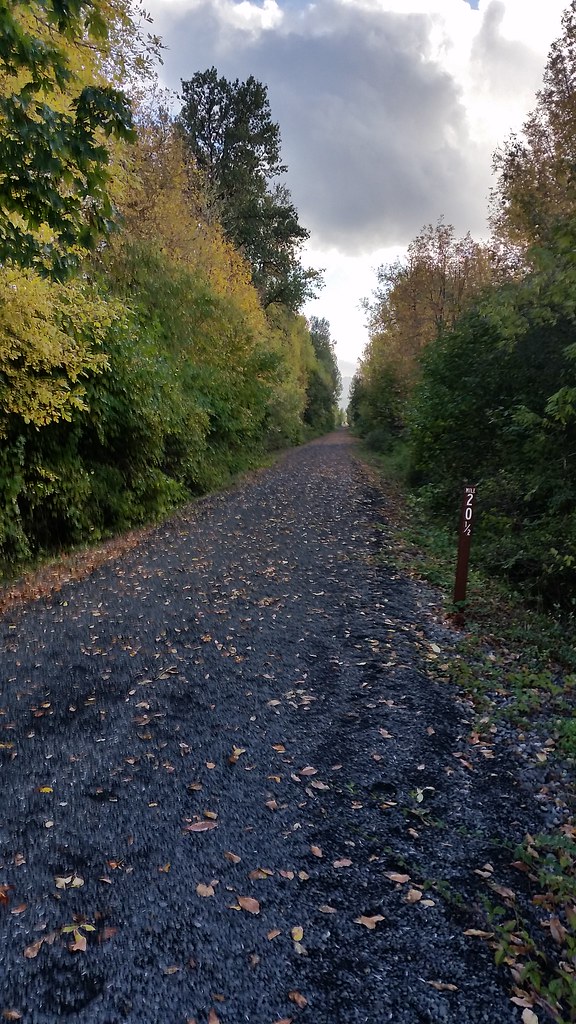
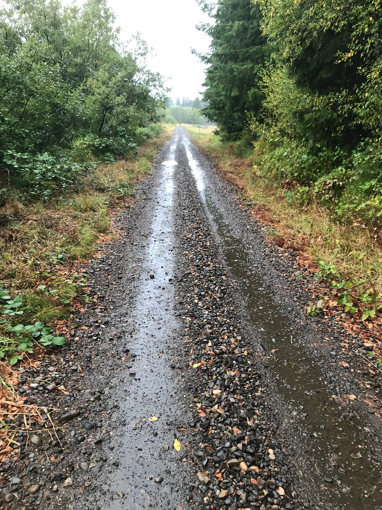
I rode another 7 mile or so section today, starting from a parking area near the 13 mile mark and riding out to the 20.5 (didn't see the 20) mile mark, then back to the truck. I liked it but not as much as the previous section. That folding bike does OK on most of the gravel but sometimes the pea gravel is piled up and the bike gets squirrelly. I'll post some more pictures when I can convince Chrome that nobody is trying to hack into my phone using the hotel's wifi. Might be a while, sigh.
This trail is great but I can't see myself riding all of it. Anybody want to start from the South Bend end? If I could get up here on some days off a nice vacation would be to spend a night in Chehalis, ride to Willipa the next day and spend the night there, ride back to Chehalis and spend the night there again, then go home. The whole thing is less than 60 miles and would be a nice ride on my Fargo. Less so on my trusty folder.
I pigged out on the blackberries on my way back to the truck.
 Yum! by Ed Miller, on Flickr
 More Willipa Hills Trail by Ed Miller, on Flickr
 More Willipa Hills Trail by Ed Miller, on Flickr
 More Willipa Hills Trail by Ed Miller, on Flickr
This trail is great but I can't see myself riding all of it. Anybody want to start from the South Bend end? If I could get up here on some days off a nice vacation would be to spend a night in Chehalis, ride to Willipa the next day and spend the night there, ride back to Chehalis and spend the night there again, then go home. The whole thing is less than 60 miles and would be a nice ride on my Fargo. Less so on my trusty folder.
I pigged out on the blackberries on my way back to the truck.
Yum! by Ed Miller, on FlickrMore Willipa Hills Trail by Ed Miller, on FlickrMore Willipa Hills Trail by Ed Miller, on FlickrMore Willipa Hills Trail by Ed Miller, on Flickr
Last edited by enigmaT120; 09-15-17 at 01:54 PM.
10-10-17, 10:10 PM
#10
Senior Member
Thread Starter
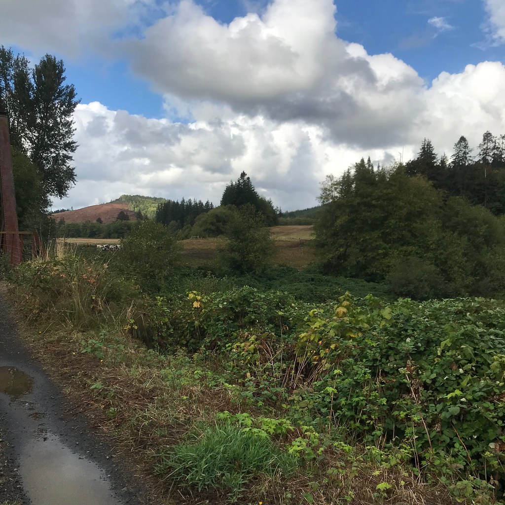
I rode a little farther today. I drove to Pe Ell, parked my car (with a Discovery day Pass in it, which was another whole boring adventure to get), then rode back to the 20.5 mile marker where I had rode last time by myself, then back to my car and farther on.
Here's where I turned back around, as I had been here before:
 20171010_163353 by Ed Miller, on Flickr
Too late to eat any delicious wild plums, which I love:
20171010_163353 by Ed Miller, on Flickr
Going back in to the Pe Ell parking spot:
 20171010_164411 by Ed Miller, on Flickr
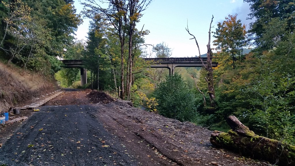
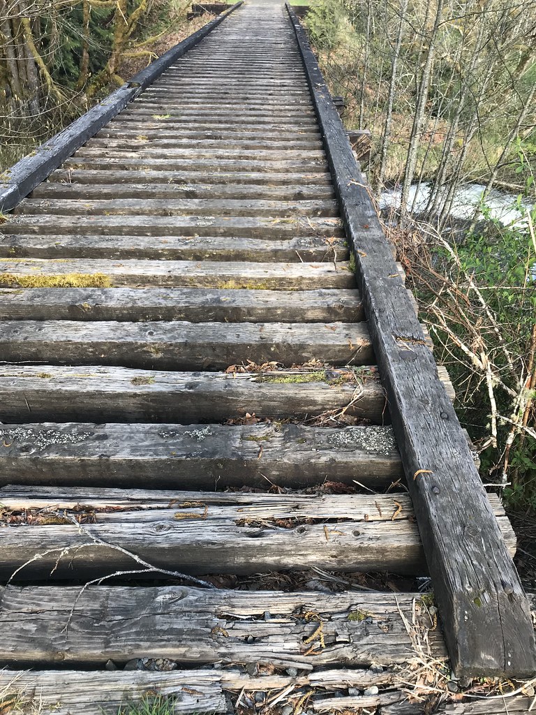
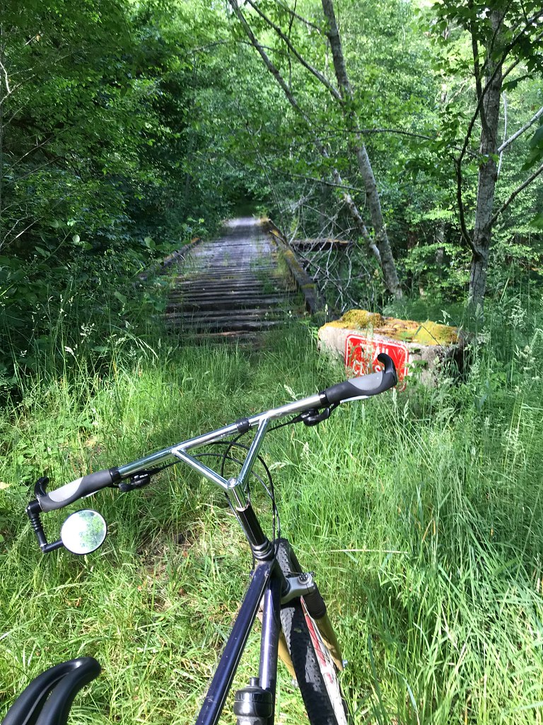
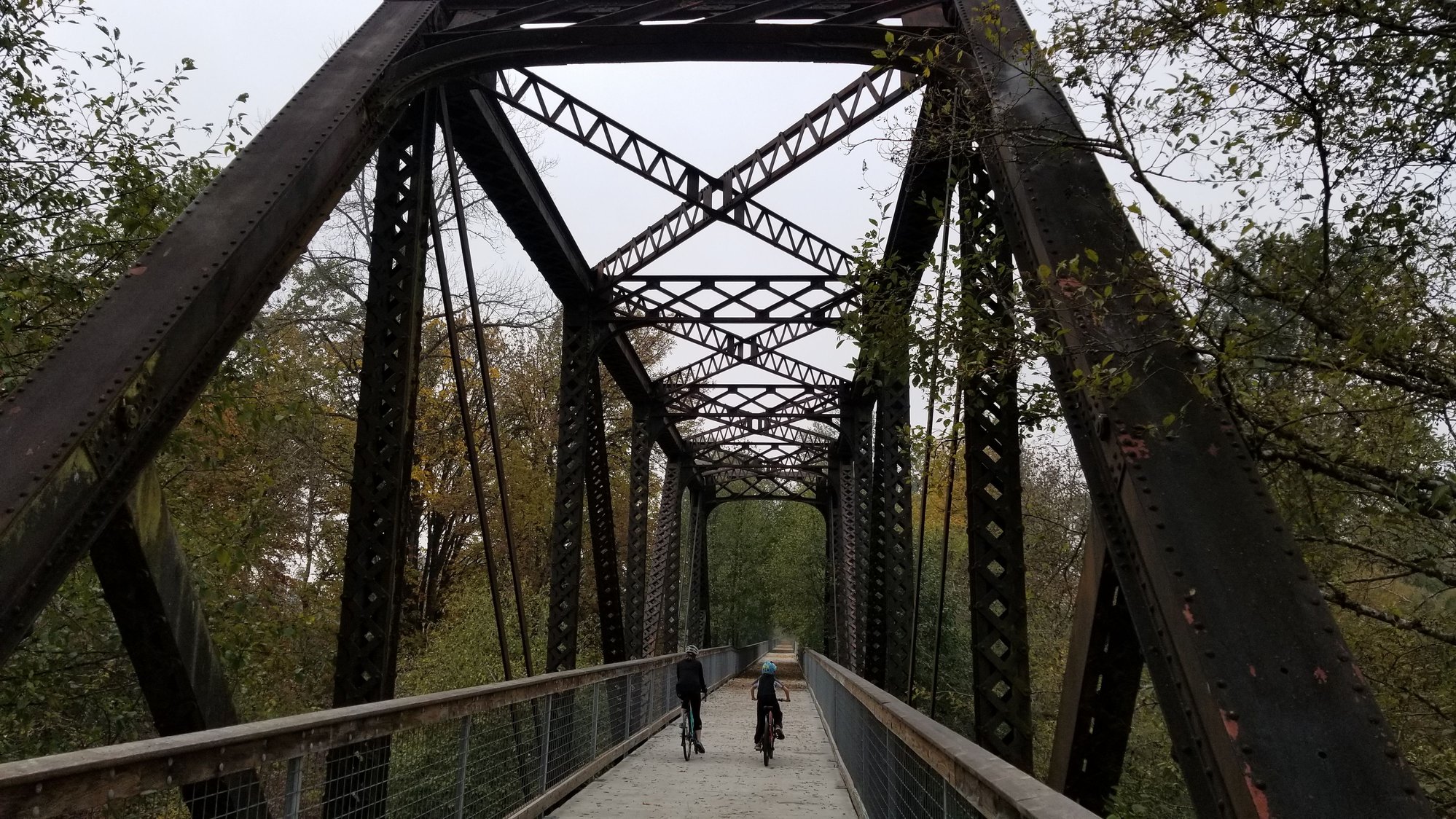
A little scary bridge which I rode over anyway:
 20171010_164652 by Ed Miller, on Flickr
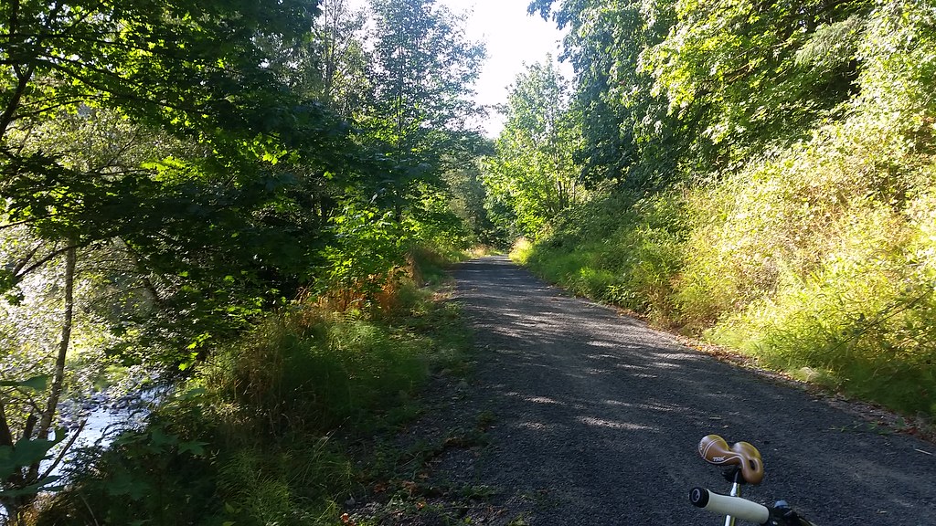
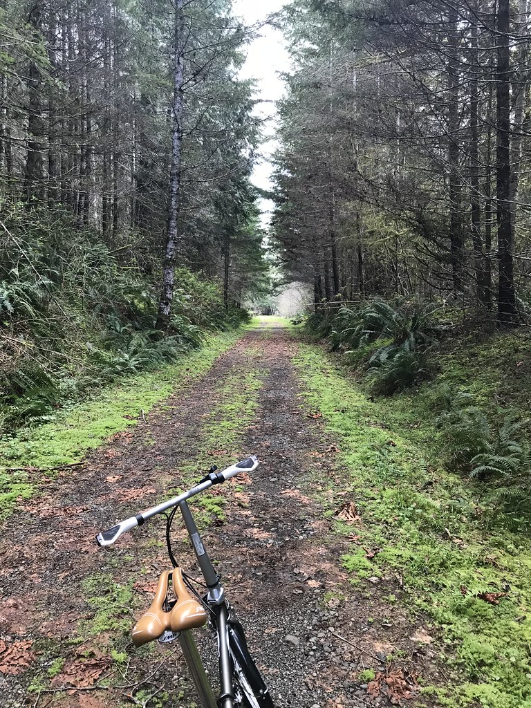
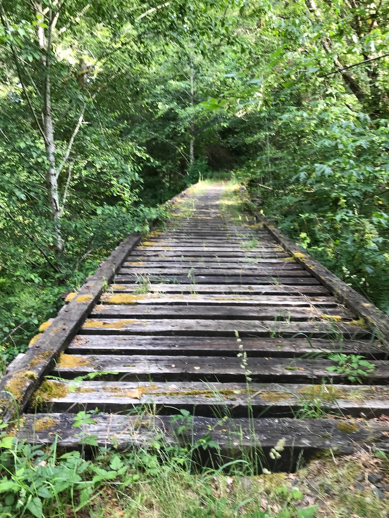
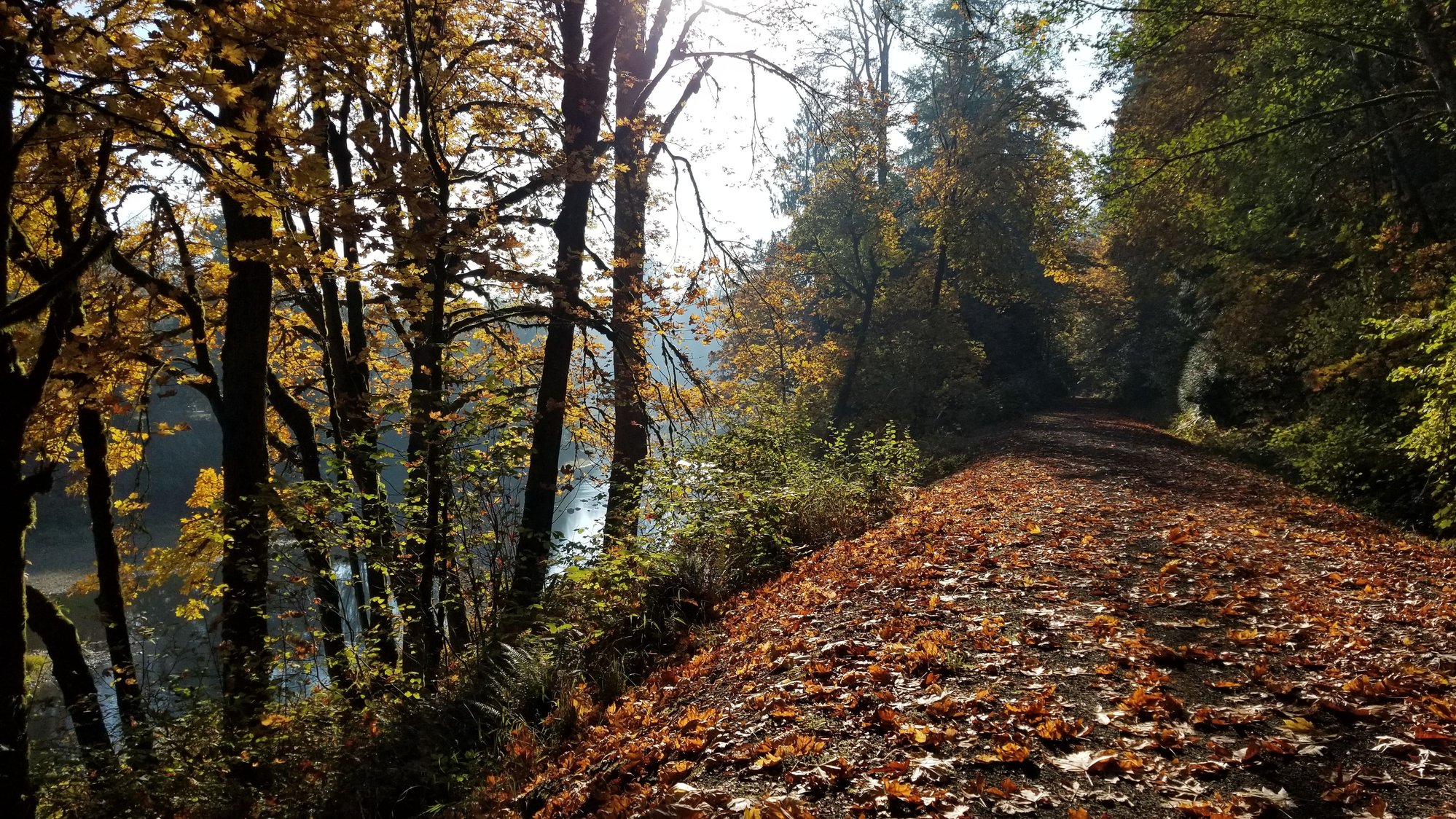
Typical trail through the woods, sorry it's not very clear:
 20171010_170004 by Ed Miller, on Flickr
Hey, let's just pretend I'm an impressionist, not just near-sighted?
This is about how far I got from Pe Ell, the grave wasn't packed any more, was too much trouble on my little folding bike, plus I wanted to get back to my hotel with food before dark. Pretty place though, like most of the trail so far:
 20171010_171131 by Ed Miller, on Flickr
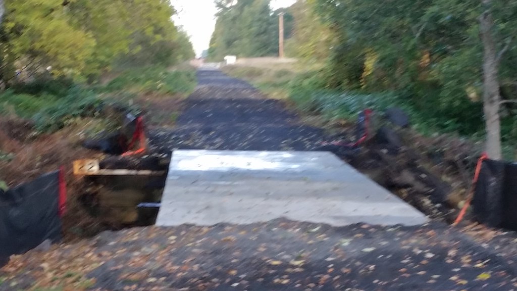
This is the loose stuff where I turned back. Notice the steam roller in the distance, this should be better very soon. Not sure when I'll be back though, with the days getting shorter.
 20171010_171122 by Ed Miller, on Flickr
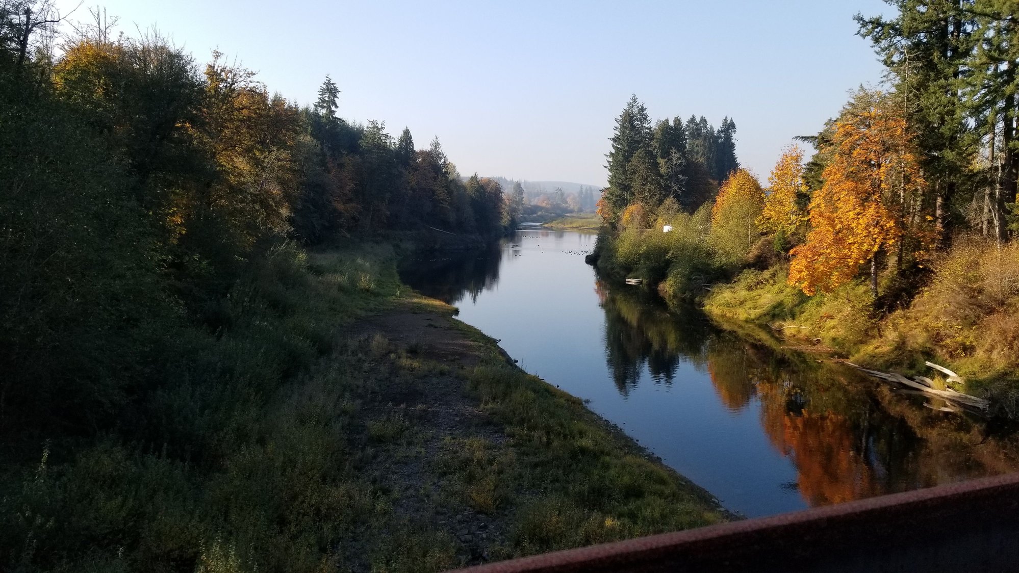
Never long without some river crossing:
 20171010_173001 by Ed Miller, on Flickr
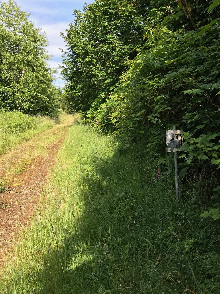
Sign on the wrong side of the cement block, I only saw it on my way back to my car.
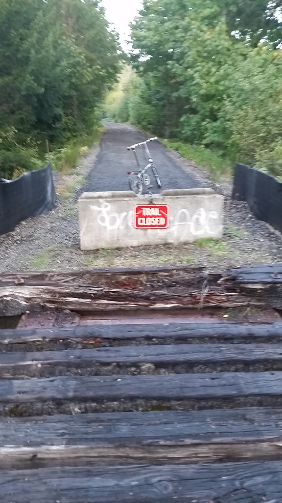 20171010_173115 by Ed Miller, on Flickr
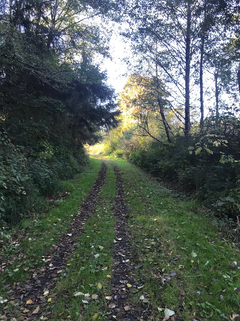
On the way back, just a pretty trail:
 20171010_172618 by Ed Miller, on Flickr
Here's where I turned back around, as I had been here before:
20171010_163353 by Ed Miller, on FlickrToo late to eat any delicious wild plums, which I love:
20171010_163353 by Ed Miller, on FlickrGoing back in to the Pe Ell parking spot:
20171010_164411 by Ed Miller, on FlickrA little scary bridge which I rode over anyway:
20171010_164652 by Ed Miller, on FlickrTypical trail through the woods, sorry it's not very clear:
20171010_170004 by Ed Miller, on FlickrHey, let's just pretend I'm an impressionist, not just near-sighted?
This is about how far I got from Pe Ell, the grave wasn't packed any more, was too much trouble on my little folding bike, plus I wanted to get back to my hotel with food before dark. Pretty place though, like most of the trail so far:
20171010_171131 by Ed Miller, on FlickrThis is the loose stuff where I turned back. Notice the steam roller in the distance, this should be better very soon. Not sure when I'll be back though, with the days getting shorter.
20171010_171122 by Ed Miller, on FlickrNever long without some river crossing:
20171010_173001 by Ed Miller, on FlickrSign on the wrong side of the cement block, I only saw it on my way back to my car.
20171010_173115 by Ed Miller, on FlickrOn the way back, just a pretty trail:
20171010_172618 by Ed Miller, on Flickr
07-01-18, 11:55 AM
#12
Senior Member
Thread Starter
I went back in April, starting at Pe Ell again hoping the trail had been improved. It had been! I rode out as far as the 30 mile marker. 24 miles to go. I ordered an annual Discovery Pass for the year, hoping to hit the trail enough times to pay for the pass.
In no particular order:
Untitled by Ed Miller, on Flickr
Untitled by Ed Miller, on Flickr
This is the gravel after they packed it down:
Untitled by Ed Miller, on Flickr
Untitled by Ed Miller, on Flickr
Untitled by Ed Miller, on Flickr
Untitled by Ed Miller, on Flickr
Tinder profile photo?
Untitled by Ed Miller, on Flickr
Trail got rough again:
Untitled by Ed Miller, on Flickr
Turn round point this time:
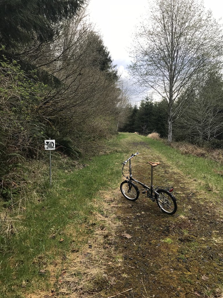
Untitled by Ed Miller, on Flickr
Untitled by Ed Miller, on Flickr
I just thought that was a sketchy trestle. Note foreboding music....
In no particular order:
Untitled by Ed Miller, on Flickr
Untitled by Ed Miller, on Flickr
This is the gravel after they packed it down:
Untitled by Ed Miller, on Flickr
Untitled by Ed Miller, on Flickr
Untitled by Ed Miller, on Flickr
Untitled by Ed Miller, on Flickr
Tinder profile photo?
Untitled by Ed Miller, on Flickr
Trail got rough again:
Untitled by Ed Miller, on Flickr
Turn round point this time:
Untitled by Ed Miller, on Flickr
Untitled by Ed Miller, on Flickr
I just thought that was a sketchy trestle. Note foreboding music....
07-01-18, 12:15 PM
#13
Senior Member
Thread Starter
I went back on June 18 and drove all the way to Lebam, the next parking lot on the trail, and rode back to the 30 mile marker where I left off before. I brought my mountain bike this time, as that last ride kind of beat me up on that little folder. Good choice:
Parking lot looking toward Pe Ell:
Willapa Hills Trail Hills by Ed Miller, on Flickr
Trail was grown in many places:

Willapa Hills Trail Hills by Ed Miller, on Flickr
Willapa Hills Trail Hills by Ed Miller, on Flickr
Some "unauthorized vehicles" may have helped:
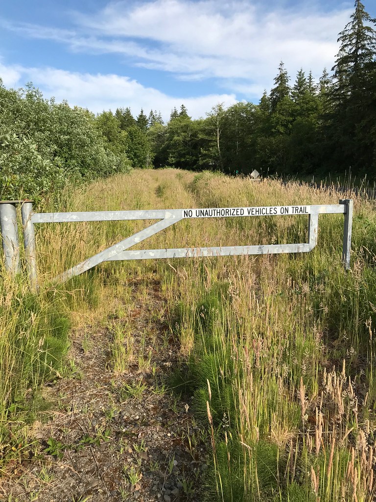
Willapa Hills Trail Hills by Ed Miller, on Flickr
Willapa Hills Trail Hills by Ed Miller, on Flickr

Willapa Hills Trail Hills by Ed Miller, on Flickr
A couple trestles scared me. I walked over the left main underbeams and walked my bike to my right.
Willapa Hills Trail Hills by Ed Miller, on Flickr

Willapa Hills Trail Hills by Ed Miller, on Flickr

Willapa Hills Trail Hills by Ed Miller, on Flickr
Willapa Hills Trail Hills by Ed Miller, on Flickr
Parking lot looking toward Pe Ell:
Willapa Hills Trail Hills by Ed Miller, on Flickr
Trail was grown in many places:
Willapa Hills Trail Hills by Ed Miller, on Flickr
Willapa Hills Trail Hills by Ed Miller, on Flickr
Some "unauthorized vehicles" may have helped:
Willapa Hills Trail Hills by Ed Miller, on Flickr
Willapa Hills Trail Hills by Ed Miller, on Flickr
Willapa Hills Trail Hills by Ed Miller, on Flickr
A couple trestles scared me. I walked over the left main underbeams and walked my bike to my right.
Willapa Hills Trail Hills by Ed Miller, on Flickr
Willapa Hills Trail Hills by Ed Miller, on Flickr
Willapa Hills Trail Hills by Ed Miller, on Flickr
Willapa Hills Trail Hills by Ed Miller, on Flickr
07-01-18, 12:16 PM
#14
Senior Member
Thread Starter
Continuing, as I exceeded the 10 picture post limit:
Here's that 30 mile marker and today's turn around point:
Willapa Hills Trail Hills by Ed Miller, on Flickr
Willapa Hills Trail Hills by Ed Miller, on Flickr

Willapa Hills Trail Hills by Ed Miller, on Flickr
View looking toward the finish, from back at the parking lot:
Willapa Hills Trail Hills by Ed Miller, on Flickr
My leg after riding through all the tall grass and briars (I'm allergic to grass):

Willapa Hills Trail Hills by Ed Miller, on Flickr
If I were going to ride this section again I would wear long pants. It has been my least favorite 8 miles so far, between the trail surface and the weeds over-growing the trail. And it's just not as scenic. I will bring long pants for the next section toward Raymond, just in case I encounter similar conditions, and will definitely bring my mountain bike again. I only have 16 more miles of the trail to cover, but I doubt I'll do it in one day with having to ride out and back.
Here's that 30 mile marker and today's turn around point:
Willapa Hills Trail Hills by Ed Miller, on Flickr
Willapa Hills Trail Hills by Ed Miller, on Flickr
Willapa Hills Trail Hills by Ed Miller, on Flickr
View looking toward the finish, from back at the parking lot:
Willapa Hills Trail Hills by Ed Miller, on Flickr
My leg after riding through all the tall grass and briars (I'm allergic to grass):
Willapa Hills Trail Hills by Ed Miller, on Flickr
If I were going to ride this section again I would wear long pants. It has been my least favorite 8 miles so far, between the trail surface and the weeds over-growing the trail. And it's just not as scenic. I will bring long pants for the next section toward Raymond, just in case I encounter similar conditions, and will definitely bring my mountain bike again. I only have 16 more miles of the trail to cover, but I doubt I'll do it in one day with having to ride out and back.
10-08-18, 06:57 PM
#15
Senior Member
Thread Starter
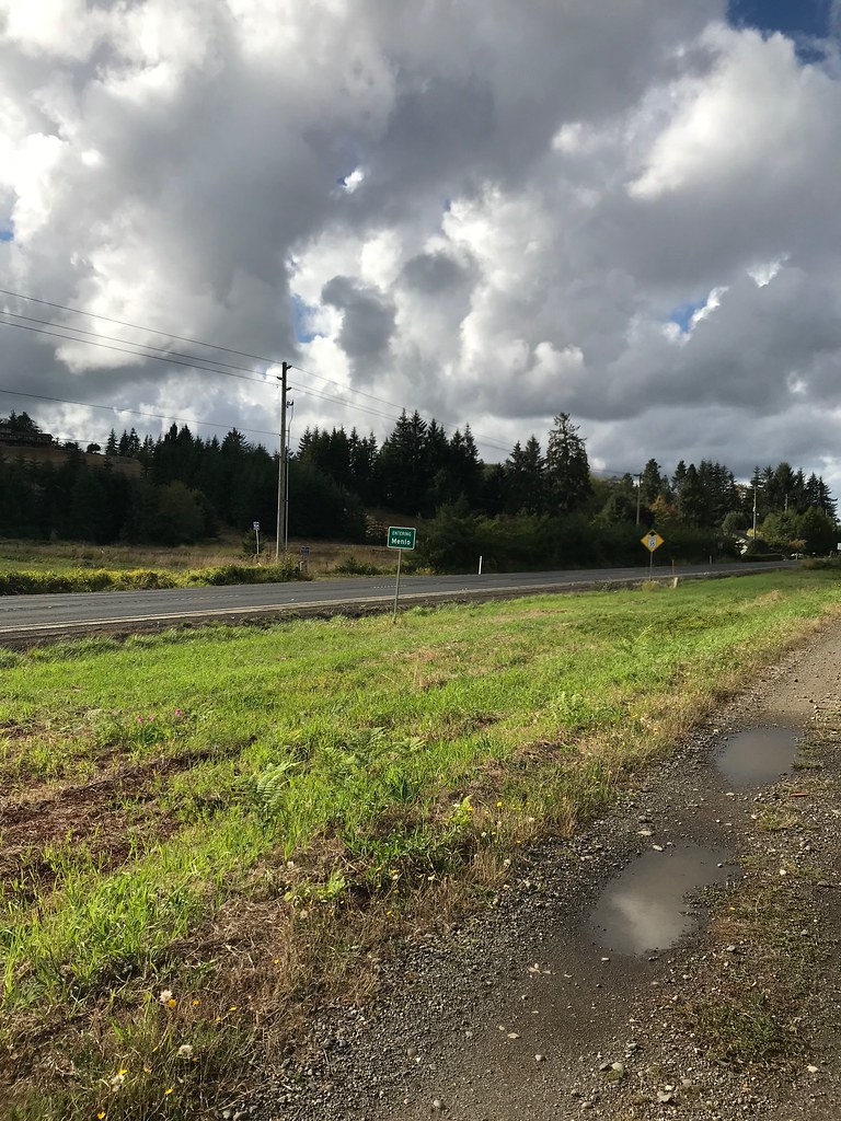
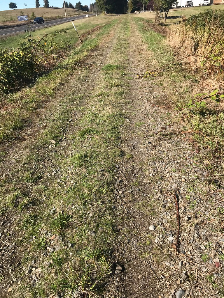
I made another trip up to Chehalis, parking at Lebam again for my ride. This time I headed the other way, toward Raymond. The trail was still really rough but at least somebody had mowed it! I wore long pants but they weren't necessary. It was pouring rain that day and several days before, but I seem to have deleted my pictures of how I looked riding for 18 miles or so on that muddy trail with no fenders on my Fargo! I still need to put them on, come to think of it. I turned around at the outskirts of a town called Menlo.

More Willipa Hills Trail by Ed Miller, on Flickr
The rainbow looked like a pool of light nestled in the little valley.
More Willipa Hills Trail by Ed Miller, on Flickr

More Willipa Hills Trail by Ed Miller, on Flickr

More Willipa Hills Trail by Ed Miller, on Flickr

More Willipa Hills Trail by Ed Miller, on Flickr
More Willipa Hills Trail by Ed Miller, on Flickr

More Willipa Hills Trail by Ed Miller, on Flickr
More Willipa Hills Trail by Ed Miller, on Flickr
I took off during a brief break in between downpours, for some reason I prefer the rain to start after I am already riding. I forgot to put the seat cover on my Brooks and thought I had ruined it, and I found that wet muddy hands don't work well to use the fingerprint reader on my work iPhone but I still took quite a few pictures. I liked the contrast between the dark clouds and bright blue sky.
This section is still not my favorite, and largely went right be Highway 6. I was tempted to ride back to my car on the highway but I decided to just go back on the trail like I always have.
More Willipa Hills Trail by Ed Miller, on Flickr
The rainbow looked like a pool of light nestled in the little valley.
More Willipa Hills Trail by Ed Miller, on Flickr
More Willipa Hills Trail by Ed Miller, on Flickr
More Willipa Hills Trail by Ed Miller, on Flickr
More Willipa Hills Trail by Ed Miller, on Flickr
More Willipa Hills Trail by Ed Miller, on Flickr
More Willipa Hills Trail by Ed Miller, on Flickr
More Willipa Hills Trail by Ed Miller, on Flickr
I took off during a brief break in between downpours, for some reason I prefer the rain to start after I am already riding. I forgot to put the seat cover on my Brooks and thought I had ruined it, and I found that wet muddy hands don't work well to use the fingerprint reader on my work iPhone but I still took quite a few pictures. I liked the contrast between the dark clouds and bright blue sky.
This section is still not my favorite, and largely went right be Highway 6. I was tempted to ride back to my car on the highway but I decided to just go back on the trail like I always have.
Last edited by enigmaT120; 10-08-18 at 07:09 PM. Reason: made a mistake
10-08-18, 07:08 PM
#16
Senior Member
Thread Starter
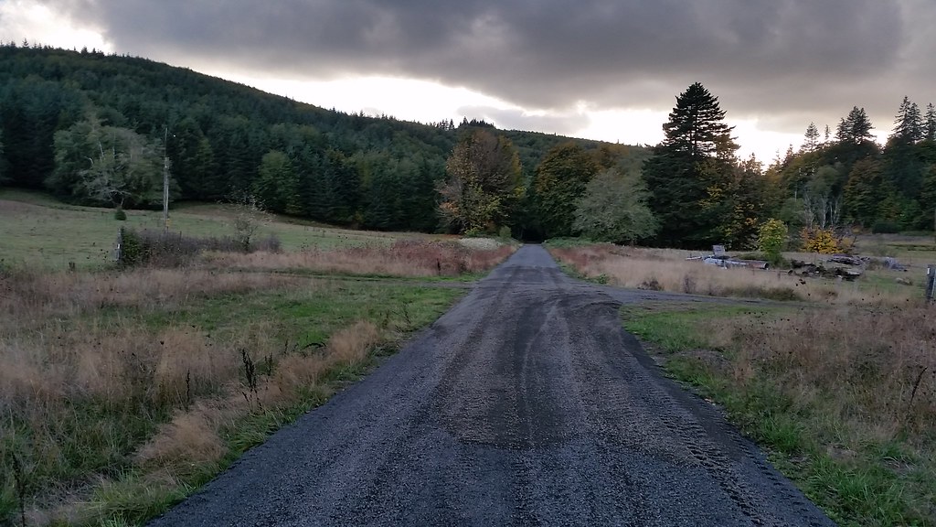
On my most recent trip I drove all the way to Menlo and found a place to park there. I rode briefly back to the city sign where I had turned around before and back to the car, then headed all the way to Raymond. I had thought Raymond was the end of the trail but at the outskirts of town, at the area I thought was the end, I could see the trail (going back to dirt/gravel with extra bumps) heading farther, so I guess I still have some riding to do. I think it's just a few more miles to South Bend and the real end of the trail. It looks on the map like it just stops. This was a nice sunny day, with a dry trail so I didn't miss the fenders.
Willipa Hills Trail by Ed Miller, on Flickr

Willipa Hills Trail by Ed Miller, on Flickr
Willipa Hills Trail by Ed Miller, on Flickr
This is the trail as it leaves Raymond (it was paved through Raymond):

Willipa Hills Trail by Ed Miller, on Flickr
Just out of Menlo the path joins a road briefly, then goes back to the trail because the river is undercutting the trail in that area. I know that because of course I went around the barriers and went through, but there was a point where it wasn't passable without a machete so I turned back and used the road detour. My Fargo is a good bike for this trail.
Willipa Hills Trail by Ed Miller, on Flickr
Willipa Hills Trail by Ed Miller, on Flickr
Willipa Hills Trail by Ed Miller, on Flickr
This is the trail as it leaves Raymond (it was paved through Raymond):
Willipa Hills Trail by Ed Miller, on Flickr
Just out of Menlo the path joins a road briefly, then goes back to the trail because the river is undercutting the trail in that area. I know that because of course I went around the barriers and went through, but there was a point where it wasn't passable without a machete so I turned back and used the road detour. My Fargo is a good bike for this trail.
 10-09-18, 08:17 AM
#18
Senior Member
Ed -
Thanks for posting these. The Willapa is a great trail and ongoing project by Lewis County and Washington State Parks to continue a finished trail from Chehalis out to South Bend. At one point back in time it was a railroad and is currently being converted into a trail. Ride the Willapa (RTW) is a great cycling event that takes place out on the Willapa Trail every summer to raise awareness and funds to help complete the trail. Currently it is a 2 day event with an overnight stay at Rainbow Falls State Park. Its been highly received by the community and has grown from 100 riders at its first inception a few years ago to over 450 riders this past summer.
My family and I volunteered this summer to help put on the event and I have been working with the event organizer (Chris Brewer) and team to help plan for the next year. We are struggling to find volunteers to support the size of the event and this next year we are looking at bringing on sponsors to help with the overall cost and visibility of the event. This is a Not for Profit event and currently all persons working the event are 100% volunteer with no pay. If you know anyone who would like to help sponsor....
This coming Saturday (October 13th, 2018) Chris will be hosting a Free for All ride from Rainbow State Park to Rock Creek on one of the prettiest parts of the finished trail. More information here - RTW Autumn Group Ride If you are interested in taking part in this event or just want to know more about the Willapa Hills Trail project all are welcome to meet up and ride with Chris from Rainbow Falls Park and ask any questions. The trees will be beautiful and the weather should be perfect. Its truly a magical ride.
Feel free to post pictures on the RTW Facebook Page. Wayne who maintains the web/social media side loves to see pictures from people enjoying and using the trail. Some of the other websites for the ride to bookmark - https://discoverlewiscounty.com/event/ride-willapa-2018 From the ride last year and the official page for the ride which is currently being worked on to prepare for 2019 - Ride the Willapa
Thanks again for taking the time to post these pictures. Some great shots!
-Sean
10-10-18, 03:05 PM
#19
Senior Member
Thanks to [MENTION=211620]enigmaT120[/MENTION] for all the pics from the trail, and to [MENTION=489487]Wilmingtech[/MENTION] for the info about Ride the Willapa. This is one of the first threads I saw when I started reading these forums a month or so ago.
Am going to try and get up there on 10/27 or 10/28...hoping for a dry weekend. Looking at the map, will probably skip the paved segment in Chehalis, and go from Adna to the closure @ Bridge 26 and back.
I just put RTW on my calendar for next year. Would love to do it!
Am going to try and get up there on 10/27 or 10/28...hoping for a dry weekend. Looking at the map, will probably skip the paved segment in Chehalis, and go from Adna to the closure @ Bridge 26 and back.
I just put RTW on my calendar for next year. Would love to do it!
10-21-18, 07:36 PM
#20
Senior Member
Willapa Pics 10/21/18
Got 20 miles in on the Willapa today. 10 miles out and back from Chehalis. Great day for pictures.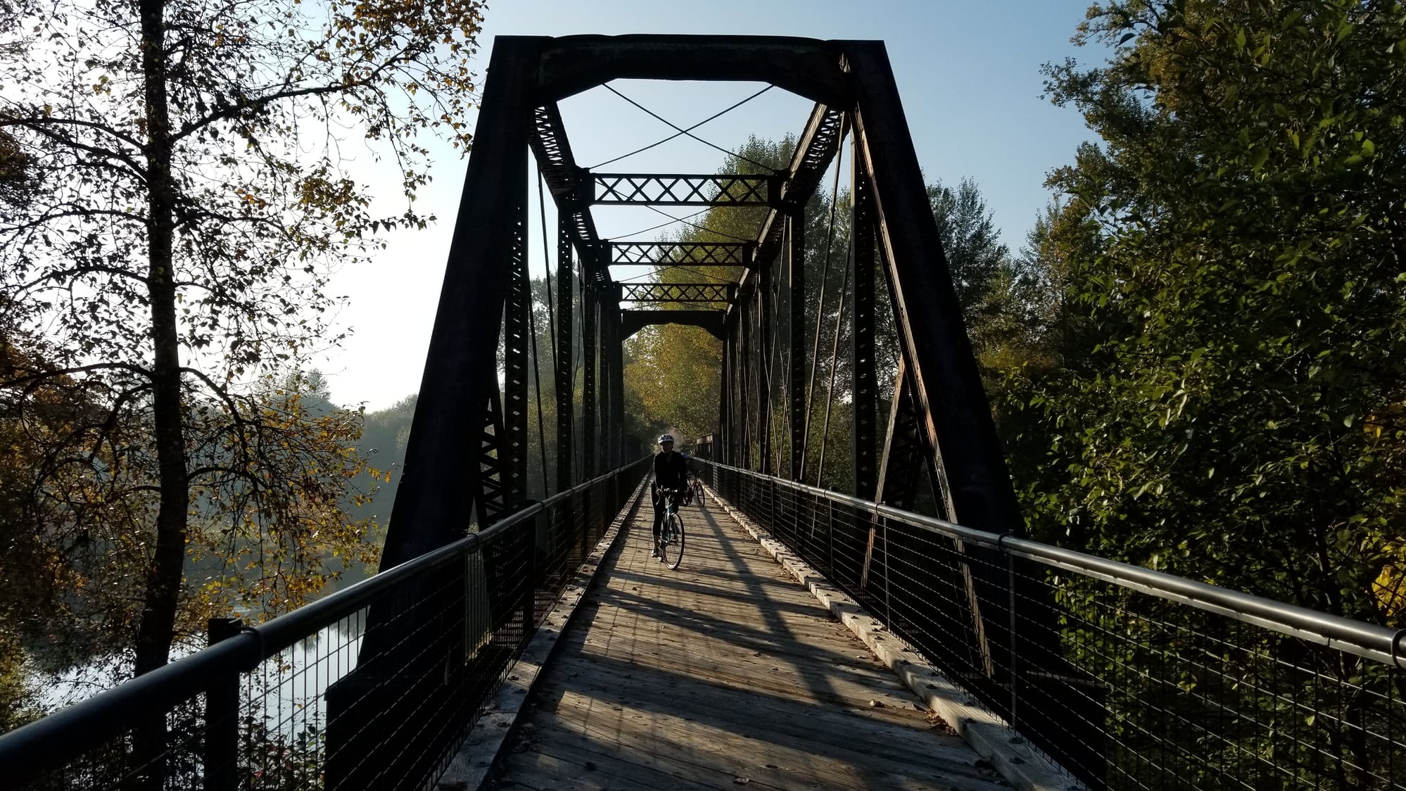

 10-22-18, 06:49 AM
#22
Senior Member
Join Date: Jul 2008
Location: 25 miles northwest of Boston
Posts: 29,658
Bikes: Bottecchia Sprint, GT Timberline 29r, Marin Muirwoods 29er, Trek FX Alpha 7.0
Liked 3,685 Times
in
2,385 Posts
 10-22-18, 08:38 AM
#23
Senior Member
Thread Starter
10-24-18, 02:23 PM
#24
Senior Member
So the weather forecast looks acceptable for this Saturday, so I think I'm going to head out there and try to ride from Adna to Pe Ell. One more question for those who know the trail well:
Are there any hunting units that the trail crosses or is adjacent to? Do I need to bring an orange vest?
Thanks!
Are there any hunting units that the trail crosses or is adjacent to? Do I need to bring an orange vest?
Thanks!
09-05-19, 01:25 AM
#25
Senior Member

Join Date: Apr 2011
Location: Vancouver,Washington
Posts: 2,280
Bikes: Old steel GT's, for touring and commuting
Likes: 0
Liked 1 Time
in
1 Post
.
Sorry for the thread-necromancy, but this seems like the right place to ask: does anyone have a map or description of the current detours on the trail? I'm having trouble finding good information online.
It looks like I'm going to be taking it from near Raymond to Rainbow Falls State Park next week, on a touring bike fully loaded with my camping gear. I'm equipped for loose gravel, but the closed trestles are probably a bit much for me this time.
Many thanks!