


This is Amazing - MI Managed Non Motorized Trail Map.
 10-15-20, 11:39 AM
#1
Senior Member
Thread Starter

Join Date: Jul 2010
Location: Michigan
Posts: 4,863
Bikes: too many of all kinds
Liked 415 Times
in
335 Posts
This is Amazing - MI Managed Non Motorized Trail Map.
This is way cool for Michigan
Interactive map has everything from Cross state trails, to mountain biking, hiking, even river trails (state managed trails only).
https://midnr.maps.arcgis.com/apps/w...7b642382632c7c
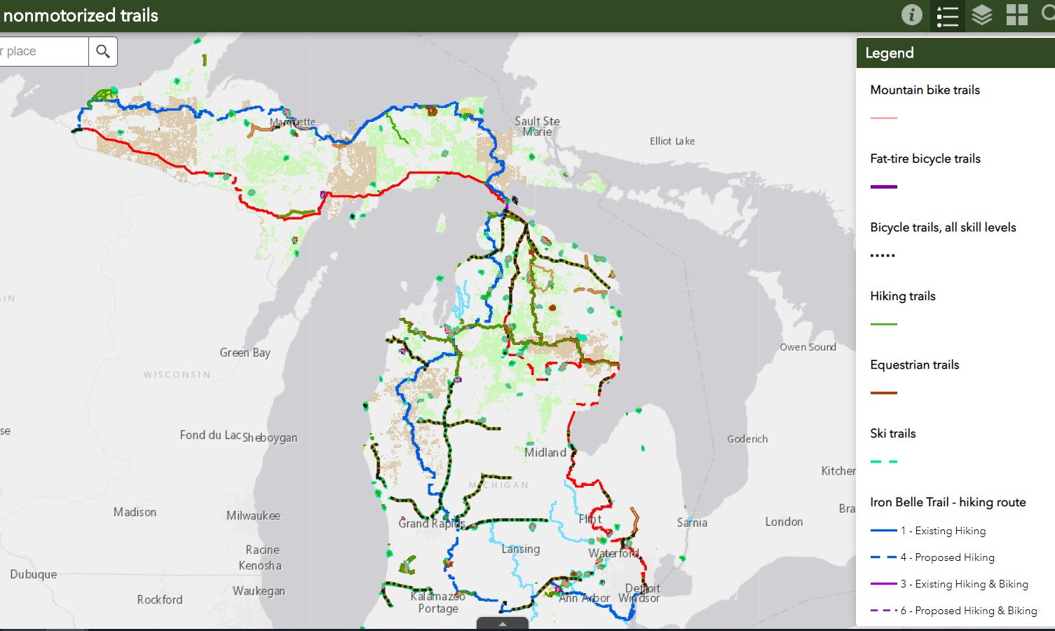
Interactive map has everything from Cross state trails, to mountain biking, hiking, even river trails (state managed trails only).
https://midnr.maps.arcgis.com/apps/w...7b642382632c7c

Likes For chas58:
10-15-20, 07:02 PM
#3

Cool... Thanks for the link!!!
When it loads up it looks like there is a lot of contiguous trails . Until you zoom in.
This is one gap I'd like to see filled sooner than later.
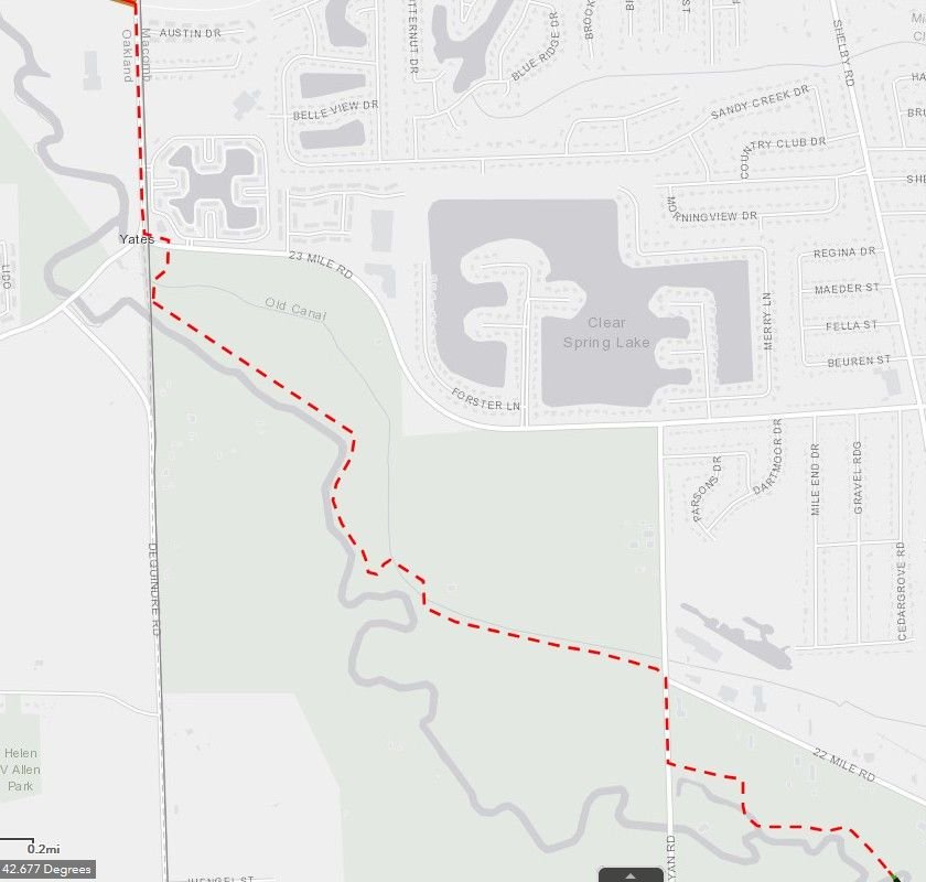
Made it larger in case you don't recognize it.
When it loads up it looks like there is a lot of contiguous trails . Until you zoom in.
This is one gap I'd like to see filled sooner than later.
Made it larger in case you don't recognize it.
10-15-20, 07:58 PM
#4
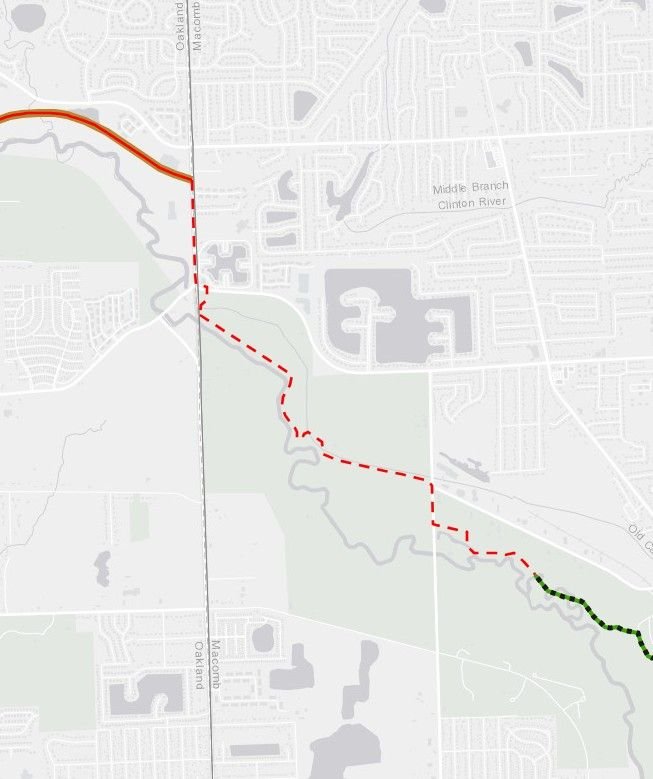
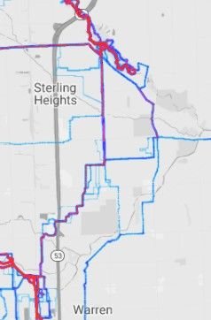
Did a bit of research . The States map shows a different route from Centerline through Sterling Heights than this one by the Greenway Collaberative.
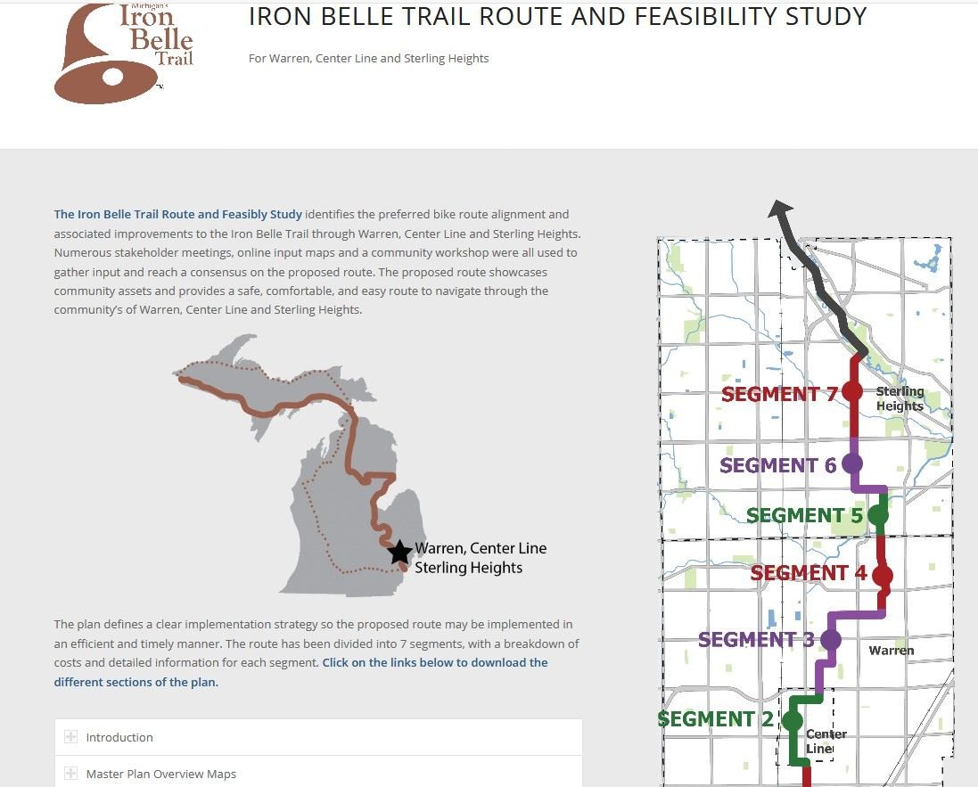
Interactive map :
https://greenwaycollab.com/ironbelle/
Segment 1 in south Warren has been completed for a few years now.
From C&G News Dec 2019
https://www.candgnews.com/news/iron-...terling-116049
Interactive map :
https://greenwaycollab.com/ironbelle/
Segment 1 in south Warren has been completed for a few years now.
From C&G News Dec 2019
https://www.candgnews.com/news/iron-...terling-116049
10-16-20, 09:35 AM
#5
Senior Member
Thread Starter
Join Date: Jul 2010
Location: Michigan
Posts: 4,863
Bikes: too many of all kinds
Liked 415 Times
in
335 Posts
You are right, that is the missing piece. Well, I ride it, but its not exactly a formal trail.
there is a plan for a formal trail there, although it goes along the roads instead of going along the river. Not too excited about that decision, although it has to be tons cheaper. There does need to be a good connection between river bends and CRT. We'll have it soon though.
UR right, that Iron Bell trail that periodically gets publicity is a great idea, but its full of holes if you zoom up on it. ;-)
10-16-20, 09:43 AM
#6
Senior Member
Thread Starter
Join Date: Jul 2010
Location: Michigan
Posts: 4,863
Bikes: too many of all kinds
Liked 415 Times
in
335 Posts
I actually ride that map you posted periodically going to and from work. It doubles my ride from one to 2 hours, but when I feel like putting some extra miles in, its great (especially early summer morning, or late fall evenings). I posted pictures of it here once and someone commented "do you live in narnia" as it was so beautiful, with deer, tunnels of trees, river views, sun streaming through the trees. It is inspiring.
Attached is my heatmap showing the routes I use:
(the east route picks up the southern end of the dodge park trial, the one to the west goes directly to dodge park.
 10-16-20, 09:46 AM
#7
Senior Member
Thread Starter
Join Date: Jul 2010
Location: Michigan
Posts: 4,863
Bikes: too many of all kinds
Liked 415 Times
in
335 Posts
Best mapping program I use is Strava heatmaps. It shows me the most popular routes, and lets me find shortcuts and cut throughs that only the locals know about.
10-16-20, 12:41 PM
#8
Senior Member
Thread Starter
Join Date: Jul 2010
Location: Michigan
Posts: 4,863
Bikes: too many of all kinds
Liked 415 Times
in
335 Posts
 10-16-20, 04:19 PM
#9
It'd be like a bicycling highway with road crossings no closer than each 1/2 mile on the southern end . Some places wouldn't have any crossings for over a mile.
In that 20 mile stretch there are about 34 roads that intersect it.
10-17-20, 04:57 AM
#10
You are right, that is the missing piece. Well, I ride it, but its not exactly a formal trail.
there is a plan for a formal trail there, although it goes along the roads instead of going along the river. Not too excited about that decision, although it has to be tons cheaper. There does need to be a good connection between river bends and CRT. We'll have it soon though.
10-19-20, 12:57 PM
#11
Senior Member
Thread Starter
Join Date: Jul 2010
Location: Michigan
Posts: 4,863
Bikes: too many of all kinds
Liked 415 Times
in
335 Posts
Is this what you are eluding to?https://www.candgnews.com/news/shelb...e-trail-118217
I agree with the comment - looks like a glorified sidewalk project.
I go from riverbends out 22 mile (which sucks, but at 20mph, half a mile goes pretty quick - although it ends up being a sprint zone for me). I then keep going straight at the end of the road which takes me through the bird watching area, along the river bank, then the remaining rail bed to yates. From there, I can head north to MOT, but typically just go into bloomer, following the rail bed to CRT.
I don't think you "can" make a path there, as the river bank area is too wild, and I'm guessing yates might own the rail bed near the cider mill. Then you have to have an official route into bloomer - and they took that bridge (across clinton river) down about 20 years ago.
05-03-21, 06:53 AM
#12
dollar-store reject
Need to sync my bookmarks with my phone..
